Stone Shatter City

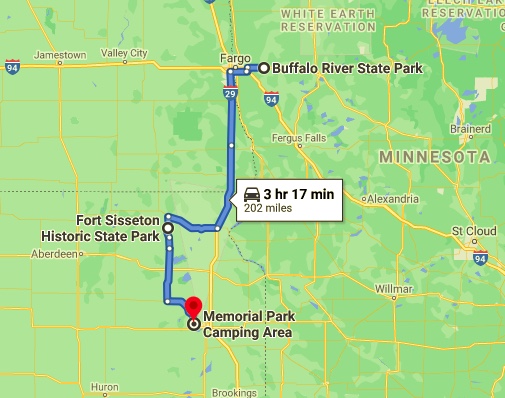
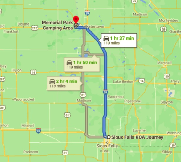
Saturday, August 28, 2021

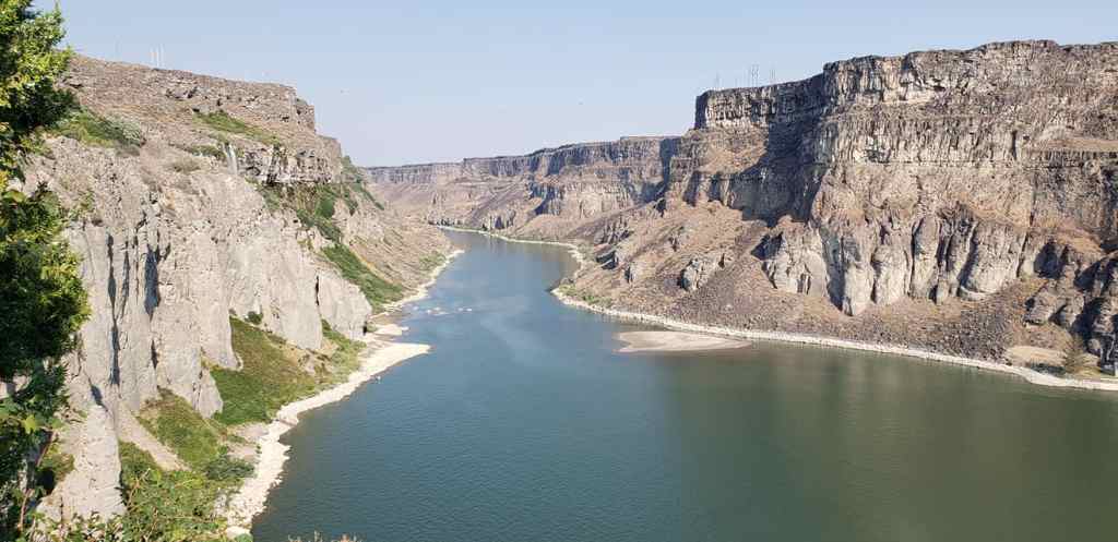
Excerpt from Wikipedia:Sioux Falls (/ˌsuː ˈfɔːlz/Lakota: Íŋyaŋ Okábleča Otȟúŋwahe;[6] “Stone Shatter City”) is the most populous city in the U.S. state of South Dakota and the 131st-most populous city in the United States. It is the county seat of Minnehaha County[7] and also extends into Lincoln County to the south, proximate with the Iowa state line. As of 2020, Sioux Falls had a population of 192,517. The Sioux Falls metro area accounts for more than 30% of the state’s entire population. Chartered in 1856 on the banks of the Big Sioux River, the city is situated in the rolling hills at the junction of interstates 29 and 90.

“Shattered Stones” at Sioux Falls

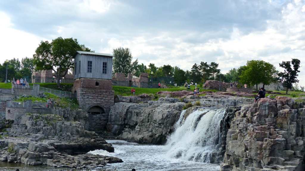
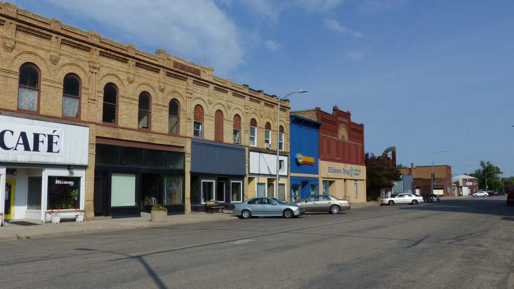
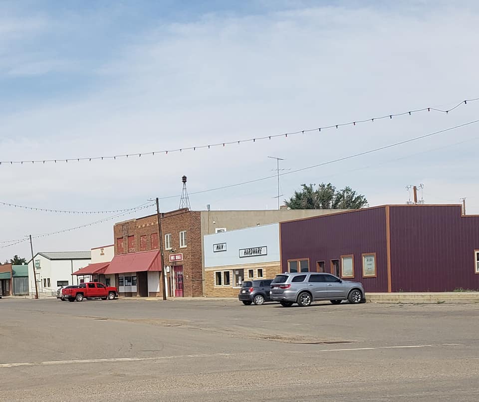
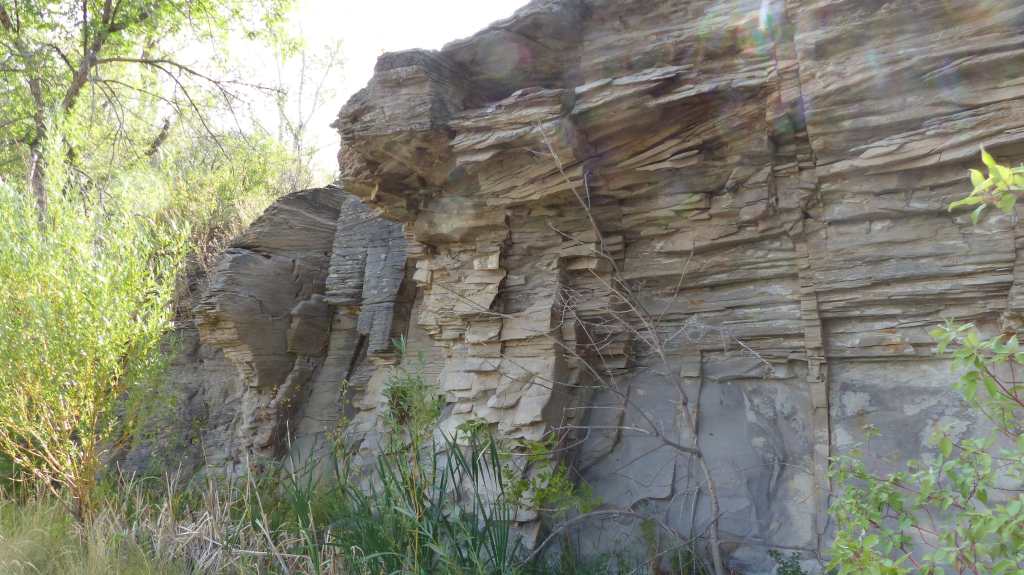
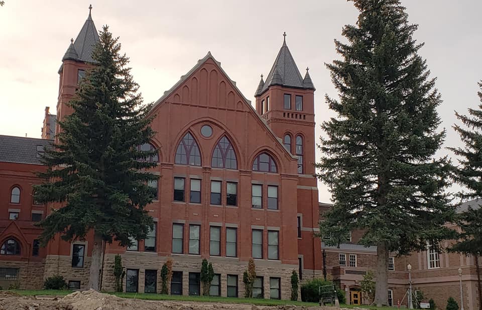
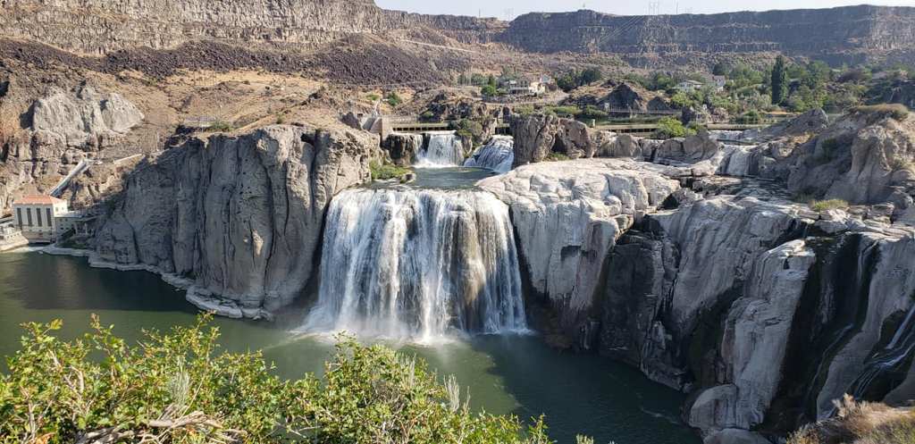
Stone Shatter City is what the Lakota called what is now Sioux Falls. Native Americans inhabited the area for thousands of years before the arrival of Europeans. After visiiing Falls Park I can understand how they arrived at that name. The rocks around the falls look like a giant had taken his club and shattered them. Sioux Falls is a typical Dakota city- clean with a lot of eye appeal. The residents around the Cathedral are just beautiful. Downtown has quite a few historic buildings. It’s a wonderful town.

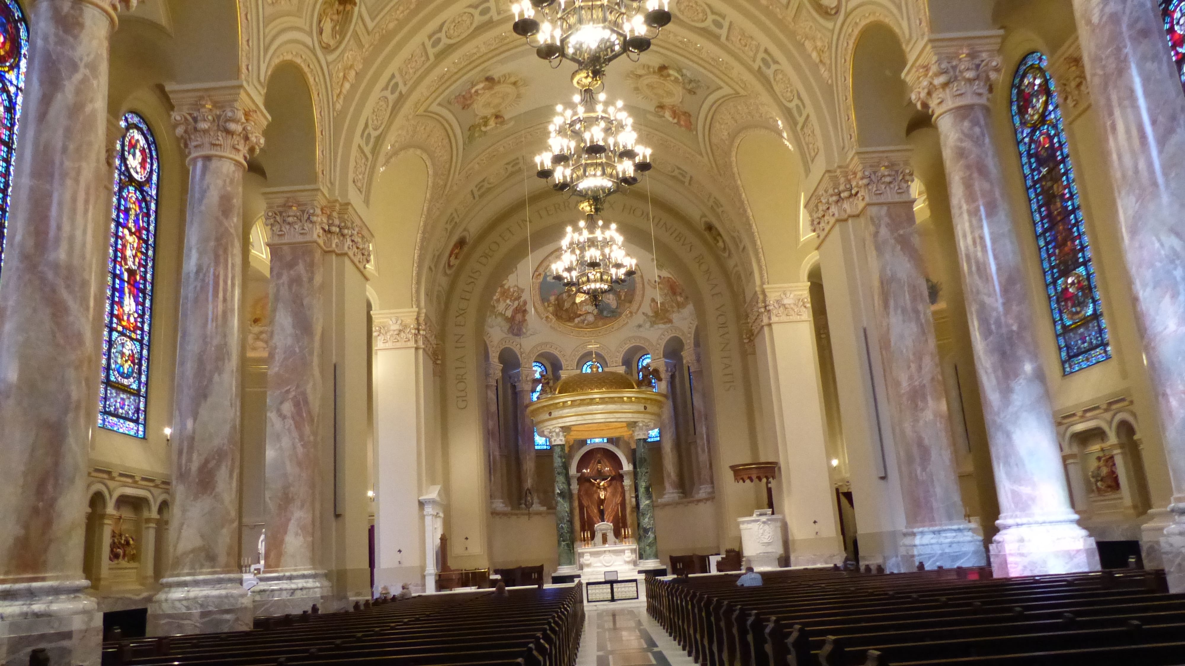
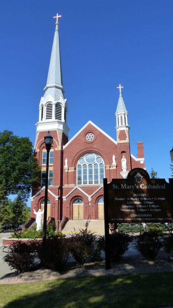
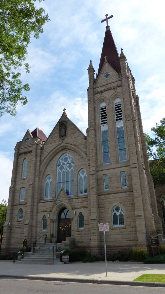
St. Josheph Cathedral, Us’ns and Praying for the unborn….

History of Sioux Falls, South DakotaThanks Wikipedia!

Two separate groups, the Dakota Land Company of St. Paul and the Western Town Company of Dubuque Iowa, organized in 1856 to claim the land around the falls, considered a promising townsite for its beauty and water power. Each laid out 320-acre claims, but worked together for mutual protection. They built a temporary barricade of turf which they dubbed “Fort Sod”, in response to native tribes attempting to defend their land from the settlers. Seventeen men then spent “the first winter” in Sioux Falls. The following year the population grew to nearly 40.

Shattered Rocks and Sioux Falls

The arrival of the railroads ushered in the great Dakota Boom decade of the 1880s. The population of Sioux Falls mushroomed from 2,164 in 1880 to 10,167 at the close of the decade. The growth transformed the city. A severe plague of grasshoppers and a national depression halted the boom by the early 1890s. The city grew by only 89 people from 1890 to 1900.
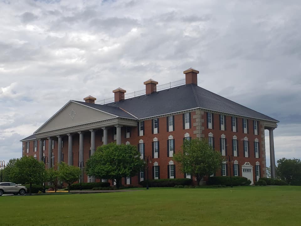
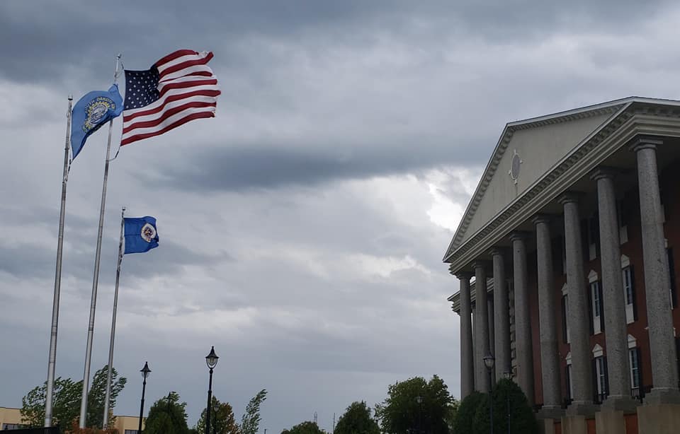
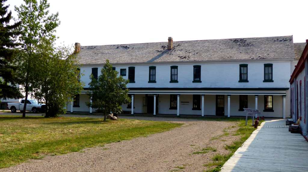
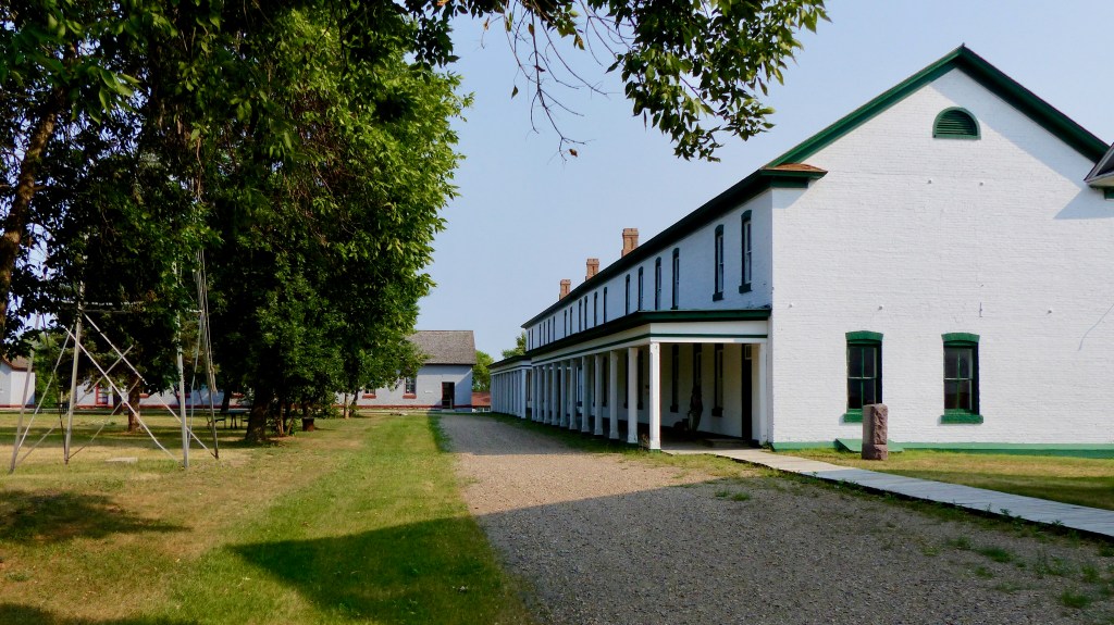
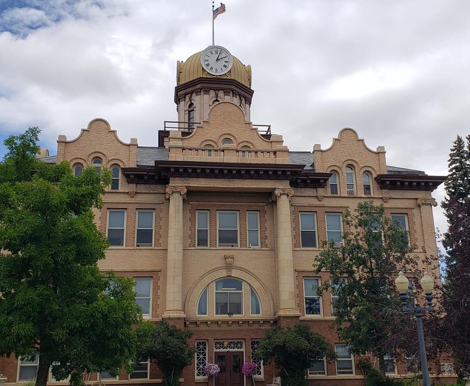
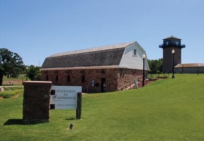
Prosperity eventually returned with the opening of the John Morrell meat packing plant in 1909, the establishment of an airbase and a military radio and communications training school in 1942, and the completion of the interstate highways in the early 1960s. Much of the growth in the first part of the 20th century was fueled by agriculturally based industry, such as the Morrell plant and the nearby stockyards (one of the largest in the nation).

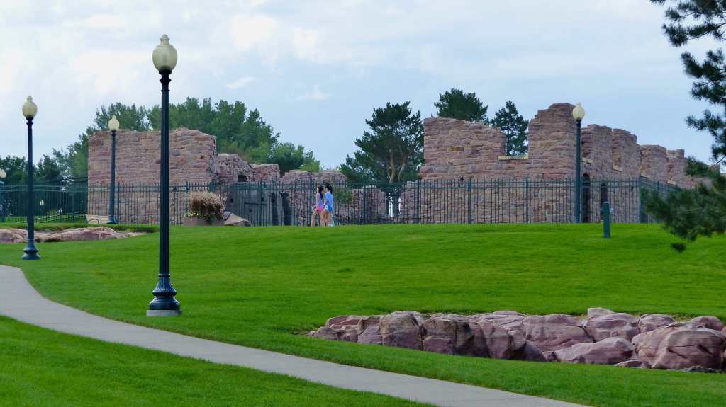
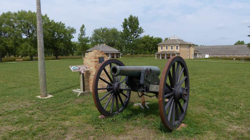
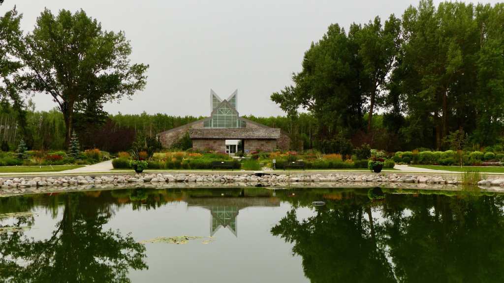
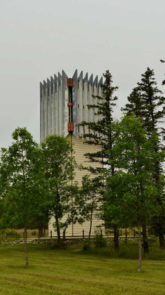
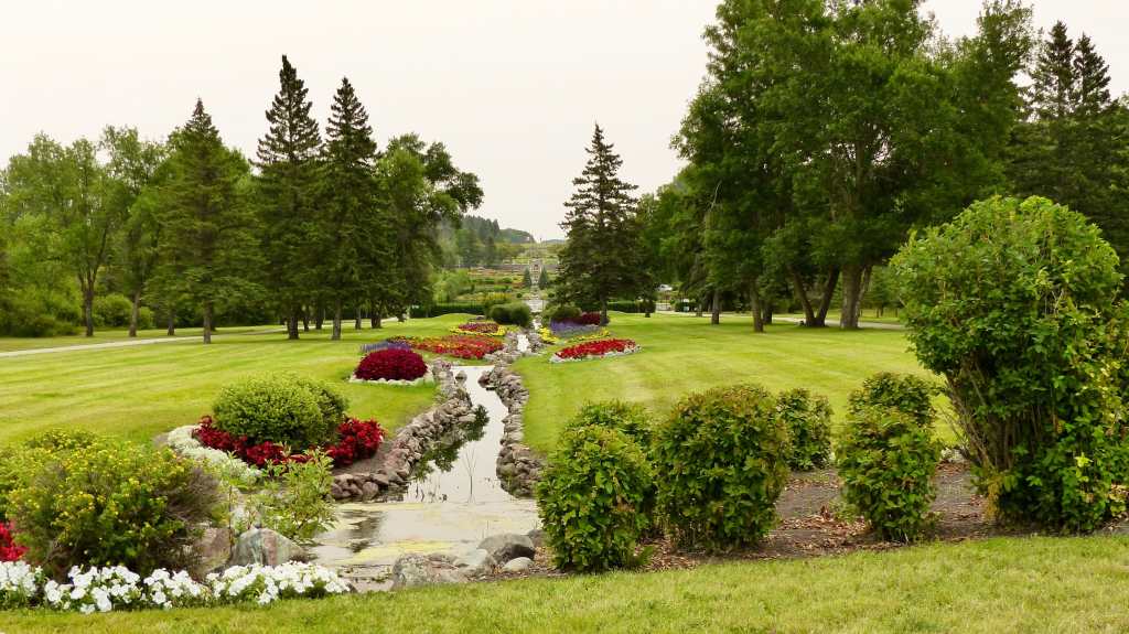
Structures in Falls Park

In 1981, to take advantage of recently relaxed state usury laws, Citibank relocated its primary credit card center from New York City to Sioux Falls. Some claim that this event was the primary impetus for the increased population and job growth rates that Sioux Falls has experienced over the past quarter-century. Others point out that Citibank’s relocation was only part of a more general transformation of the city’s economy from an industrially based one to an economy centered on health care, finance, and retail trade.

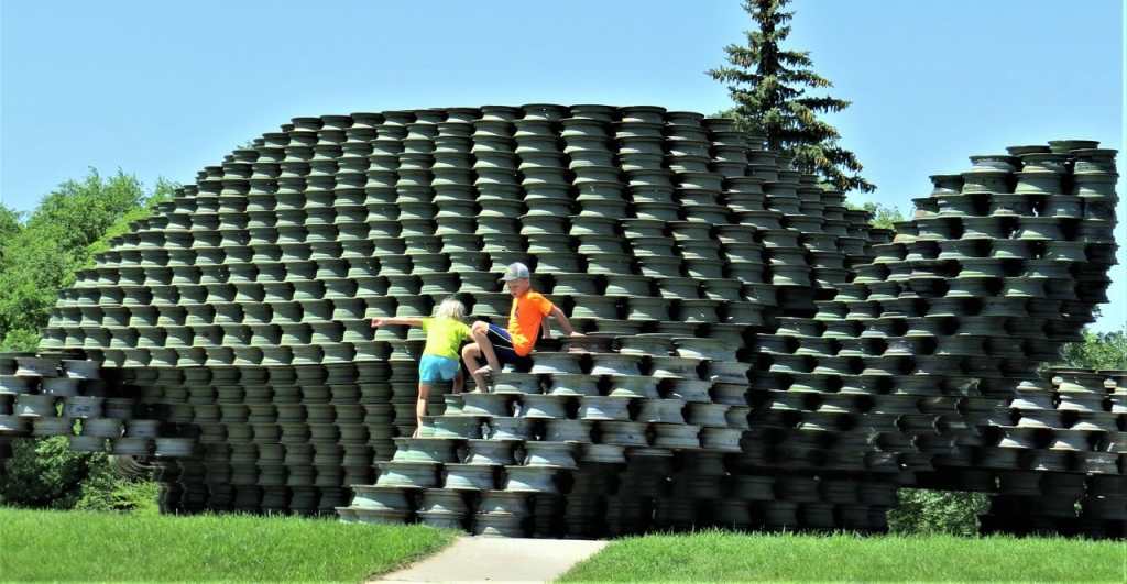
Art and Flowers in Falls Park

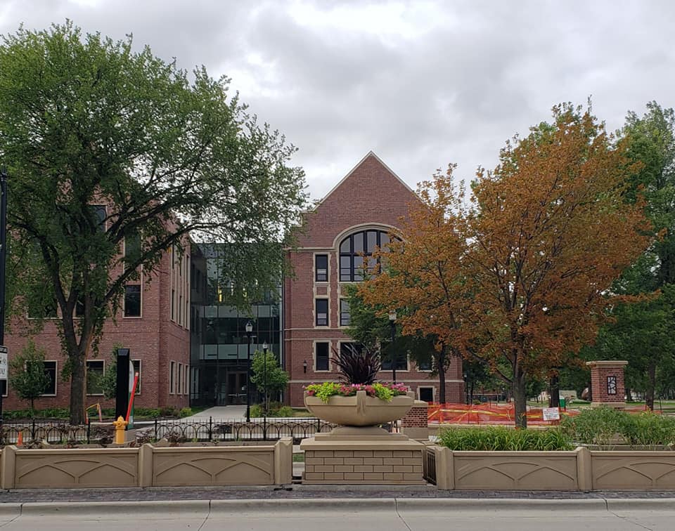
Sioux Falls has grown at a rapid pace since the late 1970s, with the city’s population increasing from 81,182 in 1980 to 192,517 in 2020. The city is home to Augustana University, the University of Sioux Falls, Sioux Falls Seminary, Southeast Technical College, National American University, the South Dakota School for the Deaf, the University of South Dakota’s Sanford School of Medicine (Sioux Falls campus), Stewart School and the South Dakota Public Universities and Research Center..

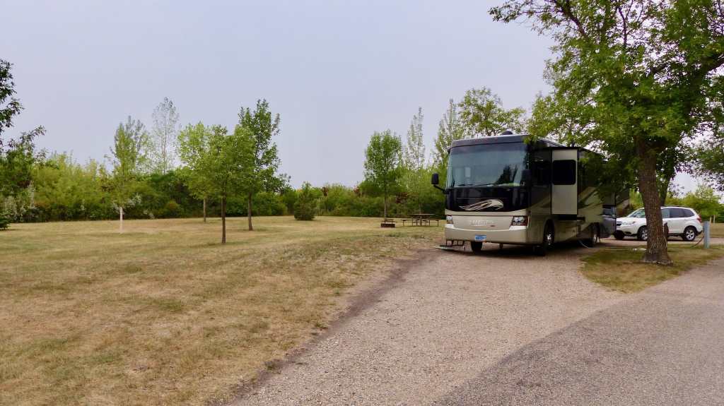
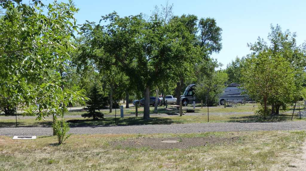
Our stay at the Sioux Falls KOA was very pleasant. The place is well maintained and the worker bees here are always buzzing around doing something. The wifi is really good which is not the norm for RV parks. The only drawback is it’s proximity to Interstate 90. We got some road noise, yet it wasn’t unbearable.

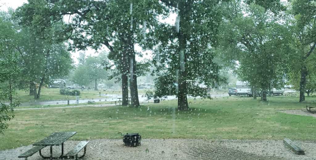
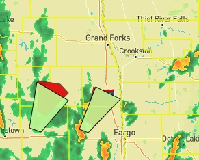
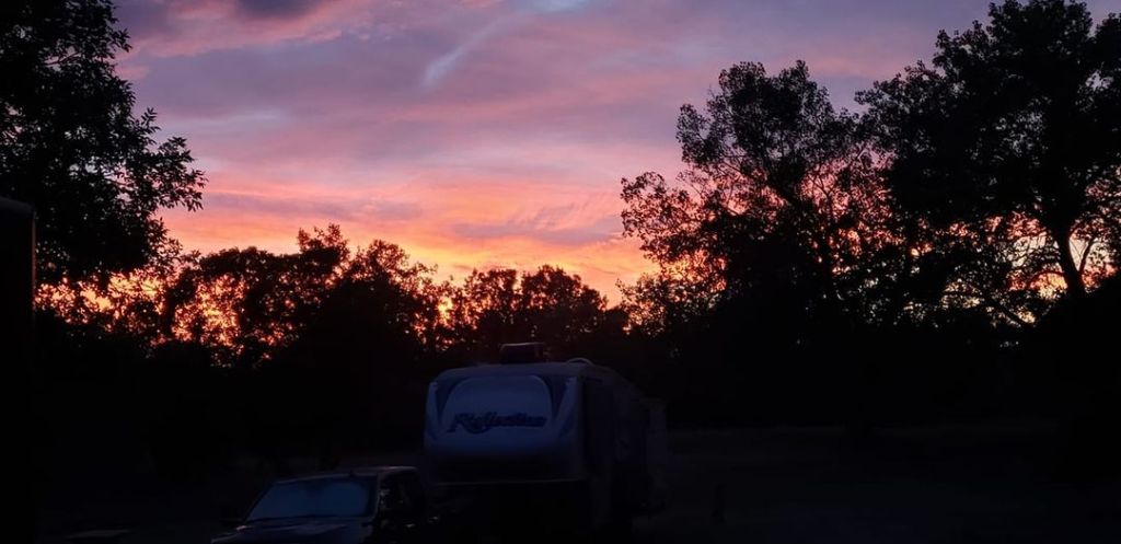
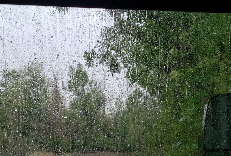
I’d been tracking a storm on Weather Underground’s really good real time weather map. The weather service had state that we could get a few severe storms come through. Well this one got larger and headed straight for us. Severe weather warnings went up indicating 60mph wind gusts with 2″ hail possible. The storm hit and up went three tornado warnings just south of town no more than 10 miles from here. Wind at over 80mph was recorded. Constant lightning and heavy rain for about an hour. This is our second encounter with a severe storm in three days. Boy, this is getting old quick!

Tomorrow we’ll head west to Chamberlain, SD. See you there!

Ollie being a little goofy!

It’s Only another 30 Miles Honey….

Wednesday August 25 through August 26, 2021

Travel today will only be 160 something miles. We like to leave early, like 8 or 9 am. Check in time at Memorial Park, Watertown SD is 4pm. Do you see a problem here?

One way to solve the problem is to leave a lot later, like in the afternoon. That won’t happen. Another is to find places to visit along the way. We chose the latter. Hey Jil, How’d you like to visit a historic fort? Sure, Mike! Let’s go! The fort is about 30 miles off our route but that’s OK. We like seeing new country.

We turn west off of I-29 at Sisseton, SD. The city of 2400 is the seat of Roberts County. It’s named for the Sisseton division of the Native American Sioux. The towns in the Dakotas are extremely clean and well kept and Sisseton is no exception.

Nocollet Tower- One can see 35 miles from the top of the tower

View from the base of Nicollet Tower- Yep, that’s smoke from western wildfires

The topography has changed since leaving the flat plains of North Dakota. Rolling, green hillsides are the norm with many small lakes scattered between them.

Fort Sisseton is sorta out in the middle of nowhere. A pleasant 30 minute drive down country lanes and both of our GPS machines, Miss Smartypants and Miss Garmin lead us to a fella’s farm! Nope, that ain’t it. We continue about a half mile down the road arriving at the fort grounds. Fort Sisseton was established in 1864 to restrict hostile warriors and to defend the travel routes to gold fields in Idaho and Montana. It is considered to be one of the best preserved South Dakota forts. The fort is mostly constructed of local material unlike many. The fort was never attacked, yet impacted the advancement of settlers across America. The soldiers kept the peace between local tribes and taught them how to be self-sufficient- at least the white man’s way of being self-sufficient.

The fort was abandoned in 1889, before South Dakota became a state. All but 32 acres of the 82,000 military reservation that contained the fort’s buildings were leased by the new state of South Dakota to farmers and settlers. In the early 1900’s a prosperouse newspaper man, Colonel W.D. Boyce leased the fort and made a hunting lodge out of the main buildings. At the end of the hunting season Boyce would host a grand ball in the North Barracks where everyone, including the locals, were invited.

The history of the fort is long, sometimes glamorous, and many times not. During WWII land around the fort was least for air to ground bombing range. 15 men lived at the fort to report hits and misses from observation towers located around the fort. After the war the fort was leased to a seed company who used it for storage and public dances and roller skating.

We enjoyed visiting the fort and continue to our home for two nights Codington Memorial Park camping area. Turns out there are two Memorial Parks and two camping areas about 5 miles apart. Miss Garmin takes us to the wrong one…. sigh…. We get turned around and pull into the park farthest from Watertown. The park is beautiful. Our site has full hookups and is no farther than 50′ from Lake Kampeska, the largest natural lake in South Dakota. What could possibly go wrong?

Well, I’ll tell you what can go wrong. This morning we wake up to a severe weather advisory which upgrades into a severe weather warning. 60 mile per hour winds, large hail the size of nickles and downpours are predicted. We got the wind at 75mph, the rain but no hail thankfully. I tried to download a video of the action- rain blowing sideways and trees swaying violently but it wouldn’t download.

After the storm passed late in the morning we visited the city of Watertown, seat of Codington County. The city of nearly 22,000 souls was founded in 1878 as a rail terminus. It proves to be another beautiful downtown and residential district.

The city is home to the Redlin Arts Center. Terry Redlin, a home grown Watertownian, is frequently named “America’s most popular artist”. His popularity arrives from painting outdoor themes and wildlife. The arts center houses over 150 of Redlin’s works of art. He’s known for his donations to raise funds for conservation, including a record $28 million for Ducks Unlimited.

Redlin Art Museum

I leave you with a wonderful memorial to those who serve our country………….

Visiting Bill’s Town

Sunday, August 21 through Tuesday, August 24, 2021

We pulled out of Red River State Park and headed south towards Fargo, ND, aka Bill’s Town. The weather is clear, we only have a hundred miles to travel and check in time is 4pm. 

Traill County Administration Building

Curiosity gets the better of us so we stop in Hillsboro (1600 souls), the seat of Traill County. Hillsboro sits in the fertile Red River Valley. Local agriculture has dominated the area’s economy from the beginning. With its location on I-29, halfway between the two metropolitan centers of Grand Forks and Fargo/Moorhead, Hillsboro has seen steady population growth in recent years and has become somewhat of a bedroom community.

Wall of Honor For All Who Have Served Traill County

The area along the Goose River that is now Hillsboro was first settled by German and Norwegian settlers around 1870. In 1880, the present day site of Hillsboro was founded under the name “Comstock”. Local folklore tells of the residents of nearby Caledonia turning away a shabby surveyor because of his appearance. This man was then offered hospitality by residents in the tiny settlement of Comstock. The man turned out to be railroad baron James Hill.

Hill was so impressed by the kindness showed to him by the residents of this small community that he decided to place his Great Northern Railway there instead of in Caledonia. The name of Comstock was changed to “Hill City” in September 1880 in honor of Mr. Hill. The city was then renamed “Hillsboro” in 1881 after it was discovered that there was already a Hill City in South Dakota.

Fargo Theater

Fargo, 125,209 souls, is the seat of Cass County. Fargo is the most populous city in the state accounting for 16% of the state population. The Metropolitan Statistical area formed by Fargo, it’s twin city Moorhead, Minnesota and adjacent cities West Fargo ND and Dilworth MN have a population of approximately 249,000 folks.

Downtown Fargo, ND

Historically part of Sioux (Dakota) territory, the area that is present-day Fargo was an early stopping point for steamboats traversing the Red River during the 1870s and 1880s. The city was originally named “Centralia,” but was later renamed “Fargo” after Northern Pacific Railroad director and Wells Fargo Express Company founder William Fargo (1818–1881). The area started to flourish after the arrival of the Northern Pacific Railroad and the city became known as the “Gateway to the West.” During the 1880s, Fargo became the “divorce capital” of the Midwest because of lenient divorce laws.

A major fire struck the city on June 7, 1893, destroying 31 blocks of downtown Fargo, but the city was immediately rebuilt with new buildings made of brick, new streets, and a water system. More than 246 new buildings were built within one year. There were several rumors concerning the cause of the fire.

Excerpt from Wiki: The North Dakota Agricultural College was founded in 1890 as North Dakota‘s land-grant university, becoming first accredited by the North Central Association in 1915. In 1960, NDAC became known as North Dakota State University.

Since the 1990’s the Fargo-Moorhead area has consistently had one of the lowest unemployment rates in the US. Due to it’s low crime rate and supply of affordable housing Money magazine ranked the city near the top of America’s most livable cities.

Saint Mary’s Cathedral, Fargo

Temperatures can vary considerably in Fargo. Record temperatures range from -48* in January 1887 to 114* on July 6, 1936 with the coldest maximum temperature of -29*F. The area has a growing season of 144 days.

Moorhead (42,000 souls) is the largest city in northwest Minnesota. Fargo’s twin city was platted in 1871. People of Norwegian descent make up 36.1% of the population while folks of German descent comprise 36% and the Swedes at 7.6% are the three leaders of European ancestry. This makeup is fairly common in North Dakota and Minnesota. Moorhead is the Home of Minnesota State U.

Moorhead hosts the Hjemkomst Center. The name is pronounced YEM_komst, Norwegian for “Homecoming”. It’s a museum and events center. One exhibit that caught my attention is Ihdago Manipi, which means “They leave marks as they come through here”. As you might have surmised, “Ihdago Manipi explores the dramatic transformation that occurred in the early years of Clay County, Minnesota, including the arrival of railroads and immigrant families, the dispossession of indigenous people, an ecological revolution, and the construction of modern American life”.

The Moorhead Stave Church is located on the grounds. Stave churches were built in and around Scandinavia from the waning years of the Viking Age (11th – 12th century CE) to the beginning of the Early Modern Period (1500 CE). The technique of using vertical posts – or staves – to construct massive wooden buildings had been modified over time through several artistic and architectural waves and eventually became an iconic European art form. The Moorhead Stave Church is a full-scale replica of the Hopperstad Stave Church located in Vik, Norway.

While visiting the Fargo area we are staying at Buffalo River State Park located near the town of Glyndon MN (1400 souls). Glyndon was platted in 1872 when the railroad reached town. The park features trails through tall prairie grasses, a nice tree shaded campground and a really great sand bottom swimming pond located near the meandering Buffalo River. The swimming pond has been closed for two seasons, partly due to low water flows of the river and COVID concerns. It is a shame as one can only imagine great throngs of kids splashing around in that pond.

View across the prairie and our campsite at Buffalo River State Park

Wednesday we’ll meander down to Watertown, not New York, but South Dakota. See y’all there!

Just in time for a 3 Day Fest!

Thursday, August, 19 through Saturday, August 21, 2021

Our short drive from Graham’s Island State Park, Devil’s Island ND to Red River State Recreation Area East Grand Forks, MN was uneventful. The only place we stopped was a really nice North Dakota rest area. Our new location is just across the Red River from Grand Forks ND, the larger of the twin towns. The weather is warm and muggy, perfect for development of some thunder storms.

Red River State Recreation Aea, East Grand Forks, MN

Well, folks, it seems that we are just in time for the The Fourth Happy Harry’s Rockin’ Up North Fest. Featured recording stars are Diamond Rio, Joe Nichols, Jordan Davis and Tigirlily with opening acts of Dariann Leigh, Jensen Sisters,  Paint the Town, Matt Aakre, The Dirty Little Secret, Junction 281. And the great thing is we don’t have to leave our campsite to enjoy their music as the stage is set up a mere 400 feet away.

Levee gate

The area was for years a meeting and trading point for Native Americans. The French set up a trading post here in the early 1700’s. The US acquired the land with the Treaty of 1818. After battling the Ojibwe and other Native Americans for years, a treaties were made which extinguished their land claims. Alexander Griggs, a steamboat captain, is regarded as The Father of Grand Forks. Grigg’s steamboat froze in the Red River in 1870 forcing he and his crew to over winter camping at Grand Forks. Griggs platted the community in 1875 and incorportated in 1881.

East Grand Forks is smaller than it’s sister across the river at 8600 souls. Downtown consists of small businesses, many restaurants, movie theater and a large Cabelas Sports Shop. Red River State Recreation Area is a short walk from downtown. It features nice grounds, large campsites, grass lawns, trees large and small. The park is located in a former residential neighborhood. Several great floods caused the neighborhood to be abandoned and rebuilt behind a very large levee. The state park sits on the bank of the Red River and will be inundated in the event of another major flood event, but for now, it’s very enjoyable.

Excerpt from Wiki: The Red River flood of 1997 was a major flood that occurred in April and May 1997 along the Red River of the North in MinnesotaNorth Dakota, and Southern Manitoba. It was the most severe flood of the river since 1826. The flood reached throughout the Red River Valley, affecting the cities of Fargo and Winnipeg, but none so greatly as Grand Forks and East Grand Forks, where floodwaters reached more than 3 miles (4.8 km) inland. They inundated virtually everything in the twin communities. Total damages for the Red River region were US$3.5 billion. The flood was the result of abundant snowfall and extreme temperatures.

Flooding in Manitoba resulted in over $500 million in damages. The Red River Floodway, an artificial waterway completed in 1968 and known as “Duff’s Ditch”, diverted some floodwaters around Winnipeg, saving it from flooding. As a result of the 1997 flood and its extensive property losses, the United States and state governments made additional improvements to the flood protection system in North Dakota and Minnesota. They converted former areas of development in the floodplain on both sides of the river to the Greater Grand Forks Greenway, providing year-round recreation areas for residents as well as a natural way to absorb floodwaters. A dike system was built to protect the twin cities of Grand Forks and East Grand Forks.

Grand Forks (52,838 souls) is the third largest city in the state and seat of Grand Forks County. Grand Forks is home to University of North Dakota, an International Airport, Grand Forks Air Force Base and a large Burlington Northern Santa Fe rail yard. The city also has large sports complexes. We found the city to have a vibrant economy.

Steady downpour for a couple of hours

The weather turned for the worse on Friday. Grand Forks is just inside the boundary of a severe weather alert issued by the National Weather Service. We decide to take a short orientation tour of the city in the morning before all hell breaks loose. When we return Jil downloads a good weather app onto her phone. Between her phone and my computer we can track any foul weather that may head our way.

Two tornado warnings just outside of town

Well, it does head our way….. Jil’s phone announces that rain will come in three minutes. It does….. how do the phone know? Lightning and thunder follow downpours. In the afternoon I track many angry looking cells on the real time Weather Underground weather map. Two heading straight towards Grand Forks are declared as tornado warnings with one producing a brief touchdown with no damage created. An hour later the tornado warnings are lifted is favor of warnings of 60 mph winds. We don’t experience those winds and all is well for the night.

St. Michael’s Catholic Church-one of six Catholic churches in Grand Forks

Saturday we spent quite a bit of time exploring. We find the very nice park that contains the Japanese Garden and spend some time touring the Univeristy of North Dakota campus. At one point we come to what appears to be Checkpoint Charlie with signage placed in the middle of the street and a young man directing traffic.

He motions us forward to his location. Jil asks “What’s going on?” He replies “It’s move in day!” for the students occupying the dorms. Well, I hope he didn’t think we were there to do that! We find a place to extract ourselves from the hoards of students milling near the dorms and tour some nice residential areas.

Back home we have full hookups- electicity, water and sewer. It’s a shame not to take advantage of the utilities so Jil throws a load of clothes in our clothes washer. Now remember clothes dryer died on the second day of our trip. This is day 22 and the only time we visited a laundry was back in Dillon, MT and that was only to dry our clothes.

Contrast the Huge North Dakota Hockey Center with typical modest “Forks” home

So with some ingenuity we set up the bedroom as a drying room. The clothes drying rack is utilized to hang some clothes and hangers others. We turn on the portable electric heater close the door, isolating the bedroom from the rest of the coach. It worked! Cloths dried in less than half the time.

Our coach located on a very spacious RV site and one of several “ice houses” that are in the park. Ice houses are towed onto frozen lakes. There are hatches in the floor where one can drill holes through the ice, then drop your fishing line in- in hopes of a catch.

Tomorrow we head down to Fargo. Again it’s not a long drive so we can dawdle a bit if we are so inclined. We again are staying in a Minnesota state park- Buffalo River. We’ve been to the park once before about four years ago when we took our Great Lakes trip. See you there!

Street Fair cousine- Fried Cheese Curds anyone?

We’ve Gone to the Devil

Tuesday and Wednesday, August 17 & 18, 2021

We pulled up stakes this morning, Tuesday August 17, and headed out of the Garden. First stop is the US Port of Entry. A border agent in the small POE building opens his window and asks how many people are in the RV. I repy “2”. “ID’s please”. We supply our driver’s licenses. He start typing on his computer, I assume entering our DL info in the system, and stares at it for a time. It appears it’s not working to his satisfaction. He returns to the little window and asks “Where you from?” I almost said “You have our DL’s, where the heck do you think we’re from?”, but I didn’t. “Reno, Nevada I reply”.

International Peace Garden, aka the Dunseith-Boissevain Border Crossing

He says I’ll be back, closes the window and walks to the main building with our DL’s in hand. He’s back in maybe 5 minutes, writes something and holds up a piece of paper in the window farthest away- we can’t read it. He takes the paper down, and opens that window. I pull up so we can converse. He says “What are you doing here?” We went to the Garden. “It’s a long way outa the way!” Yup. “Where ya headin’ from here?” Grand Fork, Fargo, Sioux City. “Have a good trip!” Thanks!. “You betcha” ! I felt like asking “What the hell are YOU doing way out here?”

The wait, maybe 10 minutes kinda makes one nervous. What if they find out something about Jil or I that we don’t even know about. Like we’re wanted for something or one or both of us are victims of mistaken identity making us escaped felons or something weird like that? Glad to be on our way……

Nice couple volunteered to take our photo

We follow ND 3 to Rugby. This place touts itself as the geographical center of North America. The town of 2600 souls was founded in 1886 at a junction of the Great Northern Railway. Several sites along the Great Northern’s transcontinental route between Devil’s Lake and Minot were named for places in England.

Excerpt from Wikipedia- North Dakota’s first permanent settlers arrived in 1812 from the Earl of Selkirk’s colony in neighboring Rupert’s Land.[9]:277 As farmers, they were more advanced than many of their contemporaries in the rest of the United States, having adopted sophisticated farming methods and machinery. Many of these implements, including an early McCormick Deering threshing machine, have found their way to the restored Pioneer Village in Rugby.

Activities on and around Devil’s Lake

We arrive at Graham’s Island State Park around noon. Check in is one o’clock. Check out is 3 o’clock. Do you see a problem with that? The young lady at the registration desk won’t let us check in until 1 o’clock so we disconnect the car from the RV and tour the park. We drive by site 28 which will be ours for two nights. No one is there. We tour the other campsites and like what we see. Two are newer and have full hookups. All but the designated tent camping areas have at least electricity. Nice.

I go back in the office at 12:55 and check in. The gal behind the Plexiglass barrier says check out is 3pm so if the site is occupied we have to wait. Soooo, what was the problem with checking in an hour earlier if we would have to wait until the site is vacated anyway? 

Outer campsites have a huge side yard

The state park is nice. It has a really nice very busy boat ramp and the campgrounds are well kept. It’s located on Devil’s Lake about 15 miles from the town of the same name (6000 souls).

Downtown Devil’s Lake

The town’s first post office came in 1882, named Creelsburg after Lieutenant Heber Creel, a topographical engineer stationed at nearby Fort Totten. The name was changed to Creel City, then in 1884 to the City of Devil’s Lake.

Devil’s Lake Flooding in the 1990’s

Devil’s Lake has been a kind of pain to the locals and the State, also the Feds. The lake has no natural outlet and the water began to rise in the 1990’s. The surface area quadrupled causing a lot of flooded farmland and the destruction of over 400 houses. One solution was to pump excess water into the Sheyenne River (into which the lake overflowed about 1000 years ago). The Sheyenne flows in to the north flowing Red River of which 158 miles are in Canada. The Canadians didn’t want Devil’s Lake water with its possible contaminants mixed with Red River water. The State didn’t like the Fed’s solution.  A $450,000,000 fix includes extensive constructions of dikes and a less costly outlet to divert water from Devil’s Lake into the Sheyenne River when needed.

Fort Totten, a town of 1200 souls, is on the south bank of Devil’s Lake and located within the Spirit Lake Reservation (4238 souls). It’s make up is of three bands of the Dakota tribe. The Dakota words for “Spirit or Sacred” were misconstrued to mean “Bad Spirit or Devil”, thus Devil’s Lake. The Christian concept of the devil is not present in Dakota Philosophy.

Fort Totton has worn many hats. First as a military post. Several of the men assigned there were part of Custer’s Little Big Horn contingent including Marcus Reno, Miles Keogh, and Frank Baldwin.

Widows and orphans were cared for at the fort by military members of the Independet Order of Odd Fellows. The fort was decommissioned in 1890. The complex then became the Indian Industrial School, a boarding school, from 1891-1935 which concentrated on domestic skills for girls and farming/industrial skills for boys. The site was used as a Tuberculosis Preventorium from 1935-1939. This successful program was aimed at small groups of Dakota children who had or were susceptible to Tuberculosis. They were taught basic studies as well as being treated for Tuberculosis.

The Fort Totten Community School then occupied the grounds from 1940-1959. Today the fort is a State Historic Site and considered one of the best preserved frontier military posts in the Trans-Mississippi West.

While on the Rez we visit White Horse Hill National Game Preserve, formerly Sully’s Hill, a 1674 acre national wildlife refuge sitting on the southern shore of Devil’s Lake. Under Teddy Roosevelt’s guidance it became a national park in 1904, then in 1914 congress designated it as a big game preserve. We didn’t expect to see much in the way of “big game” but Lo and Behold on the roadway near the visitors center is a small herd of American Bison complete with several young calves, some enjoying their mother’s milk. Well, that made our day for sure!

After a very long climb up the stairs, the view from Sully’s Hill

Tomorrow we head to the border town of Grand Forks for three days. See you there!

Are We There Yet? You Betcha!

Monday, August 18, 2021

Game Warden Memorial- International Peace Garden

We arrived at the International Peace Garden Sunday afternoon. Jil took a little tour of the Game Warden’s Museum and Memorial while I set up camp. While there Jil was given a little history of the museum by the docent. Jil thanked the lady at the desk whose replay was “You betcha”. I love the slang of the mid-western folk.

On Sunday our ride from Lewis and Clark State Park towards the northeast and the Canadian border was mostly uneventful. The road construction crew was taking a well-deserved break so we had clear sailing on ND 1804.

We travel mostly on two lane country roads, the most busy being US 2. As today is Sunday, US 2 isn’t busy either. The rolling hills around here are studded with farms, mostly hay farms. It seems each one has some sort of oil industry contraption somewhere on the property. The farther east we travel on US 2 the greener the hills and farmland become and the fewer oil contraptions there are. 

We pass by Stanley (1458 souls), seat of Mountrail County. According to Stanley’s website recreational opportunities in town consist of bowling and golf. Miss Garmin has us turn north on ND 28 at Berthold (454 souls) and head through Carpio (157 souls- couldn’t prove it by us) on ND 28. We take a right onto ND 5 and head east toward Bottineau.

Tommy Turtle, Bottineau ND

Bottineau, an agriculture based town, is the seat of Bottineau County. 2200 folks live here and is home to “Tommy Turtle” the world’s largest turtle, and a mascot of the nearby Turtle Mountains.The town is named after Pierre Bottineau, a Metis pioneer, hunter, trapper who became successful as a land speculator.  Metis are people of mixed Indigenous and European heritage, mostly French. Annie’s House was built in Bottineau Winter Park on Turtle Mountain as the first ski facility for handicapped children and wounded veterans. It is built to honor Ann Nicole Nelson, the only North Dakotan to die in the September 11 attacks on the World Trade Center.

W’eel Turtle, Dunseith, ND

Dunseith  (773 souls) is where we turn north onto ND 3. The highway will take us to the International Peace Garden. We have camping reservations there for two nights. Dunseith touts itself as the gateway the the gardens. I suppose it is. The town is also home to the world’s largest turtle sculpture, the “W’eel Turtle” made of more than 2000 green-painted car wheels. About 10 miles north I see a sight I don’t recognize. The closer we get the more it looks like some buildings are planted right in the middle of the highway. Of course, dodo, they are the US and Canadian Ports of Entry! I had expected to turn off into the Peace Garden before the POE but no, we pass by the US POE and turn left into the garden. 

Entrance to International Peace Garden- Just Gorgeous!

As Jil is inside the kiosk checking in and paying $20 for the annual permit, the only entry permit available, I can’t help but admire how beautiful this entrance is. Marigolds, zinnias and petunias are planted in formal rows that line roadway. The garden was a vision of a few men wherein peace could be celebrated at a living monument and ideals of friendship and peace would be an example to the world. The site was dedicated in 1932 with more than 50,000 people attending.

1/2 bizillion grasshoppers collected on the road- 1.2 bizillion quadrillion still out there…..

International Peace Garden Campground

Our two day stay at the Garden was very…… peaceful. The campground is set in the woods, has water and electricity so we are styling.

The Garden is kind of a no man’s land as it lies directly on the US/Canada border with North Dakota and Manitoba. The boundary runs right down the middle of the formal garden so as one walks through one walk is on the US side and the other the Canadian side.

The garden is just beautiful with its formal planters containing over 80,000 different species of annuals and perennials.

The garden extends past gates to a less formal area leading to the 911 Memorial and the Peace Chapel. It too has colorful flower beds planted along the little stream.

There is a conservatory and interpretive center, sunken garden, a carillon bell tower that rings on the quarter hour, a floral clock, two art centers, an auditorium, and the International Music Camp.. Oh, and many picnic areas dot the grounds.

If one is in the area the International Peace Garden is a must see. It’s a little off of the beaten path but well worth the visit.

When is the last time you needed the use of one of these?

Lewis and Clark St. Park, ND

Saturday, August 14, 2021

Lewis and Clark State Park in 21 miles from Williston which is the nearest town of any size, large or small. About five miles from the state park turnoff we run into more road construction. Cripes. We wait in line about 10 minutes, the pilot car arrives with a caravan of west bound traffic, then leads us eastbound on North Dakota Highway 1804. The naming of the highway reflects the first year of Lewis and Clark’s travels through the area. ND 1804 and ND 1806 constitute a portion of the Lewis and Clark Trail that runs through North Dakota along the Missouri and Lake Sakakawea.

Excerpt from North Dakota State Parks: Lewis and Clark State Park is situated on one of the upper bays of Lake Sakakawea. The park features miles of shoreline with picturesque views of towering buttes and rolling hills that provide a rugged backdrop for the park.

Modern boating facilities, including a marina with slip rentals and boat ramps are major attractions. Anglers will find excellent fishing for walleye, sauger and northern pike.

Lewis and Clark State Park is home to the largest native mixed- grass prairie of any North Dakota State Park. Visitors can become acquainted with the natural communities associated with the park by hiking the self-guided nature trail.

Mixed Prairie Grass

Visitors can also enjoy the swimming area and a day-use beach located on the east shore of the campground near the camping cabins. Kayaks, canoes, stand-up paddle boards and snowshoes are available for rent.

Lake Sakakawea

The waters of Lake Sakakawea (named after the Native American woman Sakakawea of Lewis and Clark fame), were impounded in 1953 by the Garrison Dam. It’s the largest man-made lake located entirely within the state of North Dakota, second largest in the US by area after Lake Oahe. The creation of the lake forced the displacement of the members of the Fort Berthold Indian Reservation. Members of the tribe received essentially no compensation for their displacement.

Snow shoes? Gosh, I hope not this time of year! We check in at the combined office/store and unhook the Subaru. Jil says I’ll meet you at the camp site. OK! She takes off- I don’t have the site number written down- she has the paperwork, but I have a map of the campground which doesn’t have our site markd. The campground is on a hill passed the marina. I arrive and I don’t see Jil nor the car. I go into one loop and suddenly site number 12, our site number, jumps into my head…… ah the memory of an elephant!

Site 12- All sites are adequately sized

I am on a loop road and realize site 12 is not on this loop. I see signage for another loop but site 12 isn’t indicated on that one either. As I drive back to square one all the signs face the wrong direction so I can’t determine which loop is the correct one. Heading back into the campground, I see a very small sign hidden under the branches of a tree which indicates site 12 is that-away. Jil is standing right next to the sign. The road which leads to site 12 is the only one that’s not paved- can’t see the sign for the tree and the gravel road looks like a service road- which turns out it is……… sheesh.

Looking down the Pintail Loop

The only utility we have is electricity so we’ll monitor our water usage. The fresh water tank is full and the waste tanks are completely empty. Perfect!…… But the power supply is 30 amp, not 50 so we can’t use both A/C’s simultaneously, nor one air combined with microwave use. We’ll get by I suppose.

Full Hookup Section

The park is pretty nice. We spend some time exploring a lakeside gravel road, stopping and letting Ollie play wave tag in the lake. He likes to attack and eat the waves as they slop onto shore. The park also has a small kiosk devoted to the Lewis and Clark expedition.

The campground is very quiet today, Saturday. A lot of folks come here to go boating and fishing so many are doing that. It’s in the 90’s today so I imagine many folks are doing as we- staying inside where its cooler, reading, conversing and watching TV or perusing the internet, if they have those options. Ollie doesn’t love heat so he’s relaxing on the cool tile floor of the RV.

Tomorrow is “Hoover Day” as a campground host friend used to call Sunday. It’s the day, he said, as if a huge vacuum sucks all the campers out of the park, once again leaving it peaceful and serene. Tomorrow is the day we travel to the International Peace Garden. The Hoover gonna get us too!

Following Lewis and Clark

Lewis and Clark used the Missouri River as a water highway on their quest to find a navigible route to the Pacific Ocean. We are staying close to that river on our travels through Montana and North Dakota. We say goodbye to Fort Peck and head towards Williston, North Dakota. The wind has come up once again and is not our friend. Luckily, its quartering from the west so not causing a great problem until the route takes us in a northerly direction- that’s when wrestling the gorilla begins.

The route takes us to US2, an east/west route favored by many RV’ers who wish to stay off of the interstates. The road is in good condition, wide shoulders and sports several passing lanes, chain up areas and some towns. That’s all good since we are speeding along at less than the 65 mile an hour limit, giving us a place to pull over when needed to let traffic pass.

Wolf Point, Montana

Passing the agricultural town of Glasgow we soon enter Wolf Point (2800 souls). Little is known about the early beginnings of this town or the origin of its name. The first non-Indian settlement came in 1875 when William Alderson, an Indian agent, brought a crew of workmen and a steam engine/sawmill to Wolf Point, establishing a subagency for the Assiniboine people. A small village grew, steamboats stopping in to deliver goods. The Great Northern Railway spelled doom for the steamboats. A depot was established in Wolf Point in 1887. Homesteaders came to the area by the droves to claim their “free land”.

Memorial to Native American Veterans

Wolf Point was on the huge Fort Peck Indian Reservation, the land was untouchable to homesteaders. So the Secretary of Interior “fixed” that little detail and signed the paperwork to open the Rez to homesteading in 1909- the official date was in 1914. Nonetheless, activity began as early as 1910- the first buildings were built on government land, surveying was done and when the big day, June 30, 1914 arrived there were long lines at the Federal Land Office in Glasgow. The town remains on the Fort Peck Reservation and is home of the annual Wild Horse Stampede, the oldest rodeo in Montana. As one can surmise, the population is 50.5% Native American.

Historic Fort Union Trading Post National Monumnet
Headquarters

Fort Union Trading Post Nation Monument is a little off the beaten path but worth visiting. The fort lies directly on the Montana/North Dakota border. The confluence of the Missouri and Yellowstone Rivers is nearby and we also visit that. It was never a government nor military fort, rather a trading post established by John Jacob Asor’s American Fur Company in 1828 at the request of the Assiniboine nation. Seven Indian nations traded furs for commodities brought in from all over the world.

It’s said that as many as 25,000 buffalo hides and other furs were traded annually. Fort Union was the most successful trading post on the Upper Missouri. Business continued until 1867 giving rise to a uniquely diverse, peaceful and productive cultural environment that helped make Fort Union the longest lasting fur trade post.

Missouri/Yellowstone Rivers Confluence (Yellowstone at center left)

Our destination is Lewis and Clark State Park, 20 miles east of Williston ND. Williston’s population grew by double to 29,749 souls since 2010 while the state’s population increased 15% during the same period to 779,094 souls. The North Dakota oil boom is largely responsible for that large increase. The city is located near the confluence of the Missouri and Yellowstone Rivers at the upper end of Lake Sakakawea reservoir. The city’s economy, historically agricultural, is increasingly driven by the oil industry.

Williston sits atop the Bakken formation which is predicted to produce more oil than any other site in the United States, even surpassing Alaska’s Prudhoe Bay, the longtime leader in domestic output in the US. Recoverable oil from the Bakken formation was estimated to be 4 billion barrels of oil in 2008, now thought to be 24 billion. The latest guestimators think that number could be in the 100’s of billions.

In 2019 the oil industry directly employed 24,000 people while supporting industries added an additional 35,000, employee benefits equaled $4 billion and state tax revenue nearly $22 billion. The oil industry has put a lot of people to work and I’m sure the politicians are delighted with the additional revenue.

Large Dam, Small Town

Wednesday, August 11, 2021

Fort Peck and Downstream Campground

Thank goodness the smoke from western fires hasn’t followed us to Fort Peck. After several days of intermittent rainstorms, a few packing thunder and lightning, the heat is coming back. Weather predicted for the next few days has us in the 80’s and 90’s. Thank you for whoever invented air conditioning for RV’s.

Site #30
Plenty of room between sites

The campground is pretty typical for a Corp of Engineers project. Grass infield complete with shade trees, large, spacious sites with no water nor sewer at individual sites.

Very nice tiny library box made by a volunteer- Downstream Campground

I don’t know why they don’t plumb water to the sites since most COE campgrounds are located near their projects that include rivers, lakes and streams. I’d guess it’s one less utility they have to maintain. Downstream campground is now run by the Montana State Park system. 

Pond adjacent to Downstream Campground

Just up the hill and safe from anything related to a dam failure, unlike the campground which lies at the base of the earthen dam, sits the town of Fort Peck (230 souls). In 1867 a trading post was constructed along the Missouri River which enjoyed a virtual monopoly in trade with the Sioux and Assiniboine people.

Fort Peck Theather

The modern town overlooks the Fort Peck Dam.  Originally a government community,  the town has been turned over to the local citizens. It has no grocery store and very few other businesses other than a school, a theater and a recreation center.

Veterans Memorial- Fort Peck

The Peck Hotel, considered “temporary” when built, still stands. Oh, and a post office and café combined in one building. Almost all the necessities of a real town except maybe a grocery store, barber shop, beauty salon…..

A young Englishman was asked what is was like to live and work at the Fort Peck construction site, “Well, he answered, ‘here we are out where there is nothing but thistles, black widow spiders, ticks, rattlesnakes and heat. We’re living in pasteboard boxes and eatin’ dirt, with nothin’ to do when we’re not workin’ but guzzle beer and wake up with a headache. Don’t you think we’re all crazy?'” 

Top of the Fort Peck Dam

The Fort Peck Dam is a marvel of engineering. It’s the highest of six major dams along the Missouri River. It’s one of six main stream dams operated by the COE. It’s the only one in Montana, the other five are South Dakota. The combined impounded water capacity is approximately 73,129,000 acre feet and approximately 1,111,884 acres of water surface.

Memorial to those who died in 1938 dam collapse

At 21,026 feet in length and standing over 250 feet high, it is the largest hydraulically filled dam in the US and creates Fort Peck Lake, fifth largest artificial lake in the US. The lake is 130 miles long, 200 feet deep and has a 1520 mile shoreline, longer than the state of California’s coast. It’s operated by the Corps of Engineers and exists for the purposes of hydroelectric power generation, flood control, and water quality management.

Construction began in 1933 as part of FDR’s New Deal. At its peak it employed 10,546 workers.  The dam was completed in 1940. During the dam’s construction disaster struck. On September 22, 1938 the engineer in charge of construction noticed something was amiss. A meeting was called for 1:15pm. With impeccable timing, at 1:15pm, a section of the dam began to slump with a large section of the dam eventually collapsing. 34 men were carried into sliding material and eight lost their lives. Two bodies were recovered leaving six men permanently entombed in the structure. Analysis of the collapse indicated that the shale under this section of dam was weak slip surface and the weight of the additional water caused the slippage. The dam has been damaged several times. A record high runoff in 2013 caused more than $42 million in repairs to the Fort Peck Dam.

Powerhouse and afterbay
Close up of powerhouse
Just a tiny portion of Fort Peck Lake

As one can imagine life for the dam construction crew wasn’t easy. The company town of Fort Peck was only large enough for bosses and dignitaries. The government, being clueless figured that only single men would arrive to work on the dam so most families arrived with no place to live. The enterprising folks built towns, mostly shantytowns made with whatever material was available. All were temporary. Wheeler was different. It was a town made of wood. As Ernie Pyle wrote: “You have to see the town of Wheeler to believe it. When you drive through, you think somebody must have set up hand-painted store fronts on both sides of the road, as a background for a western movie thriller. But it’s real.

Wheeler grew to 3500 souls and had 65 little businesses. The taverns opened at 8pm and closed at 6am. At night the streets were a melee of drunken men and painted women. Quite of few of the boys indulge in holdups”. Pyle noted that “Whereas the cowboys used to get drunk and ride down the main street yelling and shooting up the town, nowadays the process is to get drunk and drive down the main street at 70 miles an hour. They’ve killed and maimed as many people that way around Wheeler as the tough characters used to with their bullets.”

A young Englishman was asked what is was like to live and work at the Fort Peck dam construction site, “Well, he answered, ‘here we are out where there is nothing but thistles, black widow spiders, ticks, rattlesnakes and heat. We’re living in pasteboard boxes and eatin’ dirt, with nothin’ to do when we’re not workin’ but guzzle beer and wake up with a headache. Don’t you think we’re all crazy?'” 

The end of another wonderful day

Buttons, Salt Shakers and Freemen

Traveling from Great Falls to Fort Peck

Monday, August 9 through Wednesday, August 11, 2021.

A little rain keeps the dust down at the KOA

Fortunately a Walmart is right next door to the KOA in Great Falls. Shopping is a snap as not many folks are in the store. On the way out of town we take on 51 gallons of diesel at their lightly used fueling station and head east on US 87 which takes us through rolling grasslands, occasionally climbing over some pine covered knolls. Eventually the hills turn into vast stretches of flat rangeland.

We read that the town of Stanford (408 souls) and seat of Russell County, had a neat little museum. In it are displays of over 2000 salt and pepper shakers and 50,000 buttons. How can we pass that up?  So here we are in the heart of the Judith Basin with rain threatening. We locate the museum next to the county building and find it- closed on Mondays. So we take a walking tour of downtown, a whole 15 minutes and head to the RV and out of town. 

Russell County Administration Building, Stanford MT

At the fork in the road we head towards tonight’s stop in Lewistown, MT on MT200. The road narrows with no shoulder and no places to pull over off of the road. After what seems an eternity a nice rest stop comes into view so we pull in and stretch for a while. 

Downtown Stanford, MT

Artwork in Stanford

Not to date ourselves- We played on playground equipment like this when we were kids…….

Near Lewistown a Montana road construction crew has the road all torn up for several miles. We had to wait as that stretch of highway is one way only, traffic lead by a pilot car through the maze of heavy machinery.

St. Leo’s Catholic Church, Lewiston, MT

Lewistown MT is the seat of Fergus County. The population of this city is fairly large for this part of Montana at 6000 souls. It was the site of an 1880’s gold rush and an important railway destination supplying bricks via rail. During WWII the US Army Air Corps established a Boing B-17 Flying Fortress training base just outside of town. We stayed at Mountain View RV Park located at the edge of town, the view being of Acre Mountain.

The next day, August 11, finds us traveling US 191 eastbound. The road is also very narrow with no shoulder and no pull outs but it does have a long stretch of road construction. Again we are enveloped by dust as we follow the pace car through miles of what used to be asphalt roadway.

Downtown Jordan
Garfield Hotel, Jordan MT

We stop in Jordan, seat of Garfield County. The town has 340 souls living in and around the area but darned if we could find them. The place was established by homesteaders The place has seen better days and by 1918 a town and county was established. A railroad was supposed to link the town with others but it never materialized.

Jordan has an ominous history, the most recent event occurred in March of 1996 when an 81-day-long standoff between an anti-government gang known as the Montana Freemen and federal officers began near here. The locals are still fuming over the federal government taking over the whole town. Freemen leader LeRoy Schweitzer was convicted of conspiracy, bank fraud, mail fraud amongst other crimes, was sentenced to 22 years in federal prison. While serving time in South Carolina a couple of his pals, identifying themselves as Montana Marshals, attempted to free him. The ploy didn’t work- but heck, what are friends for?

Pushing on we find the last rest stop available an hour down the road. Only 34 miles but miles of roadwork- again. This time the road is really torn up with the road bed taken down to dirt. Dust is flying as we negotiate the heavy machinery and the ruts they’ve created. The heavy equipment operators are very aware of our caravan and are careful not to cause problems.

We turn north on Montana Highway 24 which offers no improvement to road conditions. It’s bumpy, narrow, the wind is trying to push us into the drainage ditch but I won’t let it win. Fifty miles later we reach Fort Peck Lake and motor into the Downstream Campground for a couple of nights.

OK, Where’d They Go?

Monday, August 9, 2021

OK, where DID they Go?

We’ve never been to Great Falls, Montana. We scheduled a stop at the Great Falls KOA for three nights. That will give us a nice layover after traveling 780 miles in six days.

Just north of Dillon is a place where William Clark stood on a 75’ rise on which to survey the area. It’s now a Montana State Park. We continue north on I-15 towards Butte. Last evening’s thunderstorm washed away some of the smoke from local wildfires. Arriving in Butte (34,000 souls) Miss Garmin leads us on to I-90 eastbound past Butte, then once again onto I-15 towards Helena,(32,000 souls) the Capitol of Montana. We’ve been to Helena but not Butte, the seat of Silver Bow County. We intend to visit Butte sometime in the future.

The interstate takes us through Wolf Creek Canyon. According to Southwestmontana.com “The Wolf Creek Canyon makes driving on Interstate 90 from Helena to Great Falls worth it. The twisting canyon walls that surround Little Prickly Pear Creek and the Missouri River make a beautiful path to follow as they cut through the Rocky Mountains. The community of Wolf Creek makes the perfect place to pause and take a deep breath before plunging into the many adventures the canyon offers”. The canyon has sheer volcanic rock cliffs and narrows that Wolf Creek has carved over millennia. The interstate follows the creek though those narrow gorges.

Great Falls has a population of nearly 59,000. Most of the buildings downtown are from early 20th century. The city center is located on the south bank of the Missouri River, between downtown and the Missouri are parks. The city was founded in 1883 by Paris Gibson who had the vision of turning the area into a major industrial city with power supplied by hydroelectricity. Houses, a store and a flour mill were established in 1884 as was its post office. A planing mill, lumber yard, bank, school and newspaper were established a year later. By 1887 the town had 1200 citizens and the arrival of the Great Northern Railway in October of that year helped cement the city’s future.

Milwauki Train Station

Excerpt from Wikipedia: Great Falls is named for a series of five waterfalls located on the Missouri River north and east of the city. The Lewis and Clark Expedition of 1805–1806 was forced to portage around a 10-mile stretch of the river in order to bypass the falls; the company spent 31 days in the area, performing arduous labor to make the portage. Three of the waterfalls, known as Black Eagle, Rainbow and the Great Falls (or the Big Falls), are among the sites of five hydroelectric dams in the area, giving the city its moniker, “The Electric City”. Other nicknames for Great Falls include “The River City” and “Western Art Capital of the World”.[10] The city is also home to two military installations: Malmstrom Air Force Base east of the city, which is the community’s largest employer; and the Montana Air National Guard to the west, adjacent to Great Falls International Airport.

We were interested in touring the downtown historical district. We stop at the magnificent St. Ann’s Cathedral to snap some photos and tour a few of the residential districts, most of which are very nice and well kept. Downtown was hosting a farmers market. A building of particular interest is the old Milwaukee train depot with its impressing spire.

Top photo: Black Eagle Falls; Bottom photo: Rainbow Falls

We also took in some sights along the river. Where are the falls? Where did they go? The two falls we visited, the Black Eagle Falls and Rainbow Falls were both interrupted by hydroelectric dams built just upstream. Both diverted water from the fall so instead of an impressive amount of water going over them there was not much more than running water for a bath. Well, a lot more water than that but you get the idea. We one and maybe one of the main reasons we wanted to visit Great falls was to see “great falls”. Unfortunately Mr. Gibson and his hydroelectric pals got here first.

We didn’t visit the Lewis and Clark Interpretive Center as it was too warm to leave Ollie in the car. With Megan gone we didn’t feel comfortable leaving him by himself in the RV at least until he adjusts to being alone. What did make our visit worthwhile was our visit to Giant Spring State Park. We entered the park looking for signs leading to the spring and there were none. We went too far and stumbled onto Rainbow Fall. Turning around we decided to visit the beautiful grounds of the fish hatchery and lo and behold there is Giant Spring and the shortest river in North America, the Rowe. The river originates at the spring and travels a whole 201 feet to its confluence with the Missouri.

201 foot long Rowe River confluence with the Missouri

Giant Spring is amazing. It bubbles up into a pool maybe 50 feet across and rushes 175 million gallons of water to the waiting Missouri River in just 24 hours. And the water is as clear as any we’ve seen- crystal clear! A trail that is 50 miles long runs through the grounds paralleling the Missouri.

Layer after Layer of Deposits- Sedimentary Rock

So the KOA’s we’ve stayed at thus far, I my humble opinion, have been well overpriced and have not lived up to their amenities as advertised. Neither had very good wifi if it existed at all and that amenity is very important to writing and posting this blog. The sites were very much overpriced compared to a few other parks that we have been to on this outing. Everyone’s prices have gone up considerably since COVID put a lot of families on the road, but their prices are rediculous.

View from Great Falls KOA

All in all we enjoyed our stay in Great Falls. Just a little disappointed that our research of the falls wasn’t up to snuff as we didn’t realize that they are not the falls Lewis and Clark had to portage back in 1805……..

Dillon Montana and Bannack State Park

Friday, August 6, 2021

Dillon (4100 souls) is the seat of Beaverhead County, Montana. The city was named for Sydney Dillon (1822- 1892), president of the Union Pacific Railroad. Dillon was founded in the Beaverhead Valley as a railroad town in 1880.. The town’s location was selected by the railroad because of its proximity to the gold mines in the area.

Courthouse, Dillon MT

The first ore discovered in the Dillon area was silver. Gold was first discovered at Grasshopper Creek (Lewis and Clark first named the creek Willard’s Creek in honor of Alexander Willard, member of the Expedition) in 1862, precipitating a flood of immigration to the area. The last real gold rush in the area occurred near Argenta in 1920 and lasted for 30 years. In 1881, Dillon became part of a controversial battle with Bannack to become the seat of Beaverhead County.

Downtown Dillon

While many of the gold mining towns around Dillon died, Dillon was able to thrive due to the railroad and talc mining in the area. A cattle industry was established in 1865. The agriculturally rich Beaverhead Valley became an ideal location for sheep ranching, introduced in 1869. Dillon was once the largest exporter of sheep wool in Montana.

Montana Western University

Montana Normal College was established as a teaching college in 1892. I believe today the name of the school is the University of Montana- Western. Trivia: A circus elephant named Old Pitt was struck by lightning in 1943 and is buried at the Dillon Fairgrounds; Captain Joel Rude of the Montana National Guard crashed his F-106 into a grain elevator and died during a Labor Day Parade on September 3, 1979.

Bannack State Park
The City of Bannack, Montana
Photos of Bannack- pre-state park

After lunch with adventure coursing though our veins (as much as it can be for 70+ year olds), we head the 20 miles to Bannack State Park. It’s a nice drive that begins on the Beaverhead Valley floor and ends in the mountains to the west.

Bannack State Park Headquarters

Bannack was founded in 1862 when John White discovered gold in Grasshopper Creek. The town was named after the Bannock Indians. As with many things government the name’s spelling somehow got screwed up in trnasit to Washington, thus the spelling- Bannack. As news of the gold strike spread many prospectors and businessmen rushed to Bannack hoping to strike it rich. In 1864, Bannack was named as the first Territorial Capital of Montana. Remaining in Bannack for only a short time, the Capital moved on to Virginia City. In 1863 gold had been discovered near Virginia City and at that time many prospectors left Bannack in hopes of finding the mother lode in Virginia City. However, some people stayed in Bannack and further explored utilizing more modern mining techniques. The last residents continued to live here until the late 1970’s when the state acquired the last private holdings.

From the late 1860’s to the 1930’s, Bannack continued as a mining town with a fluctuating population. By the 1950’s gold workings had dwindled and most folks had moved on. At that point the State of Montana declared Bannack a State Park. Today, over sixty structures remain standing, most of which can be explored. People from all over visit this renowned ghost town. 

Hotel Meade

As one can imagine, during the early days of Bannack men suffered from the lack of female companionship. Some of the first women to arrive were “ladies of negotiable virtue” and they were eager to “mine the miners”. Some women were eager to find a husband, some were forced physically or by circumstance, but most came for the money and adventure. Most women, although business oriented, were like the miners and barely got by.

Masonic Lodge/School House on First Floor

Not all women were prostitutes. Some were cooks, possibly a laundress, school teachers but some wanted something more exciting and profitable. Hurdy Gurdy girls were entertainers. They danced for men for as much as a dollar a dance. An attractive dancer could earn a living and there was great demand for their service. The Hurdy Gurdy was an old instrument that was played by turning a crank. Even though the Hurdy Gurdy girls were not always prostitutes, the more respectable women in town avoided them.

Site of Montana’s First Governor’s Mansion

The town also had a more respectable social life. There were fine balls, traveling theater troops and circuses occassionally came to town. It even had a bowling alley. Spelling bees, fishing, and horseback rides broke up the monotony of everyday life. The town even had a baseball team. Ice skating on Grasshopper Creek was popular in the winter.

Methodist Church- Notice the padded seats in the first two rows

The Methodist Church was built in 1877. Circuit riders or traveling ministers were the norm for isolated communities. A minister fondly remembered as Brother Bob arrived on a Sunday in 1872 and found all the gambling houses and saloons open. Stepping up to one of the bars he announced that he was a minister. The bartender whistled the crowd to quietness and announced the bar was closed for an hour. Brother Van had his chance and in his marvelous voice sang a popular song of the day, “A Diamond in the Ruff”. The crowd, hungry for entertainment, asked for more. He continued and the crowd got a good hours worth of religion.

Skinner Saloon

Placer gold was first discovered by John White in 1862. Ditches were dug to bring more water, the longest ditch carried water 30 miles. High pressure streams were used to wash away overburden where bench deposits of gold laden earth was washed into sluices. This period lasted for 30 years. In 1895 a fella by the name of Graves brought in an electric operated gold dredge., the first in the Western Hemisphere. The dredge was so successful 4 more were constructed along Grasshopper Creek. These four were wood fired steam powered dredges. Dredging lasted 7 years.

Mining Equipment with Bachelor’s Row in Background

Hard rock mining came in at the turn of the 20th century. Electric powered tools- drills, ventilation, electric lights along with dynamite led to successful hard rock mining. Quartz veins loaded with gold were mined, crushed with stamp mills, where the rock dust was treated with cyanide to extract the gold.

Center of Photo- The Gallows

As one can imagine, all was not peaches and cream in Bannack. Sheriff Henry Plummer, a man with a shady past, ordered gallows to be erected to hang a convicted killer. Red Yeager, a man captured by a posse and eventually hanged gave information concerning Sheriff Plummer. The man said that Sheriff Plumber was the leader of a 25 member criminal gang named the “Innocents”. The gang allegedly committed countless robberies and 102 murders in eight months although the evidence is slim. A meeting was held in Virginia City and the vigilante group’s decision was to capture and hang the sheriff and his two deputies. They captured all without firing a shot. The three men were marched up to the gallows and hung on January 10, 1864. Plummer, pleading his innocence, begged the Vigilantes to “Please give me a good drop”. Over the next 42 days the Vigilantes captured and executed 20 of the Innocents and banished or silenced the remainder.

Jail House

Another act of vigilante action turned into mob violence. A fella named Joe refused to answer questions asked by Vigilantes and hole up in his house. A couple of fellas volunteered to bring him out. Well, old Joe shot them. The mob borrowed a cannon from Chief Justice Edgerton and shelled the cabin. Joe was injured, dragged out of his cabin, shot over 100 times and when the cabin was set ablaze his body was thrown into the flames.

Finally a quote from a miner written in 1864: “Some miners have already washed the dirt. From the claim that Mr. Edgerton “shook” that part last fall, the men washed fifteen hundred dollars in one day, a thousand dollars another day, and six hundred dollars another day but that is all the good money will do them, for as soon as they get any, they gamble and drink it up.”

And so goes the life of the miners and townsfolk of the early gold mining town of Bannack.

Meandering Our Way To Montana

Wednesday, August 4, 2021

Our original plan was to visit the Stanley Idaho and the beautiful Red Fish Lake with its grand views of the Sawtooth Range, then proceeding north on US 93 and zinging off for a one night stand at the Big Hole River RV Park in Wisdom, MT. A 32,000 acre wildfire stood between US 93 and Wisdom. The Big Hole River RV Park owner called saying it might not be a good idea coming to her park, so we cancelled the Big Hole reservations (a Wise decision she says) and the one in Stanley. We reroute to Dillon, MT. The Dillon area looks to be an area ripe for exploration.

We choose to stay off of the interstates as much as possible and proceed up US 93 much to the chagrin of Miss Garmin. She doth protests too much as she wants us to turn around and head back to I-84. Quiet Miss Garmin! The route has us go around downtown Shoshone (1400 souls). The town is the seat of Lincoln County and yes, the “e” in Shosone is silent. We pass through several sizable communities with Richfield, pop. 460, the largest until reaching Carey.

Ah Carey- the Blaine County Fair is in full swing upon our arrival! The town of 604 souls is rockin’! When we arrive at 0900 the 4H kids are getting their swine ready for show. Wash, dry, brush, repeat. Since the entire family is involved and mom has younger children to care for a pen in the swine building is used to keep the kids corralled. Later in the week more 4H activities were scheduled- maybe even a rodeo.

Sign at Arco Park
Number Hill, Arco ID High School Graduating Classes add their Class Year Number

We reach Arco (777 souls- down from 940) and take a walk through the park. Arco, originally known as Root Hog, was the first community in the world ever to be lit by electricity solely using nuclear power. This occurred on July 17, 1955 for about an hour, power supplied by the Argonne National Laboratory’s Borax III reactor at the nearby National Reactor Testing Station, now the Idaho National Laboratory.

Downtown Atomic City

The NRTS made further history on January 3, 1961 when the SL-1 reactor was destroyed through an operator maintenance error, causing a steam explosion that killed all three personnel present. It was the worlds first and the United States only fatal reactor accident. On hearing of the nuclear accident the folks in nearby Atomic City abandoned ship. The population now stands at 25 souls.

From Arco we proceed east on US 26 through Craters of the Moon National Monument. We visited Craters last year. You can read about it here: https://wordpress.com/post/travelwithjilnmike.com/11927. True to form we take a shortcut utilizing Idaho 33 and head northeast. We arrive at the farming community of Howe, marvel at their well maintained community building, the community church, a few houses and not much else. Howe’s population is 50 souls. At a junction and off about a quarter mile multiple power poles look out of place since there is only a couple of buildings visible. Ahh, the Idaho National Laboratory North facility needs lots of power………

We pass through the settlement of Mud Lake (358 souls), an LDS settlement dating to 1919. Mud Lake made national news in 1981 when it was overrun by jackrabbits.

Heading North on I-15
Listening to some Country Tunes as we ramble down the road.

Now on I-15 heading north we pass a string of farming communities. The terrain is slowly changing from flat farmland to hills and canyons. The Continental Divide is also the Idaho/Montana state line.

We stop in Lima (pronounced l-eye-ma like the bean) Montana. This thriving metropolis of 220 souls has a drive through coffee kiosk! We decide to imbibe. The lady inside is retired US Navy, mid 40’s and seems out of place in this town. I ask her why here? Her husband, also retired Navy is from Lima. She retired first and bought a place in town in which to live. They have 22 undeveloped acres outside of town where they will some day build their forever home. She bought the coffee shop 3 months ago as she was suffering from boredom. Nice gal! And thank you for your service!

We forge on to Dillon. Countryside RV Park was our second choice but what a gem! Beautiful large grass infield forms a loop of RV sites. Good internet and the only trees to block the view of the incoming thunder and lightning cells are far away!

We miss Megan. Jil especially misses her and the two were inseparable.

On The Road Once Again- But Sad News Dampens Our Spirit

Tuesday, August 3,2021

Monday, August 2nd: We are really looking forward to this trip. Lesson learned last year is there is no such thing as having plans set in jello anymore so plans are made for every overnight stop for a month and a half. We started the reservation process back in late February. We naturally had to wait a little longer as many places we wanted to visit have a 90 or 95 day reservation window. We feel that all the places we reserved offer new adventure for us.

We spend quite a bit of time preparing for extended trips. Part one- get the motorhome ready to roll by performing all required maintenance- check. Load the rig with non perishable foods and our clothes- check. Grub and meds for the mutzos and don’t forget leashes. Lastly, load perishables in cold refer and fresh water into the sanitized water tank- check and chec. Part two is giving the house a good once over to ensure the place is clean for our house guests Jim and Nancy.

On August 1st we say our goodbyes to our friends and good neighbors and head to the Silver State RV Park located in Winnemucca, NV. We overnight there after a 174 mile shake down cruise. A systems are in order, or so we thought. Jim calls and says our internet based TV system at home is not working. Instructions are given to unplug the magic box for 30 seconds and plug it back in. I guess that worked as we haven’t heard anymore from our house guests. Megan is acting weird.

I.B. Perrine Bridge- it’s 1500′ spans the Snake River Gorge in Twin Falls, ID

The next morning, August 2nd we are on the road for a two night stay in Jerome, Idaho located just across the Snake River Canyon from Twin Falls. Two day distance is 480 miles with a little over 300 on day two. Fuel is expensive in Reno. We figured fuel would be cheaper in Idaho, but naah its about the same. We pay $3.86 a gallon for diesel fuel and 4 bucks for unleaded. Fuel costs are about $1.50 a gallon more for each type of fuel this year than last. Sheesh! It’s gonna cost $70 more per 50 gallons of diesel fuel than the highest price we paid last year.

Mike and Ollie chat with I.B. Perrine

Megan, our Lab, has been acting strange for at least two weeks. We usually contribute her weirdness to thunder storms and general nervousness. She can detect electricity in the air like no other dog we’ve had. She is acting extremely anxious and sometimes hides where she feels secure. There’s not been a cloud in the sky yet she’s still very anxious and hiding like she hears thunder.

Megan had gut problems before we left home and again in Winnemucca. OK, we’ll see how she does. We have meds for that. She doesn’t seem happy as we travel towards Jerome. She gets sick to her stomach once at the Silver State RV park and twice enroute to Jerome. What a mess. She stopped drinking water. She is sick! We are near Jackpot Nevada when Jill contacts a Vet in Jerome so off we go taking our house with us. The Vet wants to keep her overnight and give her IV fluids. After a battery of blood tests and X-rays the Vet determines that Megan has pancreatitus. No wonder she’s acting strangely the last couple of weeks- she’s been in pain. We’ll determine her fate after the Vet updates us in the morning. We head to the Twin Falls/Jerome KOA and set up for a two night stay.

Back at the RV Jil throws the rugs that were mussed by our sick mutzo into our onboard washing machine. That done, they go into the onboard dryer. Jil retrieved the dried throw rugs and tells me that the dryer basket isn’t spinning. Whaaa? The dryer is practically brand new! Nope, it’s not spinning. Gotta figure this one out and get that dryer working properly again…… So much for all systems working properly.

Shoshone (Twin Falls)- In spring water flows over the rocks on the right

August 3rd: We have a little time this morning to do some exploring so we head over the Snake River Canyon (it looks like a gorge to us) to Twin Falls Park. It’s the dry season and the falls are dry compared to springtime. Their structure is reminiscent of Niagara Falls. The scenery is still spectacular with the falls and the Snake River sitting a thousand feet below the rim. The Snake River Gorge is nearly 8000 feet deep in Oregon’s Hells Canyon, deeper than the Grand Canyon, making it the deepest canyon in North America. While the falls are spectacular our focus is on our poor gal Megan.

Snake River Canyon downstream from Twin Falls
Swimmin’ hole at Dierkes Lake

Jil and I have discussed Megan’s fate. Our Woody boy had symptoms much like Megan’s which we treated for years and years. On our first trip to the South he got worse making stops at veterinary clinics necessary in several states. In spite of the care he received we lost him in Tennessee. We didn’t want Megan to go through that pain. The Vet thought putting her to sleep was the best option because of her age. When we arrive at the Vet’s at 1230 hours, Megan is just beside herself. She’s always a little crazy but meeting with her and seeing her has justified our decision. Megan has gone to join Speck, Woody, Jenny, Boomer, Mom, Maverick, and Doyle. It’s such a sad day when we lose a pet, because they are really a member of the family. Our Boxer, Oliver has been very quiet- he misses his pal Megan as much as we.

A tribute to Megan aka Mom as she always had a stuffed toy in her mouth