The Richest Hill On Earth!

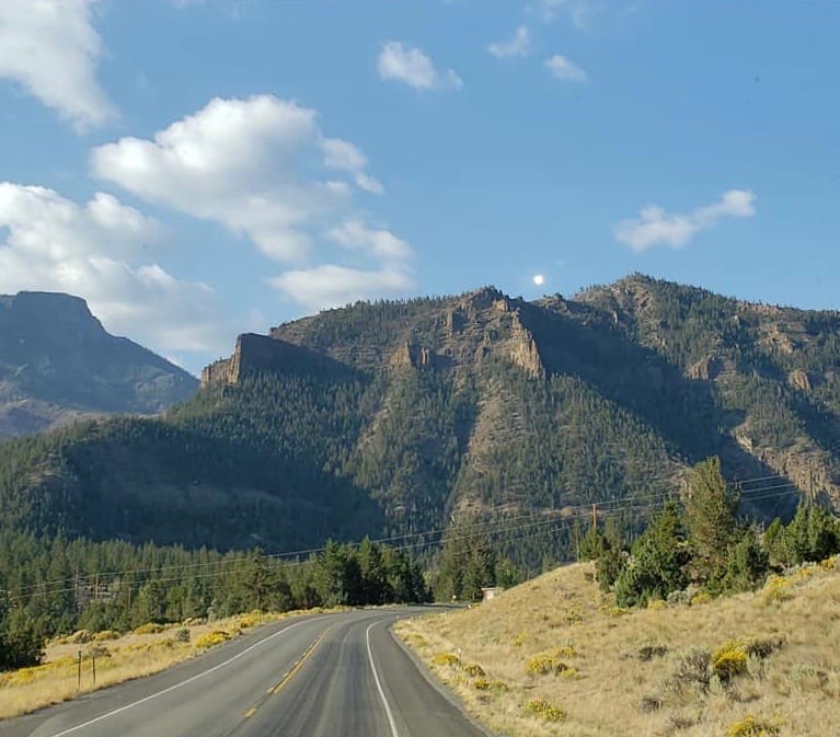
September 19 through September 21, 2021

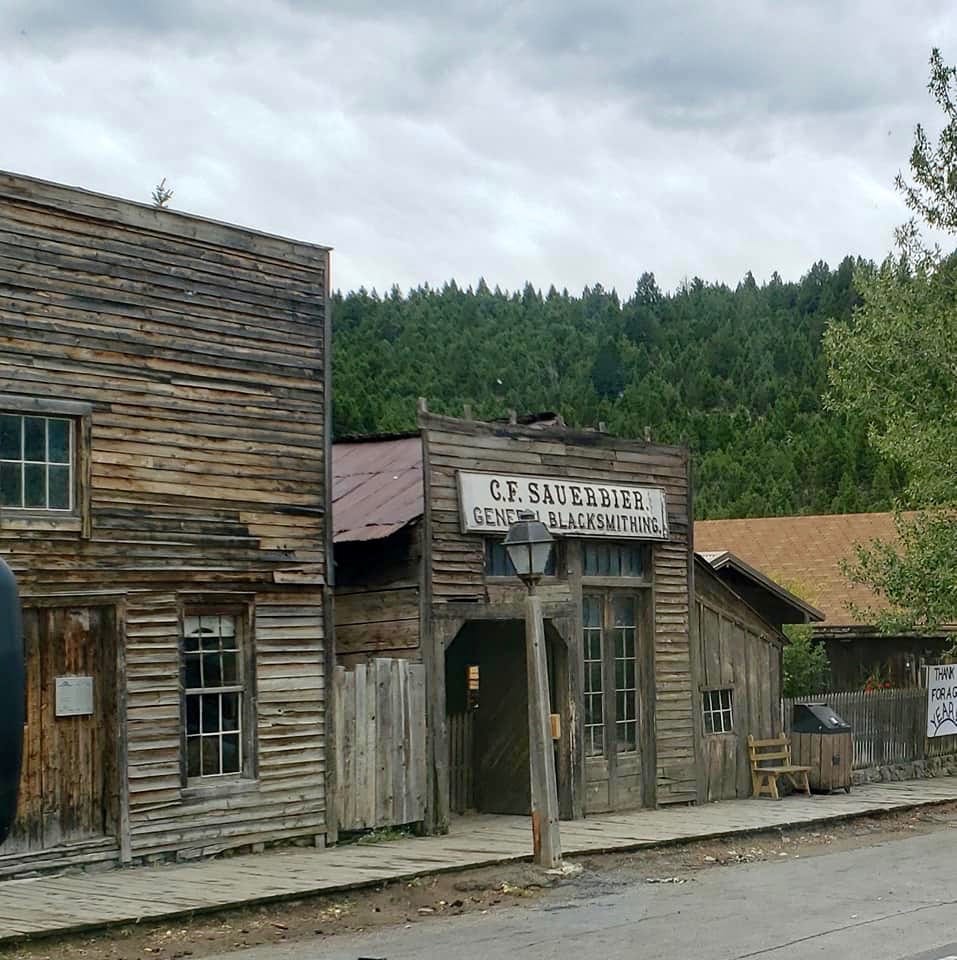
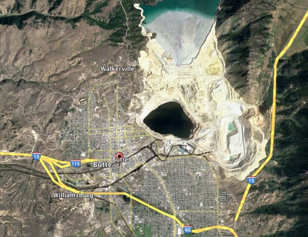
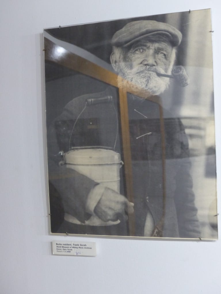
Butte Montana is the seat of Silver Bow County. The current population is 36,000 yet at the height of mining in the early 1900’s as many as 100,000 folks lived in Butte. The city began as a silver mining area. Not too long after a huge amount of copper was discovered and emphasis was switched to copper mining. The city has 14 head frames, each marking an individual mine.

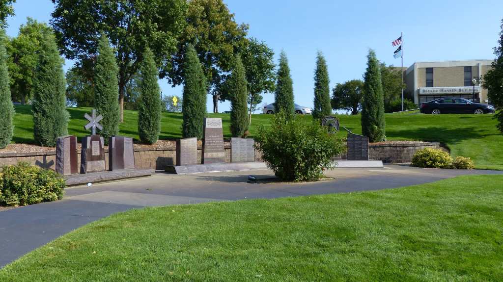
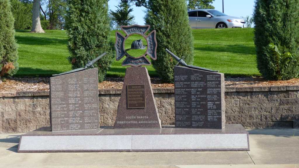
In and around Downtown Butte– Note the Mining Headframes

Established in 1864 as a mining camp in the northern Rocky Mountains on the Continental Divide, Butte experienced rapid development in the late nineteenth century, and was Montana’s first major industrial city. In its heyday between the late nineteenth and early twentieth centuries, it was one of the largest copper boomtowns in the West. Employment opportunities in the mines attracted Asian and European immigrants, particularly the Irish. As of 2017, Butte has the largest population of Irish Americans per capita of any city in the United States.

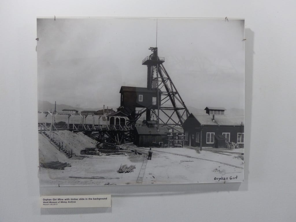
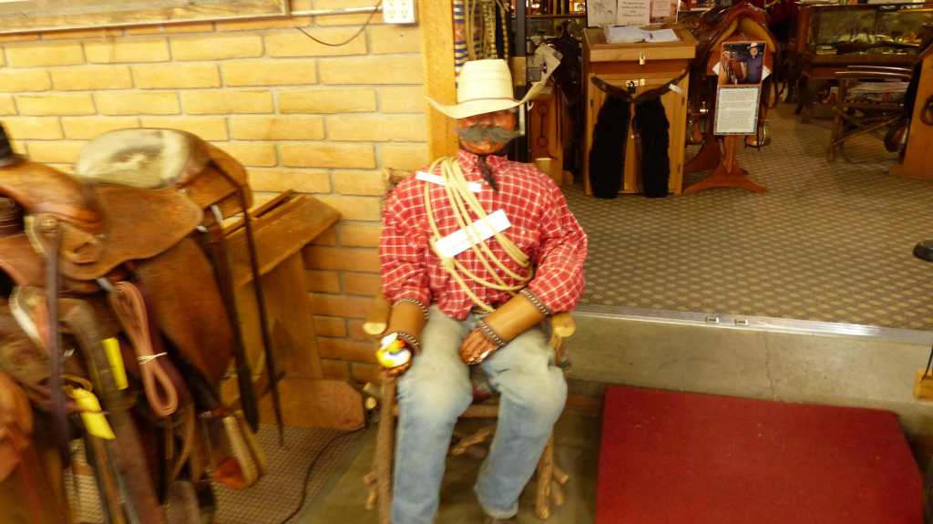
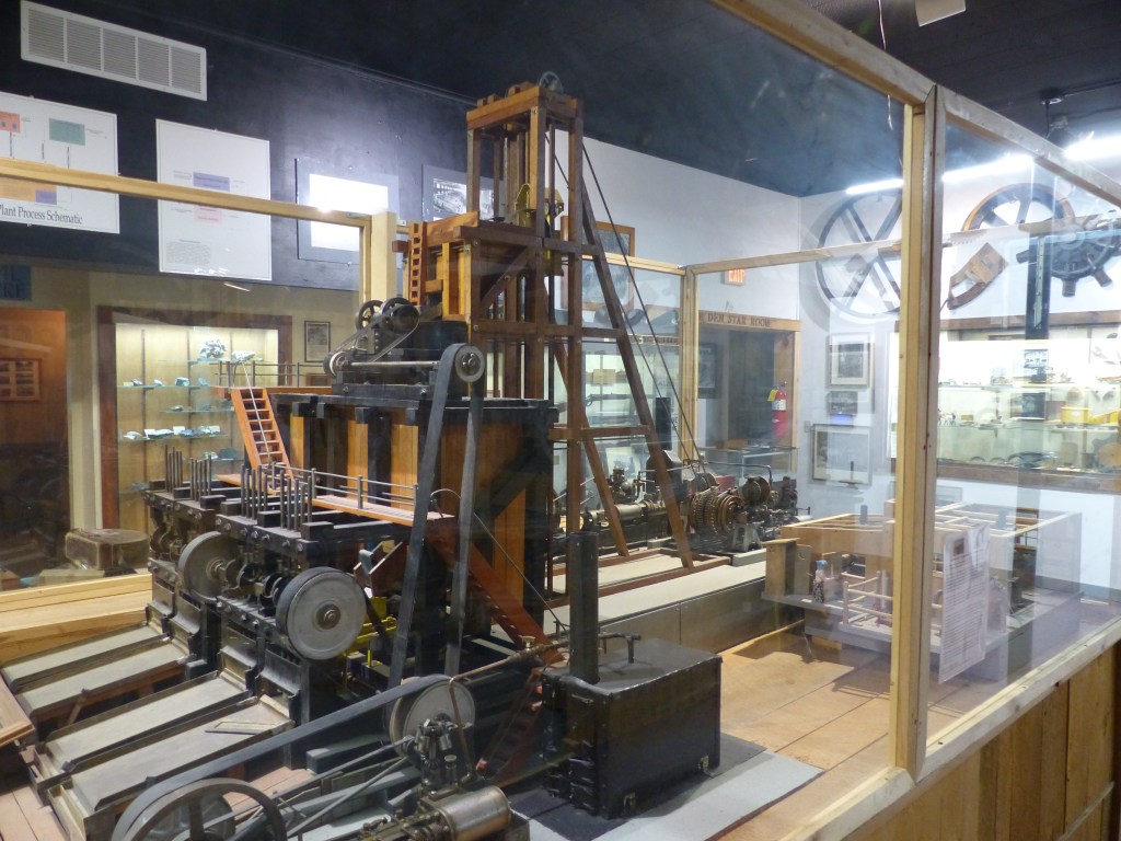
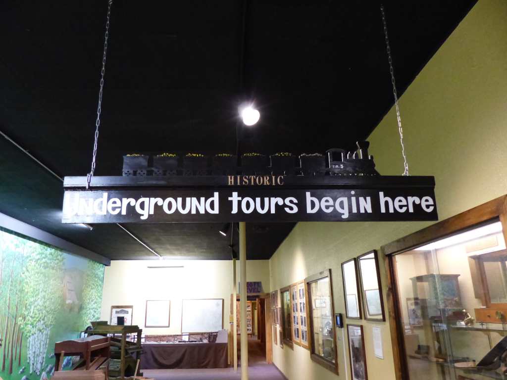
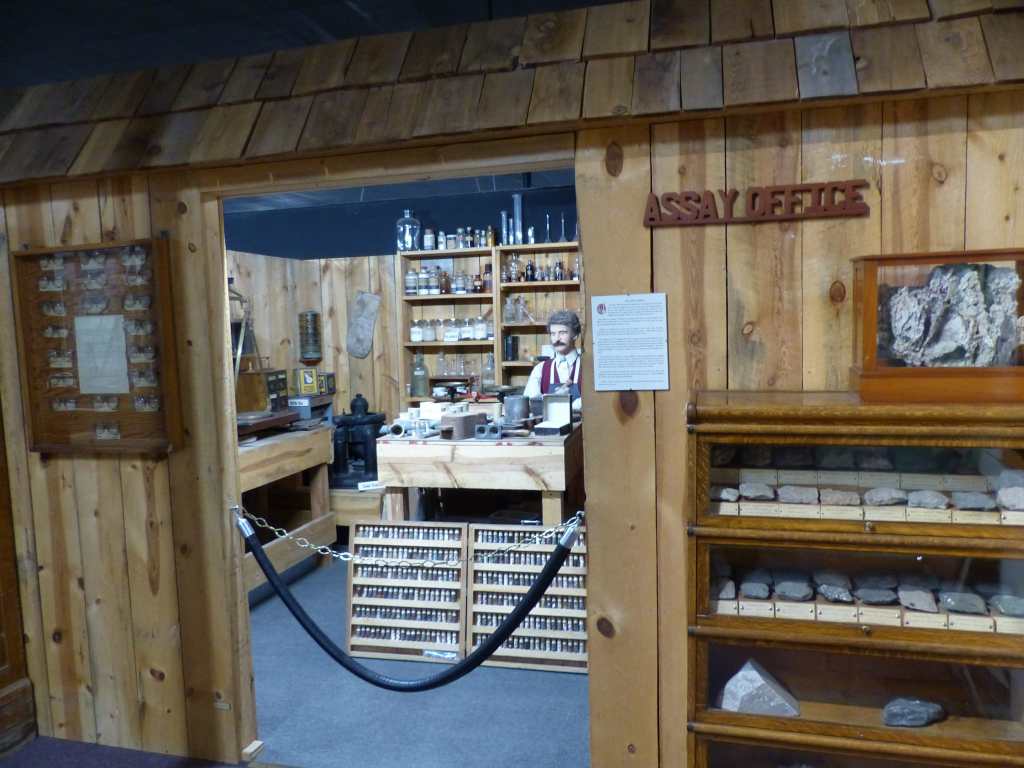
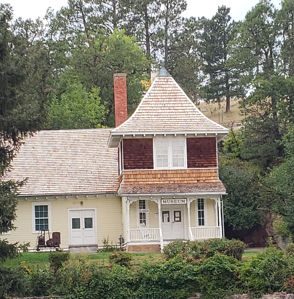
World Museum of Mining at Orphan Girl Mine Site

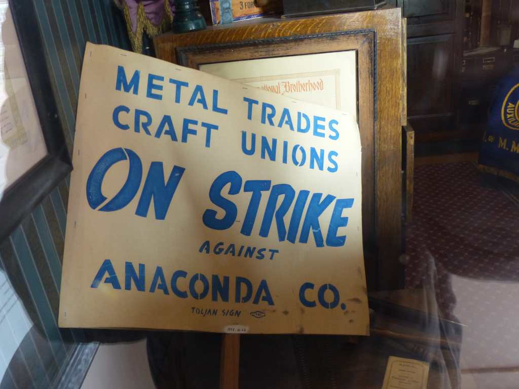
Butte was also the site of various historical events involving its mining industry and active labor unions and Socialist politics, the most famous of which was the Labor Riot of 1914. Despite the dominance of the Anaconda Mining Company, Butte was never a company town. Other major events in the city’s history include the 1917 Speculator Mine disaster, the largest hard rock mining disaster in world history.

Over the course of its history, Butte’s mining and smelting operations generated in excess of $48 billion worth of ore with the resultant environmental implications for the city: The upper Clark Fork River, with headwaters at Butte, is the largest Superfund site in the United States, and the city is also home to the Berkeley Pit, a superfund site unto itself.

Berkeley Pit

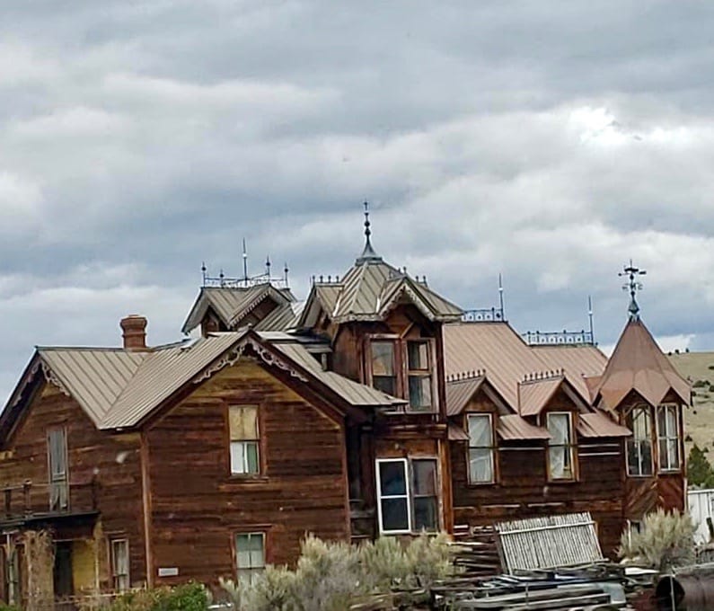
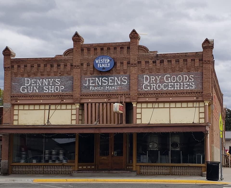
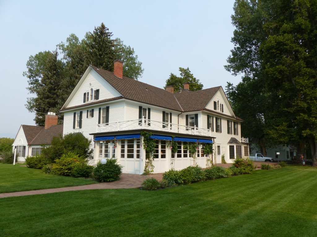
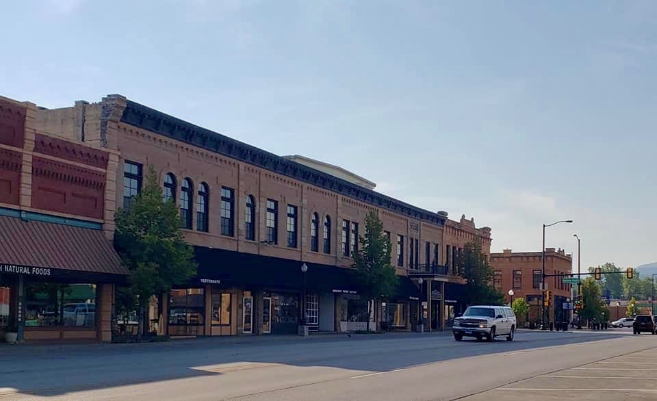
In the 21st century, efforts at interpreting and preserving Butte’s heritage address both the town’s historical significance and the continuing importance of mining to its economy and culture. The city’s Uptown Historic District, on the National Register of Historic Places, is one of the largest National Historic Landmark Districts in the United States, containing nearly 6,000 contributing properties. The city is also home to Montana Technological University.

Copper King Mansion

The influence of copper mining in Butte came from three men. These three “Copper Kings“, William A. Clark,[19] Marcus Daly, and F. Augustus Heinze constantly fought over control of the local mining industry with Daly and his original company, Anaconda Copper emerging as a monopoly. The company expanded into the fourth largest company in the world by the late 1920’s.

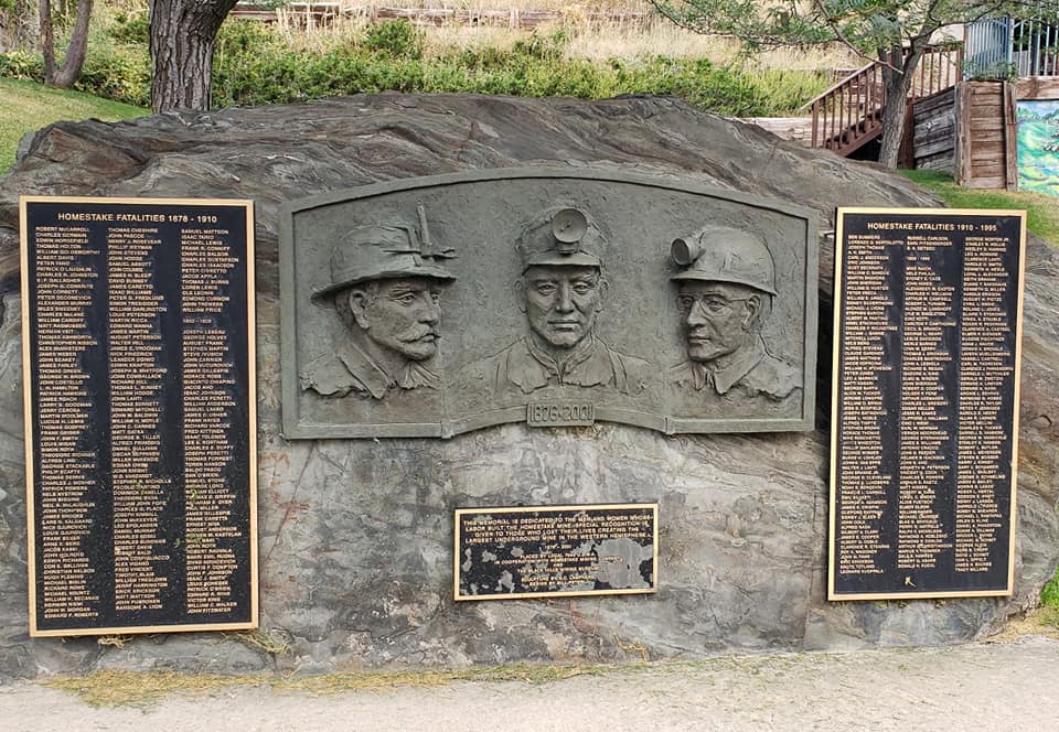
Copper ore mined from the Butte mining district in 1910 alone totaled 284,000,000 pounds. At the time, Butte was the largest producer of copper in North America and rivaled in worldwide metal production only by South America. The same year, in excess of 10,000,000 troy ounces of silver and 37,000 troy ounces of gold were also discovered. The amount of ore produced in the city earned it the nickname “The Richest Hill on Earth.” With its large workforce of miners performing in physically dangerous conditions, Butte was the site of active labor union movements, and came to be known as “the Gibraltar of Unionism.

From 1880 through 2005, the mines of the Butte district have produced more than 9.6 million metric tons of copper, 2.1 million metric tons of zinc, 1.6 million metric tons of manganese, 381,000 metric tons of lead, 87,000 metric tons of molybdenum, 715 million troy ounces (22,200 metric tons) of silver, and 2.9 million ounces (90 metric tons) of gold.

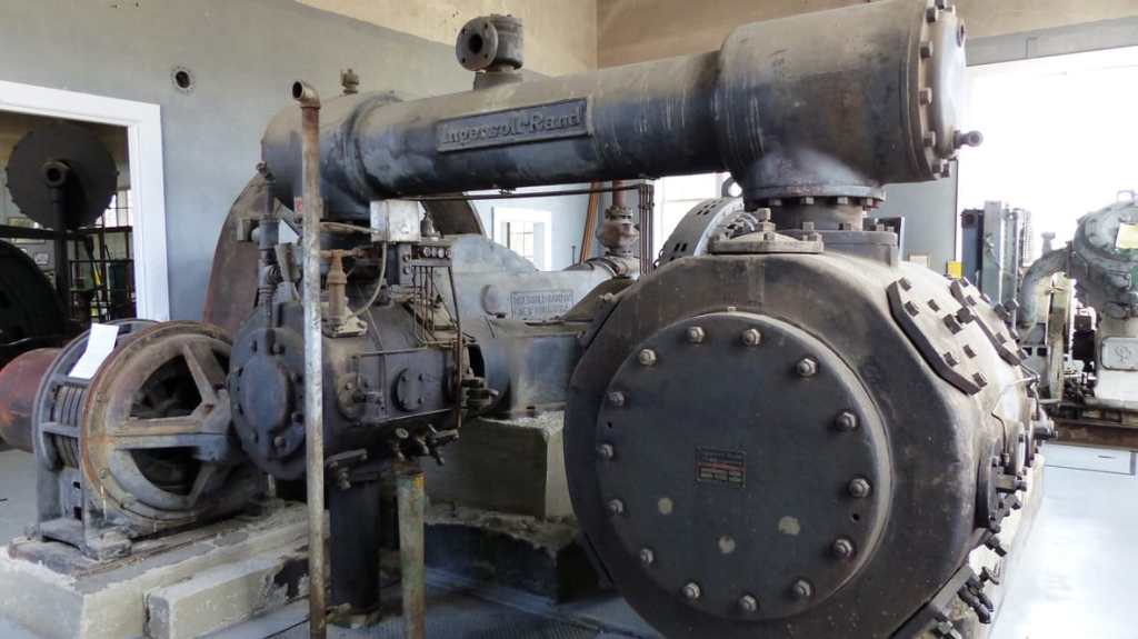
Fourteen headframes still remain over mine shafts in Butte, and the city still contains thousands of historic commercial and residential buildings from the boom times, which, especially in the Uptown section, give it an old-fashioned appearance. We are fortunate to visit the World Mining Museum located at the site of the Orphan Girl Mine. We learned a lot about mining. We also learned that 2500 miners from 1880 to 1954 lost their lives in the mines.

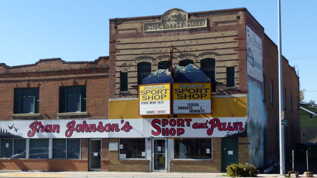
We seldom eat out so on our last day, Monday, in Butte. We feel the need for Chinese food. The Pekin Noodle Parlor is the oldest continuous operating Chinese restaurant in the US. During the 1980’s when the mining industry was in downturn some folks would try to skip paying for their meal. The restaurant is on the second floor. The owner, Danny Wong, would order the front door locked and he would stand at the top of the stairs wielding a bayonet, trapping the offenders. He’d say “Pay or wash dishes!” Mr. Wong called it Pekin Jail. The business passed from grandfather to grandson. Mr. Wong said that the basement that used to be a bar and casino at the height of mining is full of memorabilia from that era.

We pull up to the front door and discover it opens on Wednesday at 5pm. Nuts! OK, we’ll find a Mexican food joint over in the newer part of town. There’s a Taco Bell- no dining in due to staff shortage and the drive through line is long. Jil says there’s a Mexican restaurant across the street- a sign on the door says the staff was given the day off due to staffing shortages. So we amble back to El Taco. The restaurant is locally owned. Food is really cheap! Wow! And that’s because Jil’s bean burrito is made with a taco sized tortilla and so is my asada burrito. They are about a quarter the size of a normal burrito and the contents miss the mark as far as Mexican flavor. Oh well, at least we tried…….Maybe we’ll have better luck in the future. I still have a hankerin’ for Chinese.

Our Lady of the Rockies stands on the Continental Divide

On The Road To The Richest Hill on Earth

Sunday, September 19, 2021

We head out of West Yellowstone under a wintery mix of rain and snow. Snow is predicted at 6500 feet. It’s getting to be that time of year! We are once again taking the road less traveled as we head to Butte, Montana. It should be an interesting leg of the trip!

Our route follows the Madison River for quite some time. Tall mountains on either side of the valley a capped with snow. At a rest stop we watch fisherman float by in their fishing boats.

Ennis (849 souls) is considered both a blue ribbon fly fishing destination and an authentic cowboy town rolled into one and the art that comes from the area’s artists is entirely unique to the region. As one publication put it, “Ennis is a drinking town with a fishing problem!

From Ennis we head up the mountain to Virginia City (190 souls), born with the discovery of gold in 1863. The town served as the Montana Territorial Capital for ten years until the territorial capital moved to Helena in 1875.

In 1961 the town and surrounding area were designated a National Historic Landmark District. A mile down the road is Nevada City, a western town created from a collection of other ghost towns. Both towns have been largely restored and preserved having become living examples of the real Old West.

Sheridan, Montana

We drop down into the Ruby River Valley. This is cowboy country! Sheridan (642 souls) sits on the banks of the Ruby River, in the heart of the Ruby River Valley. Seven mountain ranges surround the Ruby River Valley: the Tobacco Root, the Highlands, the McCartney, the Pioneer, the Ruby, the Gravely, and the Snowcrest Mountains. If there was ever a cowboy town Sheridan is it! It’s Sunday and the sidewalks will remain rolled up until noon. The combined grocery and hardware store is open yet the restaurants don’t open until noon. Very few inhabitants are downtown and those that are look like they just rode in from the range on their horse. We love this place for its old west flavor.

Twin Bridges (375 souls) is where the Beaverhead, Big Hole, Ruby and Jefferson rivers meet. The town is home to the world famous R.L. Winston Fly Rod Company. These premier rods range in price from $500 to over $1000 per rod. Or how about a split bamboo rod for a mere $3500? Buy one of those rods and the locals will show you some world class trout fishing!

The road leaves the Ruby Valley and heads into the mountains southeast of Butte. The drive is very pretty but the road gets a little treacherous in places so we take it slow and steady. We follow a canyon down to the flats and on to our destination, Butte. We’ll be staying at the Butte KOA for three nights in order to explore this town of 33,000 souls.

We are NOT there yet….. hopefully, NEVER!………..

Bison, Wolves, and Geysers

Monday September 13 through Saturday, September 18, 2021

The drive from Cody to the east entrance of Yellowstone National Park is spectacular. US 14, designated as the Buffalo Bill Cody Scenic Highway follows the North Fork of the Shoshone River for many miles. Excerpt from Travel Wyoming.com- “From Cody it’s a gorgeous drive through Buffalo Bill State Park into the Wapiti Valley and the byway proper, a geologist’s dream and the country that Teddy Roosevelt once called “the most scenic 50 miles in the world.” The byway ends in spectacular fashion at Sylvan Pass (el. 8530 ft.) with a sweeping mountain view and the East Entrance to the world’s first national park, Yellowstone.”

We second Teddy’s observation. The scenery is most spectacular and best of all our RV never even grunted going over the pass. Once over Sylvan pass we drive down towards the huge Yellowstone Lake through a lot of dead and downed lodgepole pines, the victim of a million acre fire in 1988. The bright side is a tremendous amount of new growth is poking up amoungst the devastation- the forest lives!

Once past the entrance gate we stop at one of our favorite spots, Fishing Bridge. We’ve heard that the park is packed with humanity yet the general store only has a dozen or so cars parked nearby. Yay! Maybe most folks have been and gone! The store has a cafe. In normal times we’d ordered a hot dog. It’s cut down the middle and cooked on the flattop until crisp. Delish! Of course we would have taken it out to share with our mutzo Ollie. Times are not normal, Jil is now Vegan so I elect to bypass the most tasty hot dog ever offered anywhere in the whole wide world! Sigh…. We walk as short distance to the fishing bridge. It crosses the Yellowstone River not far downstream from its origin, Yellowstone Lake. Ironically, there’s a “no fishing” sign on the bridge.

Yellowstone NP is huge at 2,221,766 acres, 3472 square miles larger than Delaware and Rhode Island combined.. We still have to traverse the park to get to our campground in West Yellowstone, MT. There’s no quick way to get from one place to another. The speed limit is 45 miles per hour and one is lucky to maintain that speed with all the lookie-loos, bison jams and traffic trying to enter and exit parking areas. Most places of significance are 30-40 minutes apart. We choose the shorter and less crowded route: Fishing Bridge to Canyon Junction, to Norris Junction to Madison Junction to West Entrance. 37 miles of park roads yet two hours of travel time. Ya can’t be in a hurry when driving this huge park.

We head into Hayden Valley and immediately see small bands of bison. Some are grazing and some laying down, relaxing along the Yellowstone River. Jil sees people with large spotter telescopes and long lensed cameras on tripods observing some movement. “Wolves!”, she exclaims. “There’s a very large pack of wolves off in the distance!” We bypass the Yellowstone Falls area. We’ll come back to them after parking the RV. We stop in Canyon Village for a look around and a bite to eat, then head towards Norris Junction. The areas around the geyser basins are packed with cars! Like a half mile walk just to the parking lot packed! At Madison Junction we follow the Madison River to the West Entrance and West Yellowstone, Montana. Grizzly Yellowstone RV Park is less than a mile from the park entrance, making it ideal for visiting the oldest and most magnificent National Park in the US.

 Yellowstone is seventh largest national park in size. Though not the largest of the United States’ national parks, it is noteworthy for its dense concentration of geysers, mudpots, steam vents and hot springs. According to UNESCO, which has designated Yellowstone a World Heritage Site, half of all the known geothermal features on the globe are nestled within the park. Early accounts of Yellowstone’s geysers, hot springs and fumaroles were often dismissed as frontier legends, but scientists now know that they are the result of a “supervolcano” located beneath the park. 

According to the National Park Service, Yellowstone is the only place in the United States where buffalo have continuously roamed since the prehistoric era. The park’s herd dwindled to just 23 animals during the late 19th century, when overhunting helped drive the bison to the brink of extinction, but the population later bounced back thanks to more effective stewardship and protection. The roughly 5,500 bison that live in Yellowstone today constitute the nation’s largest and oldest free-range herd.

The park features multiple geyser basins along the Firehole and Gibbon Rivers. Of all of Yellowstone’s geysers, none is more iconic than “Old Faithful,” which is capable of spewing water 180 feet into the air. It’s located in the Lower Geyser Basin, the largest of them. Old Faithful used to erupt “every hour on the hour” but multiple earthquakes have caused it to slow down. These days, the gusher often takes breaks as long as 90 minutes between eruptions. Overlooking the geyser basin is the iconic Old Faithful Inn was completed in 1904. It’s lobby is one of the largest log structures in the world.

We had intended on going back into the Park at least two more times with rest days in between. We did go back into the Park wishing to visit a few of the many geyser basins. We were fortunate to visit a few of the minor basins and even Old Faithful had room to park. The other major basins had so many people attempting to visit that we felt the situation untenable, satisfied to visit less popular geysers, natural springs and lakes.

OK, one more visit is at hand. The mile long line to enter the park on Monday subsided. However, another visit was not to be. Mike got sick, going to first care. The PA said the situation would most likely resolve itself, if it didn’t go to the E.R. in Big Sky- 45 miles away. Well, Mike started to feel better but not well enough to fight the hour long line to get into the park, then many hours within the park searching for place to park a half mile away from a geyser basin or other natural feature so we just laid low.

So either due to illness or wall to wall people these are the places we wanted to visit but didn’t:

Yellowstone Falls located near Canyon Village consist of two major waterfalls on the Yellowstone River. As the Yellowstone river flows north from Yellowstone Lake, it leaves the Hayden Valley and plunges first over Upper Yellowstone Falls and then a quarter mile downstream over Lower Yellowstone Falls, at which point it then enters the Grand Canyon of the Yellowstone, which is up to 1,000 feet (304 m) deep. Combined, the falls drop 417 feet.

Midway Geyser Basin-The Grand Prismatic Spring is at this basin. No other spring is as spectacular as this one.

Mammoth Hot Springs– The springs is near the north entrance of the Park. In the Mammoth area, the hot, acidic solution dissolves large quantities of limestone on its way up through the rock layers to the hot springs on the surface. Above ground and exposed to the air, some of the carbon dioxide escapes from the solution. Without it, the dissolved limestone can’t remain in the solution, so it reforms into a solid mineral. This white, chalky mineral is deposited as the travertine that forms the terraces.

Fly fishing below Gibbon Falls. This flyfisherman hiked up the Gibbon River to reach the foot of Gibbon Falls.

Gibbon Falls lies chute as it tumbles down a rocky precipice.

Norris Geyser Basin is the oldest, hottest and most dynamic of Yellowstone’s basins. The water 1000′ below the basin is said to measure over 400 degrees F!

We were fortunate, and healthy enough, to visit the Grizzly and Wolf Discovery Center in West Yellowstone. This not-for-profit organization takes in injured and orphaned grizzlies, wolves and a few feathered predators from as far away as Alaska. They do a great job of caring for their critters!

Our last visit was something like 18 years ago. Lots of people visiting then, an ungodly amount of people this time. 18 years ago we could find parking at every stop. This time not so much. Although the mass of humanity definitely distracts from the natural beauty and the awe one experiences here, we feel fortunate that we have returned to this truly amazing place God has made for us.

Iconic Yellowstone Tour Bus

Land of the Wild West

Friday September 10 through Sunday September 12, 2021

I’m behind about a week updating this blog. It’s all due to technical difficulties- little to too slow internet being the main culprit. The blog should be back on track in a couple of days.

There’s a couple of ways we could scoot over to Cody from Sheridan. We choose the Bighorn Mountain Scenic Byway following US14 over the Bighorn Mountains to Grey Bull, then to Cody.

US14 in the Bighorn Mountains

Once leaving the Tongue Valley the road gets pretty steep and windy. The good thing is there’s lots of pull outs and scenic areas that our combo will easily slide into. The unfortunate thing is the air is thick with smoke, limiting what would be gorgeous views to hazy vistas. We’ll gain over a mile in elevation, cresting at Granite Pass, 9033′.

About two thirds of the way up the eastern slope all hell breaks loose. The driver information center located on the instrument panel sends an audio alarm as well as a “low coolant” message, then a “check engine” alarm, then the engine quits on a very steep grade with no warning. With no power steering I managed to muscle the rig partly off of the road. Crap! Set the brake, recycle ignition, the engine fires- no codes and the engine temperature gauge reads normal. Yay! I get to a pull-out and check for leaks and a low coolant and nothing seems amiss. Turns out the steepness of the hill and the hard pull might have triggered the warnings. I’ll put a little more antifreeze in the expansion tank when we get to Cody. I think that will solve the problem. We have no more rig problems the rest of the this leg of the trip.

Cresting Granite Pass US14 goes on a long downhill slide the scenery changes dramatically until reaching Grey Bull (1875 souls.

The town invites travelers to mingle with the locals in its restaurants and bars and asks that you step into history at the Museum of Fight and Aerial Firefighting, their Dinosaur Geoscience Center and to drive a short distance east to the World Famous Red Gulch Dinosaur Track Site. Of course I had researched the area months ago but an aging mind forgot all about what Grey Bull had to offer so we just passed through……..

Buffalo Bill Cody

We’ve been to Cody several times before. Cody (9500 souls) is the seat of Park County.The town is named after Buffalo Bill Cody who helped found the town. It is nice town to visit with lots to see and do, the main attraction being the Buffalo Bill Center of the West. It is five museums under one roof and a must see.

One can also partake in chuckwagon dinners, and nightly Cody Stampede Rodeo through the first week of September. The National College Rodeo is in town September 11 and 12. Old Trail Town has a large collection of old Wild West and trapper buildings. Downtown, Buffalo Bill’s Irma Hotel is still a big draw. And downtown retains its heritage of the original two story brick buildings.

We chose not to visit museums rather absorb the flavor of the town. We like old towns and feel that we can get to know them better by interacting with and supporting the locals.

Cody F.D- In remembrance on the 20th anniversary of 911

We chose to do this buy buying an ice cream cone at one of the old establishments…… It’s Saturday, September 11, the 20 year anniversary of 911. The town was very busy yesterday but not today. Both ice cream shops were closed- bummer! We are actually happy that so many businesses have shuttered their doors on this very heart wrenching day.

A few miles west of town is the Buffalo Bill Reservoir. Ollie likes to chase the wind driven waves that slop onto the shore, but not today. An algae bloom warning is posted so he’s not getting wet. Instead we drive back on US 14 through three tunnels that parallel the Shosone River.

Our stay at Cody KOA is OK. The newer sites are fairly large and all but tent sites are on gravel. People are respectful of their neighbors and keep their speeds down not wanting to kick up dust. The park features a very large dirt area which at least a part of could be converted into a nice dog park, yet it goes with a very small 15’x15′ area for pooches. Our boxer uses it as his bathroom and little else. Conversely, the park is large and Ollie likes to walk the abundance of fence lines. Just on the other side of one of the fences are horses. Ollie likes horses and can’t take his eyes off of them!

View from Cody KOA Campground

Tomorrow we’ll head the sixty miles to Yellowstone’s east entrance, drive through a portion of the park and land in West Yellowstone, Montana.

Towers, Cowboys and Tourists

September 7 through September 9, 2021

I asked Jil several times over the last two years if she would like to visit Devil’s Tower. “Honey, it’s only 20 something miles out of the way.” She- “Negatory, I don’t wanna, I don’t wanna, I don’t wanna”. We head west on I-90 and stop in a visitor’s center/rest stop just inside the Wyoming border. Jil goes in and comes out with a handful of brochures, maps, etc. Again heading westbound she says “Let’s go to Devil’s Tower”…………

Devil’s Tower is located in drop dead gorgeous Wyoming hill country. Several views of the monolith appear way before reaching the monument’s entrance. I’m wondering if we should be inside the park at all as it seems a little crowded and parking for RV’s is limited. After driving the windy, narrow road up to the Tower we find ample room to park.

The land around the Tower is composed of sedimentary rock, mainly red and yellow siltstone and sandstone interbedded with gray shale or limestone and gypsum. The Tower itself is kind of a who dunnit. Geologists have studied the formation since the 1800’s and are still stumped on how it was formed. NPS quote: “We know that the Tower is formed of a rare igneous rock, phonolite porphyry, and is the largest example of columnar jointing in the world. To better understand processes which shaped the Tower, we look back through Earth’s history to a time long before this unique feature took shape.”

The Tower is considered sacred by Northern Plains indiginous folk. The Arapaho, Crow, Cheyenne, Shoshone and Lakota are associated with the Tower site as well as two dozen more. Many associated the Tower with a bear- Bear’s Teepee, Bear Lodge, Bear’s Home, etc.. One can imagine a giant bear scarring the Tower with Giant claws. So how did Devil get into that Tower? A fella named Colonel Richard Dodge commaned a military escort for a scientific expedition into the Black Hills. In his journal he wrote “the Indians call this place ‘bad god’s tower'”. No records indicate that Native Americans associated this place with bad gods or evil spirits. Dodge, by the way, was no lover of Indians so he may have changed the name of Bear’s Teepee/Lodge/House to Devil’s Tower to show his distain for the people.

A lot of concern for suicide prevention in most places we’ve visited

We spend three nights at the Sheridan/Big Horn KOA to visit the beautiful city of Sheridan (17,44 souls). The city was named after General Philip Sheridan, a Union calvary leader in the Civil War. In the early 1880s, the nearby town of Big Horn (480 souls) was larger in population. In 1888, Sheridan County split off of Johnson County, and voters chose Sheridan as the county seat in a run-off election.

The WYO Theater

The arrival of the Burlington and Missouri Railroad in 1892 boosted Sheridan’s economic status, leading to the construction of the Sheridan Inn, where Buffalo Bill Cody was once a financial partner. The railroad created numerous side industries as well as export opportunities for raw materials. Maps of the day show Sheridan as part of the “hinterland” providing raw goods to cities like Chicago. For the next twenty years the economy and population boomed.

Street Art Sheridan Style

Sheridan has a strong rodeo culture that draws from ranching history as well as a tradition of catering to the wild-west entertainment and shopping tastes of locals and tourists. The Sheridan WYO Rodeo is a professional rodeo. It was a professional rodeo from the beginning but took a hiatus because of the Second World War in 1942 and 1943. It returned as a working cowboy rodeo in 1944 with a new name, the Bots Sots Stampede. In 1951 it resumed as the Sheridan-Wyo-Rodeo and became a professional rodeo again in 1966.

The mix of Cowboy and American Indian pageantry is still a major flavor in Sheridan’s annual summer celebrations, similar to rodeos in other reservation- border towns like Pendleton, Oregon. Sheridan’s cowboy-Indian social and community relations provided part of the inspiration for the Walt Longmire mystery novel and TV series created by local author Craig Johnson.

Interesting Storefront Signs

We walked downtown Sheridan admiring the numerous works of art placed along the sidewalk, the cleanliness of the town. The Mint Bar, touted as the oldest bar in town, “has been a meeting place for cowboys, ranchers and dudes” since 1907. King’s Saddlery and King Ropes has been in business since 1946 making custom saddles and ropes. The tack store looks like one has walked into a museum- until you walk back into their actual museum. The place is amazing! Jil said that the citizens of Sheridan are doing well considering the high quality of merchandise offered.

Across the street from King’s Saddlery is the very famous Fly Shop of the Big Horns. Anglers from afar are familiar with this shop. The establishment not only carries a wide range of fly fishing supplies but hosts fly fishing trips. Just down the street is the WYO Performing Arts Theater. The four blocks of downtown commercial district has a lot of interesting establishments.

We took a little tour just west of downtown driving by some pretty homes. Kendrick Park is really nice. Goose Creek runs through one side while a large buffalo pasture is on the other. We see a couple of nice sized bulls grazing next to the fence.

Our last visit is to the Brinton Museum. The museum is located on the 620 acre Quarter Circle A Ranch. The land was homesteaded by the Clark family in 1880 who originally lived in a dugout. It was sold several times with the Moncreiffes establishing the Quarter Circle A Ranch, building the Ranch House in 1892. The ranch was sold to Bradford Brinton in 1923 who used the ranch house as a vacation home.

Brinton, an avid collector of art, filled the home with American Indian artifacts, firearms and books and the works of the fine artists Frederic Remington Charles Russell and John Audobon. When Bradford Brinton died in 1936 he left the ranch to his sister Helen. She left the ranch as a memorial to her brother, wishing that the public should enjoy Bradford’s magnificent collection of art and that the ranch be kept in a natural state to provide sanctuary for birds and other wildlife.

Though Sheridan primarily celebrates its western culture through rodeo, the town’s history and culture includes major industrial, commercial, and recreational influences. Sheridan is a great place to visit!

Spearfish Revisited

This image has an empty alt attribute; its file name is deadwood-etc-map.jpeg

Wednesday, September 1 through Tuesday, September 7, 2021

Last year we visited this area so I didn’t feel up to writing and entirely new post. Most of the content in this post is from last year. New are a few fresh words of blabber of a visit to Belle Fourche, a town we’d hadn’t visited until this year and and a some new photos. The northern Black Hills are enchanting if one loves history and old buildings. And that’s precisely why we came back!

Driving from the northern Plains back to the Black Hills was pleasant. We’re happy to be in the hills once again. We are staying at the Elkhorn Ridge RV Resort. The place is very nice and not terribly expensive. We’ll enjoy our stay here and use it as home base in order to do a little exploring.

This image has an empty alt attribute; its file name is image-48.png

Elkhorn Ridge RV Resort

This place is truly a resort. It has a conference center/meeting room, tennis courts, swimming pool, and walking paths. Besides the nicely laid out RV sites, cabins are available for those without a home on wheels. There is lawn art everywhere mostly of animals native to the area.

This image has an empty alt attribute; its file name is p1090363-2.jpg

Sturgis Motocycle Rally

We didn’t visit Sturgis this year favoring a few other towns. The town is famous for its annual motorcycle rally. The town of 6,627 souls swells to unbelievable proportions. This year attendance was down however, with only 500,000 attending over a 10 day period. The motorcycle rally has been over for a couple of weeks and the town is quiet with only a few visitors enjoying the place.

Sturgis is a little quieter now that the rally is over!

Stugis was founded in 1878. It was originally named Scooptown because many of the residents “scooped up” their pay from nearby Fort Meade. Its name was later changed to Sturgis to honor Civil War Union General Samual Sturgis. Sturgis was designated the seat of Meade County in 1889.

Deadwood is located at 4500′ Deadwood (1270 souls) is the seat of Lawrence County. The entire city has been designated as a National Historic Landmark District. A Mustang car rally is being held in Deadwood today with the locals expecting 500 cars. The main street is blocked off and the place is already too crowded for us at 9:30am.

Mustang Car Rally forming up

Excerpt from deadwood.com: The discovery of gold in the southern Black Hills in 1874 set off one of the great gold rushes in America. In 1876, miners moved into the northern Black Hills. That’s where they came across a gulch full of dead trees and a creek full of gold and Deadwood was born.

Practically overnight, the tiny gold camp boomed into a town that played by its own rules that attracted outlaws, gamblers and gunslingers along with the gold seekers. Wild Bill Hickok was one of those men who came looking for fortune. But just a few short weeks after arriving, he was gunned down while holding a poker hand of aces and eights – forever after known as the Dead Man’s Hand.

This image has an empty alt attribute; its file name is default.jpg

Well known characters from the Old West are buried in Mt. Moriah Cemetery. Calamity Jane is buried next to Hickock and other legends like  Potato Creek JohnnySeth Bullock and Al Swearengen will forever find peace overlooking the town.

Actors in period garb

(From Deadwood.com): You can find these colorful characters walking the streets of present-day Deadwood as a part of Deadwood Alive. This theater troupe reenacts the major historic events – like the Trial of Jack McCall and Wild Bill’s assassination— that inspired the legends you know today.

As one can imagine gold played out and folks moved on. The current population of 1270 souls pales from the 25,000 who lived here in its heyday. The place fell on hard times now and then and suffered through three major fires. Gaming revived what was to become another ghost town. What is left today are the period buildings at its core, modern day resort hotels. their architecture playing off of 100 year old buildings, big name concerts, gaming and walking in the footsteps of Wild West legends.

As nothing is flat in Lead, homes march up the hills

With Deadwood ready to explode with humanity we chose to find a quieter town to explore. Lead (LEED) (3124 souls) is not far from Deadwood. The town was named for the leads or lodes of deposits of valuable ore, in this case gold. The Homestake Mine, established in 1876, lies at the edge of town. The mine was the largest, deepest (8240 feet) and most productive gold mine in the western hemisphere before it closed in 2002.

Lead has a great mining museum. If ever in Lead don’t miss it! Yes, mining at the Homestake Mine is a main theme yet a very large portion of the museum is devoted to the town and its people and its way of life.


Homestake Mine engine


Lead was founded as a company town which was made more comfortable through the efforts of Phoebe Hearst. She established a town library, free kindergarten, and opera house, provided college scholarships.


In the early 1930’s, due to fear of cave-ins of the miles of tunnels under Lead’s Homestake Mine, many of the town’s buildings located in the bottom of a canyon were moved further uphill to safer locations.

Giant hole in the ground
Memorial to Miners who lost their lives

Today Lead and the Homestake Mine have been selected as the site of the Deep Underground Science and Engineering Laboratory, a proposed NSF facility for low-background experiments on neutrinos, dark matter, and other nuclear physics topics, as well as biology and mine engineering studies.

Downtown Spearfish

Spearfish (10,494 souls), founded in 1876, lies just west of Elkhorn Ridge RV Resort. The city was founded at the mouth of Spearfish Canyon it’s roll in the Black Hills Gold Rush being a supplier of foodstuffs for the mining camps in the hills. The Homestake Sawmill was built to supply timbers for the Homestake Mine.

Spearfish Creek emerges from the canyon and runs through the center of town. An unusual phenomenom is that in winter the creek freezes from the bottom up, with ice at the bottom of the creek bed and water running over the top. The cause is the fast running creek doesn’t allow ice to form on top, only the bottom of the creek bed.

Sights around downtown Spearfish

Entrance to Historic D.C. Booth Fish Hatchery


We enjoy fish hatcheries and Spearfish has a beauty. The landscaped grounds are worth walking through, the “fish” train car is historically significant. Heck, the whole working hatchery is historically significant. The train cars were used to transport fish from one location in the nation to another. At the moment rainbow trout are being raised.

Right next door is the Spearfish Municipal Campground. It’s pretty nice, I wanted to camp there but it’s a first come, first serve sort of place. With so many people enjoying the outdoors we couldn’t take a chance. Oh well, maybe next time.

Spearfish Creek

We took the scenic drive up Spearfish Canyon. Talk about beauty! Sheer limestone cliffs, beautiful trees and a couple of small waterfalls are all highlights within the canyon.

Near the top of the canyon is Spearfish Canyon Lodge. The handsome lodge is surrounded by God’s beauty. The lodge offers overnight accommodations, fine dining and entertainment and more.

A place new to us is Belle Fourche (5594 souls). I don’t know what’s with the spelling/pronunciation of French language derived words. The correct pronunciation of Belle Fourche is Belle Foosh. So Belle Foosh is a city near the geological center of the 50 United States and has a large granite monument to prove it. The area was worked by French beaver trappers until the mid-1800’s and Belle Fourche became a well known trading rendevous point. During and after the gold rush of 1876, farmers and ranchers settled in the fertile valleys, growing food for the miners and their work animals.

At the same time huge cattle drives came into the area with the cattle in need of transportation to packing plants in the midwest. Knowing that need, a smart fella named Seth Bullock acquired land from homesteaders and offered it free for a railroad right-of-way. He also offered to build the terminal if the railroad would locate it on a point on his land. Well, you can bet the railroad jumped all over that offer! By 1895 Belle Fourche was shipping 2500 carloads of cattle a month. Belle Fourche today serves a large trade area of ranches and farms.

Tomorrow we’ll be heading west into Wyoming. See you then!

Hello Spearfish!

Wednesday, September 1, 2021

The drive from Pierre to Spearfish South Dakota was uneventful. We traveled exclusively on combined highways US 14 and SD 34 a two lane country road until US 14 zigged south and SD 34 zagged on more of a straight line towards Sturgis.

A large comples of silos and farm buildings

Jil said “I looked up the route on my phone and there are lots of towns on SD 34”. The condition of SD 34 was an unwarranted concern so SD 34 it was. The first two signs of civilization were churches. One all by itself on a little knoll and another located next to a grain elevator. No towns, just churches with a couple of farm houses within sight of Grace Church and nada near the Little Brown Church. We pass an occasional farmhouse. The farms out here are large so passing a farmhouse doesn’t happen too often.

Thousands of acres planted in sunflowers

Places named on Google Map seem to be named for a nearby farm or establishment, not for a town. The first services were in Billsburg- a truck stop with some sort of outbuilding just to the south. We stop and stretch with Jil running into the store to buy some munchies. A few more miles west is a fairly new fueling station/minimart but still no town. We come to Howes- no town, just a little country store- out in the middle of nowhere. Howes’ store claims “We ain’t no Hooterville but advice is always free”. Another church, this one with a cemetery across the street greets us as we head west.

Downtown White Owl

We finally arrive at what appears to be a multi-building community. White Owl, a metropolis of 61 living souls, has a Baptist church, a fashion boutique, community center, a graveyard and a post office- and that’s it other than a few homes.

Nellie’s Saloon in Enning, SD

We stopped in Enning, a thriving community of 49 souls. But Enning is far from devoid of services, it has Nellie’s Merchantile and Saloon. And grocery store and restaurant! Jil goes in to see what Nellie has for lunch and comes back with the best hamburger and fries I’ve eaten for a very long time. Jil spoke with Nellie as she hand formed the hamburger patty, plopped it on the flattop, dropping the fries in the deep fryer. She says she has a home in Pierre which she visits occasionally. She keeps her establishment open as a gathering place for the locals- and a place people can use the rest room. As she stated, “There’s no place for old ladies to relieve themselves for hours so I keep the place open for them. She features good home cooking with specials every day. During COVID finding help was tough but she now has three young ladies that give her a hand. As you might surmise, we enjoyed our stop in tiny Enning.

As with most places on the route Union Center is a WHAT? Not a town but allegedly has a population of 350. Cammack Ranch Supply is along the highway as well as the Bull Creek Cafe. Do those 350 people live underground- or what?

Hillside- Sturgis

We come into Sturgis. Yes, that Sturgis. The Sturgis Motorcycle Rally was a few weeks ago so those 500,000 motorcyclists have mostly gone home. The town, founded in 1878, was originally named Scooptown because many of the residents “scooped up” their pay from nearby Fort Meade. The name was later changed to Sturgis in honor of Civil War General Samual D. Sturgis. The town is quiet today with just the occasional raucus motorcycle disturbing the now almost peaceful town. Sturgis is the seat of Meade County and has a population of 6627 souls.

Heading west, now on Interstate 90, we come to our destination for six whole nights, the excellent Elkhorn Ridge RV Resort. The price is fair, the sites are large, the staff is accommodating. The park features a large swimming pool, a large kid’s playground, basketball court, tennis/pickleball court, horseshoe pits, several wash houses complete with laundry facilities. A meeting hall, a large conventions style tent, walking paths that take one out on to the prairie, two large dog parks- this place is really nice!

The historic 4700 acre Frawley Ranch is next door. Six historic homesteads are on the acreage. So is the Elkhorn Ridge Golf Club. A thousand acres of the ranch have been set aside for residential development. And of course, the RV Resort. New construction closer to I-90 is in progress so this ranch is still developing. At one time bison grazed here.

We are laying over for the Labor Day weekend here at Elkhorn Ridge. Quite a few places of interest are within striking distance so it’s a good place to stay. This place is packed for the holiday weekend and everyone with children has brought them along. The kids are having fun- all day long. The outdoor venue is hosting a wedding on Saturday. What a great place for a wedding!

Enjoying Peer

August 29- August 31, 2021

We leave Sioux City after a raucous band of thunderstorms rolled through last night which included three tornado signatures just south of us. No damage was reported until the Lennox High School staff arrived the next morning to find the roof on one school’s buildings was missing.

Oh my! The roof is gone!

Sooo, where’s an interesting place to visit today? Ahh, the Corn Palace in Mitchell, SD (15,000 souls)! The Palace has been on our must see list for a while and I’ll tell you, it is worth seeing. The palace was conceived as a gathering place in 1892 where city residents and their rural neighbors could enjoy a fall festival with extraordinary stage entertainment – a celebration to climax a crop-growing season and harvest.

The Corn Palace, Mitchell, SD

This tradition continues today with the annual Corn Palace Festival held in late August each year. The concept is so successful that the first two were outgrown, the current building constructed in 1921.The outside of the building is clothed in corn stalks, much of which are made into murals.

The inside of the auditorium has a lot of “corn” art decorating the walls. We got lucky to visit today as a street fair was going on and a “Cowboy” church service was being attended by folks on the inside.

Usn’s with Dignity in the background

The decision was made to overnight at American Creek Campground, Chamberlain (2300 souls). The town is located adjacent to Interstate 90 on the east bank of the Missouri River. It’s the site of St. Josheph’s Indian School, established and operated by the Catholic order Priests of the Sacred Heart in 1927. Near town is the soaring sculpture of Dignity of Earth and Sky which stands on a bluff overlooking the Missouri River within the busy Lewis and Clark Interpretive Center. Dignity stands 50′ tall and is made of hundreds of pieces of stainless steel. She holds a star quilt made of 128 diamonds in colors of water and sky. Dignity honors the Native Nations of the Great Plains. If we ever come back to Chamberlain we’d like to visit the Akta Lakota Museum and maybe the Old West Trading Post.

Capitol of South Dakota

OK, on to Peer. For all you smart fellers out there yes, I’m messing with you. We are visiting Pierre, South Dakota’s state capital. Us Renoites would pronounce the city’s name P-air, the locals pronounce it Peer. Pierre is a city of nearly 14,000 souls and does double duty as the seat of Hughes County. It’s the second least populous state capital in the US and the eighth most populous city in South Dakota. The city was designated as the state capital in 1889 when SD gained statehood.

Fort Pierre located across the Missouri River from Pierre has been a permanent settlement since 1817. It is the oldest white settlement in South Dakota and once the largest trading post on the Upper Great Plains. The fort was named after Pierre Chouteau, a major fur trader from St. Louis.

Pierre’s development was also influeced by the construction of the Rapid City, Pierre and Eastern Railroad. It increased access to markets for regional products and passenger transportation. Despite the railroad, Pierre is somewhat isolated as far as state capitals go. It’s one of four state capitals that is not served by an interstate highway. Unlike the other three, the city has no expressway. Just upriver river is Lake Oahe, one of the largest man-made lakes in the world.

We spend a lot of time in our home for two nights, Farm Island State Recreation Area. The park is a delight with large grassy campsites adjacent to Hipple Lake, an arm of the Missouri River. In addition to the wonderful campground it offers a spacious day use area complete with a small beach, boat launch ramp, walking paths, an archery range and a visitors center.

Although we had visited last year we chose to spend more time in downtown Pierre. As we were admiring a couple of bronze sculptures a man came out of his business establishment to explain that they were of past governors. They cost $73,000 apiece and all but three have been completed. Local artisans have been commissioned to create the works of art. The completed sculptures have been placed in strategic locations around the city. When funding is available the set will be completed.

We didn’t go into the capitol building as the legislature is in session. We drove around the residential areas admiring some of the most beautiful homes that we’ve ever seen. Jil got her flu shot at Walgreens and a visit to the market completed our stay. Tomorrow we head to Spearfish for an extended six night stay.

These folks have gathered to see us out of town!