Visiting Old Friends and Old Haunts

Thursday, September 30 through Tuesday, October 5, 2021

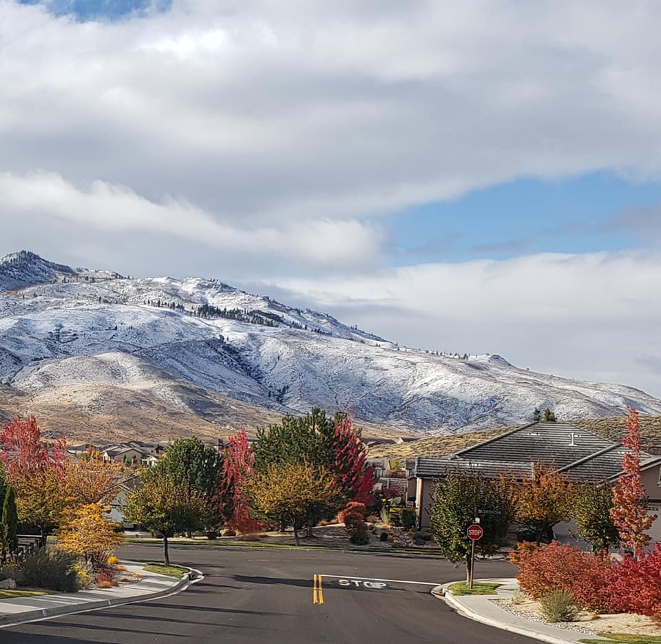
Jil and are home. As I write this last blog entry I am once again in awe of our beautiful location in Reno. The leaves are in full fall color and the Carson Range and Sierra Nevada has received two early season snowstorms. Even downtown Reno has received some of the white stuff!

Is this beautiful??? Or What?

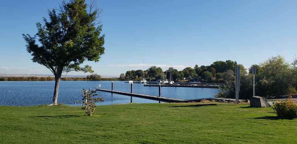
We left Walla Walla via US 12 towards the Columbia River, then southwest on US 730 where it ties into Interstate 84. We stop in Boardman (3200 souls) to stretch at the great park located on the bank of the mighty Columbia River and to fuel the beast. Diesel is as much as $1.50 a gallon more than last year. Ouch! Ollie likes roaming the nice green grass of the park and staring at the waterfowl floating in the little bay. The only other soul in the park is a maintenance fella and his utility vehicle.

Plans to visit long time friends Jim and Connie are still on yet abbreviated due to the mechanical problem we had with the motorhome. Jim and Connie bought an acre of land and are in the process of building a big metal shed which will eventually have room for their motorhome and a whole bunch of other necessities. We told them that we’d like help for a day or so before we turn towards home. We were warned by Jim and Connie that the Dalles Bridge that connects The Dalles, OR to Dallesport, WA over the Columbia River is being strengthened and modernized and is not open to traffic Thursday night through Sunday with delays when it is open.

US 97 Bridge at Biggs Junction

We chose to cross the Columbia at Biggs Junction on US 97, then proceed west on Washington 14 which closely parallels the mighty Columbia. We stop at Maryhill to stretch and admire the view of the Columbia River and its gorge from high on a bluff then head off to Jim and Connie’s place.

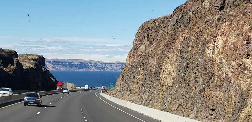
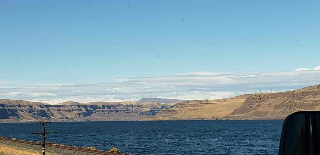
The eastern Columbia Gorge is rather dry, yet beautiful

They have a nice flat piece of property, the lot is the last on a dead end street so it only has two immediate neighbors and undeveloped land on the other side. We were able to help some and have plenty of time to catch up on each other’s lives.

Jim and Connie’s Shed is Going Up

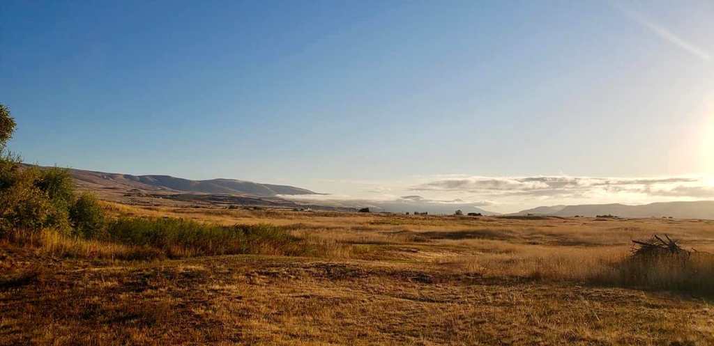
Daybreak at Jim and Connie’s

Leaving Jim and Connie’s we backtrack to Biggs Junction and head south on US 97. We stop at the park in the little burg of Moro (324 souls) and speak to three fellas who are in the process of solving the world’s problems, OK, maybe just their own. Jil asks them about Oregon’s outdoor mask mandate (none of them are wearing masks). The reply is “This is Eastern Oregon. We do what we want, not what the Western Oregonians want!” OK then……

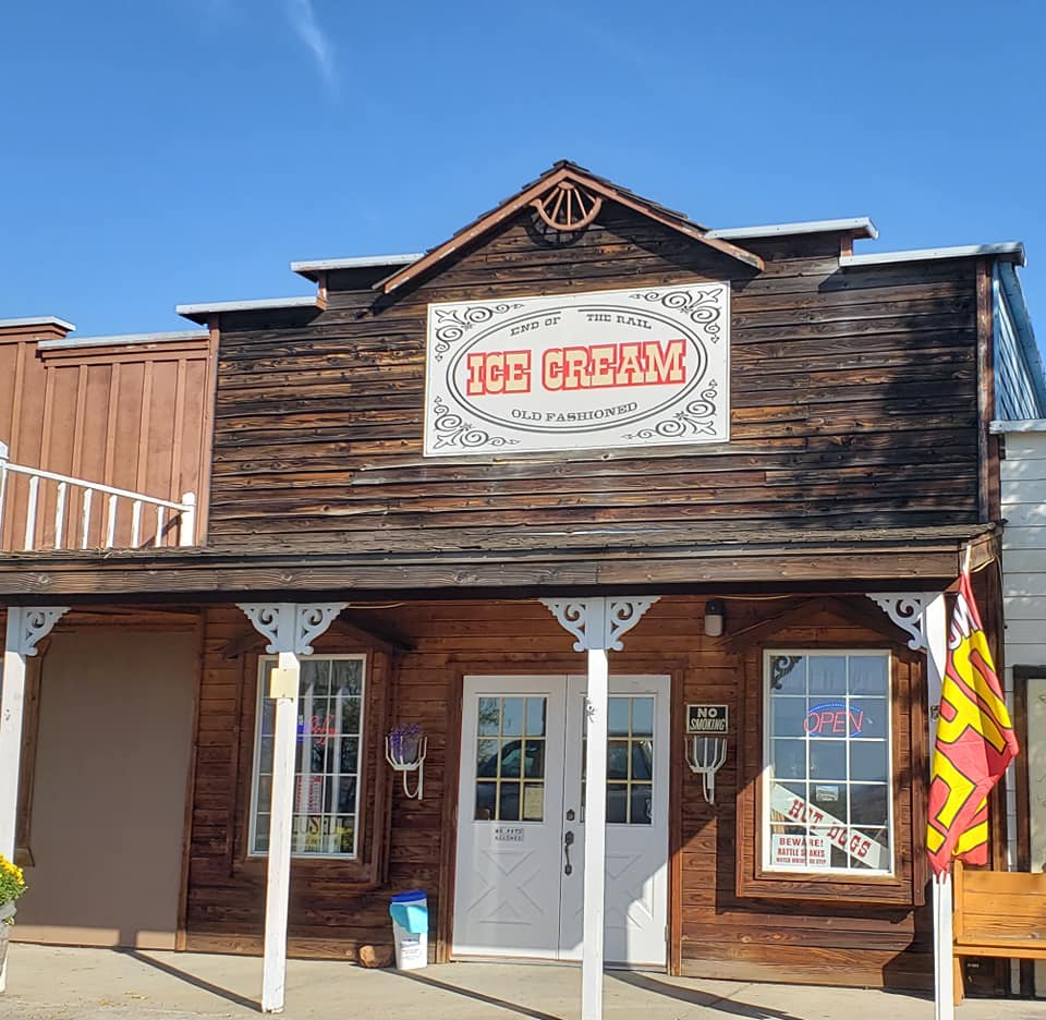
Shaniko is a metropolis- population 36. This place was a railroad hub back in the early 1900’s, the only one east of the Cascade Mountains. Goods came from as far away as Klamath Falls and even Idaho. It was known as the “Wool Capitol of the World”, shipping 2,229 tons of wool, and 1,168,866 bushels of wheat in 1903. Cattle ranches produced livestock that filled 400 railroad cars. Fortune was not to last as the railroad decided to use a “direct, quick and natural” alternate route linking Portland to Bend which diverted traffic away from Shaniko. Business steadily declined and the entire rail line was shut down by 1966. Efforts to revive the Shaniko Hotel and the town have not been terribly successful as just a few small businesses survive.

We pass through Redmond. This city of 32,421 soul has seen rapid growth at a rate of 6.7 percent a each year. Its the seat of Deschutes County. Between the years 2000 and 2006 the population exploded by 74%! We stop for fuel then continue on to our next stop for two nights, Crown Villa RV Resort in Bend, Oregon.

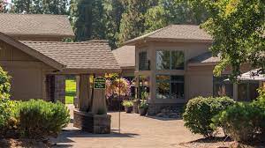
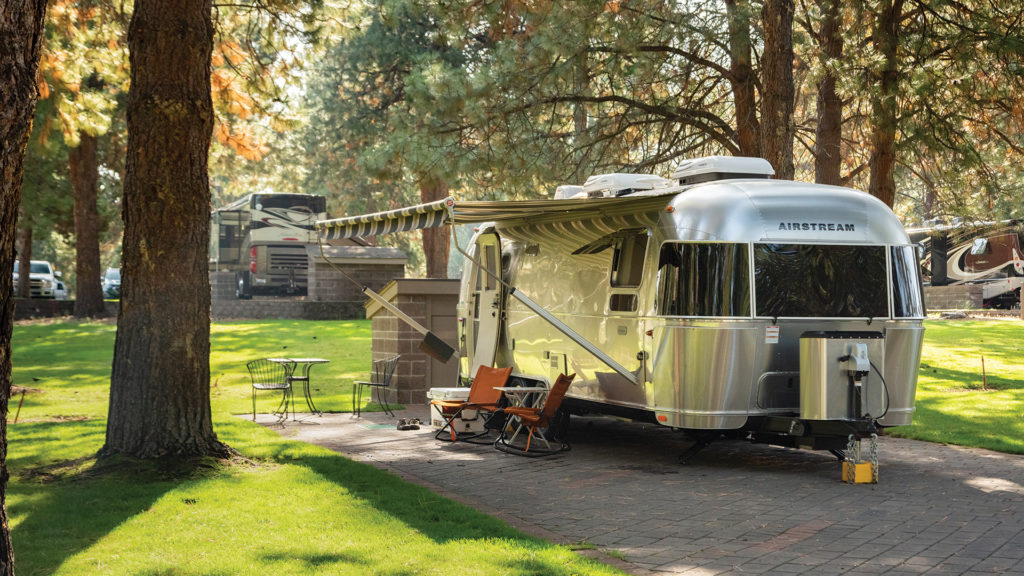
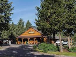
Crown Villa began as buyer/ownerRV resort. I guess folks didn’t want to buy so it reverted to a normal rental type park. Its setting in mature pine trees, RV sites set on pavers, mowed grass between and separating each row of sites, nice community buildings, one housing the office, library and gym and the other restrooms, laundromat, gathering room and hot tub. A small dog park is at one end of the park. The park has never been cheap but now its downright expensive and not nearly as well maintained as before Sun RV Resorts bought the property. Not sure why, maybe because of staffing shortages- we’ve noticed plenty of that on our entire trip- or poor management or both. Either way we don’t have a desire to return to this once well maintained park, at least for a while.

While in Bend we wanted to take advantage of the clear, smokeless air and lack of heavy traffic Bend has become known for so we head out early. The last two times we’ve been here the nearby volcanic peaks have been shrouded in wildland fire smoke. We make the short ride to Pilot Butte as a view of the beautiful peaks and most of Bend can be seen from the top of the butte . Hey, the Butte road is closed until whatever.

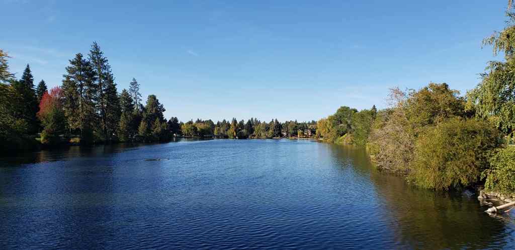
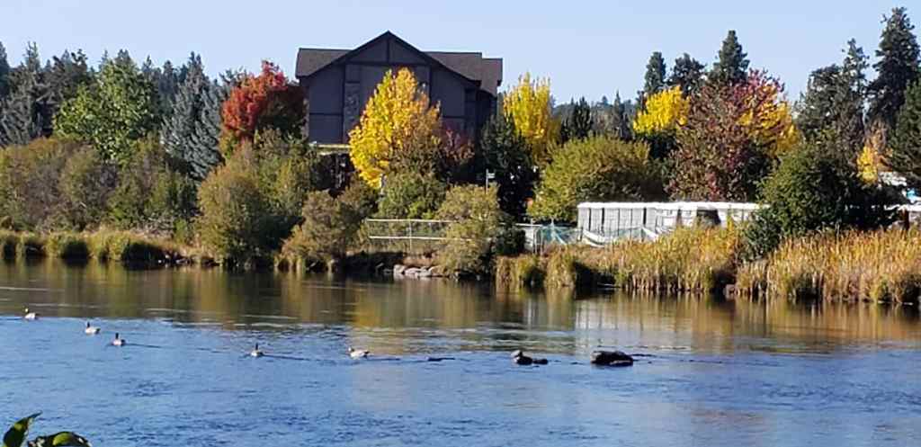
We don’t return to Pilot Butte rather head downtown. It’s 9am and downtown is already going nuts. A street fair and road closures push us straight to Drake Park. That’s OK as we’d wind up at the park anyhow. The park is located between Mirror Pond that is created by the damming of the Deschutes River and downtown Bend. Across the pond are some drop dead gorgeous homes whose manicured back yards stop at the lake’s edge. We enjoy walking with Ollie through this lovely park.

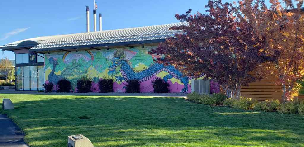
We then head to Old Mill Mall. The tall stacks of the old lumber mill still penetrate it seems like forever up, up, up into the sky; the walking paths next to the Deschutes make for a pleasant walk. From here we can see three or four of the volcanic peaks poking above the Bend’s hills. Jil must not feel good as she has no desire to go shopping……..

Volcanic Peaks west of Bend

It’s time to head towards the barn. It’s just over 400 miles to home so we’ll make one more stop along the way. We head out of Bend southbound on US 97 and leave that busy highway at La Pine in favor of a less traveled Oregon State Route 31, The Outback Scenic Highway. We travel many miles in pine country then drop down to more arid sage dominated landscape. We pass through Silver Lake (149 souls). One never would imagine the history of some of these places without a little research. On Christmas Eve 1894 a fire started in a crowded room of celebrators killing 43 people. Ed O’Farrell rode 100 miles on horseback to Lakeview for medical help and Doc Bernard Daly drove his buggy over bad winter roads for 24 hours to reach Silver Lake. Doc Daly’s efforts to reach and treat victims earned statewide recognition. The entire region is in drought and Silver Lake is dry.

Little Church near Silver Lake, OR

We stop in Paisley (243 souls) to stretch. The nearby Paisley Caves have archeological sites that give the oldest known evidence for early Native Americans that date from 12,750 to 14,290 years ago. Paisley is home to the annual Mosquito Festival that raises funds for vector control.

Approaching Pailsey, OR

Oregon 31 ends at Valley Falls which appears to have passed away. We pick up US 395 and head south. Lakeview, Oregon (2294 souls) is the seat of Lake County. The city bills itself and the “Tallest Town in Oregon” because of its elevation of 4802 feet above sea level. Its economy is based on agriculture, lumber production and increasingly on tourism as Goose Lake is nearby. During the 1950’s Lakeview’s sawmills accounted for more than half of the town’s economy. Leaving town we get a good look at Goose Lake. It also appears to be dry. The drought is bad……..

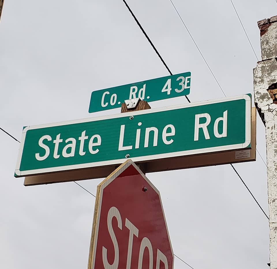
Half way down the east shore of Goose Lake Oregon becomes California and so does the tiny town of New Pine Creek (120 souls. The town is thought to be the oldest in Lake County and southernmost in Oregon despite the being south of the 42nd parallel.. Being north of the 42nd parallel the town should actually be in the state of Kali-Fornia except for a surveyor’s error. Across the border lies New Pine Creek, CA (98 souls)

New Pine Creek, California/Oregon

Alturas CA (2827 souls) is the seat of Modoc County. It is located at the confluence of the north and south forks of the Pit River. Originally known as Dorris Bridge, later Dorrisville, named after Pressley and James Dorris who built a bridge across the Pit River at this location. The Dorris Bridge opened in 1874.

There aren’t many RV parks in this neck of the woods. Sully’s is located at the end of town and gets pretty good reviews from overnighters. Sully’s is a possibility but we want to check out Likely Place Golf and RV Park in……. Likely, CA. Likely has a reported population of 63 souls but we’ll be darned if we can find them. The “town” consists of a cafe and two other commercial buildings that have long been shuttered. The only sign of life are some piles of junk behind the buildings and evidence of possible squatters taking advantage of empty buildings.

Sunrise- Likely Place Golf and RV Resort

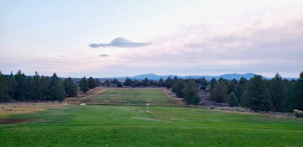
The turnoff to Likely Place Golf and RV is a couple of miles down a country road, then another mile of interior road that crosses through open cow pasture. We check in at the golf course office/cafe and settle into our site. I went back to the cafe and ordered a cheeseburger and fries. Golf course food never fails to be decent and my hamburger and fries were very tasty. The golf course isn’t too busy so dogs are invited to walk the fairways. Lots of folks here are camping with friends as evidenced by 8-10 chairs circled around a portable fire pit in one camper’s site, those same chairs occupied for several hours in the evening by folks having a great time together. We are happy with our choice of staying at Likely Place.

Our last morning on the road- pack up, jacks up, slides in, fire up the beast and we are on our way home. The first 40 or so miles has us driving through rocky volcanic hills and dales, through narrow canyons then down towards Honey Lake. We’ll bypass Susanville this trip and take a short cut through Mennonite farm country.

We make a pit stop at the rest area overlooking Honey Lake. There’s evidence of the Dixie fire having jumped the highway. That fire has burned over 939,000 acres but has calmed down an awful lot due to cooler weather. We then head home. Once again our house guests have left the place immaculate. Thanks Jim and Nancy! We unpack, give the RV a general clean up and winterize the water system. The outside of the rig and the floors will get a good scrubbing on another day.

All in all our trip was successful with very few disappointments. The places we had planned to see didn’t disappoint. Too many of those places to mention here deserve a return visit if we ever are in the area again. Yellowstone was way too crowded for our taste but it was good returning to the park after so many years. Our rig’s suspension problem could have been a lot worse in time and cost. We got to visit our good friends Connie and Jim and meet their new puppy Rhetta. And we got to see clearly the spectacular snow capped volcanic peaks that line the Cascade Range for a couple of hundred miles.

The only thing I would change is not feeling the need to plan the whole trip months in advance right down to RV park reservations and the length of stay in each. I would rather have the freedom of spending more time in some places and less in others. But that’s what COVID has done. It’s made travel less spontaneous and much more planned. As a wise old person once said “It is what it is.”

Until next time, Via Con Dios!

A City So Nice They Named It Twice!

Sunday September 26 through Friday October 1, 2021

Taking the long cut to Walla Walla only adds a few miles but adds many new places to visit so the long cut it is! We head south on US 95 towards Moscow Idaho (23,800 souls) transitioning from green mountain forests to golden rolling hills- the Palouse. No one knows how Moscow got its name. Conjecture says it was named for a Russian dude’s home town who had established a trading post here.

Moscow is the home of the University of Idaho, the state’s land-grant institution and primary research university. The city also serves as an agricultural and commercial hub for the Palouse region. Miners and farmers started arriving in the area after the Civil War with the first permanent settlers coming to Moscow in 1871.

A scant six miles to the west is Pullman Washington (34,000 souls) and Washington State University. The town was incorporated in 1888. Like the University of Idaho, Washington State was established as land-grant school back in 1891 and opened in 1892. Of note a very young Jil, like barely able to remember young, and her family lived in Pullman for a couple of years while her Dad taught at the university.

Pullman is noted as a vastly fertile agricultural area known for its many miles of rolling hills (The Palouse) and the production of wheat and legumes.

Heading towards Walla Walla we come to Colfax, WA (2800 souls). It is situated amidst wheat-covered hills in a valley at the confluence of the north and south forks of the Palouse River. The town started as a lumber town back in 1871 with the establishment of a sawmill. The area is geologically interesting, lying in the midst of the fertile Palouse country  in the middle of the Columbia River Plateau.

Downtown Colfax, WA

Walking along the main street of Colfax we spot a monument of sorts. A couple of locals tell us that its the Codger Pole, continuing to explain that back in 1938 a high school football game was played in cold winter weather on a frozen field. One of the players decided that he would get both teams together to replay the game some day. And that they did- 50 years later! The Codger Pole commemorates all the players who by then were in their 70’s.

Quote from the memorial plaque-“Master Carver Johnathan Labenne’s superb talent and whimsy captured the warmth, fun and love Colfax and St. John shared while we Codgers cavorted about the field in school colors wearing our numbers from a half-century ago. The ghosts of our youth revealed glimpses of gridiron briliance. Unfortunately brief and few but even so that glorious afternoon of fun gave us guys a chance to fulfill that dream every seventy year old kid secretly hangs onto- playing one more game. And how many old rascals ever get to do that?”

We head southeast out of Colfax on very rural country roads, Washington Hwy 127 comes to mind, mostly following canyons through palouse hillsides and canyons. The wheat fields have been harvested as evidenced by the yellow stubble left behind by farmer’s combines. The road is pretty rough and relatively slow going. Eventually we arrive in Walla Walla and settle down in the RV Park Four Seasons.

Marcus and Narcissa Whitman arrived here in 1836 and established a mission in an unsuccessful attempt to convert the the Walla Walla tribe to Christianity. Following a disease epidemic both were killed in 1847 by the Cayuse who thought that the missionaries were poisoning the native peoples. Whitman College is named in their honor. The Catholics attempted to establish a Diocese but fled after hearing of the Whitman’s plight. Fort Walla Walla was established by the Hudson’s Bay Company Fort Nez Perce fur trading post. Several of the original buildings still exist. The US Army extablished its own Fort Walla Walla in 1856. The city was incorporated in 1862. After a gold rush the community experienced rapid growth as an agricultural area. The Baker Boyer Bank was founded in Walla Walla, the oldest bank in Washington State.

RV Park Four Seasons grounds and menagerie

The RV park is immaculate but management is maniacal in enforcing frivolous rules. I guess like most rules they are made from one bad experience. The lady in the office meets us outside the office door so we don’t contaminate it with whatever. We’ve not been in states that enforce mask wearing until we arrived in Washington and that’s what she’s wearing when she greets us- outside in the open air. But like I said, the park is immaculate!

We planned on spending two nights in Walla Walla, aka, “The City So Nice They Named It Twice”, with a day trip to town. Downtown is sorta unique in that the main street is not straight but curves so it gives it a unique look to the buildings that line it. We’ve heard that the area is big on wineries but had no idea that fully one half of the storefronts would house wineries and tasting rooms.

Wine tasting is not our cup of tea but the business district is a nice, neat, clean place to visit. After visiting so many states that don’t require masks this state has kinda gone nuts on their use. Can’t wait ’til we get to Oregon where mask wearing is required out of doors……..

The morning we end our visit our right rear tires go over a low curb as we leave the RV park and all hell breaks loose. Gosh, the curb wasn’t that high. As we proceed it feels like the rig no longer has springs as it is riding really, really hard. We stop after a half mile or so in a parking lot, Mike inspects the undercarriage and determines one of the air springs has broken. Crap! We’re not going anywhere anytime soon. A call is made to the only heavy truck repair shop listed for Walla Walla, a mobile mechanic is dispatched, arrives and confirms the broken air spring.

He OK’s a limp back to the RV park and management has room for us. Mountain Hi Truck Repair goes on the hunt for a replacement air spring which is not unlike a big rubber air bag. Considering the thousands of Freightliner chassis like ours that are on the road they should be easy to find but that’s not the case. The company finally finds one in Pendleton, OR, at a Peterbilt dealer no less, and has it delivered the next day.

Fort Walla Walla

OK, we have to cool our heels for a while so we head over to Fort Walla Walla and the municipal park. Fort Walla Walla was established in 1856. The soldiers from the fort were involved in several battles with hostile Indians. Most notable was the Battle of White Bird Canyon during the Nez Perce War where 30 soldiers were killed. The soldiers from that battle and others are buried the fort’s cemetery. The fort was closed then reopened to train WWI soldiers in the art of field artillery. The fort was turned over to the VA in 1921. Fifteen original buildings remain from the military era. Today the complex contains a park, a museum, and a VA medical center. The park is really nice and has a couple of very large dog parks within it.

The repair of our RV takes less than 1/2 hour. Its too late to travel so we spend a total of four nights in Walla Walla. We are thankful that management at Mountain Hi realized the plight a couple of travelers were in and went above and beyond to find the part and get us back on the road as soon as possible. It actually took four times longer to find the air spring than to install it. So thanks again Mountain Hi and a big thanks to Jeff in the office who hunted down the part and Steve for his efficient diagnosis and repair job.

So after a two day delay we resume our trip. Hopefully our extended RV warranty will come through and pay for the repair without too long a delay.

A Hop, Skip and a Jump to Idaho

Wednesday, September 22 through Sunday, September 26, 2021

When we left Butte we headed west of I-90 stopping in Deer Lodge Montana. Why Deer Lodge? To visit the old Montana State Prison, of course! The folks in the gift shop/admissions booth even invited Ollie to take a tour of the the old prison with us.

The “Old Prison” was established 1871 as the Montana Territorial prison until statehood in 1889, then closed its doors in 1979 as the state prison. We found the old prison unlike that of the old Wyoming Prison in that the prisoners had more creature comforts.

Old Montana Prison Grounds

They had access to a movie theater, a cantina out on the exercise yard and a fine arts theater built for them by Willam A. Clark, one of the Copper Kings of Butte fame. The prison was quite crowded which lead to a prison riot in 1959. The riot was quelched by the National Guard which used WWII bazookas to get the job done.

Interesting what one finds inside an old prison

Just a sample of the hundreds of vehicles in Auto Museum

The Deer Lodge Pizza joint and a 1909 mail order Sears and Roebuck carriage house

We are quite surprised that the price of admission includes an auto museum. Who would have thunk a prison would have a quite extensive museum featuring almost every model year of the Ford Model A all the way up to the muscle cars of the 1960’s. Hundreds of beautifully restored and unrestored cars! Mike was in heaven browsing all that hardware.

We overnight in tiny St. Regis MT (319 souls) at The Nugget RV Park. The park is just beautiful as the owners have preserved a natural forested setting yet offer full amenities. The place is run by locals who have a lot of pride in this park. There are forest walking trails for those who would brave the gremlins (and possibly bear and elk) and a several acre grass field whose perimeter serves as a frisbee golf course.

The next morning we stop in the old mining town of Wallace Idaho. Wallace has stuffed itself in a narrow canyon in the Bitterroot Mountains where four streams and five canyons converge onto the course of the South Fork River. It’s the seat of Shoshone County with a population of 784 souls. In its heyday the area produced more silver than any other mining district in the United States. The town is quiet, another traveler asked where they might find a place to eat? I reply, “we are also visiting so I have no idea, sorry”. Another fella passing by in a van asked “Where’s the grocery store?” So it goes in small towns. We walk the entire downtown of Wallace appreciating every bit of this great old town. Jil heads to the grocery store which- I hadn’t noticed- is right across the street from where we parked. The fella that was asking for the grocery store is parked in its parking lot. Wallace has a nice family market by golly!

We continue to Cataldo Mission. The mission is the oldest building in Idaho constructed between 1850 and 1853. It’s now part of Idaho’s State Park system. The exhibit at the visitors center tells the story of how the Jesuit missionaries came to the interior Northwest at the invitation of the Coeur D’Alene and Salish tribes and the profound effects this sacred encounter had on both cultures.

Photos taken from our “front yard” at Blackwell Island RV Park

We are holing up at the Coeur D’Alene Blackwell Island RV Park for a few days. This park is drop dead gorgeous! Located across the Spokane River from the city of Coeur D’Alene. It’s quiet yet is close to downtown for those who want to visit. It has a boat dock and swimming beach, and large grassy areas on which to stroll. Our site is on the end of a loop so we have and unfettered view of the Spokane River, the beach and the large lawn. Life can’t get any better than this!

When the French fur traders arrived in this territory, they began interacting with the local native Americans. They called them the “Coeur d’Alene” tribe, translating literally to “Heart of the Awl”, because the French saw them as being sharp-hearted or shrewd traders.

Downtown Coeur D’alene and homes in the nearby Fort Ground HOA

Coeur d’Alene (53,354 souls) is the seat of Kootenai County, Idaho. The city is located 30 miles east of Spokane, Washington. The locals call the city CDA, I guess because Coeur d’Alene is too complicated to pronounce for them? Fort Sherman, established in 1878, named and sited for General William Tecumseh Sherman, lies on the north shore of Lake Coeur d’Alene, or Lake CDA. Gold and silver deposits were discovered in 1878. A timber boom featuring the highly prized white pine peaked in the 1920’s. Tourism is the major driver of the city’s economy today.

We drove into town and walked the very pretty business district as well as the park that was created between the lake and downtown. The townsfolk have done a great job of keeping the feeling of downtown as if it were 100 years ago. The place is really nice, clean and upscale for sure. The residential areas were neat and tidy as one would expect in this town. Our passage to and our stay in Coeur D’Alene was thoroughly enjoyable.

The ever vigilant Mr. Oliver

Tomorrow we’ll head over new territory for us to Walla Walla for a couple of days. We’ve been to Walla Walla once before but it’s been a while. We are anxious to see what has changed since our last visit.