Maybe the Scariest Road I’ve Driven- But Beautiful!

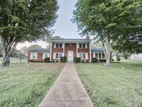
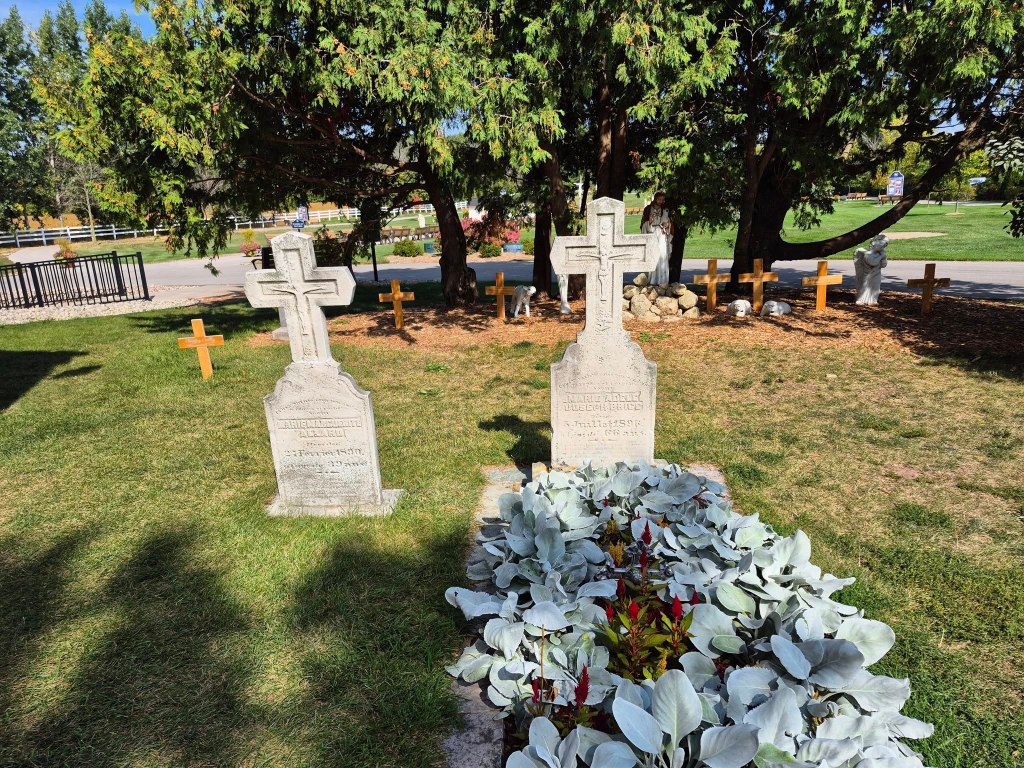
We are no longer in Tennessee as we slowly wend our way towards our home. We left Goodlettsville around 0900 hours, hoping that we’d allowed enough time of rush hour to pass through. We hooked up with I-24 heading northwest.

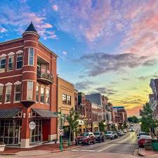
We passed Clarksville, (166,722 souls), Tennesee’s fifth most populous city and Montgomery County’s seat. The city was founded in 1785 by General George Rogers Clark- brother of William Clark of the Lewis and Clark Expedition. The city is located ten miles from Fort Campbell, site of the 101st Airborne Division. The fort straddles the Tennessee- Kentucky state line. I-24 bypasses the city so we didn’t peruse it but an intreguing read of this city is located here.here: https://en.wikipedia.org/wiki/Clarksville,_Tennessee.

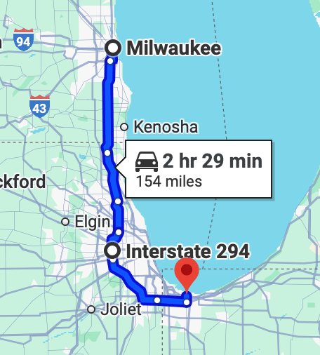
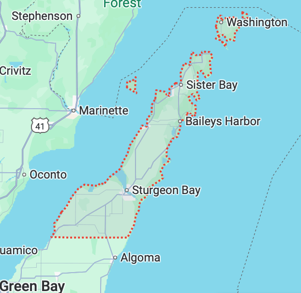
This is another multi-state travel day- four states to be exact. We start off in Tennessee then travel to Kentucky, Illinois and finally Missouri.

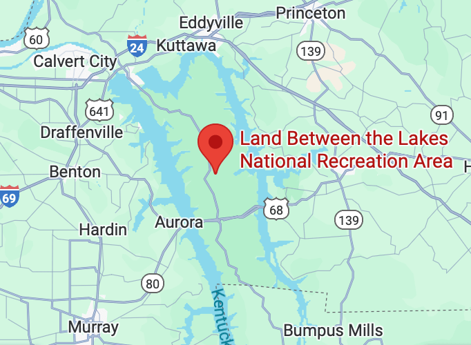
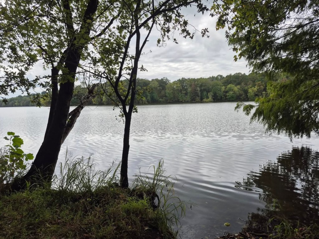
On our way to Paducah, KY we pass an area called Land Between the Lakes National Recreation Area. After the Cumberland River was impounded in the 1960s and a canal was constructed between the two manmade lakes, Land Between the Lakes became one of the largest inland peninsulas in the United States.

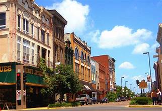
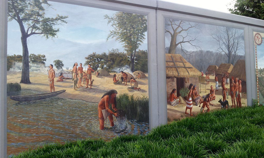
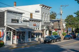
Paducah Kentucky (27,130) lies on the banks of the Ohio River. It’s flood walls are reminiscent of those of Vicksburg MS in that beautiful murals have been painted on them.

We are supposed to head towards Poplar Bluff MO from Paducah. Jil’s smarty pants phone and Mr. Garmin are once again in conflict. Jil’s phone has a route beginning before the Garmins so we follow her phone. I’m only 50% confident about Miss Smarty Pants route selection but we went with it. We find US 62 and head west. All is good for a while as the road is four lanes.

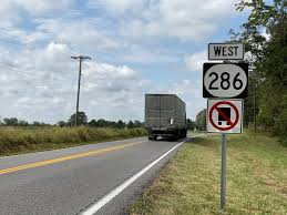
Of course two lanes end and we are no longer on US 2 but County 286 and the county is chincy with its asphalt. Not only is the road now two lanes with 3 foot deep drainage ditches on either side of the roadway but the lanes are 11 feet wide including the center line and fog line- and the rumble strip is in the fog line. So in reality my 8.5′ wide rig is traveling on a 10′ wide roadway. I’m highly focused on keeping he rig in the center of the lane but every once in a while a low spot next to the fog line wants to pull the front wheels towards the ditch- and that’s not fun. I have to correct swiftly and not oversteer otherwise the RV crosses the center line which could spell disaster. On top of that the oncoming semi trucks also are guarding against going in the roadside ditch and are riding the center line- literaly tires right on the center line. Well that gives me about of foot clearance from those oncoming trucks. If I told you I was a tad stressed would you believe me?

I thought our road woes were over when we reached Cairo, IL (1733 souls), our third state since leaving Tennessee this morning. Cairo’s downtown comprises the Cairo Historic District listed on the National Register of Historic Places. The city was designated as a port of delivery by Act of Congress in 1854 and commerce flourished. During the Civil War the city became a repair depot for Confederate boats until was then taken by Ulysses. S. Grant. Grant then built Fort Defiance at the confluence of the Ohio and Mississippi Rivers.

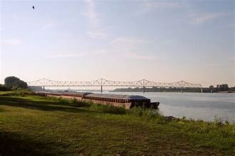
We are still following US 60 and drive through Wickcliff (640 souls) on our way to the Ohio River Cairo steel bridge. The bridge is narrow and Mr. Garmin is going nuts. A big red sign on its screen read “weight limit”. Well I didn’t see a sign indicating a weight limit for the bridge so I continue over the very, very narrow bridge and meet a semi coming the other direction. So much for the weight limit overload. We then crossed the narrow steel bridge over the Mississippi River and the Garmin relaxed a little when we were over both of the bridges. I thought it interesting that the Mississippi appeared quite a bit smaller that the Ohio at the confluence.

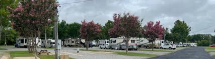
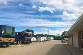
We continued on the I-75 for a time until cross streets appear and it turned back into US 60- the Future I-75 as the signs indicated. We drove to the Camelot RV Park in Poplar Bluff. It’s nice park with a weird layout and weird unwritten rules. These fine folks have planted yucca, yes yucca plants around the pull through sights. I thought yuccas would do very well in the desert, never suspected Missouri to be desert county. What’s more weird is the old folks who run this joint don’t have a computer and do all their receipts with pen and paper- but offer WiFi to its customers. Payment is cash or check which is becoming an ancient way to do business anymore. As an example we had the RV washed in Tennessee and the fella that provided that service accepted Venmo…………….

Downtown Poplar Bluff, MO | Outdoor and indoor wonders to explore. |  downtowndifferent.com

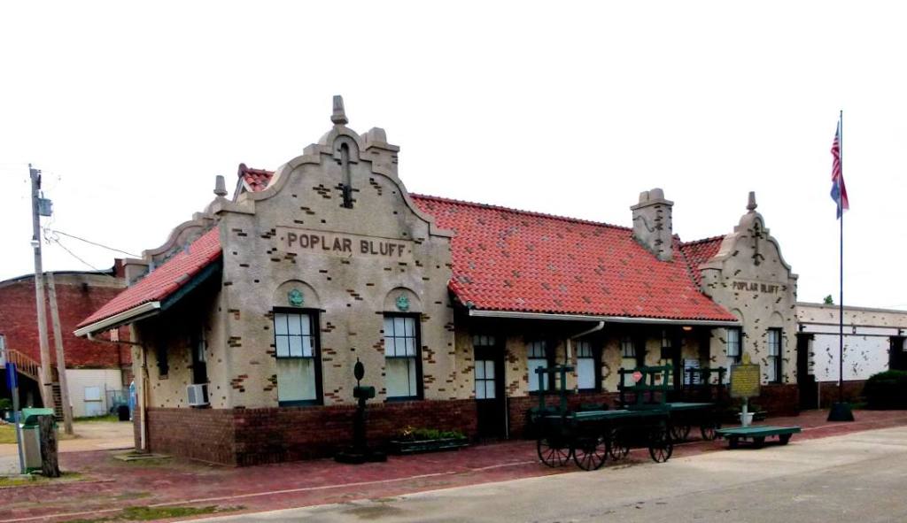
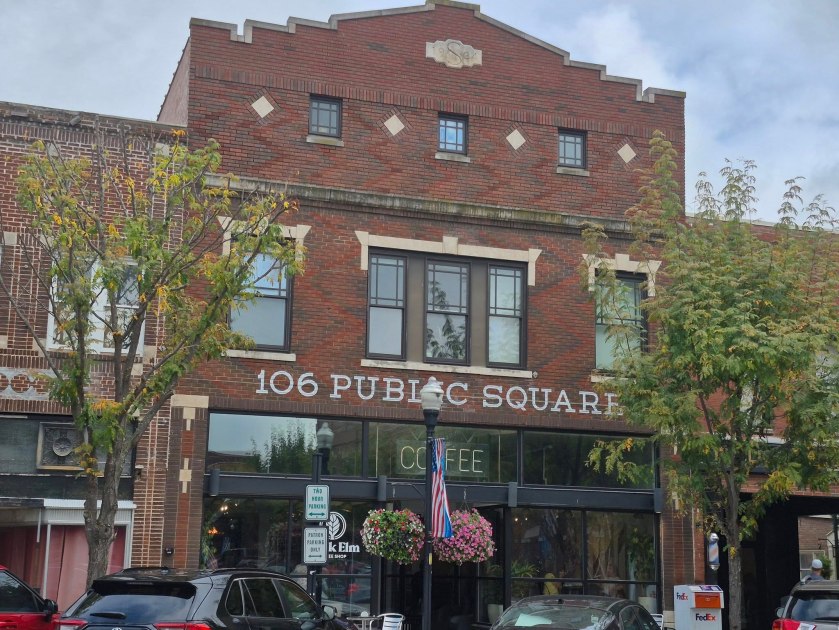
We didn’t get into Poplar Bluff’s downtown- Maybe next time. Poplar Bluff is the seat of Butler County (16,770 souls). The city is known as the “Gateway to the Ozarks”, which is why we are here.

Hope to see you next time!

Nashville? Well, Almost……..

September 2o, 2025

Traveling south from Profitstown I wanted to stay in an RV park closer to Louisville but there were no available RV sites. We continued an extra hour south to Cave Country RV on September 19. So glad we did. It’s a very nice park with a great place to walk the dogs. The only hitch were road crews were cleaning out a ditch next to I-65 and had a lane blocked. One lane closed out to two caused a traffic jam 7 miles long, a 45 minute delay- all stop and go. Sheesh!

We were fortunate to get the last RV site at Grand Ole RV park in Goodlettsville Tennessee, a suburb of Hendersonville. Our RV is a wee bit big for the site but it has to do. We’d prefer being closer to the large grassy area so we don’t have to walk Buster down rows of RV’s. Sunday in most RV parks is what a friend who was a campground host used to call “Hoover Day”. To him everyone leaving on Sunday is like a big Hoover Vacuum is sucking them out of camp.

Some areas are pretty congested while others are spacious

Well, Hoover Day worked in our favor. We went into the office to ask if a newly vacated site was available and it was. It’s the best site in the park for our matzos. We open the door of the RV and walk right out onto an acre of mowed grass.

So you ask why are you in Goodlettsville (3000 souls)? We have family- a daughter, her two sons and her hubby live in nearby Shackle Island. You may have never heard of Goodlettsville yet it is corporate headquarters for Dollar General. The main city around here other than Nashville is Hendersonville (61,000 souls).

How was Shackle Island (3300 souls) named? Earliest reference to Shackle Island was by surveyor William Lytle who wrote in 1779  “Beginning at a sweet gum, honey locust, and elm standing on an island. . . on the West side below the Great Road”. The great road he referred to was Long Hollow Pike, and the body of water that created the island was Drake’s Creek. Unproven theory suggests the name derived from a site where enslaved people were held, referencing the fact that hundreds of enslaved individuals were marched through Tennessee to western markets.

Long Hollow Pike still exists and we’ve taken the pike to quite a few places east of Goodlettsville and so does Drakes Creek. The Pike begins in Goodlettsville and goes 15 miles east through hill and dale to Gallatin. The countryside is drop dead gorgeous. The homes are well kept and beautiful. My favorites are the older homes that sit way back on their lot and majestically oversee the pike.

Downtown Springville is 20 miles from Hendersonville

This is hill country located on the north shore of Old Hickory Lake, a reservoir on the Cumberland River. Nashville (686,513 souls) is 18 miles southeast of here. There are many communities and all seem to be reached by traveling curvy roads following streams and hollows. Within the general area are Goodlettsville. Springfield, Cross Plains, Calista, Walnut Grove, Whitehouse, Cottontown, Shackle Island, and Gallatin. We’ve been to Springfield, Whitehouse, and Shackle Island, Gallatin and Cottontown. They each have their own charm and populations range from 44,000 in Gallatin to around a 356 souls in Cottonwood. There’s plenty more places but these are no more than 30 miles from Hendersonville.

I was disappointed visiting Hendersonville as the business district is just one long strip mall with no central core. Springfield has a beautiful historic downtown and so does Gallatin. But Hendersonville lies on the shore of Old Hickory Lake and goes up into the beautiful hillsides. I’ve heard many celebrity country western singers live here. Johnny Cash and his wife June Carter Cash are buried here. Taylor Swift, Dolly Parton, Alan Jackson live here. Others that have lived in Sumner County are Conway Twitty, Roy Orbison, Ricky Skaggs, The Carter Sisters, and one of my favorite current county western stars, Garth Brooks. Impressive? You betcha. Our daughter says that you can run into one of them at the market or in a restaurant.

As one can imagine this area is just packed with history. Gallatin has the historic 5600 square foot Stonewall mansion. Andrew Jackson’s Hermitage is across the lake from Hendersonville. Mansker’s Station is right here in Goodlettsville. There’s just too many to list here but you get the idea- there’s lot of historic places to visit.

The kids want us to move closer to one of them. All but one live in Kali-Fornia which is not an option for us. So it looks like we’ll be looking for a home here in the Hendersonville area. We spent quite a bit of time visiting family. Jil’s daughter Rebecca knows the area very well so we spent a lot of time visiting areas that offered some large lots, some newer places with smaller lots, even a new seniors community.

Typical country homes. Big Lots, homes made of brick but just a mile or two from city.

The new seniors community, Nexus South in Gallatin is very nice but so are a lot of older homes, most on lots larger than what Nexus South offers. We are not ready to put our house on the market- we’ll most likely do that in April. That’s when we get more serious about our house hunting.

While in the Gallatin area we went to Bledsoe Creek State Park. The park has a really nice campground with well spaced sites, and a small lake all with a cool forest setting.

We’ve been fortunate that the weather has been decent. A couple of thunderstorms at night, a little cloudy for a couple of days which made the humidity tolerable for us desert rats. And it’s not been too terribly hot when the sun is out.

We dined out with our family a few times. Jakes is located in an unexpected location- in a housing development. Jakes has really good barbecue and authentic southern side dishes. It’s very popular with the locals.

Downtown Gallatin

So we are winding up our visit to the Hendersonville area. We’ve had a nice visit with our family, so good Southern food, quite a few car rides through beautiful countryside. What more could we ask for?

So for now we’ll say “See you soon!”

Heading Down to Profitstown

Wednesday September 17 through September 18, 2025

We are heading south once again. Milwaukee isn’t very far from Chicago and that city is famous for its horrible traffic. And we either have to go through or around Chicago. I asked Dennis who drove truck in this area which way he would go around Chicago and he came up with a route that added over 100 miles to the trip. Hmmm, there’s got to be a better way. A work around is not to go through Chicago on I-94 but skirt it on I-294. So we vote and Dennis’s route loses in favor of I-294.

We take I-94 out of Milwaukee and when the time comes we veer off on I-294. The interstate is busy and there’s an awful lot of construction going on but we only stopped once for about 15 seconds and then just cruised through. Jil tends to get a little nervous in heavy traffic so she kept here nose in her cell phone which not only helped her state of mine but mine also- she tends to start yelling “watch out” a lot. I ask her to be specific. Instead of “watch out” which doesn’t help me focus on what she sees. I’ve asked her to say “on the right” or “on the left” or “brakes”. That helps me as a driver much more than “watch out”.

Before you know it, well maybe 75 minutes later, we reach I-80 and the south side of Chicago. I-294 was a good route regardless of all the construction. I-80 will take us to southbound I-65 in Gary Indiana (69,500 souls), our route through Indiana, Kentucky, an a good part of Tennessee. Gary is a steel town, at one time had 12 blast furnaces to produce steel. Due to foreign competition and automation need for workers fell off and Gary has suffered tremendously.

We turn onto I-65 and our first impression is that the roadway is very rough. I have the cruise control set and the rough road causes it to pop off so I have to reset it. The speed limit is 70mph and I’m not about to exceed 60 or we’ll be bounced out of seats. I-65 traffic seems to consist of one 16 wheeler for every passenger car. In one mile stretch I counted 22 big rigs- and that was just oncoming traffic. I’d guess the amount of trucks traveling south was the same. Every mile was just like that- and that was only oncoming traffic.

The U.S. government became concerned with the Native Americans gathering at Profits Town as numbers reached 1200. Troops were sent in to disperse the Indians, the military leader being William Henry Harrison who later became President of the United States (Tippicanoe and Tyler too!). The battle occurred at Tippicanoe Creek and was fierce. The Army won and burned the Shawnee Prophfits Town.

We are stopping at Profitstown State Park for two nights. At the site of today’s Prophetstown State Park, the great Shawnee warrior Tecumseh and his brother Tenskwatawa (the Prophet) established Prophetstown as a gathering place for like-minded Native peoples seeking to resist the impact of Europeans in the early 1800s.

Profitstown State Park offers a water park, a very nice campground, a visitors center, walking trails and a farm. The park is in tall grass- yes grass 4-6′ tall. It’s one of the nicest state parks that we have visited and it’s loaded with U.S. history.

It looks like the park is getting ready for a great Halloween celebration as there’s a whole bunch of Halloween figures scattered along the walking paths.

We’re heading down to Cave County RV Park tomorrow. The park is in southern Kentucky in Cave City. Mammoth Cave National Park is nearby, thus the name. We are not visiting the cave this trip but plan on visiting in the future. In reality there are three caves nearby.

So as our grandkids used to say, “See you soon”.

We Avoid Them Like The Plague So Why Now?

Sunday, September 14 through September 16, 2025

It’s time to pull stakes and start heading south. Some tree’s colors are starting to show a bit of fall. We have friends to meet so we are on our way.

Lambeau Field

We head back to Green Bay, the city. I’m expecting Mr. Garmin to join I-43 which is the shorter of two interstate routes south. But no, it chooses I-41 which is 40 miles longer to the same location. Jil’s smarty pants phone wants us to join I-43. Mr. Garmin must have a reason for avoiding the shorter route as it is set up for our RV’s size, height and weight and Jil’s smarty pants phone is not. So like a true believer in a less than perfect AI device I jump on I-41 as instructed by Mr. Garmin. This will play out as a possible mistake- just can’t say for sure as we didn’t travel I-43.

US 41’s pavement is rough, especially the truck lane in which we mostly travel. Traffic isn’t horrible- I’m getting used to getting cut off- but there’s not a rest area in sight in over 100 miles of travel. There is quite a few construction zones with very little construction actually being performed.

Downtown Milwaukee is a pleasant mix of old and new

We think Mr. Garmin wanted us to avoid downtown Milwaukee……..oops, the cats out of the bag! We are in Milwaukee staying at the Wisconsin State Fair RV park. It’s not pretty, it’s a parking lot, but it’s only 5 miles or so to downtown Milwaukee and its historic district/buildings. We are also here to visit our Nevada neighbors who moved back home to Wisconsin. Once a cheesehead, always a cheesehead.

Following the RV parks printed directions we drove around all four sides of the huge fairgrounds and couldn’t find the RV Park. We even inadvertently joined an equestrian event in the fairgrounds where a kind sole felt we were lost (no kidding) and gave us directions to the RV park. Jil checked in at the RV Park office and says their directions are not accurate. The gal at the desk says you should have called the office……..pshaw!

We drove downtown to Lakeshore Park and walked around a big grassy area at the edge of Lake Michigan. We were in awe of the huge hi rise buildings four of which are over 500′ tall. We then maneuvered our way to the historic district. Jil directs us to a very large building. It’s the old Blatz Brewery building that has been converted into apartments. She walk all four side of that large building looking to gain access to the lobby but all doors are locked.

We meander around a little more and stumble on to the Famous Usinger Sausage Company located in a block of very old buildings. Milwaukee still has some historic districts and has remodeled old buildings making the interiors more modern while keeping the exteriors original.

Blatz Brewery building now apartments

It’s a great use of the old buildings and it beats tearing them down, losing the character of the neighborhood in the process. Besides, the old buildings have a lot of character while new ones are just slab sided glass buildings.

The next day we head over to the Basilica of St. Josephat. This magnificent church was built in 1901 but didn’t become a Basilica until 1929. This place of worship is magnificent. Its dome towers 200 feet in the air. Its many stained glass windows stream filtered light on the pews. I was in awe of its architecture. While impressive outside, the interior is beyond words. It’s the most beautiful church I’ve ever been to the Vatican, Jil has and the Basilica of St. Josephat impressed her too.

We meet with our friends at a German restaurant just a few miles from camp. They live outside of town in a place called Waterford where many of their relatives live. Every orders something different. Baked fish for Dennis, Chicken schnitzel sandwich for Jil, Rouladen for Vicki and I ordered Sauerbraten, a favorite of mine that I was introduced to by my Swiss grandparents.

We spent a lot of time at that restaurant table catching up on old times and sharing what’s ahead in our future. Such a nice couple and a wonderful gathering with them. We hope to meet again some day.

So now it’s Wednesday and the City of Chicago stands between us and our destination. Check in on our next blog and we’ll fill you in on how that went.

Door County, Wisconsin

Thursday, September 11 through September 13, 2025

Door County, Wisconsin, is located on a picturesque peninsula located between Green Bay and Lake Michigan. The county is known for its “Cape Cod of the Midwest” nickname, extensive parklands, charming coastal towns, local wineries and breweries, fish boils, and fruit orchards, especially cherries corn fields, hay fields and cow farms (hey, we are in cheesehead country.. 

The county seat is Sturgeon Bay (10,000 souls) and its attractions include the state’s five state parks, such as Peninsula State Park, and other coastal parks and natural areas offering waterfront activities and scenic beauty.  

Door County is a peninsula extending into the waters of Green Bay to the west and Lake Michigan to the east, providing a diverse range of water-based activities and scenic waterfront views. 

The county’s name, “Door,” is believed to come from the dangerous channel between the mainland and Washington Island, a perilous strait known as “Death’s Door”.  The county is famous for those five state parks, including Peninsula State Park with its Nicolet Beach and Newport State Park, a wilderness park. 

 The picturesque villages such as Sister Bay, Fish Creek, Egg Harbor, and Ephraim, offering unique shopping, dining, and local culture are very popular. The region is famous for fruit orchards, especially for cherries, and local wines and beers from the area’s many wineries and breweries. 

 Many people enjoy boating, kayaking, and water sports on the waters of Green Bay and Lake Michigan. Traditional Door County fish boils are a popular and unique local dining tradition. The county’s natural beauty, including its parks, beaches, and long shoreline, is its most valuable asset.

The above are excerpts from the internet that explains the Door County Peninsula much better than I’m able.

We stayed at Geitner Homestead Equestrian Campground located 9 miles north of Sturgeon Bay in Carlsville. When searching the internet for a nice quiet place to spend a few days in Door County I came across Geitner Homestead Equestrian Campground.

The campground closest to the farm road is for campers without horses and the one behind the office is set up for horses that include a small corral for each campsite. All the horse niceties such as road apples and flies don’t affect the front campground. The horse campground is much more popular than the non horse campground. For four days the non horse campground had only two RV’s while the horse campground had at least four times that many.

While there we were treated to a horse competition where individual horses and riders worked their way through an obstacle course of sorts, the horse with the fastest time won the competition. Some of the obstacles obviously upset the horses and some did better than others. The riders were very supportive of one another and all seemed to have a good time.

Besides returning to a beautiful and interesting area in Wisconsin we wanted to once again visit the National Shrine of Our Lady of Champion in Champion WI. The Shrine is the only one recognized by the Catholic Church in the U.S.. Thousands of people participate in the Walk to Mary pilgrimage every year. Please take the time to read about the shrine here: https://championshrine.org/our-story/.

The Shrine is located in Champion, a very small farming community. Farms lie to both sides and rear. In fact most anywhere one goes on this peninsula will find themselves in farm land. The exception is the extreme west and east coast where the bulk of tourism and boating takes place.

The Village of Egg Harbor (1194 souls) has a tourist driven economy. Folks enjoy boating and shopping in the art galleries in this attractive little town.

Fish Creek’s population is listed as “a few hundred”. We did a little snooping, then continued north.

Excerpt from City of Ephraim website: No community embodies its heritage like Ephraim. Embedded in the harbor with a panoramic view of Peninsula State Park’s Eagle Bluff lighthouse and Horseshoe Island, Ephraim has preserved its Norwegian and Moravian roots by making them a part of its modern life.

A historic logging pier finds new life as an art gallery, an impossible fire station becomes a museum, and log cabins are reborn as coffee shops and storefronts. Each June the town hosts its annual Fyr Bal festival, a tribute to Norway’s Midsummer’s Eve. 

The Village Sisters Bay (886 souls) is a lovely town on the Unsalt Ocean. The term “unsalt ocean is a local term for Lake Superior. Since Lake Superior drains into Lake Michigan and the rest of the Great Lake and St. Lawrence River I take the liberty of naming the whole kit and kaboodle The Unsalt Ocean. As is true about all the towns in Door County, Sisters Bay’s economy is tourist drive.

Al Johnson’s Swedish Restaurant is overflowing with customers. It has goats on the roof of the restaurant.

We drove to the tip of the peninsula to Gill’s Rock. It as well as the communities of Ellison Bay, North Bay, Northport and Rowley’s Bay are in the town. Combined the population is 2096 souls. Northport has the ferry service to Washington Island.

Bailey’s Harbor

We also visited a few towns on the eastern shore of the peninsula. These towns are not as accessible as those on Green Bay as a continuous shoreline road does not exist . Bailey’s Harbor (1300 souls) is named after a ship’s captain whose ship got caught in an unexpected storm and took refuge in the harbor.

Algoma (32oo souls) is a really nice town that faces Lake Michigan as does Bailey’s Harbor. At one time the Algoma was home of the largest commercial fishing fleet on Lake Michigan.

And now words of wisdom:

Down and Around Green Bay

Wednesday, September 10, 2025

It’s been eight years since we’ve been to Door County and we’re aching to return. We didn’t see half the peninsula on which is Door County so this we plan on seeing much more of it.

The First Street Historic District in Menominee

Historic District Minominee MI

We head south passing through about ten small burgs along highway M35 until we reach Minominee (8486 souls) and turn onto US 41, the last town in Michigan in which we’ll pass.

Once we cross the Minominee River we’ll be in the twin sister of Minominee, Marinette Wisconsin (10,968 souls) . Marinette is the seat of Marinette County.The first time through here we watched US Navy ships being built in a Marinette shipyard.

Here’s some more information on Marinette: https://en.wikipedia.org/wiki/Marinette,_Wisconsin

History of the Peshtigo Fire | Peshtigo ...

South a few miles is Peshtigo (3000 souls) a town that was devastated in an 1871 wild fire. Between 1200 and 2000 lives were lost yet a bible in a church was untouched.

In order to continue this blog and other important functions like paying bills it was important to put my brains that were on the computer back where I can access them so I purchased another Mac Airbook at a Best Buy. The store is not on our route but not terribly inconvenient.- other than trying to figure out a good route there. Routing with a 35 foot RV with 20 feet of tow vehicle and hitch is not as easy as driving a 16 foot SUV into a parking lot. We only got one nasty horn blast (love you too!) driving into the mall that housed Best Buy. The parking lot was huge and finding good place to park was easy. In a short time we were out of there with the new computer which had been ordered and paid for online.

Green Bay is not only on the southern shore of Green Bay, the Fox River runs through it.

We’re back in the hunt doubling back a few miles and going east on Highway 57 through the north side of Green Bay (104,726). The city is named after the baton which it lies. Highway 57 takes us to a spot just south of Sturgeon Bay where it for no obvious reason turns int0 Highway 42. This is a newer portion of road which bypasses Sturgeon Bay itself. A good portion of the road is a four lane divided highway yet the posted speed limit is 45 mph for miles. We reach the first of two, yes, two roundabouts and lose a lane. I assume the traffic has to be 10 times heavier during the peak season here because I haven’t seen traffic heavy enough to justify a traffic signal and two, yes, two roundabouts on this road.

Green Bay Wisconsin

Although it’s 43 miles to Sturgeon Bay from Green Bay the highway goes through nary a town and even skirts Sturgeon Bay. The next town we actually go through, Carlsville, and that’s our turnoff. Carlsville is tiny population wise, consisting mainly of farms and a few tourist trap shops on the side of the highway. Its census is included in that of Egg Harbor. We follow County Road “I” deep into cornfields and cow farms. One cow farm is huge. Across the street from the farm are huge silos. The county roads around here are not named, they are given a letter of the alphabet.

We turn left on Oak Road and Garmin fails us. We drive right by our destination so the gps resets and we go around the block (blocks are huge in farm country) and we take another run at it. This time we are on the money and pull into Geitner Homestead Equestrian Center.

More on that in our next blog. Until then, Adios my friends.

We Are Now In The U.P., Eh? You Betcha!

Monday, September 8 through September 9

We packed up and headed east, mostly on US 2. We’ll follow this road to into Michigan, Escanaba to be exact.  Someone asked about US Highway 2 so here goes (no one asked I just thought it interesting). US 2 is an east–west United States Numbered Highway spanning 2,571 miles (4,138 km) across the northern continental United States. US 2 consists of two segments on either side of a portion of Canada. Unlike some routes, which are disconnected into segments because of encroaching Interstate Highways, the two portions of US 2 were designed to be separate in the original 1926 highway plan. The western terminus is in Everett WA and the eastern of this segment is in St. Ignace MI at I-75. The eastern segment begins in Rouses Point, NY and ends in Houlton Maine.

We drive through Washburn (2051 souls), then Ashland WI (16,054 souls). Ashland is a city and port located on the southern shore of Lake Superior and the head of Chequamegon Bay ( threw in the name of the bay ’cause I too have trouble pronouncing it).

We leave the coast and travel towards our destination Escanaba MI. It is kind of a lonely drive. Not too many towns on this route considering its almost 250 miles long.

Iron River MI is a city of 3000 souls. It’s the western most city in Michigan. It is the location of the world’s tallest Indian, a 52 foot fiberglass statue of tribal leader Hiawatha. Bunched up with Iron Mountain is Norway (2100 souls). There’s others but they are not directly on US2.

And then there’s the metropolis of Felch (502 souls). This sign was hanging on a baseball field fence.

Next comes Watersmeet (408 souls). I think the name of this town clever. Its located at the confluence  of Duck Creek with the Middle Branch of the Ontonagon River.

Crystal Falls (1598 souls) is located on a pretty steep hill. We are heading down this street.

This is the Pocket Park in the fairgrounds- upon reaching this point we’ve already gone by the Pocket Park RV sites.

Arriving in Escanaba (12,450 souls) we find the Upper Peninsula State Fairgrounds. We called ahead and were told that they have lots of sites available. This fairground has about 700 campsites- no lie. We were supposed to go to the pocket park camping area (or any place we choose) but blew right by it. Instructions are lacking so we go where we feel is a good spot for the dogs. One other RV is in a row of about 100 sites- we stay away from the other rig and we are happy here.

The Pasty Originated in Crornwall England

The city was founded in the mid-1800s at the mouth of the Escanaba River on Lake Michigan and grew into a vital center for the lumber and iron ore industries, We head to Gram’s Pasties to imbibe in this Northern Michigan favorite. Pasties were originally made for a worker’s lunch box. A filling of beef, potatoes, onions and rutabagas is standard fair and a pastry is wrapped around the filling and baked. Pasties would make a good lunch for a blue collar worker or anyone for that matter.

Museum Artifacts

This is a voting machine. It was used until recently!

Downtown Escanaba is very cool. We drive through town on our way to Sand Point Lighthouse. Behind the light is a museum. Signs say that it is closed…… but…….but!! Busses from tour ships are coming to the Delta County Museum so in between visits the employees see us milling around outside and invite us in. How nice of them! The museum is wonderful as have been most all the local small town museums we’ve visited.

We have a short walk to the Sand Point Lighthouse. It too is closed-only opened for the tour busses. They also invite us in. Boy are we lucky!.

Our visit is very nice. We have been able to visit their museum and light. Both of their signs state “See you in June”. It’s September……… so we lucked out when we were invited to enter the museum and lighthouse in between tour busses.

Sand Sculpture in the fairgrounds

The fairgrounds are amazingly busy considering its distance from big cities to the south. Every weekend they have an event. Last weekend it was logger and logging equipment.

We enjoyed our stay in Escanabe. Hope you did too!

Bayfield, Wisconsin

Friday September 5 through September 7, 2025

To get to our next destination we backtrack through Duluth, go over a bridge to Superior Wisconsin (26,751 souls). The Garmin GPS worked perfectly until we got over the bridge and were on approach to a “T” intersection. Garmin went silent and the blue line that indicates the direction of travel disappeared. A coin flip had us turn right which led us onto the bridge we just got off of and heading back to Duluth. We turn around in Duluth and head back over the bridge for the third and last time………. This time the Garmin is yacking its head off and tells us to turn left at the T. Thank you very much! Superior is the seat of Douglas County.

Bayfield Wisconsin(592 souls) is a small town that is extremely popular as it is home to the Madeline Island ferries. Madeline Island is the largest of the Apostle Islands and a ferry service runs out of Bayfield to the island.

A big draw to the island is its beautiful scenery and its rocky shore. Tour boats will take you to the most unusual and beautiful rock formations along the Madeline coastline. Here is a link to the National Park Service website of the Apostle Islands National Lakeshore: https://www.nps.gov/apis/index.htm.

I was going to stay home with the matzos so Jil could go island exploring. I thought she just wanted to ride the ferry over to the island and snoop around a bit. What she really wanted to do was take a tour boat to all the wonderful places on the island. When she found out the tours were 4 hours long on a cramped boat in gloomy weather she begged out.

We stayed just out of Bayfield at the Apostle Islands Area Campground. It was nice but neighbors were fairly close by meaning Buster would have to be controlled more than if it had a more wide open campground. We had a large grassy area behind the coach so I could walk Buster there and keep an eye out for other dogs. I knew that the town of Washburn had two municipalities campgrounds. Both offered a lot of open space so Buster would have been better off at one of them and Washburn is only 10 miles south of Bayfield. I think we would have been better off as well.

Rittenhouse Inn

Us’ns enjoying Bayfield

So other than a few rides through the beautiful countryside, a visit to a fish hatchery where they raise fish indoor (no predators) and a couple of strolls downtown. They raise the usual lake fish- lake trout, crappy, white fish, walleye, pike and splake. Splake?

Yep. Splake are a hybrid fish, a cross from a female brook trout and a male lake trout. They are said to be reproductively viable yet don’t seem to reproduce much in the wild. Most are hatchery raised.

So that winds up our visit with the very beautiful little Superior Lake town of Bayfield. We’ll see y’all at our next location.

A Couple of Days in Grand Marais

Wednesday, September 3 through September 4, 2025

We were able to snag a few nights in Grand Marais (1306 souls). The town is a tourist destination, has a small boat marina and a lighthouse near the entrance to the harbor. The nice RV park is municipally owned. Our RV site is on the far south end of the park. Behind some tall bushes is a clearing with a big tent in it.

Hmm, they must have had a wedding or some other event before our arrival. Nope, wrong guess. The event was coming and it was a music festival. Workers were setting up the acoustics and the stage for the event and the base tones/music was LOUD. So sorry we are leaving the morning of the very loud music festival. Darn!

We toured the cute little town and had a piece of delicious berry pie at a greasy spoon downtown. We wandered around the 2 block downtown purchasing some merchandise to help support the local economy thrive.

The real reason I wanted to come up the west coast (locals laugh at the term “west coast as if its the coast of an ocean) of Lake Superior was to visit the most wonderfully decorated restaurant that I’ve ever seen.

But first on to Grand Portage which is located 6 miles south of the US/Canadian border.

Grand Portage National Monument, designated a National Monument in 1958, lies entirely within the boundaries of the Grand Portage Ojibwe Indian Reservation. The reconstructed depot celebrates fur trade and Ojibwe ways of life. The British North West Company built its inland headquarters at Grand Portage; the post was active until 1802 when the area became a part of the United States. At that time the British North West Company moved north to Thunder Bay, Canada. An interesting fact concerning the post; when the “owners” of the North West Company met at the post they were treated like royalty. They sat at their own dining table, used their own fine china and utensils and luxuriated in meals consisting of 14 to 16 courses!

We head back towards Grand Marais and find the restaurant we are looking for: the Naniboujou Lodge and Restaurant. We stumbled upon this complex eight years ago, had a great lunch and thoroughly enjoyed the decor. This place was being built in the mid- 1920’s and was to serve as a private men’s club. The club was to have an 18 hole golf course, a swimming pool and other luxurious amenities. But the stock crash of 1929 put an end to all the plans, leaving only a small hotel and a great dining hall. We went inside and were told by staff that they no longer are serving lunch, only breakfast and dinner. Rats! However they graciously let us browse the facility, including that beautiful dining hall. The ceiling decorations, by the way, are paper mache.

The beaches in this area consist mostly of small round rocks

We’ll be heading into the State of Wisconsin from here. See you there!

The boys are tuckered out

Houston, We Have A Problem

Wednesday September 3 through Thursday September 10, 2005

Well, folks. What’s the worst thing that could happen to a travel blogger? Nope the rig is not broken down again and the coiled electrical cord between RV and the toad is back to charging the Subaru’s battery, and we are healthy. So what is it?

I fired up my Macintosh computer and it refused to respond normally. Usually it warms up a bit and the logon screen comes up. Now it doesn’t get that far. It starts up then shuts down, starts up and shuts down. If ya let it blink off and on enough times a message states to go to this web site-“support.apple.com/mac/restore” Well, how are you supposed to do that if your ‘puter is broke? I looked it up on my smarty pants phone- too much information to comprehend on a small screen. What I did comprehend is this condition rare and I may need to tether another Mac to it to make my Mac well. I called my son- he can help because he’s a computer forensics specialist. He told me how to fix the computer and Jil’s computer. Nothing worked. Fixed Jil’s laptop by purchasing a mouse. My computer- nope.

Meanwhile my brains are all on that computer. Our campground reservations, the calendar with all upcoming events, my address book which includes all of your email addresses. I don’t know how I will be able to communicate with any of now. The only cure is to fix my Mac or buy a new one.

Bought a new computer in Green Bay WI two days ago. My son said that there’s a good chance all my vital information is on the Cloud and I can retrieve it. Got the new ‘puter fired up and began to wonder how I was to retrieve the info stored on the Cloud. Lo and Behold- all my vitals have already transferred to the new computer! And I didn’t do a thing to cause that to happen. Hallelujah!

So y’all expect to get an email in the next couple of days from Jilnmike. Ya, I know- big whoop……….. but it will make me feel better to once again fire up the travel blog.

Take care y’all.

Red River Recreation Area

Friday August 29, 2025

We are finally on our way. It took 6 days to get the RV repaired, most of that time was waiting for parts to arrive from Chicago. It only took maybe 2 hours to actually diagnose and repair the rig but two days to find the parts and three days for them to arrive.

Approximately 50 miles east of Minot, deep in corn, sunflower and canola bean country, about 1/3 of a mile up on a little hill stands an old chruch. The scene is striking as the chuch is the only building in site. It is the Norway Lutheran Church built in 1886. What a beautiful site with it’s tall steeple standing majestically up on that hill.

A downtown block in Devils Lake, North Dakota.[NOTE: Devils, with no apostrophe, is correct.]

The first town we come to is Devil’s Lake (7300 souls). It lies on the east shore of……. Devil’s Lake. I assume that the lake was named first. The present site of Devils Lake is the largest natural lake in North Dakota.and was, historically, a territory of the Dakota people. However, the Sisseton, Wahpeton, and Cut-Head bands of the Dakotas were relocated to the Spirit Lake Reservation as a result of the 1867 treaty between the United States and the Dakota that established a reservation for those who had not been forcibly relocated to Crow Creek Reservation in what is now South Dakota. 

The name “Devils Lake” is a calque of the Dakota phrase mni wak’áŋ(literally translating to spirit water), which is also reflected in the names of the Spirit Lake Tribe and the nearby town of Minnewaukan. The reservation is located on the south shore of Spirit (Devil’s) Lake. The lake is a terminal lake meaning it has no outlet so elevated lake levels can present problems with flooding in town.

Grand Forks North Dakota

We pass by Lakota and Michigan as both towns are now bypassed by US 2. We come into the city of Grand Forks (59166 souls). The city is the third largest in the state. I lies at the confluence of the Red River and the Red Lake River thus the name Grand Forks. It is home of North Dakota University. Across the Red River from Grand Forks North Dakota is East Grand Forks Minnesota and that’s where we’ll be staying.

In 1997 these two towns flooded. This was the largest evacuation in the United States since the evacuation of residents in Atlanta, Georgia during the Civil War. Water reached areas more than two miles (3 km) inland from the Red River, requiring evacuation of all of East Grand Forks and 75% of Grand Forks. Flood waters reached 49 feet. All of East Grand Forks and 75% of Grand Forks was evacuated. Everything in East Grand Forks was lost to the flood and was rebuilt- except for the low lying homes along the river. They were demolished. A levee was built and everything between the levee and the river was converted into the Red River Recreation Area. In place of the homes that were displaced lies an RV Park. The original streets still exist so the park is unusual in appearance- but it works.

Our site is located on the far- west of the park. Between us and the river is a combination walking/bicycling path. The sites are spacious and popular with those who are visiting Grand Forks/ East Grand Forks area. This recreation area is one of the our favorites to visit.

We’ll push on deeper into Minnisota in the next few days. See you there!