We Slide and Beat the Tag- We are Safe at Home! What a Trip!

Tuesday, October 14,2025

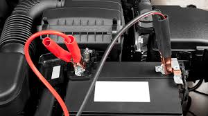
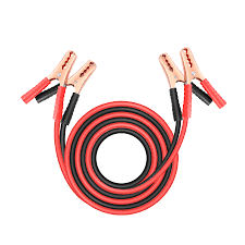
We spend a peaceful night get up with the sun and get ready to go home. I had gone into town and purchased a battery charger- just in case. The next morning the engine fired right up and we were off. It’s very cloudy today and we are expecting some rain. We jump on Interstate 80- traffic is very light. Around 8:30 or 9:00 all the truckers wake up and truck traffic gets fairly heavy. Wind is mild and not much of a factor.

Those are all padlocks hanging between the posts

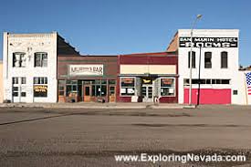
We stop in Lovelock for several minutes to stretch. A rest stop is up ahead but it’s pretty sparse and not a good place for dogs. Lovelock has a small park where we like to stop. The park has collected thousands of padlocks , er, lovelocks, The dogs ignore the locks in favor of the grass.

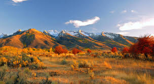
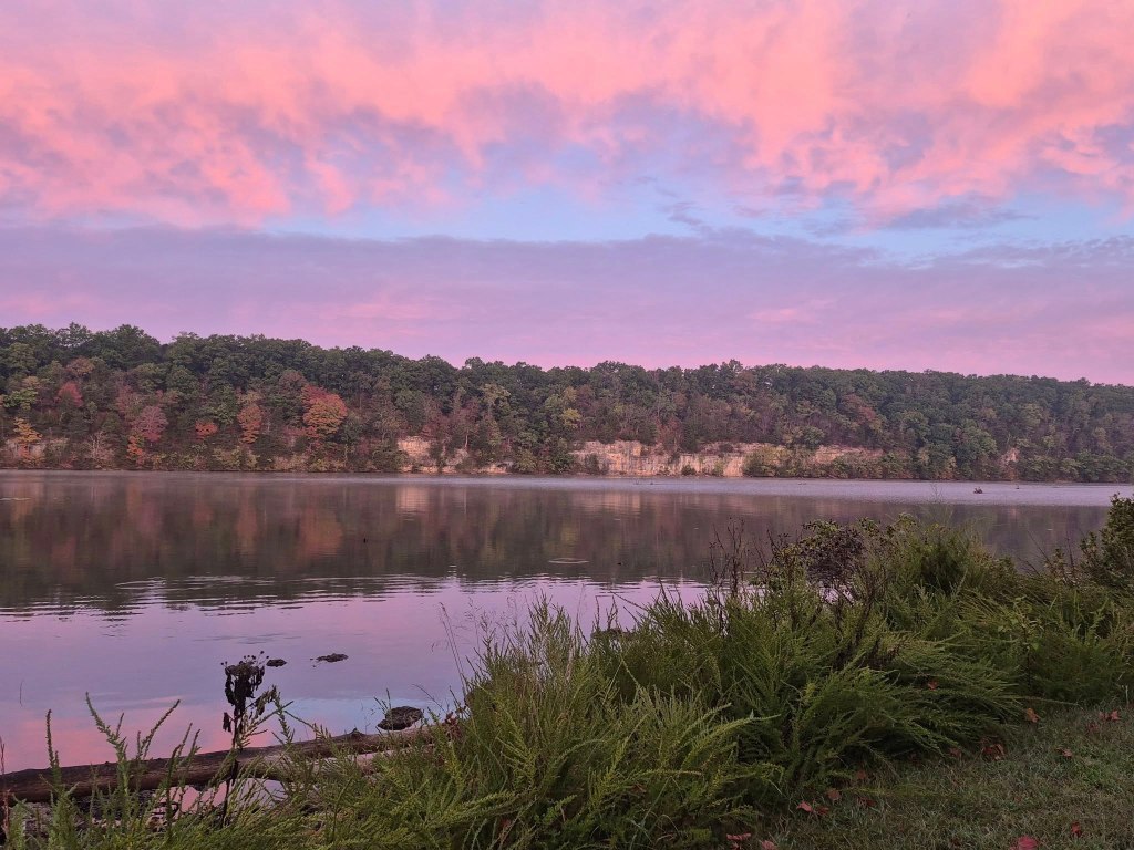
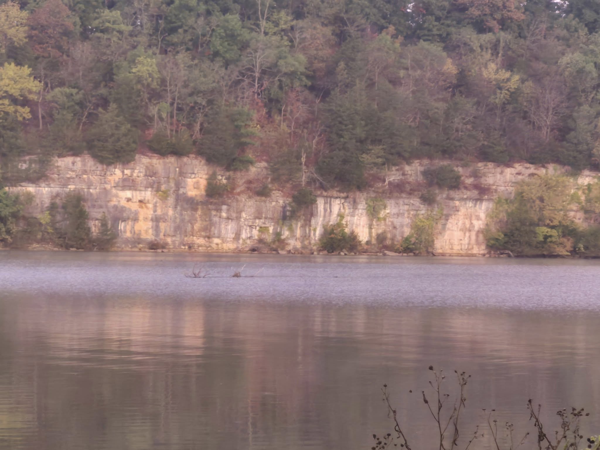
Continuing on we pass the Rye Patch Recreation area and the infamous 40 mile desert that caused so much angst to the pioneers. Thousands of years ago the Rye Patch area’s climate was colder and wetter than it is now. A much larger Humboldt River fed ancient Lake Lahontan, a body of water covering most of the Great Basin.

About 23,000 years ago when the elevation of the ancient lake was lower than the present reservoir, large animals such as camels, horses, mammoths and bison, as well as small rodents, came to drink from springs in the river bank. Some animals perished there, and their partially fossilized bones have been discovered at numerous locations on the reservoir’s shoreline.

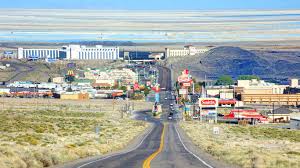
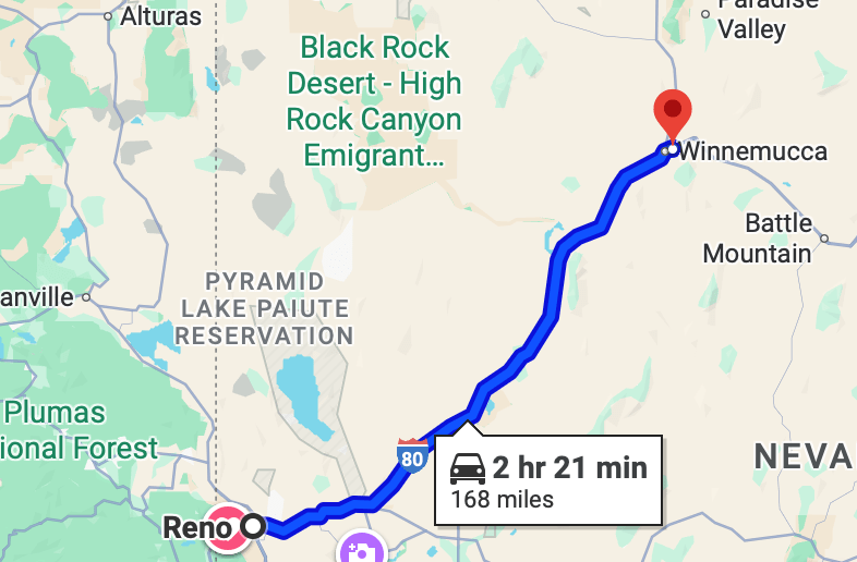
In a short time we pass Fernley (22,895 souls) and join the Truckee River as it flows down this canyon from Lake Tahoe to Lake Pyramid. We follow the canyon for quite a ways until it opens up into the city of Sparks.

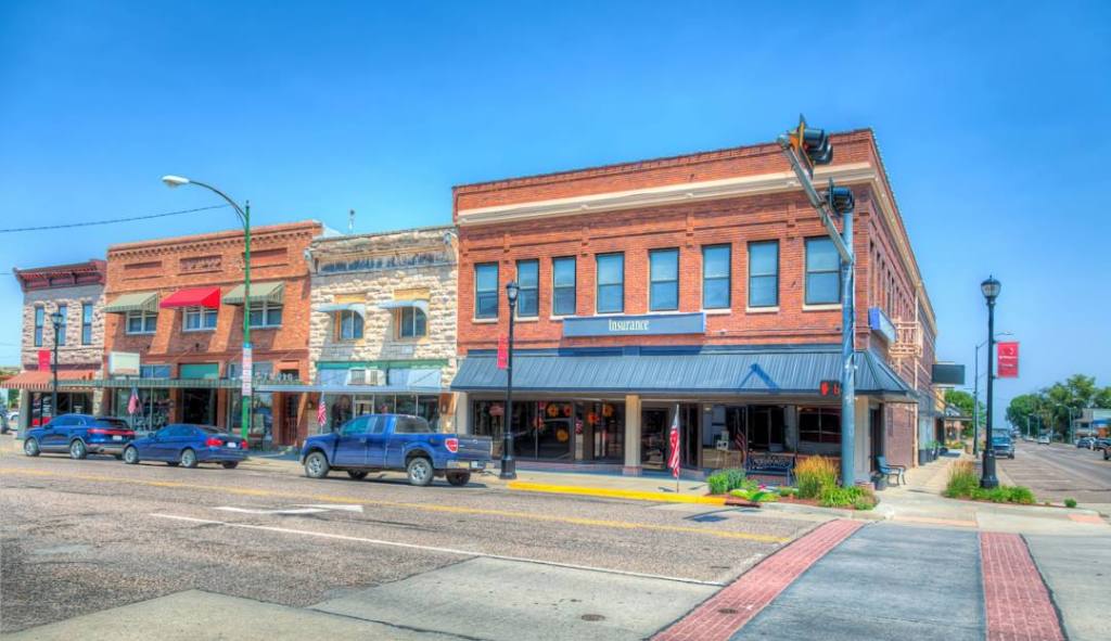
Sparks and Reno have grown together so it’s hard to determine the border of the two. The population of both cities combined is around 500,000 souls. We pass the familiar buildings of downtown Reno- 10 miles to go.

We arrive at our turnoff and head up the hill to our home. My back is killing me so I do what I can to help unload the RV and set up a power source for it. I unhook the Subaru and put it in the garage. Jil, Blesss her heart, takes a big load off of me and unpacks the coach- empty refer, empty pantry, remove clothing. Its a big job and appreciate her picking the slack that my bad back has created.

So that’s the end of our 2025 trip. How many miles? 2824 miles going to Goodlettsville, Tennessee and 2247 home for a grand total of 5071 miles not counting side trips in the Subaru. We had a good time despite a suspension hiccup in Minot ND and starting problems in Elko. We visited family in Idaho, Montana, and Tennessee. We visited friends in Idaho, North Dakota and Wisconsin. We visited 13 states and enjoyed every one of them.

We hope you enjoyed following our journey as much as we enjoyed our adventure. Until the next time Via con Dios!

Running Hard to Beat the Throw

Sunday October 12 though Monday October 13

We had some rain here in Elko and a lot of it turned to ice- yep it got cold last night. I had all utilities stowed away except for the power cord so it’s easy to head out in the morning.

All these gauges should be lit up

Jil brings the slide rooms in and stows the leveling jacks. I get behind the wheel and turn the key on and the instrument panel doesn’t appear normal- the gauges are not responding. Hmm, I turn the key to start position- nothing. Double hmmm. I do get an error message- “Check Brake Fuse”. I looked in the most logical places for the brake fuses and can’ find it- and all fuses are well marked. Now what…….

Jil asks about every half hour-“What’s the plan?” I say I’m diagnosing the problem and the more I do the less complicated the problem as the check brake fuse is no longer displaying- but the engine still won’t start. I have the generator running to supply electricity to the batteries and notice small changes.

OK, I’m going for the big guns. The fella next door left so I can drive our Subaru close to the RV starting battery compartment and use jumper cables from Subaru battery to RV starting batteries. That in itself wasn’t working so I used the auxiliary switch that connects house and chassis batteries together along with Subaru’s charging system and the RV’s diesel comes to life. And all the gauges are normal and “check brake fuse” message disappears. Whew, we had called Good Sam Road Assistance with no joy- I’m not sure that program is worth the money……..

So almost three hours of diagnosing and testing and outsmarting the RV’s battery system we are on you way. The delay in leaving Elko has made the decision easy for us- we’ll stop in Winnemucca for the night before we head for home. We decide to stay at the New Frontier RV Park once again. It was empty when we stayed there in August so we chose not to call for a reservation.

A three hour drive takes us to the RV park. We see that the site we would like is vacant- yipee! Jil goes in to register, comes out and says the site we like is taken- and the park has 40 more rigs coming in tonight! So we accept the site that is available and hunker down for the night. We meet some folks heading south for the winter-snow birds as they are called. Nice folks they are.

We spend a peaceful night and in the morning we’ll be getting ready to go home. I had gone into town and purchased a battery charger- just in case. Fingers crossed that the engine fires tomorrow…………………

And We are Rounding Third

Friday, October 10 through October 11, 2025

We leave the beautiful Coalville area driving through a pretty little valley heading towards Salt Lake City some 40 miles away

At first we trail through a beautiful green valley where farmers are are growing hay and other fodder.

We’ll travel in high country most of the way to Salt Lake so the Interstate can get pretty twisty with 55 mph curves as it follows canyons down to the desert floor and Salt Lake.. We pass the turnoff to the ever popular Park City and Heber.

We reach the valley floor and the beautiful city of Salt Lake (217,283 souls). We traverse the I-80 and I-15 merge, head north towards downtown, then transition onto the I-80 once again and head west.

Passing the Great Salt Lake it appears that lake level is a little higher than when we last passed by about 5 years ago. Interstate 80 continues on more or less west around the south shore of the Great Salt Lake.

The drive now is through dry valleys, over some mountain passes and onto a very flat valley floor. This floor is white, very white as we advance towards some more mountains. Just before we reach the upper elevations the highway takes us passed the Bonneville Salt Flats.

Wiki- The Bonneville Salt Flats are a densely packed salt pan in Tooele County in northwestern Utah, United States. A remnant of the Pleistocene Lake Bonneville, it is the largest of many salt flats west of the Great Salt Lake. It is public land managed by the Bureau of Land Management and is known for land speed records at the Bonneville Speedway. The Flats are about 12 miles (19 km) long and 5 miles (8 km) wide, with a crust almost 5 ft (1.5m) thick at the center and less than one inch (2.5 cm) towards the edges. It is estimated to hold 147 million tons of salt, about 90% of which is common table salt. The Land Speed Record at Bonneville is in excess of 763 miles per hour!

We come to Wendover. There’s Wendover Utah(1115 souls) and West Wendover, NV (4512 souls). Which one do you suppose has casinos? I’m looking for a convenient place to fuel the motorhome. Of course they are not identified by signage and are hidden by a bluff so we drive right past the exit to the fueling stations. We still have plenty of fuel to take us to Wells, NV (1292 souls), about 50 miles up the road.

The wind has started to pick up and that means I’m doing a lot of counter steering to keep the rig between the lines. I hope it doesn’t get worse. It does…..

The last time we stopped in Wells, business wasn’t doing well at all. The business section suffered heavy damage from a 2008 6.0 earthquake and it has never fully recovered. We are not going downtown so I can’t comment on Wells economy but I can say that truck stop diesel prices are the highest I’ve seen since leaving on this trip. Truck stop cost- $4.00 a gallon. Across the street is a Sinclair station with a truck fueling station- $3.56 a gallon.

So the wind has been a big pain for the last 100 miles. I’ve slowed down to make travel more manageable and that helps. The wind just likes to move the big box out of its lane and into a ditch so I counter steer each gust of wind as best I can. We stay in our lane yet weave around a lot. Wind speed is 25-35 mph from the southwest…… Not fun………

Our destination for a couple of nights is the Iron Horse RV Park in Elko, NV (20,264 souls). We have been to Elko several times but only stopped to stretch our legs. They have a large municipal park that incorporates an events center, an indoor swim center, several ball diamonds and a large shaded grassy area. Best of all- there’s no problem parking big rigs. The Eastern Nevada Museum fronts the park.

Elko has five, yes five casinos I stand corrected- ten.. One would think that the casino income drives the economy. The National Cowboy Poetry Gathering is an annual event. According to Travel Nevada- So, where is Elko, Nevada? Sitting just above 5,000 feet, this thriving Nevada city is nestled in the northeastern corner of the state. As the largest town in the region—and therefore a must-stop along the Cowboy Corridor road trip, Elko is both a confluence of Western cultures and a gateway to some of Nevada’s most surprising and untamed wilderness.

Surprisingly, the city’s economy is primarily driven by mining, specifically gold extraction., with the city considered the “capital of Nevada’s goldbelt”. Yes, gold mining is a major industry in Elko, Nevada, with the area being the leading gold-producing region in the United States.

Iron Horse RV Resort is the highest rated park in Elko. It is pretty nice. There are a lot of side by side pull though sites which I normally stay away from but this parks side by side pull throughs are different It has the standard Side by side common use pedestals between rigs but the door side has a lot of grass. It was a nice set up actually. Some of the back in sites had grass and some didn’t. The park would be nicer if all sites had grass.

We’ll stay here two days, then decide if we want to drive all the way to Reno or stop in Winnemucca to break the drive up. Driving all the way to Reno violates our 250 mile rule as it is 300 miles from Elko, so we’ll most likely overnight in Winnemucca- especially if the wind is blowing.

Catch you later!

We are in Coalville, Utah

Thursday, October 9, 2025

When we travel we look down the road for possible places to stay around 250 miles from our present location and on our preferred route. Our preferred route as we head towards home is Interstate 80 as it will take us to within a mile of our home. Pretty convenient eh?

We drive past Wamsutter (290 souls). This town is in the Red Desert, a basin where none of its water runs to the ocean. It’s also on the Continental Divide.

The next “community” is Point of Rocks (3, yes, 3 souls). Point of Rocks may be tiny yet it sports a museum inside the Conoco Fueling Station.

And then we come to Rock Springs (23,456 souls). The town is built in a narrow canyon and I don’t know why. This area is natural gas and petroleum rich. Rock Springs derives its name from a rock spring which flowed in the Number 6 district in the northern part of town. An account said that the spring was found by a lost Pony Express rider, but the spring station was known to Jim Bridger before 1860; the Overland Stage station was located nearby. The spring disappeared when the coal mine operations interrupted the underground flow.

Next community is Green River (11,825 souls). The city is the seat of Sweetwater County. The Union Pacific Railroad reached Green River on October 1, 1868, and was supposed to be the site of a division point for the railroad. Railroad officials were surprised to find that a town of 2000 residents and permanent adobe buildings had been established there, likely requiring costly negotiations for railroad land. They moved the division point 12 miles (19 km) west, creating the town of Bryan, on the Blacks Fork of the Green River. Just when Green River was on the verge of becoming a ghost town, Blacks Fork dried up during a drought and the railroad was forced to move the division point back to Green River to ensure adequate water for its steam locomotives. Bryan became the ghost town.

Excerpt from Wikipedia: The Green River Basin contains the world’s largest known deposit of trona ore. Soda ash mining from trona veins 900 and 1,600 feet (490 m) deep is a major industrial activity in the area, employing over 2000 persons at five mines. The mining operation is less expensive for production of soda ash in the United States than the synthetic Solvay process, which predominates in the rest of the world. The trona in Sweetwater County was created by an ancient body of water known as Lake Gosiute. Over time, the lake shrank. With the loss of outflows, highly alkaline water (salt brine) began to evaporate, depositing the beds of trona (a natural source of sodium bicarbonate).

We come to Little America. Built in 1952 along the old alignment of U.S. Route 30 which was also the Lincoln Highway, the first road across America, the property began with two fuel pumps, a 24-seat café, and 12 guest rooms. Today the location has 140 rooms and expanded gas pumps for both truck drivers and travelers. For a number of years this location had the world’s largest filling station based on the number of pumps in operation – 55 in all. Little America grew into hotels from Cheyenne Wyoming to Flagstaff Arizona. The properties are owned by Robert Earl Holding’s family who’s worth is 4.3 billion dollars.

Evanston was founded during the construction of the first transcontinental railroad. The railroad arrived in the area in November 1868, and Harvey Booth opened a saloon/restaurant in a tent near what is now Front Street. By December the rails had reached Evanston and the first train arrived December 16. However, orders were later handed down by the railroad managers to move the end of the line 12 miles west, to Wahsatch. Within three days, most all of Evanston had moved to Wasatch. It appeared that Evanston would become another “end of the tracks” town. In June 1869 headquarters returned to Evanston and it continued to grow.[10] Later in 1871, a machine shop and roundhouse were constructed, giving Evanston a longevity not shared by many other railroad towns. The town was founded during the construction of the first transcontinental railroad. The railroad arrived in the area in November 1868, and Harvey Booth opened a saloon/restaurant in a tent near what is now Front Street. By December the rails had reached Evanston and the first train arrived December 16. However, orders were later handed down by the railroad managers to move the end of the line 12 miles west, to Wahsatch. Within three days, most all of Evanston had moved to Wasatch. It appeared that Evanston would become another “end of the tracks” town. In June 1869 headquarters returned to Evanston and it continued to grow.[10] Later in 1871, a machine shop and roundhouse were constructed, giving Evanston a longevity not shared by many other railroad towns. The town was founded during the construction of the first transcontinental railroad. The railroad arrived in the area in November 1868, and Harvey Booth opened a saloon/restaurant in a tent near what is now Front Street. By December the rails had reached Evanston and the first train arrived December 16. However, orders were later handed down by the railroad managers to move the end of the line 12 miles west, to Wahsatch. Within three days, most all of Evanston had moved to Wasatch. It appeared that Evanston would become another “end of the tracks” town. In June 1869 headquarters returned to Evanston and it continued to grow.[10] Later in 1871, a machine shop and roundhouse were constructed, giving Evanston a longevity not shared by many other railroad towns. Evanston underwent massive growth and change during an oil boom in the 1980s. Recent drilling for natural gas has also revitalized the economy of the area

Rawlins, Wyoming

Tuesday October 7 through October 8, 2025

We are back on Interstate 80 heading west. Just over the Nebraska/Wyoming border is Pine Bluffs (1102 souls). Coming into town the Our Lady of Peace Shrine is very prominent with a statue of Mary standing 30 feet tall. Included in the complex with Mary are religious sculptures, and prayer areas. The Shrine hosts an annual pilgrimage.

The trip from Sydney NE to Rawlins WY is unremarkable. However, the highest point on transcontinental I-80 route is the summit between Cheyenne (65,704 souls) the state’s capitol, and Laramie (32,957). And guess where it snowed today.

We’ve been to Rawlins WY (8221 souls) in the past so we knew what we would find there. The city is the seat of Carbon County. Rawlins is known for its history as a Union Pacific Railroad stop, the Wyoming Frontier Prison (a former state penitentiary and now a historic site) and its role as a transportation and supply center for the state’s industries. It also has connections to the discovery of “Rawlins Red” pigment for the Brooklyn Bridge and has served as a major shipping point for uranium. 

We stay at the KOA this time. It’s pretty nice considering we are in high desert. It’s right off of the interstate so a good location for business. A lot of one nighters come and go here but do a pretty good job of filling the place up at night.

We are pretty much home bodies our first day as the Major League Baseball playoffs have begun. Some days have two games on and others 4 games. Four games is a little hard to handle for me. We look for parks to walk the matzos and find a very nice one not a quarter mile away.

The second day in the morning we head to Walmart. Yep, Rawlins has a Walmart. And an oil refinery which was locally owned, sold to non-local company which promptly changed the order of things and a hundred truck drivers lost their jobs.

We took the groceries back to the RV, stowed them away, then went downtown. The first time here Jil loved the quaint, vibrant downtown. All the shops were doing a good business. Well things are not the same. Downtown is now dead. Two major shops closed because the owners retired and no one bought their business. People started losing their jobs which affected businesses so most started to close, never to open again. Almost all of the businesses in the old business district were closed. What a shame! The one store that was open sold clothes and curios. The proprietor was a wealth of knowledge. She stated that her husband used to work construction at the refinery but there was no work there anymore so he picks up odd jobs. She also said the hospital closed its maternity unit so ladies now have to go 45 miles away to Laramie to give birth to their children. Traveling to Laramie in the dead of winter is not so good- they close the interstates during inclement weather…… so some babies are born in an ambulance or private vehicle on their way to Laramie, or Casper. She’s not sure that the hospital will stay open. That would be devastating for this small town.. This is a nice little community that is not doing well.

We drove around town for a while. We went by the historic penetentiary. It looked closed yet a school bus sat out front. A tour of the “pen” is a must when visiting Rawlins.

We enjoyed our stay here. All but four rigs pulled out of the KOA this morning and now at 1900 hours the place is packed. I gonna try to watch four Major League Baseball playoff games tonight. Wish me luck!

We are moving on tomorrow trying to follow the “250” rule

Why Sydney?

Monday, October 6 through October 7, 2025

Why Sydney (6483 souls) one may ask. Remember the “250 rule”. That’s one reason to stop here. Another is we’ve seen Cabela’s RV Campground from the interstate before and it looked interesting. Another reason is the history of the city.

Cabelas campground

Frontier newspaper editors and publishers called this lawless burgh  “Sinful Sidney”, “Wickedest Town in the West”, “Toughest Town on the Tracks” the “Hardest Hole” and even the “Magic City on the Plains.”

Thousands of gold seekers, cowboys, soldiers, desperadoes and freighters frequented the town from 1876-1881 when Sidney became the “Boss City” as the closest shipping point on the Union Pacific Railroad to the gold discovered in the Black Hills and Deadwood. 

“Boot Hill” Cemetery, or the original Sidney Cemetery, has existed since 1868.   It was first created to bury soldiers of Fort Sidney, who died in gun battle.  Sidney eventually became the wildest old west town on the rugged untamed frontier with many colorful characters.  

The abandoned Cabelas headquarters complex

Cablelas World Headquarters was located next to its store and campground. It was deeply connected to Sydney for 50 years. Bass Pro Shops acquired Cabela’s leading to the elimination of nearly 2000 jobs placing a significant negative impact on the town’s economy. The complex lies vacant today, however a local investment group purchased the former Cabela’s world headquarters for 1.5 million dollars. The investment group intends to fill the campus with businesses and collaborate with city leaders to support Sidney’s future and help it avoid a boom-and-bust cycle by diversifying its economy. 

We are glad we stopped for a couple of nights in Sydney. We did a little snooping, increased our knowledge- and Cabelas was right next to the campground.

So tomorrow look west on I-80 from Sydney and see if you can detect where we’ll be spending a couple of nights. Until then………

Mormon Island, Nebraska

October 3rd through October 4, 2025

We are heading towards from Kansas north to Nebraska as we’ve been on the road for over 2 months and we are heading towards the barn- slowly, but prefer interstates for this leg of the trip. Why Nebraska you may ask? Well, we have three interstates to choose from. Interstate 40 stays down low going from Nashville, through a portion of Arkansas, then Oklahoma, Texas, New Mexico and Arid-Zona. That route has us traveling to Kingman, AZ then north 557 miles to Reno for a total of 2249 miles. We’ve taken that route many times and it is not our favorite.

The second Interstate we could take is I-70 from Kansas City KS. That route puts us going over the Continental Divide and through the Eisenhower/Johnson Tunnel at 11,158 feet. This time of year the weather can turn rapidly at that altitude and travel by RV with no tire chains, or even with tire chains can be iffy. Home from Hendersonville through Kansas City, over the Rockies and up to Salt Lake City on Interstate 70 to I-15, and I-80 is 2194 miles. By the way, snow has been reported in the higher elevations of the Rockies already this fall.

Our chosen route home will be Interstate 80 via a few US highways to get to the that interstate. The most direct route which utilizes Interstate 80 is 2146 miles from Hendersonville to Reno. Of course we can’t just blast on home so we chose to visit Poplar Bluff, MO, Lake of the Ozarks MO, Clinton State Park, KS, then on to Mormon Island State Recreation Area in Nebraska. From Mormon Island we’ll be hugging Interstate 80 all the way home for a grand total of 2249 miles. So between all three routes the distance only varies about 50 miles as routed by Google Maps; in our case we added 103 miles and got to see some new country.

We left Clinton State Park in Kansas and headed towards Mormon Island SRA in,Nebraska. We are routed onto I-70, our third toll road of this trip. Just on the west side of Topeka we join Highway 75 north. This is a beautiful highway, the southern section is four lane and the northern is two land. We are traveling through beautiful farm country. Corn fields predominate followed by hay and canola/soy beans. From Highway 75 we head west on Highway 2, then miss a turnoff due to vague instructions from Mr. Garmin.

The garmin doesn’t even recognize that we are still on a road after the miss and shows us traveling is space………No matter…… well kinda does matter as we fail to use our intuition and rely on Mr. Garmin and confusing road signs and turn the wrong way on Hwy 77. No matter Jil’s Smarty Pants Phone tells us to make a U turn a mile down- remember Miss Smarty Pants doesn’t do big rigs. “U turn”, with big RV? It was tight but we made it and took Highway 77 up to I-80 near Lincoln Nebraska- we could see the high rise buildings. 

Mormon Island was once a thriving gold mining camp during the height of the gold rush. As the name implies, the residents were primarily Mormons. At the height of its popularity, the town had 2500 residents, 4 hotels, 7 saloons, and 1 school. The town itself is credited with the inception of the gold rush – a Mormon entrepreneur learned of this profitable camp and went to San Francisco to spread the word. He eventually made a fortune selling mining supplies in Sacramento, and left the hard labor to the prospectors.

Let me tell you Mormon Island SRA is drop dead beautiful. Located between two lakes, the mowed grass sites have wonderful views of those lakes and are spacious. There’s plenty of room to walk the doggies.

The camp sites only have electricity, not unlike other state recreation areas we’ve visited. After leveling and extending the slides I check our water level- it’s pretty darned low as we didn’t hook up to water at Clinton SP. We look across the street and there’s a water hydrant. Do I have enough water hose to reach or do I have to move the RV? I get out the 50 footer, the 25 footer and the 10 footer and stretch them from the RV to the hydrant and by golly they reach- with 3 feet to spare. The water tank is now full!

We went into nearby Grand Island because we needed to retrovision. And guess what, they have a HyVee market! This one is not quite as large as the one in Osage Beach. We love that store…….

The campground is only one feature of the SRA. Boating, swimming and taking advantage of a beautiful day use area are others. We stayed two nights at Mormon Island SRA. If we lived closer we’d probably frequent this beautiful park. And we’d be sure to bring a full tank of water with us!

So we’ll be following Interstate 80 all the way home. We will try to abide by the “250 rule”- not more than 250 miles of travel on a travel day. We’ve been doing pretty well, only slipping up to 280 miles once this trip.

We’ll see you at the next stop. Peruse your maps and you might just figure where we might stop for a couple of nights.

A Nice Ride to Clinton State Park

Thursday October 2 through October 3, 2025

In the 1939 movie, The Wizard of Oz, Dorothy says to her dog at one point, “Toto, I’ve a feeling we’re not in Kansas anymore.” Ahhh, but Jil and I are!

Both of us are a little leery of our Mr. Garmin and Miss Smarty Pants routing directions considering the routes we’ve taken the last few days. I looked on Google Maps on my computer and exploded each portion of the route and I’ve determined that even Mr. Garmin and Miss Smarty Pants can’t screw the next route up- fingers crossed.

We work our way north/northwest following perfect directions from Mr. Garmin. The roads are very good to excellent for a change. We travel through lots of beautiful farmland, then graze Kansas City, Kansas as we continue west. We are heading to a one night stand in Clinton State Park near Lawrence, Kansas. Our route is easy to follow even though there are a few route changes. I was a little confused with one route because I’m not from Kansas. State routes in Kansas have this sign:

All is good and we pull into Clinton State Park. Jil goes into the office to check in and comes out with a copy of the campground map with a line drawn on it indicating how we are to proceed to our campsite. We muff it because there is a lack of signage indicating which campsites are on each loop. We double back and find our site…… Hmmmm… the utilities are on the wrong side of our rig. I look down the row and some rigs face the same as ours and some face the opposite which puts the utilities on the correct side. No matter, I have enough power cord to reach the electrical pedestal and we don’t need water.

Clinton State Park sports 368 campsites, six cabins, a 25 mile hike/bike trail, a five mile cross country ski trail, archery range, two disc golf courses, a 3 acre trout pond, a one acre kiddie trout pond and a fish cleaning station and a marina- all on the shore of Clinton Lake, a reservoir built to protect surrounding communities from devastating floods.

The evening is warm and the sky clear and our satellite dish is working perfectly. We have plenty of room to walk the dogs so this park is serving its purpose- a layover camp on our way to our next destination.

The next blog will find us in a very nice place. Come along and see for yourself!

Oh No- THIS is the Scariest Drive Ever To a Beautiful Lake

Tuesday, September 30 through October 1, 2025

We left Poplar Bluff around 0900. We’ve not been to the Lake of the Ozarks so this is a great time to visit. We’re not in a hurry as check in time is1500 hours at Lake of the Ozarks State Park and we are maybe 5 or 5 ½ hours away. For some reason Mr. Garmin and Miss Smarty Pants cell phone can’t find the state park, only the state recreation area. As we are not familiar with the lake’s 1100 mile shore line nor it’s amenities we go with Jil’s mapping system. Mr. Garmin took itself out of the mapping game and for some reason is sulking.

We head out on nice four lane US 65 for quite a few miles. If we stayed on this highway we’d wind up in Springfield MO; the lake is quite a bit north of Springfield so we’ll be getting off US 65 in favor of other highways. That turns out to be our downfall. Jil’s phone is not set up for big rigs so it will take us willy nilly all over the countryside at its every whim. 

Country road in Kentucky at spring ...

The route it has us following today is no exception. You have a sneaky suspicion of things to come when it has us turn off onto a very narrow country road- complete with nary a soft shoulder and a deep ditch on either side of the road and oncoming semis who are not afraid to hog the road. After 20-30 miles of that the phone’s map has us turn onto an even narrower road to head 90 degrees from the original course. I tell Jil that her smarty pants phone instructions can’t be right as the campground we are going to accepts very large motorhomes and trailers and this road just isn’t built for big rigs. But we are committed.

The next country road we turn onto dead ends so we turn right at the T intersection. Not far down this road 25 mph speed limit signs pop up…… and lookie here, the road turns to gravel. Well, ga-olly! The road now is a lane and a half wide and gravel…….. and then again becomes paved with asphalt. There’s hope as we pass an RV Park. Jils says “how did those RV’s get in here” and I says “Not the way we came”. Jil now says we are to ride a bicycle path for a tenth of mile. How in the heck are we gonna travel down a bicycle path with a Class A motorhome. Well it turns out the bicycle path is where you’d expect to have one- along side a road. We cross I-44………….

So it goes for many, many miles. We spend a lot of time on Country Road K. We finally arrive at Lake of the Ozarks Recreation Area, the place Miss Smarty Pants takes us and Mr. Garmin concurs. Jil says follow the road for two miles so we follow the road for maybe 6 miles and arrive at a very small boat marina and a 12 site primitive campground. Uh, this may be the wrong location as our site number is 234 and has full hookups. So out we go six miles to the main road, stopping to reconnoiter.We are both beat and flummoxed as to why both of our mapping systems can’t find the state park. Jil finds the state park on her phone map by typing in “campgrounds” and Lake of the Ozarks State Park is the first to pop up. Jil says “it’s 22 miles away and I’m not gonna go any farther”. I says “what’s our choice?….. So clearer heads prevail and suggest that we continue to the park, so we did.

The dotted lines means Miss Smarty Pants found the state park but doen’t know how to get there. Notice we’d have to ford the lake…….

We arrived at the park two hours later than anticipated due to bad routing and really bad routing. The state park is really nice. Most of the sites are in trees and well laid out. Our site is in a new part of the park down by the lake. It’s so new it doesn’t have any trees planted yet which is OK, the location is great and we have full hookups.

Day Two: We are still tuckered out from that drive yesterday but we summon up enough energy to visit part of Osage Beach(4637 souls).This city plays much larger than 4637 people as its a very popular vacation area. There are hotels everywhere, boat rentals are more prevalent than auto rentals.

Early Morning Photos from Our Campground

A little history: Osage Beach was founded in 1886 as Zebra before being renamed as Osage Beach in 1935. Osage Beach was incorporated in 1959.When the Lake of the Ozarks was created, it caused the flooding of much of Zebra. Most of the town’s merchants chose not to establish new locations.

We have need for a few provisions. Jil maps out a grocery store call HyVee. I envision a small local store. Wrongo cowboy, this market is HUGE! We enter the store and walk past 10 rows of every kind and brand of liquor, wine, beer known to mankind. Beyond that is every kind of cheese known to man. I look down the cross isle and can’t see the end of the store. This place is incredible. They not only have the product you want but 10 more just like it. The butcher counter has 10 flavors of bratwurst- I thought there was only one! We find the groceries that we came for but can’t resist walking through the entire store just to take in its magnificence.

We end our two night stay here lookiing forward to our next stop. (We have our fingers crossed that map directions are better and roads are smooth and wide)