Meandering Around The Gorge

Sunday, September 29, 2019

Cascades Rapids- 4.5 miles long with drop of 45′

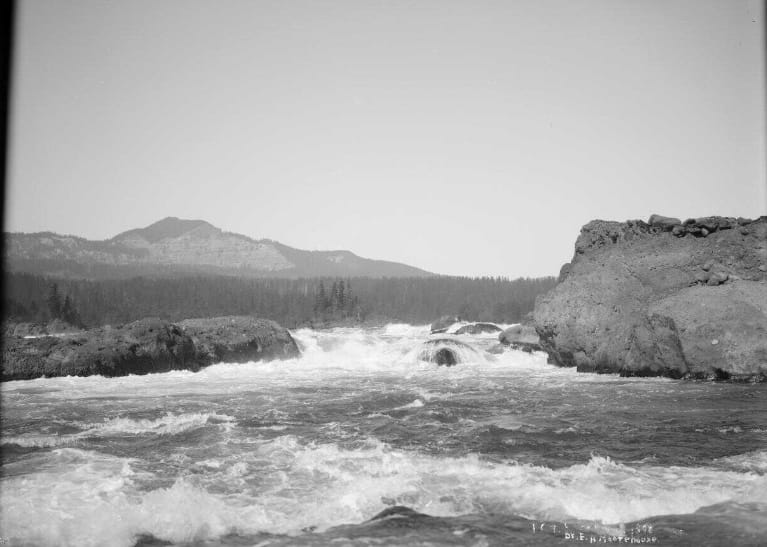
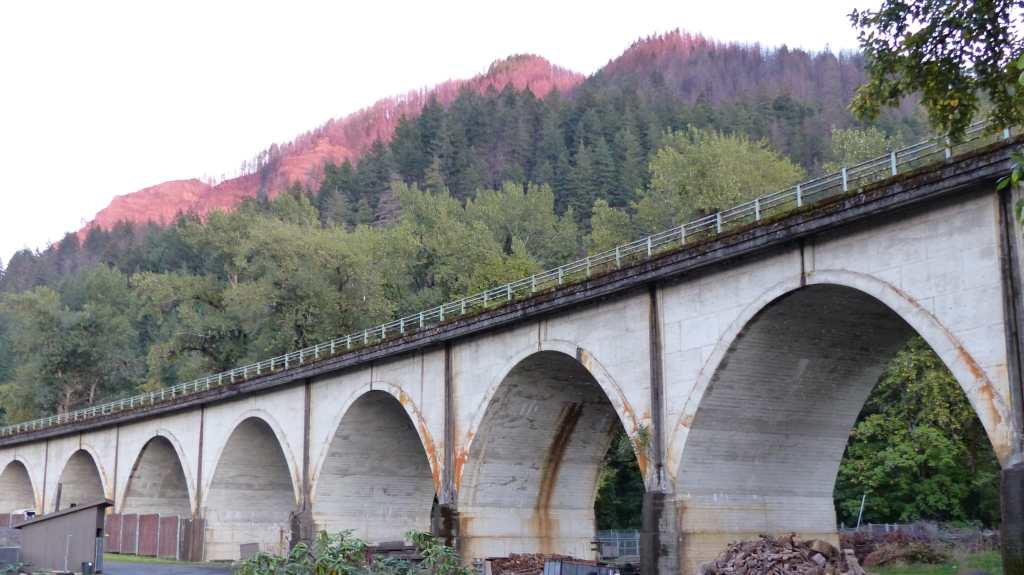
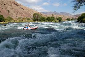
Back in the day the Cascades Rapids was a formidable navigational hinder. It fell 45′ over a 4.5 mile stretch of rock and boulder strewn river. Native Americans would portage around them as they were too dangerous to navigate by boat or canoe.

Cascade Locks- Early 1900’s

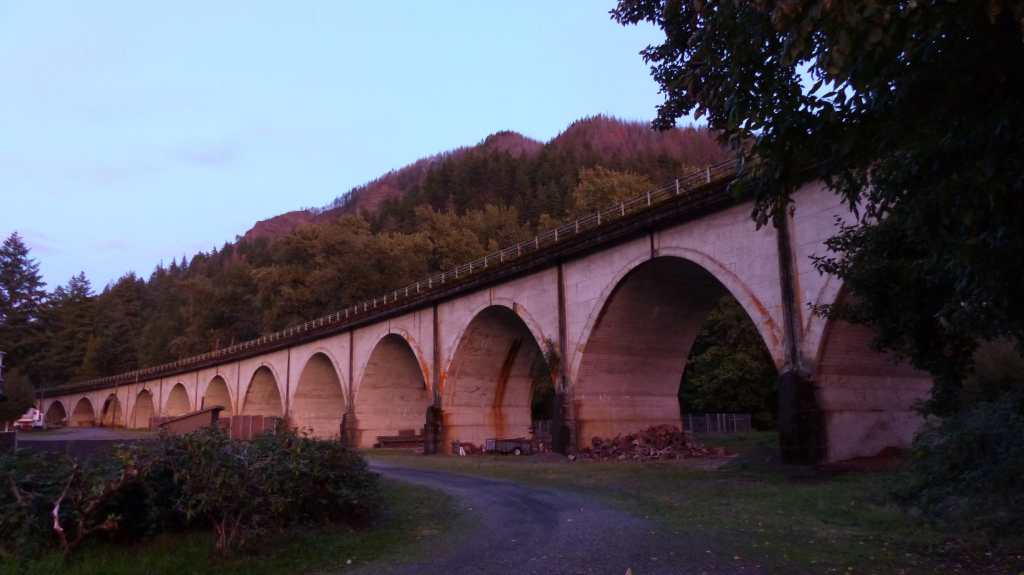
Lewis and Clark portaged the cascades twice once in 1805 and again in 1806 calling the lower cascades “The Shute”. It was not until the 1890’s when the Cascade Locks was built on the Oregon side of the river that it became navigable past the Rapids without the need to portage.

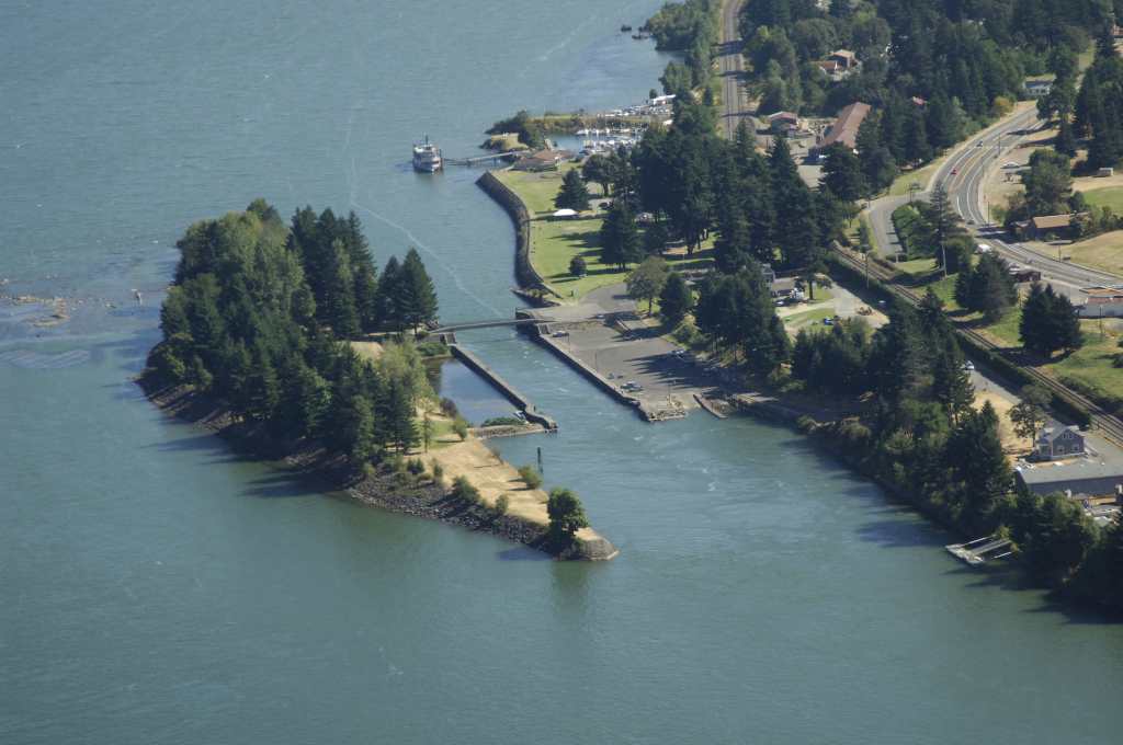
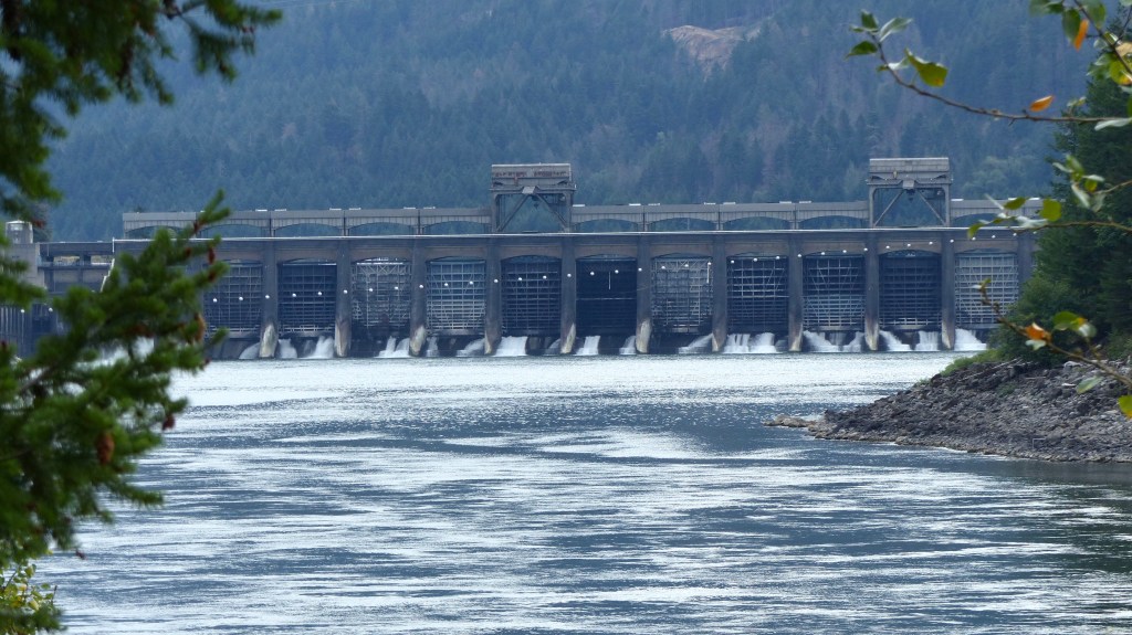
Cascade Locks was flooded and became unnecessary and the rapids disappeared under the waters of the new Bonneville Lake.

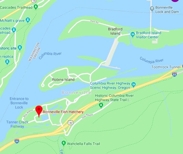
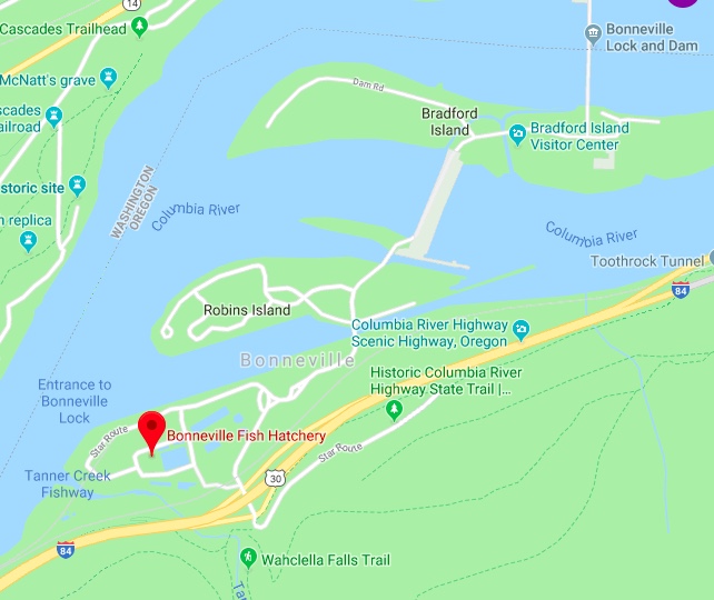
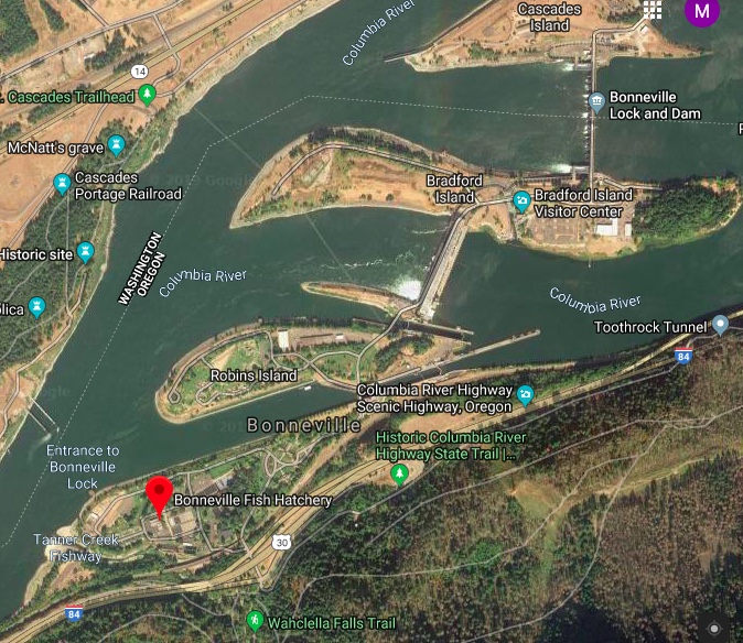
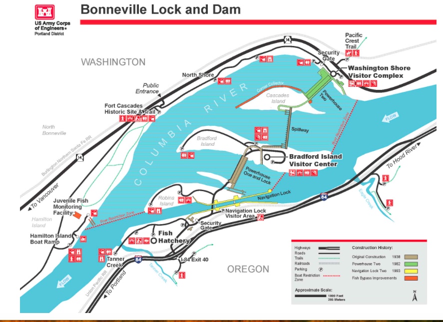
Just downriver from the dam on the Washington side of the Columbia River is Fort Cascades National Historic Site.

A fort was built here in 1855 to protect the portage road around the lower section of Cascades Rapids. The fort was abandoned in 1861. The small community of Cascades formed around the fort but it was wiped out by the flood of 1894, the largest flood of the Columbia in recorded history.

Discovery Trail- Fort Cascades Historic Site

This area is also historically significant as Lewis and Clark’s Corps of Discovery visited an Indian village near here in 1805. It is from this location that they observed and named Beacon Rock, a “remarkable high detached rock”, one of the most recognized landmarks in the Gorge.

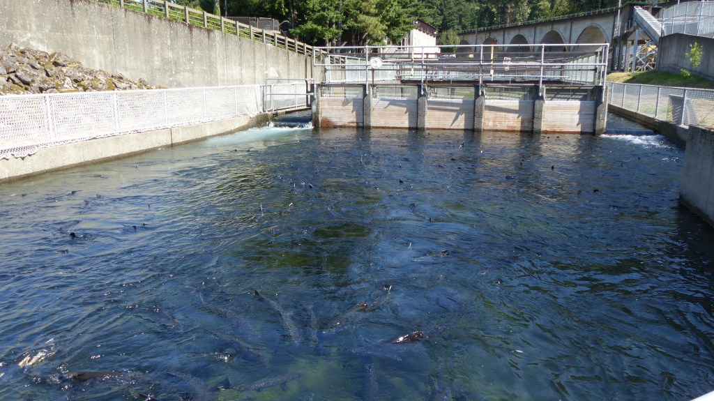
All us hatchery hosts have something in common with Lewis and Clark- we’ve camped on the same grounds along the mighty Columbia River. Yes, Bonneville Hatchery is a confirmed camp site of those explorers. I have reliable information that Lewis and Clark and the Lehr’s have something else in common. While camping at the Indian village across the river they made mention of the huge amount of garter snakes. We have them too. Our Lab Megan was sniffing around in the lawn beside our RV when she jumped straight up! Never saw a dawg jump straight up before. A little garter snake began wriggling off towards the bushes and safety. Since then we’ve seen many of the little fellers and so has Megan- yep- straight up!

Nice Path at Fort Cascades National Historic Site

From 1841 to 1846 the overland portion of the Oregon Trail ended west of The Dalles where the emigrants built rafts or hired boats to travel down the Columbia to Vancouver or up the Willamette River to Oregon City. The river trip was extremely hazardous at best and involved difficult portages around the tumultuous Cascades. Many re-embarked from this site at the Lower Cascades. After 1846 when the Barlow Toll Road was opened across the southern shoulder of Mt. Hood most emigrants preferred the safer overland route to the wild and treacherous Columbia River.

I can’t imagine the hardships of those who traveled the Oregon Trail back in those days of wagons pulled by oxen, the majority of pioneers walking from St. Louis to the Dalles, then rafting down the Columbia to Oregon City. And I know they didn’t have a crystal ball that foretold how we travel today.

Bonneville Dam from Fort Cascades National Historic Site

Stand by for our next post!

Septober in Cascade Locks

No, that title is not a misprint. The mild September weather here in the Pacific Northwest is transitioning rapidly to more October like conditions- hence Septober. Light drizzle for hours on end, an occasional break with decent weather then clouding up resulting in the occasional downpour, after downpour, after downpour. September usually brings around 2.5″ of rain but this month we’ve received 4. 25″- and the month’s not over yet folks.

Osprey and Vulture on the prowl

The average annual rainfall here in Cascade Locks is 78 inches so some rain is expected- but not this much this early in the fall season. In contrast Portland, 40 miles to the west receives 43 inches a year and Hood River, 20 miles to the east receives 30 inches a year. A little more than a week ago a tornado was spotted not far from downtown Portland and another weather cell drew major concern prompting a tornado warning north and east of Vancouver, WA.

Egg Incubation Building

The grounds are large so we have a Toro Workman to get around in. It has a water tank and pump on board so that we can water the many flower pots strategically placed around the hatchery. It also helps us transport trash, tools and whatever else is required to fulfill our duties.

Our normal volunteer job entails greeting and answering questions from our visitors, policing the visitors center, grounds and restrooms for wayward trash, disposing of fallen tree limbs, emptying trash cans, maintaining Herman the Sturgeon’s house, keeping the trout ponds free of debris (and dead trout, a.k.a. Morts). We also feed Herman, the larger rainbow trout in his pond and the small sturgeon (4 footers) salmon jacks- yearlings that have returned to the hatchery but are too young to spawn. The ladies return phone inquiries and keep the large assortment of brochures and leaflets stocked in the visitors center. Our boss Hugh makes a list of “extra” projects that need to be addressed. When we get a chance we try to check off an item on that “to do” list.

Mike feeding Herman and Friends

Us volunteers took advantage of the few rainless periods we’ve experienced the last couple of weeks to shorten the to do list. Ivy was trimmed where it had overgrown and flowed past curbing, in all 600 feet worth. Two decorative fountain pools with were drained, cleaned and refilled with fresh water.

Our cohort volunteers Jim and Connie have been suctioning coins and debris from the bottoms of the upper trout pond and the small sturgeon pond (the sturgeon are small, the pond is not) with the lower trout pond left to complete. The coins taken from the bottom of the fish ponds have to be cleaned before the bank will accept them so Jim and Connie have assumed that duty. Jim has also used his talent to repair hatchery equipment.

Jumping Fish Water Fountain

The very popular jumping salmon water fountain sprung a leak causing a soggy mess so the brass salmon sculpture was removed, the leaking pipes repaired and the sculpture replaced. Doesn’t sound like a big job but it is. The salmon sculpture is fairly heavy. It is also top-heavy making it a bit unwieldy. I have to believe it was quite a site watching three men muscle the sculpture back on to its perch while Connie was standing, teetering on the edge of the fountain trying her darnedest not to step on the wet, sticky waterproofing gunk and not getting pushed off of the edge all the while trying to keep the sculpture more or less vertical. It’s a fragile work of art and must be handled with care and that’s what happened- and no one got hurt……..

“Fish Guy” housing on premises- walk to work!

Rain means more work for us. Leaves from the many deciduous trees and needles from conifers tend to slough off. Over a short period of time they create quite a mess on the lawns and paved areas of the hatchery. The solution is to mow the lawns which does double duty in picking leaf and pine needle debris.

Volunteer Ladies walking over Mitchell Creek Bridge

If the lawns are too wet to mow those leaves and pine needles are blown off of the lawns on to pavement then vacuumed up with a trailer mounted vacuum. Since the vacuum can’t get close enough to curbing, the curbs are cleared using back pack gas powered blowers. Paved walks also need to be cleared of organic debris. It’s a half day process for two people blowing and one driving the trailered vacuum to clean up all of the leaf litter. Blowing and vacuuming is done as needed- sometimes a few times a week.

In the meantime the “fish guys” have started working the salmon. The buyers truck has been here five times to haul salmon to market. Salmon have also been spawned several times in the last couple of weeks, the eggs collected, fertilized and taken from the spawning room to the egg incubation building to begin the process of hatching and growing into fry.

Jil in foreground and Anne in background ready to receive eggs
Jil holding frozen salmon in the Freezer Room

Us volunteers sometimes get involved in the spawning process, filling in where necessary. The ladies usually assist hatchery employee Anne. She takes the freshly harvested salmon eggs and combines them with those of six other females’ eggs and fertilizes them with milt from more than one male salmon. Those eggs are placed in a 5 gallon bucket, then transported to the egg incubation room by electric cart where they are placed in trays washed constantly with fresh water. The chauffeurs can be hatchery “fish guys” but many times are volunteers.

Our stay at the Bonneville Fish Hatchery is not all work and no play. More on that next time.

Twilight falls on the railroad aqueduct

Bonneville Lock and Dam

Saturday September 14, 2014

I thought I’d throw in some information of our current location. My next post I’ll include what hosting at Bonneville Hatchery entails as well as historical information of the area.

The Bonneville Lock and Dam is located in the Columbia River Gorge approximately 40 miles east of downtown Portland Oregon. The Bonneville Fish Hatchery is adjacent to the dam. It consists of two powerhouses, and three islands. Bradford Island visitors center is accessed from Oregon and the North Bonneville visitors center is accessed from Washington.

Bonneville Lock & Dam, built and operated by the U.S. Army Corps of Engineers, was the first federal lock and dam on the Columbia and Snake rivers. The project’s first powerhouse, spillway and original navigation lock were completed in 1938 to improve navigation on Columbia River and provide hydropower to the Pacific Northwest. A second powerhouse was completed in 1981, and a larger navigation lock in 1993. 

Today, the project is a critical part of the water resource management system that provides flood risk management, power generation, water quality improvement, irrigation, fish and wildlife habitat and recreation along the Columbia River.

A Public Works Administration project of President Franklin D. Roosevelt’s New Deal, portions of Bonneville Lock and Dam Project were declared a National Historic Landmark in 1987.

Bradford Island Visitors Center (BIVC) entrance

A lot of folks like to visit the dam. Bradford Island has an outstanding visitors center which is accessed from the Oregon side of the river. In it is a large fish ladder that allows many species of fish to travel from below the dam to the lakes and river above the dam. Folks can either view the ladder outside from above or go into the visitors center where they can view fish through a long viewing window. In a private area adjacent to that window fish counters sit for hours identifying the different species of fish and the numbers of each that pass through the dam.

Back on September 5th the lock operators noticed a problem with the downstream lock gates and shut the lock down. The lock was drained and the problem identified. There is only one lock that allows vessels to pass from river level to lake level. River traffic is at a standstill. That means barges full of wheat and other goods heading down river to market are stymied and barges bringing supplies up river also have to wait. Cruise ships are on hold.

A roadway provides vehicular access over the lock and that is now closed. Bradford Island Visitors Center is not accessible to the public. The dam has another visitors center in North Bonneville, WA but it doesn’t have a fish ladder nor a viewing window. A lot of would-be visitors are disappointed. Now comes the process of repairing the damage. The estimated date when the lock will be reopened to river traffic is September 30th.

The Fish Are In!

Confluence of Tanner Creek and Columbia River. Dark areas in center of creek are returning salmon

Friday, September 6, 2019

Bonneville Fish Hatchery- Week One

The Fall Chinook Salmon run begins in mid-August and continues until the end of September. The Fall Coho run occurs a little later. Our first observation regarding the salmon is that there are a lot of them, and they are stacked thick in the holding pond and channels leading to the “crowder” channel. They are backed up several hundred yards down Tanner Creek as far as the Columbia River. Question- Are the salmon not being worked?. The answer- “There is no contract.” Since then a contract with the buyer has been approved and the buyer’s truck and refrigerated trailer arrived this morning, Friday, a full week after our arrival. Fish are finally being processed, either saved as spawners or sent to the buyers processing plant.

A little history concerning the hatchery is in order: Bonneville Fish Hatchery dates back to 1909. In it’s first year the staff was able incubate and release an estimated 15.2 million fry into Tanner Creek or nearby points along the Columbia. In 1910 the hatchery began receiving new supplies of eggs mainly from locations in Oregon and Idaho with the U.S. Bureau of Fisheries contributing 3.4 million of the 10.7 million eggs. A hatchery in Alaska also contributed 1.5 million sockeye salmon eggs.

An American Dipper, a.k.a. Ouzle searching for food in Tanner Creek

“To cope with these rearing responsibilities, the staff worked hard to construct rearing ponds where they could feed the fry until their release into the Columbia. In 1910 Warden Clanton went to the cannerymen and packers along the Columbia to solicit their assistance and secured contributions of $1,500. Using these funds, Clanton had the crews at the Central (now Bonneville) Hatchery construct three ponds, each 100 feet by 20 feet and three feet deep.

Otters Dining On Salmon In Tanner Creek
Ravens- Cleaning Up After The Otters

  The ponds at Bonneville functioned so successfully that the Fish Warden proposed in 1911 that all hatcheries in Oregon construct rearing ponds. The pond system at the Central Hatchery was expanded steadily so that by the end of the year fifteen large ponds held the fry. The crews constructed a new flume to carry water from Tanner Creek to flush these rearing facilities. …” [Bonneville Dam Historic District, National Historic Landmark 1986 Nomination Package]. And that’s how it all began 110 years ago.

With construction of the Bonneville Dam in the 1930s the Fish Hatchery itself had major renovations, realignment, and construction. Of the original rearing ponds only the three farthest to the northeast were retained and were rebuilt as new display ponds. The Incubation Building was built in 1936. In front of the Incubation building are 22 concrete rearing ponds, constructed in the 1930’s. Each pond has a capacity of 300,000 fingerlings.

Egg Incubation Building built in the 1930’s

The facility was remodeled and expanded again in 1957 and again in 1974 the last as part of the U.S. Army Corps of Engineer’s mitigation of fish losses from the construction of the John Day Dam. In 1997 the Hatchery was added to the National Register of Historic Places as part of the Bonneville Historic District.

Host Site #2- Beautiful spot right next to Tanner Creek

Host Site #2 is our home for two months. It’s located away from the public areas of the hatchery behind the fish ladder, holding pond and channels where the salmon enter the hatchery. Out our right side windows not 35′ away is Tanner Creek. The fish come in from the ocean via the Columbia River and turn right into the mouth of Tanner Creek. They are prevented from continuing up the creek as far as our location by an electrified “fence”. Their desire to continue to the spawning grounds is what brings them here.

View of Railroad Trestle From Our Front Window

For those who aren’t savvy to the workings of a salmon hatchery I’ll do a little ‘splainin’, as Ricky Ricardo once said. The hatchery raises 10-15 million fish a year and may see a return of 1-2 million.

Hee, Hee- Salmon Dorsal Fins, NOT Shark Fins…….

Each female holds 3000-5000 eggs so the number of females required to fulfill the amount of eggs needed to perpetuate the species is small in comparison with the amount of salmon that return to the hatchery. Many less males than females are needed as their milt fertilizes the eggs of more than one female. The most desirable spawning candidates are separated from the crowd and placed in one of two spawning ponds, the rest are sold to a buyer.

The weather thus far has been on the warm side. A possibility of rain is in the forecast for early next week. More about the hatchery, Bonneville dam and surrounding area in future blogs. Until then, Adios!

A Good Night To All!

160 To Bonneville

Sunday, September 1, 2018

We are heading north from Bend this morning, destination Bonneville Fish Hatchery, a distance of 160 miles. The hatchery will be our home for two months. We’ll take US 97 to Madras then US 26 to the outskirts of Government Camp and then OR 35 to Hood River. Once there we’ll head west on Interstate 84 four miles past Cascade Locks, OR to the Bonneville Dam and Fish Hatchery turnoff.

The first city north of Bend is Redmond (30,000 souls). As with her sister city Bend, Redmond has had rapid growth due mainly to the availability of jobs and less expensive housing. In fact, from the 2000 census to the 2010 census the city population doubled. Points of interest include Smith Rock State Park, a favorite of rock climbers, The Redmond Caves, and Eagle Crest Resort.

Madras (2600 souls) is another 26 miles up the road and it is Madras where we join US 26. Madras. The city is the seat of Jefferson County. It lies in rolling hill country dotted with farms and ranches. It’s believed that the name “madras” was inspired by the cloth fabric of the same name. Its is a tidy farm based community.

On the way to Madras Highway 97 crosses over a deep canyon carved by the Deschutes. Jil has never looked into that canyon so we stopped. The 300 foot drop is dizzying and dangerous. No dogs are allowed past the parking lot, thankfully, or there would be a lot more of man’s best friend in the bottom of that precipice.

We dive down the steep sides of the lower Deschutes Canyon winding down, down until we reach the Deschutes River. In the narrow portion of the canyon is Whitehorse Rapids which continues on for a half a mile.

Fourteen miles north of Madras on US 26 is the community of Warm Springs (2900 souls). The community is located in the lower Deschutes River Canyon on the Warm Springs Indian Reservation. The Warm Springs Agency represents the Warm Springs, Wasco and Piute tribes.

The agency built a beautiful resort and casino naming it Kah-Nee-Ta for a woman who used to live near the springs. The resort was built 12 miles from town along the Warm Springs River adjacent to the hot springs. It included a small casino, convention center, golf course, olympic size pool, spa and RV park. The tribe council felt that the casino should be moved to the major highway to generate several times more revenue than the $2-4 million it was netting, so US 26 it was.

Lacking the draw of the casino, the resort slowly started to decline. For a reason only know to the tribe council outside influence was not an option for the tribal council. The decision to move the casino coupled with poor management caused the demise of resort 2018 putting 140 agency residents out of work. We passed the Indian Head Casino- it didn’t appear busy at all, maybe because the closest lodging is 14 miles away in Madras……..and Madras is not primarily a destination town. For that matter, neither is Warm Springs.

After leaving Warm Springs the road has us climb onto a plateau where we see Mt. Hood off in the distance. Sage gradually changes to juniper, juniper to pine as we gradually gain altitude. Then comes a thick conifer forest, it’s trees blocking most of the suns light. We summit at Barlow Pass (elevation 4155).

US 26 and Oregon 35 intersect just outside of Government Camp (193 souls). This place is the defecto “mountain town” or “ski town” of Mount Hood. It’s the gateway to several ski resorts. A sign in front of the town’s post office states, “Formerly a camp on the old Barlow Road, the village was named in 1849 when U.S Cavalry troops were forced to abandon wagons and supplies here.

Heading down the southeast shoulder of Mt. Hood we come to a large barren rock and boulder strewn area reminiscent of glacial activity- and it is! The White River Glacier has left it’s mark on the mountain. This is also the headwaters of the White River.

The road takes us to lower elevations but not out of the conifer forest. It does begin to transition to a mixed forest as we drop down towards the Hood River Valley following the Hood River.

The valley is spectacular. Farms and vineyards have been carved out of the forest creating a patchwork of multi hued green. Pear, cherry and apple tree orchards as well as grape vineyards abound. In other areas not suitable for those crops alfalfa and hay are grown. Farm stands dot the road. As we look back we see Mt. Hood standing sentry over us. It doesn’t get any more beautiful than this!

We drop down into the community of Hood River (7100 souls) which is located at the confluence of the Hood River and the mighty Columbia River. The city does double duty as it is also the seat of Hood River County. The hilly downtown commercial district overlooks its harbor and the mighty Hood River/White Salmon Bridge.

We jump on Interstate 84 and head west, the highway paralleling the largest river in the Pacific Northwest. We drive past 3000 foot high basalt cliffs and greenest of green forest. We stop in Cascade Locks to refuel and fill our propane tank, continuing on the last four miles of our journey exiting on the Bonneville Dam/Bonneville Fish Hatchery offramp.

We are fortunate to find our “boss” Hugh on the grounds of the hatchery. He says he needs us to work Sunday/Monday. I said we could relieve the hosts that are leaving on Sunday and work their shift on Saturday so they can take their time packing. He said “that’s not necessary, Mike and Sue love it here”. So we ran into Mike and Sue, offered to work Saturday for them and they jumped at our offer. You see, they were planning to leave between 4 and 5 am Sunday morning and had a lot preparation to do. No problem Mike and Sue- Safe Travels!

These two are playing in our back yard at Bonneville Fish Hatchery