Sunday, September 1, 2018

We are heading north from Bend this morning, destination Bonneville Fish Hatchery, a distance of 160 miles. The hatchery will be our home for two months. We’ll take US 97 to Madras then US 26 to the outskirts of Government Camp and then OR 35 to Hood River. Once there we’ll head west on Interstate 84 four miles past Cascade Locks, OR to the Bonneville Dam and Fish Hatchery turnoff.
The first city north of Bend is Redmond (30,000 souls). As with her sister city Bend, Redmond has had rapid growth due mainly to the availability of jobs and less expensive housing. In fact, from the 2000 census to the 2010 census the city population doubled. Points of interest include Smith Rock State Park, a favorite of rock climbers, The Redmond Caves, and Eagle Crest Resort.

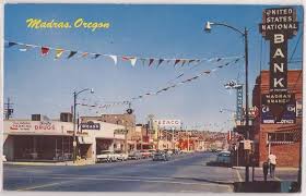
Madras (2600 souls) is another 26 miles up the road and it is Madras where we join US 26. Madras. The city is the seat of Jefferson County. It lies in rolling hill country dotted with farms and ranches. It’s believed that the name “madras” was inspired by the cloth fabric of the same name. Its is a tidy farm based community.
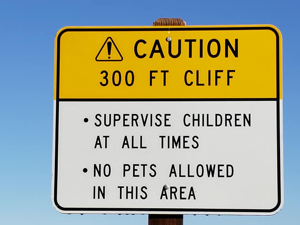
On the way to Madras Highway 97 crosses over a deep canyon carved by the Deschutes. Jil has never looked into that canyon so we stopped. The 300 foot drop is dizzying and dangerous. No dogs are allowed past the parking lot, thankfully, or there would be a lot more of man’s best friend in the bottom of that precipice.

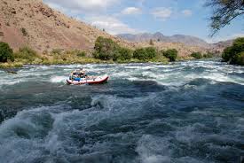
We dive down the steep sides of the lower Deschutes Canyon winding down, down until we reach the Deschutes River. In the narrow portion of the canyon is Whitehorse Rapids which continues on for a half a mile.
Fourteen miles north of Madras on US 26 is the community of Warm Springs (2900 souls). The community is located in the lower Deschutes River Canyon on the Warm Springs Indian Reservation. The Warm Springs Agency represents the Warm Springs, Wasco and Piute tribes.

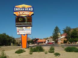
The agency built a beautiful resort and casino naming it Kah-Nee-Ta for a woman who used to live near the springs. The resort was built 12 miles from town along the Warm Springs River adjacent to the hot springs. It included a small casino, convention center, golf course, olympic size pool, spa and RV park. The tribe council felt that the casino should be moved to the major highway to generate several times more revenue than the $2-4 million it was netting, so US 26 it was.

Lacking the draw of the casino, the resort slowly started to decline. For a reason only know to the tribe council outside influence was not an option for the tribal council. The decision to move the casino coupled with poor management caused the demise of resort 2018 putting 140 agency residents out of work. We passed the Indian Head Casino- it didn’t appear busy at all, maybe because the closest lodging is 14 miles away in Madras……..and Madras is not primarily a destination town. For that matter, neither is Warm Springs.
After leaving Warm Springs the road has us climb onto a plateau where we see Mt. Hood off in the distance. Sage gradually changes to juniper, juniper to pine as we gradually gain altitude. Then comes a thick conifer forest, it’s trees blocking most of the suns light. We summit at Barlow Pass (elevation 4155).

US 26 and Oregon 35 intersect just outside of Government Camp (193 souls). This place is the defecto “mountain town” or “ski town” of Mount Hood. It’s the gateway to several ski resorts. A sign in front of the town’s post office states, “Formerly a camp on the old Barlow Road, the village was named in 1849 when U.S Cavalry troops were forced to abandon wagons and supplies here.“
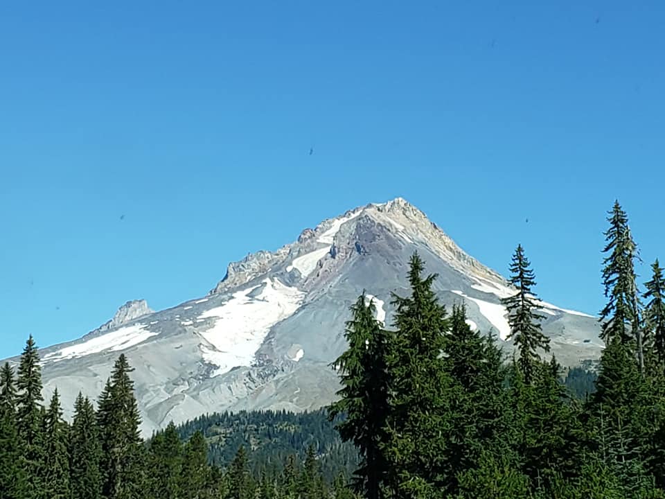
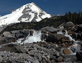
Heading down the southeast shoulder of Mt. Hood we come to a large barren rock and boulder strewn area reminiscent of glacial activity- and it is! The White River Glacier has left it’s mark on the mountain. This is also the headwaters of the White River.
The road takes us to lower elevations but not out of the conifer forest. It does begin to transition to a mixed forest as we drop down towards the Hood River Valley following the Hood River.

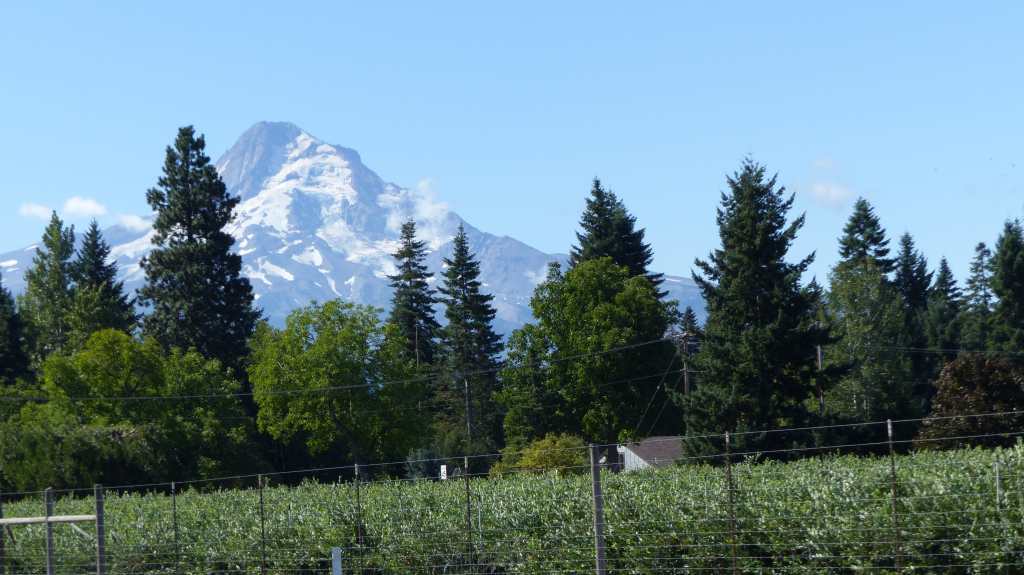
The valley is spectacular. Farms and vineyards have been carved out of the forest creating a patchwork of multi hued green. Pear, cherry and apple tree orchards as well as grape vineyards abound. In other areas not suitable for those crops alfalfa and hay are grown. Farm stands dot the road. As we look back we see Mt. Hood standing sentry over us. It doesn’t get any more beautiful than this!
We drop down into the community of Hood River (7100 souls) which is located at the confluence of the Hood River and the mighty Columbia River. The city does double duty as it is also the seat of Hood River County. The hilly downtown commercial district overlooks its harbor and the mighty Hood River/White Salmon Bridge.

We jump on Interstate 84 and head west, the highway paralleling the largest river in the Pacific Northwest. We drive past 3000 foot high basalt cliffs and greenest of green forest. We stop in Cascade Locks to refuel and fill our propane tank, continuing on the last four miles of our journey exiting on the Bonneville Dam/Bonneville Fish Hatchery offramp.


We are fortunate to find our “boss” Hugh on the grounds of the hatchery. He says he needs us to work Sunday/Monday. I said we could relieve the hosts that are leaving on Sunday and work their shift on Saturday so they can take their time packing. He said “that’s not necessary, Mike and Sue love it here”. So we ran into Mike and Sue, offered to work Saturday for them and they jumped at our offer. You see, they were planning to leave between 4 and 5 am Sunday morning and had a lot preparation to do. No problem Mike and Sue- Safe Travels!
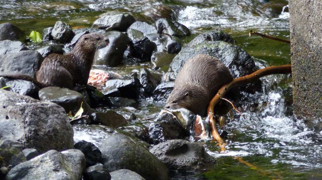
These two are playing in our back yard at Bonneville Fish Hatchery
