We Drove 562 Miles!

Saturday, October 17, 2020

It’s difficult for me to finish a blog once we get home. Our RV is stored out of doors so we gotta store anything that freezes in a safe location. The work begins. Clean the coach in and out and empty the refer. Drag our clothes into the house, then winterize the water system. And then yack with our neighbors catching up on two months worth of events. Do about a thousand pounds worth of laundry and start cutting back garden plants and cleaning out the planters. Oh, reconnect with our church, its organizations and some HOA committees that we are on. So now that most of that is in the works or accomplished I can finish this blog…………..

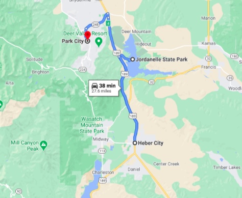
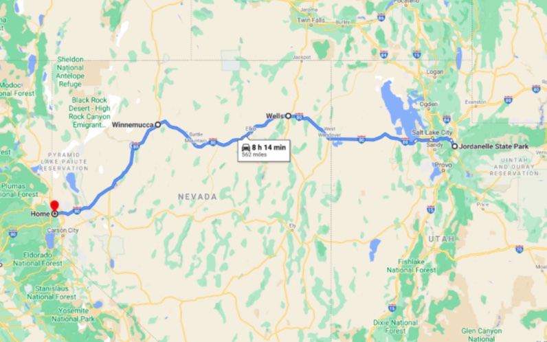
OK, OK, I know what you are thinking. We did drive 562 miles- in three days….. We wouldn’t want to break our string of 150-200 mile days would we? We left Jardonelle State Park on Monday, the twelfth of October and headed a short distance to I-80 then west towards home.

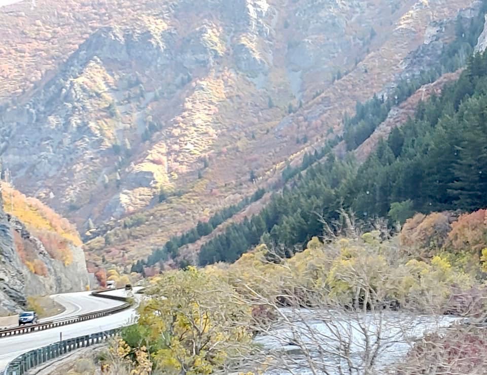
Not long after joining I-80 we are taken through Parley’s Canyon where the interstate resembles a snake slithering to and fro following the canyon walls. The descent towards Salt Lake is fairly steep, requiring trucks, and us to slow the pace to maintain control. We leave the Wasatch Range behind and are now on the wide open flats driving through Salt Lake City. The city itself is not huge at 200,500 souls yet the Salt Lake Metropolitan area is very sizable with a population of over 1.2 million folks. Our timing is pretty good as traffic is pretty heavy compared to what we’ve experienced thus far on the trip but people are driving courteously.

As we pass downtown we catch a glimpse of the beautiful Salt Lake LDS Temple located at the 35 acre Temple Square. The temple took 40 years to build between 1853 and 1893. The temple is sacred to members of the Church of Jesus Christ of Latter-day Saints, and is not open for tours, you can stroll around the grounds and stop in the South Visitors’ Center to see a scale model of the temple and its interior. The Temple is undergoing renovation and won’t be open to anyone for several years.

Miss RV Garmin GPS helps us select our escape route from Salt Lake and before we know it we are heading west past the 75 mile long by 35 mile wide Great Salt Lake. The lake is so salty one cannot sink, rather float like a cork. The sand at Bridger Bay Beach consists of a hundred yard wide by two mile expanse of oolitic sand which is formed at the lake. It consists of concentric layers of calcium carbonate. Interestingly most grains are smooth and perfectly round.

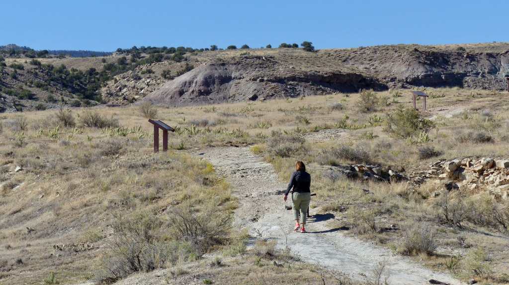
The landscape is pretty stark out here. Not exactly barren but not lush with desert plants either. There’s evidence of white minerals along the road- probably salt.

Speaking of salt, we pass the Saltair Resort, now practically abandoned except for the few concerts held there. Its history is extremely interesting.

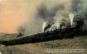
In 1893 the Mormon church built Saltair on the south shore of the Great Salt Lake, about sixteen miles from downtown Salt Lake City. They also built the railroad connecting the resort with the city. The church owned the resort until 1906, at which time it was sold to a group of private Mormon businessmen. 

In building Saltair the Mormon church had two major objectives: in the words of Mormon apostle Abraham H. Cannon, they wanted to provide “a wholesome place of recreation” under church control for Mormons and their families; and they also intended that Saltair be a “Coney Island of the West” to help demonstrate that Utah was not a strange place of alien people and customs. This was part of a larger movement toward accommodation with American society that had begun in the early 1890s as church leaders made a conscious decision to bring the church into the mainstream of American life. Saltair was to be both a typical American amusement park and a place that provided a safe environment for Mormon patrons.

The resort reached its heyday in the 1920’s but burned to the ground in 1925. It was rebuilt but never regained its former glory. Another fire and a receding lake level left the resort a half mile from the shore didn’t help. The resort struggled during WWII and closed for good in 1958- once again destroyed by fire in 1970.

A new pavilion was built in 1981 but struggled as the lake reached it’s highest level in history in 1984 putting the pavilion’s main floor under five feet of water. The water began to recede in the late 1980’s. It was purchased in 1982, the structure restored and a concert stage added. It reopened in 1993- again with limited success.

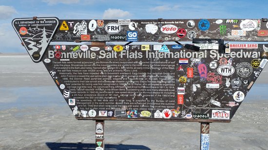
The next place of significance is the Bonneville Salt Flats. Seasonal flooding, evaporatation of surface water and then wind create a salt surface so flat one feels that they can see the curvature of the earth here. The flat surface makes an ideal surface on which to race one’s vehicle. At one time a 9 mile long straight and an oval are set up every year. The current land speed record at Bonneville is in excess of 500 miles per hour!

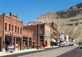
We stopped in West Wendover Nevada which is just across the border from Wendover, Utah (1200 souls). The Utah town is noted for being an station stop on the Western Pacific Railroad (1908), and the transcontinental telephone line was completed there in 1914. During World War II, the nearby Wendover Army Airfield (later known as the Wendover Air Force Base) was a training base for bomber pilots. The Enola Gay and its crew piloted by Paul Tibbets were stationed there. The Enola Gay would drop the first atomic bomb on Hiroshima, Japan. Of course the Nevada side of the border is where all the gambling casinos are located.

The terrain is looking more Nevada like. Most people unfamiliar with Nevada would suspect its just a big, flat desert. In reality the state has numerous mountain ranges with tall peaks that mostly run north/south with the 13,147 foot Boundary Peak being the tallest. Nevada is not all desert as those mountains have trees and lakes just like other mountainous states. In fact the state shares beautiful Lake Tahoe with our neighbors in California.

We stop in Elko for fuel and to stretch at the city park. This city of 18,900 souls is the seat of Elko County. Though Elko lies along the route of the historic California Trail, it wasn’t inhabited until 1868, when it was at the east end of the railroad tracks built by the Central Pacific Railroad (the portion of the First Continental Railroad built from California to Utah). When the railroad crews moved on, Elko remained, serving as a center for ranching, mining, rail freight and general supplies. The Western Folklife Center,Northeastern Nevada Museum and the California Trail Interpretive Center are all nearby. While in town one can enjoy Basque cuisine.

Our overnight stop is in Wells (1292 souls). It was established as a water station by the Central Pacific Railroad in 1869 due to its strategic location at the headwaters of the Humboldt River. The town got its name from the springs and swampy area just west of town. A magnitude 6.0 earthquake significantly damaged its old historic downtown in 2008 and has yet to be rebuilt. The town is located at the junction of US93 and I-80 and gateway to the beautiful Ruby Mountains.

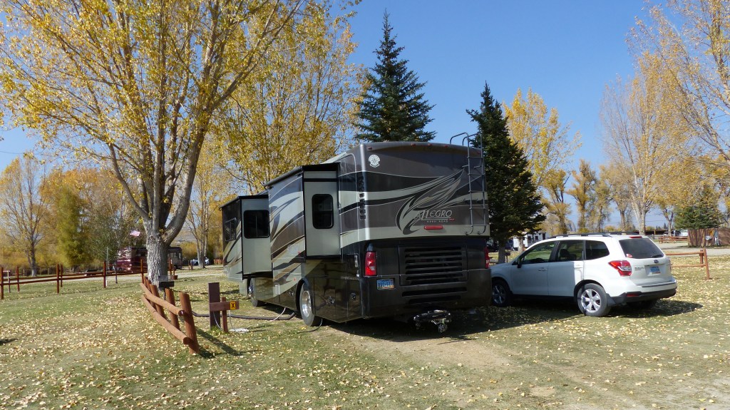
We stayed at Mountain Shadows RV Park which is an OK stay. Nothing fancy but it served our purpose. A couple of blocks away is Archie Smiley Field. The field consists of baseball and softball diamonds with some nice picnic areas thrown in. Our mutzos appreciated the nice green grass and the exercise after a day of travel.

On the last leg home we stopped back at the Silver State RV Park in Winnemucca which happens to be the first place we camped on this trip. We could have driven all the way home but decided to split the 330 miles up, get an early start the next morning and come home arriving before noon. So that’s what we did.

From Winnemucca it’s deja vu as we retrace our route back to the barn. We stop in Lovelock to walk Lover’s Lock Park, drive past the 40 Mile Desert and the city of Fernley, then drive through the Truckee River Canyon spitting out in Sparks. From there its only 10 miles to home sweet home.

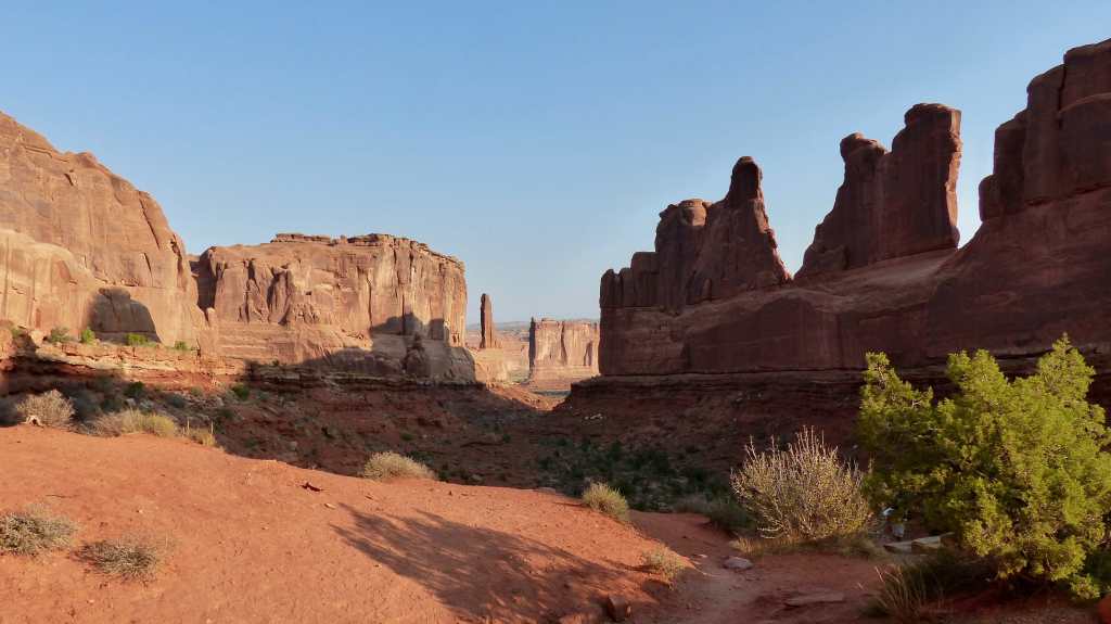
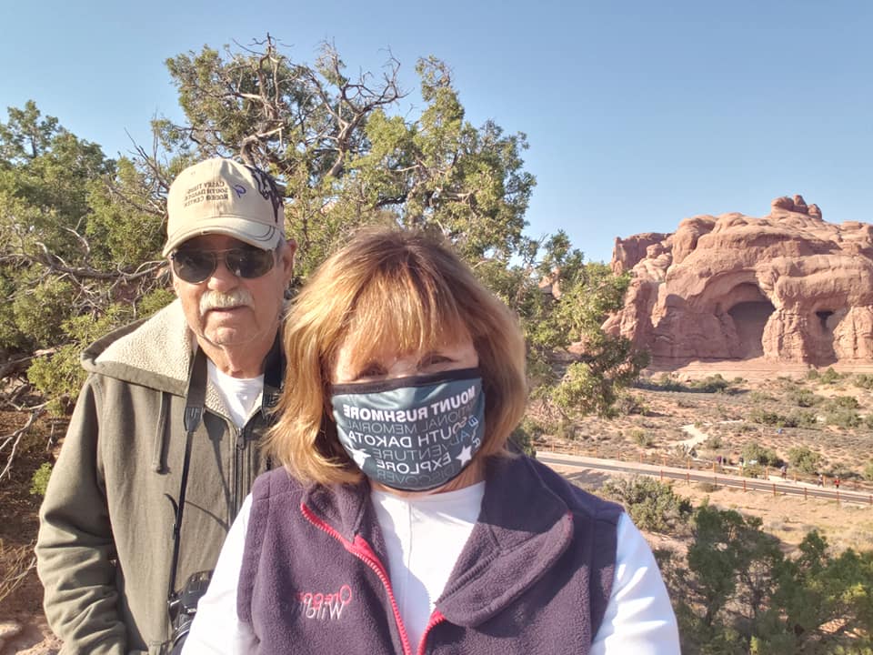
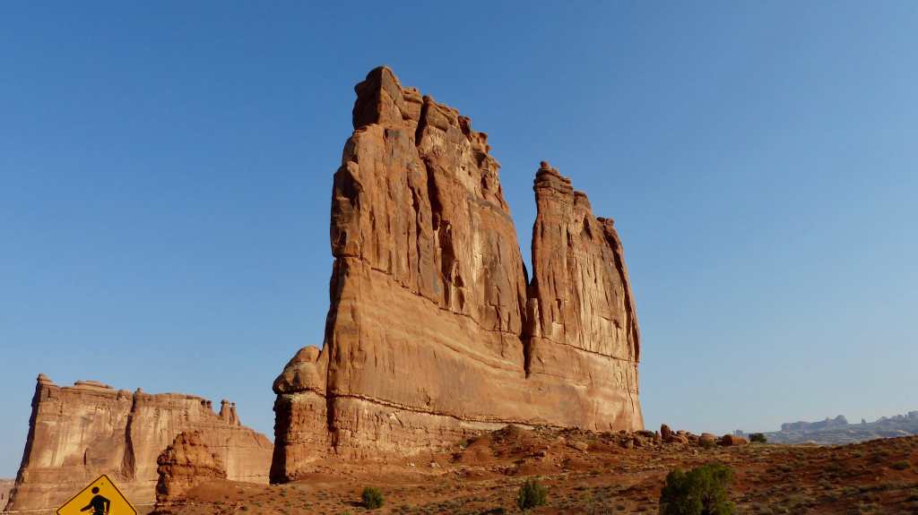
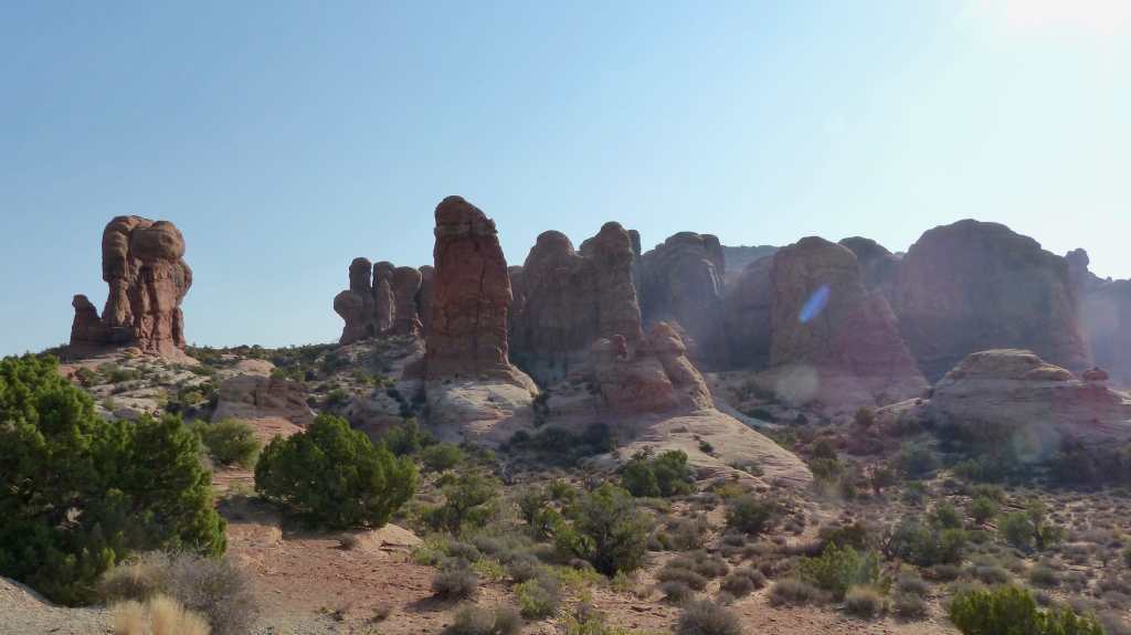
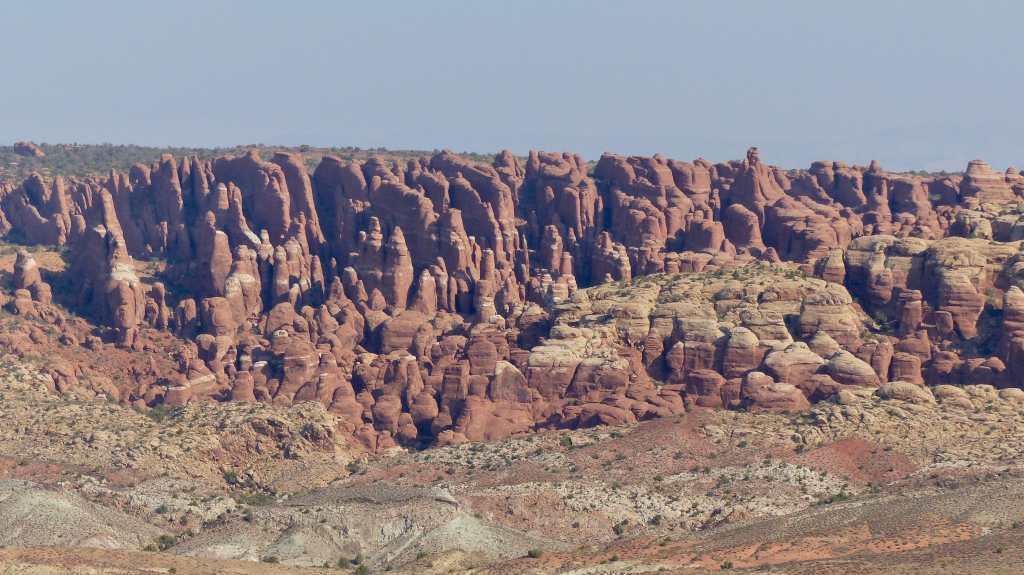
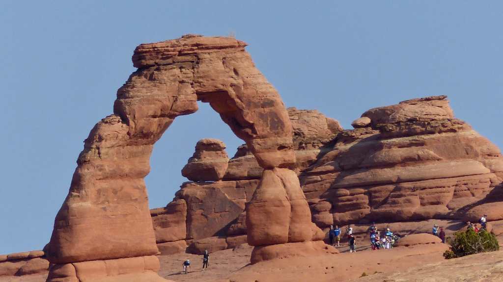
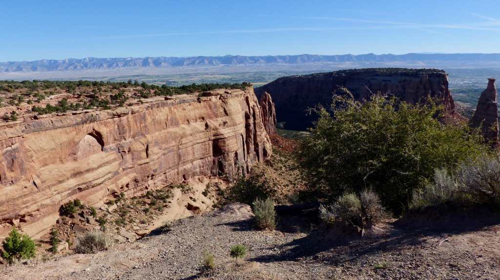
The trip brought us to many unintended, interesting places as the COVID virus had changed the rules somewhat. Traveling to places we wanted to visit and staying in places we wanted to stay came to a screeching halt as those places proved to be unbelievably popular with newbies (new to RVing) as well as us old timers. Usually that time period after Labor Day and the first snowfall is not as popular a time to RV giving us retired folk an advantage over working stiffs- but COVID-19 changed that. We had to bypass Yellowstone National Park for the first time ever due to the crowds and lack of RV campsites but were fortunate to find other interesting places to visit in its stead- like Thermopolis and Colorado National Monument. And we got lucky when Jil found a vacancy at the Desert Moon Hotel and RV Park, Thompson Springs, so that we may visit Arches National Park, a place that wasn’t even on our radar when we began this trip.

All in all we had a wonderful time. Hopefully next year won’t be as busy as this year and eventually we’ll be back to pre-COVID normalcy. Until next time- Adios!

Jordanelle, Heber City and Park City Utah- Wow!

Sunday, October 11, 2020

Our move today has us in a quandary. We have so far to travel today yet daylight is coming so late in the morning the lack of daylight makes it difficult to pick up our umbilicals- water sewer, cable, and power cords at the hour we prefer to perform those tasks. And we have so far to go this morning. I guess we’ll just have to accept a late start………

We traveled mile after mile, leaving Provo Utah in favor of Heber Valley and Jordanelle State Park- a total of 35-40 miles! OK, the move was our shortest of the trip yet offered a ton of beauty. The route included several miles traveling north on I-15 and then northeast onto US-189, the latter following the Provo River through its namesake canyon. The canyon is beautiful, steep walls with at least one cataract, Bridal Veil Falls dropping down hundreds of feet to the river below.

We pass Sundance Resort, where actor Robert Redford’s film festival is held reaching Heber Valley, first passing Deer Creek Reservoir, then passing through the city of Heber on our way to Jordanelle State Park.

Heber City (11, 362 souls with last guestimate at 15000) was founded by English immigrants who were members of The Church of the Latter Day Saints in the late 1850s, and is named after the Mormon apostle Heber C. Kimball. It is the county seat of Wasatch County. The original Heber City town square currently houses city offices as well as the historic Wasatch Stake Tabernacle and Heber Amusement Hall. The city was largely pastoral, focusing largely on dairy farms and cattle ranching, and has since become a bedroom communtiy for Orem, Provo, Park City and Salt Lake City.

Heber City was first settled in 1859 by Robert Broadhead, James Davis and James Gurr. John W. Witt built the first house in the area. The area was under the direction of Bishop Silas Smith who was in Provo. In 1860 Joseph S. Murdock became the bishop over the Latter-day Saints in Heber City and vicinity.

On May 5, 1899, the Wasatch Wave published this on the 40 year anniversary of Heber, “Forty years ago this week [April 30, 1859], this valley was first settled by a company of enterprising citizens from Provo. This company consisted of John Crook, James Carlile, Jessie Bond, Henry Chatwin, Charles N. Carroll, Thomas Rasband, John Jordan, John Carlile, Wm Giles and Mr. Carpenter, the last five named persons having since died. Forty years ago today, John Crook and Thomas Rasband commenced their first plowing in the beautiful little valley of the Timpanogos. A wonderful change has taken place of the appearance of the valley since that time. Delightful meadows and fields of waving grain have taken the place of sage brush and willows. Beautiful homes have erected where then was heard only the dismal howl of the coyote.” 

Jordanelle State Park is located on the the banks of Jordanelle Reservoir. The parks foliage is displaying fall colors, the grass is golden and the aspen trees’ leaves are a vibrant yellow. Some trees are starting to turn a rust or red color. It’s very pretty here.

Jordanellre Reservoir looking towards the dam

All RV sites offer water and power while one loop has sewer hookups too. The restroom/comfort stations are very nice, offering a laundry facility.

The lady at the entrance station said that we could take the dogs down to the lake, but only to the “natural areas”. Jeez, it’s a man-made reservoir- where might be the “natural areas?”. We receive no explanation nor a map so we take the mutzos down to the closest water access. Megan immediately dunks- dunk, dunk, dunk, dunk. Ollie spots the Canada Geese out about 50 yards and wades into his ankles- deep for our Boxer. He then notices the wind waves lapping up on the beach and goes into attack mode, trying to eat each wave that comes ashore. Both of the dogs are happy and soaked. Megan takes a beach towel’s worth of drying while Ollie’s short fur requires a lot less towel- but he enjoys being dried off so much we spend just as much time toweling him off as Megan.

Our campground is located equidistant from Heber City and Park City. We go back and visit Heber City, walk around the city park with our mutzos and see a few of the local sites as well as do a little grocery shopping.

One reason we’re holed up at Jordanelle State Park is so that we may visit Park City. Jil’s been here in past years to ski, hasn’t been for 30 years and I’ve never been. Park City (7558 souls) is a rags to riches town. After the area’s mining industry shut down the city rebounded in the 1980’s and 1990’s through an expansion of its tourism business. Currently the city brings in over a half billion dollars to the Utah economy, eighty million of which is attributed to the Sundance Film Festival.

The town is most noted for its winter sports. Deer Valley Resort and Park City Mountain Resort offer fabulous powder for skiing and snowboarding. The 2002 Winter Olympics were held in Park City. In 2015, Park City Ski Resort and Canyons resorts merged creating the largest ski area in the U.S. In all, the resort boasts 17 slopes, 14 bowls, 300 trails and 22 miles of lifts.

We find the town very active for a fall afternoon, too active. We like quiet or calm at least. Main Street is packed with parked cars and/or people attempting to park a Cadillac in a space large enough for a Kia, multiple generational families jay walking, popping out from between parked cars, and not a one of them watching for traffic. While walking and sight seeing on Main Street might be fun before the crowds arrive, arrive they have and we withdraw and head back to the state park.

On the way back to camp we are treated to a very wide rainbow. The colors in the photo are not as vibrant as they were in person- the photo was taken through a rain soaked windshield but you get the picture…..

Our last night/early morning brought rain, enough to make things a little muddy and snow to the upper elevations. It’s windy and cool/borderline cold. Tonight the temps are supposed to drop to freezing and we are ready for it.

We will be heading towards the barn tomorrow. We’re in no hurry so our planned arrival won’t be for three days. Hope to see y’all soon!

Provo, Utah

Thursday, October 8, 2020

Provo is the third largest city (116,700 souls) in Utah. It is also the seat of Utah County. The city is located 43 miles south of Salt Lake City along the Wasatch Front. Huge Utah Lake is located to its west and that’s where we are staying. Lakeside RV Campground is just down the street from Utah Lake State Park. We might have stayed there, however the campground in the state park is closed.

The City is home to Brigham Young University, owned by the Church of Latter-day Saints. It’s possible for a non-Mormon to attend the university but students are required to take at least three credits of religious classes per semester to graduate. All prospective students are encouraged to apply.

While Father Silvestre Velez de Escalante, a Spanish Franciscan missionary-explorer, is considered the first European visitor to the area that would become Provo, the first permanent settlement was established in 1849 as Fort Utah. The name was changed to “Provo” in 1850, in honor of Etienne Provost, an early French-Canadian trapper. The population of Provo has grown from 2,030 in 1860 to an estimated 116,618 in 2019. Members of The Church of Latter Day Saints (LDS Church) comprise almost 82% of the city’s population.

America’s Freedom Festival at Provo, held every May through July, is one of the largest Independence Day celebrations in the United States. Several cultural points of interest in the city include the Covey Center for the Arts, the LDS Church’s Missionary Training Center, and the Provo City Library at Academy Square.

Provo Tabernacle circa 2006 before it was destroyed by fire.

Provo has two LDS Church temples: Provo Utah and Provo City Center, the latter being restored from the ruins of the Provo Tabernacle. The Utah Valley Convention Center is also located in downtown Provo. There are several museums located on the BYU campus.

If enjoying nature is more your style there are many natural features to visit. Bridal Veil Fall, the Provo River, Utah Lake, Uinta-Wasatch-Cache National Forest are nearby as is Timpangogos Cave National Monument. Any yet you may be just as interested in a number of national historic landmarks are located within Provo, including the Reed O. Smoot House. Mr. Smoot was co-author of the Smoot-Hawley Tariff Act of 1930, an act to primarily regulate commerce with foreign countries, to encourage U.S. industries, and to protect American labor.

Eye appealing downtown Provo

The Provo City Center Temple

Great three story building in City Center

We walked around the older section of City Center enjoying the sights. We were very impressed on how clean everything was including the streets, sidewalks and buildings. No litter or graffiti anywhere.

Street Art- Downtown Provo

Just a few blocks from downtown is the campus of Brigham Young University which is separated from the downtown by several blocks of residents. The streets and homes are so clean and handsome, just like downtown.

We drove into Brigham Young University far enough to be confronted by a security shack with a big sign stating “Show Your I.D.” Oh brother, we’re just visiting and don’t have a university I.D. There’s no place to turn around so we idle up to the shack and are met by “The Friendly Guard”. Before I can explain that we just wanted to tour the campus he says “Welcome, come on in!” Well shucks, we must’ve looked just like these 18 to 22 year old students roaming the campus! Jil asks the young feller where we can find the interesting looking buildings and he says “The campus is sorta boring but the Hinkley Center is kinda nice……” A short time later we cross paths with a campus police officer who offers to help us with directions. We told him we just want to take a look around so with a smile on his face he says “Have a nice visit!” We will, sir!

We found the campus exceptionally uncluttered and clean. School was back in session with students going to and fro, some going to class, others walking or running for exercise. The campus is very nice. We’re glad that we took the time to visit the campus.

A visit to nearby Utah Lake State Park was in order. The park features a nice big grass picnic area with big trees to provide shade, a boat marina and a campground. Jil didn’t want our Lab to take to the lake so we made several laps around the picturesque picnic area.

Who woulda thunk we’d find Marilyn and Elvis right next door to our RV park? Elvis appears to be playing the “air guitar”!

Right next door to Lakeside RV Campground is Lakeside Storage. The proprietor has a huge collection of oil related signs. I counted over a hundred gas station signs then stopped as I realized there are most likely several hundred more. Most are from companies that no longer exist or changed their names due to the mergers of oil companies but some are from small, local companies. There’s even 50 old gas pumps. I mean really old. When’s the last time ya saw a gravity pump- the kind you hand crank gasoline into a measured glass cylinder, then let it gravity feed into your car’s gas tank.

We’ll be heading up towards Heber City tomorrow. The weather has been pretty warm for this time of year and that’s about to change with rain predicted in the lower elevations and snow possible in the higher elevations. Guess where we are going to be? Yep, in the higher elevations!

See you next time!

We Know They Are There- But We Can’t See Them

Thursday, October 7, 2020

We got an early start this morning. The only umbilical cords we had deployed were the power cord and the portable satellite dish so getting ready to travel was a snap. We say Adios to the Desert Moon Hotel and RV Camp. As we head towards I-70 we notice that the Book Cliffs have all but disappeared. In fact almost all geological features have been masked by dirty brown smoke. With all the wildfires out west it’s no wonder. We’ll follow the “ghost” Book Cliffs for many miles and not enjoy the scenery they provide.

I’ve been relying on our Garmin RV GPS system to lead us from place to place. One of its features is it’s rolodex of RV parks. We have been reserving sites in RV parks which is not the norm for this time of year. We even reserved a site at Desert Moon, a non-destination place for sure. Normally I just type in the town that we want to travel to and a list of RV parks comes up. I then select the park in which we have reservations and the GPS displays a map complete with directions to that park. Sometimes it doesn’t have our park listed so I type in the address of the park and that works. But neither address nor a list of RV parks came up for Thompson Springs. What did appear was an auto fueling station which I knew was close enough so that’s where the GPS took us. We winged it for the last half mile to Desert Moon.

Which brings me to my reliance on the GPS and me guessing which route it will take us. I thought that we’d stay of I-70 until it terminates at I-15 in Cove Fort, Utah, then proceed to Provo, our next destination. Boy, was I thrown a curve when it had us zing off onto US 6/191! That move saved us a lot of miles and the route was good.

We drive through what’s left of the ghost town named Woodside, a dilapidated gas station, and continue Wellington (1676 souls) and Price (8300 souls). The two towns almost run together. Both have similar beginnings in that they were founded in the late 1870’s and early 1880’s.

Wellington is typical of Utah towns as it was established by a band of 13 Mormons. Price, the seat of Carbon County, is atypical for Utah as it has a history of religious and ethnical diversity. Greek, Italian, Eastern European, Mexican and Japanese as well as other ethnic groups make up the population. Both towns have a history of mining and agriculture.

Then comes the town of Helper (2200 souls). Helper is known as the “Hub of Carbon County” and was developed as a freight terminal by the Denver and Rio Grande Western Railroad, later designated as the division point between eastern and western D&RGW terminals in Grand Junction CO and Ogden, UT.

In the 1880’s the town grew and with the coal mines and railroading needing laborers, Chinese, Eastern Europeans, and Italians were brought in. Some eventually left the laborer ranks, some of them kicked out of the mines for leading a strike, and started ethnic businesses in town.

If you are wondering how the town of Helper got its name here goes: Helper is situated at the mouth of Price Canyon. Trains traveling westward required additional “helper” engines in order to make the steep 15 mile climb up Price Canyon to the town of Soldier Summit. Helper was named for these helper engines.

This section of US-6 reaches its peak elevation at Soldier Summit, el. 7477 feet. When the Civil War broke out in 1861 soldiers station at Camp Floyd were released from the U.S. Army. A group of 40 men led by General Phillip Cooke were caught in a freak snowstorm and six men and a 14 year old boy froze to death. This place was named in their honor, Soldier Summit. The summit later became a town of some 2000 souls in which the D&RGW railroad established machine shops to service helper engines. The railroad decided that servicing the helper engines at Soldier Summit was a poor idea due to the nasty winter weather and moved the operation back to the town of Helper in the 1920’s. Realignment of the tracks also eliminated the need for helper engines so the town of Soldier Summit slowly declined to what it is now- a gas station and a few occupied houses.

We follow US 6 to Spanish Fork Canyon and stop at Tie Fork Rest Area. The building looks like an early 1900’s train depot complete with replica roundhouse and a non-functioning steam locomotive. Within the roundhouse are informational signs which explain the geology and history of the area. We follow Soldier Creek, then Spanish Fork River after their confluence into the town of Spanish Fork. We head north on I-15 to Provo and Lakeside RV Campground where we’ll reside for three nights.

Our next post will concern our stay in Provo, Utah, home of the Brigham Young University Cougars.

The Impossible Made Possible- Thanks Desert Moon!

Arches National Park is located 20 miles south of Thompson Springs just north of Moab

Tuesday, October 6, 2020

A few days ago we were again looking for interesting places to visit that had campsite availability. That’s how we wound up in places such as Yampa State Park CO, Fruita CO, and Gunnison CO. All those places were unplanned yet were great places to visit. Now we are stymied. With campgrounds anywhere near Arches and Canyonlands National Parks, places we’d like to visit, where to now?

Downtown Thompson Springs………..

Jil says “What about Thompson Springs?” Where? “Thompson Springs Utah!” I looked at Thomson Springs on the map and there’s nothing there. Jil-“There’s two RV parks and one has new owners and it seems like it would be OK. And it’s not far from Arches NP”. Ya gotta be kiddin’ me! But no, she’s right. I look up the place she recommends, Desert Moon Hotel and Campground. It’s a small hotel with 10 campsites. The new owners have only owned the joint for 6 weeks and are in the process of renovating the hotel. They have a website and we sign up for two nights.

This was someone’s home quite some time ago

We drove 200 miles to Thompson Springs (39 souls) from Gunnison. The community is a mere shadow of its former self and darned near a ghost town. We drive past several old wooden buildings that are in various states of decay.

The campground at the Desert Moon Hotel has full hookups and a few trees for shade but no other amenities. We don’t need any utilities other than electricity so that’s fine. Fine Utah dusty dirt goes unfettered and tracks into the RV, but it’s not bad. We’re glad its not raining because that stuff would create a muddy mess. A bonus is the property is pretty large so we can walk the dogs through sage and dry grass, and around old cabins (which are being restored) and a couple of abandoned trucks to their hearts content.

Our campsite at the Desert Moon Hotel and RV Park

The owners of the establishment are a young couple intent on renovating the old hotel and its grounds. In only six weeks they have upgraded the water and electrical systems of the hotel and renovated the upstairs guest rooms. They haven’t done it alone as friends have come and gone given them a helping hand. As I write there are a total of 12 people involved in the property’s renovation fully 1/3rd of the entire population of Thompson Springs. They are great young folks who in some ways remind us of 1970’s hippies. We wish them nothing less than good health and prosperity as they live their dream. Desert Moon Hotel and RV Campground definitely isn’t for everyone but we found it to be OK and it is close enough Arches National Park and the city of Moab that we are able to visit those places.

Here’s the history of this near Ghost Town of Thompson Springs per Wikipedia: Thompson Springs (39 souls) was named for E.W. Thompson, who lived near the springs and operated a sawmill to the north near the Book Cliffs. The town began life in the late nineteenth century as a station stop on the Denver and Rio Grande Western Railroad (D&RGW), which had been completed through the area in 1883. A post office at the site was established in 1890, under the name “Thompson’s”. The town was a community center for the small number of farmers and ranchers living in the inhospitable region, and it was also a prominent shipping point for cattle that were run in the Book Cliffs area. Stockmen from both San Juan and Grand counties used Thompson.

Thompson gained importance in the early twentieth century due to the development of coal mines in Sego Canyon, north of town. Commercial mining in Sego Canyon began in 1911, and that year the Ballard and Thompson Railroad was constructed to connect the mines with the railhead at Thompson. The railroad branch line and mines continued operating until about 1950.

Completion of Interstate 70 came in 1990. The highway located two miles south of Thompson Springs drew traffic away from the city as the former Old Cisco Highway (US 6 and US-50) was no longer used. The coup de grace was dealt in 1997 when the passenger train stop moved about 25 miles to the west, now located in Green River.

We took a short drive up Sego Canyon as we’d heard that there were some ancient petroglyphs on the canyon walls. Yep, there sure were but we didn’t find ‘um all. The Barrier Canyon Petroglyphs (6000- 100 B.C.), the Fremont Culture (600-1200 A.D.), and the Ute Indian (1300-1880 A.D.) cultures are all represented here as rock art. I’m sharing photos from ScienceViews.com

Barrier Canyon Petroglyph
Fremont Indian Petroglyph
Ute Indian Petroglyph

We’d spoken to the young fella who is parked next to us. He and his wife, two kids and three dogs are RV’ing in a nice motorhome. We drum up a conversation and find that the family is from Florida, are home schooling their kids since their home schools are providing classes via internet and hadn’t reopened, and have traveled all the while. I mention that we are going to Arches this morning and he says you’d better get there early as a line forms with little to no access to the park by nine or ten o’clock in the morning. Holy Cripes, we’d better get going!

We are heading for Arches by 0830 hours, reach the park by 0900 and find we are number three in line moving through the entrance station. We use our “Old Geezers” National Park Pass saving another entrance fee of $30. What a great deal our pass is! We choose to bypass the visitors center in favor of visiting all the sights the park has to offer.

I’ll tell you folks, I envisioned many, many natural arches and not much else. The arches are really an outstanding natural feature but the buttresses, mesas, and rock formations that dominate the park are nothing to sneeze at. I’m more enamored by the rock formations than the arches. Don’t know why, just me I suppose.

We did a pretty good job of avoiding crowds until we reach the end of the road- Devil’s Playground. One has to loop through the huge parking lot in order to return. Drivers are trying to find parking spots with utter disregard to folks behind them. People are parking in the middle of the road in hopes someone will walk to their car, get in and pull out. That doesn’t happen so these rude drivers just sit blocking traffic rather than loop on through the parking lot again. I found a spot wide enough to get around one driver who was content on sitting right in the middle of a two lane wide traffic area totally disregarding the folks behind. Sheesh!

Arches is beautiful for sure. October is the end of the high visitation season for Arches. However, I’d say less than half of the people who visit today would normally be here if it weren’t for COVID and related lock downs. As we drive out of Arches National Park autos and RV’s are backed up two deep and several hundred yards long at the entrance station with all their occupants hoping that they will be able to view the beautiful natural wonders of this most beautiful park.

Jil wants to go see Moab, especially it’s RV parks. Moab is where we wanted to stay in order to visit Arches as it’s only 5 miles from the entrance. I’m pretty happy that we couldn’t find a camp spot in town as it’s very busy, the main road is being reconstructed- and we don’t like busy. The few campgrounds we did see seemed to pack RV’s in like sardines- again not our style. We found a nice city park and walked the dogs, then got the heck outa there. During normal times prior to the COVID pandemic I’m pretty sure we would be happy staying in Moab, but not now……….

Delicate Arch using partial zoom lens. The arch is center left.
Delicate Arch zoomed in 24 times. I didn’t even see the people until I downloaded this image.

Heres’s a little history of the city of Moab (5800 souls) courtesy of Wikipedia: Moab is a city on the southern edge of Grand County known for its dramatic scenery.  It is the county seat and largest city in Grand County.[7] Moab attracts many tourists annually, mostly visitors to the nearby Arches and Canyonlands national parks. The town is a popular base for mountain biders who ride the extensive network of trails including the Slickrock Trail, and for off-roaders who come for the annual Moab Jeep Safari.

During the period between 1829 and the early 1850s, the area around what is now Moab served as the Colorado River crossing along the Old Spanish Trail. Latter Day Saint settlers attempted to establish a trading fort at the river crossing called the Elk Mountain Mission in April 1855 to trade with travelers attempting to cross the river. Forty men were called on this mission. There were repeated Indian attacks. After the last attack in which one man was killed, the fort was abandoned. A new group of settlers from Rich County, led by Randolph Hockaday Stewart, established a permanent settlement in 1878 under the direction of Brigham Young. Moab was incorporated as a town on December 20, 1902.

Moab’s economy was originally based on agriculture, but gradually shifted to mining. Uranium and  vanadium were discovered in the area in the 1910s and 1920s. Potash and manganese came next, and then oil and gas were discovered. In the 1950s Moab became the so-called “Uranium Capital of the World” after a geologist found a rich deposit of uranium ore south of the city. This discovery coincided with the advent of the era of nuclear weapons and nuclear power in the United States, and Moab’s boom years began.

During WWII a Japanese American internment camp, the Moab Isolation Center was set up at the then recently closed Dalton Wells CCC Camp in 1943. It seems that the War Relocation Authority deemed certain Japanese Americans troublemakers so they were segregated out of the general populations of other interment camps such as Manzanar in California and sent to the Moab Isolation Center. None of the internees were ever convicted of any crime other than being accused of being “incorrigible instigators of upheaval”. The camp only operated for four months. In April of 1943 all 49 of the captives were sent to another more secure camp in Arizona.

The city population grew nearly 500% over the next few years, bringing the population to near 6,000 people. With the Cold War winding down, Moab’s uranium boom was over, and the city’s population drastically declined. By the early 1980s a number of homes stood empty, and nearly all of the uranium mines had closed.

In 1949, Western movie director John Ford was persuaded to use the area for the movie Wagon Master. Ford had been using Monument Valley around Mexican Hat UT. A local Moab rancher (George White) found Ford and persuaded him to come take a look at Moab. There have been numerous movies filmed in the area since then, using Arches National Park and Canyonlands National Park as backdrops.

Since the 1970s, tourism has played an increasing role in the local economy. Partly due to the John Ford movies, partly due to magazine articles, the area has become a favorite of photographers, rafters, hikers, rock climbers, and most recently mountain bikers.. Moab is also an increasingly popular destination for four wheelers.  Moab’s population swells temporarily in the spring and summer months with the arrival of numerous people employed seasonally in the outdoor recreation and tourism industries.

That pretty much sums up our visit to tiny Thompson Springs, Arches National Park and Moab. We’ll be traveling tomorrow. I’ll catch you all up on our upcoming adventures when we settle in. Adios!

The Gunnie and the Butte

Saturday, October 3, 2020

We had read quite a few comments regarding the Gunnison KOA RV park. Quite a few people commented on the barnyard animals, i.e. pigs, goats, donkeys, cows, that wander unfettered within the park and many were put off by it. Well shucks, that’s right up our alley!

Turns out all animals are corraled except the goats- they wander unfettered. Of course our Boxer Boy is enamored with all of those animals and will stare at them incessantly. He’s gone nose to nose with the pigs and donkeys and none of them seem to mind. Another plus for this RV park is that the sites are spacious and there’s lot’s of green grass.

Gunnison (6000 souls) is named after John Gunnison, a fella who visited the area while searching for a route for the transcontinental railroad. Population of the town increased in the 1870’s due to a mining surge throughout the state. The railroad arrived in 1880, making miners, ranchers and farmers very happy.

In the early 1800’s first Europeans arrived in the area most being fur trappers and mountain men. By the 1840’s fur trade dwindled and by the 1850’s gold mining was the vogue. All this activity upset the Ute’s and they killed some miners causing some of them to flee. An increase of people in the 1870’s saw more miners as well as ranchers and farmers which ultimately forced the Ute people out of the area. A total of 130,000 ounces of gold were produced from the beginning of the gold rush until 1959.

The farmers who settled in the area found out the hard way that the area wasn’t good for that trade. With not enough rain and a short growing season due to the high elevation (7703′) farmers turned to ranching. But to do so was not so easy. They had to clear land and cut irrigation ditches in order to grow hay for horses and cattle- practices still in use today. Around 1875 the brothers Outcalt homesteaded land three miles north of Gunnison then built the irrigation system for it and began growing hay and various grains.

The enterprising brothers were able to convince the railroad to run a spur to their ranch. They named the stop Hay Spur, from which they shipped over 800 carloads of hay a year. Hay as well as carloads of potatoes and other vegetables were sent to Crested Butte, helping to feed the miners and their mules.

Gunnison lies at the bottom of several valleys and all roads leading to it go over fairly high passes. Due to its location in the Rocky Mountains, cold air in all the valleys settles into Gunnison at night, making it one of the coldest places in winter in the United States, especially when snowpack is present. There’s no snowpack while we visit Gunnison but it’s still cold in the morning- 26 degrees cold.

We spent some time in town walking the old business district. The town caters to young and older folks alike. One restaurant which serves breakfast had 12 people milling about on the sidewalk waiting for their order as outdoor seating is still allowed but not indoor. All had their masks on but non were social distanceing.

Up on a hill a little ways outside of town is a huge “W”. Hey, Gunnison starts with a “G”- what gives? Well, Gunnison is home to the first university in Colorado west of the Rockies, Western Colorado University, established in 1901.

Approaching Crested Butte

Crested Butte is about 28 miles north of Gunnison. It’s a former coal mining town a sees itself as “the last great Colorado ski town”. In the 1860’s and 1870’s coal and silver mines began to open. As silver mines played out Crested Butte was in a good position to survive because it served as a supply town to the surrounding area. Ranching also helped carry the day. Once the coal mines closed the town began to shrink, the high school closed and the kids had to travel to Gunnison’s high school. The town did not revive until a ski area was built on Crested Butte Mountain. The town’s school system was not fully revived until 1997.

Mt. Crested Butte

Several attempts to establish a molybdenum on nearby Mt. Emmons were beat back by W. Mitchell, then Mayor. The High Country Citizen’s Alliance was formed in 1977 which is dedicated to protecting natural resources within the Upper Gunnison Valley.

Crested Butte offers plenty of summer outdoor activities- rock climbing, hiking, mountain biking, backpacking and white water rafting come to mind. And don’t forget about fishing! However its more known for winter activities- skiing, snowboarding and cross country skiing in the surrounding mountains is among the best in Colorado. The town also has an ice skating rink.

We have never taken a liking to crowd and downtown Crested Butte has squeezed its roadway down to one lane to allow outdoor seating in the street. We opt to take one pass through via auto and leave. We did get a chance to walk around in more calm parts of town.

We also drove up the partially paved Kebler Pass Road to the summit to get a good look at the golden fall leaves of the Aspen trees. Two mining towns, Ruby and Irwin were established close to the pass in 1879 but both communities ceased to exist after 1885. All that remais is the small cemetery Old Irwin Cemetery that is located at the summit. Graves date back from the 1800’s pioneer days to fairly recent although not many markers remain from the old days.

We head back to camp after enjoying the beautiful Crested Butte area. After all, our donkeys, goats, sheep, pigs and the very large cow are waiting for us.

We head out tomorrow. We’ll let you know where in the next edition of this blog. Adios!

Sights on the way to Gunnison

OK, we’re still in Plan C, meaning all Plan A and B area campgrounds are booked until the third week of October. So Plan C places we are interested in visiting are Gunnison and Crested Butte Colorado and they aren’t too far from Fruita. So off we go first backtracking a ways to Grand Junction, then south on US following the valley that the Gunnison River has carved. It’s wide, long and in sage country.

In about an hour we stop in Delta (8900 souls), elevation 4900 feet, seat of Delta County, to stretch and visit a reconstruction of historic Fort Uncompahgre. The town lies at the confluence of the Gunnison and Uncompahgre Rivers.

The fort, really a trading post, was constructed in 1828 in what was then Mexican territory by Antoine Robidoux, a trader based out of Mexican Santa Fe. This area offered abundant timber for construction purposes and firewood as well as pasture for pack animals. It was also a favorite gathering place for Ute Indians.

The Ute Indians apparently encouraged the presence of a trader deep in their territory so they could obtain firearms and items/tools made from iron or steel as the Utes up until then had been in the stone age. Firearms had been introduced to other tribes to the north which upset the balance of power among the western tribes. Although both Spanish, then Mexican law prohibited the sale or trade of firearms to Indians, such trade at a remote location in a difficult country to traverse was most likely conducted without much fear of official sanction.

Although the fort was located on the Old Spanish Trail, Robidoux established several other trails for supplying goods to Fort Uncompahgre. The Mountain Branch came up from Santa Fe and Robideoux’s Cutoff was used to import goods from St. Louis. Interestingly, the cutoff bypassed Santa Fe making it shorter than going through Santa Fe and it avoided Mexican customs, where taxes could be as high as 30%.

The fort employed 15-18 people, all Mexican. Cottonwood pickets formed the perimeter and that fence was meant to keep animals inside the fort and was not for protection. The common articles of trade were horses along with beaver, otter, deer, sheep, and elk skins, in barter for ammunition, firearms, knives, tobacco, beads, awls, etc. Over time Robidoux built two more forts, Fort Uintah for trade and Fort Robidoux, built to ward of the intrusion of the Hudson’s Bay Company.

Cottonwood pickets formed the perimeter and that fence was meant to keep animals inside the fort and were not for protection. Over time Robidoux built two more forts, Fort Uintah and Fort Robidoux, a fort built to ward of the intrusion of the Hudson’s Bay Company.

In the mid-1830’s beaver pelt prices dropped rapidly due to style changes in the East. To make up for lost revenues Fort Uncompahgre increased its trade in California horses and in Indian slaves although the practice was prohibited but not enforced by Spanish and later Mexican authorities. More powerful tribes would capture the women and children of their weaker neighbors and sell them in the northern colonies (New Mexico) where demand for laborers and wives was high. In the 1830’s boys between the ages of 8 to 12 years were valued at $50 to $100 in trade goods and girls were worth approximately twice as much.

By 1841 the Oregon Trail had been opened up and became a major route for immigrants, hauling freight and supplying posts such as Fort Hall and Fort Bridger. The effect was that Oregon Trail freight costs were lower and goods manufactured in the east were less expensive than what Robidoux could offer. The Indians didn’t understand the logistical and industrial economics and felt they had been cheated for years by the Santa Fe and Taos traders, including Robidoux.

War broke out in the summer of 1843 between the Utes and Mexicans and it spread into the Gunnison River basin. The fort was defenseless as it was designed more as a holding area for livestock. All but one Mexican were slaughtered by the Utes with women taken hostage. One Mexican trapper escaped carnage arriving fourteen days later hungry and exhausted in Taos. A visiting American was captured and later released with a message for Robidoux that all furs, hide and buildings were intact at the fort, that the Ute’s quarrel was with the Mexicans, not Americans, nor French. No one knows if the Ute’s were trying to lure Robidoux back to the fort so the could kill him or they truly wanted to resume trade.

The fort was left standing and vacant for two years before it was destroyed by local Utes. Robidoux never returned to the Uintah Basin to trap or trade for furs. In 1990 Fort Encompahgre was reconstructed upriver from its presumed original location on land owned by the City of Delta, CO.

The fort was located right next to a big city park which had a couple of bark parks. The dogs didn’t run much preferring to sniff the perimeter and greet other dogs through a chain link fence.

We continued on to Montrose (19,500 souls), elevation 5800 feet, the seat of Montrose County and gateway to the Black Canyon of the Gunnison National Park. We headed southeast towards Gunnison still on US50. After a few miles a sign indicates that the Black Canyon of the Gunnison National Park is to the left so that’s the direction we go. We arrived in the park and find zero parking for RV’s as all RV spots were taken by autos. Sheesh! So I double parked, jumped out and took a couple of photos of the 2000 foot deep, black walled canyon. From what we saw that canyon is right up there with the most impressive natural sights we’ve seen.

The road has us gaining altitude fast. We climb to Cerro Summit, elevation 8042 feet, then drop down a ways, the road now twisting and turning through cuts and draws between ridges and steep sided cliffs, eventually leveling out as we reach Blue Mesa Reservoir. We are only a few miles from Gunnison now and coast into our home for three nights.

Home base here in Gunnison is the Gunnison KOA Journey. More on the park later. Our next post will include our adventures in and around Gunnison and Crested Butte. See you then!

The Colorado Monument- Pshaw!

Thursday October 1, 2020

Our drive from Yampa River SP to Fruita CO was uneventful. We enjoyed some pretty spectacular scenery along the way. Colorado Hwy 13 brought us right into the community of Rifle. We wanted to drive through town and find a nice spot to eat lunch but the Garmin GPS wasn’t specific enough as which exit to take a turnabout so we missed a turn and wound up on US6.

That worked out OK as we eventually jumped on I-70 and went a rest area in the town of Parachute (1000 souls). The rest area seems to have been established by local merchants and is unlike any state or federal highway rest area we’ve visited. It’s parking area is small- maybe large enough for two RV’s and 10 cars. BUT across the street are no less than two marijuana dispensaries with a total of seven in town! One by the name of Tokin Tipi which initially I thought was a taco joint, and the Green Joint a nursery.

Holy cow, am I gullible or what. Then I saw the light, er, the traffic pulling in and out of those establishments’ parking lots. A thought crossed my mind that if those tokers get hungy right next door is a Mexican food joint and a Chinese restaurant. I assume a good portion of the profits from the sale of “buds” goes back into the community as taxes because as we leave town we pass the most drop dead gorgeous athletic field we’d seen outside a professional ball park. I don’t think that most towns of 1000 souls could afford anything like that.

We take I-70 through the Colorado River Canyon and out into a large broad valley, appropriately named Grand Valley, to the Monument RV Park located in Fruita, CO (12,646 souls). The park is pretty nice as far as RV parks go. We’d like it a lot better if there was grass between sites rather than gravel, but it’ll do for three nights.

Fruita was originally home to the Ute people before they were moved to a reservation. The town was established in 1884 by white farmers as a fruit producing region- mostly apples and pears were grown. Today the city is well known for it’s outdoor sports activities such as mountain biking, rafting and hiking as well as it’s proximity to the Colorado National Monument.

So back to the title- The Colorado Monument is not what some may think such as a statue or an obelisk, its actual name is the Colorado National Monument. Monument status was established in 1911 and several efforts have gone forth to upgrade its status to National Park.

As the National Park Service website states “Colorado National Monument preserves one of the grand landscapes of the American West. But this treasure is much more than a monument. Towering monoliths exist within a vast plateau and canyon panorama. You can experience sheer-walled, red rock canyons along the twists and turns of Rim Rock Drive, where you may spy bighorn sheep and soaring eagles.”

The Monument is just a couple of miles from our campsite so how can we resist? A word of warning to you big rig drivers- there are a couple of tunnels that your rig might not fit through and the road is very twisty, steep in places with long drop offs and nary a guard rail in sight. Fifteen and twenty mile an hour curves are the norm even though the posted speed limit is 35mph. But it is a spectacular road in a spectacular park. I found it interesting as one looks up the canyon the road is imperceptible- ya just can’t see it- but it’s there.

23 mile long Rimrock Drive

We drove the Rimrock loop which put us close to Grand Junction (58,566 souls) the seat of Mesa County. Downtown is pretty neat as the streets are lined with planters containing flowers and trees which not only beautify but act as traffic calming devices. The city’s name derives from the convergence of Grand, renamed the Upper Colorado and the Gunnison Rivers.

We are so glad we stopped in Fruita so we could visit the Monument. To me it’s reminiscent of combination Zion National Park with a touch of Bryce Canyon thrown in. The colorful rock cliffs are a sight to see as are the many spires created by the forces of erosion.

We also climbed Dinosaur Hill, located outside of the national monument, where 600 pound dinosaur bones were discovered. The hill had a great trail with signs explaining its geology and how the bones were discovered and recovered.

We also were fortunate to visit the Fruita Paleo Area located within the McInnis Canyons National Conservation Area. The one mile loop trail has excellent signs explaining the geology and paleontology of the area of which there are two separate excavations.

Downtown Fruita looked like it was getting ready for a festival. Cross streets off of the main drag had been blocked off to auto traffic and outdoor seating put in the street. I assume it is Fruita’s merchants way of dealing with the COVID-19 virus- no indoor seating so they improvised.

Jil and Mike enjoying life!

Our next stop has to be classified as Plan C with Plan B again washing out. Our original Plan B was to visit Arches and Canyonlands National Parks. Again, RV site availability prevents our visit as all the parks in or near Moab are booked solid through the third week of October. We’ll settle for Plan C as that plan will take us to another beautiful place!