
Thursday, October 7, 2020
We got an early start this morning. The only umbilical cords we had deployed were the power cord and the portable satellite dish so getting ready to travel was a snap. We say Adios to the Desert Moon Hotel and RV Camp. As we head towards I-70 we notice that the Book Cliffs have all but disappeared. In fact almost all geological features have been masked by dirty brown smoke. With all the wildfires out west it’s no wonder. We’ll follow the “ghost” Book Cliffs for many miles and not enjoy the scenery they provide.
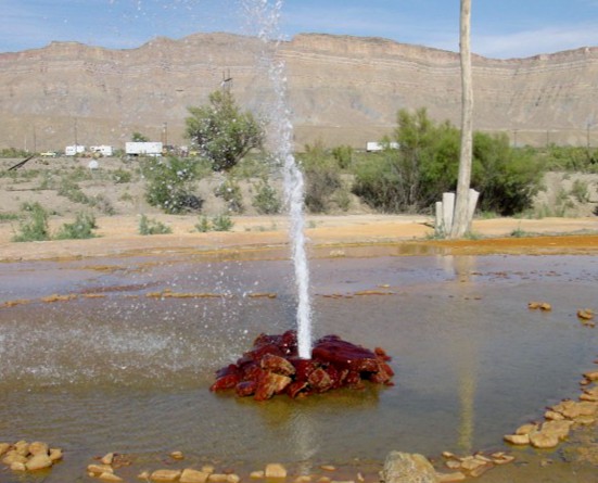
I’ve been relying on our Garmin RV GPS system to lead us from place to place. One of its features is it’s rolodex of RV parks. We have been reserving sites in RV parks which is not the norm for this time of year. We even reserved a site at Desert Moon, a non-destination place for sure. Normally I just type in the town that we want to travel to and a list of RV parks comes up. I then select the park in which we have reservations and the GPS displays a map complete with directions to that park. Sometimes it doesn’t have our park listed so I type in the address of the park and that works. But neither address nor a list of RV parks came up for Thompson Springs. What did appear was an auto fueling station which I knew was close enough so that’s where the GPS took us. We winged it for the last half mile to Desert Moon.


Which brings me to my reliance on the GPS and me guessing which route it will take us. I thought that we’d stay of I-70 until it terminates at I-15 in Cove Fort, Utah, then proceed to Provo, our next destination. Boy, was I thrown a curve when it had us zing off onto US 6/191! That move saved us a lot of miles and the route was good.

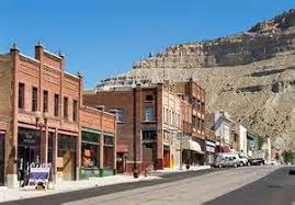
We drive through what’s left of the ghost town named Woodside, a dilapidated gas station, and continue Wellington (1676 souls) and Price (8300 souls). The two towns almost run together. Both have similar beginnings in that they were founded in the late 1870’s and early 1880’s.

Wellington is typical of Utah towns as it was established by a band of 13 Mormons. Price, the seat of Carbon County, is atypical for Utah as it has a history of religious and ethnical diversity. Greek, Italian, Eastern European, Mexican and Japanese as well as other ethnic groups make up the population. Both towns have a history of mining and agriculture.

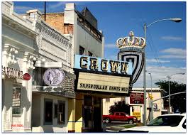
Then comes the town of Helper (2200 souls). Helper is known as the “Hub of Carbon County” and was developed as a freight terminal by the Denver and Rio Grande Western Railroad, later designated as the division point between eastern and western D&RGW terminals in Grand Junction CO and Ogden, UT.
In the 1880’s the town grew and with the coal mines and railroading needing laborers, Chinese, Eastern Europeans, and Italians were brought in. Some eventually left the laborer ranks, some of them kicked out of the mines for leading a strike, and started ethnic businesses in town.
If you are wondering how the town of Helper got its name here goes: Helper is situated at the mouth of Price Canyon. Trains traveling westward required additional “helper” engines in order to make the steep 15 mile climb up Price Canyon to the town of Soldier Summit. Helper was named for these helper engines.

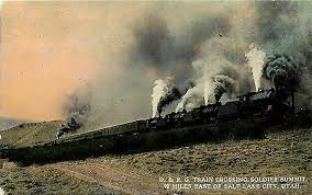


This section of US-6 reaches its peak elevation at Soldier Summit, el. 7477 feet. When the Civil War broke out in 1861 soldiers station at Camp Floyd were released from the U.S. Army. A group of 40 men led by General Phillip Cooke were caught in a freak snowstorm and six men and a 14 year old boy froze to death. This place was named in their honor, Soldier Summit. The summit later became a town of some 2000 souls in which the D&RGW railroad established machine shops to service helper engines. The railroad decided that servicing the helper engines at Soldier Summit was a poor idea due to the nasty winter weather and moved the operation back to the town of Helper in the 1920’s. Realignment of the tracks also eliminated the need for helper engines so the town of Soldier Summit slowly declined to what it is now- a gas station and a few occupied houses.

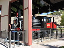
We follow US 6 to Spanish Fork Canyon and stop at Tie Fork Rest Area. The building looks like an early 1900’s train depot complete with replica roundhouse and a non-functioning steam locomotive. Within the roundhouse are informational signs which explain the geology and history of the area. We follow Soldier Creek, then Spanish Fork River after their confluence into the town of Spanish Fork. We head north on I-15 to Provo and Lakeside RV Campground where we’ll reside for three nights.
Our next post will concern our stay in Provo, Utah, home of the Brigham Young University Cougars.
