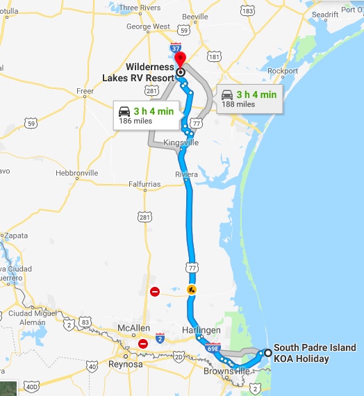
Our Visit of South Padre Island

January 31, 2019

It sure seems like we are in West Texas as the U.S./Mexico border is only eight miles away as the crow flies. If one looks at a map of Texas one can only conclude that we are really in the eastern side of the state- but on the western international border with eastern Mexico. Capiche? Hmmmm. If you are confused just look at a map of Texas. South Padre Island is located waaay down at the southern tip. OK, so we’re in the southernmost eastern part of Texas that so happens to be a short distance from the western U.S. international border with Mexico. Got it? Interestingly, the northern latitude of South Padre Island is approximately the same as Fort Lauderdale, FL.

Laguna Madre Stretches From
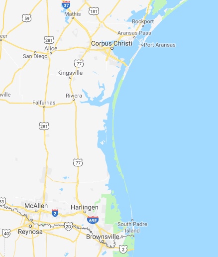
South Padre Island North To Corpus Christi

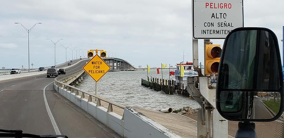
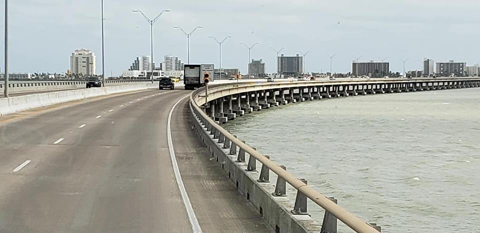
To reach South Padre Island one passes through Port Isabel (5000 souls), over Laguna Madre (Mother Lagoon), the lagoon that stretches all the way to Corpus Christi or about 200 miles, via the 2.4 mile long Queen Isabella Causeway.

Pelicans Are A Traffic Hazard On The Queen Isabella Causeway

The lagoon is a rarity as it is only one of six hyper saline lagoons in the world. The water contains more salt that the ocean. The island itself is a long, narrow sandy spit of land. A pass separates it from Padre Island to its north so there is no road that runs from one island to the other.

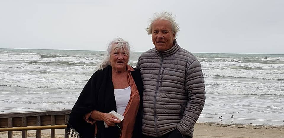
We were not drawn to visit S.P.I. except to visit with our friends and neighbors Brian and Linda. They spend the winter in a condo complex and their unit’s balcony overlooks the Gulf of Mexico. We spent a lot of time catching up on one another’s adventures. Linda made a wonderful breakfast for us. After breakfast we took a stroll on the nearby beach. Somehow the mutzos escaped their leashes and went on a jolly old romp chasing sea birds. We were then politely informed that dogs are welcome on the beach only if they are leashed. Ooops! We really enjoyed our visit with Brian and Linda and are looking forward to seeing them once again in Reno.

Linda And Brian

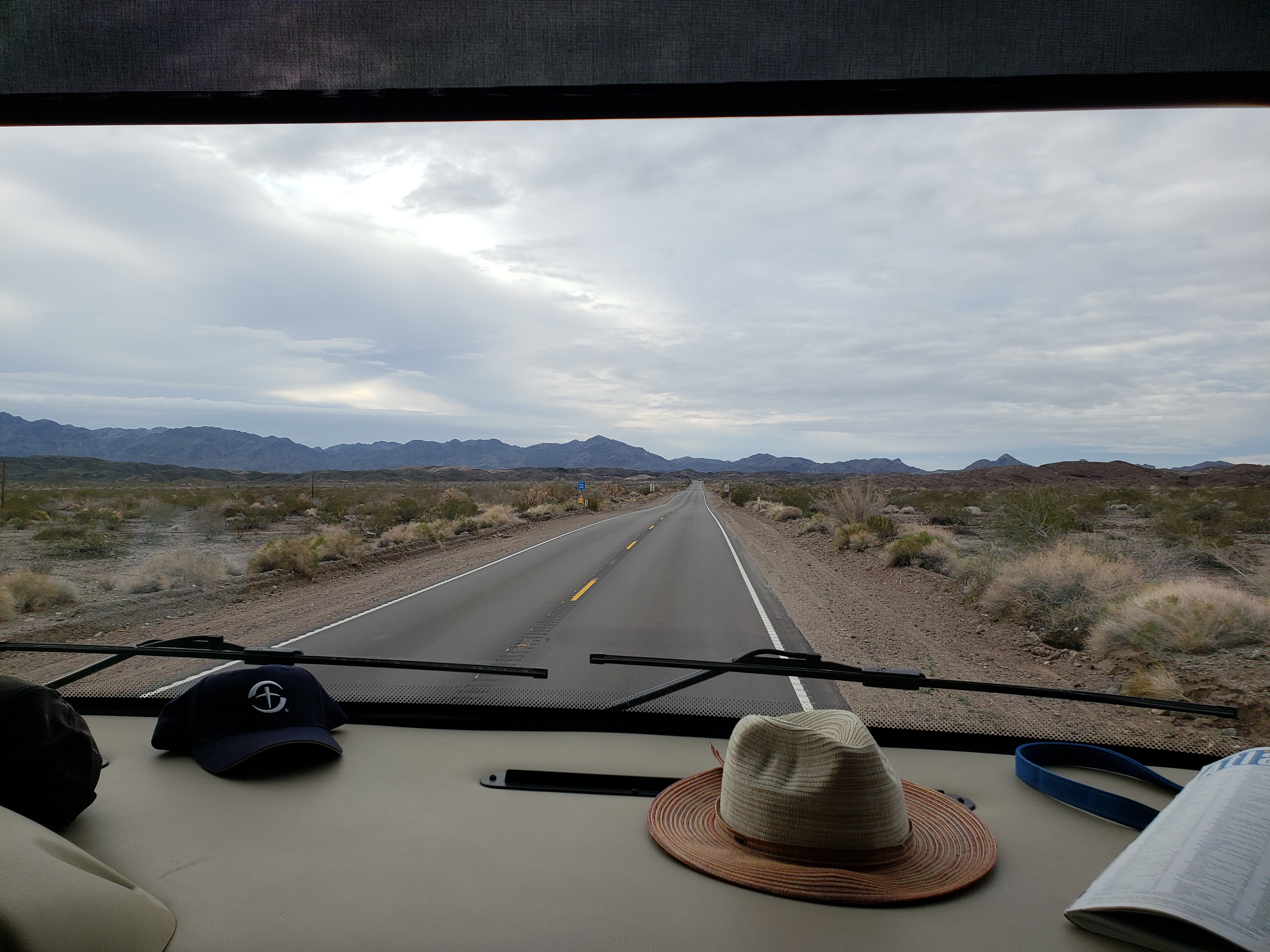
Our first day in any location is always a short one. We pick up, pack up and travel, then land somewhere. “Somewhere” is usually a planned location as either a place we want to visit or in many cases just a place to overnight. South Padre Island is obviously a planned “wanna visit”.

Looking From Port Isabel Towards South Padre Island

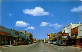
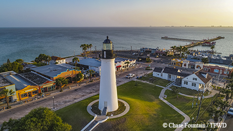
The island lies across from Port Isabel (5000 souls). Established as a town after the Mexican War of Independence, Port Isabel became an important cotton-exporting port before the American Civil War. The harbor, town and lighthouse all were fought over and exchanged hands during the Civil War. Today its economy is driven by the accommodation and food service, agriculture, forestry, fishing, hunting and real estate rental and leasing which employs nearly 2.5 times more people than what would be expected in a location this size. That makes sense as this place is a destination for those seeking fun and sun. Apparently the port is no longer the dominant economic industry of yore.

Our second morning is a scheduled visit with Brian and Linda. But what to do after the visit? Of course, take the dogs for another walk, this time on the many grassy vacant lots that line Padre Road. Well, the mutzos were game until they got their feet full of stickers. Oops. We found another more maintained lot to walk them. They only got a couple of stickers there. By the time we got home it was trying to rain and the wind was blowing. We also ordered refills for our medications at CVS Pharmacy then drove north past all civilization on the sand swept extension of Padre Blvd. through sand dunes. When we got home I hailed the RV wash and wax crew who gladly cleaned and waxed our beast for very reasonable sum of $145. The crew did a very good job so a nice tip was in order.

OK, now it’s day three. We are not “bar scene” folks so we don’t like to spend time at “happy hour”. Being morning folks we’d probably fall asleep at the bar anyhow. So this is what we did. Our “happy hour” begins before 8am.

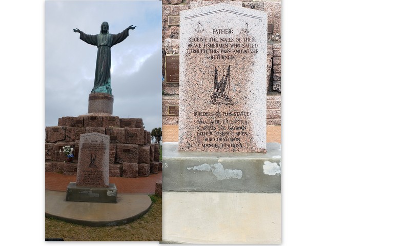
First thing this morning we drove to the far southern tip of the island, a whole one half mile, to the entrance to the Cameron County Park. Somewhere behind that gated entrance is a statue of Jesus that commemorates fishermen who have been lost at sea and we felt it was worth the $10 entrance fee to go see it- and it was. The park is large. In it is a 600 site RV Park which would have been a better choice to stay for us and the kiddos as the sites are very spacious and surround by grass, not gravel as it is here at the the KOA. The park is also surrounded by paths and more grass.

Lost Seaman’s Memorial
One Of The Many Fisherman Lost At Sea

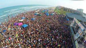
It appears that the park is getting ready for Spring Break. We pass by two major construction sites. One looks like an outdoor amphitheater. You know Spring Break, the time college and younger kids take an academic break, travel in hordes to the beaches and raise all holy heck, er, enjoy the friendly gathering of friends. Brian and Linda told us that everything on the island that is reasonably priced before Spring Break goes up dramatically during.


Before Spring Break
During Spring Break

Sea Turtle, Inc. is a Sea Turtle Rescue organization. Turtles tend to get caught in fishing nets, boat strikes or are injured in other ways. The sick and injured are brought to Sea Turtle where 80% of the rehabilitated turtles are released back into the ocean.

This Green Sea Turtle Is Too Friendly With Humans
This Gal Only Has 1 Flipper- A Prosthesis Helps Her Get Around
A Rare Sand Turtle Is Seen Out In The Parking Lot

Those that will never be released if they lack of 3 of their 4 flippers. They actually have fashioned a prosthesis for one turtle who lost three flippers. Another that will never be released is a big turtle that had become too sociable with humans. A docent told me that because of existing Federal Law, the endangered turtles cannot be directly helped in the wild nor their eggs gathered to help perpetuate the species. What can be done is what is done here- rehabilitate the sick and injured and when well enough, be returned to their natural environment.

The sun finally came out after a night of rain and morning drizzle. I actually stripped down to my T shirt. You thought I was going to say Speedos, didn’t you. The afternoon was rather routine- wash and dry clothes, walk the dogs a few times, work on the blog while one of us takes a nap. After dinner we’ll start preparing for tomorrow morning’s departure.

We are heading to Corpus Christi tomorrow, and will cross the Nueces Bay landing in Port Aransas. See you there!

Grackle Taking A Morning Bath

Traveling to South Padre Island, Tejas

January 31, 2019

Wilderness Lakes RV Resort, Mathis TX to South Padre Island KOA

Our route from Mathis to South Padre Island was mostly uneventful except our friend The Wind decided to join us once again. The majority of the time it was following at various angles which wasn’t too bad but as usual we had to change course on a port tack, making the force of the wind much more prevalent. Driving a big box with 22 mph winds and 30 mph gusts trying to upset the turtle ain’t fun.

Although this part of Texas doesn’t look very inviting to this gringo thankfully its value was and still is recognized by a lot of folks. I’ve included an excerpt from The King Ranch website: https://king-ranch.com. I recommend reading about its legacy on the website.

The King Ranch Legacy

In 1853, Captain Richard King purchased a creek-fed oasis in the Wild Horse Desert of South Texas, sparking generations of integrity, preservation, and innovation.

King Ranch now covers 825,000 acres—more land than the state of Rhode Island. Over the course of over 160 years, King Ranch led some of the first cattle drives, developed the Santa Gertrudis and Santa Cruz breeds of cattle, bred the finest Quarter Horses, and produced champion Thoroughbreds—all under its iconic Running W® brand.

Today’s King Ranch is a major agribusiness with interests in cattle ranching, farming (citrus, cotton, grain, sugar cane, and turfgrass), luxury retail goods, and recreational hunting.

King Ranch continues to foster a culture of uncompromising quality, stewardship, and authenticity—a true testament to Captain King’s integrity and commitment to the land.

We drive through Kingsville (23,000 souls). Henrietta King deeded a portion of the ranch to entice construction of a town and to bring the railroad close to the ranch.

Texas A&M Campus, Kingsville
Downtown Kingsville

In 1904 Robert Kieberg Jr. was charged with planning and constructing the town. At nearly the same time the construction of the St. Louis, Brownsville and Mexico Railway began which would connect the Rio Grande Valley to the rest of Texas. And so it began and the legacy continues.

Driving south on Highway US 69/Texas 77 we pass ranching, and some farming communities with names such as Ricardo (1000 souls), Riviera (1900 souls), Sarita (382 souls), Armstrong (0 souls but a post office?), Norias and Rudolph (never towns but shipping points), Yturria (named after the ranch), then Raymondville (11,300 souls)- seat of Willacy County and Gateway to the Rio Grande Valley. Lyford, a town of 2800 souls, and Combes (2900 souls) come next.

Then we reach the large city of Harlingen (65,000 souls), It is known as the capital of the Rio Grande Valley. The World Birding Center is in nearby Mission, TX but this city has its own sites on the Great Texas Coast Birding Trail. It appears that San Benito is being absorbed by Harlingen as the two appear to be growing together.

Los Fresnos Sun and Fun!

We exit US 69 in favor of highway 100 and cruise through Los Fresnos (6600 souls), then to Port Isabel (5000 souls) where we cross the Queen Isabella Causeway over the Laguna Madre, the body of water that separates the port from South Padre Island.

Port Isabel, Queen Isabella Causeway, South Padre Island In Background

We are staying at the South Padre Island KOA Holiday for a few nights. Our friends and neighbors Linda and Brian are wintering here. We will visit them for sure!

Port Isabel Lighthouse (circa 1852) State Historic Site

I Chickened Out

January 28, 2019

Last night I was studying Google Maps with the thought of skirting the seventh largest city in the United States, San Antonio (1.5 million souls). I thought I had it all figured out until something jumped out at me- another farm to market road was on the route. Oh my! Not another narrow, no shoulder, twisty little road! So I was resigned to going through the metropolis. Gads…….

The Alamo

The city was founded as a Spanish mission in 1718 and became the first chartered civil settlement in 1731 making it the state’s oldest municipality. We visited San Antonio on our first visit to the South in 2011 to visit the infamous Alamo. An interesting fact is the Alamo is located smack dab in the middle of town surrounded by modern skyscrapers.

A short walk away is another draw, the River Walk.

Not far from downtown is the San Antonio Missions National Historical Park.

Back to maneuvering through San Antonio. I was totally relying on Jil’s “smarty pants” phone to take us safely through this large city. Unfortunately, miss “smarty pants” wanted to turn navigation into an adventure. Instead of skirting town on I-410 she takes us the shortest route- straight through the middle of town. Sheesh! To add insult to injury she wouldn’t announce the route to take until we were nearly on top of it. You try to change lanes with a 55′ combination of beast RV and toad at the last second in heavy traffic. Somehow we spit out of the metropolis unscathed and on the correct road. Phew!

Technically we are still in hill country, but the hills are flattening out considerably. The wind is a different story- she decides to start blowing all the flags stiff. A hundred miles to our destination and it has to be done under high wind conditions. Again, we survive but I am starting to develop some awesome “driving muscles”, not only in my arms but on my patootie from tenaciously gripping the drivers seat.

Looking Across A Lake Towards The RV Park

Our home for the night is the Wilderness Lakes RV Resort, Mathis, TX. It is located about 5 miles off of I-10 and 40 miles north of Corpus Christi near Lake Corpus Christi. As we drive to the park we notice a very large dam nearby, the one that has formed Lake Corpus Christi.

Large Treed Fields at Wilderness Lakes

Wilderness Lakes has its own small lakes. It also has acres of treed areas both of which contain little signs that inform visitors of the local fauna…… alligators, snakes, wild boars, that sort of thing.

Ibis, Coots, Ducks and Geese Live at Wilderness Lakes,
But Birds Are Not The Only Residents!

The roads are a little rough and could use a good dose of gravel. That’s the down side. The upsides are the staff and residents are extremely nice, the sites are spacious with grass in between, and the Bingo game starts tonight at 7pm, the buy in for 14 games is the cost of 14 dimes and a nickel! Oh, I almost forgot to mention that the park is a Passport America park and it’s honoring our membership. It’s the first time that I’ve stayed at an RV resort for so little money. How’s $18.50 a night fur ya?


More on Fredericksburg

Sunday, January 27, 2019

Fredericksburg is a thriving town. The town retains its German heritage well. There are lots of restaurants that serve German fair and the street signs are in English and German languages. It’s difficult to find a parking place in the blocks long business district.

We attended 9am Mass at St. Mary’s Church, stretched the dogs walked the neighborhood around the church.

Old and New St. Mary’s are side by side.
St. Mary’s Catholic Church

After Mass we walked aways around the neighborhood. We really liked the architecture of the homes.

Old Jail House?
Library
In The Park Adjacent to the Library

We all pile into the car and drove one block to Main Street expecting to find lots of parking available. NOPE! We managed to find a spot two blocks down, away from most of the restaurants and near the Nimitz Naval Museum. Yes you read that right. Admiral Chester Nimitz of WWII fame was born here. He served as a fleet admiral of the U.S. Navy as well as Commander in Chief, U.S. Pacific Fleet and Commander in Chief, Pacific Ocean Areas, commanding Allied air, land, and sea forces during WWII.

After our visit downtown we head off a few miles to another area attraction, Luckenbach (pop. 3). It was first established as a community trading post possibly as early as 1848. The community grew to a high of 492 in 1904 but was almost a ghost town in 1960 when the town was offered for sale. Rancher Guich Koock and folklorist Hondo Crouch snapped up the town and turned it into a festive place.

The following photos are of Luckenbach, Texas:

Luckenbach Cemetery

Many unique festivals and concerts are held here. Entertainers such as Willie Nelson have made appearances. One building consists of the remnants of a post office, a working saloon and a general store. The other is the dance hall. Many concerts are held here annually which have featured big name country artists such as Willie Nelson, Waylon Jennings, Lyle Lovett, Kenny Chesney and Kid Rock.

Luckenbach Rendition of “Curly Fries” are More Like Potatoes Cut With Spiral Apple Peeler

The rest of our day is spent relaxing in the 60 degree sunshine. Tomorrow we are traveling half way to South Padre Island where we will visit our Winter Texan neighbors from our neighborhood in Reno.

Texas Lone Star

Fredericksburg, Texas

Sunday, January 27, 2019

Lady Bird Johnson Municipal Park

Our three day stay, really 2 1/2 days, in Fredericksburg (11,300 souls) is proving to be too short. Texas Hill Country is beautiful and Fredericksburg is smack in the middle of it. Oak trees abound, grassy ranches with cows and goats grazing on the gently rolling land. There are a lot of things to see in the area besides downtown. We managed to visit several places of interest though. Our next door neighbors pulled in this morning after a five day drive from Wisconsin. They said when they left the wind chill was -25 degrees! Brrrr. They are volunteers with Habitats for Humanity. The first project involves the local animal shelter.

Fredericksburg was founded in 1846 by German emmigrants who developed their own language, Texas German, when they refused to learn English. Fredericksburg shares many cultural characteristics with nearby New Braunsfels. These Germans had fled unfavorable conditions in their homeland. Upon arriving in Texas they found the area in what is now Fredericksburg a wonderful place to live but had to deal with the native Americans. A treaty was brokered between the Germans and the Comanche Tribe so that all could live in peace and share the land. Its one of the few treaties with native Americans that was never broken.

Mona was a Texan?

Saturday at mid day proves to be a busy time for downtown Fredericksburg so we decide to visit the Wildseed Farms just outside of town. It is off season and we don’t expect to see flowering plants but the farm is supposed to be a nice place to visit. And it is. One can purchase wildflower seeds that are packaged to represent different parts of the U.S.

A Play on the Popular Blue Bonnet Ice Cream Brand

They also sell clothing and souvenirs, have a wine tasting room for Texas wineries, and of course, the obligatory beer bar. Jil buys some seeds and a couple of other trinkets.

On the way back from the Wildseed Farm we come across a memorial for the Texas Rangers and the old Fort Martin Scott. A docent who had not been a Ranger but had been a Texas Highway Patrolman gave us a very interesting spiel concerning the memorial and the fort.

Texas Ranger Memorial Tower
Whatdoya suppose has drawn their attention?

As a side he also told us where the granite came from to build the state capitol in Austin. Seems that the prevalent limestone is not suitable to build a capitol building in Texas. Granite is the favored stone for such a purpose. A rancher in the Texas panhandle had all the granite one could want, but not enough land. So the powers to be traded 3,000,000 acres of state owned land in exchange for all the granite needed. No, I don’t know who got the best of that deal……….

Entrance to Fort Martin Scott

That’s about it for Saturday except for doing some power shopping at the local huge HEB market.

The rest of the day we enjoyed the park until evening. It rained a little off and on, then after the sun set all heck broke loose. I think we were ground zero for every thunder clap and lightening bolt that the heavens through at us. And talk about downpours! Doyle wasn’t bothered but Megan was a nervous wreck! Ah, yes, we are definitely in the South.

We Are In The Lone Star State- Tejas, a.k.a., Texas

Saturday, January 26, 2019

I wish everyone drove like those in Texas!


We left Las Cruces, NM on January 23rd, destination Fort Stockton, Texas for a night’s stay. The plan was to skirt El Paso taking the El Paso Bypass, highway 375 but when we got close not one truck headed for it. Hmmmm, maybe we should just stay on I-10 and bite whatever bullet the El Paso traffic throws at us. So we followed the trucks through the very large city. We hit some stop and go traffic before the downtown area. Now I’m starting to second guess our decision. I think half of the city’s 683,000 souls are all attempting to use the freeway as we pass through. However, the traffic jam broke after a couple of miles and proceeded, slowly at first then at a reasonable pace.

El Paso lies right on the U.S./Mexico border. Cuidad Juarez, El Paso’s neighbor directly across the Rio Grande River is very visible from the highway. Juarez is a pretty rough place to live as I understand. Drug cartels and gangs have invaded the city making it not so nice a place to visit, or live for that matter. Just a few years ago Juarez was rated the most violent city in the world! Juarez’s population is over 1.3 million souls- a lot of them not happy souls…….

What lies ahead is hour after hour of nondescript desert as the road takes us southeast. The mountains in Mexico start to fade into the distance. As we near Van Horn signs indicate an inspection station lies ahead.

Van Horn, TX Border Patrol Inspection Station

It’s the same place that a service dog made a hit on our sewer pipe in 2011 that caused us a bit of havoc. At that time a young Border Patrol agent asks-“Do you have weapons?” A pocket knife and kitchen knives. “Take your knife out of your pocket. Don’t put your hands in your pocket!” Jil and I are separated, mutzos left in the truck, agents search our 5th wheel but don’t toss it. We are sent on our way, but not before we thank them for their service. It was certainly a disconcerting experience, one we will never forget. This time we pass through unscathed. The Border Patrol agent waves us through and we bid each other a good day…..

Wile E. Coyote Hanging Around Rest Stop Parking Lot

Our destination for the night is Fort Stockton RV Park, another place we have visited on our last pass through this area. It’s a nicer park than the Lordsburg KOA for sure. Grass, although dormant, is planted between sites and the sites are adequately spaced. A lot of travelers show up after us and darned near fill the place up. When I register in the office I ask about the long term families living in the back of the park. The lady at the desk tells me that they are all energy workers, some petroleum, some solar and some wind, all here working in the Fort Stockton (8300+ souls) area. Originally an army post, circa 1859, the city grew up one of the largest sources of spring water in Texas, Comanche Springs.

After a restful night we are up and out by 0730 hours. The sun in western Tejas, er, Texas is just starting to rise making out drive straight into the sun somewhat difficult. 100 or so miles down the road we stop in Ozona (3400 souls).

Ozona is the seat of Crockett County. It’s also the ONLY town in Crockett County. We recall that the town square is a good place to stop and stretch. We fuel up before reaching the center of town. Diesel is $2.80 a gallon, $.55 cheaper than in Lordsburg. The last time we walked the town square a big sign stated that it was illegal to pick up the pecans that lie on the grass. This time there were none.

Mile after mile of somewhat boring country brings us to some jagged hills. For some reason the road goes right through them rather than take the easy route around. The terrain slowly changes from pretty flat to a little more hilly. The flora also changes from mostly dormant shrubs and small trees to leaf laden oaks and other varieties of shrubs and trees. We exit I-10 in favor of US Highway 290 heading east. In the town of Harper (1190 souls). Our experience tells us that Harper is typical Hill Country farm town.

This is where things get exciting. Google wants us to turn off of the perfectly fine highway 290 onto FM 2093. For you non Texans, FM stands for Farm to Market, mostly county roads, and not major ones. Real county roads have a county road designation, so I guess one could say that they are roads only locals are familiar with. FM 2093 is not 20′ feet wide, nonexistent shoulder which makes driving the 8.5′ wide beast in a 9.5′ wide lane over hill and dale a bit challenging. Luckily we meet little oncoming traffic. We pull over for the only vehicle behind us. The road dips down into drainages several times. The drainages all have a gauge reading from zero to five feet- the depth water may be running over the road. One would be wise to observe the depth of water on the road before proceeding! It’s a beautiful drive through farm and ranch country making it one of our never to forget adventures.

So after 15 miles on FM 2093 Google wants us to turn right on Leydecker Road. Naaa, we’re not going to turn down a narrow dirt road! Continuing on for a couple of miles brings us to an intersection with a major drag. We turn right. Google- “turn right in 1/4 mile”. We turn right, paralleling the airport. Google- “turn left”. We can’t turn any other way! Google- “Turn right”. Geez! Google- “turn right into Lady Bird Johnson Park”. Here’s the deal- if we would have stayed on FM 2093 to the major intersection, turned right and stayed on that street, we would have intersected with the interior road to Lady Bird Johnson Park, with is where we are spending the next there nights! Booooo, Google! You are set up to take the shortest route no matter what. Big rigs don’t like you some times!

We survived the country road and pulled into Lady Bird Johnson Municipal Park in Fredericksburg. The park is very large located on a rolling hillside right next to the municipal airport. The landing strip is large enough for small private jets. The park is nice. Lots of grass here as well as a creek and reservoir, a golf course and of course, an RV Park.

More on Fredericksburg and surrounding area in the next blog.

Casa Grande to Las Cruces

Wednesday, January 23, 2019

We are on the road by 0800 hours, a typical time for us. We like to leave fairly early. The weather is clear but very cool. We are on our way to Lordsburg, NM. Not a long trip but this part of the country can bring howling winds. We travel over some hills that might be classified as small mountains then down to what appear to be perfectly flat playas, the lowest portion of which are invariably dry lakes. This is typical of the terrain along I-10 heading east from Tucson AZ to at least Las Cruces NM. The wind does kick up but does not create unbearable driving conditions.

Rock Formations Near AZ Rest Area

This part of Arizona is not very eye appealing, at least not to me. There were a few spectacular rock outcroppings in one area however. There are not many variations in desert flora. We did spot snow on a very high peak off in the distance. Interstate 10’s roadway was good in some portions and not so good in others. Although a federal roadway, I believe that repairs of the interstate are a cost sharing venture with local governments. I draw that conclusion as there is a marked difference in the quality of the road surface at every posted county line.

Even These Critters Like This Rest Area

Upon pulling into Lordsburg, New Mexico (2460 souls), elevation 4200′ we fuel up, top off the propane tank at the KOA we at which we are staying, then hunker down. The park is all gravel with a few mesquite and cacti around its perimeter. Nothing fancy, but it will do.

This morning was very cold at 18 degrees, but the sky was clear making the warmth the from early morning sunshine very welcome. The dogs are walked, utilities stored, leveling jacks are up and off we go.

Continental Divide in the Middle of the Desert? Yep!

We are only traveling as far as Las Cruces (110,000 souls, 3900′ elevation) today as we want to visit the old town of La Mesilla.

Las Cruces, NM

We arrive before noon- our travel day is less than 150 miles. We are staying at the Hacienda RV Resort with a lot of other folks. Wow, this RV park is popular! La Mesilla is just a couple of miles away.

The Plaza

La Mesilla, established in 1848, was originally in Mexico, the border moved south after the Treaty of Guadalupe Hidalgo took effect. The U.S. was determined to protect its citizens from Apache attacks but the border was in dispute due to a mapping error. The Gadsden purchase solved that problem.

Two Civil War battles were fought here. During the “Wild West” era the area attracted characters such as Billy the Kid, Pat Garrett, and Pancho Villa. The area was also a crossroads for two major stagecoach, mail and trade routes. The village of Mesilla was the most important city in the region until 1881. In 1881, the Santa Fe Railway was ready to build through the Gadsden Purchase region of the country. Mesilla was naturally seen as the city the railroad would run through. However, the people of Mesilla asked for too much money for the land rights, and a landowner in nearby Las Cruces, a much smaller village than Mesilla, stepped in and offered free land. The city of Mesilla has not grown much since, and Las Cruces has grown to a population of an estimated 101,000 people (2014) and is currently the second largest city in New Mexico.

Billy The Kid Was Tried At The Mesilla Courthouse
Businesses Across From Mesilla’s Plaza

Today Mesilla (2600 folks) is really a part of Las Cruces. Historic Mesilla still has the flavor of an old Mexican town. A large plaza in its center- three sides are businesses and the fourth is the Basilica of San Albine. The architecture is great, the brightly colored doors are wonderful. A great place for a stroll. We ate lunch he Double Eagle restaurant.

Interior of the Double Eagle Restaurant

This is amazing building was built in 1849 as a private residence. It was purchased in 1972, made into a restaurant and became home for a collection of museum quality antique pieces. The food was really good but the building itself is wonderful. The four wings of the building are built in the hacienda style around a central court. If you are interested in the description of all of the antiques in the restaurant follow this link: http://www.doubleeagleonline.com/history/

Basilica of San Albino

The Basilica of San Albino may be the smallest basilica in the United States. The original bell cast in 1876 as well as three large bells added at later dates still are rung to gather parishioners to Mass. The original church was built in 1850, the present in 1908.

Mary, Altar and Ombrellino

The Basilica is of a minor (lesser) class. There are seven major basilicas and fewer than two thousand lesser basilicas around the world, fewer than one hundred in the U.S. Nonetheless, basilicas enjoy privileges and honors greater than most Roman Catholic Churches. Three special symbols of a basilica are the Coat of arms, the Tintinnabulum, and the Ombrellino.

Mother Mary, Alway Present At A Catholic Church

Who woulda thunk it? The Mesilla Valley and specifically the Dona Ana County is the largest grower of pecans in the world. As Jil spoke to the proprietor of the Legacy Pecans store which specializes in pecan products she learned that her family also owns and lives on a pecan farm along with relatives and farm workers. In fact, she is fourth generation farm girl. It was very nice talking with her. Of course we couldn’t walk away empty handed……………

We thoroughly enjoyed visiting Mesilla and will be sure to visit again if we are ever back in this area.

Tomorrow we are heading south on Interstate 10 and stopping in Fort Stockton for the night, then on to Fredericksburg, TX, our first stop in Texas Hill Country.


Five Days In Casa Grande

Monday, January 21, 2019

Leaving Needles Heading Towards Vidal Junction

We left Needles the morning of January 17- destination Casa Grande. AZ. Our route will take us 291 miles transitioning from the Mojave Desert to the Sonora Desert. So this is how our journey went right from the get go. Jil’s “smart” phone leads us directly to a railroad underpass that’s so low I’d have to duck to get under. Our 13’ high rig definitely won’t fit! Another RV’er apparently fell for the same directions from his computer/”smart” phone and is in the process of trying to get turned around in an area shorter than his rig. Our options are (1) back up a block, first having to unhitch the toad from the RV or (2) make use of the dirt lot that conveniently is on our right. We choose (2) albeit proceeding very slowly to avoid the giant holes. We escape from that mess and make it to highway 95.

Highway 95 is the roller coaster highway. It’s pretty curvy going through the rugged hills, then vascillates up and down as the road straightens out but dips into innumerable dry washes, typical of desert two lane highways. Then comes the “nightmare highway”. We turn east on highway 62 towards Parker, AZ. That road has more potholes than any 20 roads we have taken. We fuel up in Parker- $1.90 a gallon cheaper than in Needles!

We pick up AZ 95 and continue to Quartzite. This town on 3000 souls hosts the largest gathering of RV’s in the world, some estimates are over a million, all here to socialize and/or attend the Quartzite Showcase and Swapmeet. The show starts next week but thousands have already gathered making forward progress rather sluggish.

We are successful escaping Quartzite and head east on I-10 towards Phoenix. At Highway 85, the Phoenix Bypass we head south to Gila Bend in order to avoid the heavy Phoenix traffic, then east on I-8 to Casa Grande and our destination the Palm Creek Golf and RV Resort.

Okay, now to our stay at Palm Creek. The resort is huge covering about 1.5 square miles with more than 3000 RV and more permanent manufactured home sites. Most of the folks here are from the colder climes of the U.S. and Canada. It is very resort like as it includes amenities found at finer hotels. It contains multiple swimming pools, a golf course, a library, a ballroom, a huge mail room, 8 tennis courts, 32 pickleball courts, a softball field, many pet areas, and a huge woodworking shop. I’ve probably left a few things out. The only reason to leave the grounds is to go grocery shopping. Needless to say, this place is pretty nice.

Lawn Bowling
Lots of Activities at Palm Creek- Pickleball, Golf and Swimming to Name a Few

We are here for 5 days to visit friends. Dick and Ellen live down the street from us in Reno. The have purchased a home in nearby Robson Ranch in which to spend the winter months. Jim and Connie also have a winter home in nearby Arizona City. They are the folks which we volunteer with at the Bonneville Dam. We met with both couples and really enjoyed our visits.

Ellen and Dick, Our Neighbors From Reno

We continue our journey tomorrow, January 22. We will continue progress towards south Texas with several stops in between. More to come as we continue our journey.

Well, It Is Winter!

Wednesday, January 16, 2019

We left Chico last Sunday. Weather was not a factor although foggy conditions are in our path to the south. By the time we got down to Marysville the fog had burned off. I was a little discombobulated when we arrived at the Highway 70/ Highway 99 split in the road. I took Highway 70 which turned out to be a better choice as the road is a four lane divided highway with no town slowdowns all the way to Marysville rather than the two lane Hwy. 99 that runs through every little town east of the Sacramento River.

We stopped and spent the night at The Lakes RV and Golf Resort in Chowchilla (18,500 souls). It is adjacent to a nice residential area that surrounds Pheasant Run Golf Club. As we didn’t travel very far we had time to wash four days of clothes that were mucked up during our volunteer stint at Paradise. I didn’t know Jil was washing four loads of wash and didn’t open the gray water dump valve. Yep, I walk outside and see water dripping down the right rear of the RV. Oh Crap! I hadn’t opened the dump valve. The valve was opened and a torrent of water goes whoosh, down the drain. Little water stayed inside the coach but the right rear compartment outside, which, by the way, contains a lot of vital electronic gizmos related to the engine and transmission was full of water. OH MY! I bailed that compartment out, then toweled it out as best I could. Fortunately nothing vital was submerged but water in that compartment is not good. The next morning the engine started and the transmission functioned properly. Phew!!!!

Monday we continued south on Hwy. 99. Rain is predicted but we are only traveling 175 miles or so to lay over at the Orange Grove RV Park, Bakersfield (380,000 souls). The farther south we travel the windier it gets. Then rain joins the wind. We exit Hwy. 99 in Tulare, and find a park. No one is here except us chickens. It’s safe to let the mutzos run and they love the freedom. Back onto the highway and the rain picks up. But the WIND, Holy Crapola! By the time we pull into the Orange Grove RV Park I feel like I’ve just gone 10 rounds in a wrestling match with a 400 pound gorilla.

Before arriving at the Orange Grove RV Park we see signs indicating that I-5 has been closed due to snow just a few miles ahead. All through traffic is being routed onto Hwy 58, the highway to the Orange Grove. That’s a very long detour indeed- Hwy 58 to Hwy 14, back to I-5 = 125 miles. Needless to say, traffic for 10 miles or so was pretty darned heavy. Tuesday weather wasn’t going to be any piece of cake either with high wind warnings in the Tehachapi (12,600 souls) area. That’s the direction we are heading so the decision is made to stay put for another night.

Things You See in RV Parks!

We did take the opportunity to scout around during the layover. we found a park not too far away. It wasn’t in the best shape, guessing here that Bakersfield isn’t a rich community but the mutzos again got to run a bit. We also visited the nearby California Fruit Depot.

California Fruit Depot

The depot has a store that sells dried fruit, candied fruit, sauces of various kinds, nuts and God knows what else. Inside there is a window where we observed employees packing oranges in crates and bags. We are surrounded by orange orchards, in fact the RV park has orange trees growing in each site. One is invited to pick oranges to their heart’s delight.

Clear Skies, then FOG!

Wednesday, January 16- the sun is shining, the wind has diminished and we are good to go. We pack up and pick up, destination the Needles Marina RV Park, Needles, CA.

The almost 300 mile trip was uneventful. Not much wind, a mixed sky, and pleasant temperatures. We arrive at the RV park around 1330 hours, check in and drive to our site. Right next to us is our twin! An Allegro Red just like ours except one strip on its side is a slightly different color is to our right. What’s the chances of that?

To top it off, they just came in from the Orange Grove RV Park! They too had stayed an extra day to wait out the high wind warning at Tehachapi! We didn’t even see each other’s rigs there. How strange………

Tomorrow we are off to the Casa Grande area of Arid….. er Arizona. See you there!

Paradise Lost

Monday, January 14, 2019

We spent three and a half days working with the Samaritans Purse, a faith based international disaster relief organization. Excerpts from Samaratins’ Purse Website- “Let my heart be broken with the things that break the heart of God.” Bob Pierce wrote these now-famous words in his Bible after visiting suffering children on the Korean island of Koje-do. This impassioned prayer is what guided him as he founded and led the ministry of Samaritan’s Purse in 1970. He passed in 1978, the baton passed to his protege Franklin Graham who has led the organization ever since. Through over 40 years of earthquakes, hurricanes, wars, and famine, Franklin has led the ministry in following the Biblical example of the Good Samaritan all across the globe.

It was heartbreaking seeing all the carnage in Paradise and neighboring Magalia, the origin of the fire, where electrical power lines were brought down by high winds. Listening to local folks tell their story of escape as fire literally licked at their heels, the heartbreak of their loss as we sift through a thick, wet slurry of ashes, drywall, and whatever is left of the contents of their home. Some folks were devastated and wished that they hadn’t survived the fire. Others were eager to rebuild and were making plans to do so. All were grateful to Samaritan’s Purse for its support.

Too much can be said about our experience here. I’ll let the images do most of the talking.

Over 90% of the City of Paradise is Completely Destroyed By the Camp Fire
How Would You Feel If This Was Your Home?
Nothing Escaped Destruction. Markings on Pavement Indicate Search and Rescue Team Task Force 6 Has Searched Here on 11/19/18 and Found No One.
Christian Youth Organization Members From Modesto, CA Volunteer
Our Group Leader Palmer Presents a Bible Inscribed by Group Members, Then a “My Pillow” donated by Michael Lindell, Inventor of the My Pillow Company is Given to the Homeowner
Mostly Retired Folks Comprise Our First Full Day’s Work Group
Safeway Store Burned Out As Well As Most Other Businesses

As of this writing not all of the folks who lost their life in the Camp Fire have been identified. Authorities feel that some had just been passing through or were possibly homeless whose DNA doesn’t match any of the residents’.

Our group leader Palmer (that’s his first name) said that this is his sixth disaster deployment in a year. He’s seen damage from floods and hurricanes. He said most of those folks have something to come back to. Although damaged, their homes can almost immediately begun to be rehabilitated. Not so with fire- nothing is left.

He told us at the beginning of our deployment that our real purpose is not to find whatever valuables may be left by the fire. Our real purpose is to show support, spiritual support for those thousands of people who lost everything- their homes, their possessions and their hope. God Bless them all.

Memorial For Folks Killed In The Camp Fire- Eleven Are Still Missing Almost Two Months Later. White Crosses Are For Known Victims, Unpainted Await Victims Names.

Traveling Towards Paradise

Thursday, January 10, 2018

Our drive from Cal Expo RV Park in Sacramento was almost uneventful- almost! Google maps shows us the easy way out of Sac. Just take the North Sacramento Freeway to Interstate 5. Easy Peasy, right? Except I missed the part where one exits the North Sac at Richards Blvd. So here we are in all our glory (50 feet of it). We are heading towards downtown just blocks from the state capitol on a surface street. Oh my! We take it slow and deliberate until Jil can crank up the map on her “smart” phone. Directional signage indicating how one proceeds to the interstate is nonexistent. This time the phone bails us out, we turn right on I Street and within a few blocks we join I-5 heading north.

A short drive takes us to our preferred route to Chico, Highway 99. This highway used to be the main north/south thoroughfare traversing the great San Joaquin and Sacramento Valleys. Same valley really. The southern portion lies in the San Joaquin River Drainage, the north in Sacramento River Drainage. Highway 99 is more interesting than traveling the newer I-5 which runs parallel but farther west. The difference is Hwy 99 is not a freeway and in many instances is a two lane road where I-5 is a freeway and is mostly two lanes each direction. The big difference is Hwy 99 goes directly through every farm town east of the Sacramento River on our way to Chico, large or small. Travel is much more slow than the interstate so the scenery doesn’t pass by as quickly.

Our 90 mile excursion takes 2.5 hours. It’s raining off and on and the wind is blowing. The big box we travel in lets us know that it’s not happy with the wind. We pass through several towns- East Nicholaus, Yuba City (pop. 64,000), sideswipe Marysville, Sullivan, Sunset, Live Oak (8300 souls), sideswipe Gridley (6700 souls), parallel the Feather River Project’s huge Thermalito Afterbay, then through Shippee. As you may recall the Oroville Dam’s near failure in February 2017 caused the evacuation of 250,000 people. We stopped for some coffee and to walk the mutzos as we were in no hurry. Our appointment with Samaritan’s Purse has us arriving at 8 pm this evening. We arrive in the late morning.

Samaritan’s Purse is occupying two locations. We are confused as to which we are to report. I call the national number and am given the location of a more remote Christian Conference Center. I also had a call into the local S.P. hotline. A person from Chico called us back as told us the national info was incorrect and that we will park our RV at the Calvary Chapel parking lot in Chico. That makes sense to us as the Chapel is the location of Samaritans Purse base operation and is located 10 miles closer to Paradise.

We pull in and are directed to set up near the other RV’s. There are 5 rigs here now. We are informed that if we can set up in 45 minutes we can attend the mandatory orientation. No problemo! We attend the orientation, fill out various forms and are told that we can go to work this afternoon- a day earlier than scheduled. Not knowing the conditions in Paradise we decide that I should stay with the mutzos and Jil will go up and do some work. She will decide if the dogs can join us in the morning.

Parked by Calvary Chapel
Samaritan’s Purse Supply Trailer in Front of S.P. Command Trailer at Right, 

The Calvary Chapel kind of looks like a big box store with a cross prominently displayed on the front of the building. When we entered to attend orientation we walked past a coffee/drink counter that looked familiarly like a movie theater’s snack bar. The ramp leading to the many conference/gathering rooms looks theater like also. The loudly colored wall tiles and paint echo the same. Heck, this place is a converted movie theater! Turns out this location wasn’t a good spot to attract movie goes so the church bought it lock, stock and barrel, right down to the audio system and movie projectors.

Calvary Chapel Coffee and Tea Bar
Main Gathering Room

Other than add a desk, closet or small room inside an individual theater or three not much has been changed in 10 years. Our gathering room and I think every other room that used to be a theater room still has the movie screen and those floors still slant at least 10 degrees back to front. The main theater still has the original chairs while some smaller ones do not.

More on volunteering with Samaritan’s Purse and the devastation of the Camp Fire in my next post.

Sacramento or Bust

Tuesday January 8, 2018

The weather hasn’t been conducive to exploration, so we didn’t do much of that sort of thing. Not much exploring, but we had a few adventures. Not being familiar with the area sort of make us explorers even if that includes a trip to the market. I guess one could say trying to get to a super market that is only 2 miles away could be an exploring adventure of sorts. It sure was! Traffic was pretty bad, like backed up between traffic signals. Gridlock! But that was Friday, a.k.a get-away day. An adventure……..

The Sacramento Area Sports Two Major Rivers- The Sacramento and the American.

We did have a little adventure today, Wednesday, if you can call visiting the civic center of a large city that. We chose to drive surface streets from Cal Expo RV Park to downtown Sac, a distance of 8 miles. The 2 miles was down the same street that took us by the market. Traffic was not bad this time. We approach Fair Oaks and hang a right. Fair Oaks leads us over the American River towards downtown Sacramento on two lane residential streets. No adventure there!

The next 3 or so miles was through a very nice residential part of town. There are lots of big trees planted in Sacramento as it can get pretty warm here in the summer. Quite a bit of tree material has been raked up and left in piles on the roadside for pick up. Even some large limbs were stacked up, a casualty of the recent wind and rain event. I think this neighborhood is called East Sacramento. Beautiful older homes were they, some built before WWII and some after. A very nice mix of architecture. A nice drive but still no adventure…..

We turn a corner and lo and behold a parking spot!……. but no meter. OK we are downtown, this parking space can’t be free. A pay station is spotted. Old minds try to figure out how to use same as there are no printed directions. Push OK, a screen appears with costs for different lengths of time in which to park. I push the least, which is an hour for $1.75. Nothing happens. I insert my credit card……. nothing happens. I insert the card upside down…… nothing happens. I start all over again with the same result. The card reader is broken and I don’t have a roll of quarters handy to feed the machine. A half a block down is another one that works. I pay, grab the pay stub and put it on the cars dashboard. A little more adventure…………..

Cathedral of the Blessed Sacrament
The Interior of the Cathedral- Beautiful!

As I get the dogs out of the car Jil tells me not to step in the human barf next to the car. Jeez! The streets and sidewalks look dirty two days after a record breaking rainfall. As we walk towards the Cathedral lots of homeless looking folks seem to appear all at once. Double Jeez! Arriving at the Cathedral Jil knocks on the office door. A face appears from behind a pulled curtain, the curtain closes, the door finally opens a crack. Jil asks if we can go into the Cathedral. The lady explains that if the doors of the Cathedral were left open that the homeless would rush in and would never be able to be removed. Jeez! Sorta an adventure……..

California State Capitol Building

Defeated we walk two blocks to the state Capital grounds. The building itself is very pretty and the park like grounds that stretch two blocks to the east are beautiful, even in winter.

Another View

We walk through groves of camellias that have grown to the size of small trees as well as a couple of orange trees bearing fruit to visit the many memorials and monuments.

Flora- Camellias, Flowering Maple, Orange Trees in Fruit

Two memorials are especially touching to us, the Vietnam Memorial where all the names of California military members killed in the war are memorialized. Jil finds her friends name- he was 19 years old when he died. She stated that he missed at least 60 years of life on earth…………………

California Firefighters Memorial

The California Firefighters Memorial is a short distance away. The names of my fallen brothers and sisters from the Los Angeles Fire Department are included on the engraved stone wall. I knew many of them, more than half. Seeing their names brings back fond memories. It makes me proud to have worked with them yet sad that they are gone, making the ultimate sacrifice. That memorial wall hasn’t much more room to include many more names of fallen firefighters. I hope there is no need to expand it…….. but I know that is not realistic. There will always be one more firefighter who gives their life so someone else may live.

Lots of Statues and Significant Historical Artifacts

We’ve been to Sacramento and the State Capitol before, so our real adventure was getting in and out of the Big City without getting in a wreck running over a jaywalker or walking the sidewalks without stepping in human fluids of some sort, then getting out of town unscathed. At least the Capital grounds were clean and inviting. We met some mounted bicycle police officers. They were members of the California Highway Patrol.

World War II Memorial

Ironically, the newly installed Governor, Gavin Newsom is more concerned about maintaining a sanctuary state and aligning the thought process of President Trump and Congress with that of Kali-fornia than making his own cities, Sacramento being one of them, safe, clean and inviting for everyone, including those of that are less fortunate than ourselves.

.

Our First Days in Sacramento

Saturday, January 5th and 6th, 2019

Well, the weather caught up to us. We are so glad that we decided to get over Donner Pass before chain controls went up. The interstate was actually closed for 17 hours due to hazardous weather conditions and heavy snow. The Cal Expo parking lot, er, RV park, which is asphalt where we are parked or gravel in the lower area was clean as a whistle. That is, before the storm came in and the wind came up. Somehow all the deciduous and evergreen trees here gave up what seed pods, leaves and dry needles they had to offer and the heavy wind distributed them all over the park. Trees were blown down and 100,000 folks lost their power around the Sacramento area. By the by, rain is predicted for every day this week with some high wind events thrown in for good measure.

We received photos from our neighbors of the most recent events from home. So glad we got over the Sierra Nevada before this storm set in. 48″ of the white stuff fell at ski resort level. Interstate 80 was shut down for 17 hours until the storm broke and the highway cleared for travel. How would you like to have been heading over the mountain and get caught in that shut down? Ever spend 17 hours in a traffic jam? Nah, me neither and I hope I never do!

The Rockin’ Snow Removal Team in Person!

They are shoveling the street so they can drive out! (Photo Courtesy of our neighbor Catherine)

Cousin Linda and her hubby Chuck who live in nearby Citrus Heights agreed to meet us for lunch at a local Applebees Restaurant. We hadn’t seen them for a while so we had a great time catching up. Service was very slow-I think our server actually fell asleep then went on break, which made for even more time to converse. It was sure nice seeing those nice folks again.

Rain makes exercising the mutzos an experience in patience as well as a burst of intensity. After all, they don’t want to go out in the rain and neither do I. So we wait until there’s a lull in the rainfall, then burst out so they can sniff and do their business. This scenario is repeated as needed several times during the day as one can imagine.

Most folks drive slowly through an RV park, especially if they are towing a trailer or a towed vehicle behind their motorhome. This night, after dark, I see this blur of a rental Cruise America Class C motorhome split our coach and the one one space over driving the wrong way through RV sites, not on the access road. Two loops up he comes to a quick halt, parked backwards in an open site which requires him to hook up to the power pedestal adjacent to his own site, which is the neighbors pedestal, not his own. The site next to him is vacant at the moment so he must not notice that the power outlet is facing the wrong direction. I don’t know what he was thinking splitting three loops of RV parking sites driving least 15 miles an hour (nobody does that for safety reasons), and parking 180 degrees in orientation to other RV’s. One would think if one was parked bass ackwards in relation to everyone else one would notice. Just sayin’.

See the lighthouse?

This morning, Sunday January 6th we are off to church services. St. Mary’s is less than four miles away. She was built in 1948, probably about the time this very nice residential tract was built near the west boundary of Cal State Sacramento. The steeple of the church is somewhat unusual as it looks a lot like the many lighthouses that we’ve visited over the years.

The Altar


St. Michael

Mary agonizing over the crucified  Jesus

Weather hadn’t improved when we exited the church. We abandoned plans to visit downtown Sacramento, instead went grocery shopping. A walk albeit brief, was warranted as the mutzos needed to stretch after being cooped up the the car for two hours.

So we are back at the RV park, inside our nice dry and warm coach watching NFL playoff games, listening to the rain pounding on the roof and wind blowing so hard that it’s actually rocking our very stable coach. Gads, won’t the rain ever stop? Uh oh, here comes the wind again!

Safe!

Saturday, January 5, 2019

Sunrise on Get Away Day

We have a calling, one that requests that we volunteer once again. Samaritan’s Purse is a Christian organization devoted to helping people in need. such as those affected by hurricanes, tornadoes, and wildfires. One can contribute to Samaritan’s Purse monetarily or by volunteering. Since we have contributed many times monetarily we’ve also decided to donate our time. We are on our way to Paradise, Kali-fornia to help folks affected by the devastating Camp Fire that virtually burned the entire town to the ground. Upwards of 23,000 people have been displaced by that fire. We hope to help as much as possible.

Westbound on I-80 just east of  7057′ high Donner Pass

So that’s what we’ve done- left home really at lot earlier than planned- five days earlier. Our destination for five nights is the Cal Expo RV Park, Sacramento. We’ve stayed there before but it’s been a while. Nothing fancy but a safe place to spend our time until our due date on January 9. Heck, we might even visit downtown Sacramento, Kali-fornia’s state capital while here. There are many RV parks closer to or within Chico, most of which do not have availability for five nights. You see, many folk who were made homeless by the Camp Fire are now their occupants. No matter, Cal Expo is not that far from Chico.

More Snow

The drive over the mountain was uneventful. The road was clear with little snow around Truckee, elevation 6000′. However, a lot of that pretty white stuff clung to the rugged rock outcroppings of the high elevations that Interstate 80 deftly avoids. Before long we are heading down, down, down the long western slope to Sacramento, a city of over 500,000 souls and a mere 52′ in elevation. That’s 4870′ lower in elevation than our home in Reno! Traffic builds near Auburn with a little stop and go thrown in just for grins. Other than that and not being used to big city heavy traffic the trip went fine.

The dark horizontal line through the snow is a Union Pacific Railroad snow shed

We are not due in base camp until Wednesday January 9 and it is less than a day’s drive away. However, this time of year one must keep a constant vigil on the weather if one wishes to travel from Reno west over Donner Summit, elevation 7200′. One day’s weather report is not the next. Two weeks out the weather looks fine for travel. A week out it looks a little iffy. By last Wednesday it appears as if nasty weather will set in several days before the planned travel date. Up to a foot of snow and wind up to 100 miles per hour is predicted in the Sierra Nevada with the first weather system to arrive this weekend with more to come shortly after that. Escape from our high desert abode may not be possible unless……. unless we leave several days earlier than first planned.

The weather is Sac is not going to be great. A large weather system is coming in and its going to be very wet. Hopefully we’ll be able to see some sights and visit with relatives that we haven’t seen for quite some time.