Plan B of Plan B= Plan C?

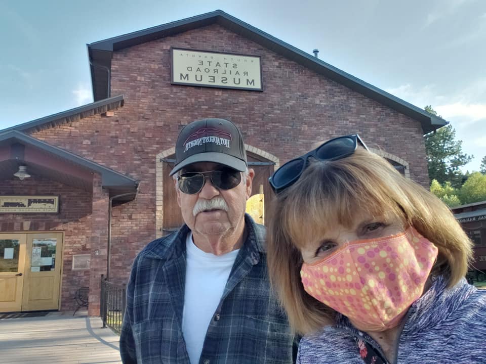
Wednesday, Sept. 28, 2020

It seems that we’ve been stymied at most every turn, not from illness, not from mechanical failure, nor weather. As I’ve said before our problem is too many people out enjoying our great nation rather late in the season! A lot of folks have figured out that they can work while on the road, home school from the road and breathe COVID-free air in states that may or may not only require a face mask when entering into buildings.

Our Philosophy

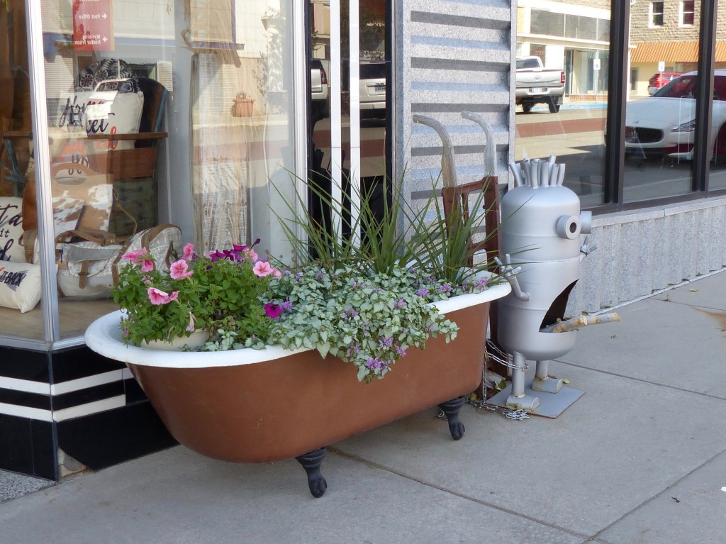
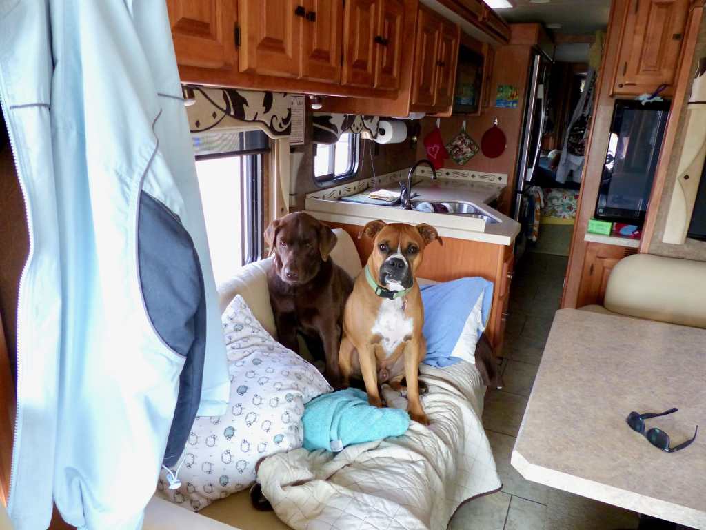
In the same vane I’ve talked to some private RV park work kampers- retired folks that want something to do in places they like to visit for and extended time and make a little cash doing it. I asked to refill our RV’s onboard propane tank at the park we are currently in. The workcamper fella said it’s a little difficult to maneuver to our propane filling station as I look over his shoulder at the easily accessed station. I said it doesn’t look too bad, I can do it. He says to me “I don’t know how good a driver you are.” Really, a real novice should be able to negotiate to that propane filling station!

As he is filling our propane tank I drum up a conversation. I says “Boy, there are sure a lot of people out camping for this time of year”. He says “Ya, and a lot of them are new to RV’ing and are very demanding”. I ask how so? And he says they expect services that they would receive in a 5 star hotel. Wow! And he says, “they are bad drivers!” Oh good, that’s all we need is a bunch of bad drivers driving rigs weighing anywhere from 10,000 to 50,000 pounds highballing it down the highway.
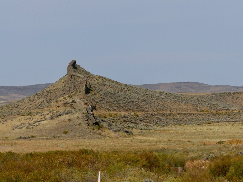
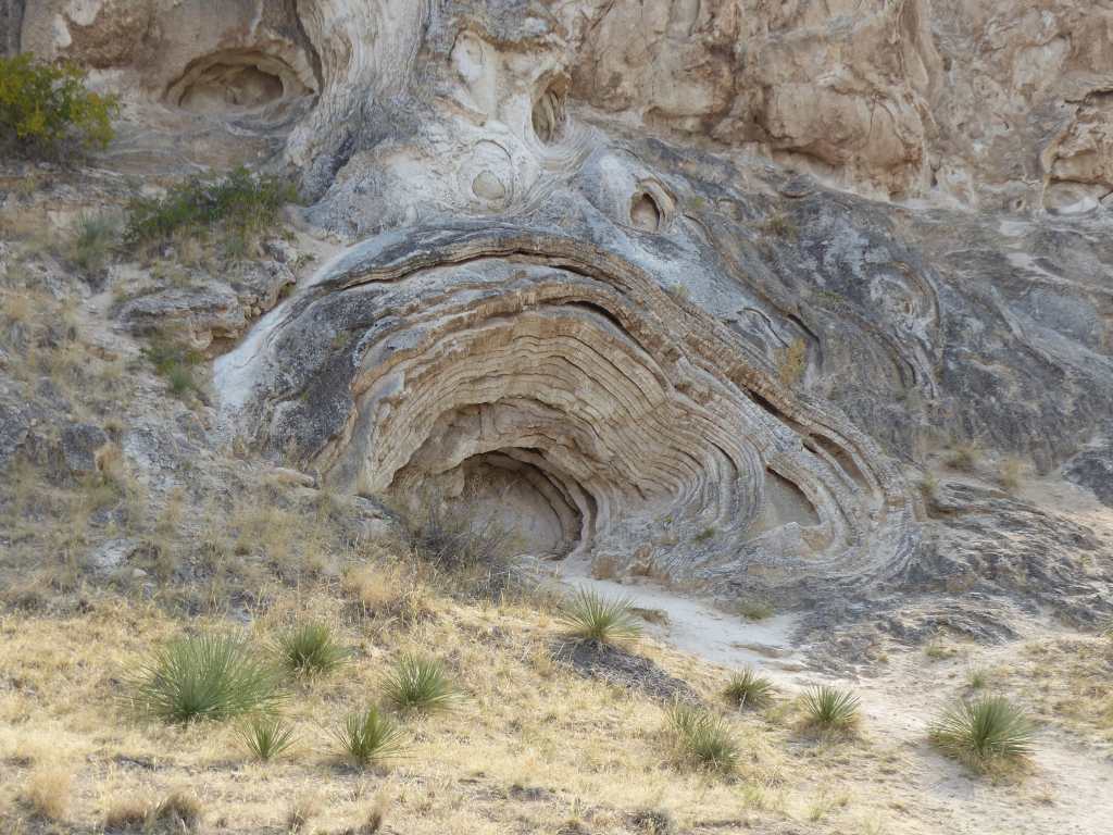
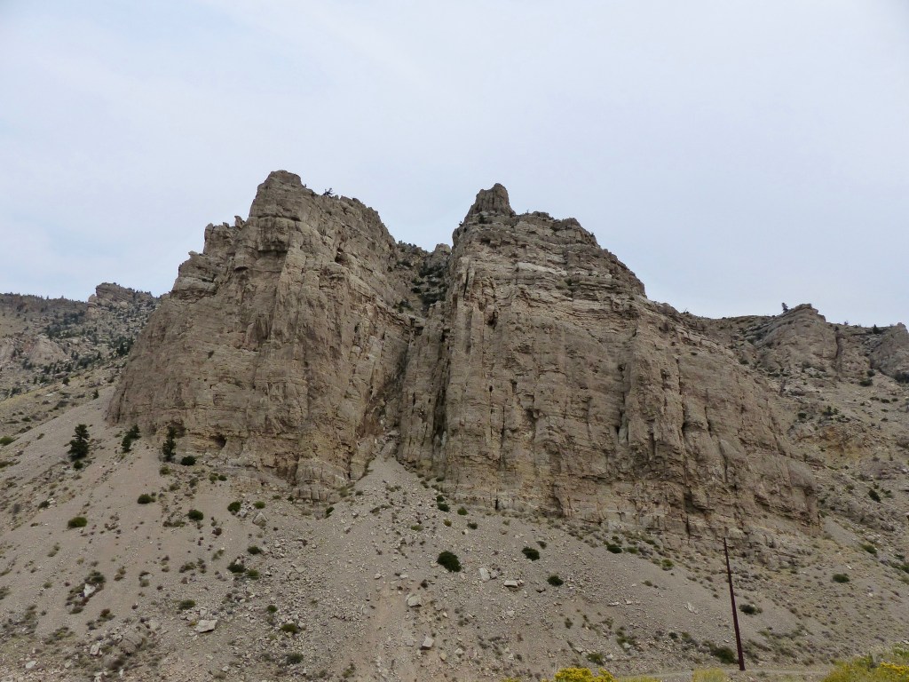
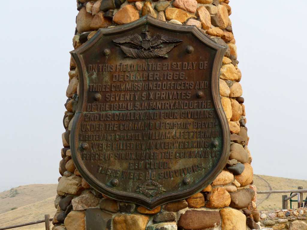
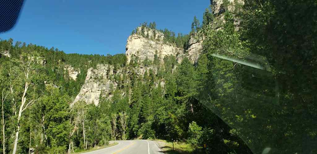
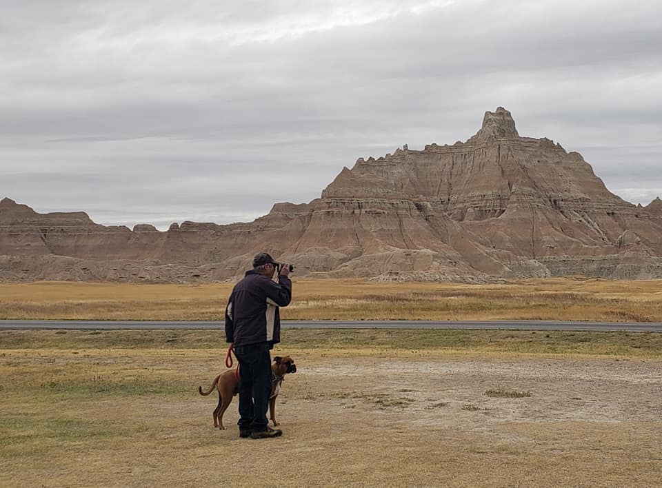
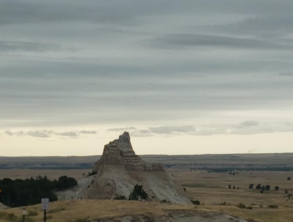
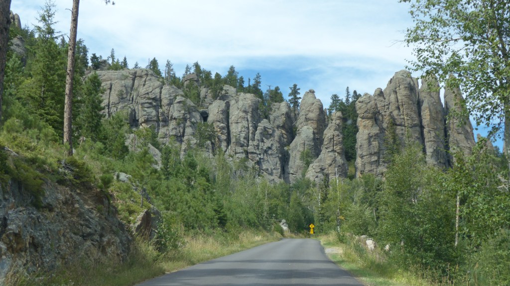
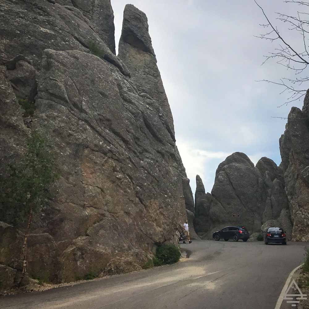
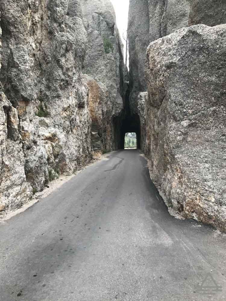
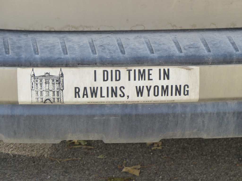
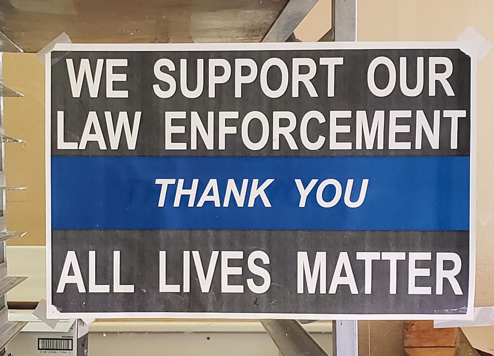
We all want to enjoy the out of doors, new to us places and the beautiful scenery in between. So to all, slow down and enjoy life! Heck, I like to adhere to Tiffin RV’s motto “Roughing it Smoothly”- that’s my philosophy while on the road. Don’t believe me? Just look at the sign on the back of my coach!

(Sounds of me stepping off of soap box) So our plan was to visit Dinosaur National Monument after visiting Rawlins. No go- no RV site availability. Sigh. So since we are still in Plan B mode (Yellowstone NP was Plan A) we set our sights on anyplace that sounds interesting that has a campsite available. Aha, let’s try Yampa River State Park in Colorado! It’s not too far away, has site availability over the weekend and is located 20 minutes from Steamboat Springs. Plan B of Plan B= Yampa River State Park.

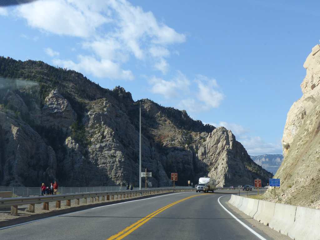
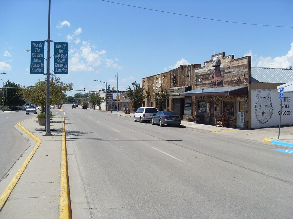
We catch WY 789 west of Rawlins and head south. The terrain gets more hilly with a more lush growth on the prairie and some pinyon type pine trees here and there. The bottom lands are occupied by farmers mostly growing hay and alfalfa raised for livestock. At the Colorado border the highway’s designation becomes Colorado Hwy 13.

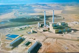
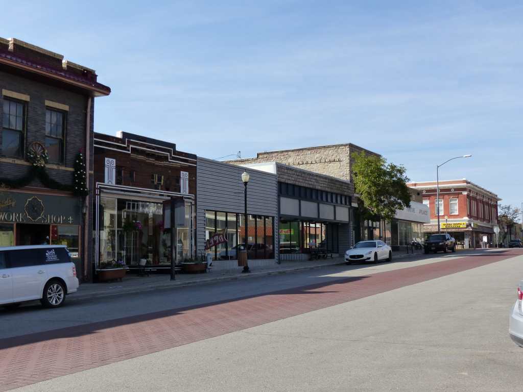
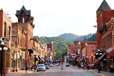
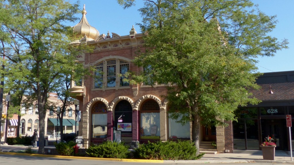
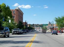
We’ll be turning at remote Craig, CO (10,000 souls) onto US40 and heading east to Yampa River State Park. Craig is the county seat of Moffat County. Downtown is surprising large with a several square block mercantile district and a Walmart located on the edge of town. It’s known as the elk hunting capitol of the US as most of those hunters stay in town. In the early 1970’s and 80’s the largest coal generated power plant in Colorado and several coal mines were constructed near Craig. The Craig-Moffat Airport is busy during winter season as folks flood Steamboat Springs to enjoy winter sports.

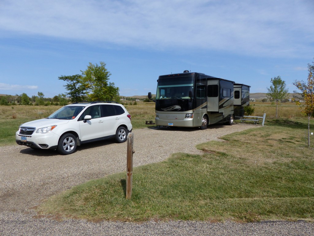
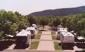
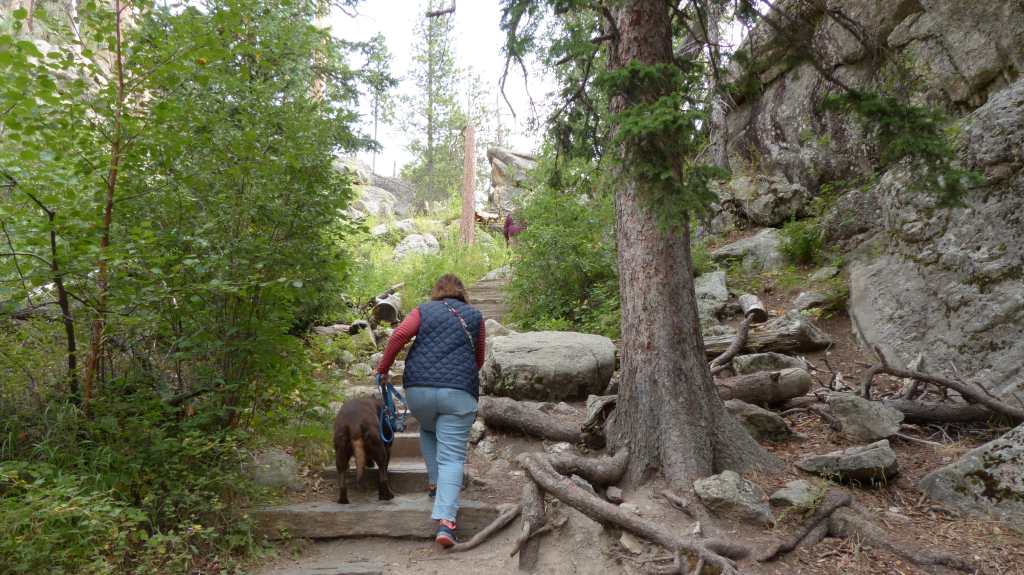
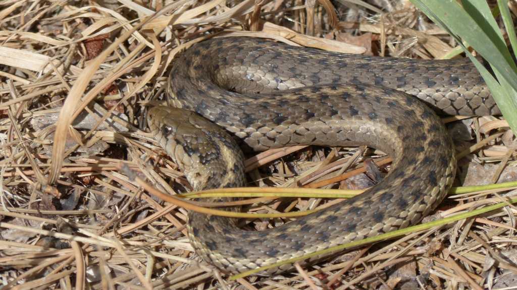
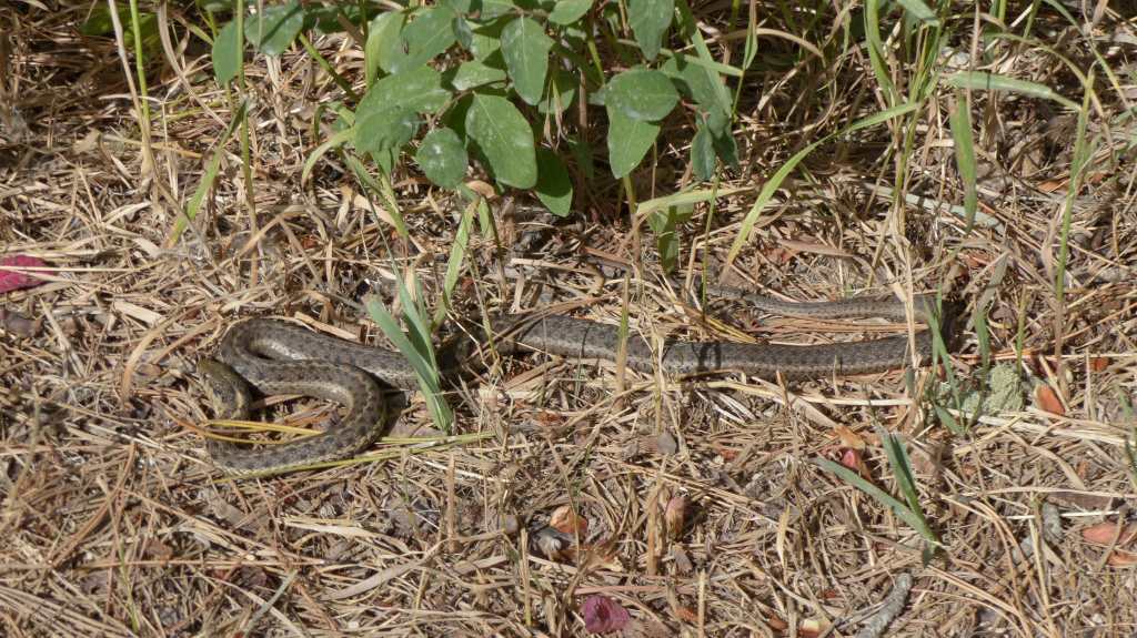
We camped at Yampa River State Park for three nights. The park is right on the banks of the Yampa River, has a lot of wildlife around, has electricity for our basic needs and has trails to explore. It proves to be a good stop. It’s a basic campground that offers power and that’s what attracts us. Fall colors are more in evidence now.

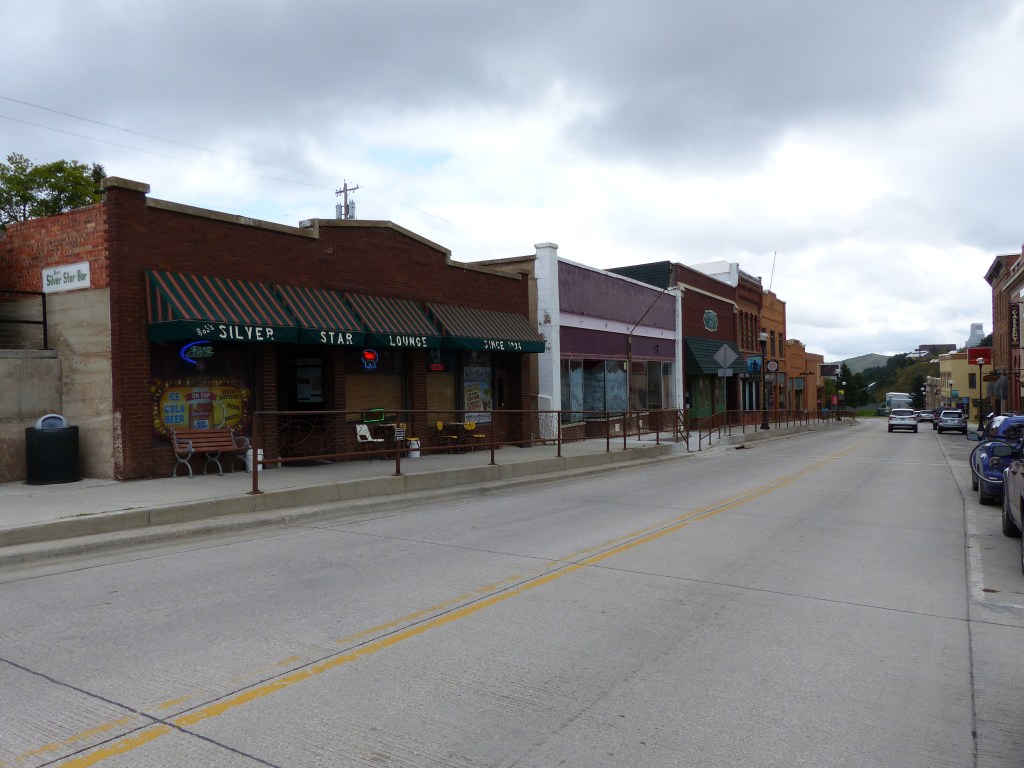
Hayden, CO (1800 souls) is the nearest town to the State Park. We go into town to the grocery store and find it firmly attached to the Ace Hardware store! Both stores are well stocked. It’s just a bit unusual being able to walk from grocery to hardware in the same building.

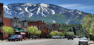
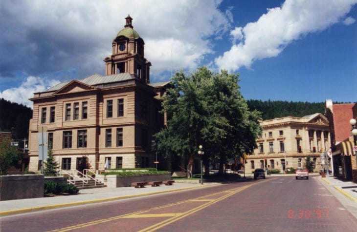
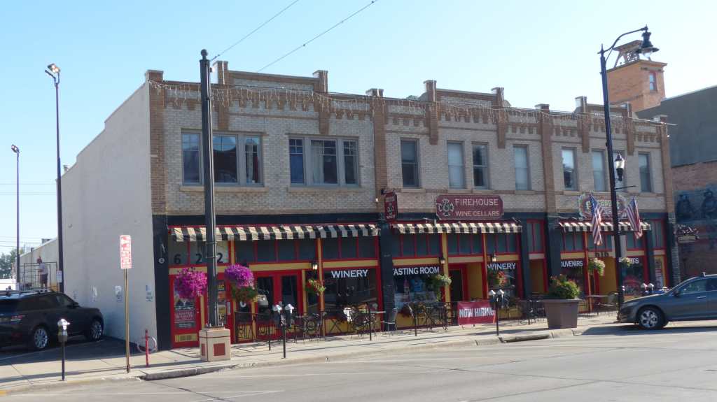
While there we cruise up to Steamboat Springs (12,000 souls). Steamboat is the seat of Routt County and is an internationally known winter ski resort. The city has produced more Winter Olympic athletes than any other town in North America. The town/area got it’s name when early trappers heard chugging sounds coming from the area’s many hot springs and believed a steamboat was coming down river.
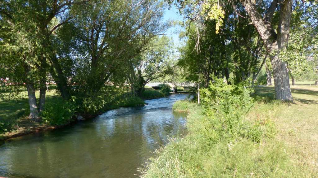
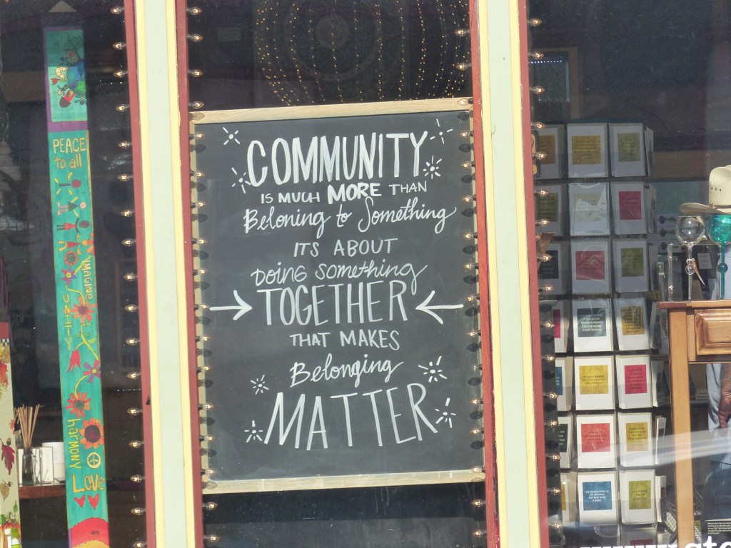
“The Boat” as the locals call it, is a nice town with a walking path next to the Yampa River. Walking the path we noticed signs stating that due to low water levels and high water temperatures, the river was closed to swimming. Sheesh! Steamboat is an affluent town that caters to the more affluent young folks- a “woke” town. . We find their life’s philosophy quite different from ours. A storefront sign babbles “Be kind”-why wouldn’t you?- while a young fella wearing a Black Lives Matter T-shirt holds a hand written sign “Deport Melania”. How is that being kind?

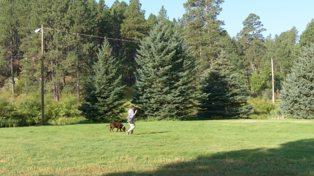
We also visit the nearby Elkhorn Reservoir where our Lab Megan goes for the gusto and actually goes swimming, fetching a stick thrown out into the lake. Ollie runs up and down the bank barely getting his feet wet. That water must have magic traits- as Megan dries off her fur shines!

Tomorrow we’ll head down to Fruita, CO. The town is just west of Grand Junction so there should be plenty to do. See you there!

Please, Not The Dungeon- again!

September 25, 2020

It’s been a real chore finding places we’d like to visit that have camping availability. Most of the RV parks have said that attendance now is incredible compared to what is normal for this time of year. We’ve gone to Plan to Plan B and C several of times. That’s how we wound up visiting Rapid City, Thermopolis and now Rawlins, Wyoming. They all have been interesting places to visit. They were just not on our “A” list.

From this day forward I doubt if any of the places on our “A” list will be visited by Jil and Mike, Megan and Ollie. Example: Since we are heading down to western Colorado (Plan B) we thought it would be great to visit Arches and Canyonlands National Parks. The closest place we could find was over 80 miles away and the only reason we are that close is the park had a last minute cancellation! That’s OK, we’ll visit those parks at a future date when the COVID scare is over and people feel comfortable staying home. Unless, of course, we can find a campground with a last minute cancellation.

Highway 26 takes us from Thermopolis to Shoshoni and Riverton, places we visited on our way to Casper. We pass by Lander (7500 souls), seat of Fremont County, somehow miss Sweetwater Station that has a visitors center, transition on to US 287 and stop in Jeffrey City (58 souls) to stretch.

The only place that showed any life in Jeffrey City was the Monk King Pottery studio across the street, the tiny Split Rock Cafe appeared to be open for business and one cowboy throwing up a dust cloud as he drove down a dirt road. Please click on Jeffrey City to read about it’s colorful past! From Jeffrey City we continue on to Rawlins.

As for Rawlins (9200 souls), a Plan B stop, Jil found an interesting place to visit in this small town of little notoriety except for one place- the old state prison.

Excerpt from rawlins-wyoming.com: In 1867, while in command of the troops protecting the crew surveying the route of the first trans-continental railroad, General John A. Rawlins (chief of staff of the U.S. Army) expressed a wish for a drink of good, cold water. A detachment of scouts explored the countryside as they rode west and approached the hills that stand guard over the present city, and they discovered a spring.

General Rawlins declared it was the most refreshing drink he had ever tasted and exclaimed, “If anything is ever named after me, I hope it will be a spring of water.” General Grenville Dodge, commander of the survey party, immediately named it Rawlins Springs and the community that grew around it bore the same name. Later shortened to Rawlins, the town was incorporated in 1886 and was designated the seat of Carbon County.

Carbon County’s name was derived from extensive coal deposits found in the area. Originally covering the entire width of the Wyoming Territory, Carbon County was reduced in size by the creation of Johnson County in 1875 and Natrona County in 1888. Historically, it has been traversed by the Overland Trail, Oregon Trail, Mormon Trail, and both the original route of the Union Pacific Railroad and the Lincoln Highway. Interstate 80 is now the trail of choice for most travelers through the county, although several scenic backroads and byways offer pleasant alternatives.

So now for the place we came to visit, The Wyoming Frontier Prison, and a few photos of downtown Rawlings……….

The old Wyoming State Penitentiary, now known as the Frontier Prison, is a historic state prison located in Rawlins, Wyoming. This was Wyomings first state prison which operated from 1901 to 1981. The cornerstone was laid in 1888 but due to budget constraints and Wyoming’s notorious weather, the doors wouldn’t open for thirteen years.

Although the original plans addressed the necessities of life most were omitted. No running water, no electricity, no sinks or toilets in each cell and the heating so inadequate that it only raised the temperature inside Cell Block A 20 degrees in -45 degree weather! That block finally received hot water in 1978. Honey buckets were supplied to do one’s business. Cell Block A’s 104 cells measured 4’x7′ with double occupancy!

Overcrowding was a huge problem so an additional 32 cells were added to Block A in 1904. Cell Block B was built in 1950 which temporarily relieved the overcrowding. The new cell block had a more efficient heating system, electricity and hot running water, sinks and toilets in each cell and the cells were quite a bit larger that Cell Block A’s. It also included solitary confinement cells, closing the dungeon in Cell Block A. Cell Block C was completed in 1966 to house serious discipline cases. It only had 36 cells.

Discipline varied. In solitary confinement if the problem prisoner wasn’t too bad he was put in a completely dark room located in the basement of Cell Block A with only a hole in the floor in which to relieve themselves. That area was known as The Dungeon. Guards may or may not remember that a prisoner was even in the cell meaning meals and liquids were most likely intermittent at best. If the inmate didn’t take the hint to straighten up he was put in the “standing” cell. It measured 4×4 feet in size and an inmate was placed in there for a week! One inmate spent a week in that cell, came out and acted up again. He was placed back in that cell for another week. When he came out he was stark raving mad and had to be institutionalized. Besides the “dungeon” another means of discipline was the “punishment pole” to which men were handcuffed and whipped with rubber hoses, the hoses leaving no mark. This was not a good place to spend a vacation folks……..

Some interesting characters were housed at the Pen.  Henry Edmundson, was pardoned by Governor John Kendrick because the prisoner’s behavior was so bad that the governor preferred he leave the state; and Bill Carlisle, the gentleman bandit who robbed trains in 1916, escaped and robbed again, was again imprisoned, and finally earned parole in 1936. Bill earned his name as he refused to rob from women and children. Carlisle went on to marry, start a business and become a model citizen.

Back when the prison was in full swing baseball was the favorite sport of inmates. Interagency games were played but only at the prison. The State team was very good and had winning season after winning season. Enthusiasm for the game waned when the starting catcher was hanged.

Two hundred fifty people died here, most died of natural causes, suicide or were victims of inmate violence. Around 30 were never claimed by clan and are buried at the prison’s cemetery. Fourteen men were executed. The first two were hanged on the traveling Julien gallows, the same contraption used to hang convicted murderer Tom Horn in Cheyenne in 1903. Seven others were also were hanged on the permanent Julien gallows that were installed in Death Row and five were executed in the gas chamber, which was added to the prison in 1936.

A joint powers board turned the abandoned building into a museum in 1988 and renamed the facility the Wyoming Frontier Prison. Visitors today can tour the cells where 13,500 inmates, including 11 women, served time. Annual events include Halloween haunted night tours, as well as other events. Weddings have been held there and one can rent a cell for $10 a week- if one so desires.

We stayed at the Red Desert Rose RV park for a couple of nights. It’s a no frills campground but served it’s purpose- giving us a launch point and a place to lay our weary heads.

Tomorrow more Plan B. We’re heading down to the State of Colorado. See you there!

It’s the Water…….

We heard from other RVer’s that a neat little town is just a short drive from Cody so we decided to check it out. Thermopolis (3009 souls) is about an hour and a half’s ride from Cody. Thermopolis is the largest town in Hot Springs County and also the county seat.

Thermopolis is located near the northern end of the Wind River Canyon and Wedding of the Waters, where the north-flowing Wind River becomes the Bighorn River. It is an unusual instance of a river changing names at a point other than a confluence of two streams. The dual name is ascribed to the mountain barrier between the Wind River and Bighorn basins, obscuring the fact that the river that drains the two is the same. The term “Wedding of the Waters” dates to at least 1934, when a marker was placed at the location.

The large Boysen Reservoir lies 17 miles to the south. The lake offers excellent fishing.  Legend Rock, a cliff located in the central part of the county, displays some of the most spectacular petroglyphs in Wyoming. Bloody Hand Cave, near the mouth of Wind River Canyon, also has pictures and carvings.

The town claims the world’s largest mineral hot spring, appropriately named “The Big Spring”, as part of Wyoming’s Hot Springs State Park. The springs are open to the public for free as part of an 1896 treaty signed with the Shoshone and Arapaho Indian tribes. Dinosaur fossils were found on the Warm Springs Ranch in 1993, and the Wyoming Dinosaur Center was founded soon after.

Later, after the Shoshone Reservation was established in the Wind River Valley in 1868, the hot springs were on the reservation. This meant that white settlers could not formally claim the land or erect permanent structures. It did not prevent numerous squatters from living near the springs in tents and dugouts, however, either to soak in the springs themselves or to sell food and lodging to others.

Through a convoluted deal with the Shoshone 100 square miles of land including the hot springs was purchased by the US Government. The Indians no longer had need for the land as most of the game had been driven off by settlement of the area around the springs and could use the money to transition to reservation life. One square mile was given to the state and the remaining 99 were opened for settlement. The Shoshone requested that the springs remain open to the public forever. Purchase price- 94 cents an acre.

Thermopolis began in the 1880s near the mouth of Owl Creek, just outside the reservation boundaries of the time and downstream from the town’s present-day site. It provided better quarters for visitors than the pole-and-brush “Hotel de Sagebrush” near the hot springs, and offered stores and other businesses to serve the ranchers and homesteaders on Owl Creek and along the river. In 1910 the Burlington Railroad reached Thermopolis bringing with it 60 or more people- here to visit the therapeutic hot springs. Prior to the railroad the only access was by wagon road.

Just across the Bighorn River from Thermopolis was the town of Andersonville, where outlaws like Jim McCloud; Harry Longabaugh, known as the Sundance Kid; and Robert Leroy Parker, known as Butch Cassidy appear to have visited regularly.

Although agriculture seemed unlikely a lot of early settlers made a go of it by raising hay and alfalfa for livestock feed. Cattle ranchers brought in their cattle and sheep ranchers brought in their sheep. Coal mining began in 1898 and oil was discovered at the Grass Creek field in 1907 and the Hamilton Dome opened in 1915.

Bar from Hole in the Wall Saloon

Today Thermopolis is a mecca for seekers of the therapeutic waters of its hot springs. Hot Springs State Park incorporates hotels, public soaking pools, walking and biking trails. Buffalo free range in the hills above the springs and one can visit the Dinosaur Center.

Downtown Thermopolis is typical for turn of last century downtowns. It consists of one block of one and two story brick buildings, one of which houses a bakery- which I visit and purchase freshly made cherry fritters. Yum! We also visit the Old West Historical Museum. The place is packed with memorabilia that local folks have donated as well as historically significant artifacts. The museum is a must see while in town.

The town of Thermopolis is a little off the beaten path but well worth the visit. And if one is into bathing in hot mineral waters this is the place to go!

See you at the next place we visit. Adios!

Cody- The Man and the Place

September 21, 2020

One of the places we desire to visit is Yellowstone National Park. We were first to visit Cody, WY, then enter the park through the east entrance and stay several days in an RV Park in West Yellowstone. Alas, every RV Park in West Yellowstone is booked solid and Cody is has the closest availability to the park at 53 miles- and that’s just to the entrance station. Yellowstone is huge and takes several days just to get a good feel for the park and see the main sights. So this trip we’ll not visit Yellowstone. Darn!

Within a day’s drive of the Little Bighorn Battlefield Monument is another place of historical significance, the city of Cody Wyoming (9500 souls).

We head up I-90 through Billings MT (110,000 souls) then south on US 310 and stop in Fromberg MT which has a population of 438 souls. Downtown Fromberg looks like its on its last legs. The blacksmith’s shop looks busy and ever other shop looks quiet or closed.

Cody, The City

Cody lies in the Bighorn Basin surrounded by mountain ranges on three sides: the Absarokas on west, the Owl Creek Mountains to the south and the Bighorns to the east. The Shoshone River has cut a deep canyon at the edge of town, sort of a mini Grand Canyon. The Bighorn Basin was restricted from white settlement by treaties with the Indians in 1868. Ten years later, those restrictions were lifted and early settlers began to come into the basin. This made the area one of the last frontiers settled in the lower 48 states.

Excerpts from Wyoming History.com: William F. “Buffalo Bill” Cody was visiting Sheridan, Wyo., in 1894, when his son-in-law, Horace Boal, took him to the top of the Bighorn Mountains for a view to the west over the Bighorn Basin. On learning that a group of Sheridan businessmen was already interested in founding a town there, Cody eagerly joined the effort. He saw the beauty of the region, its proximity to a Yellowstone already attracting tourists, the abundance of game and fish, and land available for ranching and farming.

 In 1895, Cody, George T. Beck, Cody’s Wild West show partner Nate Salsbury, Harry Gerrans, Bronson Rumsey, Horace Alger, and George Bleistein founded the Shoshone Land and Irrigation Company. In the fall of 1895, construction began on the Cody Canal, which would carry water from the south fork of the Shoshone River northeast to the town. In May 1896, Beck and surveyor Charles Hayden laid out the site of the present town.

To ensure the success of Cody the Chicago, Burlington and Quincy Railroad was sold the majority of town lots, thus the railroad gained a vested interest in the town. The railroad line to Cody opened in 1901. By 1900 the town had a population of 300, the Irma Hotel, named after Buffalo Bill’s daughter was opened in 1902.

The Buffalo Reservoir was created with federal money by damming the narrow cut created by the Shosone River between Cedar and Rattlesnake mountains. The Shoshone Dam was completed in 1910 and renamed Buffalo Bill Dam in Cody’s honor in 1946 on the anniversary of his 100th birthday. Three highway tunnels are adjacent to the dam.US highways 20/14/16 follow Shoshone Canyon past the dam with the most westerly being Wyoming’s longest tunnel at 3202 feet.

Although oil and gas remain viable industry here it’s a popular stop for travelers on the way to and from Yellowstone just as Colonel Cody envisioned it, as well as a hunter’s and fishermen’s paradise. Irrigation has overcome the high desert climate enabling ranchers and farmers to succeed. Buffalo Bill’s legacy continues today at the Irma, the Buffalo Bill Historical Center, and numerous other businesses seeking to catch the eyes of tourists.

Cody, The Man

Excerpt from Wikipedia: William Frederick “Buffalo Bill” Cody (February 26, 1846 – January 10, 1917) was an American soldier, bison hunter, and showman. He was born in Le Claire, Iowa Territory (now the U.S. state of Iowa), but he lived for several years in his father’s hometown in Toronto Township, Canada before the family returned to the Midwest and settled in the Kansas Territory. After his father’s death he became a rider for the Pony Express at age 15. During the Civil War, he served the Union from 1863 to the end of the war in 1865. Later he served as a civilian scout for the US Army during the Indian Wars, receiving the Medal of Honor in 1872.

Cody returned to Army service in 1868. From his post in Fort Larned, he performed an exceptional feat of riding as a lone dispatch courier from Fort Larned to Fort Zarah (escaping capture), Fort Zarah to Fort Hays, Fort Hays to Fort Dodge, Fort Dodge to Fort Larned, and, finally, Fort Larned to Fort Hays, a total of 350 miles in 58 hours through hostile territory, covering the last 35 miles on foot. In response, General Philip Sheridan assigned him Chief of Scouts for the 5th Calvary Regiment

Buffalo Bill’s legend began to spread when he was only 23. Shortly thereafter he started performing in show that displayed cowboy themes and episodes from the frontier and Indian Wars. He founded Buffalo Bill’s Wild West in 1883, taking his large company on tours in the United States and, beginning in 1887, in Great Britain and continental Europe. For a more complete biography of Cody please refer to: https://en.wikipedia.org/wiki/Buffalo_Bill

Probably the largest tourist draw in Cody is the Buffalo Bill Center of the West. It’s actually five museums in one: Buffalo Bill Museum, Plains Indian Museum, Draper Natural History Museum, Whitney Western Art Museum, and the Cody Firearms Museum. If you think you can whiz right through all five museums and be on the road towards Yellowstone think again and look at your pass. It’s a two day pass! Example: The firearms museum includes 10,000 artifacts. It’s the most comprehensive firearms museum in the United States. We visit all but the Whitney Western Art Museum.

Buffalo Bill Museum
Plains Indians Museum

I believe I took 200 photos while touring the museums just so I’d have a log of the most interesting things I saw there. Hope you enjoy just a few of them that have been chosen worthy of this blog. (gads, more than a few- a lot!) Here’s a few more…………..

Natural History Museum

Firearms Museum

And last but not least we have the rare wave eating long tailed, floppy-eared Boxer Dog. Found only near lakes with wind driven waves the wave eater will race up and down the shore attempting eat/swallow every last drop of water that laps onto the shore. Burrrp…….

Uh, General….. I Wouldn’t……

September 20, 2020

Most of us have heard of the Battle of Little Bighorn and Custer’s Last Stand. If one is ever in the vicinity of Little Bighorn National Monument don’t hesitate to visit this remarkable place. Our stop in Hardin, MT was to do precisely that. The monument is located on the Crow Indian Reservation, Garryowen, MT. Since our last visit it seems that the Crow Agency has seen fit to take advantage of the park’s visitors by erecting a couple of trading posts, a casino and hotel near the entrance. Heck, why not?

On June 25, 1876, Native American forces led by Crazy Horse and Sitting Bull defeat the U.S. Army troops of General George Armstrong Custer in the Battle of the Little Bighorn near southern Montana’s Little Bighorn River.

Crazy Horse and Sitting Bull, leaders of the Sioux tribe on the Great Plains, strongly resisted the mid-19th-century efforts of the U.S. government to confine their people to reservations. In 1875, after gold was discovered in South Dakota’s Black Hills, the U.S. Army ignored previous treaty agreements and invaded the region. This betrayal led many Sioux and Cheyenne tribesmen to leave their reservations and join Sitting Bull and Crazy Horse in Montana. By the late spring of 1876, more than 10,000 Native Americans had gathered in a camp along the Little Bighorn River–which they called the Greasy Grass–in defiance of a U.S. War Department order to return to their reservations or risk being attacked.

The Indians were encamped down where the trees appear just past the rolling hills

In mid-June, three columns of U.S. soldiers lined up against the camp and prepared to march. A force of 1,200 Native Americans turned back the first column on June 17. Five days later, General Alfred Terry ordered Custer’s 7th Cavalry to scout ahead for enemy troops. On the morning of June 25, Custer drew near the camp and decided to press on ahead rather than wait for reinforcements.

Last Stand Hill looking towards Custer National Cemetery

At mid-day, Custer’s 600 men entered the Little Bighorn Valley. Among the Native Americans, word quickly spread of the impending attack. The older Sitting Bull rallied the warriors and saw to the safety of the women and children, while Crazy Horse set off with a large force to meet the attackers head on. Despite Custer’s desperate attempts to regroup his men, they were quickly overwhelmed. Custer and some 200 men in his battalion were attacked by as many as 3,000 Native Americans; within an hour, Custer and every last one of his soldiers were dead.

The Battle of the Little Bighorn—also called Custer’s Last Stand—marked the most decisive Native American victory and the worst U.S. Army defeat in the long Plains Indian War. The gruesome fate of Custer and his men outraged many white Americans and confirmed their image of the Native Americans as “wild.” Meanwhile, the U.S. government increased its efforts to subdue the tribes. Within five years, almost all of the Sioux and Cheyenne would be confined to reservations.

READ MORE: What Really Happened at the Battle of the Little Bighorn?

Custer Memorial
Cheyenne and Sioux Memorial

The total US casualty county included 268 dead and 55 severely wounded. Six later died of their wounds including four Crow Indian Scouts and at least two Arikara Indian scouts. The dead at the Battle of the Little Big Horn were given a quick burial where they fell by the first soldiers who arrived at the scene. Custer was later disinterred and reburied at West Point. Other troops were also disinterred for private burials. In 1881, a memorial was erected in honor of those who lost their lives.

Indian fatalities at the Battle of Greasy Grass (winner’s term) are a little more difficult to determine. Figuring out the Indian casualties has been complicated by inconsistencies in their accounts and pictorial depictions, largely because Indians often bore more than one name and some of the deaths may have been duplicated. Accounts vary between 26 warriors killed According to One Bull, a Cheyenn who lived near the Little Bighorn battlefield listed 26 warriors killed while Major Marcus Reno said he saw 18 dead Indian warriors on the battlefield.

It seems that most people bypass the drive in favor of the visitor’s center and the large monuments nearby. The Custer National Cemetery is also located within the grounds. If one visits be prepared to drive 4.5 miles through the monument. Not making the drive is a mistake. The road follows ridge lines where information plaques explain how to battle unfolded, points of interest and other narratives. Standing on the ridges looking down at all those grave stones is a humbling experience.

We walk the National Cemetery and pay our respects to all who have served or given their all for our great country. We discover that veterans are not the only residents here but wives and children of veterans. We’ve seen wives buried with their husbands but never children nor an unknown Chippewa Indian woman.

Above are a few scenes outside of the Monument on the Crow Rez. Below is a monument constructed at a privately owned museum just down the road.

Next we are off to Cody Wyoming. See you there!

And a little whimsey to end with.

Heading North to Hardin, MT

September 19, 2020

We love to take the byways over the interstates. Today US 87 was on our radar as there are a couple of historic places we’d like to visit. We’re on our way to Fort Phil Kearney when we see a sign directing us to the sight of the Fetterman Massacre.

Fetterman’s Massacre site is a long ways from nowhere

In 1866 group of 10 warriors including Crazy Horse attempted to lure a detachment of U.S. soldiers into an ambush. Captain William Fetterman was given strict orders not to go over the hill, do not lose sight of the fort. He took the lure, leading his detachment of 80 men after the band of Indians only to be intercepted by a large group of their brethren who promptly killed Fetterman and all his men- all 80 of them. At the time it was the worst military disaster ever suffered by the US Army on the Great Plains. The Fetterman Massacre took place on Crow Indian land, the attack orchestrated by an alliance of Lakota, Cheyenne, and Arapahoe tribes without the consent of the Crow.

Fort Phil Kearney was one of three forts established along the Bozeman to protect miners traveling north from the Oregon Trail in 1866. It was the largest of the three stockaded fortifications.

Its eight foot high log walls enclosed anarea of 17 acres, the longest wall being 1496 feet in length. At its height the garrison had 400 troops assigned and 150 civilians. The Fetterman Massacre occurred in 1866 and the Wagon Box Fight of 1867 was the last major engagement that ended Red Cloud’s War. The three forts were abandoned in 1868 when the Union Pacific Railroad reached far enough west the emigrants could reach Montana gold fields through present-day Idaho, rendering the dangerous Bozeman Trail obsolete. Shortly after Fort Phil Kearney known to the Indians as “the hated post on the Little Piney” was burned by the Cheyenne Indians.

Sheridan (17,900 souls), the seat of Sheridan County is our next stop. The town is beautiful with a 1890’s wild west feel to its downtown district with beautiful homes to its west. The town is named after Union calvary general Philip Sheridan. The townsite grew from a trapper’s cabin to a small town in 1882. The arrival of the Burlington and Missouri Railroad boosted Sheridan’s economy leading to the construction of the Sheridan Inn where Buffalo Bill Cody was once a financial partner.

Where else would have buffalo roaming in their city park but Sheridan, WY?

Coal mines opened north of town along the Tongue River in the 1890’s which drew farmers from back east as well as cattlemen. Immigrants arrived from Europe and Mexico. Today mining, farming, manufacturing drives its economy as well as a strong rodeo culture. Summer events draw participants and spectators for all over including the nearby Crow and Northern Cheyenne reservations, leading to the slogan “Cowboy Days and Indian Nights”.

We settled into Grandview Campground and RV Park, Hardin MT. It’s the only campground in town yet I would hesitate to recommend it. The park itself is OK but could use a lot of clean up. It appears to have been a farm at one time. Farmers don’t throw much away so there’s a lot of used “treasures” lying about that could be recycled or at the least removed from public view. We meet some interesting fellas here at the park. Several are from Pennsylvania and are participating in a safflower harvest. A couple of others are transporting huge combines, machines used to harvest crops, in caravans from Montana back home to Kansas. They drive work trucks that displays a “wide load” sign. Since they are never in one place very long when transporting, they pull their travel trailer home on wheels behind them. Interesting young men!

A visitor magnet for Hardin is the Big Horn County Historical Museum. Of course like a lot of museums and places of interest it’s closed. The main building is closed but the grounds are open, but dogs are not welcome. We take some photos and wish the place was open to the public. Sigh…….

Original entrance gate to Custer Battlefield

Tomorrow we will visit a place that has gone down in infamy. See you there!

We’re in Buffalo!

Thursday, September 17, 2020

We left Spearfish Monday morning heading towards Buffalo Wy. We’ll travel Interstate 90 all the way, leaving the Black Hills behind. We’ll be back in the high plains traveling by towns whose names may be familiar to you.

We drive past Sundance, WY which lies on the eastern slope of Sundance Mountain. Excerpt from Wikipedia: Sundance (Lakota: Owíwaŋyaŋg Wačhí;[6] “Sun-Watching Dance”) is a town in and the county seat of Crook CountyWyoming, United States.[7] The population was 1,182 at the 2010 census. The town is named after the Sun Dance ceremony practiced by several American Indian tribes.[8]

American criminal Sundance Kid, Harry Longabaugh, was born in 1867 in Mont Clare, Pennsylvania. At age 15, he headed west and received his nickname when was arrested for stealing a horse in Sundance, Wyoming. He was part of Butch Cassidy’s gang, The Wild Bunch. The group embarked on the longest stretch of successful train and bank robberies in the history of the American West. It’s said that Longabaugh was the fastest gunslinger of the group, although he never killed anyone.

We also bypass Moorcroft (1100 souls). The town located at the confluence of the Belle Fourche River and Donkey Creek. The town was originally called LaBelle. The Chicago, Burlington, and Quincy Railroad built its railroad through town in 1891 then renamed it. Beautiful Keyhole State Park is nearby.

We stopped in Gillette just because we never have. We found a nice little greenbelt right next to a community ice rink to walk the dogs. The downtown’s business district was too busy through with the beast so we continued on. Excerpt from Wikipedia: Gillette is the county seat of Campbell County, Wyoming. The population was estimated at 32,030 as of July 1, 2019. Gillette is centrally located in an area involved with the development of vast quantities of American coaloil, and coalbed methane gas. The city calls itself the “Energy Capital of the Nation”; Wyoming provides nearly 35% of the nation’s coal. Gillette’s population increased 48% in the ten years after the 2000 census, which counted 19,646 residents.

Before its founding, Gillette started as Donkey Town, named after Donkey Creek, and then was moved and called Rocky Pile after Rocky Draw a landmark recognized by travelers. Gillette was founded in 1891 with the coming of the Chicago, Burlington & Quincy Railroad and incorporated on January 6, 1892, less than two years after Wyoming became a state. Chicago, Burlington & Quincy Railroad changed the name to Gillette for Edward Gillette, who worked as a surveyor for the company.

Downtown Buffalo WY

We’ve run into a lot of smoke, most of it coming from wildland fires to the west. The foothills of the Bighorn Mountains are barely visible and the mountains themselves are invisible. Bummer……..

We pulled into the Deer Park Campground, Buffalo Wy (4600 souls) after a drive of 170 miles. . The campground is located on a hill just east of town. The population of the park ebbs and flows like the ocean’s tides with a lot of RV’s leaving in AM and as many coming in to camp in the PM. The park has lots of places to walk the mutzos. Wildlife in the form of deer and turkey inhabit the area and we saw both. A couple of curious horses reside in a large grassy field just on the other side of a two wire fence. Megan didn’t care about them but Ollie went nose to nose with one horse. Every time we took a walk he’d pull me over to the fence to see if his equine pal was waiting for a another meet.

If one owned a mansion in Buffalo what kind of pets would one have? These white tail deer were lounging by the front door of a beautiful home that was being remodeled.

The town of Buffalo was founded on a buffalo trail that forded Clear Creek in 1879 and became seat of Johnson County in 1881. It is located on eastern foothills of the Bighorn Mountains. The region was prime hunting ground for Sioux, Arapaho, and Cheyenne Indians, and many armed conflicts ensued as settlers moved into the area. Forts were established to protect miners and other white travelers on the Bozeman Trail; these were abandoned in 1868, but white settlement was not far in the future. The community soon saw considerable conflict between farmers and cattlemen, and the site of the final battle in the Johnson County Cattle War of 1892 is 13 miles (21 km) south at the TA Ranch.(https://www.wyohistory.org/encyclopedia/johnson-county-war-1892-invasion-northern-wyoming)

Buffalo is a shipping point for livestock and lumber, with grain and sugar beet cultivation and oil wells in the vicinity. It also serves as a tourist center for the Bighorn Mountains region. The sites of Fort Phil Kearny and the Fetterman Massacre (1886), in which 80 U.S. soldiers were trapped and killed by Sioux Indians, are a few miles northwest.

Occidental Hotel circa 2020

Famous is the historic Occidental Hotel. Founded in 1880 the hotel became one of the most renowned in Wyoming. Located near the Bozeman Trail the hotel was visited by many famous people of the Old West. People who enjoyed the hospitality of the Occidental were Buffalo Bill Cody, Teddy Roosevelt, Calamity Jane (who drove freight wagons on the Bozeman). Even the Butch Cassidy and the Sundance Kid rode from their hideout at the Hole-in-the-Wall would visit on occasion. As time passed the Occidental was expanded and rebuilt until it became a “grand” hotel.

Tomorrow we’ll head north and visit some very historic western sites. See you there!

The always curious Boxer Boy, Ollie

Deadwood, Spearfish and Lead- aaand Sturgis!

Sunday, September 13, 2020

We drove from Pierre SD to Spearfish SD, a drive of around 219 miles on Thursday. We’ve been in the area before but never to Lead or Sturgis. Driving from the northern Plains back to the Black Hills was pleasant. We’re happy to be in the hills once again. We are staying at the Elkhorn Ridge RV Resort. The place is very nice and not terribly expensive. We’ll enjoy our stay here and use it as home base in order to do a little exploring.

This place is truly a resort. It has a conference center/meeting room, tennis courts, swimming pool, and walking paths. Besides the nicely laid out RV sites, cabins are available for those without a home on wheels. There is lawn art everywhere mostly of animals native to the area.

Our first place to visit is Sturgis. Yes, THAT Stugis. The town famous for its annual motorcycle rally. The town of 6,627 souls swells to unbelievable proportions. This year attendance was down however, with only 460,000 attending over a 10 day period. That attendance figure is down about 7% from normal.The motorcycle rally has been over for a couple of weeks and the town is quiet with only a few visitors enjoying the place. Those attending the rally said they were there because it was something to do.

Stugis was founded in 1878. It was originally named Scooptown because many of the residents “scooped up” their pay from nearby Fort Meade. Its name was later changed to Sturgis to honor Civil War Union General Samual Sturgis. Sturgis was designated the seat of Meade County in 1889.

Downtown Deadwood

Deadwood is located at 4500′ and Tuesday it snowed! There’s still patches of snow on a couple of rooftops and in shady areas around town. Deadwood (1270 souls) is the seat of Lawrence County. The entire city has been designated as a National Historic Landmark District.

Excerpt from deadwood.com: The discovery of gold in the southern Black Hills in 1874 set off one of the great gold rushes in America. In 1876, miners moved into the northern Black Hills. That’s where they came across a gulch full of dead trees and a creek full of gold and Deadwood was born.

Practically overnight, the tiny gold camp boomed into a town that played by its own rules that attracted outlaws, gamblers and gunslingers along with the gold seekers. Wild Bill Hickok was one of those men who came looking for fortune. But just a few short weeks after arriving, he was gunned down while holding a poker hand of aces and eights – forever after known as the Dead Man’s Hand.

Well known characters from the Old West are buried in Mt. Moriah Cemetery. Calamity Jane is buried next to Hickock and other legends like  Potato Creek JohnnySeth Bullock and Al Swearengen will forever find peace overlooking the town.

(From Deadwood.com): You can find these colorful characters walking the streets of present-day Deadwood as a part of Deadwood Alive. This theater troupe reenacts the major historic events – like the Trial of Jack McCall and Wild Bill’s assassination— that inspired the legends you know today.

As one can imagine gold played out and folks moved on. The current population of 1270 souls pales from the 25,000 who lived here in its heyday. The place fell on hard times now and then and suffered through three major fires. Gaming revived what was to become another ghost town. What is left today are the period buildings at its core, modern day resort hotels. their architecture playing off of 100 year old buildings, big name concerts, gaming and walking in the footsteps of Wild West legends.

Lead (LEED) (3124 souls) is not far from Deadwood. The town was named for the leads or lodes of deposits of valuable ore, in this case gold. The Homestake Mine lies at the edge of town. The mine was the largest, deepest (8240 feet) and most productive gold mine in the western hemisphere before it closed in 2002.

Lead has a great mining museum. If ever in Lead don’t miss it! Yes, mining at the Homestake Mine is a main theme yet a very large portion of the museum is devoted to the town and its people and its way of life.

Lead was founded as a company town which was made more comfortable through the efforts of Phoebe Hearst. She established a town library, free kindergarten, and opera house, provided college scholarships.

In the early 1930’s due to fear of cave-ins of the miles of tunnels under Lead’s Homestake Mine, many of the town’s buildings located in the bottom of a canyon were moved further uphill to safer locations.

Today Lead and the Homestake Mine have been selected as the site of the Deep Underground Science and Engineering Laboratory, a proposed NSF facility for low-background experiments on neutrinos, dark matter, and other nuclear physics topics, as well as biology and mine engineering studies.

Spearfish (10,494 souls), founded in 1876, lies just west of Elkhorn Ridge RV Resort. The city was founded at the mouth of Spearfish Canyon it’s roll in the Black Hills Gold Rush being a supplier of foodstuffs for the mining camps in the hills. The Homestake Sawmill was built to supply timbers for the Homestake Mine.

Spearfish Creek emerges from the canyon and runs through the center of town. An unusual phenomenom is that in winter the creek freezes from the bottom up, with ice at the bottom of the creek bed and water running over the top. The cause is the fast running creek doesn’t allow ice to form on top, only the bottom of the creek bed.

We enjoy fish hatcheries and Spearfish has a beauty. The landscaped grounds are worth walking through, the “fish” train car is historically significant. Heck, the whole working hatchery is historically significant. The train cars were used to transport fish from one location in the nation to another. At the moment rainbow trout are being raised.

Right next door is the Spearfish Municipal Campground. It’s pretty nice, I wanted to camp there but it’s a first come, first serve sort of place. With so many people enjoying the outdoors we couldn’t take a chance. Oh well, maybe next time.

EF1 tornados did a lot of damage to trees but missed all structures in the canyon.

We took the scenic drive up Spearfish Canyon. Talk about beauty! Sheer limestone cliffs, beautiful trees and a couple of small waterfalls are all highlights within the canyon. Partway up the canyon quite a few trees have been broken about 20 up. No, couldn’t be. We’re in the Black Hills! But it’s true. Back in July two tornados hit the canyon wreaking havoc on the trees. Not only did the twister break the tops off of some they toppled others.

Near the top of the canyon is Spearfish Canyon Lodge. The handsome lodge is surrounded by God’s beauty. The lodge offers overnight accommodations, fine dining and entertainment and more.

Tomorrow we’ll be heading west into Wyoming. See you there.

Pierre

Friday, September 11, 2020

Alrighty then, while in Rapid City we had a day maxing out a 102 degrees last Saturday. Two days later here in Pierre the high was 47 degrees. That’s a 55 degree temperature swing folks! Nighttime temps dropped from high sixties to nearly freezing. Sheesh! The weather slowly started to warm into the low sixties during our stay, which is comfortable for us.

A major encounter which affected the destiny of all inhabitants of the region occurred in Fort Pierre on September 24-28, 1804. At the mouth of the Bad River, in present day Fischer Lilly Park members of Lewis and Clark’s Corps of Discovery met for the first time with the Lakota people, known to them as the Teton Sioux. Differences in trade objectives, diplomacy, and the lack of an interpreter lead to an armed confrontation, the closest Lewis and Clark came to a premature end to their expedition. Today the park is certified as a National Park Service Lewis and Clark National Historic Trail site.

Also of historical interest is the Verendrye Site. French explorers Francois and Louis-Joseph Verendrye buried a lead plate on this hillside overlooking what now is Fort Pierre on March 30, 1743. The plate documents the Verendryes as the first European explorers on the northern plains. The Louisiana Purchase of 1803 made the area a part of the United States. The plate was found in 1913 by a couple of teenagers who considered selling it to the local print shop. A state historian caught wind of the plate, realized it’s importance and saved it. The plate is on display at the Cultural Heritage Center in Pierre.

We visited Casey Tibbs Rodeo Center in Fort Pierre. Casey was born in nearby Orton, SD in 1929. He held the “World All-Around Cowboy Champion” title twice, the world saddle bronc riding championship six times and the world bareback bronc riding championship once all between 1949 and 1959. He was featured on the cover of Time Magazine in 1951.

He went on to raise and breed horses in Ramona, CA but not before becoming a stunt man, stunt coordinator, technical director, livestock consultant, wrangler, and actor for the film industry. He even wrote, directed, produced and starred in the film Born to Buck! He was inducted into the Rodeo Hall of Fame of the National Cowboy and Western Heritage Museum, the South Dakota Sports Hall of Fame and three more Halls of Fame. A man this famous and I’d never heard of him. He passed in 1990 from cancer.

Pierre is a small capital city as far as capitals go at just over 13,000 souls. It is only one of four state capitals that don’t have an interstate running through it and is unique among them in not having access to an expressway. The locals say that because there is no interstate not many folks from out of state visit. By the by, Pierre is not pronounced as the French pronounce the word, Pea-aire, but more like “Pier”. The city lies on the east bank of the mighty Missouri River and our campground is just a few miles downstream.

Capitol of South Dakota

Pierre was founded in 1880 on the east bank of the Missouri River opposite Fort Pierre, a former trading post that developed as a community. She was designated as the temporary state capital when South Dakota gained statehood in 1889 and another election was held in 1890 to become the permanent capital. It was selected because of its location in the geographical center of the state. However there were several attempts to move the capital. After three elections, many citizens believed that a large, permanent building would end any further relocation efforts.

Looking at the capitol building I had a sense of deja vu and I was right. The same architects were hired that designed the Montana State Capitol and that design was to be used again for the South Dakota State Capitol with some variations.. Construction began in 1905 and completed in 1910- the total cost of the building under one million dollars. We’ve been to the Montana State Capitol in Helena and this capitol building is very similar.

Development of the city was influenced by railroads which run east-west through the city, increasing access to markets for regional products and transportation of passengers.

Jil walked in but the Gov. Kristi Noem was on the phone and couldn’t visit…….

Farm Island State Recreation Area is one of the nicest state parks that we have encountered. It lies on the bank of a back bay of the Missouri. All picnic and campgrounds luxuriate in mowed grass, all surrounded in natural grassland. The camp sites are large and deep, an invitation to any RV or tent camper. Electric hookups are at each site but no water or sewer which is typical of campgrounds designed by the US Corps of Engineers. Included in the park are picnic areas, a playground for children, meeting rooms, and an archery range and boat launch.Farm Island is one of a handful of state recreation areas located along the river and Lake Oahe, created by the Oahe Dam.

The Corps of Engineers began building the Oahe Dam in 1948 and in 1962 started generating electricity. It’s the fourth largest man-made reservoir in the United States, measuring 231 miles connecting the capital cities of South Dakota and North Dakota, Pierre and Bismarck. The dam measures 9360 long, 3500 feet wide and 245 feet high. The lake’s capacity is 23,137,000 acre feet of water. Folks that’s big!

So who do you think the big losers were as a result of the dam’s construction? Yep, the Cheyenne River Indian Reservation lost 150,000 acres most of it prime agricultural land. The loss was profound. One visitor asked why there were so few older Indians on the reservations and was told that “the old people died of heartache” after the construction of the dam and loss of the reservations’ land. Not only did they lose their farmland but their towns.

Pierre was a great visit for us. The town is nice, the Capitol is awesome and Farm Island State Recreation Area is outstanding.

The Wall and the Badlands

Thursday, September 10, 2020

Pierre (13,500) souls is the state capitol of South Dakota and we are heading over there to visit the city and maybe have a chin wag with Governor Kristi Noem! We’ll be heading east on Interstate 90 for a while, then head through farmland on country roads. Two places on the route worth visiting are Wall Drug and Badlands National Park.

The first place we come to is Wall, SD (766 souls). Wall Drug is the principal industry in the town of Wall. It’s a sprawling tourist mall that occupies most of downtown and employs nearly a third of its population. Over a million people stop at Wall Drug every year — 20,000 on a good summer day. If every Wall resident decided to rent a motel room on the same night, there’d still be over 400 vacancies.

Wall used to be known by locals as “the geographical center of nowhere.” But that was before Ted Hustead came along. This small-town drugstore made its first step towards fame when it was purchased by Ted Hustead in 1931. Hustead was a Nebraska native and pharmacist who was looking for a small town with a catholic church in which to establish his business. He bought Wall Drug, located in a 231-person town in, ahhhh, “the middle of nowhere,” and strove to make a living. Business was very slow until his wife, Dorothy, thought of advertising free ice water to parched travelers heading to the newly opened Mount Rushmore monument 60 miles (97 km) to the west. From that time on business was brisk.

Wall Drug grew into a cowboy-themed mall and department store. It includes a western art museum, a chapel based on the one found at New Melleray Abbey near Dubuque, Iowa, and an 80-foot brontosaurus that can be seen right off Interstate 90. It was designed by Emmet Sullivan who also created the dinosaurs at Dinosaur Park in Rapid City.

To this day, Wall Drug still offers free ice water- and coffee for 5 cents, the bumper stickers that advertise the place used to be free but now cost an affordable 15 cents. Coffee and doughnuts are still free to military personnel. We heard that Wall’s plain cake doughnuts are delicious but we’re not willing to stand in a line 20 deep to give them credence.

Ted Hustead died in 1999. The following day, South Dakota Governor Bill Janklow began his annual State of the State address by commemorating Hustead as “a guy that figured out that free ice water could turn you into a phenomenal success in the middle of a semi-arid desert way out in the middle of someplace.” 

We leave this well-known tourist trap, er, attraction and head towards Pierre. Do we really want to go see the Badlands? I’d like to go, Jil is iffy. Curiosity won out and we are sure glad it did! Badlands National Park is a must see. It’s pretty easy to drive by as ya really can’t see it from the Interstate. We stop at the entrance station, present our Geezer Pass (the America the Beautiful Senior Pass) and proceed without having to pay the $30 seven day pass fee. That pass has paid for itself over and over again. When purchased many moons ago the price was $10. Today it’s cost is $80 plus a $10 handling fee- and it’s still a bargain if one frequents National Parks of National Monuments. Heck even some states allow their use at their parks.

Driving the five miles to the Visitors Center we pass three munchers- ram bighorn sheep graze right next to the road, then drive around weird formations and down a steep and narrow road to the bottom of the Wall (explained later). There was a line to go into the visitors center so we pass, preferring to walk the mutzos and snap a few photos of this beautiful area.

Excerpt from US Parks.com: The bizarre landforms called badlands are, despite the uninviting name, a masterpiece of water and wind sculpture. They are near deserts of a special kind, where rain is infrequent, the bare rocks are poorly consolidated and relatively uniform in their resistance to erosion, and runoff water washes away large amounts of sediment. On average, the White River Badlands of South Dakota erode one inch per year. They are formidable redoubts of stark beauty where the delicate balance between creation and decay, that distinguishes so much geologic art, is manifested in improbable landscapes – near moonscapes – whose individual elements seem to defy gravity. Erosion is so rapid that the landforms can change perceptibly overnight as a result of a single thunderstorm.

At Badlands National Park, weird shapes are etched into a plateau of soft sediments and volcanic ash, revealing colorful bands of flat-lying strata. The stratification adds immeasurably to the beauty of each scene, binding together all of its diverse parts. Viewed horizontally, individual beds are traceable from pinnacle to pinnacle, mound to mound, ridge to ridge, across the intervening ravines. Viewed from above, the bands curve in and out of the valley like contour lines on a topographic map. A geologic story is written in the rocks of Badlands National Park, every bit as fascinating and colorful as their outward appearance. It is an account of 75 million years of accumulation with intermittent periods of erosion that began when the Rocky Mountains reared up in the West and spread sediments over vast expanses of the plains. The sand, silt, and clay, mixed and interbedded with volcanic ash, stacked up, layer upon flat-lying layer, until the pile was thousands of feet deep. In a final phase of volcanism as the uplift ended, white ash rained from the sky to frost the cake, completing the building stage.

Broad regional uplift raised the land about 5 million years ago and initiated the erosion that created the Badlands. The White River, which now flows west to east five or ten miles south of the park, eroded a scarp, the beginning of what is now called the Wall (remember Wall and its Drugstore?). Numerous small streams and rills furrowed the scarp face and eventually intersected to create the Badlands topography. Each rainstorm over the next 5 million years chewed away at the Wall, making its crest recede northward away from the river as its base followed suit. This is an old story in the arid and semi-arid regions of the West. It always happens in rocks that are relatively non-resistant erosion and it always starts with a scarp.

We thoroughly enjoyed our visit to the Badlands and now must continue on towards Pierre. Back on I-90- Uh, oh, traffic is coming to a crawl. Crap! We crawl along for several miles until we finally reach a farm road, highway 63 that will take us to US 14 and Pierre. There’s one town on this road, Midland (127 souls). It was named because it lies halfway between the Cheyenne and Missouri Rivers. The Garmin GPS tells us to turn right at the grain bins. Really? No, but that’s exactly what we did, turn at a farmer’s grain bins.

Highway 14 is the main east west road to Pierre. It’s a two lane rolling country road and I’m not in any rush so I travel at a comfortable speed. It’s too slow for the cowboys that live out here so we get passed a few times. Then a semi comes up behind us and he’s too close for comfort. I move as far over to the right as I can so the truck driver can see down the road. He honks at us with his air horn but doesn’t pass. There’s no turnouts so I continue on- but a little faster. He stays right up with us. Finally there’s a good place for the trucker to pass- I slow down a little, he passes but not with furiously blowing his horn! What the heck was that about? Finally, we arrive, first in Fort Pierre which is on the west side of the Missouri River, then cross the bridge into Pierre, South Dakota’s Capital, continuing on US 14 to Farm Island State Recreation Area, our home for three days.

Touring In and Around Rapid City, SD

September 5, 2020

We had problems trying to find a place to stay over the Labor Day Weekend. Originally we were to visit Pierre, SD during that period but every and I mean every place to lay our heads was booked solid. OK now going to Plan B- we’ll just stay here at Custer’s Gulch Campground! So sorry, we’re booked…..drats!

Alrighty then, on to Plan C- find any place where we could possibly spend four days and still have some fun. Happy Holiday RV Park just south of Rapid City (75,400 souls) has room for us, we’ve heard there’s a lot to see and do in that city, so that’s where we are.

Every once in a while everyone suffers from a little absentmindedness. Lessons learned today. Lesson 1) do not turn on the kitchen faucet with the stoppers in the sink and walk away. Lesson 2) The clothes drier is not the clothes washer! Do not put dirty clothes in the drier and add liquid detergent! All came out well, the sink did not overflow all over the floor and the clothes were placed in the washer and the drier wiped out. No biggie!

A little smokey looking down towards downtown Rapid City from Dinosaur Park

Excerpt from Wikipedia; Rapid City (Lakota: Mni Lúzahaŋ Otȟúŋwahe;[7] “Swift Water City”) is the second most populous city in South Dakota and the county seat of Pennington County.[8] Named after Rapid Creek, where the settlement developed, it is in the western part of the state, located on the eastern slope of the Black Hills mountain range. The population was 67,956 souls as of the 2010 census.

Known as the “Gateway to the Black Hills” due to its location and the “City of Presidents” because of the life-size bronze president statues located downtown, Rapid City is split by a low mountain ridge that divides the western and eastern parts of the city. Ellsworth Air Force Base is located on the outskirts of the city. Camp Rapid, a part of the South Dakota Army National Guard, is located in the western part of the city.

Rapid City is home to such popular attractions as Art Alley, Dinosaur Park, the City of Presidents walking tour, Chapel in the Hills, Storybook Island, Main Street Square, and more. The historic “Old West” town of Deadwood is nearby. In the neighboring Black Hills are the tourist attractions of Mount Rushmore, the Crazy Horse MemorialCuster State ParkWind Cave National ParkJewel Cave National Monument, the museum at the Black Hills Institute of Geological Research, and to the east of the city is Badlands National Park.

The public discovery of gold in 1874 by the Black Hills Expedition, led by George Armstrong Custer, brought a mass influx of European-American miners and eventual settlers into this region of the Dakota Territory. Rapid City was founded in 1876 by a group of unsuccessful miners trying to create other chances; they promoted their new city as the “Gateway to the Black Hills”; it was originally known as “Hay Camp.” In February 1876 John Richard Brennan and Samuel Scott, with a small group of men, laid out the site of the present Rapid City. It was eventually named for the spring-fed Rapid Creek that flows through it.

The city’s location on the edge of the Plains and Hills and its large river valley made it a natural hub for the railroads that were constructed in the late 1880s from both the south and east. By 1900, Rapid City had survived a boom and bust and was developing as an important regional trade center for the upper Midwest. (end Wikipedia)

Construction of Mt. Rushmore began in 1927. In 1930, the Rapid City Chamber of Commerce sent a letter inviting Al Capone to live in the Black Hills. South Dakota’s governor did not support the idea, and Capone declined the offer. In the 1940’s the Rapid City Army Air Base, now Ellsworth Air force Base opened, greatly benefiting the city and the population exploded from 14,000 to neary 27,000 souls.

During the Cold War the government constructed missile installations in the area. Nike Air Defense sites were built around Ellsworth AFB in the 1950’s, then three Titan Missle launch sites containing a total of nine Titan 1 missiles were built in the general vicinity in the early ’60’s. In late 1963 the land for 100 miles on three sides of Rapid City was dotted with the construction of 150 Minuteman Missile silos and 15 launch command centers. All were deactivated in the early 1990’s.

More Wiki: Following the worst natural disaster in South Dakota history, the Black Hills Flood of 1972, a building boom took place over the following decade to replace damaged structures. On June 9, 1972, heavy rains caused massive flash flooding along the course of Rapid Creek through the city. The toll- 238 people dead, 3057 injured including 118 hospitalized, 770 homes and 565 mobile homes destroyed, 2035 home and 785 mobile homes damaged, 36 businesses destroyed and 236 damaged, 5000 vehicles destroyed. The financial loss was $165 million. Debris along Rapid Creek after 1972 flood. Ya would think that since the Lakota named the place Swift Water City the White Eyes might take notice………….

In response to the devastation the city received an outpouring of private donations and millions of dollars of federal aide. It was able complete a part of its 1949 master plan by clearing the area around the creek and making the floodplain a park. Homes were rebuilt and Rushmore Plaza Civic Center as well as a new high school were constructed.

More Wiki: In 1980 in United States v. Sioux Nation of Indians, the Supreme Court of the United States ruled that the Federal government of the United States had illegally stolen the Black Hills from the Sioux people when the government unilaterally broke the treaty that guaranteed the Black Hills belonged to the Sioux. As a result of this ruling, the federal government offered a financial settlement, but the Lakota Sioux declined on principle: that the theft of their land should not be validated. They still demand the return of the land. The settlement funds accrue interest.[12] This land includes Rapid City, which is by far the largest modern settlement in the Black Hills. As of 2019, the dispute has not been settled.

In the 1980s, tourism increased again, as the city hosted the annual Sturgis Motorcycle Rally. Places of interest include Dinosaur Park, Hart Ranch, Reptile Gardens, Bear Country USA, Storybook Island, Watiki Waterpark, as well as Canyon Lake Park and the Berlin Wall in Memorial Park. Rapid City is just a short drive to Custer, Custer State Park, Mt. Rushmore, Hill City and numerous lakes that provide water sports, fishing and swimming to boot! Today, Rapid City is South Dakota’s primary city for tourism and recreation. Oh, I forgot to mention Badlands National Park and the infamous Wall Drug Store, located about an hour south of town. Geez, there’s just so much to see and do here…..

The 1880 Train

We took a ride to Hill City (948 souls). We had passed through the town on our way to Rapid City and it’s downtown looked interesting. The town, established in 1876, is the oldest existing city in Pennington County. As mining waned tourism and timber became increasingly important industries. Now a tourist attraction, the 1880 Train carries passengers from Hill City to Keystone on the old Central Line.

From Hill City we completed the loop driving Highway 385 and 44, stopping at two lakes- Sheridan, then Pactola. It’s 9:30 in the morning and both already have a lot of people set up to enjoy this Saturday of Labor Day Weekend. Sheridan Lake had a really nice picnic area on its south shore. Pactola was packed (pun intended) with power boats and pontoon boats, and families with a lot of small children.

We’ve seen more than a few banners, flags and shops in Wyoming and now South Dakota promoting a candidate for the Presidency of the United States. I thought I’d share a couple of photos with y’all so you can ponder which candidate might be most preferred in these two Plains states.

Tomorrow is Labor Day and Get Away Day. We are heading east, weather permitting. Rain in the lower elevations, snow in the upper and the temps are going to drop 50 degrees. Yikes!

Today is Sunday so I’d like to share this cross located on a hill overlooking Canyon Lake Park

Custer, The Town, Wildlife Loop and Needles Highway

Friday, September 4, 2020

The town of Custer (2067 souls) is generally considered to be the oldest town established by European Americans in the Black Hills. Gold was discovered there in 1874 by the Black Hills Expedition conducted by the 7th Calvary led by Lt. Colonel George Custer which initiated the Black Hills Gold Rush.

It was because of the discovery of gold that the Oglala Sioux were forced to cede this historical and sacred portion of their reservation- the land was then opened up for individual purchase and settlement. In 1978 the settlement was named Stonewall (for Stonewall Jackson) but renamed for Custer. The town was almost abandoned in 1876 after much larger gold strikes were reported in Deadwood Gulch. Today mineral extraction is still an important part of its economy as is tourism.

We spent some time in Custer sight seeing. We met Tim and Renee and ate breakfast at Baker’s Cafe. Boy, is the food good and plentiful at this small bakery/cafe! Down the street is a nice, fenced grassy dog park. We heard from a local that the high school kids here are required to plan, produce and complete a project that will enhance life in Custer, so a young lady decided a dog park was in order. She helped plan the park, picked a suitable location, held fund raisers and got’er done! Job well done, youngster! Ollie and Mollie thoroughly enjoyed Custer’s Bark Park!

Custer State Park is named for George Armstrong Custer, who led an expedition that discovered gold along French Creek in 1874. The park was designated a game preserve in 1913 and a state park in 1919 primarily through the work of Governor Peter Norbeck.

I wouldn’t recommend approaching bison this closely! (Photo borrowed from Visit South Dakota)

The wildlife loop in Custer State Park is world renoun for great viewing of grazing animals- free-ranging bison, elk, deer, even burros. Yep, burros. They were first used as pack animals nearly a century ago when they were used to transport visitors from Sylvan Lake Lodge up the steep path to the summit of Black Elk Peak, the highest point in the U.S. east of the Rockies. When the tourist trips ended, the burros were released into the wild. They share the park to this day with their more wild brethren, mooching handouts from visitors even though they know the park rangers frown on mooching.

We meet up with Tim and Renee and caravan to the Wildlife Loop Road. The loop is 20 miles long and takes about an hour to complete the circuit. The best times to view wildlife is just after sunrise and dusk. We choose dusk- wrong choice! The first bison we see is not on the loop, rather the main road through the park. That’s encouraging actually! We drive the entire 20 mile loop with the only animal spotted being a lone coyote, it disappeared quickly. We are done with the loop, exit on highway 87, and finally see two more adult bison and a calf. Sheesh! We did spot eight deer, however but no thundering herd of bison. They must of known we were coming- shhhhh, quiet, here they come- hide!

The next day I wanted to complete the Needles Highway. Jil-“How long is it?” About 14 miles. Jil- “I’ll go with you if it only takes an hour.” Heck, how do I know how long it’s going to take? I’ve never been on this section. It’s 14 miles from Highway 16A to Sylvan Lake and that’s where we can head back to the barn. Jil-“Oh, OK……. I’ll go”.

She reminded me of Eeyore of Winnie the Pooh fame. She seems to be going begrudgingly, not sure why and not very enthusiastic about joining me. We drove several miles starting on Highway 16 then the Needles Highway……… no needles but plenty of beautiful forest. We drove some more….. hmm, a few big rock outcroppings poking their noses above the trees. Aha- a tunnel! The Iron Creek Tunnel is a skinny 9 feet wide and low at 12 feet 3″. OK for cars and pickups but nothing larger.

Now we are driving on the shoulder of mountains leaving the meadows behind when we come the first “needles” that jut straight up into the blue sky. Wow, Jil exclaims! I’m glad I came along for the ride! Me too, my Sweetie! We travel a little farther and the road is swallowed by spires, needles and rock outcroppings. I exclaim that this place looks like something Disney would have produced, but God beat him to it!

There are quite a few people and cars from the Needles area to Sylvan Lake. A major bottleneck is the Needles Eye Tunnel. Just like the others it is narrow at 8’4″ wide and 12′ high. The width just barely allows pickups through without scraping fenders or side view mirrors against granite wall. I know, I was following one through the tunnel and it was close! The approach to the tunnel isn’t straight so the guy in front of us would pull forward and take a peak- then back up to allow oncoming traffic to pass. He did that several times until finally advancing…… we and the cars behind us followed that pickup through.

On the other side we pass hordes of humans and their vehicles spread all over the landscape, admiring the view towards the town of Custer. Most on foot are oblivious to traffic making this narrow road even more hazardous. And then there’s the dually pickup coming the other way- that truck may not clear the tunnel and if it does it will be by 4 very slim inches! We didn’t stick around to watch that action but I wanted to….

Needle’s Eye Tunnel looking east

We turned towards US 16A at Sylvan Lake with both of us amazed at the sights on that section of the Needles Highway. If you are ever in the area and want to view the Needles take the cut off road from Highway 16A in Custer to Sylvan Lake and turn right at the Needles Highway. That’s the shortcut to the Needles and you’ll also get an eyeful of Sylvan Lake to boot.

Tomorrow we have to move and can’t go to where we want to go this Labor Day Weekend due to lack of camp site availability in Pierre, SD. We booked the weekend in Rapid City. There’s lots to see and do there so we should have a good time. See you there!

Exploring Custer, SD- Mount Rushmore and Sylvan Lake

Thursday, September 3, 2020

South Dakota’s State Motto– “Under God The People Rule

We spent three glorious days in Custer. Wow, is this part of South Dakota ever beautiful! One morning we went up to Mount Rushmore passing the still very incomplete sculpture of the Crazy Horse Memorial. The completed sculpture will have the Lakota Chief riding a horse, presumably point toward a herd of buffalo. Funding for the project comes at least partially from Indian Museum of North America, also located on premises. The museum is a must see; the Crazy Horse Memorial isn’t quite there yet.

We spend quite a bit of time admiring the work of Gutzon Borlum, the American sculptor who created the monument.

He created the design and oversaw 400 workers who sculpted the colossal 60 foot high carvings of US Presidents George Washington, Thomas Jefferson, Theodore Roosevelt and Abraham Lincoln. The four President were chosen to represent the nation’s birth, growth, development and preservation, respectively.

South Dakota historian Doane Robinson is credited with conceiving the idea of carving the likenesses of noted figures into the mountains of the Black Hills to promote tourism. His initial idea was to sculpt the Needles; however Borlum rejected the idea because of the poor quality of the granite and strong opposition from the Lakota Sioux, who consider the Black Hills to be sacred ground. One must remember that the Black Hills were orginally included in the Great Sioux Reservation, then broken up afte gold was discovered there. The mountain on which it is carved is known to the Lakota as Six Grandfathers.

The sculptor and tribal representatives settle on Mt. Rushmore, which faces southeast for maximum sun exposure. Robinson wanted to feature American West heroes such as Lewis and Clark, their expedition guide Sacagawea, Chief Red Cloud, Buffalo Bill Cody and Chief Crazy Horse. Borglum believed the sculpture should have broader appeal and chose the four Presidents.

President George Washington in profile

Peter Norbeck, US Senator from South Dakota sponsered the project and secured federal funding. Construction began in 1927, the President’s faces completed between 1934 and 1939. After Borglum died in March of 1941 his son Lincoln took over as leader of the construction project. Each President was originally to be depicted head to waist. Lack of funding ended the project on October 31, 1941. Sometimes referred to as the “Shrine of Democracy”, Mount Rushmore is visited by more than two million people a year.

Heading back to the barn we decide to take a side trip into Custer State Park- the 71,000 acre premier nature lover’s attraction of the Mt. Rushmore State. Deemed “impossible” to construct by its critics, Needles Highway (SD Hwy 87)—a National Scenic Byway—was completed in 1922. The road lies within Custer State Park, just 30 miles south of Rapid City, and is an impressive 14 mile stretch that includes sharp turns, narrow tunnels, granite spires and world class views. Needles Highway is one of three scenic routes along Peter Norbeck Scenic Byway.

Hood Tunnel

We travel the Needles highway from US385 to Sylvan Lake. Climbing up the mountain we come to a tunnel. The highway is a decent two way except for it’s tunnels. At 10’6″ wide and 11’3″ high the Hood Tunnel is the widest but not the tallest passage through solid granite on this road. Remember, when this highway was constructed- 1922. Model T Fords were still king and Model A Fords weren’t produced until 1927. Modern vehicles can pass through this tunnel with adequate clearance albeit one way only. I like the way the State of South Dakota leaves the original tunnels for all to admire.

Sylvan Lake is quite unusual. Rock outcroppings on two sides really highlight this small lake. One can walk a one mile path all the way around. Most of the trail is good but ya do have to do some billy goating over rocks. The rocks cause some strife. We are trying to gain good toe holds- the dogs with four paw drive don’t have a problem so they have a tendency to pull us off balance once in a while. We made it through without shedding blood.

The trail gets a little tougher

Jil and I really like what the state has done with this park. It’s still has plenty of nature in which to ooh and aah yet also has a several lodges and campgrounds to accommodate its two million visitors.

Lookie Where We Are!

Tuesday, September 1, 2020

Travel from Casper to our present location in Custer, SD was quite exciting! Not because of the miles of High Plains we traveled through but the incessant wind. Our RV is built like a big bread box and handles poorly with strong side winds trying to push it either off of the road or into oncoming traffic. But that was the downside. We made it safely and without incident.

In earlier times we have traveled with weather in mind, staying put sometimes and traveling others to avoid bad weather. But that was when it was easy finding camp site availability. This has not been the case this particular trip. It’s a COVID-19 thing. Lots of people are out camping with their families, enjoying the outdoors, breathing fresh air rather than hunkering down at home. We’ve had to preplan our stops due to the lack of RV site availability and make reservations in advance, a style not to our liking.

We found Casper an OK place to visit. About 50 miles east right off of I-25 is the town of Douglas (6100 souls), the seat of Converse County and home of the Wyoming State Fair. Wow, what a beautiful little town. We exited the highway just to drive through town and stretch our legs. We found a school with a fenced field and let the dogs romp. They hadn’t been allowed off leash for several days and boy did they have fun!

Douglas (named after Senator Steven A. Douglas) has a colorful history. It had been in existence since 1867 when Fort Fetterman (1867- 1882) was built to protect the Bozeman Trail. It was first known as “Tent City”. The town served as a supply point, warehousing and retail for surrounding cattle ranches as well as providing services for railway crews, cowboys and US Army troops stationed at the fort. Douglas was the site of a WWII internment camp, Camp Douglas, first housing Italian, then German prisoners of war. Nearby sights include the Douglas Railroad Interpretive Center, Thunder Basin National Grassland, and the Ayer’s Natural Bridge.

In 1932, the legendary Jackalope was attributed to Douglas Herrick (1920−2003) of Douglas, and thus the city was named the “Home of the Jackalope” by the state of Wyoming in 1985. Douglas has issued Jackalope Hunting licenses to tourists. The tags are good for hunting during official Jackalope season, which occurs for only one day, June 3rd.

We leave I-25 in favor of Highway 18 at Orin. The wind had been following and now quarters off of our left side making steering the bread box a little more interesting. We pass a few towns, again some without census until we come to Lusk (1500 souls), the seat of Niobrara County. The town is another of many cattle towns and is known as the seat of the least populated county in the least populated state in the Union.

Excerpt from Wikipedia: The Black Hills Gold Rush brought fortune seekers to the Wyoming Territory. Within two years, the stage coach route between Cheyenne, Wyoming and Deadwood, South Dakota delivered freight, including salt pork and whiskey. The boom also brought armored stage coaches and gold bricks, along with Indians and thieves.[8]The Cheyenne–Deadwood route operated from 1876 to 1887, when it was replaced by the Wyoming Central Railway.[9]

US 18 takes us almost due north which puts the heavy winds blowing perpendicular across our port flank. That’s when the evil wind tries to blow us off into the sagebrush but I won’t let it. We arrive at Mule Creek Junction where US 85 continues north and US 18 takes a right turn to the east. Thankfully a nice rest stop has been thoughtfully provided by the State of Wyoming. We stop and take a breather, then continue on and are thankful the wind is at our back.

The flora is changing. Grass is now the dominant species. Hmm…. Just across the Wyoming/South Dakota border is a sign indicating that we have entered Buffalo Gap National Grassland. Jil waits anxiously to snap a picture of the “Welcome to South Dakota” sign and misses it because it’s a very small sign partially hidden by a parked car. It’s not the first state welcoming sign she’s missed on this trip- she’s missed ‘um all!

Edgemont (774 souls) first town we come to in SD. Edgemont sets alongside the Cheyenne River on the southwestern flank of the Black Hills. To the north of this gateway community on US 18, the mountains of the Black Hills abruptly rise 1,500 feet in two miles. Edgemont is the southern terminus of the George S. Mickelson Recreational Trail, the premier hike-bike-horse recreational trail in the Black Hills. From Edgemont, the trail runs 114 miles north, all the way to Deadwood.

There’s more to Edgemont than meets the eye. This area of South Dakota was involved in a uranium mining boom that lasted four decades. What’s left remains scarred by abandoned mines, millions of pounds of buried radioactive waste and persistent human health concerns. Not knowing the town’s problems the place looks pretty normal to this traveler.

We continue on and have a choice. Continue straight towards Hot Springs, the long cut or turn towards Custer on SD89, the shortcut. Maybe if we hadn’t been fighting the wind and we were a little younger we may have continued to scenic Hot Springs. So SD89 it is. Scenery continues to change. More hills, some trees and the road has us gaining elevation. We turn onto US 385 at Pringle.

Pringle is a near ghost town with around a hundred souls. This place got its start as a stage stop on the Sydney-Custer Trail. The operator, Henry Pringle named it the Point of Rocks Station for the rock outcropping located nearby. During the Black Hills Gold Rush of 1874-1876 this trail was jealously guarded by the Lakota and Cheyenne, who regularly attacked wagon trains and stagecoachs as they were trespassing on tribal sacred ground. Road agents and horse thieves did their own dirty work. A small community developed, the settlers making their livelihoods from ranching, mining, and logging.

In 1890, the Chicago, Burlington and Quincey Railroad reached the settlement at which time the town’s name was changed to Pringle, in honor of Anna Carr Pringle’s generous hospitality towards railroad crews.

Unfortunately, today Pringle is best known as the town closest to a compound belonging to the Fundamentalist Church of Jesus Christ of Latter Day Saints. This “fortress was established in 2003 by a polygamist offshoot of the LDS Church. This is the same group that was raided 2008 at their Texas compound over accusations of sex abuse with Warren Jeffs receiving a life sentence. The compound still exists today. Little towns, little problems, right?

If I’d had walked to the other side of the it would have read “Entering” Black Hills National Forest- Duh!

Just past Pringle we enter a beautiful forest, the Black Hills National Forest. Eleven miles up the road we arrive at the city of Custer (1940 souls), driving through the colorful little place to our home for four nights, Custer’s Gulch RV Park. Custer is on our list of destinations as this is where our friends Tim and Renee have a summer home……. and who can pass up seeing the wonderful Custer State Park?

Next time I promise to have many beautiful photos of the outstanding scenery in and around Custer!