
Friday August 8 through Saturday August 9
Take heed!- This blog entry is very, very long! I found the places along our route fascinating, especially the history of the Nez Perce People. I read about their lives, their battles, their treaties with the U.S. Government, their 1100 mile flight in an attempt to escape from the U.S. Army. I’ve been to his Chief Joseph’s burial site in Joseph Oregon. To say I could have written much more is an understatement. So please bear with me as I have condensed this segment of our trip as much as my blabber fingers would allow…………………… So buckle your seat belts folks, and continue on!
It’s time to be on our way. We are visited once again by Rob just before we pulled up stakes. It was nice visiting with he and Cathy again.
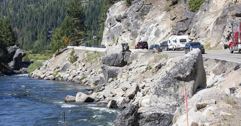
US 55 winding through canyon paralleling Little Goose Creek
We take a route that does not take us downtown, soon passing through the canyon of Little Goose Creek. The road through that canyon winds left and right down a narrow path so we go slow. After a few miles we are retracing our steps back to New Meadows.
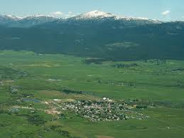
The village of New Meadows- the huge meadows in the background
At New Meadows we turn north on US95 toward Riggins. The meadows are huge and beautiful ringed by forested mountains. The meadows provides a lot of fodder for grazing animals and not just for the many cows that are raised here.


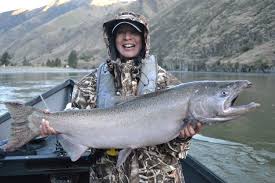
Having fun in Riggins Idaho!
After a short while we pass through the small communities of Pinehurst (1600 souls). Pollock (322 souls) lies on the Little Salmon River. We’ll follow the river for 10 miles until we reach Riggins (419 souls). Riggins, nestled deep in a canyon, is located at the confluence of the Little Salmon and Salmon Rivers. The town is known as the Whitewater Capitol of the World. Riggins is the most northwestern Idaho town in the Mountain Time Zone as Pacific Time Zone begins just outside of town. Ask me why….. I don’t know…….. The town has an annual rodeo and a two day music festival. Rafting, kayaking and fishing are very popular.
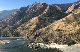

We enter the Salmon River Canyon he Salmon River Canyon, also known as the River of No Return. This area is a vast wilderness area, the largest in the 48 states. It is renowned for its deep canyon and whitewater rapids. It’s one of the deepest canyons on the continent, second only to the Snake River canyon. The canyon is over a mile deep for approximately 180 miles. The Salmon River Canyon is significantly deeper than the Grand Canyon with granite walls plunging 5000 feet deep in some areas. Interestingly, the Salmon River is the highway for the longest migration of Sockeye Salmon in North America terminating at Redfish Lake- Pacific Ocean to Redfish Lake is 900 miles with an elevation gain of 6250!

We have a long and steep climb out of the canyon at White Bird with an elevation gain of approximately 2700 feet over several miles.
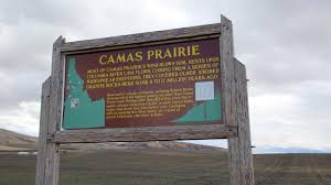
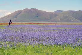
We summit at 4245 feet and head to the Camas Prairie, now the Nez Perce National Historical Park. Camas bulbs were a important food source for Native Americans, especially the Nez Perce.

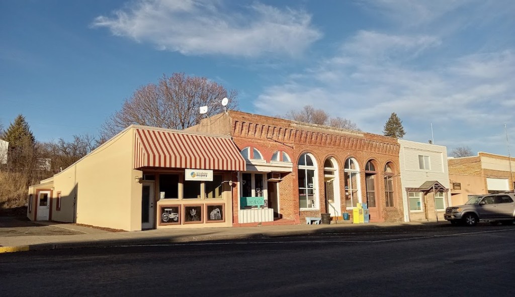
Downtown Grangeville, ID
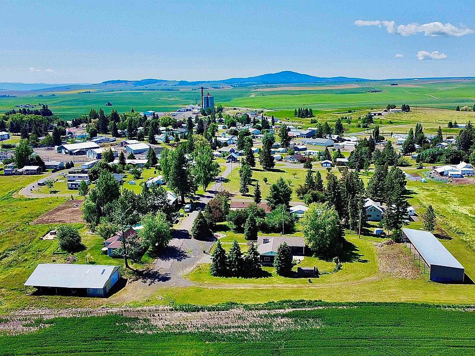
Ten miles north is Grangeville (3141), the largest city and seat of Idaho County. It is home to the state’s oldest rodeo as well as the world’s largest egg toss. Well, that’s what Wiki states. The Camas Prairie Railroad (known for its large trestles) was discontinued in 2000 as not profitable. The economy is driven by agriculture, forestry and a growing tourism sector.

Cleaver architecture for a dwelling, eh? Cottonwood ID
Still heading north on US95 we come to Cottonwood (822 souls). Cottonwood began in 1862 as a series of way station shelters for prospectors and mining suppliers on their way south. It was named for the dense growth of trees that formerly lined Cottonwood Creek.
Just up the road is Craigmont (501 souls), the first town on US95 that is within the Nez Perce Reservation. When the railroad came through the Native town of llo, named after llo Leggett, daughter of town founder and merchant W.O. Leggett it ignored the town. In 1904 the Camas Prairie Railroad bypassed the town and started a settlement on the northeast side of the tracks calling it Vollmer after the man that platted the townsite. llo responded by moving its community to the southwest side of the railroad tracks, adjacent to Vollmer. After a decade long feud and consolidation of school districts the communities merged in 1920 and became Craigmont.

The Nez Perce, pronounced in English is Nez Purse, were named by the French, Nez Perce meaning pierced nose. Ironically the Nez Perce did not pierce their noses as other tribes did. Their reservation today is 750,000 acres or 1171 square miles. Lapwi is headquarters. Ironically Tribal members only own 13% of the reservation. I have no idea why only 13%, I would have thought 100%. Tribe enrollment is 3500 souls.
Historically the tribe is nomadic hunting Buffalo on the plains and fishing for salmon at Celilo Falls on the Columbia River. They interacted with tribes from the Oregon and Washington coast, to Montana and down to the Great Basin of Nevada and Idaho. Of course, they would harvest camas bulbs on the Camas Prairie. Notice that the reservation doesn’t seem to include much of the Camas Prairie locate near Grangeville. The tribe bred Appaloosa Horses. Tribal co-responsibility is for many rivers and drainages. They fish on the Clearwater River.
The tribe’s first treaty with the U.S. government came in 1863. A lot of tribe members regarded it as the “Thief or Steal Treaty.” The Nez Perce War of 1877- began when Nez Perce and some allies refused to give up their ancestral lands and move to a reservation- all this in violation of the 1855 Treaty of Walla Walla which granted the tribe 7.5 million acres of their ancestral lands and the right to hunt and fish on lands ceded to the U.S. Government.
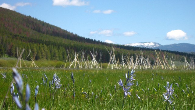
The treaty of 1883 didn’t treat them any better at it cut them off from horticulture sites and the source of camas bulbs on the Camas Prairie. Armed conflict ensued causing the Nez Perce to embark on an arduous trek north initially seeking help from the Crow Tribe- the Crows refused. They sought sanctuary with the Lakota led by Sitting Bull but Chief Joseph realized their only hope was to make a run to the Canadian border. The Nez Perce fought battles and skirmishes on a fighting retreat of 1170 miles. The war ended after a final 5 day battle at the base of Montana’s Bears Paw Mountains- 40 miles from the Canadian border. Chief Joseph then gave his famous speech- “I will fight no more forever”. The New York Times editorial discussed the conflict this way: “On our part, the war was in it origin and motive nothing short of a gigantic blunder and crime.”
We stop at a rest stop on the Rez- its a fast food restaurant and gas station with an area to park big rigs. Well, at least the locals are taking advantage of the parking by offering food and fuel and a tribe owned rest stop to enhance highway safety.

St. Joseph’s Mission, Culdesac ID
We bypass Culdesac (380 souls) as its not located on US95. It’s named from its location at the end of a railroad line, i.e. a cul de sac.
We pass through Sweetwater (143 souls). Next is Lapwai (1137 souls). It is the seat of government o f the Nez Perce Indian Reservation and site of the former Fort Lapwai. Lapwai, by the way, means butterfly. The city as well as others to the south including Cottonwood are served by the BG&CM Railroad, formerly known as the Camas Prairie Railroad.
Spalding is the site of the Nez Perce National Historic Park. This location has long been a place where the Nez Perce have lived and fished. Many changes took place here as the Indian Agency was moved to this location in 1861 remaining until 1904. When the agency moved out of town, Spalding shrank down to its last business, Watson’s General Merchandise Store, closing in 1964. The site of the mission was preserved by the state.

Then in 1965 Congress created what was known as Spalding Park- the headquarters and visitor center for the Nez Perce National Historical Park.
We cross the Clearwater River, paralleling it for a mile or two. Then, still on US 95, we leave the lowlands, heading north up into the hills.
Genesee business district
Genesee (955 souls) is off to our right. It’s know for its grain production. The 1981 movie Talent for the Game was filmed there.
Downtown Moscow Idaho
Our stop for a night or two is at the Latah County Fairgrounds. It has a few full hookups and maybe 10 partial hookups It offers boondocking (no hookups) for free. We are here to visit Mosow (25,435) souls(University of Idaho) and nearby Pullman WA (Washington State U.) Moscow is the seat of Latah County. Moscow, by the way, is pronounced MOSS-coe.
When we pull into the fairgrounds we are greeted with a surprise. We’ll get to that “surprise” in the next blog. Until then, stay safe out there!

Very cool. Can’t say as I would want to live inside a giant dog, even temporarily, but it is charming nonetheless.
LikeLike