
Thursday, August 27, 2020
Today we will continue on US 26 and head southeast. Just south of DEW-boiz and run smack dab into another road construction zone and are stopped by a flagger. The road has been reduced to one way traffic so we wait for oncoming traffic to clear and are once again on our way.
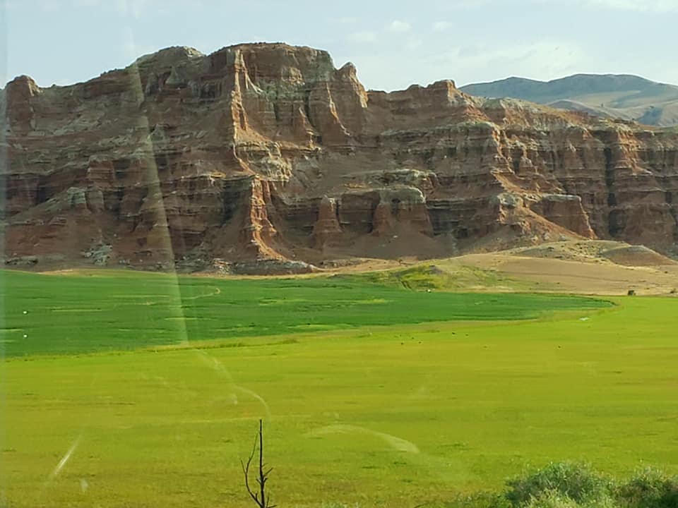

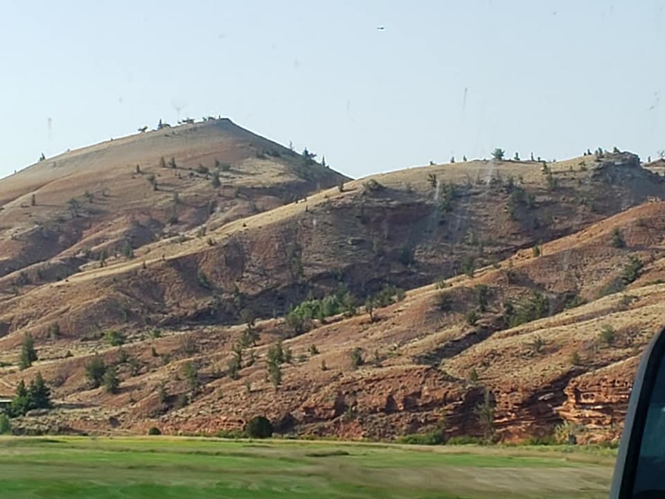

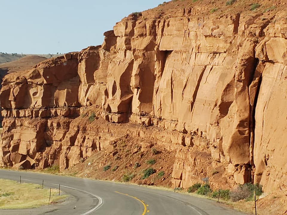
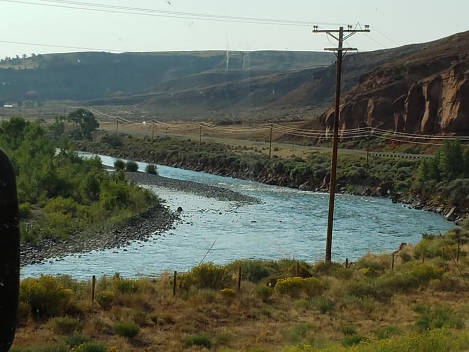
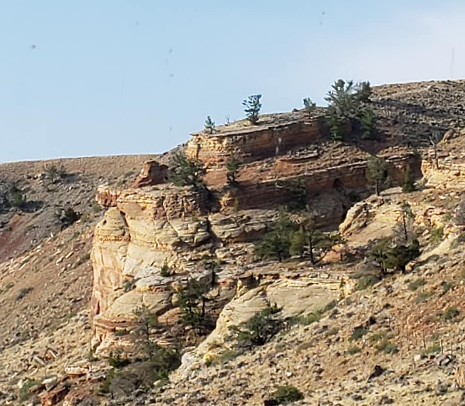
The scenery south of town is drop dead gorgeous. The Wind River has created a magnificent place indeed! We enjoy the green bottomland next to the river and the beautiful hills. Scenery like this just can’t be beat.


The only Indian reservation in Wyoming, the Wind River Indian Reservation was established with the Treaty of Fort Bridger in 1868. Originally home to the Eastern Shoshone Tribe, the Northern Arapaho Tribe was moved to the reservation in 1878 where they were welcomed by Chief Washakie of the Eastern Shoshone. A traditionally nomadic tribe for thousands of years, the Eastern Shoshone traveled throughout 16 states from central Wyoming to the west coast. Archealogical evidence reveals that the tribe called parts of Wyoming home for millenia. Today, both tribes share their cultures, history and traditions through oral storytelling, songs, dances and much more. The reservation encompasses 3,473 square miles of the Wind River Basin which makes it the seventh largest Indian reservation in the US by area. About 11,000 Native Americans still live on the reservation.
Crowheart (141 souls) is little more than a fueling station, a minimart and some ranchland but it has significance. Ever wonder how some of these places get their name? I do. This is how Crowheart got it’s name. Nearby Crowheart Butte was the site of a battle between the Crow and Shoshone tribes in 1866. According to legend (and Wikipedia), following a five-day battle for rights to the hunting grounds in the Wind River Range, Chief Washakie of the Shoshone and Chief Big Robber of the Crow agreed to a duel, with the winner gaining the rights to the Wind River hunting grounds. Chief Washakie eventually prevailed, but he was so impressed with the courage of his opponent, that rather than scalp him, he instead cut out his heart and placed it on the end of his lance. Could’a been called Big Robber Heart I guess………

Chief Washakie is the only Shoshone warrior to be honored by the US Government for leading General Crook’s army to defeat the Sioux after Custer’s defeat at the Little Big Horn. Fort Washakie is named in his honor. Speaking of Fort Washakie, Lewis and Clark’s Indian guide’s grave marker is there. It was thought that an old Native American woman who died in 1880 was Sacajawea since she was so knowledgable of the expedition. She never claimed the name of Sacajawea. William Clark had adopted Sacajawea’s two children in 1813. He made entries in his cashbook tracking the members of the Corps of Discovery between 1825 and 1828 and made the entry- Sacajawea dead. That would logically explain why he adopted her children. However, there are a lot of folks who swear that she is buried at Fort Washakie.
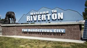


Riverton- 10,900 souls. Excerpt from Wikipedia- Largest city in Fremont County. It lies along the Bighorn River at the mouth of the Wind River. Founded as Wadsworth in 1906, it was renamed Riverton because of its location near the convergence of four rivers. Once part of the Wind River Indian Reservation- land ceded in 1905 by a Land Act of Congress in order to create city. That decision remained controversial. In 2014 the Department of Interior and the EPA declared the city on the reservation. The ruling stuck until the 10th Circuit Court of Appeals reversed EPA Boundary Ruling in 1917. Riverton is a shipping point for the Wind River basin, which is irrigated by the Riverton Reclamation Project. The city has livestock interests, uranium and sulfuric acid plants, and mills that produce railroad cross ties and fence posts. Oil and natural-gas fields are nearby. Riverton is home to Central Wyoming College (1966; two-year).
Shoshoni (650 souls) is east of Riverton. Excerpt from Wikipedia- Shoshoni has a continental arid desert climate and is, some years, the driest town in the entire Mountain Time Zone; occasionally it receives less than 4 inches of rainfall annually. Shoshoni’s closest body of water is Boysen Reservoir which is also the confluence of the Wind River, Badwater Creek and Poison Creek. As the water exits the dam it flows into the Wind River Canyon and joins the Big Horn River at the Wedding of the Waters at the canyon egress near Thermopolis. Since we are east of the Continental Divide rivers generally flow towards the east- the Wind flows southeast, the makes a U-turn to join the Bighorn which flows north to the Yellowstone River.
Hiland had a post office but it has since closed as the population dwindled to ten souls. We looked for those folks as we passed through but saw no one. Powder River’s population is more than four times larger than that of Hiland- at 44 souls with population density of 7 souls per square mile…… it’s post office is open.
So as the title of this post goes here’s a list of named places complete with road signs and identified on Google Maps that we passed that have no census, meaning no one from the US government or its agent has been there to count people who live there. We went by these small communities, Burris, Willow Creek, Morton, Moneta, and Natrona- the name of this county, the seat being Casper. According to the “Census” no one lives there or no one representing the US Government has been there to take a census.
Natrona- no census. Wyoming legislature named the county for the large deposits of natron a naturally occurring mineral that has been used as a detergent, for cleaning teeth, as an insecticide, bleach for clothing and processing leather and preserving meat. The ancient Egyptians used it extensively as a drying agent, in pottery making and producing glass.
A few miles down the road we pull into our campground for three nights the Fort Caspar Campground. Like many campgrounds advertised on the internet, photos of this campground don’t really reflect reality, maybe because they were taken in the spring when all the grounds are green. We expected the RV sites to be gravel but sorta expected the park right next door to look like a park, not a vacant lot. The native grass is tall and dry, the ponds are algae infested and access to the North Platte River isn’t good. So our hopes of letting Megan and Ollie go dunking have been dashed. We’ll just have to find another way to entertain them.
Until next time, Adios!
