Sunday, August 16, 2020


We were up by sunrise- the mountains and hills had disappeared. I still don’t know if it was dust that was kicked up by the wind or smoke from a wildfire. It just hung in the air without a whisper of wind blowing. We left Winnemucca first thing Thursday morning. We drove for mile and mile, OK, maybe three miles before we reached US 95 near the center of Winnemucca.


We saw the city park that we’ve stopped at a few times before and looked at each other. Why not? So we walked the dogs around the park- sniff, sniff, sniff, sniff. At that time of morning we didn’t have to share it with anyone. Everyone was satisfied and once again we were on our way.
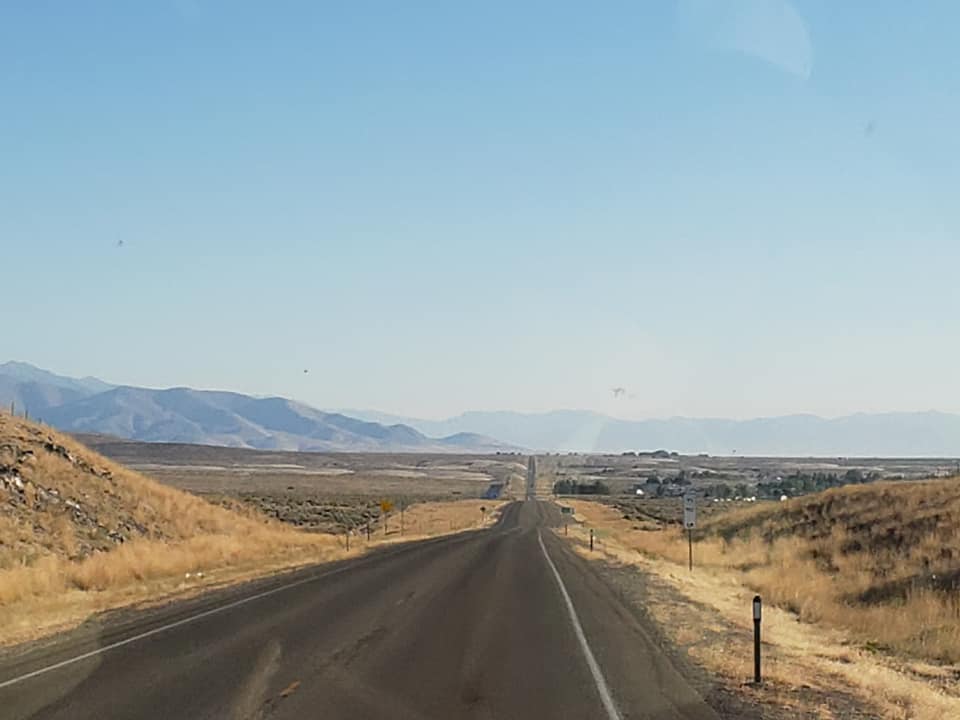
We first drove through farm county, then the wide open spaces. If you are familiar with Nevada’s topography you know that the state is quite mountainous with ranges following a north/south pattern. In fact there are 35 peaks over 10,000 feet. So the north-south routes invariably follow valleys and canyons. So that’s what US 95 does. It’s interesting that some of the ranges that we pass are designated as “hills” which have peaks over 8,000 feet.
I don’t believe that US 50, “the loneliest road in the U.S.” has much on this portion of US 95. We travel for miles with only a fueling station and a few small ranches scattered about until mile 73 when we reach McDermitt (500 souls). 75% of the residents are Native Americans, Northern Paiutes of the Fort McDermitt Indian Reservation . There’s not many businesses open in McDermitt except a small casino and a gas station. Just beyond McDermitt is the Oregon border.
Excerpt from Wikipedia- “The community, originally called Dugout, was named after Fort McDermit. It was named after Lt. Col. Charles McDermit,[5][6] commander of the Military District of Nevada, who was killed by Indians in a skirmish in the area in 1865.[7] It is not known why there is a discrepancy in the spelling.[5]Fort McDermit, which was five miles (8.0 km) outside the current township, was originally established to protect the stagecoach route from Virginia City through Winnemucca to Silver City, Idaho Territory. The stage road was the military’s most important transportation route in southeast Oregon.[8] The township of Dugout was established as support for Fort McDermit.[2]“

Not far past the intersection of Highway 78 and US 95 (Burns Junction) the highway drops down into a place called Rome (170 souls), or Rome Station after its business, named by a geologist for the nearby Pillars of Rome cliff formation. Rome consists of a small RV park, a gas station and a restaurant that is supposed to have food to die for. The complex is located next to the Owyhee River (pronunciation similar to Hawaii) where there is a boat launch area for rafts, canoes and kayaks.

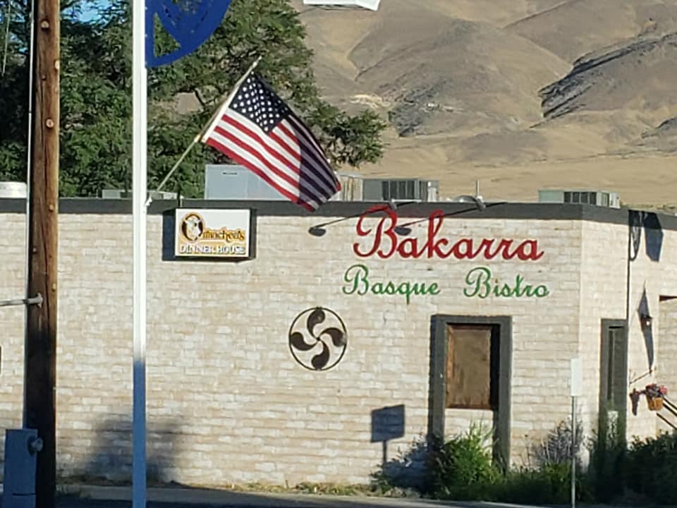
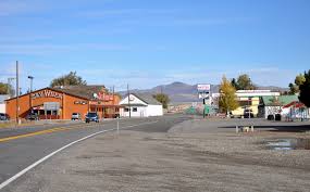
We travel mile after mile through what seems to be endless sagebrush country until we reached Jordan Valley. The 2010 census for Jordan Valley is 173 souls but seems to be a much more vibrant town than McDermitt. At least there’s a gas station, market, laundromat, a garage and a high school. The town was named after one of the early gold prospectors who camped in the area in 1863. Amongst the early miners was Jean Baptiste Charbonneau, the son of Sacagawea, the guide and interpreter of the Lewis and Clark expedition. As gold played out cattle ranching became king by 1888 there was an estimated 100,000 head of cattle in the area. Many Basque immigrants came to the valley around 1889 and before long comprised 2/3rd’s of the population of town. A pelota court (Pelota Fronton) that was built in 1915 still stands as a historic landmark. Today cattle is still king in the Jordan Valley.

We climb over the hill and head down into the Treasure Valley of Idaho- our third state of the day. Historically the Treasure Valley encompasses only a portion of the Snake River Valley. Treasure Valley was coined by realtors and it stuck. We drive through miles of beautiful green farmland with corn, alfalfa and other crops abound.


We find our way to our Caldwell ID (46,000 souls) destination after a little hiccup- the road we were to take to the other side of Interstate 84 was closed for construction. Sigh. That can be a pretty big problem with big rigs. Do I have to unhitch the toad and do a 50 point turn around? Can I find another escape route that is compatible with big rig life? I this case we found an escape route through a residential neighborhood and arrived at the Ambassador RV Resort unscathed….. except the road the RV Park is located on is under construction and mud is splashed everywhere on the Beast. Oh, well, the Motorhome needs a bath anyhow…..


So enjoy your travel blog. You include interesting facts about the areas and are a skillful writer. Have you ever thought about writing a book?
LikeLike