Friday, August 21, 2020

Rob came by this morning to chat and say Adios. It was good visiting with he and Kathy once again. We pack up, pick up, jacks up, hook up and walk the furry ones- we are off.


Miss RV Smartypants sends us down US 55 towards Boise. It’s a beautiful drive first through the pastureland of Long Valley, then careening down the twisty Payette River Canyon. The canyon is very narrow in places with rocky slopes diving steeply into the river. Maybe the title of this blog would be more appropriately entitled “Negotiating The Payette River Canyon” but how dramatic would that be?

Eventually the canyon opens into a valley. We climb out of the valley and down into the much larger Snake River Valley, a.k.a Treasure Valley. The population of Ada County is almost 500,000 souls, most are in and around Boise. Boise itself has 234,000 of that total. We first arrive in Eagle, then travel through Garden City on our way to the interstate.
Our Garmin, Miss RV Smartypants is new to us. It’s set up so it will select routes that will handle an RV considering it’s length, weight, height. I’ve not come to trust it 100% as of yet. Only time will tell. Well, time told not too long after arriving in Boise. It helps us negotiate through a maze of streets and heavy traffic. We eventually want to head east on I-84. As we approach Miss RV Smartypants says to go straight towards I-84 West, Jil’s smartpants smart phone concurs. BUT the street sign indicates I-84 East is to the left.
I make a command decision. Left it is towards I-84 East. Those GPS’s have been known to be wrong. The direction is validated with yet another I84 sign and then another. What can go wrong? You can see it coming, can’t you. Well, what went wrong is we wind up on surface streets in busy Downtown Boise! Sheesh! It turned out OK as it was a one way street and three lanes wide. We turn right on Broadway to escape humanity. Total travel is at least 15 miles on surface streets through a big city……….. Oh, and only one traffic problem encountered. A guy in the far left lane decides he is going to turn right at an intersection from the far left lane, then proceeds to stop traffic as he forges his way past our big rig and another vehicle that could just as well have T-boned him.
I wanted to see what went wrong following that I-84 East sign so I went back into Google Maps. Aha! The sign indicating I-84 East was actually indicating the 184 East. And the Smartypants Garmin and Smartypants Cell phones were correct. Maybe, just maybe I’ll trust Miss RV Garmin Smartypants a little more now.
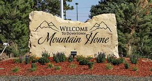
We found Interstate 84 East and travel that direction passing through many miles of sage covered flat, arid country. One would never know that not far to the south is the mighty Snake River. It hides in it’s own canyon that it has carved for itself over a God knows how many millennium. The interstate bypasses a few farm towns, the largest being Mountain Home. And, as you will see it’s not just a farming community. A large area in proximity to town now has irrigated farmland peaking through the sage.

Excerpt from Wikipedia: “Mountain Home is the largest city and county seat of Elmore County, Idaho, United States.[5] The population was 14,206 in the 2010 census. Mountain Home was originally a post office at Rattlesnake Station, a stagecoach stop on the Overland Stage Line, about seven miles (11 km) east of the city, on present-day US-20 towards Fairfield. With the addition of the Oregon Short Line Railroad in 1883, the post office was moved downhill and west to the city’s present site.[6][7].
Mountain Home Air Force Base, an Air Combat Command installation, is located 12 miles (20 km) southwest of the city. Opened in 1943 during World War II, the base was originally a bomber training base and later an operational Strategic Air Command bomber and missile base (1953–65). It switched to Tactical Air Command and fighters in January 1966; TAC was succeeded by ACC in 1992.”

We continue on to our destination for three nights, the historic Three Island Crossing State Park. We didn’t travel far today, 182 miles. About a hundred of that was mountain driving on US 55, 20 through downtown Boise and the balance on Interstate 84.
Until next time- Adios!
