Casper the City, not the Ghost!

Saturday, August29, 2020

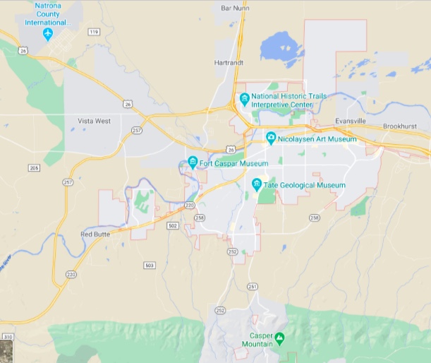
Sunrise in Casper WY

Before I get started with today’s blog I’d like to backtrack a little. We had seen signs on US 26 stating “Sand Creek Massacre Trail” and I had forgotten to mention it. The Massacre involved Arapaho and Cheyenne Indians who had been fighting the US government for quite some time. They had grown weary of battle, had ceded their land and agreed to move to reservations.

But on the morning of November 29, 1864 about 500 mostly women, children and elderly Arapaho and Cheyenne were waking from sleep of the banks of the Big Sandy Creek in Colorado Territory. Assured of peace, the tribes’ men were away finding meat. 800 volunteer troops from Colorado and New Mexico under the command of Col. John Chivington descended on the village slaughtering between 150 and 184. Accounts note extreme brutality by the soldiers.

Newspapers initially reported a valiant victory by Chivington and his men. The true story, when it came out, made even bigger headlines and shocked the nation. Neither Chivington nor his troops were punished. How atrocious is that? The 600 mile long Sand Creek Massacre Trail commemorates the route the surviving Arapaho took to their new home, the Wind River Reservation.

Most of the following was borrowed from Wyoming History.com. Sure saved me hours of research and a couple of worn out pencil erasers!

Located at 5,150 feet above sea level, on the banks of the North Platt on Wyoming’s high plains, Casper is the seat of Natrona County. The town began when the tracks of the Fremont, Elkhorn & Missouri Valley Railroad arrived in June 1888, and was named for nearby Fort Casper, by then a ruin. The fort had been named for Lt. Caspar Collins, killed near the fort by Indians in 1865. The Army misspelled his first name when they renamed Platte Bridge Station not long after his death.

Soon after the railroad arrived the town became an important shipping point for cattle and wool. On April 9, 1889, residents asked the officials of Carbon County to allow the incorporation of the town of Casper and the request was approved. Natrona County would not split off from Carbon County until the following year.

One can imagine that Casper was a pretty rowdy town in the early years. The west side of Center Street had numerous saloons and the raucous culture that went with them. By 1890 the city fathers began plans to bring water, streets, schools, a fire department and a library to the town as well as moving the city government into its first two story brick building on Center Street.

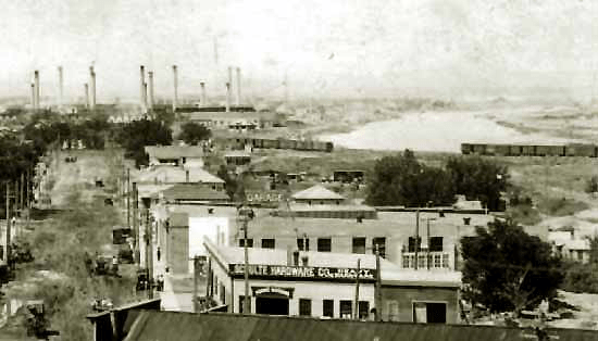
In Casper’s first two decades, most of its wealth still came from agriculture, primarily from sheep and cattle ranching. The most successful ranchers built fine houses in what is still called the Mansion District, south of downtown. The first electric lights from the Casper Electric Company were lighted in 1912 and telephone service began in 1900 with 49 telephones installed by Rocky Mountain Bell Telephone. The first hospital opened in 1911.

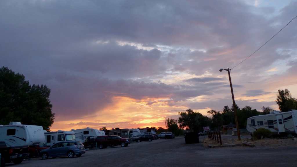
Casper grew to the status of an industrial city when the Salt Creek Oil Field began producing and several refineries were established, the first being the Pennsylvania Oil and Gas Company of 1895.

Casper boomed with the oil and refining businesses when the population grew from 2639 souls to 16,619 between 1910 and 1930. The Great Depression took its toll and the city survived. It was when WWII broke out that its economy started to improve. The biggest boost was the construction of the Casper Army Air Field west of town where more than 400 buildings were built in three and a half months providing work for hundreds. The Army Air Corps trained 16,000 soldiers at the field, mostly bomber crews and pilots before it closed in 1945.

The economy rose and fell through the remaining decades as did the population. The local oil business waned but the coal-bed methane boom in northeastern Wyoming of the 1990’s revitalized Casper’s drilling services. Slowly, the population began to grow again, to 49,654 by 2000, and 55,316 by 2010.

Casper continues as a retail, medical and energy-industry service hub for the surrounding region and for much of Wyoming, and has continued to grow and diversify in the 21st century. Interstate 25 and the Casper/Natrona County International Airport are the town’s major connections to the outside world. Aaand Casper has the only international airport in Wyoming. Even the state capitol, Cheyenne, is void of an international airport. That airport and Interstate 25 are the city’s major connections to the outside world.

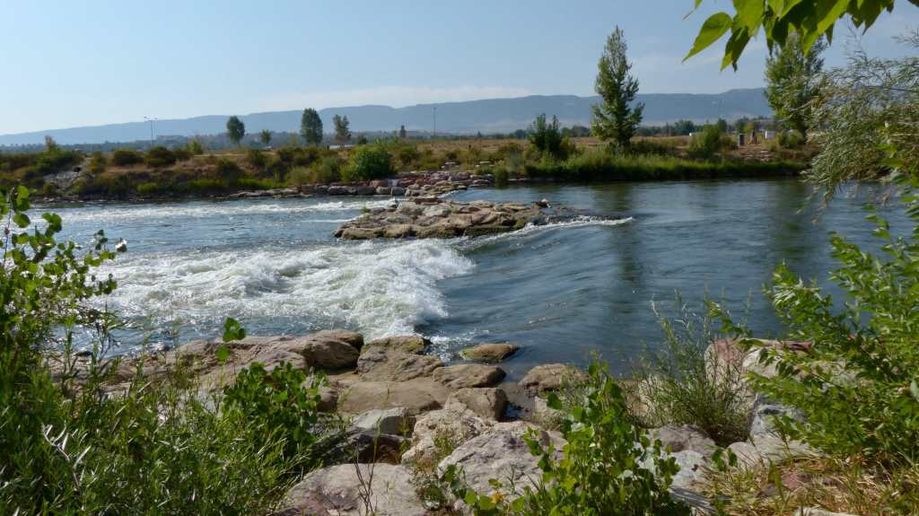
The city has many nice parks along the Platte River, some great sports fields, walks and bike paths also follow the banks of the river. There are several golf courses if one wishes to imbibe. We drove the mansion district and were in awe of the beautiful homes located on wide, tree lined avenues.

Replica of Fort Caspar
Centennial Park, town of Fort Caspar

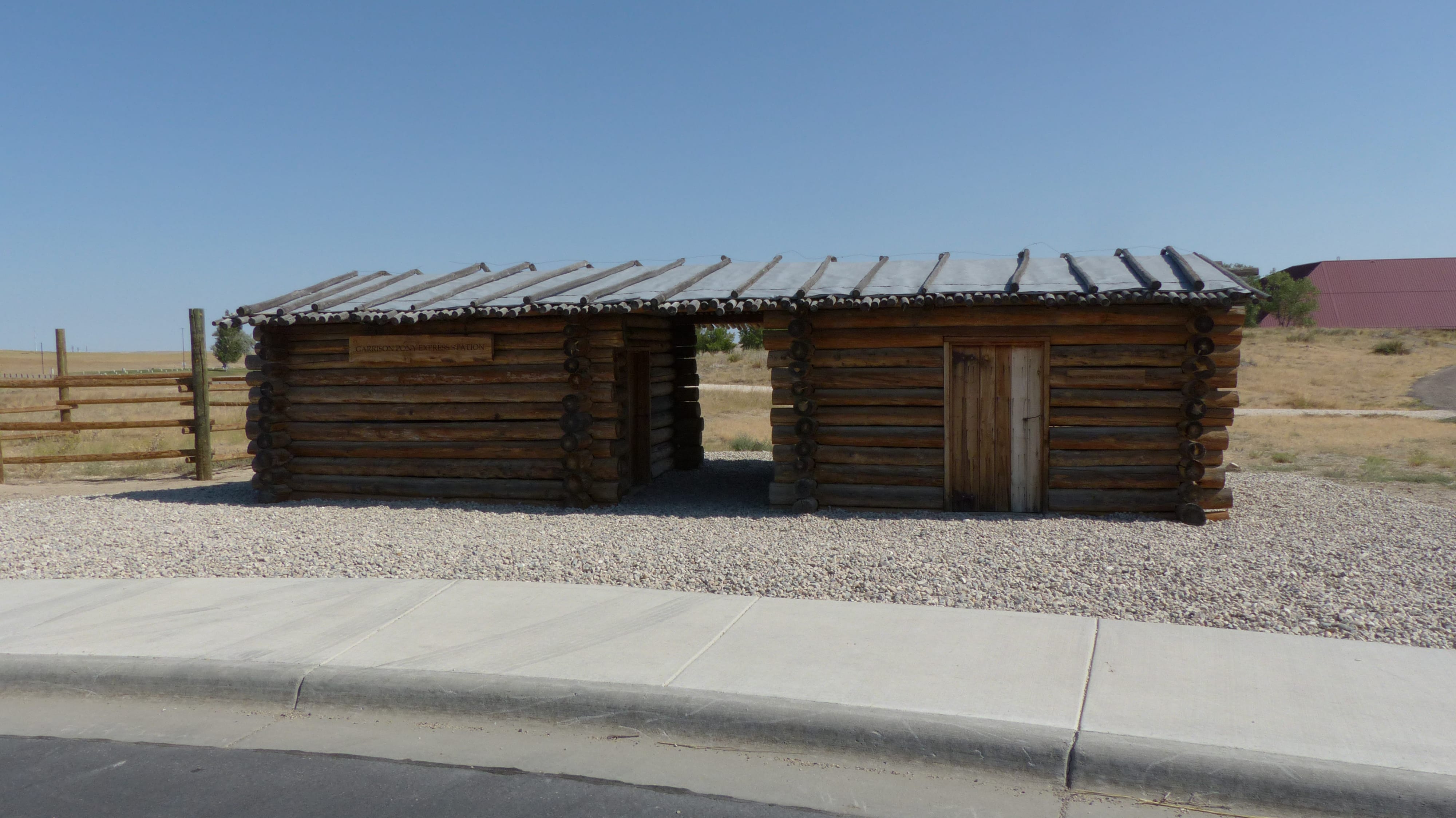
Our campground is located right next to Centennial Park. Within the park is the Ft. Caspar Museum. We didn’t go inside the museum. Just on the other side of a split rail fence are historical log cabins set up much like the layout of old Ft. Casper. The old fort is gone, as it fell into disrepair and returned to nature.

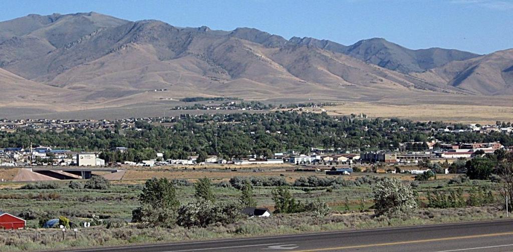
The Mansion District just south of downtown

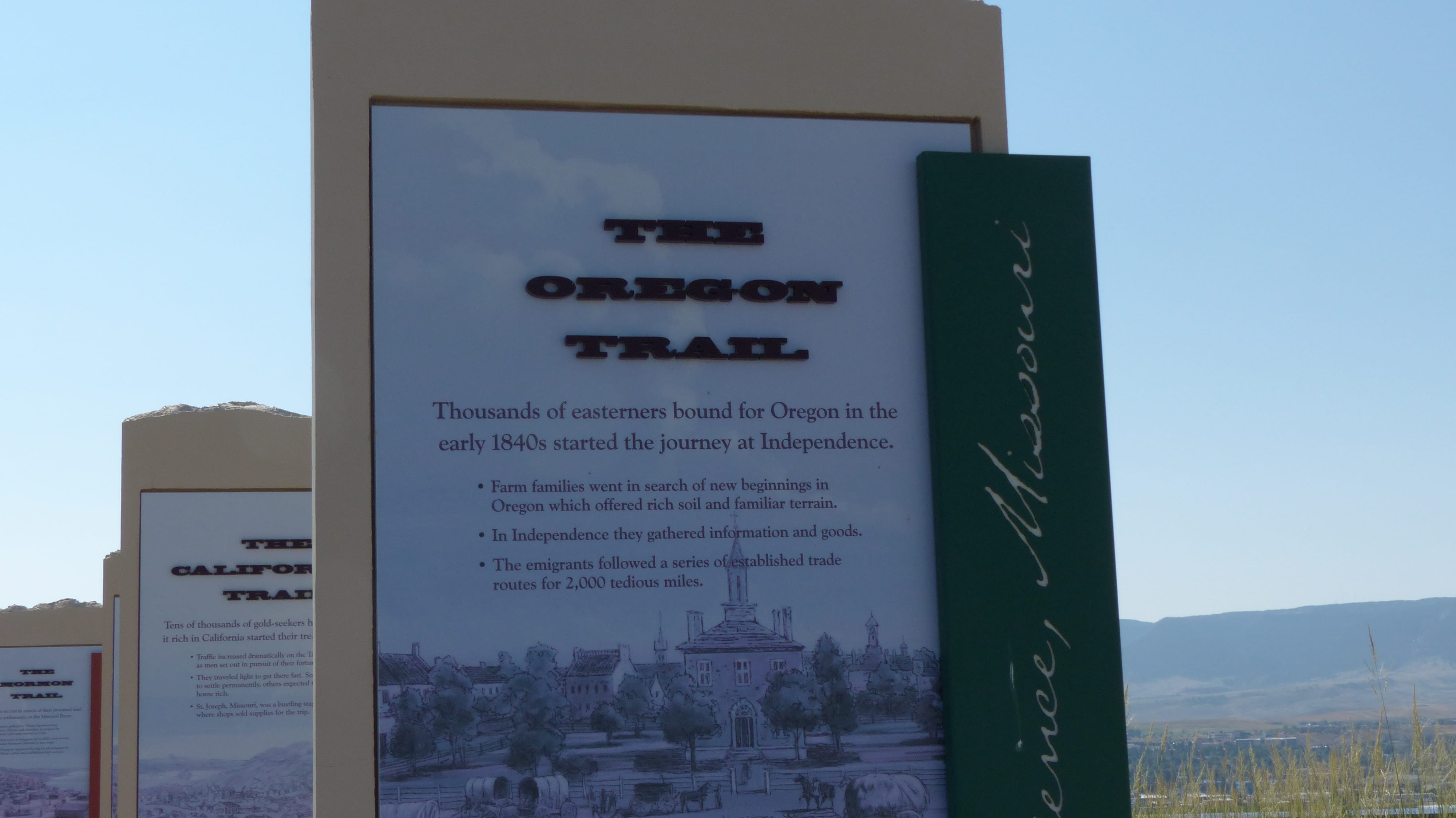
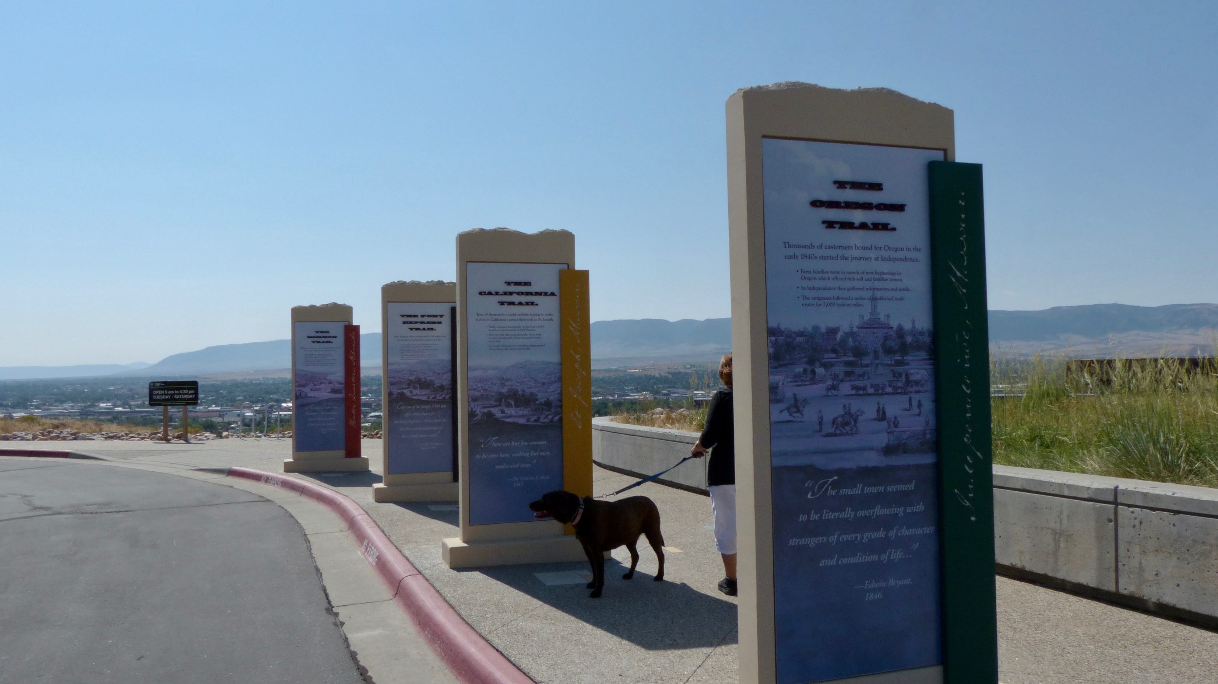
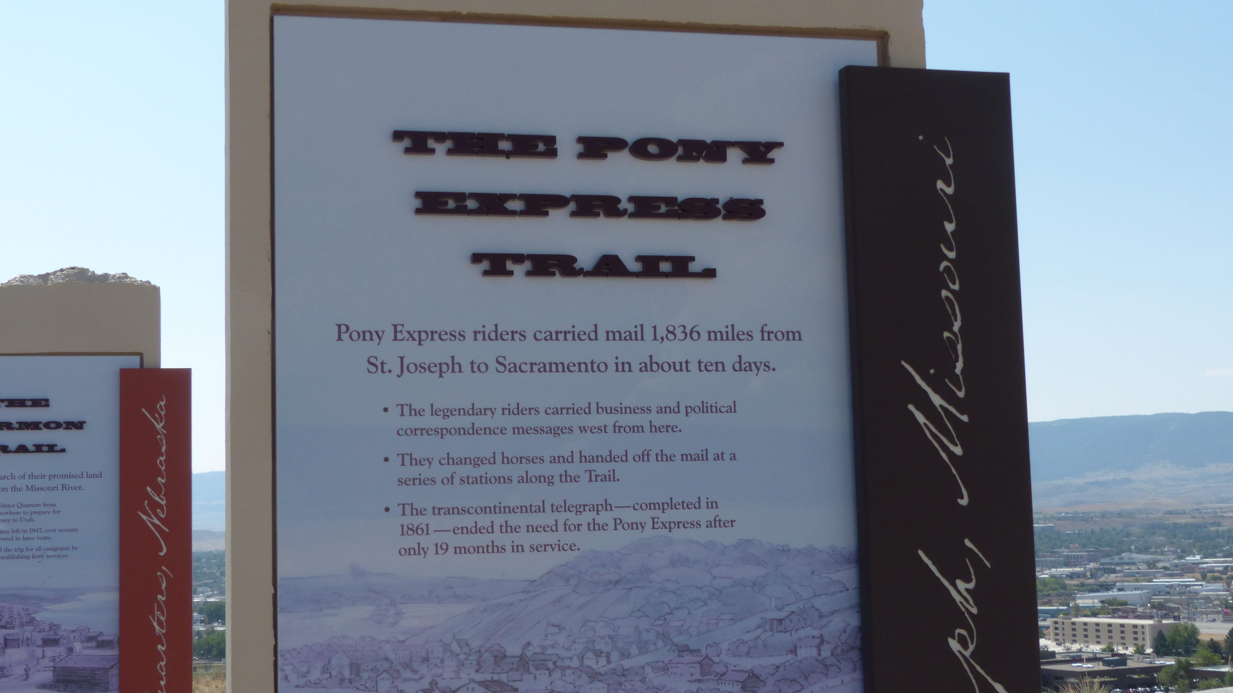
Grounds of the National Historic Trails Interpretive Center

At first we felt our stay may be one day too long. We couldn’t visit the Interpretive Center yesterday as we didn’t want to leave the dogs in the RV and it was too hot to leave them in the car. And I’m sure the Ft. Caspar Museum is a fine one- we just weren’t interested in visiting this time.

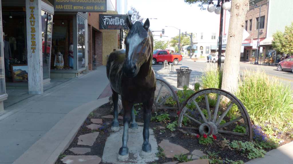
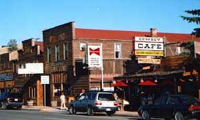
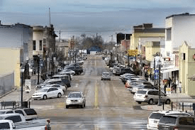
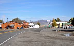
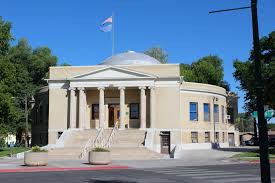
Casper Business District

All in all we spent as much time looking around Casper as we wished to, walking around downtown, even found a Walmart this morning during a lightning storm (Megan is afraid of the kabooms) and drove the very fine Mansion District. We also walked a ways at Amoco Park which lies on the northern bank of the Platte.

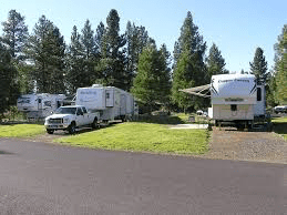
The Ft. Caspar Campground is packed. When we drove in on Thursday there must have been at least two vehicles, mostly pickup trucks, sitting in front of every RV. Hmmm. Worker bees. Our experience says that the camp should be quiet and that proved to be true. The working stiffs are gone during the day, are tired, thus quiet, when they return. There are a few families who appear to have been here quite a while. Not the most beautiful camp but doable.

Tomorrow we head out to Custer, South Dakota. We’ve visited Custer many moons ago and we are looking forward to refreshing our memories. We also have friends that now own a summer home just outside of Custer. It will be great visiting with Tim and Renee once again.

See you in Custer!

For all you Longmire series fans- A bumper sticker………..

Heading To Casper- Passing Through Places with Names But No People

Thursday, August 27, 2020

Today we will continue on US 26 and head southeast. Just south of DEW-boiz and run smack dab into another road construction zone and are stopped by a flagger. The road has been reduced to one way traffic so we wait for oncoming traffic to clear and are once again on our way.

The scenery south of town is drop dead gorgeous. The Wind River has created a magnificent place indeed! We enjoy the green bottomland next to the river and the beautiful hills. Scenery like this just can’t be beat.

The only Indian reservation in Wyoming, the Wind River Indian Reservation was established with the Treaty of Fort Bridger in 1868. Originally home to the Eastern Shoshone Tribe, the Northern Arapaho Tribe was moved to the reservation in 1878 where they were welcomed by Chief Washakie of the Eastern Shoshone. A traditionally nomadic tribe for thousands of years, the Eastern Shoshone traveled throughout 16 states from central Wyoming to the west coast. Archealogical evidence reveals that the tribe called parts of Wyoming home for millenia. Today, both tribes share their cultures, history and traditions through oral storytelling, songs, dances and much more. The reservation encompasses 3,473 square miles of the Wind River Basin which makes it the seventh largest Indian reservation in the US by area. About 11,000 Native Americans still live on the reservation.

Crowheart (141 souls) is little more than a fueling station, a minimart and some ranchland but it has significance. Ever wonder how some of these places get their name? I do. This is how Crowheart got it’s name. Nearby Crowheart Butte was the site of a battle between the Crow and Shoshone tribes in 1866. According to legend (and Wikipedia), following a five-day battle for rights to the hunting grounds in the Wind River RangeChief Washakie of the Shoshone and Chief Big Robber of the Crow agreed to a duel, with the winner gaining the rights to the Wind River hunting grounds. Chief Washakie eventually prevailed, but he was so impressed with the courage of his opponent, that rather than scalp him, he instead cut out his heart and placed it on the end of his lance. Could’a been called Big Robber Heart I guess………

Chief Washakie is the only Shoshone warrior to be honored by the US Government for leading General Crook’s army to defeat the Sioux after Custer’s defeat at the Little Big Horn. Fort Washakie is named in his honor. Speaking of Fort Washakie, Lewis and Clark’s Indian guide’s grave marker is there. It was thought that an old Native American woman who died in 1880 was Sacajawea since she was so knowledgable of the expedition. She never claimed the name of Sacajawea. William Clark had adopted Sacajawea’s two children in 1813. He made entries in his cashbook tracking the members of the Corps of Discovery between 1825 and 1828 and made the entry- Sacajawea dead. That would logically explain why he adopted her children. However, there are a lot of folks who swear that she is buried at Fort Washakie.

Riverton- 10,900 souls. Excerpt from Wikipedia- Largest city in Fremont County. It lies along the Bighorn River at the mouth of the Wind River. Founded as Wadsworth in 1906, it was renamed Riverton because of its location near the convergence of four rivers. Once part of the Wind River Indian Reservation- land ceded in 1905 by a Land Act of Congress in order to create city. That decision remained controversial. In 2014 the Department of Interior and the EPA declared the city on the reservation. The ruling stuck until the 10th Circuit Court of Appeals reversed EPA Boundary Ruling in 1917. Riverton is a shipping point for the Wind River basin, which is irrigated by the Riverton Reclamation Project. The city has livestock interests, uranium and sulfuric acid plants, and mills that produce railroad cross ties and fence posts. Oil and natural-gas fields are nearby. Riverton is home to Central Wyoming College (1966; two-year).

Shoshoni (650 souls) is east of Riverton. Excerpt from Wikipedia- Shoshoni has a continental arid desert climate and is, some years, the driest town in the entire Mountain Time Zone; occasionally it receives less than 4 inches of rainfall annually. Shoshoni’s closest body of water is Boysen Reservoir which is also the confluence of the Wind River, Badwater Creek and Poison Creek. As the water exits the dam it flows into the Wind River Canyon and joins the Big Horn River at the Wedding of the Waters at the canyon egress near Thermopolis. Since we are east of the Continental Divide rivers generally flow towards the east- the Wind flows southeast, the makes a U-turn to join the Bighorn which flows north to the Yellowstone River.

Hiland had a post office but it has since closed as the population dwindled to ten souls. We looked for those folks as we passed through but saw no one. Powder River’s population is more than four times larger than that of Hiland- at 44 souls with population density of 7 souls per square mile…… it’s post office is open.

So as the title of this post goes here’s a list of named places complete with road signs and identified on Google Maps that we passed that have no census, meaning no one from the US government or its agent has been there to count people who live there. We went by these small communities, Burris, Willow Creek, Morton, Moneta, and Natrona- the name of this county, the seat being Casper. According to the “Census” no one lives there or no one representing the US Government has been there to take a census.

Natrona- no census. Wyoming legislature named the county for the large deposits of natron a naturally occurring mineral that has been used as a detergent, for cleaning teeth, as an insecticide, bleach for clothing and processing leather and preserving meat. The ancient Egyptians used it extensively as a drying agent, in pottery making and producing glass.

A few miles down the road we pull into our campground for three nights the Fort Caspar Campground. Like many campgrounds advertised on the internet, photos of this campground don’t really reflect reality, maybe because they were taken in the spring when all the grounds are green. We expected the RV sites to be gravel but sorta expected the park right next door to look like a park, not a vacant lot. The native grass is tall and dry, the ponds are algae infested and access to the North Platte River isn’t good. So our hopes of letting Megan and Ollie go dunking have been dashed. We’ll just have to find another way to entertain them.

Until next time, Adios!

From Ririe, Through Jackson, then on to Dubois for a Couple of Nights

Wednesday, August 26, 2020

We start the day as usual- get up (duh), walk the dogs, feed the dogs, feed ourselves. We are in no hurry- we break camp and are on the road at 0830 hours instead of 0800. We are die hard early morning people- what can I say?

We head east on US 26 passing the villages of Swan Valley (204 souls), Irwin (219), and Palisades (no census). Swan Valley, Irwin and Palisades comprise the scenic communities that nestle the banks of the South Fork of the Snake River, one of the best dry-fly fisheries in North America.

The valley is part of the Yellowstone ecosystem which is home to the largest elk and Rocky Mountain big horn sheep herds in the country as well as numerous white tail and mule deer, moose, bear, mountain lions and some mountain goats. Swans, sand cranes and many other species of birds.

Early morning at Palisades Lake

The west end of the valley is mostly farmland . As we head towards Palisades Lake the valley narrows and soon we are traveling on the slopes that parallel the shoreline of the lake. It’s beautiful but still a bit smokey.

The dogs need to stretch, we see campers out in a large meadow and vault toilets. The road looks paved from our perspective- and it is for all of ten feet. The rig’s tire falls into a large pothole and everybody and everything inside the coach rocks! The refer flies open but nothing falls out. The dogs enjoy the walk and we are able to advance a hundred yards to wide spot in the road and extricate ourselves by retracing our path, avoiding that big hole in the gravel road.

On our way to Jackson and nearby Grand Teton National Park

US 26 and US 89 combine at Alpine Junction. The road follows the Snake River through mountain passes and canyons ejecting into the Jackson Hole Valley just south of Jackson Wyoming. Jackson (9580 souls) is the seat of Teton County. I seems to grow every time we come through this city- up 900 folks since the last census. Winter draws are three ski resorts and nearby Grand Teton and Yellowstone National Parks which draw two million visitors a year. The National Elk Refuge borders the north side of town and the National Museum of Wildlife Art lies just out of downtown.

We stop at the visitors center- closed! However there is a nice grassy park next to it. Jil goes one way with Megan, I go another with Ollie. We passed a sign stating “No Pets” back at the center’s elk viewing stand. We’re not interested in climbing to the viewing stand and keep walking in the grass. Ollie does his business, I pick it up. Megan pees one hundred feet away. I dump the doggie bag in the trash, see a park employee stop in the parking lot a few feet away. I say hello and commence to read three signs facing the parking lot. One says No Pets. Oops. I am then chastised by the park employee. I apologized and told him we had walked in from that-away and there were no signs the way we entered the park. Ollie and I were on the sidewalk by then- and then he spots Megan taking a leak. He runs over towards Jil yelling “You dog pooped! You have to pick it up! You can’t have a dog in the park!”. Jil replies- “She did not poop!” The employee is emphatic- “I saw brown!” Jil- “That was her tail……” We left as the employee searched the area diligently for the nonexistent poop pile……..

We left passing by the Elk Refuge. The elk are still in high country browsing fresh greens so we didn’t see any of the magnificent animals. Five miles down the road we pass the Grand Tetons. There’s still a lot of smoke in the air- we don’t take any photos and we don’t enter the park loop road at Moose Junction choosing to stay on what is now US 191.

Boy, there’s a lot of folks out enjoying this beautiful country! The Park service did it right and provides a lot of large parking/viewing areas. Most are full of vehicles so we don’t stop. The view is obscured by smoke anyhow so what’s the point? We’ve seen the Tetons when the air was crystal clear.

Four of the fifty in the herd

A few miles down the road traffic comes to a crawl. There is not viewing area so people are parked half on and half off the road. A buffalo herd (they are magnificent animals) is grazing a couple of hundred feet to our right. Many of my fellow humans decide to block the road, get out of their vehicles with some approaching much too closely on foot towards the 2000 pound animals. Some who are very intent on shooting that “Kodak Moment” photo actually walk backwards out into traffic without looking! I had to give a guy a big, loud air horn blast to let him know he was in imminent danger of being squashed by our 30,000 pound RV! Geez! He was almost a victim of natural selection!

After the Beefalo, er, Buffalo Jam we turn right again joining US 26 and head the 48 miles to Dubois. We cross the small Buffalo River and head into the mountains. The air is much more clear and fresh smelling as we climb, climb, climb, cresting at Togwotee Pass, summiting at 9655′. Sheesh we’ve been up and down so many grades there was no telling the elevation. Hmm, I found an elevation setting on Miss Garmin RV GPS- elevation- imagine that!- and it was dead on.

Now we are on the downhill slide. We pass some beautiful ragged mountain peaks, wonderful meadows, and before you know it we are down in hilly, dry sagebrush country at just under 7000′. Just before coming into Dubois we pass what appear to be painted hills. Hues of burnt umber and earthtones run horizontally through the hillsides- just lovely.

Dubois (968 souls) isn’t pronounced the French way, Dewb-wah, it’s pronounced the Wyoming way, DEW-boyz. Who knew? The original residents wanted to name the town Never Sweat but the postal service found that name unacceptable, so it named the town after Fred Dubois, an Idaho Senator. The locals protested by rejecting the French pronunciation- thus DEW-boyz, heavy accent on the DEW…………

Dubois lies within the Wind River Valley- a very historical place. The Sheepeater band of Mountain Shoshone used to frequent the area. Many petroglyphs adorn rock faces as well as hunting traps and blinds and stone teepee circles. Homesteaders arrived in the late 1870’s. Butch Cassidy owned and managed a ranch on the outskirts of town in 1890. In 1913 the town expanded with the addition of a hotel, bar, and general store in anticipation of the arrival of Scandinavian lumber workers. I believe all of these structures are still standing.

Attractions in town, besides the old buildings are the Dubois Museum and the National Bighorn Sheep Interpretive Center. The sheep are seen in certain areas near the town, albeit not too frequently now as most haven’t come down from the mountains to their winter grazing areas. We chose not to travel 16 miles round trip on a gravel road in hopes of seeing one.

However one can mount a “real” stuffed giant jackalope or enter the alleged Butch Cassidy hideout, a mine, right here in the middle of town.

So what we did was spend a relaxing couple of days in town, spent time checking out the town and walking the river path several times with the Mutzos. We parked at the Dubois Campgrounds. It’s a funky place. The owners decided to make some extra cash and put an RV park on their property. The layout is OK, the grounds are pretty nice, the owners and their employees super nice, and the Wind River runs through it.

Ollie- Always diligent

More next time.

Where the Heck is Ririe?

Tuesday, August 25, 2020

Welp folks, we picked the Juniper Campground to rest our weary heads for a couple of nights. The farm town of Ririe (674 souls) is about 21 miles northeast of Idaho Falls (61,000 souls) and Juniper Campground is on the shores of Ririe Reservoir about six miles from town. It sounded like a nice place. It’s right on a big body of water which our Lab loves, there’s mowed grass at the campsites, it offers full hookups and is reasonable in price. Aaand sites are available- site availability has been problem we’ve encountered the entire trip.

We head out of Three Island State Park, through Glenn Ferry and head east on I-84. We haven’t been through Craters of the Moon National Monument for a zillion years. At Hagerman (884 souls) we join US 26 and head northeast through, you guessed it, farmland. The first town we come to is Shoshone (1400 souls), seat of Lincoln County. During different times most kids would be back in school people would be working at their place of employment and we’d be headed up Highway 75 to Redfish Lake and the Sawtooth Mountains. During this strange COVID-19 time in our history that was not to be so we continued on.

The first town of any consequence we come to is Carey (604 souls). We are looking for a nice place to walk the dogs. Lookie there! A fairgrounds with a nice grassy infield right across the street! Out we go and discover not only a nice grassy area but a swine and cow barn. Boy, the mutzos were in heaven. Sniff, sniff, sniff, SNIFF.

Next is Arco (995 souls), a very unique town indeed! It’s the first town in the world to be lit by electricity generated solely by nuclear power. This occurred for about an hour on July 17, 1955, powered by Argonne National Laboratory’s BORAX-IIIreactor at the nearby National Reactor Testing Station (NRTS), now the Idaho National Laboratory. Beyond Arco is Craters of the Moon National Monument.

We drive through high desert passing the Idaho National Labratory. It’s a part of the US Department of Energy’s complex of national labratories and is the leading center of nuclear energy research and development. The smoke is so thick we can’t see the grounds, which sit way off of the road for security reasons, only its sign.

We pass through Idaho Falls, continuing on US 26 for about 20 miles. We turn down a farm road that splits wheat and hay farms and head to the campground. While here we will go into Ririe and check it out.

Ririe Community Center circa 1936- all log construction

The campground was laid out by someone not too familiar with RV’s at least the “C” loop was. “A” loop is the only one reservable and it is very nice and RV friendly. “B” loop is pretty good too. It’s first come first serve. C loop is an extension of “A” loop and like “B” loop it is also first come first serve. Who would know that one has to drive through “A” to get to “C”? Loop “C” isn’t a loop at all, it’s a one way road. All but one site in “C” are drive through loops so if one comes in the right way through “A” loop the RV door would have one exit onto a pile of ankle breaking rocks instead of the grassy area on the other side on half of the sites making them almost unusable.

Our campsite. The ones on the other side of the road would have you steop out onto those rocks on the right side of the photo rather than the grass area on the left

The reservoir is a bust as far as Megan is concerned. The only access to the water is down a boat ramp or down rocky embankments. She decides the irrigation sprinklers will do just fine and gets in her dunks.

All in all Juniper campground is well maintained and a nice stop for a day or two, especially for boaters and fishermen.

Tomorrow we are off to Dubois, Wyoming. See you there!

Fording the Snake River at Three Island Crossing

Sunday, August 23, 2020

The original plan was to spend two nights at Three Island Crossing State Park. Who would’a guessed that every RV park within a million miles is booked for the weekend. We were able to reserve another site within this park for one more night but we’d have to move.

We pulled up to the entrance station and a very nice lady greets us. She notices that we have two reservations both in the more expensive companion sites. She says she had a cancellation and would we like to stay in one site for our three night stay- and it will save us 42 smackers. Heck ya! So we gladly occupy site 73.

Glenns Ferry (1300 souls) was one of the most famous and treacherous river crossings on the Oregon Trail. Pioneers forded the Snake River at the Three Island Crossing until 1869, when Gustavus “Gus” Glenn constructed a ferry about two miles upstream, primarily to expedite freight but also for emigrants. His boat, which could hold two wagons, cut nearly twenty miles from the former route.[4] In 1871 the city of Glenns Ferry was established. Construction of the Oregon Short Line Railroad through the town in 1883 gave the city its first major employer. (Wikipedia)

Today Glenns Ferry is largely dependent on agriculture. Three Island Crossing State Park is 1.5 miles rom the center of town. In that short distance we passed to small cattle farms and a vineyard and a field of row crops. The terrain has changed from flat to rolling hills which only enhances the beauty of this section of Idaho. We stop at the entrance station and check in. We had extended our stay from 2 nights to 3 and had to reserve two companion (double) sites to do that. The lady attendant said a single site had opened up and we were welcome to it. We took it saving us 42 bucaroos over the price of the companion sites. The reason we stayed an extra night is there happens to be half the population of the United States is out enjoying the camping experience this summer, which is said to be a direct effect of COVID-19.

HISTORY- Three Island Crossing was the most important and difficult river crossing in Idaho. Crossing the Snake River was always dangerous, but when the water was low enough to negotiate, everyone crossed who could, to take advantage of the more favorable northern route to Fort Boise. During high water, most emigrants were forced to travel along the South Alternate route into Oregon – a dry, sandy, dusty, and hot trail that wore out man and beast.

On September 11, 1843, William T. Newby “. . . crossed Snake Rive[r]. First we drove over a part of the river one hundred yards wide on to a island, the[n] over a northern branch 75 yards wide on a second island; then we tide a string of wagons together by a chane in the ring of the lead cattles yoak & made fast to the wagon of all a horse & before & him led. We carried as many a[s] fifteen wagons at one time. . . . The water was ten inches up the waggeo[n] beds in the deepe places.”

There are two large campgrounds, a very nice day use area at the park, and a small Oregon Trail visitors center. The camp sites are well spaced, the pavilions and rest rooms well maintained. The campsites are on the circumference of a large grass “infield”. We like that arrangement and so do our mutzos. If there are minuses it would be no sewer available at each site but there is a dump station……. and we are now accompanied by a blanket of wild fire smoke. It seems like every time in the last 3 years that we are in the Pacific Northwest we have encountered heavy smoke. Three years ago the smoke followed us from home through Kali-fornia, Oregon, Idaho, Montana, North Dakota- even saw it in the orange colored sun in Minnesota.

This post got a little long so I’ll have another post ready for y’all. Ever seen millions gallons coming out of a lava cliff. You will in the next post!

Where In The Heck Is All That Water Coming From?

Monday, August 24, 2020

We haven’t seen the Thousand Springs area for quite some time. Road Trip! We head east and head towards Hagerman on Highway 30. We stop and admire a great memorial dedicated to Basque sheepherders.

About 30 miles east of here is a natural phenomenom. Thousands of gallons, maybe millions of gallons of water a minute in the form of springs exit volcanic rock cliffs and tumble down towards the Snake River over a large area. The springs originate at the “lost river” where water percolates down into the porous lava rock at the Craters of the Moon and disappears. That’s nearly 100 miles away! The water takes approximately 200 years to reach the Snake River Gorge in the form of waterfalls as pure and clear as water can be. This natural wonder is called Thousand Springs.

Thousand Springs State Park consists of five units spread over several miles. Malad Gorge Unit features the Devil’s Washbowl, a 60’ waterfall created by a combination of volcanic rock that flowed from Gooding Butte (nine miles away) where snow melt flowing towards the snake widened weak points in the lava eroding them to ever widening widths and depths.

Nearby is the Billingsley Creek unit. There’s a sign announcing the turnoff to the Creek but not it’s significance. We bypass it later to find out its one of the five units of the complex. 

Finding Ritter Island Unit is an adventure in itself. No signage to turn off main road, wrong road sign designations, miles of farm roads passing by corn fields and then a mislabeled turnoff to Ritter Island- but we found it. A gal by the name of Minnie Miller established a cow farm on this island in 1918 wanting to make the property a demonstration farm. Not satisfied with the local dairy cows she went to England and purchased Guernsey cows and had them transported to her farm. She was a very successful dairy farmer and won many awards for her efforts.

The home she built on the island was air conditioned way back in 1929. She found that the nearby spring water cascading down the lava rock face was a constant 59 degrees. She plumbed its water into her home and kept it cool in the heat of the summer. Millie’s farm was sold to Judge Willis Ritter in 1954, who renamed the farm and island after himself. The Nature Conservancy purchased the farm in 1986. Minnie Miller’s spring is the largest remaining spring in the world. Ritter Island State Park and Minnie Miller’s Springs is worth the visit!

While there we listened to a volunteer host’s spiel on the history of the island. Megan, our Lab, wasn’t too impress until noticed how crystal clear the water was. She just had to take a plunge- dunk, dunk, dunk! Ollie, our Boxer was enthralled with the cows. Megan didn’t even notice………. We visited the dairy barn and find it’s just the way Millie left it.

We didn’t explore the other units of Thousand Springs State Park opting to spend time around Glenns Ferry. The town is a typical small agriculture/ranch town. Not much in town but a couple of small markets, a couple of gas stations and a one block long downtown that seems very quiet…… most of the time….. as a train runs right through it.

We did find a very nice park where we let the dogs run a few times- much to their delight. We also met some fellow campers who, almost to the person, were from the Boise area.

Cow getting a drink from a irrigation sprinkler head

Negotiating the Payette River, Then on to Three Island Crossing

Friday, August 21, 2020

Rob came by this morning to chat and say Adios. It was good visiting with he and Kathy once again. We pack up, pick up, jacks up, hook up and walk the furry ones- we are off.

Miss RV Smartypants sends us down US 55 towards Boise. It’s a beautiful drive first through the pastureland of Long Valley, then careening down the twisty Payette River Canyon. The canyon is very narrow in places with rocky slopes diving steeply into the river. Maybe the title of this blog would be more appropriately entitled “Negotiating The Payette River Canyon” but how dramatic would that be?

Eventually the canyon opens into a valley. We climb out of the valley and down into the much larger Snake River Valley, a.k.a Treasure Valley. The population of Ada County is almost 500,000 souls, most are in and around Boise. Boise itself has 234,000 of that total. We first arrive in Eagle, then travel through Garden City on our way to the interstate.

Our Garmin, Miss RV Smartypants is new to us. It’s set up so it will select routes that will handle an RV considering it’s length, weight, height. I’ve not come to trust it 100% as of yet. Only time will tell. Well, time told not too long after arriving in Boise. It helps us negotiate through a maze of streets and heavy traffic. We eventually want to head east on I-84. As we approach Miss RV Smartypants says to go straight towards I-84 West, Jil’s smartpants smart phone concurs. BUT the street sign indicates I-84 East is to the left.

I make a command decision. Left it is towards I-84 East. Those GPS’s have been known to be wrong. The direction is validated with yet another I84 sign and then another. What can go wrong? You can see it coming, can’t you. Well, what went wrong is we wind up on surface streets in busy Downtown Boise! Sheesh! It turned out OK as it was a one way street and three lanes wide. We turn right on Broadway to escape humanity. Total travel is at least 15 miles on surface streets through a big city……….. Oh, and only one traffic problem encountered. A guy in the far left lane decides he is going to turn right at an intersection from the far left lane, then proceeds to stop traffic as he forges his way past our big rig and another vehicle that could just as well have T-boned him.

I wanted to see what went wrong following that I-84 East sign so I went back into Google Maps. Aha! The sign indicating I-84 East was actually indicating the 184 East. And the Smartypants Garmin and Smartypants Cell phones were correct. Maybe, just maybe I’ll trust Miss RV Garmin Smartypants a little more now.

We found Interstate 84 East and travel that direction passing through many miles of sage covered flat, arid country. One would never know that not far to the south is the mighty Snake River. It hides in it’s own canyon that it has carved for itself over a God knows how many millennium. The interstate bypasses a few farm towns, the largest being Mountain Home. And, as you will see it’s not just a farming community. A large area in proximity to town now has irrigated farmland peaking through the sage.

Excerpt from Wikipedia: Mountain Home is the largest city and county seat of Elmore County, Idaho, United States.[5] The population was 14,206 in the 2010 census. Mountain Home was originally a post office at Rattlesnake Station, a stagecoach stop on the Overland Stage Line, about seven miles (11 km) east of the city, on present-day US-20 towards Fairfield. With the addition of the Oregon Short Line Railroad in 1883, the post office was moved downhill and west to the city’s present site.[6][7].

Mountain Home Air Force Base, an Air Combat Command installation, is located 12 miles (20 km) southwest of the city. Opened in 1943 during World War II, the base was originally a bomber training base and later an operational Strategic Air Command bomber and missile base (1953–65). It switched to Tactical Air Command and fighters in January 1966; TAC was succeeded by ACC in 1992.”

We continue on to our destination for three nights, the historic Three Island Crossing State Park. We didn’t travel far today, 182 miles. About a hundred of that was mountain driving on US 55, 20 through downtown Boise and the balance on Interstate 84.

Until next time- Adios!

Enjoying McCall Idaho

Wednesday, August 19, 2020

McCall (3400 souls) was a lumber town until 1977 when the mill closed. Today it’s a four season resort town. It lies on the southern shore of Payette Lake which in the warmer months is a mecca for water sports and fishing. Fine restaurants are available for those wishing to imbibe as well as comfort food for folks who prefer good wholesome food like me- smile! The town is just 100 miles from Boise and you’d better believe the Boise folks take full advantage of the amenities of this town.

At an altitude of 5000′ winter sports are big here too. Brundage ski area is just a couple of miles outside of town and Ponderosa State Park does double duty as a summer camping/outdoor sports mecca and winter cross country ski and snow mobile area.

The beautiful Ponderosa State Park is a mile from downtown. The park is enjoyed by thousands of campers and outdoor enthusiasts. It offers miles of biking and hiking trails and a boat launch area as well as two camp grounds.

We’ve stayed at the McCall RV Resort several times. Just can’t get enough of this place. It’s grounds are beautiful, the sites are spacious, it’s well kept and the staff is friendly. What more could a mother want? Downside, sure, every place has it’s pluses and minuses. Only minus I can think of is the park is across the street from the airport. The sound of helicopters and planes taking off is not obnoxious, it’s just a reminder that we are not in heaven but in civilization. The airport is also a USFS Smokejumper base.

We met with Rob and Kathy, Jil’s brother and sister in law several times in the last few days. They bought a really nice house just outside of town in a shady, wooded paradise. Behind the house is forestry land. It’s a real beauty! Rob and Kathy are doing well and we are grateful for that. It was good visiting with them again.

I received an email the other day from my cousin Ernie. He said that he and his wife were coming up to McCall to meet with his son. Unfortunately we will be gone by the time they arrive. Darn! It would be good visiting with him again and having the opportunity to meet his wife.

Tamarack Hotel

While in the area we visited the Tamarack community. It’s a four season resort style complex on the west side of Cascade Lake that went into bankruptcy while under construction. Condos sat half finished, the hotel had very few guests, the golf course returned to nature, and some of the ski lifts were repossessed. That was 12 years ago. The property was purchased by a conglomerate of investors and the condos and market place are back under construction. What we’ve seen in the past- few to no visitors has changed. There were people everywhere enjoying this very beautiful community.

While here we circumnavigated Payette Lake. It’s a beautiful drive through a ponderosa pine forest. We stop at North Beach to allow our Lab Megan a swim- to our amazement Ollie joins her- shock! The boy that never got more than his toes wet is standing chest deep in the lake, then takes off at breakneck speed around the sandy beach, then finds a log and takes a dive back into the lake!

Our time here comes too soon. New adventures are on the horizon. We’ll keep you posted.

McCall- I know Thee Well!

Tuesday, August 18, 2020

Our new Garmin RV GPS surprised me when it picked the route from Caldwell to McCall as the route was almost 20 mile longer going up US 95 than US 55. We did as directed and headed northwest on I-84 towards Ontario, OR. We exit the interstate and head towards Weiser, ID on US 95 stopping in Payette OR for fuel. Diesel at $2.19 a gallon at the Maverick fuel stop is as cheap as I’ve seen it for a long time.

Downtown Weiser, ID

We continue on through farmland and cross the Payette River into Weiser (pronounced Weezer) Idaho (5560 souls). The town was named after Peter Weiser, an American soldier and member of the Lewis and Clark Expedition known as the Corps of Discovery. Weiser is the seat of Washington County. This is a proud rural community that hosts the National Oldtime Fiddle Contest and Festival.

Weiser River Valley near Midvale, ID

We no sooner leave Weiser and we are deep in farm and ranch land sometimes traveling in valleys and at other times in rolling hill country. There’s a wildland fire north west of here so the air is not as clear as usual.

Overlook of Midvale farm and ranch land

We stop at the Midvale Hill rest area to enjoy the view down towards the farming/ranching community of Midvale (173 souls).

Cambridge (321 souls comes next. It has by far the largest downtown district between Weiser and New Meadows. The town is huge at three blocks long! It’s actually a very neat and clean place that is a jumping off point to Hell’s Canyon Recreation Area.

Downtown Council, ID

We stop in Council (839 souls), the seat of Adams County. The community hosts the Council Mountain Music Festival the third weekend of August. Also of note is the July 4th “World Champion Porcupine Race”. Wild porcupines are captured then “raced”. After the race they are returned to the place where they were captured.

US 95 was realigned not too long ago and bypassing downtown. That may have been good for the locals as there aren’t any more semi’s rolling through town. It may also had a negative effect in that most vehicular traffic now bypasses the town. That can’t be good if you are a local merchant. The Forestry Service headquarters is a good place to meander for a while and the small parking lot is always empty. We take advantage of the nice grounds and walk the mutzos.

Climbing up into the pines after leaving Council, ID

Shortly after leaving Council the road heads uphill. Soon we are in pine country. US 95 winds through the Weiser River Canyon for miles. It’s a very pretty part of the drive, slow and windy but pretty nontheless. Twenty 21 miles later the canyon opens up into a huge meadow.

New Meadows (496 souls) is located just south of the 45th parallel and on the Little Salmon River. The junction of US 55 and US 95 lie on the east end of downtown. The town hosts the last surviving Pacific and Idaho Northern Railroad Depot (circa 1910). The railroad served as an important “farm to market” function until 1940 and then as a timber railroad. The railroad was abandoned in the 1970’s. Without the depot the town would probably not existed. It serves today as the community center. The beauty of the New Meadows area is a real plus on this leg of the trip.

After leaving the meadows and now joining US 55 we start a climb up a very narrow, very windy canyon that’s just not big rig friendly. I don’t like this portion of the drive- not one bit- of the five miles of steep uphill, shoulder-less, straight down dropoff, rocky mother of a roadway. With what seems a half a lifetime we work our way out of the canyon but still are in the climbing mode.

The road passes the Brundage ski area turnoff before cresting. It’s a long, gentle downslope into downtown McCall. We turn at Mission Street, head up the hill in a residential area. Within minutes we reach our turn and head into the McCall RV Resort.

More next time.

Knocking Around Treasure Valley

Thursday August 14, 2020

You are probably wondering why we stopped in Caldwell. Wonder no more! We have friends nearby. Julie went high school with Jil and they’ve been best friends forever. Julie and her hubby Terry have moved around since retirement and now live in a nice house in Star. So Friday we headed over to their new to them (it’s pretty darned new) to visit.

Jil and Julie- Best of Friends!
Julie and Terry hamming it for the camera
Mike and Terry solving the problems of the world. Notice Terry is holding Ollie’s leash

Their home is in a recently built tract of beautiful homes and their back yard overlooks a lake. One can walk from their grass back yard and wet a line or dip your toes in the water. The houses are nicely spaced unlike some newer houseing tracts where the builder crams the homes together. Their housing tract is only one of a half billion that are or have been built in the last 10 years or so. The entire Boise area has gone bananas building new homes- all on what used to be farmland. There’s plenty of farmland left……. we hope it stays that way.

We have a nice visit with Julie and Terry. They serve us a nice lunch on their back veranda and we spend a few hours catching up on old times and all the new things that have happened in our lives since our last visit six or eight years ago. We brought our dogs with. Megan is an aloof Lab and doesn’t care if she visits with strangers or not. Ollie, our Boxer, either instantly loves you or will growl at you like you are a threat. Well Ollie loved Julie and fell head over heals for Terry. Wag, wag, Wag, WAG went his tail. Ollie even allowed Terry to lead him down by the lake. Turns out Terry and Julie used to have a Boxer so they and Ollie spoke the same language.

We like the big RV garage!

After saying our farewells Jil and I decided to look at a few housing tracts in the slim to none chance we decide to move from Reno. We like the homes and the way the tracts are laid out. And the price of homes is lower in this part of the world than ours. A couple of drawbacks is some of the tracts are built quite a ways from a town of any consequence and since most of them are built on what was farm/ranch land the roadways are all two lane country roads. Traffic can be heavy- hopefully the main arteries will be expanded in the near future.

Tomorrow we will head up to McCall, ID. Depending on the route our new Garmin GPS selects we’ll either travel US 95 or US 55. US 55 is shorter by 20 miles but we would have to pass through the west side of Boise to reach it. I’ve programed the Garmin to consider the size, height and weight of our RV so I’m curious as to which route it selects. We’ll find out tomorrow. See you then!

Winnemucca NV to Caldwell ID

Sunday, August 16, 2020

We were up by sunrise- the mountains and hills had disappeared. I still don’t know if it was dust that was kicked up by the wind or smoke from a wildfire. It just hung in the air without a whisper of wind blowing. We left Winnemucca first thing Thursday morning. We drove for mile and mile, OK, maybe three miles before we reached US 95 near the center of Winnemucca.

We saw the city park that we’ve stopped at a few times before and looked at each other. Why not? So we walked the dogs around the park- sniff, sniff, sniff, sniff. At that time of morning we didn’t have to share it with anyone. Everyone was satisfied and once again we were on our way.

Heading North out of Winnemucca on US 95

We first drove through farm county, then the wide open spaces. If you are familiar with Nevada’s topography you know that the state is quite mountainous with ranges following a north/south pattern. In fact there are 35 peaks over 10,000 feet. So the north-south routes invariably follow valleys and canyons. So that’s what US 95 does. It’s interesting that some of the ranges that we pass are designated as “hills” which have peaks over 8,000 feet.

I don’t believe that US 50, “the loneliest road in the U.S.” has much on this portion of US 95. We travel for miles with only a fueling station and a few small ranches scattered about until mile 73 when we reach McDermitt (500 souls). 75% of the residents are Native Americans, Northern Paiutes of the Fort McDermitt Indian Reservation . There’s not many businesses open in McDermitt except a small casino and a gas station. Just beyond McDermitt is the Oregon border.

Excerpt from Wikipedia- “The community, originally called Dugout, was named after Fort McDermit. It was named after Lt. Col. Charles McDermit,[5][6] commander of the Military District of Nevada, who was killed by Indians in a skirmish in the area in 1865.[7] It is not known why there is a discrepancy in the spelling.[5]Fort McDermit, which was five miles (8.0 km) outside the current township, was originally established to protect the stagecoach route from Virginia City through Winnemucca to Silver CityIdaho Territory. The stage road was the military’s most important transportation route in southeast Oregon.[8] The township of Dugout was established as support for Fort McDermit.[2]

Not far past the intersection of Highway 78 and US 95 (Burns Junction) the highway drops down into a place called Rome (170 souls), or Rome Station after its business, named by a geologist for the nearby Pillars of Rome cliff formation. Rome consists of a small RV park, a gas station and a restaurant that is supposed to have food to die for. The complex is located next to the  Owyhee River  (pronunciation similar to Hawaii) where there is a boat launch area for rafts, canoes and kayaks.

We travel mile after mile through what seems to be endless sagebrush country until we reached Jordan Valley. The 2010 census for Jordan Valley is 173 souls but seems to be a much more vibrant town than McDermitt. At least there’s a gas station, market, laundromat, a garage and a high school. The town was named after one of the early gold prospectors who camped in the area in 1863. Amongst the early miners was Jean Baptiste Charbonneau, the son of Sacagawea, the guide and interpreter of the Lewis and Clark expedition. As gold played out cattle ranching became king by 1888 there was an estimated 100,000 head of cattle in the area. Many Basque immigrants came to the valley around 1889 and before long comprised 2/3rd’s of the population of town. A pelota court (Pelota Fronton) that was built in 1915 still stands as a historic landmark. Today cattle is still king in the Jordan Valley.

We climb over the hill and head down into the Treasure Valley of Idaho- our third state of the day. Historically the Treasure Valley encompasses only a portion of the Snake River Valley. Treasure Valley was coined by realtors and it stuck. We drive through miles of beautiful green farmland with corn, alfalfa and other crops abound.

We find our way to our Caldwell ID (46,000 souls) destination after a little hiccup- the road we were to take to the other side of Interstate 84 was closed for construction. Sigh. That can be a pretty big problem with big rigs. Do I have to unhitch the toad and do a 50 point turn around? Can I find another escape route that is compatible with big rig life? I this case we found an escape route through a residential neighborhood and arrived at the Ambassador RV Resort unscathed….. except the road the RV Park is located on is under construction and mud is splashed everywhere on the Beast. Oh, well, the Motorhome needs a bath anyhow…..

Well, We’re Are On Our Way- Once Again!

Wednesday, August 12, 2020

We have plenty of time to ready for this trip. Our plan is to bring the motorhome out of storage and ready it for travel meaning check all the vitals, air up the tires and move all of our belongings into the coach, including food and clothing. Aaaand- ready our home for our visitors Jim and Nancy. Piece of cake, especially since we started three days before our departure.

Well, getting the coach ready for departure was pretty routine but the house became a three day long expedition to cleaning ville. The house wasn’t that dirty but Jil was hell bent on making it perfect- and perfect it was by the time we departed this morning. This was our morning- up at 0500 hrs. because we couldn’t sleep, take the dogs on a run at the ball field at McQueen High School, home by 0700 hours. Clean the floors, water the plants, load what was left in the house into the RV (the house is now empty!)……..done by 0900 hours.

We were planning to leave around 1100 hours so we wouldn’t have to sit for hours in the RV park where we were to spent the night but someone got antsy (I won’t mention her name- Jil) so we piled into the RV and left at 1000 hours. Sheesh….

Our route takes us through Reno, then Sparks and then past some small communities located in the Truckee River Canyon. Mustang, Lockwood, McCarran, and Patrick come to mind. Still following the Truckee we pass the massive Tahoe-Reno Industrial Center, home of the Tesla Gigafactory.

We come to Fernley, the first community of any size (19,370 souls) since leaving home. Fernley- the name was given when the Southern Pacific Railroad established a siding in 1904. The area developed primarily as an agricultural and ranching community. Canals were build to support both industries and the transcontinental Lincoln/Victory Highways were completed in 1920. The first significant non-ag./ranching business was the Nevada Cement Company which started operation in 1965. Amazon.com opened a 750,000 square foot order fulfullment center in 1999. Many more nationally know companies followed suit.

Forty Mile Desert

Shortly after leaving Fernley we cross the Forty Mile Desert, a barren stretch of waterless alkali wasteland that was the most dreaded section of the California Emigrant trail. Pioneers back in the 1840’s-1860’s tried to cross it at night due to the great heat. Starvation for man and beast stalked at every mile. A survey made in 1850 revealed 1061 dead mules, 5,000 horses, 3750 cattle and 953 graves with a then value of personal property loss of $1,000,000.

Rye Patch Reservoir– Humboldt River

Next comes Brady’s Springs. These are the Emigrant Springs of the Forty Mile Desert described by early emigrants in the mid-1800’s. Early travelers called it the Spring of False Hope. The oxen of the wagon trains smelled the moisture before reaching the springs, rushing forward to drink the scalding water. The emigrants collected the scalding water in casks to cool for later use, then pushing on to the Truckee River. The springs also been referred to as Hot Springs, Springer’s or Fernley Hot Springs. They are currently being used for geothermal exploration and development.

Pershing County Courthouse– Lovelock

We stop in Lovelock (1800 souls), the seat of Pershing County to stroll in Lover’s Lock Park. Lovelock was named after George Lovelock, an early homesteader and storekeeper. The area first came of prominence as a midpoint on the Humboldt Trail to California. A marsh known as Big Meadows was a gathering point for pioneers. Two hundred and fifty wagons could be there at one time, with wagon trains constantly coming and going. Grasses up to cattle and mule’s knees was sweet to the hungry animals.

Monument at Lovers Lock Park

Lovelock has some 40,000 acres under irrigation, mostly devoted to grain for feeding livestock. The area is also world renouned for it’s high quality alfalfa seed. A bit of trivia- it is said that the stop light in the center of town was last signal light to regulate traffic between San Francisco and New York before I-80 was completed in 1963.

Winnemucca (7800 souls) is the seat of Humboldt County. It’s named for the Paiute Indian Chief Winnemucca. The Chief’s daughter Sarah was an advocate for education and fair treatment of the Paiute and Shoshone tribes. Their family all learned to speak English and Sarah worked as an interpreter, scout and messenger for the U.S. Army. In 1883 Sarah published the first autobiography written by a Native American woman.

The railroad reached Winnemucca in 1868. Basque immigrants worked as sheep herders in the mid-19th century. In their honor the city hosts an annual Basque Festival. Trivia- Butch Cassidy’s gang robbed the First National Bank of Winnemucca of $32,640 in 1900. The town’s brothel district is known as “The Line” or “The Ring Circle” based on the layout of the street where they are located. Winnemucca styles itself as “The City of Paved Streets” and is home to the Buckaroo Hall of Fame and Heritage Museum.

Our stop for the evening is at the Silver State RV Park in Winnemucca. It’s not fancy, and it does have a swimming pool. It’s serving as a launch point for our drive to Caldwell, Idaho tomorrow. It’s hot out so our walks with the dogs are abbreviated. The park appears to have a lot of working residents which is OK. We’ve found that parks with working stiffs tend to be pretty quiet.

Tomorrow we’ll head north on US 95. See you then………..