Skedaddling Towards The Barn

Saturday, October 21, 2017- Trip Day 78
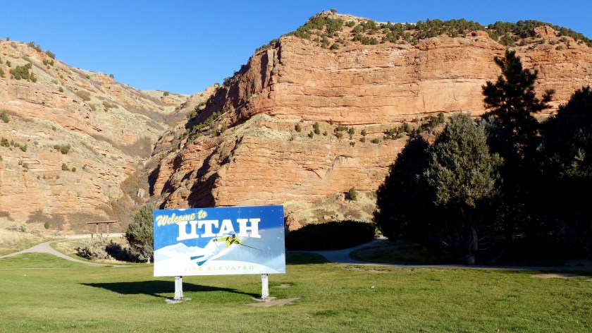
P1060680

Friday, October 20, 2017Weather is coming in- snow producing weather. Fort Bridger is located at 6600 feet so our intent is to get to lower elevation. Doing so we will put some miles between us and the old fort. We planned on traveling as far as Wells, maybe Elko Nevada, but ol’ Mom Nature has other plans for us. She says, I’ll huff and I’ll puff and I’ll blow yer trailer over! So erring on the side of caution we moved west, but only to Salt Lake City, Utah, a distance of 110 miles.

As we traveled the wind came up and it was pretty stiff. We passed the turnoff to Jordanelle State Park and Park City which is where we’d be right now if the weather was good.

Jordanelle Reservoir/ Park City Utah     

As luck would have it we also encountered a lot of traffic. Now traffic isn’t bad in itself but when everybody and their brother is in a huge hurry and feel that they are more important than anyone else on the road, then traffic gets bad. A big rig driver cut into our lane on a curve and nearly hit us. A bazillion other drivers were tailgating us and each other at 70 mph down a curvy Interstate 80 with high gusty winds. A lot of them couldn’t keep their vehicles in their own lane. Cripes, I didn’t sign on for this, did I?

Red Cliffs/ Crazy Quilt Hillside

Before the mayhem, we did pass a beautiful pastoral valley where Coalville (1200 souls) and Hoytville (600 souls) are located. This is farm and dairy country. The trees had turned golden and the pastures were still green. This is just gorgeous country and the reason we like to travel. As we climb out of the Weber River Valley the rocks and cliffs turn a little more red in color- a sure sign that one is now in Utah. After a very long downhill grade that followed a canyon we flush out onto the Salt Lake Valley. Traffic on the interstate through Salt Lake wasn’t too bad and we arrive at the Salt Lake KOA in one piece.

Mormon Temple/Utah State Capitol/Council Hall circa 1866

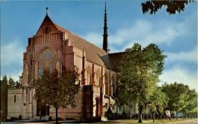
Salt Lake City (190,000 souls) has grown a ton since I first visited as a kid. At that time, ya I know, that was a long time ago, over 50 years, the skyline was dominated by the Utah State Capitol Building and the Mormon Temple. No more- they are lost in a sea of high rise buildings. In fact, if you don’t know your way around town you could pass by both. It’s kind of a shame really, as both buildings are really beautiful especially compared to the modern slab sided high rise. We also drove by the Cathedral of Madeleine, the mother Catholic Church of Utah. Council Hall was dedicated in 1866 and replaced the original city hall building which was immediately deemed too small.

Eclectic Paint Job- Hate to Tell Him- Burning Man Is OVER

The population of Salt Lake is somewhat deceiving. This area is much like the coastal area of Southern California in that Salt Lake, Ogden and Provo have grown together creating a metropolis of over 2 million souls, and the highways reflect it. Lots of cars and truck commute on Interstate 15 traveling north and south and Interstate 80 which runs east and west. So the city of Salt Lake feels a lot bigger than it really is. An interesting fact  is that the Salt Lake metropolis and Reno Nevada are the only two major urban areas within the Great Basin.

The Church of the Latter Day Saints is headquartered here in Mormon Square. Many other buildings are associated with the church. After all, the Mormons founded this city back in the 1840’s. They were driven out of Illinois and settled here where they felt they could practice their religion in an isolated location yet still under the sphere of influence of the U.S. government. They didn’t count on the emigrants heading to the gold fields of California which in short order, brought an end to their autonomy as the U.S. Government sent in the Army to ensure the emigrants protection.

Saturday, October 21, 2017The weatherman lived up to his promise yesterday with wild winds and rain. We’re glad we decided to stop in Salt Lake. This morning is a cool 32 degrees when we leave- burrr! Stark country awaits us west of town. Not much grows in this salty environment.

P1060695

Early Morning Photo of Great Salt Lake

Heading west on I-80 we skirt the Great Salt Lake, then about 100 miles farther west is the Bonneville Salt Flats. The Bonneville Salt Flats International Speedway hosts timed speed trials for different classifications of vehicles. They are timed over a running mile in one direction, then, to keep them honest, they are timed going the opposite direction. The land speed record was set in 1970 by Gary Gabelich in the rocket engined “Blue Flame” at a mere 622.407 mph but the current record was set by the twin turbofan “Thrust SSC” in 1997 at a sound barrier breaking 763 mph!

Bonneville Salt Flats

Shortly after leaving the salt flats we reach the state of Nevada and there directly across the street from the Welcome to Nevada sign is a big casino. Honestly, ya couldn’t put the building any closer to the state line.

Nevada State Line/Surprise, Surprise- A Casino!

I-80 climbs over a mountain range, then drops down into a valley. Oasis is located there; its a ’50’s style one stop shop that is abandoned. Wells (pop. 1200) is the next town and lies at the intersection of US 93 and I-80. The very prominent Hole-In-The-Wall Peak lies southwest of town. At an elevation of more that 11,000 feet she got more than a dusting of snow from yesterday’s storm. As a matter of fact, many peaks near and far are now snow covered.

P1060722

Hole-In-The-Wall Peak Near Wells, NV

We stop in Elko for fuel and to stretch. The storm has passed but has left a biting cold wind in it’s wake. Elko has a population of over 18,000 souls making it the largest city for 250 miles in all directions. I fact checked that statement and found Twin Falls Idaho is 164 miles away- it’s populations is 44,000 so maybe Elko’s claim was true at one time but would have to shrink the 250 miles down to about 160 miles.

The eastern portion of northern Nevada is not just flat desert. It is all high desert meaning not one cacti grows here. It’s grass and sagebrush country. It’s mountains and valleys. The Humboldt River runs through it. It’s quite amazing actually and the scenery changes often enough so as not to get boring. Several brand new game bridges are being completed. The bridges allow large animals such as deer, antelope, or elk to pass safely over the interstate. We’ve seen the bridges in many states and Canada, now Nevada.

Game Bridges, a.k.a. Deer Overpass- Interstate 80

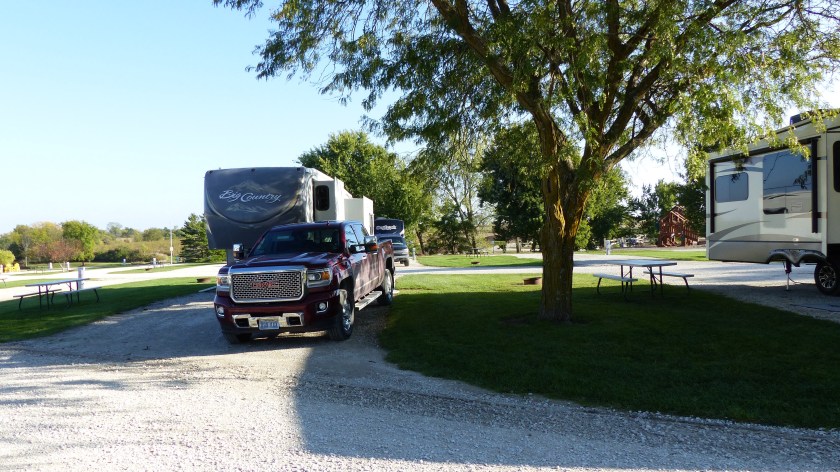
We’ve decided to end the day in Battle Mountain at Clark Park Campground. Not much irrigation goes toward growing lawns here in the high desert. The RV park is all gravel, which could be very warm in the summer months but today at 40 something degrees gravel is not a problem. The RV park is nicely laid out. While we had a few moments we toured the town of Battle Mountain (3600 souls) and found it not a thriving place but in the survival mode. It’s primary economic base is gold mining which doesn’t appear to make any of the townspeople wealthy. Who knows how long it has been in this state- I’d guess a long time.


Historic Fort Bridger

Thursday, October 19, 2017- Trip Day 76

P1060592

This is our second day at Fort Bridger. We’ve shopping to do and a tour of Fort Bridger State Historic Site which just happens to be located right next door to the RV park. The town of Fort Bridger is so small (390 souls) that the population doesn’t warrant a real grocery store, it has a convenience store. We head off to Lyman (2100 souls) located 5 miles away. One would think that a town that size would have a grocery store but nope, it doesn’t! So……. we double back and head south to Mountain View. Benedict’s Market is a really nice full service market. It even has a real full service hardware department! Some of the vehicles outside depict the values of the locals.

Mountain View, stock feed and Personal Opinion of Tree Huggers

Mountain View is what it says it is. The views of the Wasatch Mountains are stunning. Unfortunately, the view is obscured by a haze of which I don’t know the cause. I borrowed a couple of photos from the internet to give you an idea of how the name came about. We find a great park with nary a soul about so Megan got to go for a run.

After shopping and playing in the park we dropped the groceries off at camp then visited Fort Bridger State Historic Site. The gate to the parking lot was closed, the locals said you can just walk in so we did. No one was there so Megan got to run again and found Groshon Creek. In she goes- Dunk, Dunk, DUNK!  According to literature cooking in grills, dogs on leash (our bad on this one), are welcome but no horses, no alcohol, fireworks, overnight camping or throwing of any objects are permitted.

This location has been important over the years

From the Historic Sites brochure:

“I have established a small fort, with a blacksmith shop and a supply of iron in the road of the emigrants on Black Fork of Green River, which promises fairly…….”. Thus spoke Jim Bridger in a letter he dictated to would-be suppliers in 1843. While that fort would last little more than a decade Bridger’s word would prove prophetic. The location proved to be one of the main hubs of western expansion used by mountain men, Indians, emigrants and Mormon Pioneer, the U.S. Army, Pony Express, Overland Stage and Union Pacific Railroad. Even during the 1900’s The Lincoln Highway, Highway 30 and Interstate 80 crossed in or near Fort Bridger.

Reconstructed Jim Bridger Trading Post

Established in 1843 by Jim Bridger and Louis Vasquez, it was obtained by the Mormons in the 1855 for $8000. The Mormons replaced the stockade fence with a cobblestone wall. The place was evacuated and burned upon the arrival of Johnston’s Army in 1857. It became a military outpost in 1858. The fort was abandoned in 1890 and most of the wooden structures were sold or moved off the grounds. Those that remained fell into disrepair. Eventually groups and individuals took interest in preserving and restoring what remained. In 1933 the property was dedicated as a Wyoming Historical landmark.

There are enough restored and replica buildings to make the Fort interesting. Some old horse drawn equipment is on display in the shed. Signed areas indicate where barracks and officer’s quarters used to stand. The grounds are outstanding even in their fall attire. The prevailing aspen trees a devoid of foliage and the grass is dry and brown. One can imagine how pretty this place is in the spring.

We’ve been on the road a long time, over two and a half months. The weather is getting a little iffy. A little snow is predicted for tomorrow night and daytime temps are to be in the 40’s on Saturday. Even though we are only an hour and a half from places we’d like to visit it’s time to move on.

P1060650

A row of Aspens on Fort Bridger Grounds

How’d We Get Way Up Here?

Wednesday, October 18, 2017- Trip Day 

P1060541

Man, it’ starting to get cold! By the time we picked up outside our hands were freezing! Our destination today is Cheyenne, WY. The drive is easy on I-80 but there’s lots of roadwork causing oncoming traffic to occupy the number one lane westbound. The temporary lanes are well marked so present no problem but the four-lane highway is reduced to two. Pine Bluffs (1200 souls) is the first community just inside state line of Wyoming. The town became the largest cattle shipping point on the Union Pacific Railroad around 1884. We stop and stretch our legs. We traveled 170 miles stopping on occasions to stretch and exercise Mega. The rest stops are not as big rig accommodating as they were behind us so we had to squeeze in with the 16 wheelers.

Pulling into Cheyenne we looked at the KOA Kampground located right next to the interstate. It’s too noisy! We then went over hill and dale for 6 miles to reach the one place we thought would be quieter and a little nicer…….and it would have been but it was CLOSED for the winter! What? So, what to do……. We head to Laramie which is between 40 and 50 miles farther west.

The terrain changes as we head towards Laramie. Relatively flat land turns into rolling hills. The interstate takes advantage of canyons and cuts in the hills which at times look like Black Hills SD country. The main problem we face is wind. Wind warnings indicate gusts to 50 mph and we are feeling it. We slow down to 50 mph.

Highballer Trucks/Signs/Rolling Hills

The terrain changes as we head towards Laramie. Relatively flat land turns into rolling hills, then canyons. The interstate takes advantage of canyons and cuts in the hills which at times look like Black Hills SD country. The main problem we face is wind. Wind warning indicated gusts to 50 mph and we are feeling it. We slow down to 50 mph.

Lincoln Memorial At Rest Stop- Sherman Pass El. 8640’/Snow!

The highballer trucks also slow down, probably to 60 or a little more…….. they were traveling at the speed limit or better at 75 mph. We come to the highest point on Interstate 80 near Buford, Sherman Pass, elevation 8640’. Holy Moly, no wonder there’s big snow patches in the hillsides. The elevation of Sioux City was 1200’, the climb is very gradual. We sure couldn’t tell that we’d “elevated” nearly that much.

We arrived at Laramie KOA in the early afternoon. This KOA probably isn’t any better than the one in Cheyenne. Gravel pads, gravel roads,  both of which need a lot more gravel. The potential for dust is high but so far we are lucky.  We’re surrounded by a couple of old mobile home parks. It’s very close to the interstate so I anticipate a lot of road noise. At least we can get satellite reception in order to watch the MLB playoff games this evening!

This morning we traveled to Fort Bridger WY. We haven’t traveled 280+ miles in one day on the whole trip but none of the RV parks in between Laramie and Fort Bridger appear to be worth stopping. Although no wind warnings were issued for today the first thing we run into is interstate signs warning of wind gusts to 40+ miles per hour. The big rigs slow and so do we. The gusty winds seem to be prevalent in just a few areas along the highway so we slow for those and then resume a little faster pace when the wind subsides.

We stop at Little America (pop 64), a place that was purposely located in a remote location to serve the weary with a hotel, the hungry with a restaurant and fueling station and service shop for big rigs. The complex is quite something!

Entrance to RV Park/ Cows in our back yard

We pulled into Fort Bridger RV Campground just before 1400 hours after 6 hours on the road. We traveled 281 miles today making our two day total in excess of 500 miles. That’s the farthest we’ve traveled in two days the entire trip. We don’t like to travel that far but we survived somehow. More later………….


The Storm Has Passed- We head Southwest

Monday, October 16, 2017- Trip Day 73

Unknown copy

Hall County Courthouse, Grand Island NE

We departed South Sioux City on Sunday heading southwest on US 77, then on US 30. We enjoy driving the byways of America much more than traveling on interstates. We don’t pass towns we drive through them. Most places along the way are very small farm based communities such as Winnebago (775 souls), named after the Indian tribe whose reservation is close by. Every little town we pass through shows a lot of home pride a they are neat as a pin. When we reach Fremont (pop. 23,000) turn onto US 30 and head in a more westerly direction following the Platte River.

As you might surmise the areas that we have driven through is farmland. It appears that the main crop is corn, corn and more corn. The next city we come to is Columbus (22,000 souls), the seat of Platte County. Columbus is a really pretty town. It thrives on agriculture and manufacturing. Finally we enter Grand Island (48,000 souls). Grand Island is just a beautiful city. We’re glad we are here on Sunday as traffic is not bad. The two most outstanding buildings here are the Hall County Courthouse and St. Mary’s Cathedral.

Unknown-1

We Stayed in Fort Kearney State Recreation Area last night. The campground is nice and the sites are nicely spaced surrounding a couple of small lakes. It’s not crowded but I was amazed on how many families with school aged kids were here- Sunday afternoon. Maybe there’s no school tomorrow. We are also amazed at the amount of flies are hanging around our coach, especially by the door. We must have inadvertently let in 50 of them suckers!

22528255_10214027446181016_6535068763673380305_n

This morning we visited the Pioneer Museum in Minden. Boy, talk about sensory overload! This place doesn’t look like much from the outside but they have 10 large buildings just crammed full of horse drawn carriages of all types, early motorized vehicle (mostly Fords), old farm equipment horse drawn and motorized.

Displays of early phonographs, art, TV’s, recording devices and small buildings of different types of Plains origin. This place is great!

Tonight we are staying in an RV park in Ogalalla as we decided to travel 150 miles after visiting the Pioneer Museum. An easy 150 miles, a little grocery shopping and we are done for the day.

Play Chicken With Mother Nature? Nah!

Saturday, October 14, 2017- Travel Day 71


22449823_10214011415340255_6164720209821404103_n

Sculpture- Larsen Park Sioux City, IA

So, we chickened out. Ma Nature decided to throw us a curve at least according the weather guessers. So instead of heading towards our original destination to the southwest we headed northwest. Just before reaching Omaha we turn towards our new home for a couple of nights, Sioux City IA.

More Larsen Park Photos

After an easy 170 mile drive we pull into Scenic Park Campground which is actually in South Sioux Falls NE across the Missouri River from Sioux Falls IA. This is a municipal campground with nice sites separated by a lot of grass located right on the banks of the big river. Wow, what a spot. The campground is part of a larger sports complex that extends for blocks. A swim complex, soccer fields, ball diamonds and play equipment are available for everyone. Were here for two nights to let the nasty weather go by, so what shall we do?

It turns out yesterday we just chilled, watched the baseball playoffs and walked the dog a bunch of times. Weather was the best we’ve had for a week. This morning we wake up to gloom, gloom and more gloom…… and a little rain. We’re not going to sit in the coach all day so off we went. across the river to Sioux City IA. First, we went to Larsen Park which located on the east bank of the Missouri. We saw the riverboat built in 1932 for the Corps of Engineers and named for Sgt. Clarence Floyd. Sgt. Floyd was the only fatality on the Lewis and Clark expedition. He died of an illness and is buried just south of downtown. A 100-foot obelisk stands at his grave site. There is also a Lewis and Clark interpretive center here. It was closed at the time we visited.

We toured the historic downtown and found a grocery store that catered mostly to Hispanics. No matter, they had most of the items we needed. We next stopped at the Cathedral of the Epiphany. She’s a pretty building but locked up tight. The church is in the same neighborhood as the grocery store so most Masses are in español.

Sometimes it pays to do a little snooping. In this case Jil did her best imitation of Inspector Clouseau and found a real gem right here in Sioux City. Trinity Heights/ Queen of Peace is a dream come true for a Catholic Priest. He envisioned a small Catholic community with beautiful grounds.

22405527_10214012569729114_1977833394910955802_n

Trinity Heights- Queen of Peace

Trinity Heights is built on the previous site of a Catholic College/High School. The schools were razed, a group of 16 condominiums were built and several acres of land were landscaped and decorated in spiritual themes. Amongst them are the Way of the Saints, The Outdoor Cathedral, a Grotto, a shrine to the Unborn Child. At each end of the gardens is a huge statue of the Queen of Peace- St. Mary surrounded by the Mysteries of the Rosary.

22489814_10214012587689563_8238793698768249854_n

At the other end is another huge statue of Jesus- the Sacred Heart of Jesus. A small museum displays an incredible life size wood carving of the Last Supper. The carving was done by Jerry Traufler from 1986 to 1993.

22406032_10214014881866916_2287066267657445488_n

Each figure is individually carved except James and Andrew. Each figure weighs between 200 and 300 pounds, the entire sculpture measures 22’ by 7’. The Disciples faces were modeled after La Mars Iowa residents and the sculptures format is based on Leonardo da Vinci’s painting. If you are ever in Sioux City, IA we highly recommend visiting Trinity Heights.


Antique Archeology

Wednesday October 11, 2017- Trip Day Number 68

22405643_10214011414460233_1100762406386151153_n

If you were an Iowan would you be so welcoming of these two mugs? 

We’re working on selfie quality- balieve me!

From Pollmiller Park we drove to Coloma IL and camped at Scott Family Park. It’s a so so park, nothing bad and nothing outstanding. We’re here to visit Antique Archealogy of the History Channels fame. You know and love American Pickers right?

P1060437

We drive across the Mississippi into Le Claire, IA. It’s a quaint town oriented along the west bank of the Big Muddy. Being an off season week day, it’s also very quiet. The stars of Antique Archeology are seldom here. The place is now more of a tourist destination with most of the antiques that the boys pick are now located down in Nashville Tennessee.


We learn that Mike actually owns Antique Archeology, Frank owns his own shop located behind a biker bar in Savannah IL. They are boyhood friends that pick together, buy and sell from their own shops. The other stars of the show, Danielle and Mike’s brother Robbie live locally.

After an enjoyable visit made more enjoyable by the ladies that hold down the cash registers we depart only to find a group of folks gathered around our truck. It seems that a lady lost control of her car and let it slide back into the front of our truck causing some damage. It doesn’t appear to be too bad so we’ll let the insurance company handle it when we get home.

From Le Claire we are heading west. The NOAA Storm Prediction Center has detected potentially severe weather coming our way in the next two days. We…. Are… OUTAHERE!


Unfortunately we have to pass a lot of places worth visiting. Des Moines (203,000 souls) is the capitol of Iowa. We bypass her.  Amana Colonies is a must see. Check out the history of the Amana Colonies here: http://www.amanacolonies.com/history-of-amana. We bypass the colonies. Bummer. Maybe some day we’ll get back this way………… when thunderstorms producing 1.5″ hale and possible tornadoes are not in the forecast.

Unknown-3

State Of Iowa Capital Building

Our destination for one night is the Des Moine West KOA. The park is really nice. We wish we could stay more than one night but we must push on. Bad weather, ya know, is not fun especially in an RV!

P1060445

Des Moines West KOA- first sunshine we’d seen for many days

New Heading Quartermaster! Roger Captain!

Wednesday, October 11, 2017- Trip day 68


P1060428

Tom Sawyer and Huck Finn Statue

We’ve decided to travel up the Great River Road. It’s not just one road but a conglomeration of roads that run parallel to the Mississippi River. The road could be and is on either side of the Big Muddy. As the river is the boundary between many states one could easily travel from one state to another by merely crossing a bridge.

Portsmouth

Today we will begin on the Missouri side. We travel all the way to Clarksville, a whole 40 miles, which is actually on the banks of big river and run into a detour- a bridge has been closed due to construction and we are rerouted up a narrow seldom used county road. As we travel I noticed that we have been rerouted almost halfway back to our starting point! Holy Moly! We’d been way better off just taking the four lane US highway to Hannibal. So with the delay of nearly an hour of traveling over hill and dale, winding up the the very US 61 highway we wanted to avoid we arrive at the outskirts of Hannibal Missouri.

We stopped at the visitors center and the gent there gave us a map, directions, and where we could park our 51′ long RV and truck combo downtown. So we follow his instructions only to be blocked by a police officer and his vehicle on the offramp that would have brought us into downtown Hannibal. As we pass we see lots of emergency vehicles at the bottom of the offramp- a crash! Our only choice is to reroute, go across the bridge traversing the Mississippi into Illinois and turn around. We do so then follow the directions of Jil’s “smarty pants” phone. The stinking phone reroutes us right back to the offramp that was closed due to the auto accident!

Well, I”ll have no part of that so I follow the map on the truck’s onboard navigator, without the aid of the navigation system and drive us safely to downtown Hannibal. This town has a population of 18,000 souls but feels much smaller, like maybe 2000 souls.

Old Hannibal was established in 1819 and was important due to it’s access to the Mississippi River. It is a lovely little town that begs to be explored. The ever present rain has subsided to a sprinkle or two. I can’t imagine how crowded this place could be in season. Today the streets are pretty quiet with just a few cars and a few visitors walking downtown- all four blocks of it. The buildings are quiet ornate and well cared for. It’s also the birthplace of Samuel Clemens- a.k.a.  Mark Twain.

His dad was a pretty big mucky muck back in those early days. He was a lawyer, instrumental in establishing a railroad between Hannibal and St. Joseph. We visit both Mark Twain’s birthplace and his dad’s law office building as well as walking the entire town. We are sure glad that we visited Hannibal.

We decide to head north towards our next destination, Le Claire Iowa. We stop at Pollmiller Park Campground in West Point, IA. The ranger Jil spoke to on the phone said we could occupy any site that did not have a reservation tag on it. It’s nothing fancy- and no one is here! There are no reservation tags hanging on the site posts. Literally no one! After we set up a fella comes in and spends an hour picking up nuts off of the ground. I’m not sure what kind of nuts have dropped from that tree but he’s very busy picking them up. He leaves and the rain comes back with a vengeance- including some fierce- and very close thunder and lightning. As the sun sets we have the whole park to ourselves- literally- along with 2.5 inches of rain. We are- ALONE!

P1060408

Heading- 270 degrees- Aye Aye Captain!

Monday October 9, 2017- Trip Day 66

P1060403

Sunday, October 8th– This day marks our course change towards the barn- our home in Reno. Up until this day we’ve meandered. Now we put our heads down and drive forward with purpose. Well, if you call making 200 miles a day purpose, that is. We plan on driving to St. Louis, then up the Great River Road to LeClaire Iowa and then burn rubber on I-80 towards home. Weather to the west has already caused some early snowstorms and we need to be vigilant of hazardous weather occurring between our location and home.

Today we plan on traveling more miles in one day than we’ve traveled for a long time. Our goal is to escape the remnants Hurricane Nate as it makes its way towards the northeast. We are not completely successful as it rained hard in a very short time last night as 2.3 inches of the wet stuff came down. Sunlight doesn’t come until well after 0700 hours so picking up our gear has to wait. Luckily the heavy rain also holds off until we are picked up and ready to roll. We are off at 0845 hours.

Our route is mostly Interstate highways today so we should be able to make pretty good time- for us. I-75 south to I-64 west and we are heading toward Louisville. Weather is iffy right now but don’t you worry, it will get worse. It starts raining pretty hard, wipers at standard steady wipe now- non of that intermittent stuff. The rain and high humidity make sight seeing impossible- ya just cain’t see mucha anythang! Did I mention that as soon as we crossed the Ohio River from the North that Southern accents in Kentucky became quite noticeable?

We pass through Louisville and it’s still raining hard but at least we can see the iconic Louisville Slugger Bat leaning up against a brick building and can see a lot of bridges that lead back into Jefferson Ohio. Today is not a good day to be out in the weather. It would have been nice to stop, especially since it’s Sunday morning and downtown Louisville should be quiet. We pass a pair of big locks on the river and continue on. The only stops we made were at rest stops to stretch our legs a little. One of them had a huge grassy field just past the visitors center so our Muttzo Megan had herself a romp!

We are at the Vanderburgh 4H Center campground near Evansville Indiana for the night. The rain has subsided- now it’s just warm and muggy. This park has quite the reputation on the web. The office is closed on the weekends, there is no campground host, there is no box containing registration forms nor a place to deposit payment. In fact, we don’t even know what the camping fee is as it varies on the web by as much as 18 dollars! I guess we’ll find out in the morning when the office opens and before we leave. Tomorrow the weather is supposed to sour once again so we will continue our trek towards St. Louis MO.

Monday, October 9- The campground office never opened so we’ll contact them and ask what we owe for the night. As one camper facetiously stated on the internet the park is FREE! We traveled through three states today, Indiana, Illinois, and now in Missouri yet only covered 190 miles. With the time changing to Central from Eastern getting up at 0630 seemed so much more natural getting up at a reasonable time rather than scraping my patootie out of bed way before sunup, that time being after 0700 hours. We were actually on the road before 0800, our customary time to depart as opposed to 0900 hours in Eastern time. I guess our getting up later and departing later had a lot to do with being on the western edge of the Eastern time zone as the sun comes up later there than, say in New York City or Richmond. Weather warnings were in effect as we drive west.

Fog is limiting visibility but it’s not too bad only affecting our view of the landscape. The interstate system is unlike the US highways as they are designed to bypass local towns. This one is no different. We drove off of the highway only once entering the outskirts of Mt. Vernon to purchase fuel. As we approached St. Louis the Illinois landscape turned from rural farmland to urban metropolis. Just before reaching the Mississippi River we see downtown St. Louis and the famous St. Louis Arch. Unfortunately the whole area was darkened by a fog layer so we only saw St. Louis in black and white.

Driving east of town on I-70 now old districts of the big city come into view. We are amazed at how many brick structures appear to be burned out. Jil investigates and states that the structures have been abandoned then burned over a period of many years and the building’s owner’s leave them as they lay. Pretty sad. We pass through now famous Ferguson………… and are saddened by the turmoil that recently occurred there.

Our campground for the night is 370 Lakeside Campground in St. Peters located about 20 miles north and west of downtown St. Louis. It’s a multi use park, the west end being an RV park. The RV park is nicely laid out with lots of space between sites. A lake is within sight and a bike path runs through it. Very nice!

P.S.- This is the mid west. Even though we are well into autumn severe storms are making their presence. One past by us not 20 miles away this evening dropping 1.5 inch hail in downtown Louisville. Yikes!


Kentucky Horse Park

Saturday October 7, 2017- Travel Day 64

P1060362

The main reason for traveling to Kentucky is to visit the famed Kentucky Horse Park.  This 1200 acre park lies just to the north of Lexington on green rolling hills. The entire complex is canine friendly except for the museum building and the restaurant. Every other area, barn, arena or venue is dog friendly.

Megan did well and was not bothered at all by the equines- and they didn’t give a rats about her either. The Park includes a Visitor Center, Dressage Complex, the Big Barn where one finds draft horses. The Breed’s Barn houses multiple breeds of horses with some being quite rare. There are Event Stables, the Covered Arena, and the Stadium Jumping Complex.

Man-O-War

Man-O-War is honored and buried here under a monument of his likeness. His stride was 8′ longer than the average thoroughbred at 28′. He only lost one race in 21 when he was boxed in by two riders. His reputation was so great that when he ran the Preakness only one other horse was entered. He and his handler, who love and respected one another, died the same year, 1947.

The Hall of Champions is where several champion horses are kept. A Champion trotter, a pacer and a thoroughbred are brought out of their stables to show them off to the audience. One of the handlers is 91 years old and that gent actually rode Man-O-War before that great racehorse died in 1947!

Gent in Upper Left Photo Rode Man-O-War!

We spent quite a bit of time watching the dressage horses prance around, moseyed through much of the complex of buildings before watching horse and rider, more like horses and riders going through their paces at the Stadium Jumping Complex. We sauntered through the Mounted Police Barn and stopped in the Covered Arena to watch a couple of kids perform tricks on the back of a trotting horse. I spent some time in the International Museum of the Horse as Jil watched our muttzo Megan and I stayed with Megan while Jil spent time in the gift shop.

The Big Barn was the must see place of all places in this complex for Jil. She wanted so to see the big draft horses. She got her wish. Four of them were being readied to pull the horse drawn trolleys as we entered the barn. Other hay burners were in their stalls. These animals are so big yet look so gentle. They just look you right in the eye as if to say “Hey, where’s my carrot, or how ’bout a little scratch behind my ear?”

I must tell you that we were amazed at the amount of horsemen here at the Park. Horses were being led or ridden everywhere going to or coming from on event or another. There had to be hundred of them that we saw and probably that many more not in sight in this big park. The Kentucky Horse Park is a must see if you are ever in the Lexington KY area for sure!

Unknown

Lexington- A contrast in architecture

Hey, let’s go into downtown Lexington (318,000 souls) while we are this far! Okie Dokey. Lexington is known as the Horse Capitol Of The World and is located in the heart of Bluegrass Country. She is home to the University of Kentucky, two horse race tracks, and the Rupp Arena, the world’s largest basketball-specific arena. We take I-75 several miles south and exit at the “Downtown Lexington” sign………. and immediately run into heavy traffic! Gads! So after just a few miles and many minutes of waiting for a green light only to travel to the very next red light……. repeat that several times if you will…….. we arrive in downtown Lexington. I’ve since read that Lexington traffic is the worst in the state. The old town is just beautiful but way too much traffic to easily slide over and take a few photos. As if someone drew a line in the road the old brick multistory buildings end and the modern glass and steel buildings begin. It’s quite a contrast. We exit stage left……..

We needed to do a little grocery shopping. A Walmart Super Center is close by so that’s where we went. After we took a little cruise into nearby Georgetown (34,000 souls) and are at awe of the beauty of it’s downtown historic district…… and those houses are magnificent! We love old style architecture.

P1060374

Georgetown, KY

A big storm is coming in that will affect this area. Hurricane Nate is making landfall in the Gulf and a lot of it’s moisture is heading our way………. inches of the wet stuff will fall over the next day or two. Get out the life preservers!


Kentucky Moon

Friday October 6, 2017- Trip Day 62 & 63

P1060230

Floodwall Mural, Maysville KY

Roll along roll along Kentucky moon
Shed a ray of light on one I love tonight
Roll along roll along Kentucky moon

The above are lyrics written by a fella by the name of Jimmie Rodgers back in 1932. The moon last night was beautiful!

We drove southwest on Ohio 159 then south on US 23 to Portsmouth Ohio (20,000 souls) Thursday. The both roads were far superior than the Amish buggy roads that “miss smarty phone” has picked for us. Portsmouth is located on the Ohio River just east of the mouth of the Scioto River. It was the southern most port on the Ohio and Erie Canal. The city boomed early with major industries that included meat packing. Later a rail yard was added making the Canal less important. By 1916 she was listed as a major industrial center with steel and bricks being the major products.  Population rose to over 40,000 souls in 1930. Since then the steel works has closed and labor outsourcing has caused a decline in jobs. The population has dropped by half.

Portsmouth

At Portsmouth we picked up US 52, the Ohio River Byway, and headed west. That title, in my opinion is somewhat of a misnomer. Although the road parallels the Ohio River one only catches glimpses of it now and again. The two lane road is nice for a few miles with 12′ lanes then narrows for many miles to 10′ lanes so once again I have to concentrate on keeping the rig on the road and in my lane. I miss a lot of pretty scenery that way. The population along the way is pretty sparse with just a couple of settlements not worth naming and a number of farms. Near our turnoff we drive through Manchester (pop. 2000), a down and out town. We continue on without stopping. Just before Aberdeen we turn left towards Kentucky.

300px-SimonKentonBridge

OMG! We’re staring at a very narrow steel suspension bridge! The Simon Kenton Bridge witha span of 1060 feet, was completed in 1932 when vehicles were a little smaller and narrower. Man, I hope no trucks are coming our way. There is no wiggle room on this bridge. The lane is less than 9′ wide with a high concrete curb on the right. I put the trailer within inches of the center line and can’t see the pavement between the right side of the trailer and the curbing in the side view mirror. We did pass two trucks nearly clicking mirrors as we passed. I find after we settled in for the night that a more modern bridge was built in 2002 and that would have been the one to take……. little did I know……. I just went across the one closest to our destination but the William Harsha bridge is just a couple of miles down the road.

We are now in historic Maysville, KY (9,000 souls), founded in 1784 by Simon Kenton. Had we crossed the newer Harsha bridge we would have missed this beautiful downtown district. We would have also missed driving down some pretty narrow streets dragging our fifth wheel all the way.

Downtown Maysville

Careful observation of semi trucks passing through town gave us a clue to our escape route when the time came. Frontiersmen Simon Kenton and Daniel Boone are amongst the city’s founders. Boone is known for blazing his Wilderness Road through the Cumberland Gap in the Appalachian Mountains amongst his other accomplishments. Maysville is historically important as a port on the Ohio River.

More Maysville

It exported bourbon whiskey, hemp and tobacco. It was once a center of wrought iron manufacture sending ironwork to decorate the buildings of Cincinnati OH and New Orleans LA. It was also an important stop on the Underground Railroad as the free state of Ohio was just across the river.

From Maysville we head up the hill into much newer Maysville. Lot of new construction and more big box stores and chain restaurants……. and traffic. We push through and now are on our way to Whispering Hills RV Park located in Georgetown, KY. State highway 62 is another E ticket for the driver of a big rig. More rolling hills to negotiate, a very narrow road deck with no shoulder, just a ditch to contend with. The countryside is most beautiful as this is now Kentucky horse farm country. We pass farm after farm with lots of equines out enjoying their pastures. Unfortunately there is no, I mean NO place to pull off of the road to take some pictures. We pull into Whispering Hills RV Park after the driving twice as far as norma ltired but ready to take on another great day tomorrow.

P1060248

Our Neighbor’s Cheerful Night Lighting


Ohio and Erie Canal and the Historic Roscoe Village

Wednesday October 4, 2017- Trip day 61

P1060201

She’s Here But Isn’t Going Anywhere This Morning

Today was the day we start heading towards a new state for us, that of Kentucky. On the way are a couple of local and historical sites to see. First of all, the dreaded navigation system on Jil’s phone struck again. Instead of routing us onto the larger highways it decided that we wanted to travel up and down and around on narrow, bumpy Amish carriage roads. While these roads are very pleasant to travel they are not pleasant when towing a 34 foot fifth wheel. We came across several horse and buggies always near the top of a grade. The horses were slowed considerably and visibility of oncoming traffic wasn’t good….. so we wait for the moment we can pass them safely. After 20-30 miles of this routing I’ve had enough and do my own routing which turns out to be on much better roads for towing.

World’s Largest Basket and Retired Basket Shop, Dresden OH

We stop in Dresden (1500 souls), home of the world’s largest basket. It’s really a building at the edge of the downtown district. Dresden has a long history dating back to 1773 when a missionary tried to convert very hostile Shawnee Indians. Later it was an important trading town on the Ohio and Erie Canal. Dresden is also the original home of the Longaberger Company, a manufacturer of hand crafted maple wood baskets.

The canals were built by hand

Historic Roscoe Village is located a few miles south of Dresden in the city of Coshocton (12,000 souls). We walked to the canal boat but it wasn’t running until later so we walked back to the village. Most of the shops in the village were closed for the day- rats! Oh well, it was nice looking at the old buildings that date back to the 1820’s.

Historic Roscoe Village

We drove through Lancaster (pop. 37,000) which, by the way, is a lovely town, on our way to the Lakeside RV Park. The park is located between two lakes but is not our favorite. Sites are a little too close together for our taste and maybe a little too rusty, er, rustic. A lot of folks with their families are living here on a temporary basis and working locally. We’ve seen quite a bit of this lately, young families living in travel trailers.

Lancaster Ohio

Just before sundown a bunch of fellas pull into camp in their own vehicles, get out and chew the fat for about two hours out on the street. I only mention this, not because their socializing was bothersome but to note that these families appear to have been together at this park for quite a while.

Our site right on the lake at Lakeview RV Park

Below is some history of the Ohio and Erie Canal and Historic Roscoe Village for you history buffs:

Agitation for a canal system (1787–1822)

As early as 1787, George Washington and Thomas Jefferson had discussed the desirability of a canal linking Lake Erie to the Ohio River as part of a national system of canals. In January 1822, the Ohio Legislature passed acts to fund the canal system. Since canals must generally follow river valleys, it was difficult to design a suitable system. Specifically, the bridging of the Scioto and Miami river valleys required raising the canal to such an elevation that water from neither river could be used as a source. As a result, the canal was divided into two sections.

On July 4, 1825, ground was broken for the canal at Licking Summit near Newark, Ohio. The canals were specified to have a minimum width of 40 feet (12 m) at the top, 26 feet (8 m) at the bottom, and a depth of 4 feet (1.2 m) feet minimum. These limits were often exceeded, and indeed it was cheaper to do so in most cases. For example, it might be cheaper to build one embankment and then let the water fill all the way to a hillside parallel, perhaps hundreds of feet away, rather than build two embankments. Where it made economic sense to do so, such as lock widths or portions of the canal through narrow rock or across aqueducts, the minimum widths were adhered to.

Workers were initially paid $0.30 per day and offered a jigger of whiskey. As work progressed, and where labor was in shortage, workers could make as much as $15 per month. Working on the canal was appealing and attracted many farmers from their land.

On July 3, 1827 the first canal boat on the Ohio and Erie Canal left Akron, traveled through 41 locks and over 3 aqueducts along 37 miles (60 km) of canal, to arrive at Cleveland on July 4. While the average speed of 3 mph (4.8 km/h) may seem slow, canal boats could carry 10 tons of goods and were much more efficient than wagons over rutted trails. During 1832, the Ohio and Erie Canal was completed. The entire canal system was 308 miles (496 km) long with 146 lift locks and a rise of 1,206 feet (368 m). In addition, there were five feeder canals that added 24.8 miles (39.9 km) and 6 additional locks to the system.

After the maximum of the 1850s and a cessation of revenue due to the Civil War during the early 1860s the canal’s expenditures started to outgrow its revenues due to increasing maintenance costs. By 1911, most of the southern portion of the canal had been abandoned. On March 23, 1913, after a winter of record snowfall, storms dumped an abnormally heavy amount of rain on the state, causing extensive flooding. This caused the reservoirs to spill over into the canals, destroying aqueducts, washing out banks, and devastating most of the locks. In Akron, Lock 1 was dynamited to allow backed up floodwater to flow.

Roscoe Village is located in Coshocton, Ohio, United States, is a restored Ohio and Erie Canal town. Roscoe Village was laid out in 1816, Roscoe was originally named Caldersburgh after its founder James Calder. After going bankrupt, the Coshocton merchant moved across the Muskingum River to some land he had somehow managed to retain. Setting up a store and naming the place after himself, Calder reasoned that the rural farmers would much rather do business in Caldersburgh than pay the twenty-five cents for the ferry over to Coshocton.

The transformation of Roscoe from a small, sleepy community into a thriving port along the Ohio and Erie Canal came with the arrival of the canal and the landing of the first canal boat, the Monticello, on August 21, 1830. The Ohio and Erie Canal, which provided cheap transportation for people and goods, granted great economic development for communities along the waterway. With its status as the fourth largest wheat port on the canal, Roscoe’s prosperity ignited a chain of businesses in the area, including a blacksmith, a cooperage, a hotel, a mill, and several stores. State Route 16, which runs parallel to Roscoe today, is the location of the original Ohio and Erie Canal bed. The canal continued to operate until the Great Flood of 1913 and the coming of the railroad after which the once thriving canal port quickly declined.

Delving Into Amish Country

Tuesday, October 3- Trip Day 60

I’ve no clue as to why the Dundee designation for Evergreen RV Park as it’s located a quarter mile from the village of Mt. Eaton. This park is really nice. Whoever designed this park was an RV’er! Nice large sites are located on a hill. Some leveling is needed front to back but side to side is pretty level.

P1060077 (1)

Huge grass dog run with a corn field behind our rig.

Grass grows between sites. Picnic tables and fire rings at every site. The office has a lot of RV supplies, a few staples and some gifts. The attached laundry room is huge with 20 washing machines and 20 dryers. There’s a large grassy field towards the rear- the dog walk. It’s got to be at least 5 acres in size. At the edge of the grassy field is a corn field, and to the east is a horse and donkey farm.

P1060076

The beautiful rolling hills and an extension of the dreaded (by Megan) fence!

Ah, the horse farm…….. we walked Megan this evening along the fence line. The horses that were in view earlier were no longer there. Megan stuck her nose down along the fence, yelped and started hauling arse away from that fence! Gosh, we hadn’t seen the electric wire between ground level and about a foot up! We didn’t know what had happened until we spotted the “wire”. I don’t know why that hot wire was mounted down so low other than to keep smaller animals out of the pasture. Megan’s had a few “Megan moments” lately. She didn’t like the ferry ride to Mackinac Island, she hated the ferry ride to Put-In-Bay, she deplored the golf cart ride at the same place. Now she get she gets zapped at our current location……….. no pun intended on the “current”.

We’ve literally driven over hill and dale admiring this beautiful portion of Ohio. We’ve gone to Brewster (2100 souls), Beach City, Dundee, Sugar Creek, Walnut Creek, Berlin, Mt. Hope, Winesburg, Wilmot, and of course Mt. Eaton. Most of these towns are not touristy, which we loved, with the exceptions of Walnut Creek, Berlin and Sugar Creek.

Brewster is the location of the corporate headquarters and shops of the Wheeling and Lake Erie Railway, both the historic company and the current regional railroad. The WLE began producing locomotives at its Brewster shops in 1910, and boasted one of the finest steam locomotive producing facilities in the country. It’s also the headquarters for the largest swiss cheese plant in the U.S.

We didn’t expect to see this beautiful Amish Door Inn, Wilmot

We drove through Beach City (pop. 1000) and the village of Dundee, then stopped in Sugar Creek (2100 souls). Sugar Creek is known as the “Little Switzerland of Ohio”. A local fella thought it would be for good tourism to recreate the architecture of a Swiss village on the town’s buildings. I guess he was right as we just missed the Swiss Festival by a week. My mom was born in Switzerland so I was curious. The town is cute. Nevertheless it’s a tourist trap with little to do with the country it represents. It does have one of the world’s largest cuckoo clocks however.

Downtown Sugar Creek

We drove a short distance (seem’s like all towns are just a short distance apart) to Walnut Creek. Holy Smokes, we found the motherload- of tourism! Big Big shopping centers that cater to tourists, a huge farm that does the same.

We drive past those places and enter the village. What the……. there is no downtown to speak of,  just a restaurant that serves Amish style food family style. We continue on to the Yoder’s Amish Home. It’s another place that caters to visitors but is different. Hardly any visitors are here. There is a farm tour, a house tour and a parochial school tour. We learned a lot about the Amish way of life taking the school tour.


We visited Kidron this morning. Kidron was founded in 1819 by Swiss Mennonites who wished to escape persecution and poor farming conditions in their homeland. They were referred to as “Die Stillen im Lande”- the quiet people in the country”. 

From vintage hand tools, to wood burning stoves to a gasoline powered

clothes washer to an $8100 modern electric replica stove!

We heard about a huge hardware store located there, one that caters to the likes of the Amish. Lehman’s Hardware is huge. At least 4 buildings have been incorporated into just one. The store displays many items of farm life from the past and some from the present. It has a huge store of kerosene type lamps, health items, soaps, candy, kids toys, a food court, interior design items……….. and a couple of small sections dedicated to some actual items that one would find in a hardware store. Another tourist trap……. but interesting due to all the antique farm items and retro kitchen appliances on display.

Wood Carvings by Paul Weaver

Also on display at Lehman’s are several wood carvings by an Amish furniture maker by the name of Paul Weaver. As of this date he doesn’t carve for profit, just pleasure. He laminates butternut wood to a maximum of 7″ of depth then starts carving that big block of wood. He doesn’t consider himself an artist. I hope he reconsiders as his work is wonderful.

So we type in “Berlin, OH” into the truck’s onboard navigator. It takes us over hill and dale right through the heart of Amish farms. The road is narrow and not unlike a roller coaster heading up and down some pretty steep hills. One has to be careful cresting these limited visibility hills so as not to run smack dab into a slow-er moving horse and buggy. Slower but not slow- I clocked a couple of those black buggies at 15 mph. But there are slower horse drawn implements that use these country roads….. like a four horse team drawing a hay baler! We had to reroute once due to a road closure, then to Berlin.

P1060191

Berlin is another touristy town. We are not interested in walking the streets here nor going into the shops, but we did find a big park to let Megan run.

Amish and Mennonite clothing is easily distinguishable from English- us non Amish or Mennonites. Here’s how to do it:

Conservative Mennonites:

mennonitegirls

Wear prints (solids considered to be fancy), wear cape dresses that button up the back, head coverings are small, often transparent. Little girls don’t wear head coverings until school age and wear their hair in long braids. No wedding bands allowed. Women rarely go barefoot. Men are clean shaven or neatly trimmed beards with or without mustaches. Men wear store bought clothes and button up shirts.

Amish:

photo

Women wear solid color clothes (consider prints to be fancy), wear cape dresses that fasten in the front, head coverings are larger (solid white or black) and are tied under the chin. Little girls wear their hair up. Girls wear black caps until married then wear white. No jewelry of any kind is worn. Both men and women love to go barefoot- some communities will be dressed up in their Sunday best yet go to the meeting barefoot. Men wear beards when they get married and may wear store-bought solid color button up shirts. Shirts may be homemade but pants are all homemade broadfall pants. They are more likely to work off of the farm.

So we’ve found that the Amish and Mennonites are anabaptists (adult baptism). The Amish are offshoots from a larger group that split off in the late 1600’s as a reaction to what one faction saw as liberalized trends. Both believe in values of non- resistance and in some cases plain clothing. Old Order Mennonites or closest to the Amish culturally and also rely on horse and buggy for transportation. They both maintain small labor intensive farms although Amish are more likely to work off of the farm. They both practice social shunning.

The Yoder Name is Everywhere!

The differences come in technology. Old Order Mennonites now allow electricity in the home as well as telephones. They make greater use of tractors as well. Old Order Mennonites worship in meetinghouses while Amish have retained home worship. An offshoot of Amish are the Beachy Amish, a group more like Mennonites as they accept certain technologies, notably the car and computer. “Modern” Mennonites wear modern dress, accept cars, use of the internet and to on to higher education.

So there it is, our visit to Amish country is complete. Tomorrow we will be back on the road.


We’re In Amish Country!

Monday, October 2, 2017- Trip Day 59

22089844_10213908029955685_3616456853617326334_n

We left Cedarlane RV Park this morning with 107 miles to travel. Almost four hours later we check into Evergreen RV Park in Dundee, MI. We stopped a couple of times, once at a roadside antique shop and once in beautiful downtown (I’m not kidding!) Wooster. I will tell you that we traveled on no less than six different roads- some were highways, some were compacted gravel with the only tracks coming from Amish horse drawn wagons! Terrain changed from mostly flat to rolling hills as we head southeast away from Lake Erie.

Wooster, a town of 24,000 souls is the seat of Wayne County

The State of Ohio has the largest population of Amish people in the U.S. numbering around 59,000 folks. We are here to learn and witness of the Amish way of life. The Amish live in communities of approximately 40 people.

Their kids go to Amish Schools, mixed grade schools. When the student population exceeds 40 kids, they build another school. The Amish don’t have churches per se. They have services at farm houses, rotating services from one farm to another. Every other Sunday they attend services at a neighboring community. That way they stay in touch with their neighbors.

A lady Amish docent at the Yoder Family Farm who travels by buggy 9 miles each way to work explained how the Amish live. She taught school in Amish communities for 30 years. Amish have no electronic communication devices- no cell phones, no TV, no nada. We visited the morning after the massacre in Las Vegas and she was blissfully clueless. They have not motorized farm equipment, no cars, no motorized lawn mowers yet their farms are beautiful. Their main mode of transportation is the horse and buggy, their farm equipment powered by draft horses. If you see a truck or car on their property it belongs to someone else who is visiting, making a delivery, or loading milk, hay or other farm product for market. They will ride in a car, even rent one to travel a long distance but they hire someone to drive them. Jil asked if many Amish kids went to college. The docent looked at us like we were kinda dumb and replied “None. There’s no need for a college education in our way of life.”

We’ll continue the tour tomorrow……….. Until then, be safe my friends……….

P1060082

We weep and pray for all affected by the Las Vegas Massacre. God Bless Them All…..

Catawba and Put-In-Bay

September 30, 2017- Travel Day 57

P1050999

Perry Memorial

We’ve finally left Michigan after a two week cruise through the Upper Peninsula, Lower Peninsula and the banks of Lakes Michigan, Huron, and Erie. We drove through Toledo Ohio with no problem. Unlike Southern California or the San Francisco Bay area suburbia is not so spread out so one is in and out of the city in a relatively short time- 10’s of miles instead of multiples of 10’s. We look back at Toledo and see factory smoke stacks across farm fields of corn. Nice! And not much farther up the road this:

P1050975

We are staying on Catawba Island at the Cedarlane RV Park. It’s a 500 site park filled mostly with seasonal rigs. People leave their rigs on site during the winter and vacation during the summer. We met a couple from Dayton who vacation in their 5th wheel trailer. We asked if they had stayed at this park long. “No, just 10 years” was the reply. I guess they like it here

We are here to bear witness to Perry’s Victory and International Peace Column, a tribute to Admiral Oliver Perry’s Lake Erie victory over the British fleet in 1813 during the War of 1812. The story is fascinating as Perry’s victory came, literally, against all odds and was thought by many to be the turning point in the war. Read about it here: http://www.historynet.com/war-of-1812-battle-of-lake-erie-oliver-perrys-miraculous-victory.htm.

The Perry Memorial was built in 1915. It stands 352 feet above Lake Erie, making it the tallest national monument in the U.S. Unfortunately, it’s being renovated and the public is denied access. But I’ll tell you it’s one impressive sight!

Voyage to South Bass Island

The column to honor Admiral Perry is located in Put-In-Bay on South Bass Island. We took a ferry ride into 20 mph headwinds to get there. The lake had wind whipped four foot swells at the time and the ride was a little bumpy. Our muttzo wanted none of it. The ferry is mainly a vehicle carrier, we had to ride on the lower deck meant for vehicles because of her presence, and the trip was noisy due to roaring engines, blowing wind and waves breaking over the bow. When we got to the ferry dock on the island she was a mess. But we had another surprise for her.

Little did we know that town was two miles away- we rented a gas engine powered golf cart. She definitely didn’t like that! So with a 90 pound Lab protesting all the way to town riding between the two of us we arrived in the village of Put-In-Bay.

Downtown Put-In-Bay

The town is not like Mackinac Island. Mack is composed of many historical buildings approaching 200 years old, Put-In-Bay is more modern. It’s a tourist town for sure as all the eateries have huge outdoor seating areas. We like it because we got there early. The bars and restaurants are gearing up for the Ohio State football crowd that will arrive a little later. We did have lunch at a bar and grill, Jil had a caesar chicken salad and I had a beer battered walleye fish and chips meal. Boy were they tasty!

We drove around another half hour or so to time the return ferry trip back to Catawba Island. Our timing was much better than we thought. After turning in the golf cart we saw that the ferry was off loading at the dock so we just walked on board. The ride back wasn’t quite as rough but we experienced a lot more roll as the boat and the waves were running perpendicular to one another. Unhappy doggy was beside herself but we maintained some semblance of control over her. We felt bad for her but she needs to learn to suck it up!

Tomorrow we pick up stakes and head towards Amish country. See you there!