Lake Itasca and Pokegama COE

Wednesday, August 30, 2017- Travel Days 24-26

P1040653

I spent a couple of hours writing this post, the text disappeared somehow and all that remained was the photos. So I’ll try this once again.

We traveled less than 100 miles from Buffalo River State Park to Itasca State Park. Jil’s “smart phone” calls out the route: East on hwy 10, northeast on hwy 34, north on 37, east on 58 to east 44 to east 41. Then the “smarty pants” phone makes a call to turn too late. Crap! Oh well, I’ll just drive down the road and find a place to turn around. What’s that ahead? It’s highway 71 which will lead us to Itasca’s park entrance. Gosh, that was easy. All we really had to do was take highway 10 east to the 71 and head north! At least the route we took avoided almost all semblance of civilization except for some beautiful farms and a couple of ranches. The only town being Detroit Lakes (8000 souls) which we past in the beginning and Two Inlets near the end- which is not really a town but a gateway to several recreational lakes. The only place Jil wanted to visit was Park Rapids which has become the gateway city of Itasca State Park.

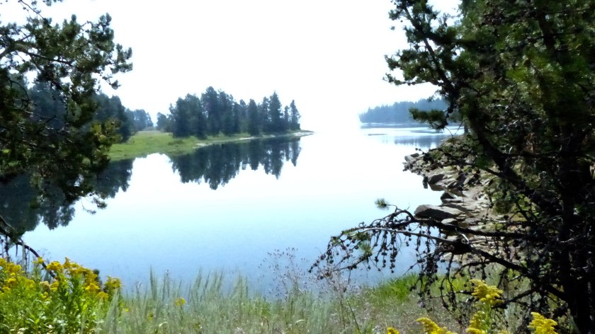
Itasca is the oldest of the Minnesota state parks. The park was established in 1891 to save the region from logging. It is also the headwaters of the Mississippi River- the reason we visit. The park is heavily forested and the campground is nice. Electricity is offered at many sites but not water or sewer.. A dump station and fresh water are available.


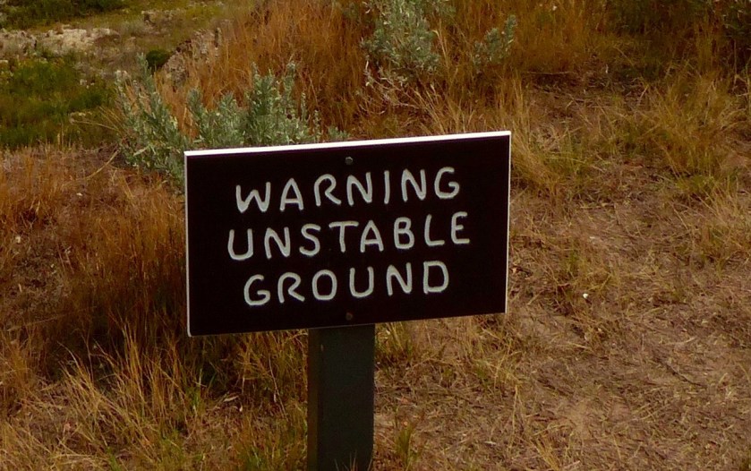
Narrow, twisting access roads with big tree branches overhanging the road make maneuvering our 51′ combo a little challenging. The park is very popular as it offers many amenities such as cabins, a lodge, multiple campgrounds and of course, the headwaters of the Mississippi River.

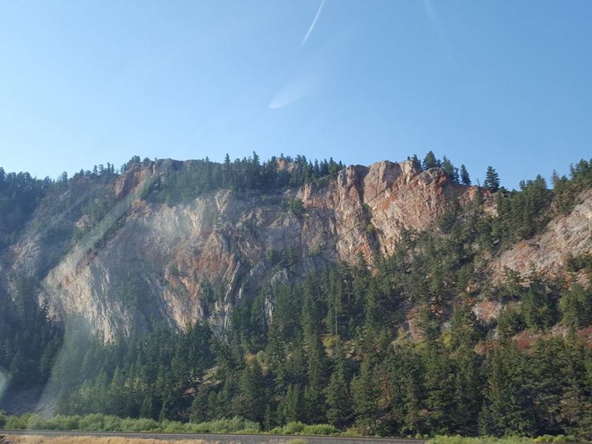
From Lake Itasca we traveled again on highway 71 to US 2 all the way to Grand Rapids MN, not the more well known Grand Rapids, MI. Grand Rapids is a town of just over 10,000 folks. We pass Cass Lake (770 souls) , once a mighty lumber town of 2100, the town now relies more on tourism and recreational activities. Its the headquarters of the Minnesota Chippewa Tribe and Leech Lake Band of Ojibwa. We stretch our legs the rest stop that overlooks Cass Lake. What a great stop!

P1040684

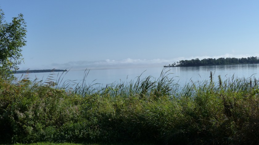
Cass Lake as Seen From The Cass Rest Stop

An interesting place we past through between Cass Lake and Grand Rapids is the little burg of Ball Club. As we roll into town I see the sign announcing “Ball Club”. I thought it a very large sign just to give directions to the local ball club, and in what sport might that club specialize? Well, Ball Club is a town of 340 souls named after a type of Native American lacrosse stick. Who knew?

We pass a few other towns, and not so towns but wide spots in the road that happen to have a couple of human built structures. No info on those small places on the internet.

We pull into our home for two nights- Pokegama COE campground. It’s located adjacent to the Pokegama Dam. The original dam was built in the 1880s to provide flood control, navigation and drinking water. It was rebuilt at the turn of the 20th century. What a beautiful beautiful place to camp.

The campground is all mowed grass, the site pads are gravel. Trees provide a canopy of shade……. and our site is located no more than 50′ from the Mississippi River!

OK, so the downfall of camping in the beautiful state parks and the COE campground is- no laundromat. We have accumulated a weeks worth of soiled clothing and are presently wearing our last pair of clean chonies. The laundromat that was recommended is not cheap. $6.75 for one washer- two needed. Dryers $3.00 a pop times two, eventually three since two drying cycles wasn’t enough to dry all of our clothes. So $22.50 later we leave with clean clothes.

Grand Rapids was the end of the line for river boats. It’s  three mile long rapids prevented further upstream navigation. The rapids are now drowned by a dam built to support the Blandin Paper Mill. And the Pokegama dam kind of finished off large vessel navigation until one reaches Pokegama Lake. Grand Rapids is the seat of Itasca County. She has just over 10,000 souls living here. If we had more time we’d explore the area more thoroughly.

Tomorrow we head to our first Great Lake- Lake Superior. See you there!

The Wood Chipper Exists!

Saturday August 26, 2017- Trip Days #22 & 23

P1040596
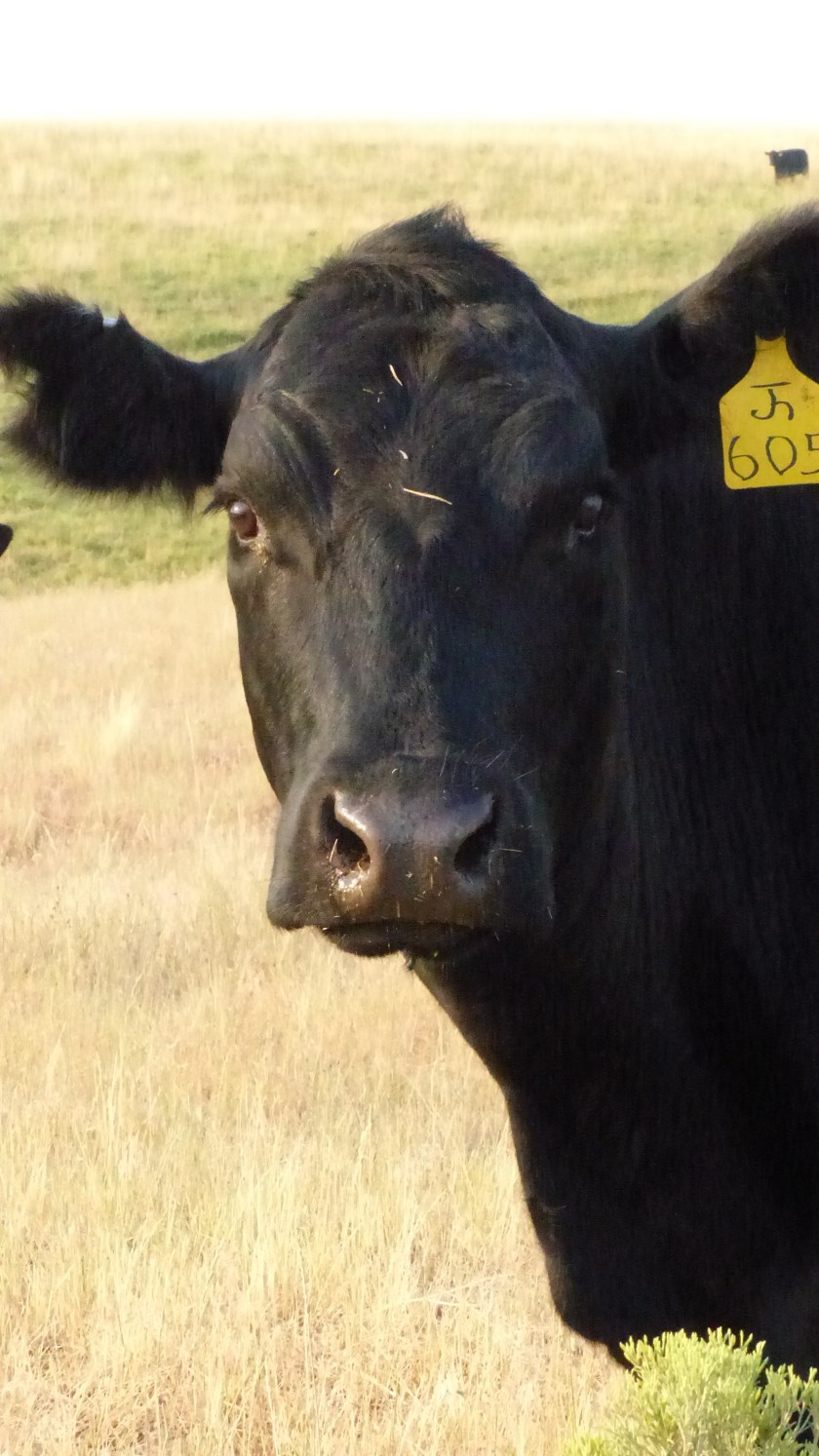
Yesterday we traveled 115 miles to Buffalo River State Park. We are now in our second new to us state- Minnesota. As we cruised east the hills got a little smaller and the northern plains became more evident. Again we see large fields of crops, a checkerboard of corn, sunflowers, maybe some wheat and alfalfa. We travel quite a distance without seeing cows, then spot one that had gotten past the barbed wire fencing and was laying on the side of the road. We are used to seeing raccoons, deer, even porcupines and armadillos in the South but hardly ever cows.

As the terrain flattens out more water is evident. Hobart Lake is in the path of the interstate so the interstate goes through it. Many of the towns along our path are several miles away, too far away to visit. Valley City (6800 souls) is one of the larger cities located near the interstate and is the seat of Barnes County. It’s known as the City of Bridges due to the numerous bridges crossing the Sheyenne River. One of particular interest is the Hi-Line Bridge. When built in 1906 it was the longest railroad bridge for its height in the world at 3860′ long and 162′ above the river. The bridge is in use today.

Tower City is named for Charlemagne Tower, a railroad official. 250 folks live there, surrounded by large farms and ranches. We pass Casselton and arrive on the outskirts of Fargo. Buffalo State Park, named for the Buffalo that wintered here, is located on Highway 10 across the Red River approximately 15 miles east of Fargo in the state of Minnesota. It’s a very nice park with mowed grass in between sites, a large swimming pond, many nature trails and of course, the Buffalo River. This makes three great campgrounds in a row that offer more than a place to lay our weary heads for the night.

Prairie (upper left)  Swimming pond drained (swamp drained?) (lower right) on Monday

World Famous Fargo Theater

Today we head back into visit Fargo. The city is the most populous in the state at 121,000 souls. Downtown is turn of the 20th century brick with newer structures to its south. She is also the seat of Cass County. Nearby towns are West Fargo, Moorhead and Dilworth Minnesota. North Dakota State calls Fargo home. She is named after Northern Pacific Railway Director and Wells Fargo Company founder William Fargo. The area started to flourish after the arrive of the railroad and became known as “The Gateway to the West”.

St. Mary’s Catholic Church, Fargo

Does anyone remember the movie Fargo? It’s described as a black comedy crime film that starred Frances Dormant as a pregnant police chief and William Macy as the desperate car salesman. Macy hires two guys to kidnap his wife in order to extort a healthy ransom from his father in law. It’s a very complicated story that begins in Minneapolis and doesn’t end until a lot of bad guys commit heinous crimes against innocent and not so innocent folks. Remember the wood chipper scene?……

P1040636

THE Wood Chipper from the Movie Fargo

On the way back to camp we stop at the Hjemskomst (don’t ask me how to pronounce that!) Heritage Center. We didn’t go inside choosing instead to walk the grassy grounds. Behind the main building is the replica of the Hopperstad Stave Church located in Norway.

There’s a turkey lurking’ in front of ya Jil!

Weather here has been cool with a touch of rainy mist from clouds that hug the ground like fog. No blue skies today. Still, it’s been a great place to visit. We’ve met some nice locals, at least they are more local than ourselves. The cool weather has made our numerous walks through native bottomlands along the Buffalo River a real treat. Together with the adjacent Bluestem Prairie Scientific and Natural Area it protects one of the largest and highest quality prairie remnants in Minnesota. There’s lots of wild critters- 200 species in all from moose to plains pocket mice as well as hundreds of bird species.

Tomorrow we’ll travel to the headwaters of the mighty Mississippi- Itasca State Park.


Fort Abe Lincoln and Jamestown

August 24, 2017 Trip Day 20 & 21

We stayed put yesterday in order to visit Mandan and Bismarck and the rest of Ft. Abe Lincoln State Park. Why travel when we are parked in one of the most beautiful campgrounds ever!

Mandan (21,000 souls) lies on the west bank of the Missouri River across from the state capital of Bismarck. She is the seat of Morton County. The city was founded in 1879, named for the indigenous Mandans who lived on the banks of Missouri River. The town is not unlike most we have traveled through- the Catholic influence is very noticeable. Mandan has multiple Catholic churches.

Touching Tribute To Dad From His Kids/ Mandan Church

We drive across the Missouri to the state capital of Bismarck. The original capitol building burned in 1930. In it’s place the “High Rise Of The Prairie” was built- all 21 stories of it. The grounds are large and nicely landscaped. We cruise around the town admiring how clean it is and how nice the houses are kept. We also visit the Cathedral District- the Cathedral of the Holy Spirit is what the district is named for.

For you history buffs: “From 1872 to 1887 Bismarck was an important transportation center and Missouri River port. Freight was hauled to Bismarck from the East by the Northern Pacific Railroad. Until a railroad bridge across the Missouri was completed October 21, 1882, the railroad terminated at the east side of the river and resumed on the west side. During the winter, trains crossed the ice on specially built track and during the summer, they were ferried across. A line called the River Landing Spur ran down to the steamboat warehouse so that freight from the railroad could be transferred to steamboats for shipping via the Missouri River. The river connected St. Louis, Missouri, Fort Benton, Montana, and ports in between.”

Back at the Fort- the Mandan lived in villages that consisted of many round earthen lodges. They were considered a very friendly people. The Slant Indian Village here in the park was abandoned due to the outbreak of of white man’s disease- smallpox. William Clark visited this location on his way back to Missouri in 1805.

P1040496

Fort Lincoln was Lieutenant George Armstrong Custer’s home base. This is where he and the 7th Calvary began their ill- fated expedition to round up the Sioux Indians. The visitors center has the largest collection of Mandan Indian relics in existence. Many artifacts and photos are on display and is a must-see.

Today we packed up and headed to Jamestown, ND. We are staying at the municipal campground of Lakeside by the Jamestown Reservoir. The grounds are nice, the park is great, catering not only to campers but picnickers and boaters. We arrive at St. James Cathedral just in time for Mass followed by Adoration.

St. James Basilica/ County Courthouse

We next drive through town and are pleased that this town is like all the others we’ve visited in North Dakota. The locals show a lot of civic pride- the homes are well maintained, the streets are clean and free of debris. This town is also heavily influence by the Catholic ethic.

The last place we visit is the Pioneer Village. It consists of small structures emulating what a pioneer town would look like. The Village also is home to the National Buffalo Museum. A genuine real live white buffalo lives there- and so does the world’s largest buffalo!

Tomorrow we travel to Buffalo River State Park. See you there!


We pass Fort Sauerkraut…..Fort What???

P1040426August 22, 2017- Travel Day #19

We are in no hurry to pack up and hit the road this morning. After all we are only traveling a hundred miles……. So off we go before 0800 hours. Man, it seems that we cannot sleep in no matter what. Heading eastbound on I-94 we pass Gladstone.


A planned stop is in the little town of Richardson (pop. 520). The town was founded in 1883 and is home for Assumption Abbey. The Abbey was founded 10 years later by a Swiss Benedictine monk. St. Mary’s Catholic Church is on Abbey grounds and is shared by the monks with the community. We walked the grounds, then entered through a door marked “Information”. We are astounded that we are in the bowel of the abbey.


She meets a Benedictine that has 60 years of service as a monk. We find that he is 81 years old and very spry. He invites us to look around and wander around to our heart’s content. Wow! Another monk opens up the small gift shop for us. As Jil is cleaning the contents off of every shelf to purchase for gifts, the monk tells us that the grounds consist of 2000 acres, most are rented to farmers, many products in the gift shop are hand made here at the Abbey. Several books were written by the Abbey’s monks. Only 28 monks remain at the Abbey so they don’t have a beef herd anymore.

81162723When approaching Hebron we see a sign. “Fort Sourkraut Next Exit”. Fort Saurkraut? Ya gotta be kiddin’ me. No, they are serious. Fort Saurkraut was raised in three days by settlers interested in saving their hides from Indian attack. The fort was built out of sod with (stolen) railroad ties for roof support. It was then surrounded by barbed wire in the hopes that it would deter the rumored attack. The Indians never planned on attacking the settlement, the attack never came. Fort Saurkraut (so ya think there were a lot of Germans in this town?) is the only sod fort ever built in North Dakota. The fort was recreated a few years ago by dedicated farmers in the hope that “If we build it, they will come”. I don’t know how that worked out for them………

Hebron (940 souls), on the other hand is known as “brick city” for its brick factory. It is also the nations top producer of canola, dry peas, certain wheat, dry beans, sunflowers, barley, honey and sweet crude. Not bad for a small town, eh?P1040428

Glen Ullin (800 souls) is another town founded in 1883 along the Northern Pacific Railroad in the Curlew Valley. She is on of many farming communities that sprang up along the railroad route. Then we are back in New England passing the town of New Salem also founded in 1883.

We exit the interstate at Mandan. Mandan at 21,000 folks (8th largest in the state) was founded in 1879. She is the seat of Morton County. Her main industry is oil- a Tesoro refinery pumps out 71,000 barrels of sweet crude oil a day. Mandan lies on the west bank of the Missouri directly across from the state capital, Bismarck. We turn south and head for our encampment for two nights Fort Abraham Lincoln State Park.

P1040456

Fort Lincoln is a treasure of history. This is the place where General Custer assembled the Seventh Calvary and lead them to annihilation at the Battle of the Little Bighorn. His house has been recreated as well as troop barracks and a lookout post way up on a hill that offers a 360 degree view of the surrounding area. The campground is nicely treed with a large mowed grass infield separating loops. We love it here!


Dickinson- What to Do, What to Do?

August 21, 2017- Travel Day #18

Sigh…… We stopped in Dickinson, a city of 23,000 souls and the seat of Stark County (haven’t seen so many seats since Dodger Stadium) for two nights for a reason- the Eclipse. We didn’t want to be on the road during the eclipse even though the sun would be only 80% covered by the moon here- most eclipses, if there is such a word, will be much farther south. We’ve heard many places are experiencing a population explosion just for this one event. We hope we didn’t make a mistake by staying put one extra day.

P1040386
Honey, I don’t know if we should go this way.

So we do a little research and find an interesting sounding place, the Enchanted Highway. The Enchanted Highway is a collection of the world’s largest scrap metal sculptures constructed at intervals along a 32-mile stretch of two-lane highway in the southwestern part of the U.S. state of North Dakota. I type in the closest town to the highway into the onboard navigation system, start up the perfect tow vehicle and we are off. I immediately flip out the “navigator” as I turn left down a country road instead of heading towards the interstate. “Make a U-turn at your earliest convenience!” Nah, we continue on the country road. More protests from the “navigator”. Shush!

P1040390
“Navigator” wanted us to turn down this road!

We travel over hill and dale passing beautiful farms. Some grow cattle fodder, others sunflowers. Acres and acres of sunflowers. The asphalt road turns to oiled, then to dirt. We make a right and head towards the interstate where we catch another asphalt road that heads towards the burg of Gladstone.

Unknown

At the I-94 overpass we see the first huge metal sculpture- that of a flock of geese. A little background- a young artist fella by the name of Gary Greff wanted to enhance the lives of the folks in his hometown of Regent. So how better to do that than do what farmers are good at- welding. He helped them create art one welding bead at a time. So Gary and 3 dozen farmers built the sculptures that depict local life we see today.

We continue down this road all the way to Regent stopping at each sculpture as we go. The countryside is beautiful and the huge sculptures are amazing- both a must see.

P1040398 (1)

Several miles down the Enchanted Highway we see a few tree, which usually means civilization- and a church steeple rising above them. What the???? Lefor is almost a ghost town with only 60 inhabitants. It used to have a post office (closed in 2002), a bank- closed during the great depression. What still exists is a few inhabited homes lining dirt streets- and St. Elizabeth’s Catholic Church, circa 1929. Mass is still held there……

Sculpture on right got the blue ribbon! (just kidding, OK?)

We finish the tour in Regent. Not a lot in town. Not even a coffee shop that we saw. But it did have a nice two diamond ball park that just begged for a mutzo to enjoy. Megan ran around like crazy. She’s used to being off leash once in a while and this was it. This is where we saw as much of the eclipse as God offered. We viewed the sun with approximately 80% of it covered by the moon. Lighting was a little eerie……….

Yes, we did drive through New England…………….. (North Dakota)

We headed back to the barn from Regent. The drive to the Enchanted Highway, the highway itself and the road home put us in at 80 miles. That’s enough driving for one day. Tomorrow we travel to Fort Abraham Lincoln State Park in Mandan, ND.

P1040422
North Park Campground, Dickinson ND

We Enter A New State

August 21, 2017- Trip Day 19

P1040384

We’ve never been to North Dakota- have you? We left Miles City KOA and headed east, er west then east to I-94. Couldn’t cruise through town as a low bridge would put our 5v’er in the hurt locker. It’s just over 100 miles to the new-to-us state of North Dakota. Terrain consists of rolling grass covered  hills that sometimes turn angry- badlands angry. Of course down by the Yellowstone River green farmlands abound.

Not long after we hit the road we come to Terry, Montana. Terry (600 souls) is the seat of Prairie County. The town was named after General Alfred Terry, a commander of  an 1876 expedition in relation to General Custer’s campaign against Native Americans. One of it’s world famous events is the Terry Yippee BBQ. Never heard of it? Neither have I….. The Terry Badlands Wilderness Study Area also attracts a lot of visitors.

Unknown
Glendive, MT

Glendive (pop. 4900) is another county seat, that of Dawson. It is just one of many towns established by Northern Pacific Railway. The town is an agricultural and ranching hub of eastern Montana. Makoshika State Park is located nearby. It’s a large 10,000 acre park that features badlands and fossils of the tyrannosaurus Rex. Our time following the Yellowstone River comes to an end here as the river continues northeast and we east.

Thirty eight miles later we see a big Welcome to North Dakota sign.20953914_10213551905092786_2463391061324782167_n

On The Road To Medora, ND

Yippee, We made it! We crest the hill and head down into more hills, more badlands. Some of the hills are severely eroded. In stark contrast others are just normal looking grass covered hills. We soon pull into Medora.

Whatcha doin’? Oh, just walking’ our goat!

Medora had a population of 112 souls in 2010. It’s, gads, the seat of Billings County- and the only incorporated town in that county! This town was also founded by the Northern Pacific Railroad in 1883. Geez, how many towns have we been to or through that were founded by the NPR? It is known for the Medora Musical making it one of the most popular attractions in the state. President Roosevelt visited there in 1903. He felt that he had helped stop the bickering in the West as he was greeted warmly by folks far and wide. He stated that his only regret was that he couldn’t spend 3 hours visiting with the locals.

President Theodore Roosevelt visited the area in 1883 to hunt bison. He immediately fell in love with the area’s ruggedness. He eventually purchased 3 ranches around the area. The entrance to the South Unit of Theodore Roosevelt National Park is in the center of town. It offers a small, busy visitors center. The road into the park is not too good and there’s no place to drop the trailer. We bypass the people crush at the park in favor of visiting the Painted Hills overlook.

Painted Hills Visitors Center

The overlook stands on an “unstable” cliff. A father had talked his teenage son into climbing the rail fence to better pose him for a photo while mom looked on. The son pointed out the sign below. Dad said “How bad can it be? They let us stand on this side of the fence don’t they?” WOW!P1040381 (1)

Off we go. We are spending a couple of nights in Dickinson, ND. Not sure what we’ll do but we are a little road weary- and the smoke from wildfires in the West has greatly diminished.


Every Where We Stop Is A Seat!

P1040186August 19, 2017- Trip Day #17

We left Billings this morning. We are not in a hurry but we still pulled out at 0800 hours. I couldn’t screw up our route today as we only need to travel east on I-90 to I-94 and head towards North Dakota. If I miss that junction we’d wind up in Wyoming or South Dakota! All goes as planned as we swing northeast on the 94.

Our first impression of the territory around us is that it is rugged. Almost badlands rugged. We pass the Pompey’s Pillar National Monument turnoff as I have second thoughts of visiting that historical location.

The monument was used as one of William Clarks navigational landmarks during the Lewis and Clark Expedition back in 1806. He even inscribed the rock and that inscription is preserved today. Bad decision on my part. Unfortunately the signage to most places does not include mileage anymore. Pompeys Pillar was less than 2 miles from the interstate….. crap!

We travel from badlands to prairie, back to very eroded hills, to prairie following the Yellowstone River all the while. A rest stop sign enlightens us to the importance of this area. William Clark stopped at the convergence of the Yellowstone and Bighorn Rivers to camp and reconnoiter on his way back from the Pacific Ocean in 1806. A year later a fella named Manuel Lisa established a trading post at the same location- the first building in what is now the state of Montana. Lisa sent John Coulter out to contact the Indians to let them know that he would trade for furs. In Coulters quest for Indians he discovered what is now Yellowstone National Park.

We continue on and stop in a town known as Forsyth. Ya never know what you’ll find in a small town and we found that it is the seat of Rosebud County…. and its celebrating an event that requires blocking the main drag.

No problem- we maneuver around the back side and wind up at the county courthouse. The courthouse was built in 1914 with a budget of $125,000 but went over budget by $40,000. The county refused to pay the contractor the extra cash, the contractor locked himself inside the courthouse. That all came to an end when the court awarded the contractor what was due him. By the way, the town looks like its had better days.

We continue heading towards North Dakota. Our destination is Miles City, MT. On a mowed field we spy pronghorns grazing in field stubble. We pull into Miles City before noon, our second seat.

Miles City is the seat of Custer County and is obviously more prosperous than Forsyth. The place is named for General Nelson Miles who is credited with the subjugation of the remaining “uncontrolled” Native Americans in the 1880’s. According to Miles his larger problem was the sellers of spirits to his troops so he kicked them out of camp- but they just moved a short ways from the fort and established what is now Miles City.

Unknown-8
Custer County Courthouse

Miles City is home to the infamous Range Riders Museum. According to the Miles City Visitors Guide 2009 edition, “The Range Riders Museum captures the essence of area ranches, railroads, Indian villages, Fort Keogh and all the things that make south-eastern Montana special and historical.” And that it does. If you have a spare couple of hours to do the museum justice, drop on in.

We overnight in the Miles City KOA. Nothing fancy but all necessary amenities are offered. Even a very small swimming pool. It’s located on the south side of town near the confluence of the Tongue and Yellowstone Rivers. We are under cottonwood trees to block the hot sun. This park could be really nice if the grass wasn’t browned out and the pads gravel renewed.

Tomorrow we head to new territory- North Dakota and the town of Dickinson.


Ooops! A Minor Miscalculation on our way to Billings Montana

August 18, 2017- Trip Day 16

P1040127

We were up early this morning in anticipation of a 250 mile travel day. 250 miles isn’t that far but we were hellbent on keeping the mileage down to 200 or less. We are on our way at 0730 hours. Adios Lincoln RV Park and Helena!

We jump on Interstate 15 southbound intending to travel to Butte, catch Interstate 90 East and head towards Billings. What could go wrong? I’ve Google Mapped the route twice…… all is well. Just past Helena Jil says “I’m sure glad we’re only going 198 miles today!” Gulp!!! I reply “More like 248.” We are both wrong. One of the shortests routes is around 230 miles. It traverses over hill and dale down country roads- our kind of road. The other routes are around 250 miles, also following country roads. How-some-ever, I chose the interstate routes for sheer speed of travel……. the only thing I forgot was to change the routing on Google Maps………. sigh……. this route is at least 50 miles farther!

For You, Bernice!

Building A Dam Above Butte                       Butte, Montana

Oh well, we are committed to the interstates. We pass Montana City (2700 souls), our last chance, unbeknownst to us, to reroute and head down towards Butte. Butte is Montana’s fifth largest city at 34000 souls and is the seat of Silver Bow County. The area is home to some of the richest copper mines in the country. One such famous mine is the Anaconda. We chose to bypass Butte and head east on I-90.

Pulling the grade to Homestake Pass we see a fellow traveler has laid his sport utility and Airstream trailer on their sides. Emergency services are on the scene. We pray that they are OK. We grunt over the Continental Divide at Homestake Pass (elevation 6329). Water now flows towards the Mississippi. We pass a few small burgs, namely Whitehall, Pipestone and Caldwell in the Jefferson River Valley. The entire population of Jefferson County numbers 11,000 souls. We are on our way to Three Forks.

Three Forks State Park is a historically significant area. The confluence of the Madison, Jefferson and Gallatin Rivers form the Missouri River, the longest single river in North America as well as the major portion of the Missouri-Mississippi River system from Three Forks to the Mississippi Delta. The rivers were named after President Jefferson, Secretary of State Madison and Treasury Secretary Gallatin by Merriweather Lewis. Sacajawea, the Corp of Discovery Indian guide is from this area. Lewis and Clark reached the confluence on July 28th, 1805.

We pass a number of small ranching communities and reach Bozeman (37000 souls), fourth largest in the state) the seat of Gallatin County. The town is named after John Bozeman, who opened the Bozeman Trail in 1863. Nelson Story successfully drove 1000 head of cattle into Paradise Valley, just east of Bozeman in 1866. He later donated the land to the state for the establishment of Montana State University- Bozeman.Bozemans-MSU-Aerial1

We finally reach the Yellowstone River Valley at Livington (pop. 7000). Livingston is the seat of Park County. This ranching and railroading towns founding is a direct result of the Northern Pacific Railroad. From here we will follow the Yellowstone all the way to Billings.

Unknown-2

We stop in Big Timber but not before seeing the sign “Crazy Mountains”. The name Crazy Mountains is said to be a shortened form of the name “Crazy Woman Mountains” given them, in compliment to their original Crow name, after a woman who went insane and lived in them after her family was killed in the westward settlement movement. Big Timber (1600 souls) takes its name from Big Timber Creek, so named by William Clark for the big cottonwood trees, is a good stop for us. There is a little coffee shop right on the main highway that also sharpens chainsaw blades. We stop and purchase two coffees and a delicious slice of spice cake. We are fresh out of chainsaw blades………


We pass at least five more small farming communities before reaching Billings and the Billings Village RV Park, our stop for the night. Billings is the largest city in the state at 166,000 souls with a trade area of 1/2 a million. Billings ,originally founded as a railroad town, is the seat of Yellowstone County. The city avoided the economic downturn due to the proximity of the Bakken oil development in eastern Montana and western North Dakota, the largest oil discovery in American history, as well as the Heath shale oil discovery just north of town. Billings also boasts more hotel accommodations than any area within a five state radius. As a result it hosts many conventions, concerts and sporting events. Within a 100 mile radius lies attractions such as Pompey’s Pillar, Pictograph Cave, Chief Plenty Coups State Park, Little Bighorn Battlefield National Monument, Red Lodge Mountain Resort, and the infamous Beartooth Highway to Yellowstone National Park. Whew!

Unknown-5

Night All. I’m tired………….


The Capital and Capitol of Montana- Helena

Thursday, August 17, 2017- Trip Days 14&15

Yesterday, August 16th was a pleasant trip day. We took our time and really didn’t travel that far. I-90 follows the Clark Fork River for a long way. It was in our view quite often except when the canyons broadened out into valleys. We passed many ranches on the way. Most didn’t look too large, more like family operations.

20882218_10213517078982155_1947042140163709173_n

We drove past Drummond, a town of 300 souls, and stop in Gold Creek or Goldcreek. I’ve seen it spelled both ways. Interesting fact-the community Gold Creek (Goldcreek?) doesn’t exist on the internet even though it has a post office- but the creek there is historical. The first recorded gold found in Montana was found here in 1862 but not enough to make it commercially viable. What the creek lacks in gold the community makes up with the Dinnerbell, a combination deli and bakery, store and restaurant. Popular at the Dinnerbell is the Mennonite family style dinner  that starts off with a prayer on Thursdays. To partake in the fried chicken or meat loaf, vegetable, salad, fresh homemade rolls and homemade pies one must have a reservation!

On the advice of a friend we overshoot the turnoff to Helena in order to visit Grant-Kohrs Ranch located in Deer Lodge (3100 souls). The working cattle ranch is run 24/7 by National Park Service employees, Rangers and volunteers. Johnny Grant first owned the ranch and lived in what he called a leather lodge (teepee) that he got from an Indian in exchange for a horse. P1040024Conrad Kohrs opened a butcher shop. Grant build a 4000 square foot house in 1862 and 5000 square feet was added to that home by Kohrs in 1890. Augusta Kohrs salvaged the bug ridden house in a “war of extermination”. Over time she acquired the finest things in life, luxurious furnishings, Pershian rugs, the finest china. P1040030
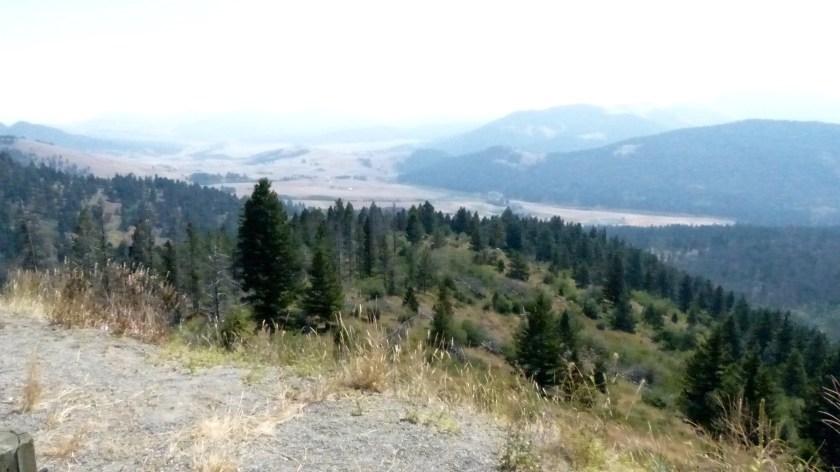
The ranch house is open to the public as are the grounds. When we visited a volunteer fella had a chuck wagon on display and offered us cowboy coffee he had made over the campfire. A blacksmith was busy making andirons in the blacksmith shop. And Miles, a volunteer cowboy was mounted on Fox, a quarter horse who lives on the ranch. We enjoyed the information that the knowledgeable volunteers and Rangers shared, and the ranch is beautiful.

We backtrack to Garrison and turn towards Helena on highway 12 this time following the Little Blackfoot River. Eventually we leave the river and go over 6100′ McDonald Pass  which is on the continental divide. Great views would have been had looking down towards Helena Valley but again- thick smoke!

P1040064
Helena Valley From McDonald Pass- Ugh, the Smoke!

We are staying at Lincoln Road RV Park just north of town. Not the prettiest park but it has full hookups, a laundry and is fairly quiet. We took the rest of the afternoon off, taking time to run down to Hauser Lake and Lake Helena.

Megan snuck in a few dunks in Hauser and fetched a couple of sticks. She is definitely on report as mutzos are allowed “on leash” only!

Today, August 17th, we headed into town to visit the Montana State Capital, downtown Helena and the Cathedral of St. Helena. Helena (28,000 souls) doubles as the state capital and the seat of Lewis and Clark County. It was established as a very successful gold camp in the 1860’s. Over 3.6 billion dollars worth of gold were mined in 20 years. Helena became one of the richest cities in the U.S. and that wealth contributed to the city’s prominent abundant Victorian architecture.

The capitol building is as magnificent as any you will see. Walking through the hallways it was fairly obvious that the legislature was out of session as there were no security folks around. The colorful history of the Helena Valley and the city are a good read.

Next we visit the magnificent Cathedral of St. Helena. She was constructed at the beginning of the 20th century. It is fashioned after the Votive Church of the Sacred Heart in Vienna, Austria. The statues and altars are carved from the purist Carrara marble, and genuine gold leaf decorates the sanctuary.

The pews are hand carved oak. The special lighting fixtures are hand-forged bronze. The spires outside soar 230 feet above street level. We are in awe of this beautiful cathedral.

Downtown Helena is interesting. Some of the streets follow the original layout of the old gold mining days where the roads meandered around mining claims and followed the gulch. The downtown area has a two block long pedestrian mall in amongst the old stone and brick multistory buildings.

It’s a pretty downtown as downtowns go. The surrounding residential neighborhoods are tree lined beauties. Many of the Victorian era homes still survive. The strangest building architecturally is the Community Civic Center building.

Construction began in 1919 as the Western District Algeria Shrine Temple. The building, which resembles a mosque is the Moorish Revival style, was purchased by the city after the 1935 earthquake. Today civic events are held in the auditorium as well as housing county offices.

P1040125
The Historic Watchman Fire Watchtower


1800’s One Room School House/ Modern Man’s Attempt to Build Same

Tomorrow we saddle up and head towards Billings.


The Unknown is Always- The Unknown!

August 15, 2017- Travel Day 13

Yesterday we motored down to Bretz RV in Missoula. On the way we stopped at St. Ignatius Mission in a town named after same.

P1030979

The mission was built in the early 1890’s. 58 of its murals were painted by a monk that was there as a cook. The mission is beautiful. While there we met the Franciscan Priest assigned there. He’s new with 3 months of service there but he has served in Iraq. He was very knowledgeable of the places we wanted to visit. He recommended visiting the Cathedral in downtown Missoula as its artwork is just as fascinating as that of St. Ignatius.

The 133 miles went by quickly and before long we are backed in to an overnight spot at Bretz RV, Missoula. The dealer offers electrical power and water- the essentials. I check in to the service department as a “sandwich” job with no appointment. The service manager stated that we could be waiting to have our new air conditioner installed until Friday. Yikes! Today is Monday!dealership_long


We decide to go exploring. The rig is closed up into the travel position and power disconnected so the in the slim to non chance the service guys move the rig into a service bay nothing will restrict them from doing so. Traffic is horrible on Reserve Street (US 93).  We head towards downtown. Traffic is horrible!

We reach downtown and head towards the St. Francis Xavier Church. The church was built about the same time as St. Ingatius. It also has a large collection of hand painted pictures. So beautiful. We spend some time at a park walking Megan, then head back. THE 5TH WHEEL IS GONE! Yippee! The Bretz boys are working on her!

OK, we have to cool our heels for a few hours…… what to do? We head to the Rocky Mountain Elk Center located just a couple of miles north. The center contains large, relatively new buildings. The largest states that it is for the use of volunteers. Another large- but not as large- building is where the visitors center is located. The public area is not terribly large. The displays are mostly of stuffed elk with a smattering of other species. Some history going back to Lewis and Clark is present. Outside a “nature trail” with minimal signage explains what one is viewing. The nature trail, in my opinion is a fizzle. We take one last look around  at the opulence of the structures compared to what is actually presented to the public and figure….. giant government grant!

Next we head east and wonder around the University of Montana, Missoula.P1040011

We head east on I-90 and visit Bonner and Milltown just to kill time. Bonner is interesting in that it’s an old company town. They are easy to distinguish as the houses look the same. It’s now 4 pm.

We are tired of driving. We head back to Bretz………. and….. the rig is ready to pick up! Yeah!!! We pay our bill and thank the service people profusely for squeezing us in and spitting us out this afternoon. We hook up and head towards Jim and Mary’s RV Park.

Jim and Mary’s RV Park is located a few miles back on US 93. The park is highly recommended and now we know why. It is a well treed, well maintained park- a real beauty. We set up and relax. It’s been a long day and we deserve a little time to kick back.P1040019

Whitefish, Montana- part 2

August 14, 2017- Travel Days 9-12

We arrived in the Whitefish area last Friday and spent the rest of that day setting up camp, wrestling the satellite dish aiming ritual to a successful standstill, and relaxing. Glacier Peaks Storage and RV Park is a no nonsense park. No real extra amenities here, just full hookups and the shade of tall conifers. The park is easy to find if you know what to look for…. 😉

This is What to Look For!

Saturday we joined Jil’s sister’s family down at their cabin near Rollins on Flathead Lake. Their abode used to be part of a Methodist camp that featured several small cabins that stepped down a hillside towards the lake. Most of the cabins have been upgraded to make them more comfortable. A sandy beach with a boat dock is shared by all of the homeowners. Two boats, a bunch of kayaks, a stand up style paddle board, all with assorted safety paraphernalia are close at hand. Two Quik Shades offer relief from the very warm sun. We meet the in-laws, and their kids. The group totals about 14 folks. The kids go swimming, kayaking and exploring while some of the adults just yack. After several hours Jil and I take our leave.

Kim and Dave’s Grandkids               Jil (Eva) and Kim (Zaza)

We are hungry but don’t find a shady place where we can leave our muttzo in the truck. We look for a place where we can take out food. We are not successful until we reach the little village of Somers. Somers Bay Cafe is willing to accommodate us. I order two burgers, one with a side of fries, the other onion rings. Only one order for one person is ahead of mine so this should be quick. I occupy myself by walking around the small cafe admiring the photos of old time Somers back when it had a thriving lumber company. Today the village is just a nice place to visit if one is looking for a place that serves good food that happens to be right next to a wonderful hardware store. Which by the way, are the only two businesses in the old downtown district. I won’t count the mom-and-pop store-turned-casino a block down the street. The hamburgers come out after an extraordinarily long wait (didn’t seem long, it was really, really long!). They are scrumptious, as are the fries and onion rings- well worth waiting for. Mission accomplished- we are full!

Somers Bay Cafe/ Old Barn Near Downtown Somers

It’s Saturday, our tummies are full and it’s hot, in excess of 90 degrees. We look forward to relaxing in our nice, cool RV. Ugh, it’s hotter inside the coach than out! The A/C has failed. What to do? Aha! Call the many area mobile RV repair folks. I call one- “leave a message”. I call the next- leave a message”! I call the third- leave a message”! Ai Caramba. So I went out and bought a fancy hazza gazza of a floor fan to move solar heated air around and around inside the coach…… it helped but is not the same as refrigerated air.

Sunday the heat breaks- Thank You Lord! Rain clouds come in cooling the afternoon air to the mid 70’s. It rains some off and on. We drive around the Whitefish area exploring, unknown to us, territory. We visit Whitefish State Park on Whitefish Lake. It’s beautiful but the sites are too small for our trailer. At least the smoke has lifted some…….

P1030962
Picnic Area Whitefish Lake State Park

We drive out US 93 to a horse farm and spend time admiring several of the majestic animals.

Monday Morning- no calls from “mobile RV repair guys”. I call each of them again. One finally calls back and said he’s booked for 10 days. Another calls and says he’s out of town for 10 days. Phooey! The one that was advertised as “called back promptly and does excellent work” never did call back. I call two local RV service centers and neither are a help- no time to effect repair/replace of A/C unit and/or no A/C unit available for 10 days. The last mobile repair guy calls back but I beat him to the punch. I’ve located the right A/C unit in Missoula, which was not easy to do, and we have an appointment to have it installed on a “we’ll squeeze you in when we can” basis at Bretz RV. Hah!…… this could be a several day ordeal. At least they say we can stay in our RV and offer power and water.

We spent the rest of the day with Jil’s sister Kim. Her family, grandkids, grandpa and some of the parents were out sheering sheep at a sheep ranch. Or maybe they were just going to watch them being sheered? Either way, Kim and Jil parallel talked about two different subjects simultaneously and completely understood what the other was saying. I sat there amazed as most guys would. We said our goodbyes, see you soon’s and gave each other a hug. It was a nice visit with nice folks.

We didn’t visit nearby Glacier National Park this trip- too many people and couldn’t see the glaciers for the smoke. Business in the local towns is down due to low visibility.

A Peak in Glacier National Park; Going To The Sun Road

Tonight we picked up what was not needed for the night and cleaned inside the coach in preparation for an early getaway tomorrow morning. We have an appointment to keep in Missoula at Bretz RV to have our new A/C unit installed and can’t be late! Hope they can complete the job tomorrow…… fingers crossed!

Whitefish, Montana- part 1

August 11- August 14, 2017- Travel Days 9-12

We are spending the next four nights in and around Whitefish. We drove through downtown Kalispell to Glacier Peaks RV Park which is actually just west of downtown Columbia Falls. We are close to three local burgs, Kalispell, Whitefish and Columbia Falls and the mighty Flathead Lake here. Jil’s sister Kim, her hubby Dave and her son Dillon, Kim’s grandkids Maci and Flynn all live in Whitefish, a town of 6300 souls. Whitefish is popular with US citizens as well as Canucks as Whitefish is a short 60 miles from the border. Whitefish offers downhill skiing on Big Mountain, riding snowmobiles through the forest and ice skating in the winter, water sports and fishing on the Whitefish River and beautiful Whitefish Lake in the summer.

Whitefish developed around the Great Northern Railroad. Originally called Stumptown due to the abundant timber that needed to be cleared to build the town and the railroad. As the lumber industry became less important the tourist industry rose to what it is today. The historic Whitefish Depot saw 68,000 people embark and disembark in 2006. US Highway 93 is the main thoroughfare; during peak season that rode is bumper to bumper with traffic.

Whitefish, MT
Downtown Whitefish

Kalispell, Salish for “flat land above the (Flathead) lake” is the seat of Flathead County and is the most populous city in the county. The Micropolitan Statistical Area reports a population of over 93,000 souls. Besides being a commercial hub to northwest Montana, Kalispell serves as the gateway to Whitefish Mountain Ski Resort, Glacier National Park, many golf courses and of course, Flathead Lake.

Flathead County Courthouse
Courthouse sits in the middle of a traffic circle on US 93

A Little Kalispell Whimsy in Upper Photos

Columbia Falls (4600 souls) is northeast of Kalispell. US Highway 2 runs through it as does the Flathead River. The Montana Veterans Home is located here. If you like to “recreate” this is the place. Swimming, hiking, visiting Glacier N.P., river raft trips and camping are available in the summer. Winter activities include dog sledding, cross country skiing, snowmobiling, ice skating and ice fishing are all available.

Columbia Falls, MT
Aerial of Columbia Falls

Onward to Whitefish Montana

August 11, 2017- Trip Day #9

20727941_10213474861526745_7456450730912105357_n
Momma and Baby Moose

We bid adieu to the lovely Powell Campground and travel east to the summit of Lolo Pass on our way to the Bitterroot Valley.

3685862071_d637290c4bWe also say goodbye to Idaho at that point and enter Montana. The road on the east side of Lolo pass is much smoother, wider and a more gentle slope as it follows Lolo Creek down towards the town of Lolo. We pass numerous ranches and more than a few fire camps and fire drop points. We meet momma moose standing on one side of the highway looking towards the other. She’s waiting for her baby. The few motorists stop and wait for baby to catch up. Then they disappear into the woods. We are still on the path that Lewis and Clark took in 1805 but I think we have it much easier than they. No paved roads for them and no gigantor home on wheels either!

Speaking of the Nez Perce and the ongoing saga with the US Calvary……. the eastern slope of the Bitterroots down the highway 12 corridor is rich in the history of 1877. The peace loving Nez Perce attempted to evade the US Calvary, and they do a darned good job of it. The US forces determined that the Indians were headed down to the Bitterroot Valley via well worn Indian trails. In his infinite wisdom, the commander ordered his troops to build a fort/barricade in a rather large meadow. He intended to block the Nez Perce escape but the Indians got wind of it and just went around the fortress. ‘Nuf said!

At Lolo we turn north on US 93 skirting downtown Missoula. After several miles we turn west onto I-90 where we rejoin US 93. The road takes us through some hill country then to a large plain. We pass through quaint Arlee (600 souls), named after Salish Chief Alee. No the chief’s name is not misspelled as the Salish alphabet has no “r”. Native Salish is spoken in Arlee. The town hosts a popular Pow Wow and rodeo during the July 4th weekend.

Unknown-1
St. Ignatius- Mission Mountains

Next comes St. Ignatius (840 souls). This town is located on the Flathead Indian Reservation. Not surprisingly, 40% of the population is Native American. St. Ignatius Mission, founded in 1854 by Father Pierre-Jean De Smet is located on the edge

of town. According to literature, the most exceptional feature is the 58 murals painted by Brother Joseph Carignano, an untrained artist who worked at the mission as a cook. We plan to visit the mission on our way back towards Missoula at a later date.

Above photos taken from same location; 2015 on left, 2017 on right

We now travel north through the beautiful (except for thick wildfire smoke) Mission Valley, the Mission Mountains to our right are all but invisible due to said smoke. Ronan (1800 souls) is also on the Flathead Indian Reservation, in the Mission Valley and 12 miles south of Flathead Lake. Native Americans make up 33% of its population. It serves as the agricultural hub of Mission Valley.Unknown

Our travel through the beautiful Mission Valley is disappointing and only because of the dense smoke. The beautiful views that we’ve seen in past travels are reduced to brown silhouettes of almost everything including the mountains. Crap! But as Jil says, “You get what you get when you travel”- or something like that.

Polson lies on the southern shore of immense Flathead Lake (4400 souls), also is located in the Mission Valley, is the seat of Lake County and yes, is on the Flathead Indian Reservation, phew! It’s interesting to note that the White Eyes outnumber the First People nearly 5 to 1 here. Could it be that the Flatheads have an aversion to White Man’s politics?Unknown-2

We skirt the western banks of the Flathead Lake, the largest natural freshwater lake west of the Mississippi. It is the remnant of a massive glacial damned lake, Lake Missoula. To give one a comparison to LARGE lakes it is only slightly larger than Lake Tahoe and contains a significantly less volume of water.

The first town we come to Big Arm (131 souls), then Elmo, a small village (140 souls) comprised mainly of First Nation folks. It’s noted for its delicious Flathead cherries and hosting the Standing Arrow Pow Wow. Next is Dayton (pop. 95)- a wonderful place to launch one’s sailboat in order to explore Wildhorse Island State Park. Rollins (183 souls) is a few miles up the road. It offers wonderful beaches, the nice Rollins Restaurant and RV Park with Boat Docks (best burgers on the lake!). In front of the RV park is M&S Meats & Sausage. The shop is well known for its buffalo meats and sausage as well as more traditional products.Unknown-3


Lakeside, a resort community, is the largest on the west shore of Flathead Lake- and the most commercial. It has increased 600 folks since 2010, now with 2600 souls. It lies in Flathead County. The median family income here is more than four times greater than that of Elmo!

Lakeside Montana
Lakeside MT.

The last village on the lake on the way to Kalispell, Whitefish, Columbia Falls and Glacier National Park is Somers. Somers population has doubled in less than 20 years to 1100 souls. The downtown district consists of a hardware store and the Somers Bay Cafe…… period. A few blocks down in a mainly residential area is a small casino (looks like a converted corner market) and a couple of churches. Somers is a sleepy little community today but has not always been:

In 1909, the Industrial Worker, a newspaper published out of Seattle by the Industrial Workers of the World, described Somers thus:[2]

The nearest approach to hell on earth is at Somers, Mont. The principal industry at Somers is sawing railroad ties for Jim Hill. Jimmy owns everything around Somers including the water, docks, sawmills, county roads, and all the land that the town is situated on. Jimmy also owns the United States postoffice and nearly all the judges and lawyers in Flathead county.

— F. W. Heslewood
20727820_10213485999685192_3771712399092580702_n
We are now camped at the Glacier Peaks RV Park and Storage. The park is not bad with gravel roads and gravel site pads…… and trees! Last time we were here 2 years ago the temperature was 103 degrees and we needed shade!

Strange Time(s)

August 10, 2017- Trip Day #8

P1000165.jpg
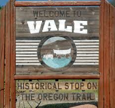
We left McCall and headed northwest on Highway 55. We’ve been on Mountain Time since we left Vale, Oregon. We assumed that once in the more eastern state of Idaho that we would stay in the Pacific Time Zone. Whoa, cowboy! Not so fast there pardner! We now know it’s true that the southern part of Idaho is in the Mountain Time Zone, the northern Idaho is in Pacific Time. So as we turn on highway 95 and head north towards Riggins, a town of 420 souls, we are still on Mountain time.

Idaho Time Zone
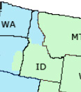
North of Riggins, right across the Salmon River Bridge we are back in the Pacific time zone! What the hey! So begins the strange time……zone!

P1000190Riggins is nestled deep in a canyon at the confluence of the Salmon and Little Salmon Rivers at 1800′ in elevation. As Riggins is the northwestern most town in the Mountain time zone, US-95 is the only highway for the state that connects the panhandle to the south. The town claims to be Idaho’s Whitewater Capital and well it could be. Rafting, kayaking are very popular as are fishing and hunting. The Seven Devil’s Mountains and Hell’s Canyon National Recreation area close by.

We pass a couple of small burgs following the ever beautiful and ever deepening Salmon Canyon where the river twists and turns flowing lazily, then a flurry of whitewater. P1000171Before climbing out of the canyon we pass White Bird. The town of 91 folks is named after the Nez Perce chief that lead his people to the first fight and a significant defeat of the U.S. Army in 1877. P1000182The entire area is like traveling through an American history museum. Signage is mostly dedicated to the Nez Perce people, how they lived and how the U.S. tried to remove them from their homeland so that the west could be settled by emigrants, miners and others. It’s interesting to note that before the army, the settlers and the miners made their presence the Native Americans and fur trappers and traders got along well together.

P1000180US-95 climbs the 2100 vertical feet out of Salmon Canyon onto the Camas Prairie. Native Americans coveted the camas plant root as food. camas_fieldcamas_root

woman_with_camas_bulbs
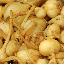
The Nez Perce depended on the root for sustenance. The women would dig up the camas bulbs using elkhorn tied to wood digging sticks. After being cleaned the bulbs were piled on a bed of grass on hot stones and place over a fire pit and steamed. Once cooked they were dried. The extensive cooking broke down a good portion of the starch content to sugar, producing a sweet potato- like flavor. The story goes when the Corp of Discovery, i.e., Lewis and Clark Expedition arrived gaunt and starving, the Nez Perce offered them camas root to eat. The root didn’t agree with the guts of most of the men and caused them a lot of grief for an extended period of time.

On the prairie is Grangeville (3100 souls). Grangeville is the seat of Idaho County. The city appears to be a farming community (large silos appear from a distance) but farming is #4  here. Construction is #1 with retail and manufacturing numbers 2 & 3. A railroad ran to it until 2000 but proved not profitable and was discontinued. It’s a pleasant little town with nice residents. It’s also where we leave US 95 in favor of highway 13.

250px-Grangeville,_Idaho

Highway 13 leads us east down into a steep canyon to the south fork of the Clearwater River, then north following the river valley through Harpster, Stites to Kooskia. From Kooskia (pronounced Kooskee) we turn east onto highway 12 into the Bitterroots and follow the Clearwater River upstream to Lowell. At Lowell the confluence of the Lochsa and Selway Rivers form the middle fork of the Clearwater.

P1030907

P1030912
Ever see a fire station/city clerk office located in such small quarters?
P1030913 (1)
Pulling in to Kooskia
P1030916
A Rare Albino Roof Elk

Our destination for the day is Powell Campground. Powell is a nice US National Forest campground that offers electrical power in its RV sites. At 3700 feet the camp is deep in the forest and beautiful. Lochsa Lodge is nearby. We’ll spend the night here.

P1000198
One of the few signs of civilization on the Lochsa River
P1030917
Our Site At Powell Campground


McCall, Idaho

August 10, 2017- More Photos, Hopefully Less Blabber

Since arriving in McCall we’ve traveled around a little. We drove south through a portion of Long Valley to Donelly, historic Roseberry, Donnelly and Tamarack Resort Village. We’ve met with Rob and Kathy every day for a good yack session. And we’ve driven to Ponderosa State Park’s North Shore where Megan went for a dip. In between we’ve done some grocery shopping, RV fixin’, truck washin’, and BBQing. Need I mention the multiple daily walks with Megan?

P1030884
Hazy Cascade Lake, Donnelly Idaho
P1030874
Tamarack Lodge

The one place I want to mention more than any is Tamarack Resort Village, the first new ski resort built in 23 years. History: After a few name changes and sputters construction began in 2003 with the first ski lift operating in 2004 with a total of 62 ski runs, 7 chair lifts, two golf courses planned. A large multi-story lodge was built and work started on a large inn. A lot of this multi million dollar project (closer to $1.5 billion) was financed through the sale of residential properties within the resort. The existing homes are gorgeous, by the way. The majority owners filed for bankruptcy in 2008, Tamarack was closed to the public. However, the golf course stayed open. More than rumor has it that the developer Jean-Pierre somebody absconded with the funds and fled to Europe somewhere. A lot of large buildings currently sit in decaying condition, the exteriors only wrapped in Tyvek, a material used for weatherproofing underlayment, not an exterior finish. Apparently a bunch of homeowners are trying to revive the resort to protect their investment and I hope they do. Finished, Tamarack is a world class resort.

We are traveling to Montana via highway 12 over Lolo Pass- the same route that Lewis and Clark took to the Pacific Ocean in 1805. It should be beautiful following the Clearwater River, then the Lochsa. We are staying at Powell Campground, an unusual US National Forest campground in that each RV site has electrical power.

P1030870P1030871

P1030882
Tamarack Inn Lies Fallow For 9 years.
20604450_10213441167924426_1529986471290977610_n
Kathy and Rob


McCall, Idaho

August 7, 2017- Trip DAYS 4, 5, &6


McCall-Idaho.jpg

McCall, a town of 2900 souls, is a beautiful mountain town located on the southern shore of Payette Lake. At 5000′ in elevation the area is rift with conifers. A nearby state park is named after them- Ponderosa State Park. Originally a logging community whose last mill closed in 1978 McCall is now a tourist destination. 100 miles to the south in the warm Surprise Valley lies Boise whose population seeks water skiing, wake boarding, sailboating, camping and other summer outdoor activities offered in the McCall area. The resort town is also popular in the winter offering alpine skiing and its popular Winter Carnival.

images.jpeg

Aerial Photo McCall & Payette Lake

The only problem I see with McCall is actually what keeps it thriving- the throng of people! It’s population can triple or quadruple during busy months. Highway 55 is a two lane road that leads from Boise through downtown McCall. The speed limit is posted at 25 mph. There is side traffic and frequent pedestrian crossings that fill with inattentive pedestrians. There are two signaled intersections and neither one of them are downtown. There is so much traffic it is almost impossible to merge onto highway 55 from a parking lot. Other than that, I love the place- before 0800 in the morning (before traffic builds)!

northshore3-1024x563.jpg

Large Crowds on Small Beaches

Jil and I are staying at the McCall RV Resort. It’s location is ideal. Close to town, off the beaten path, right next to McCall airport. Not a gripe, but aircraft engines definitely lack mufflers. Most of them take off fairly early in the morning leaving the rest of the day quiet. Once in a blue moon a private jet will take off. I’ve never had a private jet sound like it’s flying right through my RV! Anyhow, the resort is located on the Payette River. The grounds are manicured grass and beautiful flower beds. It has a large lodge/office the sites are large with grass and trees in between the pads. The work- campers and regular employees always have a smile on their face. We love it and they love it.

We’ve met with Rob and Kathy, Jil’s brother and sister in law a few times. Lots of reminiscing and catching up on current family happenings. Last night we went out to dinner at the Shore Lodge, an upscale place for sure with a great location right on Payette Lake. Good food and beautiful views had by all!

images-1.jpeg

Shore Lodge


Vale Oregon to McCall, ID

A SHORTER TRAVEL DAY

August 5, 2017- Day 3

I’ve made a little change to the look of this blog. Can you detect the difference from previous blogs?

The Vale Trails RV Park is a basic park on the edge of Vale. It’s within walking distance of downtown. There are some long term campers here but about half are short term and overnighters. The road adjacent to the park carries quite a bit of traffic but its not unbearable. This morning at dawn the Harleys fire up. Man, they sound close! Well they are! Four bikers came in last night and tent camped 150 feet away. Of course if you own one of those ungodly noisy bikes one must fire them up a half hour before departing and let them idle. However, if you can’t hear their motors idling one must gun the engine everyone and then. God, how I love those Harleys! The bikers all departed before 0730.

Unknown-1.jpeg

Downtown Ontario, Oregon

We packed up, hitched up and walked the dog before heading out by 0800 hours. Our route will take us into Ontario, Oregon where we will head up highway 95 to New Meadows, Idaho, then to highway 55 to McCall and our destination for a few days. Ontario is a snap to drive through this time of morning. Our problem arises when the truck’s onboard navigation system recommends a route that seems to take us out of our way. Jil looks up the directions on her “smart” phone which seem to be more direct. We are guided by Jil’s “smart” phone. Truck navigation reroutes in response. Truck and “smartie” systems again don’t jive. I ignore both of their recommendations. Truck and “smartie” go nuts. I’ve been in Ontario before and remember the best route for our 53′ length and 12.5′ of height. Both systems issue warnings of misdirection- “Danger Will Robinson, Danger”! Ah fooey with you guys I tell them. I’ve got it now…. RELAX!

76e41cb31c60a6d31db14f9ae82507c7.jpg

8577762671_d810485e51_b.jpg

Historic Weiser Train Depot

Navigating through Ontario presents no problems and we merge onto highway 95 and soon are back out into the country. Traffic is light as we drive by fields of corn and sorghum. Crossing the Snake River bring us to the State of Idaho. The town of Weiser (pronounced Weezer), a town of 5000 souls lies on its banks. No one knows who the town was named for but one Weiser was a member of the Lewis and Clark Expedition and the other a trapper-turned-miner. Weiser is the seat of Washington County and is known for its area orchards, farms and livestock. The town was founded in anticipation of the opening of Olds Ferry across from Farewell Bend in 1861.

6081658583_b855419757_b.jpg

Pythian Building, Weiser

From Weiser the road takes us through bottom land, up over tall hills down to more bottom land. That scenario repeats itself several times. We come to the crest of one hill to find a roadside sign stating “Low Visibility Area Ahead”. Yep, that meant cold smoke had settled into the valley below. We pass through tiny Midvale, then not quite as small Cambridge (325 souls), which is the second largest town in Washington County behind Weiser. Cambridge is host to the Washington County Fair and Rodeo which is in full swing as we pass through.

buckys2.jpg

The Sorta Famous Bucky’s Cafe

31932244723_2695a731a2_b.jpg

More farmland, a narrow steep walled canyon which the Weiser River runs through, and more rolling hills before we reach the seat of Adams County. Council (830 souls) was mourning the loss of one of their finest in Iraq when we passed through two years ago. He left a wife and and infant child. So sad. This time we stop at the ranger station and find Smoke Jumpers! The men and women are deep into their morning exercise routine- 200 pushups, 100 burpees, 200 sit ups, 1 thousand pull ups, 40 mile sprints. OK, I exaggerate a wee bit, but they were working up a sweat. I asked one if they had fought fire. The reply- “not yet, but we are getting ready”. Go with God, my friends, and be safe.

images.jpeg

e0c695e5b2aed5fa019d8b7e6aaa912b.jpg

Two Block Long Downtown Council

OK, now we are heading uphill into pine country following the Weiser River canyon for miles. It’s really pretty up here. We pass a few cabins and the Tamarack Lumber Mill. The mill is situated on both sides of highway 95. The mill prides itself in the fact that only 1% of a log ends up unusable waste. That, to me, is incredible. A few miles past the mill is New Meadows, a community of just less than 500 souls. It is located at the intersection of US. 95 and Idaho State 55. The town hosts the last surviving Pacific and Idaho Northern depot, a significant cultural and historical resource, listed on the National Register of Historical Places. Without the P.I.N. railroad New Meadows would arguably not exist.

The area around New Meadow is an outdoorsman’s heaven. Hunting, fishing, alpine skiing and off roading are close by. To the north lies Riggins- the Gateway to the Salmon River. Travel east and one can visit Payette Lake and the lakeside community of McCall. We travel over Idaho 55 past ranch land then up a steep, narrow canyon. Reaching the crest the road takes us to the very popular resort town of McCall. Traffic is heavy on its two lane main street as the town of 3000 swells to 10,000 at times. This might be one of those times!

Our layover here includes a 5 night stay at the super nice McCall RV Resort. Jil’s brother and sister in law live in town. The last time we visited was two years ago. We have a lot of catching up to do. So two and a half days of travel brings us to the first of three planned visits.

And the smoke from all of the wildfires lingers on…………………..


August 4, 2017- Day 2

Lakeview, Oregon to Vale, Oregon

We are awakened by the sound of MOOOooooo, MOOOoooo. The cattle are not in camp but close. The only thing that needs picking up outside is the power cord and a couple of leveling blocks, inside everything is stowed for travel. We are off at 0730 hours.

We drive by several cows, one with a yearling calf. The ones closest to the gravel road seemed perturbed that we have the audacity to want to drive past them. After a little “coaxing” they relent and move farther away allowing us to pass. We drive back to highway 140, then to north US 395 to continue our journey towards Idaho.P1030854.jpg

We had hoped to outrun the immense cloud of smoke being produced by multiple wildfires but that hope was dashed at the highway 31 and US 395 junction in Valley Falls. A big flashing sign with the words “Entering Active Fire Area” in bold greets us. Crap! It doesn’t specify that the road is closed nor how far up the road the fire may be. We decide to push on towards Riley and highway 20 knowing that we may have to turn back. Oh well, it’s only 95 miles to Riley. If we have to turn back we really don’t have an alternate route without going several hundred miles out of our way. What have we got to lose?

We skirt Lake Abert, a very large, very shallow alkali lake. Next comes the metropolis of Wagontire, named after local Wagontire Mountain. From 1986 to 1997 Wagontire was home to just two people, the Warners. The complex consists of a gas station, a motel, cafe, RV park, general store and of course, an airport which is on the other side of the road. When pilots land they had to taxi across US 395 to fuel up! As far as I can tell, the community is still owned by two folks. We stop at a roadside rest where we talk to a fella who has first hand knowledge of the nearby wildfire. He states that the fire doesn’t pose a problem right now, that firefighters have set up a base camp in Riley and we might run into fire companies staged along side the road. We see lots of smoke and a few areas of actively burning brush in the distance as we travel north.

Reaching Riley the firefighters base camp is clearly visible in a large pasture. It’s not a big camp, or at least not many firefighters are in camp. We turn east onto Oregon Highway 20 and travel towards Burns. The fire is behind us but more smoke lies ahead.P1030859.jpg

Firefighters Base Camp in Riley

Burns (pop. 2800) is the seat of Harney County, ninth largest county in the U.S. at 10,000 square miles. 60% of the county’s population lives in Burns and nearby Hines (1600 souls). Cattle ranching and alfalfa farming are important to this area, so are annual events like the migratory bird festival, county fair and a county music jamboree.Unknown.jpeg

Unknown-1.jpeg

Downtown Burns & Locals unappreciative of the Bundys

So in a little over two hours we travel the remaining 113 miles to Vale, Oregon. Much of the road follows the Malheur River which flows through gorges, canyons and valleys on it’s way to the confluence with the Snake River.

images.jpeg
Historic Vale, Oregon

Unknown-1.jpegUnknown.jpeg


Vale, Oregon, 1900 souls, is the seat of Malhuer County. The town lies at the confluence of  the Malheur River and Bully Creek and the intersection of highways 20 and 26. The community was the first stop in Oregon on the Oregon Trail, celebrated by multiple murals painted on the town’s buildings. Farming, sales, production and product moving are its main businesses.

We will stay overnight in Vale at the Vale Trail RV Park after a travel day of 277 miles. Smoke update- still plenty of it! Ugh!


August 3, 2017- Day One

RENO TO JUNIPERS RESERVOIR RV RESORT

Our butts are definitely not accustomed to long travel. After all we haven’t traveled long distances since November of last year. We got up early (0500 hours) and started our pre-launch routine. You know, the last minute items- Vacuum the carpets, clean the wood floor, strip the bed and put on fresh sheets, wash the soiled sheets, load the last of the refer items into the coach, clean the toilets and bathroom floors……. whew! Oh yes, hitch up the trailer, load the portable generator, walk the dog…… I’m sure I’ve forgotten to mention a few things. Hopefully we will travel out of the wildfire smoke that has lingered in the Washoe Valley for a couple of month now.

By 0900 we are ready to roll. Our destination is just west of Lakeview, OR. We head out to I-80 and head east to US 395. Traffic is light as we’ve missed the Reno rush hour- such as it is. We turn north on US 395 and head towards Susanville about 100 miles north of Reno. Susanville used to be a thriving community based on timber and mining. Today its main industry is the High Desert State Prison. We pass lake beds that were previously dry. This winter has been and exceptional winter. All the lake beds have lots of water and Honey Lake is not exception.

In contrast to the cold and snowy winter this spring has transitioned directly into summer. The record number of consecutive days that exceed 90 degrees have been exceeded- our trip is a hot one. And no,  we have not outrun the lingering smoke from multiple wildfires. It’s very smokey no matter where we travel.

P1030855

When does the smoke end?

P1030857.jpg

It can’t get any smokier, can it! Or can it?

Anyway, we bypass Susanville via a country road cutoff and rejoin US 395 east of town. We love the beauty of this country, the Sierra Front, as we closely parallel the Sierras to the west and the sage dominant rolling hills to the east. We pass more lake beds filled with water, Goose Lake is brimming with aqua. After what seemed like a short day of travel and a longer morning cleaning the house we arrive at Lakeview, OR. I look for Highway 140 and somehow wind up on that highway to Klamath Falls, which is the way we want to go. Ten minutes down the road we come upon the turnoff to Juniper Reservoir RV Resort.


P1030844.jpgMorning at the ranch

The RV “resort” is located on a working 5000 acre cattle ranch. We drive about a mile down a dusty dirt road (past some of the bovine residents mind you, who are so close we could reach out of and touch some of them) to the RV area. It is quite nice, with views of Junipers Reservoir and the cattle pastures. Man, this is livin’! We set up, turn on the electricity to the water heater- and it doesn’t work. OK, propane it is. Set up the portable satellite dish- and it doesn’t work. Crap! No matter what I do it won’t work. The park does not offer cable TV so we watch one year old recordings on the DVD after the sun goes down.P1030854.jpg

Tomorrow we travel about 280 miles to Vale, OR. Hope we outrun this smoke! Moooo!

We are on our way!

Our blog server decided to throw in the towel. To their credit they didn’t leave us in the lurch giving us an opportunity to download our entire blog. So now we are on our way on this new site. Some day I will transfer our old travels on to this site…… if it’s not too difficult.

After a lot of preparation, i.e. getting the mechanicals of the coach and truck into extended travel condition, checking and rechecking everything, evicting the mice that have taken up winter residence in the coach, having window shades installed on the big side windows of the coach and installing a solar shade over its gigantor rear window to make the coach more tolerable in this day of global climate change.

We are almost ready to launch… oh not yet you aren’t buddy! In our past life we were accustomed to having the coach reside on our own property in mild climate. We could leave most of our goodies in the coach without fear of it freezing or being eaten by rodents. That changed when we moved to Northwest Nevada. Coke cans don’t do cold weather, our clothes don’t like mice living in them so most everything is off loaded for the winter. The chore begins when travel time arrives- everything that belongs in the coach has to be loaded back in to her. And so it goes, one day of prep has turned into three or four.

Our friends Jim and Nancy with their furry friend Willy are once again occupying our home in our absence. It’s a win win situation. We have someone to watch our house and they can visit with their friends who live in the neighborhood. As someone said “It’s kind of strange leaving your house and trying to erase all signs that you were there, knowing that strangers will soon be living in it.” Well Jim and Nancy aren’t strangers having lived only two doors down from us but the rest is true……. erasing all signs that you were there is a lot of work!

Our route will take us up U.S.Highway 395, then Oregon State Highway 20 through Burns, OR and onward to McCall, ID to visit Jil’s brother and sister in law. Then onward up Highway 95 to Highway 12 which takes us up Lolo Pass in Idaho, zinging through Missoula, MT winding up in Whitefish, MT to visit Jil’s sister and her hubby. Our plans from there are pretty loose, except we eventually want to end up at the Great Lakes.

I’m hoping that this new to me wordpress blog is easy to work with………. we’ll see!

The Travels of Jil and Mike

This is the post excerpt.

uimg.p1050092.jpg

August, 2011

Jil and I have long histories of visiting wonderful places on this God given earth. Before we met Jil traveled, mainly by air to parts of Europe, Israel and numerous ski resorts located in the U.S.A. and Canada.

She had never been camping, you see. I had never left the U.S., nor flown for that matter (except in fire department helicopters), choosing instead to travel our great country with the aid of almost every type of mobile shelter known to man.

I introduced Jil to camping by taking her on short trips in my very old but functional 1973 Revcon 25′ class A motorhome. Jil fell in love with camping, but the old rig not so much. It was soon replaced with a travel trailer.

Constantly having to step over two large dogs lying on the very limited floor space of the travel trailer lead to a costly but welcome upgrade- a new truck to tow a new, more comfortable double slide 5th wheel. We wore that combination out and purchased  our second 5th wheel, a triple slide Heartland Big Country 3250TS, then a new truck to pull it up to Alaska and back. Three slides and we still step over the dogs! Oh well.

We started RVing in a Class A motorhome and will probably end our adventures in another one. Our rolling stock consists of a four slide Tiffin Allegro Red that’s short enough to be accepted into most state parks and a Subaru Forester toad. For our preferred method of travel it is ideal. We like to travel relatively short distances and only stay a couple of days in any one place. Set up for the motorhome is much quicker and more simple than a trailer and every convenience is inside our rolling home. One of the downfalls of towing a trailer in hot weather is no A/C running while in transit. That’s not a factor in the motorhome as we can run the A/C units with our generator as we travel.

The events of 9/11/2001 have soured us on air travel. We now travel almost exclusively with Jil as the copilot/navigator and moi as the pilot of 25,000 pounds worth of rolling stock. Scenic byways and country roads are preferred over interstate highways. We were both raised in large urban communities so visiting small towns is a treat. We like to meet those small town folk and visit the places they call home.