Houston, We Have A Problem!

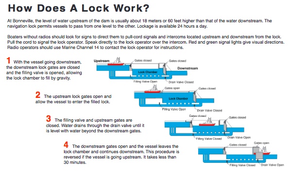
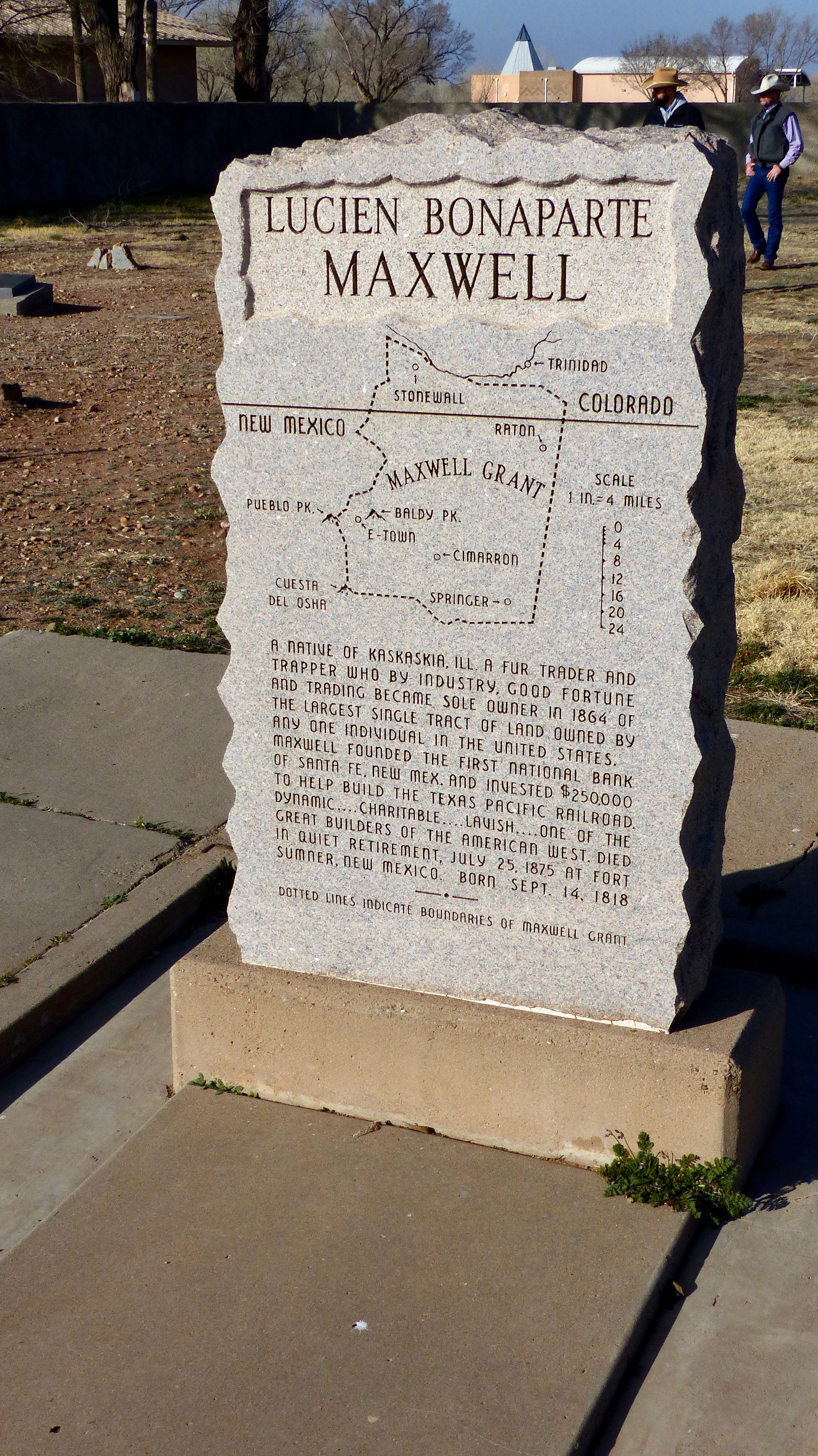
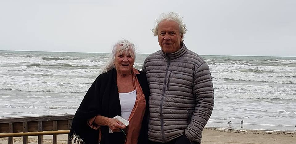
Sunday, February 9, 2012

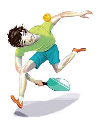
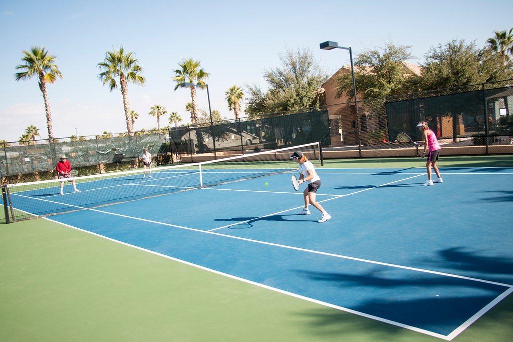
Remember this photo because Jil won’t be using her pickleball paddle for a while:

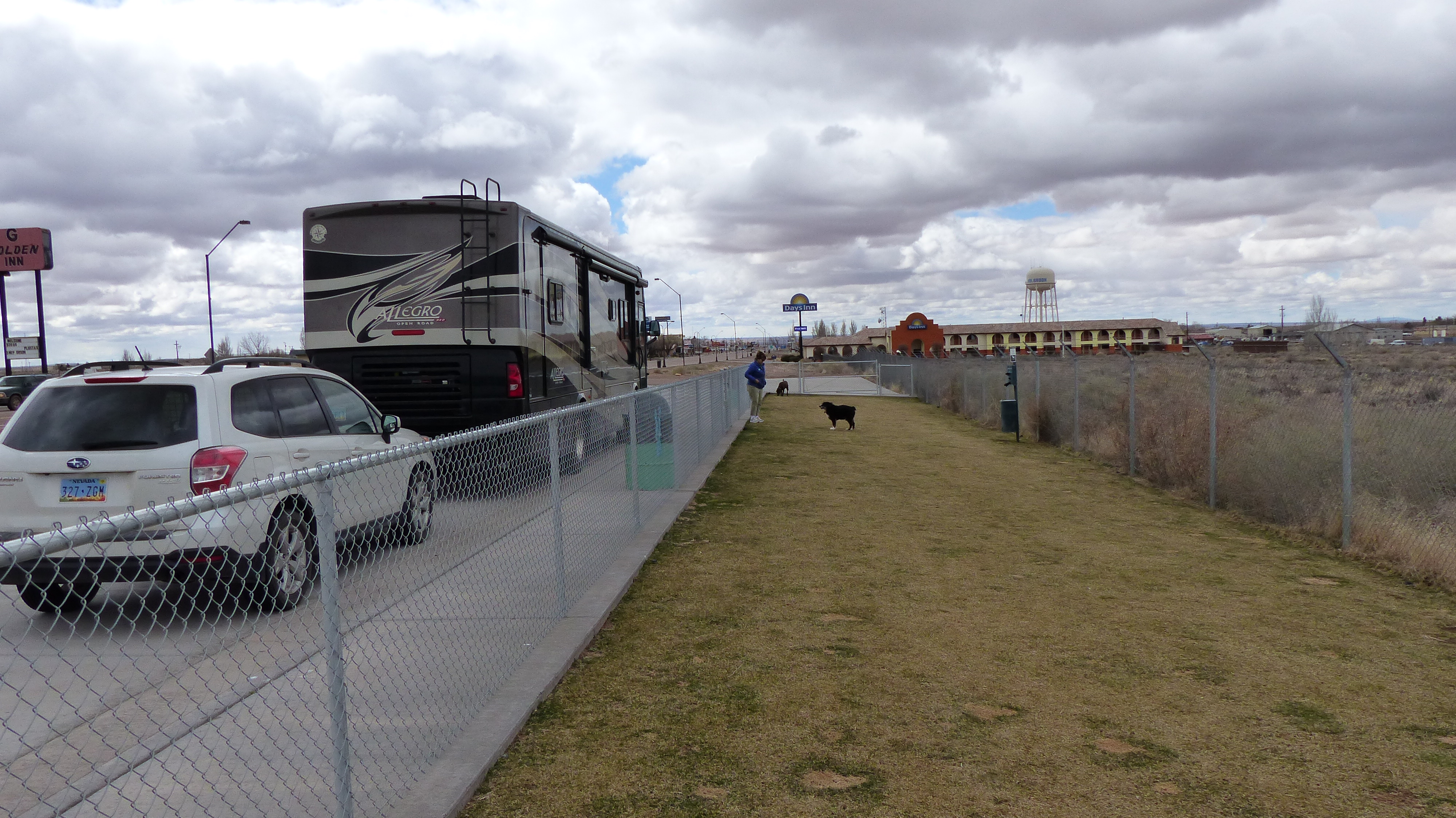
Back on January 30th Jil and three gal friends decided that they were going to put in some afternoon practice for the Palm Creek Pickleball tournament to be held the first week of February. All went well until Jil decided to chase a ball that probably wasn’t returnable. The result is pictured below:

Yep, she broke the radius bone right off of the wrist. A lady was kind enough to transport her back to our RV in her golf car. I saw her sitting in the car as it approached and the light bulb didn’t come on- until I saw her supporting a very deformed looking wrist.

She told me what happened. Of course ya just don’t break your wrist on a fall like that- she hurt her hip, her side, her shoulder as well as hitting her head on that fall. We decided to go to Banner Urgent Care located less than a mile from the park. We were there maybe an hour. X-rays were taken and Jil’s wrist was placed in a splint, her arm in a sling. We were told to contact the Orthopedic docs at the Banner Hospital complex in the morning.

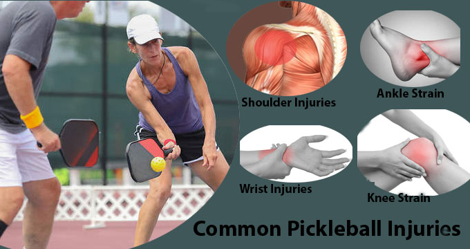
Pickleball Injuries are similar to all active sport injuries. Even tennis pro Raphael Nadal can take a spill now and then.

Morning comes, the call was made- the Docs had access to the images of her wrist taken the evening before. Nope, we can’t fix it says the Ortho Doc. What? Understand that this group of Ortho Docs are the only game in town. Well, who then? Call Doc Myo in Chandler. He specializes in hands, wrists, etc.

We called Doc Myo’s office on Friday. Can’t see you until Monday, dear! Is your hand in a splint? Yes…… Do you have a sling? Yes……. OK, see you Monday! Sheesh! What about pain control? Orthopedic Docs usually say “It’s gonna hurt- suck it up Buttercup”. No pain control prescribed by any of the three Docs consulted.

OK, Jil is in a lot of pain. The urgent care Doc didn’t want to give her pain pills but would prescribe high strength Motrin. She has Motrin so why purchase more? Motrin helps calm the pain but it doesn’t help enough. Aha! Call a friend! Friend has had her share of injuries, maybe she has a few extra pain pills laying around. She has a few- but there are for her German Shorthair Pointer. We’ll take ‘um! Same med as for humans……. I make the round trip in short order and Jil has pain meds enough to last until her Monday doctor’s appointment. She has taken a couple of pills now- and no, she didn’t start barking……….nice try though……..

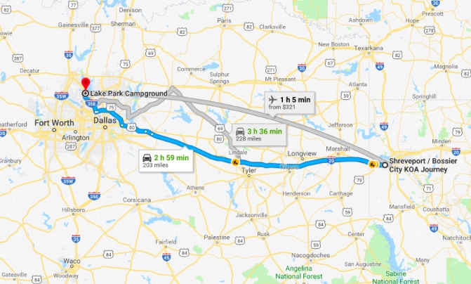
Monday’s appointment was in Chandler, a distance of 35 miles. Half of that is on I-10, the rest on rural country roads until we come into town. Then maybe eight miles through nice neighborhoods on a nice wide road. Once in the office we fill out 9, count ‘um, nine pages of paperwork. Jil’s writing hand is in a sling- guess who gets to fill out all those forms?

The bottom line from Doc Myo- you can elect not to have surgery but the function of the wrist will never be normal and it will deformed forever OR elect to have surgery, no more deformation and regain 90-95% of the function of the wrist. What do you want to do? Duhhh- lemmi think……… Surgery is scheduled for the next afternoon at the Gilbert SurgCenter just 4 miles from Doc Myo’s office. AND, he prescribed her pain meds.

When one travels with dogs a lot of concessions are made as to where, what and when we can visit and air temperature must be considered. We tried leaving Megan, our neurotic Lab with Jim and Connie on Monday with limited results, electing to bring our rambunctious Boxer put with us. She was not a happy camper nor were the Gales. Even so Jim was kind in offering help in the future if needed but we didn’t want to put him or Megan through another stressful day.

Tuesday we head to Gilbert taking both dogs. The weather is in the 50’s, there’s a park nearby where we can get some exercise while Jil undergoes surgery. Everything worked out as planned. The dogs got some exercise, the car never got too warm and I was able split my time with them and spending time with Jil in the recovery room.

The outcome- Jil’s surgery went well. We were back home at the RV five hours after we left. Jil is comfortable because she received a nerve block that numbed her entire right arm. Numbing the arm sounds great when intense pain is involved but that too has it’s hazards. If ya can’t feel it ya don’t know where it is! Her arm flopped out of bed and scrared her to death because she didn’t know what it was!

She is now in her fifth day of recovery. Her wrist is in a splint and wrapped heavily with an elastic bandage. The only things peaking out are her finger tips. She’s taken her arm out of the sling quite a few times in order to exercise her shoulder and elbow. She’s wiggling her fingers and thumb to keep the swelling down. She’s even taken doggie walks several times each day. Relearning how to open jars, remove bottle caps and just basic things one normally does (like dye one’s hair) with two hands is coming along. The good thing is she is managing the pain with only occasional doses of Motrin/pain killers.

If you know Jil she’s always doing too much too soon when in recovery and pays the price. Right now she’s spending more healing time relaxing and sleeping. Yay! And then she puts in 10,000 steps the next. Phooey. She mentioned to me when she starts to feel the least bit sorry for herself she recalls the ad on TV that shows our soldiers with missing limbs- blown off by IED’s in Iraq, all with positive attitudes-and she experiences an instant attitude adjustment. That ad should sober anyone……

By the way her wrist, her side, shoulder and head were not the only casualty. As has happened in the past when she receives anesthesia one of her crowns came off- never to be found again. We really don’t understand the dynamics of losing a crown because she was sent to LaLa Land, do you? So Monday we have an appointment with a dentist. Sigh…………….at 0700 hours…….. it’s still dark at 0700 hours here in Arid-zona………

COWBOY WISDOM: Life is simpler when you plow around the stump.

Life in a True RV Resort

Thursday February 6, 2020

Entrance to Palm Creek Golf and RV Resort
Palm Creek Golf and RV Resort, Casa Grande, AZ

Some of you are probably wondering about Arid-Zona’s weather this time of year. When we first arrived earlier this month we had ice on the car’s windshield in the morning. High temperatures were in the 50’s. That’s pretty much changed as the temps have gone up at night to near 40 degrees and highs approaching 70 degrees. We’ve had a good rain and a couple of showers. The weather is by in large pleasant but the wind can be chilling.

I took the liberty of copying the blurb below from Palm Creek Golf & RV Resort’s web page. The amenities here are impressive. Unlike many self proclaimed RV “resorts” this park truly is. With so many far ranging amenities one can stay busy what seems like forever. Like many have said “If you are bored it’s your fault”.

  1. PALM CREEK GOLF & RESORT
  2. AMENITIES

OUR AMENITIES

Resort living means golf and so much more at Palm Creek. There is a vast array of wonderful amenities to tempt you. Centrally located in the heart of the community is Guest Services, the Activities Center, the Ballroom, the Billiards Room, Fitness Center, the Arts and Crafts Building, the main Swimming Pool with a jumbo-sized Jacuzzi, The Bistro, Pro Shop, Fireside Patio and Laundry.

A new Sports Complex complete with a beautifully manicured softball field, sports pool, Jacuzzi, pickleball courts, and Sport Grill await your use in the east end of the resort.

Our onsite Activities Manager is available daily to help you join in the fun. You’ll find shuffleboard, billiards, horseshoes, water volleyball, softball, tennis and a putting green as well as water exercise, weight room, Yoga and Pilates.

Craft classes include pottery, sewing, quilting, oil and watercolor painting, woodshop and carving, lapidary, silversmith, stained glass, computer, crafts, monthly craft fairs featuring vendors from around the state. Palm Creek sponsors all kinds of dancing from Saturday night variety dancing to line dancing and pattern dancing.
Special parties, BBQ’s, Thanksgiving, Christmas and Easter dinners, New Year’s Eve party, special entertainment and the Palm Creek Chorus and Drama Club will entertain you and spice up your social life!

If you like to play games, we have bridge, pinochle, cribbage, poker, euchre, dominoes, hand and foot, and, of course, Monday night Bingo, just to name a few.

We’ve taken advantage of some of the amenities, namely joining the pickleball club and participating in round robins. One signs up online to play. Sometimes the courts are so busy the club managers ask that a person only sign up for one round robin a day which means that all 32 courts are booked all day long. The 1001 club members are grouped by skill level with 2.0 being beginners and 5.0 highly skilled. Here’s a Youtube video that explains the game: https://www.youtube.com/watch?v=kqLRRNOpe8U

Jil has taken advantage of the exercise room. We walk the dogs a minimum of 5 miles a day. It’s easy walking- it’s flat as a billiard table here. During those walks we will visit one or two small fenced dog parks and let the dogs romp. We attended a spaghetti dinner put on by the resort- a fund raiser for the Casa Grande Fire Department. The dinner was very good, we met new friends and was serenaded by a bagpiper- all for a good cause. Attendance= 400 folks.

Ollie finally tuckered himself out!

Speaking of dogs, Megan our Lab and Ollie our adopted Boxer are getting along swimmingly. They sleep together, walk together and play roughly together. Mr. Ollie is a terror. The longer we have him the more rough he plays. I guess it’s a young Boxer thing. We have to intercede occasionally to prevent an accidental injury.

Our neighbor flying his paraglider

We’ve met a lot of nice people. Most are from the colder climes of the midwest or northwest, some from Canada and a few are from the east or Kali-fornia. Some midwestern state’s folk have distinctive speech mannerisms. It’s a hoot when speaking with a neighbor and guessing correctly that they are from say Wisconsin or Minnesota. No matter where folks are from everyone we’ve met are very nice. Heck, who wouldn’t be especially if one were a Minnesotan spending the winter in a relatively warm climate as compared to their home that has 3 feet of snow on the ground and minus 40 degree temps?

The golf course is central to this huge park. The older section has more amenities, i.e. wood shop, car wash, dog wash, tennis courts, etc. but the RV sites are narrower- sort of cozy. Over the years manufactured homes have taken the place of RV sites and most are of the single wide smaller variety that fit the narrow lots. It makes that part of the park feel a little cramped compared to the newer side of the park.

Older section of RV Park
Newer Section of RV park

The newer side of the park where our site is located has 40′-50′ wide sites so it feels very roomy. That’s where we are located. Almost every site has a cement patio surrounded by crushed rock. The amenities over here are more sports related than the older side and the flora is not as well developed. We only have two smaller swimming pools, (only he says) with spas, a regulation sized softball field, 32 pickleball courts, a small meeting room with a laundromat incorporated in the same building- smile!!!

There are many permanent manufactured homes on our side of the park with more to come. All of them at least double the size of those in the older portion. There are a few new ones for sale and they are not cheap considering one does not own the land that they sit on. Expenses include paying a hefty association assessment and property taxes. Considering all of that they still are selling pretty well and those folks that own them are very satisfied.

We’ve had thoughts of purchasing either a home or an RV site in the sunbelt. Those thoughts quickly vanish. We don’t want to feel obligated to go anyplace that isn’t home because we have money invested. We’d rather stay loose and fancy free, travel when we want and where we want.

I’ll be updating the blog fairly soon. Lots going on here with a few surprises…….

Ridin’ Along In My Automobile

Tuesday January 21, 2020

Just another ho-hum desert sunrise

With Chuck Berry’s classic song dancing around in my head, hence the title of this post, we head out of the park…… Ridin’ along in my automobile with no particular place to go!.. Jil has seen some pretty cool looking lawn art here in the park and she wants to look for some for herself. We head over towards Florence, AZ to peruse the Happy Adobe metal art shop. OK, I stand corrected- we do have a particular place to go……….

Along the way we stop at the Casa Grande Ruins National Monument. We have seen photos of the ruins and didn’t expect to find them as interesting as they are. The ruins are what remains of the Hohokam Indian’s Great House (Casa Grande) and surrounding compound.

Casa Grande Ruins National Monument Visitors Center
Jil and Megan exploring Casa Grande Ruins National Monument

It is one of the largest prehistoric structures ever built in North America and yet its purpose remains a mystery. Archeologists have found evidence that these ancestral Sonoran Desert people also developed wide scale irrigation farming utilizing canals. Many small Hohokam communities have been discovered along the Gila and Salt Rivers. The ancient people also had extensive trade connections which lasted over a thousand years until about 1450 C.E. when Casa Grande was abandoned.

The name Hohokam is somewhat of a misnomer as it is really more of a term. No one knows what the builders of this complex community called itself. Hohokam is a Pima term meaning “those who have vanished”. Scientists feel that a probable reason for these ancient farmers to have left was an extended drought making subsistence farming next to impossible.

Above photos: The protective roof structure above Casa Grande was built in 1930 to help preserve the ruins. The man lift in the left photo was part of the equipment used by structural engineers to determine the integrity of the structure. The man at right is repairing one of the original remnants of a wall. The worker said he used a mixture of the local dirt, sand and mud- the same materials that the Hohokam used to build the walls.

We continue on to Florence (26,000 souls), the seat of Pinal County. The town is one of the oldest in the county and is regarded as a National Historic District with over 25 buildings listed on the National Register of Historic Places. It is located in an area once inhabited by the Hohokam, ancestors of the O’odham people. Prior to the establishment of the town the Gila River served as part of the border between the United States and Mexico. The Gadsden Purchase of 1853 extended the American territory well south of the Gila.

A fella by the name of Levi Ruggles founded Florence on the south bank of the Gila River. Originally a U.S. Indian Agent he recognized the agricultural potential (remember the Hohokam?) of the valley, found an easily fordable location on the Gila and surveyed a townsite there. He then secured a post office the same year. Silver was discovered in 1875 in the nearby mountains which led to the creation of the famous Silver King Mine.

In 1870 Fred Adams decided to give old man Ruggles a little competition. He founded a farming community 2 miles west of Florence. The town had stores, homes, a post office, a flour mill and water tanks. It was named Adamsville for you-know-who. Adams apparently was unaware of the nature of desert rivers meaning he hadn’t a clue of flash floods. In the 1900’s the Gila overflowed its banks and most of the town was wiped out. The residents moved to……… Florence! The area is now a ghost town.

A canal was built in the 1880’s which enabled water from the Gila to be diverted for irrigation (again, remember the Hohokam?). Farming and ranching played a major roll in Florence’s economy. A current boon to it’s economy are the multiple prisons located nearby. Not many communities have state, federal, county and private prisons in their back yard. Speaking of prisons, a large prisoner of war camp for German and Italian prisoners of war was established just north of town during WWII. Japanese Americans were interned at the nearby Gila River War Relocation Center during that sad time in our history.

Of note:

This is a tough way to have a natural feature named for you: Silent film Cowboy actor Tom Mix died when his car went into a wash, now named Tom Mix Wash, in 1940 just outside of Florence. A riderless horse monument was erected nearby.

McFarland State Park is named for Ernest McFarland (Arizona State Senator, Governor of Arizona and Chief Justice of the Arizona Supreme Court) is a small historic park in Florence that contains the first Final County courthouse. McFarland purchased the property, donated it to the state, and paid for it’s renovation. The park opened in 1979.

The Pyramid Tomb of Charles Debrille Poston (1825-1902), known as “The Father of Arizona” is located on Primrose Hill which was renamed Poston Butte. It was through his efforts that Arizona became a U.S. territory. Click on his name for a good read!

Tomb of Charles Poston First Pinal County Courthouse

That pretty much catches the blog up with our adventures. I’ll be writing about life here in the resort in the coming blogs as well as the status of our car and how well our new boy Ollie is fitting into the family.

An Eventful Two Weeks!

Palm Creek Golf and RV Resort

Sunday January 19,2019

Sunrise in Casa Grande, AZ

We have friends who live in the area and wanted to meet with them. Connie and Jim, our Washington State pals who cohost with us at the Bonneville Fish Hatchery, and Ellen and Dick who live down the street from us in Reno. Both couples own homes nearby in which to over winter. We met with both couples and had great visits with each. We’ll be seeing more of them in the near future.

Here we are at the Palm Creek Golf and RV Resort in Casa Grande, AZ more or less minding our own business and wham!- life happens………. Let me explain:

We’d been in Casa Grande for a week and needed to restock our pantry. Off we went to Walmart shortly after dawn which in Arizona comes late. No daylight savings here ya know- and on Mountain Time to boot. The sun is bright and very low on the horizon behind us. We are stopped at a red light in a left turn pocket when this fella on the cross street begins his turn towards us and into the sun. He drives very slowly and deliberately as he angles his car…….. right into the front of ours! Bang!…… Crap……. No one is hurt but both vehicles show damage, like our hood won’t close. The other driver has in his possession an expired drivers license, no vehicle registration and no proof of insurance. Luckily a Casa Grande Fire engine company witnesses the accident, stops, makes sure everyone is OK and directs traffic.

That’s not our car- our accident was not nearly that bad- just added photo for dramatic effect!

Shortly thereafter a Casa Grande Police Officer arrives, determines the other fella’s at fault, then takes the report- which takes over a week to post and for me to retrieve for insurance purposes…. jeez! Anyhow our car is in the shop being repaired and we are driving a rental. The good news is the other fella has a current driver’s license, liability insurance and current registration so all is well there-and he got a ticket for reckless driving. Our insurance company is in contact with his so all is well and our car should be repaired and out of the shop next week. By the way, that low speed impact is probably going to cost the other fella’s insurance company over 3000 smackers. It’s almost unbelievable how much it costs to repair these newer autos anymore. This accident wouldn’t even have put a scratch in the bumper of my ’62 Chevy Impala……………

The morning after the accident Jil is walking Megan when she notices a Boxer dog closely following her. It makes her nevous so she shoos it away. A couple of hours later we both see the Boxer running loose inside the park. The front desk is notified and the Boxer is put into a pet run for safe keeping. The dog is in the pet area for hours so I go down to see how he’s doing. Turns out he is doing OK and someone has left a bowl of water for him to drink. But boy, is he skinny! The fact that he is so skinny, has no ID and still has his manhood is a good indication that he doesn’t belong to anyone in the park. I spend some time with him and give him a couple of cups of kibble- which he inhales. He lays down at my feet as if to say “thanks mister”. He’s really a gentle guy……..

This where things get strange. The office staff decide to post a notice on their Facebook page of the dog’s plight but doesn’t notify animal control. Jil calls the office again to voice her concern about the dog’s welfare- the sun will set in a couple of hours, he has no shelter and the nights temperatures have been near freezing. Oh yes, Jil is assured everything is good. Animal control will be here in a half an hour. We go down an hour and a half later and he is still in the pet area. Concerned for his welfare we load him up in our car and take him to the Casa Grande Animal Shelter.

Our new rescued doggo- Oliver

OK, you’re smarter than the average bear- you saw this coming, didn’t you? Yep, we adopted him! After a 72 hour waiting period and about the same length of time for Ollie to lose his manhood, he is home. We still can’t believe no one came forward to claim him. Megan had a couple of grumpy spells at first then accepted him. Ollie never had a problem with Megan. It’s very apparent that Ollie likes his new digs. He likes to ride in the car, go for walks and to Megan’s chagrin even started playing while off leash in the pet park. And he’s the first to arrive when the dinner bell rings! He’d been with us for four days before we felt we could leave both the mutzos alone in the RV for over an hour- no problemo! Then we took the furry ones on a car ride, left them both in the car for about a half hour as we shopped and still no problemo!

The only issues Ollie has had is he is not leash trained. We are working on that and he has steadily improved. The big one is he is leash aggressive towards other dogs. Working on that one too. He should be OK after some intense learning sessions. Strange thing though, he was not aggressive and more like complacent when I took him to the Vet for a free checkup. The waiting room was standing room only with dogs and their owners and all he did was look at the other dogs, then lay down at my feet- and we waited for an hour before we were seen.

Mr. Ollie enjoying his new bed

Now I know you are saying to yourself, self those folks sure didn’t do much in their first two weeks in Casa Grande. Well we did get around to a little sightseeing. More on that in the next post………..

Sunset at the Palm Creek Golf and RV Resort

A New Adventure

Wednesday, January 15, 2020

Several months ago Jil and I discussed spending some time away from home, hopefully in a warmer climate. We had spent a few days at the Palm Creek Golf and RV resort in Casa Grande, AZ last winter on our way to the Deep South- and liked it. Palm Creek is a true resort featuring a golf course tennis and pickleball courts, lawn bowling, a ball room, and places where one can woodwork, silver smith, make pottery, and knit/sew. You name it, they’ve got it. It even has a cafe.

After storing our Christmas decorations we hit the road on December 28th, hoping for decent travel weather. We hope the 6 day snow event that occurred during Thanksgiving week isn’t a precursor for what’s to come.

That white “cushion” on the bench is all snow!

We got off to a late start by design as we wanted to do a last minute clean up of the house. We are only traveling 140 miles. Our first stop is the Whiskey Flat RV Park in Hawthorne, NV (3200 souls). It’s a no frills park- we are comfortable here- and it’s location is a good jumping off point for our trip south.

Skirting Walker Lake on our way to Hawthorne, NV

We are off by 0800 the next morning. Our main concern is driving into high altitude and the possibility of snowy and icy roadways. Most of US 95 in Nevada is laid at 4000′ following long flat sagebrush covered valleys. Tonopah is a tad over 6000′. No worries though, a little snow on the ground but the road is clear. This town is the seat of Nye County, her nickname is Queen of the Silver Camps so named for the 1900 discovery of silver, the second richest silver strike in Nevada history.

Continuing south on US95 we come upon Goldfield. Goldfield (268 souls) is an interesting old town. Between 1903 and 1940 Goldfield’s gold mines produced more than $86 million at then-current prices or $1.496 billion in today’s dollars! Due to the remarkable production of gold the town rapidly grew to be the largest in Nevada at over 20,000 souls. By 1923 gold production and the population were in steep decline.

That year a moonshine still exploded destroying most of the town’s flammable buildings. Of note Wyatt and Virgil Earp resided there- Virgil taking the position of Goldfield sheriff. Virgil contracted pneumonia and died here- Wyatt moved on shortly thereafter. As tiny as the town is it is the seat of Esmeralda County.

Our next overnight stop was to be Beatty, NV (1000 souls). We had an early start which meant we arrived in Beatty just after noon and way too early to stop for the night. Beatty is a jumping off point for Death Valley National Park and the the historical mining town of Rhyolite. We found a municipal park, walked Megan, and enjoyed lunch. A command decision was made to continue on. Somewhere in a desolate section of the Amargosa Valley we hook a right onto Nevada State Road 160. We pulled into the Lakeside Casino and RV Park after traveling 277 miles.

Lakeside RV Park, Pahrump NV

Pahrump (36,000 souls) has it’s own story. Originally inhabited by the Southern Paiute, the valley was slowly inhabited by settlers in the late 1800’s. The area has numerous artesian wells; the water they provide is vital to farming. Numerous large farms were established, most over 1000 acres on which cotton and alfalfa were grown and livestock raised. Until the 1960’s there was no phone service except for one radio phone nor paved roads in or out of the valley. Real estate speculation prompted the establishment of paved roads and telephone service.

Snow level just above the highway’s elevation- glad it’s up there and not down here!

We are on our way shortly after 8am figuring all that white slippery stuff was in our rear view mirror. Wrongo Cowboy! As we approach Mountain Springs Pass (elevation 5400′) about 60 miles from Lost Wages, er, Los Vegas (650,000 souls) snow appears on the hills, then on the side of the road, then ICE on the road. Holy Smokes, who would have thunk it? To make matters more interesting the road is under construction and the construction guys had made a narrow obstacle course out of the normally straight road. The good thing was the construction crew also limited the speed to 25-35 miles an hour and had treated the roadway making the slippery roadway more safe.

Oops! Now we are up there (in the mountains) making our way up Mountain Springs Pass

Traffic is not terribly heavy going through the southern suburbs of Lost Wages (620,000 souls), at least by big city standards. Us big rig jockeys don’t appreciate it one bit. I-5 to I-215 to the new section of I-11 brings us to the Hoover Dam/Lake Meade overlook and across the Colorado River Canyon Bridge into Arid Zona, er, Arizona. This time of year brings some rain to the area so it doesn’t look so arid- the hills are actually green.

We are now traveling on US93, the road that will be replaced by I-11 when it is complete. As such, this highway is not getting a lot of attention as the road surface is pretty rough. As we pull into the Kingman (28,000 souls) area traffic is backed up for blocks. The cause- two traffic signals that don’t appear to be synchronized and trucks trying enter and exit the nearby truck stop. We again have arrived at our loosely planned destination early. We fuel up at Loves Truck Stop, have a bite of lunch, walk Megan and are off, this time on I-40 east where we once again catch US 93 south. We stop for the night at the Hidden Oasis RV Park located in Wikieup, AZ (320 souls) after a drive of 211 miles.

The Oasis RV Park and Cool Water Cafe is an eclectic place for sure. Most of the folks live here year round so there are no newer rigs in the park. The folks here are definitely country and they are all nice, respectful and willing to help one another. The co-owner and head chef at the Cool Water Cafe that fronts the RV park is also down to earth friendly. Brenda and her mom offer wholesome vittles but are mostly known for their delicious home made pies made fresh every day. She stated that most of her clientele live in the RV park with some walk-in travelers. Folks, if you are driving through Wikieup AZ be sure and stop in at the Cool Water Cafe- the food and pies are delish!

We drove another 190 miles on December 31. The wind was blowing a little and the road very rough. We almost got in a traffic accident in Wickenburg when a pick up truck pulling a trailer cut us off in a traffic circle. From Wickenburg we head south on US60 to I-17 to I-10 continuing on through Phoenix. The traffic through Phoenix (1.6 million souls) wasn’t horrible but like I said we drive a big rig.

Continuing south on I-10 our turnoff comes in Casa Grande- a 190 mile day. We arrived a day before our reservation began so we spent the night in the overflow section of the Palm Creek Golf and RV Resort, our home until March.

Our Trip Home- And Sad News Concerning Our Little, Little Boy

December 23, 2019

It’s two days before Christmas and it’s snowing- again. Thanksgiving week was a duzy as snow fell every day for an entire week. Our snow is often called “Sierra Cement” as it’s water content makes it very heavy- and hard to shovel…..ugh…….

Grandson Jackson visiting from SoCal enjoying the snow

Before you rant about how late this post is let me tell you something Mister! OK, you’re right, we’ve been home since late October but I have an excuse…… I didn’t feel like writing, OK? Had nothing to do with brain cramps nor writer’s block. For various reasons, one of which I’ll get to a little later, I’d chosen to take a little hiatus. So now I’ll punish you with an exceptionally long post- here goes (someone once said be careful what you ask for!).

The weather has not been kind during our two months volunteering at the Bonneville Fish Hatchery as Fall rains had come early. It even snowed on the 3000′ bluffs that abut the Columbia Gorge. Even so we had a great time with our volunteer buddies Connie and Jim as well as Hugh (our Boss), Dan, Alex, Patrick, Kelly, Ann, Scott, Deanne, Trent, Dave and the rest of the hatchery team. As Jim would say “It was a Hoot!” Jil and I decided to leave before the end of the month. We had completed our obligation for the week and had no reason to stick around. We hitched up, picked up, packed up, fired up, slides in, jacks up and said Adios to our friends at the Hatchery. We’ve got all that hitching and pick and packing stuff down pat so it really doesn’t take too long, maybe an hour, to get the wheels rolling.

Our path home will take us through the lower elevations of Oregon, not because of the fall weather trying to sneak into winter so much as there are many more places to rest our weary heads on the I-5 corridor than on the alternate route, The Dalles-California Highway- Oregon 97. We are in no hurry but yearn for home if you know what I mean. Its 619 miles to home and we’ll take a minimum of three days to travel the distance. The I-5 corridor in Oregon also has a whole passel of rest stops and we’ll take advantage of those to stretch and walk our mutzos. The first 150 miles we’ll travel through the Willamette Valley. The next day we’ll transition into hill country, then the Rogue Valley eventually ejecting into the Shasta Valley. After an overnight on the western shoulder of Mt. Shasta we will head for the barn.

Our first stop is the Hi-Way Haven RV Park in Sutherlin, Oregon. The park is unusual as it is built on an old drive-in theater lot. The current owner used to come to the drive-in as a kid, fell in love with drive-ins, eventually purchasing this one. He plays a movie every night on the big screen with sound being piped in through your vehicle’s radio.

We headed south the next morning. It’s cold, like 22 degrees cold, so picking up the hoses is akin to wrestling a frozen snake. We are on our way at 0830- late for us. Our concern are the passes in higher elevations. Most of the passes through the hills south of Eugene and the Willamette Valley are no higher than 2000′. We’ll be cresting the highest point on I-5 just south of Ashland, 4300′ Siskiyou Summit. We are fortunate as the weather holds- no snow……

After the summit we drop down into volcano country. It’s quite a sight coming off the summit, crossing the Kali-Fornia state line and seeing the majestic Mount Shasta in the distance as well as some smaller volcanic cinder cones that dot the golden grassland of the Shasta Valley. In comparison to that majestic peak the cinder cones remind one of gopher mounds…….

Our second night is spent at Abrams Lake Mobile Home and RV Park near the town of Mt. Shasta. The RV portion of the park is small yet offers all the amenities including internet access and cable TV. During the low season it’s first come, first served. Its quiet, well away from major thoroughfares and the nearby pine woods are enjoyed by the furry ones.

The next morning we are on the road at the usual time. It’s in the 20’s again. Brrr….. We’re back on I-5 for a short distance and then jog over on to Highway 89. Passing the quaint town of McCloud we head off through the woods. The drive is beautiful as we pass Burney Falls State Park, head towards Hat Creek and turn on to Highway 44. Highway 44 takes us to Susanville and the 395- US395 takes us to Reno and home.

The Captain- always vigilant………….

We always adopt adult mutzos so one never really knows how old the new addition is nor the history of their health, heck not even who the previous owner was. Adopting a pet is somewhat of a crapshoot, so to speak. That said, this concerns our little, little boy as Jil calls Doyle. He’s really not that little as far as dogs go. He’s just the smallest dog that we’ve ever had. Shortly before our trip Doyle had been diagnosed with diabetes. We started him on insulin injections twice a day and his blood glucose dropped from 380 to 88- normal. Yes! He and Megan had a ball on the trip and especially at the hatchery where they were allowed to run free before our visitors arrived and anytime in areas where the public is not allowed.

Shortly before we came home Doyle became blind. I think he could see well enough not to bump into objects, still running around a little with Megan and had no trouble negotiating the stairs into the RV. He was still happy. When we got home we called the Vet- his blood glucose had gone from the normal 88 to over 500 even on insulin. He had become insulin intolerant. Time is no longer on his side.

Doyle loved snow- but it didn’t love him- at all!

Just a few days after the Vet visit he was still doing well negotiating the back yard and the house as if he could see. Then it happened- he became very confused and couldn’t find his way around the house any longer. I touched his side attempting to guide him through a doorway and he yipped. Oh Lordy…..We sadly said goodbye to our loyal friend on November 6.

So this is a tribute to our Little, Little Boy. He was a little boy with a giant personality. Doyle had more than a little larceny in his soul. He was half the size of our Lab, Megan, but would harass her, ripping stuffed babies out of her mouth and proudly prancing away with his prize.

When Megan would run in the field Doyle would herd her like an Aussie is bred to do. At night he’d join Jil in bed, bury his face in MY pillow and grunt with pleasure, then roll on his back, thrash around and grunt some more- then let out a big sigh as he settled in. He didn’t mind barging in on you at all- bump, bump, push, tug. However, once he claimed his spot and given the lightest of touches- grrrrr. He was a one way type of guy…..

And yes, he was a noisy little guy. His internal clock that’s accuracy is to be admired by the finest watchmakers. He had dinner and snack time down to the second and would let you know it’s time to EAT- yap Yap! He’d bark to be let out, he’d yap when he wanted to go for a walk, he’d yap about most everything. I had wished that he could speak English for I knew he had a thousand stories he’d like to share. Yap, yap, YAP. We miss you buddy.

We have always traveled with our dogs. We’ve had seven in total. We’ll be traveling again, blogging again and when the time comes, bring home another furry friend. But for now our Lab Megan will be the queen of the household.

As I write Jil is already planning a couple of trips for next year. So until our next adventure, Via Con Dios my friends. From Jil and I a Merry Christmas to all!

The Columbia Gorge- From One End to the Other

Monday, November 18, 2019

I know, I know. I hear ya. Where ya been? Well, we’ve had an eventful month which I will share with you in the next, and last, blog that will put this trip to bed. We are home and I’ll do my darnedest to catch you up. As I write our high desert home is experiencing our first winter storm of the season complete with snowfall.

Scenes from the Historic Columbia Highway

The best way to tour the Oregon side of the Columbia Gorge is to do it the old fashioned way- by auto or if you prefer astride your trusty bicycle. And the best place to start is Troutdale, OR where one can access the western portal of the Historic Columbia River Highway 30. Quote from Travel Oregon website-“The vista-inspired railroad lawyer Samuel Hill and engineer extraordinaire Samuel Lancaster to “conquer” the wild beauty of the Gorge with a grand scenic drive. It was an implausible plan — a road that would cling to sheer cliffs, traverse rushing rivers and tunnel through hammer-hard basalt — but they made it happen”. The road is narrow with a lot of tight twists and turns, poorly designed by modern standards but hey it was built beginning in 1913 during the Model T Ford era. The road today still exists in fits and spurts all the way to The Dalles. Many portions of the original roadway are now designated as the Historic Columbia River Highway State Trail, a hiking and biking path. When finished, the State Trail will be 73 miles long.

Vista House/ Crown Point
View from Crown Point/Vista House

The road east of Vista House takes one through beautiful deep fern infused forests offering few glimpses of the Columbia River below, the exception being the outstanding Gorge views from Crown Point’s Vista House, built in 1918. East of there is a whole passel of beautiful waterfalls, Latourell, Shepherds Dell, Bridal Veil and Wahkeena come to mind, culminating with the most spectacular fall, the 620′ Multnomah Falls.

Historic Columbia Gorge Highway Falls/ Multnomah Falls & Visitor Center

And that’s just what can be seen from the old highway. Many more falls are accessed by trail. The I-84 corridor offers many state parks and recreation areas a few of which are located on geological sites mentioned by Lewis and Clark.

The historic highway east of the village of Dodson merges with I-84. In this section of the Gorge the original road only appears as spurs going to and from the small villages and the few towns such as Cascade Locks and as part of the Historic Columbia River Highway Trail. Four miles west of Cascade Locks is the Bonneville Lock and Dam and our home for two months, the Bonneville Fish Hatchery. Both are a must see. East of Bonneville are two more hatcheries- Eagle Creek and Oxbow.

Cascade Locks- Town, Bridge of the Gods and Cascade Lock

The next place worthy of a visit is Hood River. The wind tunnel effect of the Gorge has made the town a mecca for wind surfers. Downtown has several breweries for those who wish to imbibe. It has a small boat marina and a dock where large tour boat passengers debark. Another must see while in Hood River is the Western Antique Aeroplane and Automobile Museum. All of their exhibits are fully functioning- the planes fly and the cars are roadworthy.

The nearby beautiful Hood River Valley is a must see. Apple and pear orchards dominate the valley where fruit stands are the norm. Alcapas and lavender are also raised in the valley. A a relative newcomer are the many vineyards that have been established. Adding to the beauty of the valley are grandiose views of 11,200′ Mt. Hood.

White House Farm Located in the Hood River Valley

The last intact segment of the old highway begins at Mosier, heads up into a fir and oak forest passing through pasture/orchard highlands where one can stop for another spectacular view of the Gorge at the Rowena Crest viewpoint. It becomes obvious from this vista that the eastern end of the Gorge is much dryer than the western portion.

Neat looking Mestablishment in Mosier
Interesting Signage in Mosier

Heading down the winding section old highway known as the Rowena Loops we find The Dalles, the eastern terminus of the Historic Columbia River Highway. The Dalles was long a Native American gathering place, another Lewis and Clark encampment and later a staging area for Oregon Trail pioneers readying for the treacherous trip down the Columbia’s rapids. A must see while in The Dalles is the Columbia Gorge Discovery Center and Museum.

Rowena Loops

The Dalles was long a Native American gathering place, another Lewis and Clark encampment and later a staging area for Oregon Trail pioneers readying for the treacherous trip down the Columbia’s rapids.

A must see while in The Dalles is the Columbia Gorge Discovery Center and Museum.

The distance between Troutdale and The Dalles is not great at less than 80 miles but there is so much to see. One could spend an entire day exploring that section of the old Historic Highway between Troutdale and Dodson. The Dam and hatchery deserves a few hours of exploration and the Hood River area maybe a half a day. Several hours can be spent at the Columbia Gorge Discovery Center in The Dalles. A couple of days would be well spent touring the Oregon side of the Gorge.

That concludes the tour. For you more adventurous folks there are plenty of trails in the Gorge that lead to waterfalls and drop dead Gorge-us vistas to die for.

Busy Days

Sunday, October 20, 2019

Official weather report: cloudy with chance of showers for next 7 days. My weather report: completely overcast skies, no blue showing ever, chance of never-ending rain 100% with occasional downpours for weeks at a time. Honestly, we haven’t seen more than a couple of hours of sunshine in over a week. Everyone is starting to grow webs between their toes, including the muttzos! Sigh……..

Our days at the hatchery have been busy. The “fish guys” have spawned once or twice a week asking for our assistance each time. Hundreds of thousands of Tule salmon fingerlings have been released from the rearing ponds through a complicated series of underground waterways and valving, splashing into Tanner Creek not 50′ from our motorhome. Waiting to feast on them are seabirds, great blue herons and sea lions as they negotiate their way down Tanner Creek, the Columbia and finally to the Pacific Ocean.

Even though some salmon remain, the fall run is over. The coho run will begin shortly and with it more collecting and spawning. Attention turns towards raising the smelt and fingerlings along with incubating the salmon eggs in the incubation building, a.k.a. the egg house.

Jil transfers fertilized eggs into 5 gallon bucket, which is then taken to the incubation building.

Picking Salmon Eggs: About once a week the millions of eggs are “picked”. The eggs that have not survived must be removed to prevent contamination of viable eggs. This goes on until the eggs hatch, but the process of removing the expired never ends until the fingerlings are finally released.

We are beset with the wrath of Fall- 2.15 bazillion falling leaves all sporting seasonal hues. The wind and rain coupled with gravity give the leaves from deciduous trees an incentive to fall creating quite a mess. The pines, cedars and sequoia redwoods like to get in on the action too!

And guess who gets to pick them up? You guessed it! The volunteers, all of whom are north of 70 years old, ’cause nobody (fish guys south of 40) else wants to do it. Well, that’s not exactly true. It’s the job of us old timers to pick up every single one of those pretty leaves. So out come the backpack blowers, the trailer mounted vacuum and rakes……. again and again. The trees are still turning and loaded with leaves so this process will be ongoing from now until who knows when. Oh yes, we also pick up and dispose of their fallen branches and limbs………

Us volunteer hosts have also done a lot of ivy trimming, maintaining Mitchell Creek, cleaning light fixtures, removing cobwebs, also cleaning and repairing fountains. The upper and lower trout ponds were vacuumed and the coins from the bottom of the ponds were collected, cleaned and sent to the bank in the name of the State of Oregon.

Fixing broken power equipment seems to be the order of the day as an inordinate amount has broken down. Sink drains have been unplugged, inquiring phone messages returned, and a lot of printing of flyers has been accomplished. We also feed Herman the Sturgeon and his pals. Oh yes, and we also remove the morts (dead trout) from the trout display ponds. I’m sure there’s more that us volunteers have been involved with. We do what needs to be done so that our one million visitors have a pleasant experience here at this very busy hatchery.

Our boss Hugh in waders vacuuming bottom of upper trout pond

We have a safety issue that we hadn’t noticed in our previous stays. It involves the safety of our guests. Cars are driving where pedestrians aren’t expecting them. Hikers are walking into “verboten”areas. They apparently are following their GPS which shows egress down a paved roadway leading to the back of the grounds- i.e., a shortcut. It’s pretty obvious these folks are GPS’ing because they are looking down as they pass the large double stop signs marked with “No Entry” written across them. What GPS doesn’t show is the “No Unauthorized Entry” signs nor the eight foot high fence and locked gate between the wayward hikers/motorists and the exit, so they all have to turn around and go out the proper way.

I ran into an interesting fella a while ago. He had driven his car into the portion of the hatchery that forbids unauthorized vehicles. I was prepared to jump down his throat- “Hey, didn’t you see those big stop signs stating NO UNAUTHORIZED ENTRY? Of course you did- you drove right between them!”…. or something like that. Instead he drove over to me, rolled down his window and said “My name is Anderson and I know I drove where I wasn’t supposed to but I wanted to show my wife where I used to live as a boy.”

Old photo of historic government town of Bonneville- lower right, before new navigation lock.

Really? Yes, he lived across the street as a young boy (he’s now in his early 80’s). His dad was the superintendent. He told me that the Corps Of Engineers had built a small village for dam employees and named it Bonneville, right where the channel for the newest lock is now. In fact, the village was dismantled to make room for the lock and the residents had to find housing elsewhere. Mr. Anderson is a very nice fellow. We had a very nice chat before he and his wife drove off. I’m so glad I bit my tongue- for once…..

Question of the Day from a five year old boy visiting the hatchery: Boy: Do you work here? Jil: Well, I am a volunteer here. Boy: Can I ask you a question? Jil: Sure! (Jil readies herself for a question pertaining to the hatchery). Boy: What do you know about the Titanic? Jil: Not much…………….

Has Anyone Seen Willard?

Saturday, October 12, 2019

We hadn’t seen Willard- but now we have! Our intention was to drive to Willard, then on to Big Lava Flow north of town. We almost didn’t find Willard as the main highway actually bypasses town.

No signs indicate town is that-away, and data cell service is iffy. However the small street sign we passed was marked “Willard Road” so we turned around and headed up that-away. Curiosity got the best of me. This tiny community must have a big history. We saw evidence of water flumes. Hmmmm. Flumes and lumber go together……

Portion of Original Water Flume

Willard is located on an old Indian trail that closely followed the Little White Salmon River. The well worn trail had been used for hundreds of years as a route to the Big Huckleberry Mountain berry fields. Evidence of an Indian camp was found years later near Willard, when the land was being cleared for farming.

Around 1885 a fella by the name of Charles Myers, originally from Ohio, built a semblance of a road here and constructed a log cabin. I understand the cabin passed through a few hands until it became the Willard Place.

Over the years more folks arrived to homestead. The Fishers arrived as did the Oklahoma Boomers, a group of folks from Oklahoma. In the 1880’s Amos Buirgy, his brother Arbon and J.W. Hill built a water powered shingle mill. Oregon Lumber Company a established sawmill (Mill A) in the 1890’s and closed in 1907.

Steel flume replaced original wood Flume that crossed over roadway.

A flume was constructed from Willard to Hood,Washington by the Drano Flume and Lumber Company in 1923 and purchased by Broughton Lumber in 1927. Logs were brought to the Willard mill and rough sawn into boards (cants).

The cants were dropped into the flume for their nine mile long journey to the finishing mill in Underwood/Hood. Up in Willard two steam engines were used to haul logs from the woods to the mill at Willard. The nine miles of tracks did not have a permanent location as they were moved and re-laid as necessary. The Broughton Lumber Company closed in 1986 and the flume was dismantled.

OK, there’s got to be thousands of tiny communities with stories similar to Willard’s- humble beginnings, economic boom and then just fade away.

Fall color in Cedars County Park

We continue up the (wrong) road and come upon Big Cedars County Park. The mutzos need to stretch- into the park we go. Nobody, I mean NOBODY is home. The park is ours. We drive through the empty campground to the nice grassy day area and let the mutzos romp. Megan, our Lab finds the path to Little White Salmon River and takes a dunk.

Back on the correct, very rural road we drive for several miles through what feels like, looks like primordial forest.

I’m driving on the fairly narrow road with eyes peeled for a T Rex, Tarzan, or at the least a bear or an elk. We see none of those but within a few miles we come upon the Big Lava Bed- our destination for the day.

Beatiful Fall Color

The Big Lava Bed originated from a 500 foot deep crater in the northern center of the bed. It’s the youngest flow of the Indian Heaven volcanic field (https://volcanoes.usgs.gov/volcanoes/indian_heaven/) at 8200 years old.

The flow traveled eight miles from its source. Lodgepole pine, alder and pioneer plants, hardy species which are first to colonize barren environments, struggle, sparsely growing between and amid towers of rock piles, caves and strange lava formations. We are not into clamoring over the rough and tumble lava beds so we observe from roadside.

It always amazes us on how mother nature is always in flux. She creates new land mass via lava flows. Somehow enough soil is deposited through wind, erosion and water flow into depressions in solid rock to allow seeds to sprout and grow into plants and trees on otherwise barren land. Growth is sparse here in the Big Lava Bed, but it’s here. Sparse enough to be able to recognize growth on the bed and growth on ground more suitable for prolific growth.

Big Lava Bed- Very Rugged

Sometimes the human experience parallels that of Mother Nature. Willard was at one time humanless (barren lava), then Indians used the area as a camp, emigrants came and established homesteads which generated income by harvesting the forest (pioneer plants). Then lumber companies moved in with industrial technology to harvest the forest and move their product to market (trees). The raw material became sparse so the companies moved on, leaving behind not much more than what was found here before the company’s intrusion in the first place (primordial forest).

The other day I was talking with Ann, who is a hard working part time employee of the hatchery and mentioned that we had visited Willard. “My parents live in Willard”, she says. Well, talk about a small world!

Jil’s very proud of her photo taken at the hatchery. It looks like a painting, doesn’t it? Just beautiful!

Exploring The North Shore

Friday, October 4, 2019

The 1800′ Bridge of the Gods located at Cascade Locks ties the states of Oregon and Washington together. This steel truss bridge was completed in 1929.The Pacific Crest Trail crosses over the bridge. Foot traffic crossing the bridge must share the traffic lanes.

The bridge’s toll is $2.00 for autos. We are in the area long enough to warrant the purchase of a toll ticket book which reduces the cost by half. The distance between bridges over the Columbia ranges between 25 and 40 miles so traffic is steady on all of them.

We crossed the Bridge of the Gods and hooked a right onto the Lewis and Clark Highway, Washington 14, the main two lane highway that parallels the Columbia. A few miles later we arrive at Stevenson, WA (1450 souls) the seat of Skamania County.

Our Lady Star of the Sea Church

The town has a nice community grocery store and that’s where we do most of our shopping. We also attend Mass at Our Lady Star of the Sea Church. The church doesn’t have it’s own priests so they travel from Portland.

Downtown Stevenson has much more to offer than Cascade Locks. More variety in restaurants, a pharmacy, a well stocked hardware store, a nice grocery store, fairgrounds, and a dock large enough for ships, including the big stern wheeler tour ships American Pride and Queen of the West.

Queen of the West on left; American Pride on right

The drive east past Stevenson on Washington Highway 14 is very scenic. It parallels the Columbia giving one a different perspective of the high peaks and steep volcanic bluffs across the river as well as a close up look at the Washington side.

Several miles east of Stevenson the rock outcroppings extend clear to the river making tunnels for the roadway and railway a necessity. Visually the tunnels are outstanding. None are very long but going through narrow, relatively low tunnels one after the other is pretty cool!

Two hatcheries lie between Stevenson and White Salmon. Little White Salmon is tucked in a narrows at the confluence of the Little White Salmon River and Drano Lake while Spring Creek National Fish Hatchery is on the Columbia and is closer to the town of White Salmon. We visited both and the two don’t seem to have an abundance of salmon returning from the ocean.

The city of White Salmon (2500 souls) is in Klickitat County. It sits on a very high bluff overlooking the Columbia River. The town is a mecca for outdoorsmen.

Hiking, mountain biking, paragliding, exploring water falls, kite boarding, windsurfing and rafting are all attractions. Husum Falls on the White Salmon River is the tallest commercially rafted waterfall in the country. And the views of Mt. Hood are to die for.

From White Salmon one can cross the Columbia via the 4418′ Hood River Draw Bridge. The two lane bridge opened in 1924 and currently handles over 7000 crossings a day. Many of the vehicles crossing are trucks, 8.5 foot wide trucks with side view mirrors that stick out farther- the lanes are 9 feet wide. You do the math….. it’s too narrow for the modern trucking industry but trucks still cross that bridge managing to squeeze by one another.

We enjoy visiting the Washington side of the Gorge as it is a little more accessible to the marvels of nature. Quite a few less traveled country roads follow river canyons that lead lead to beautiful sites such as Panther Falls, the Mt. St. Helen’s Overlook, Goose Lake, etc.

The Oregon side is dominated by high basalt cliffs without intersecting river valleys/canyons so it doesn’t have as many roads to explore. That doesn’t mean there isn’t much to see on the south side of the Columbia as there certainly is.

Next time we’ll do more exploring and fill you in on what’s been going on here at the hatchery.

Just make yourself at home Mr. Doyle!

Meandering Around The Gorge

Sunday, September 29, 2019

Cascades Rapids- 4.5 miles long with drop of 45′

Back in the day the Cascades Rapids was a formidable navigational hinder. It fell 45′ over a 4.5 mile stretch of rock and boulder strewn river. Native Americans would portage around them as they were too dangerous to navigate by boat or canoe.

Cascade Locks- Early 1900’s

Lewis and Clark portaged the cascades twice once in 1805 and again in 1806 calling the lower cascades “The Shute”. It was not until the 1890’s when the Cascade Locks was built on the Oregon side of the river that it became navigable past the Rapids without the need to portage.

Cascade Locks was flooded and became unnecessary and the rapids disappeared under the waters of the new Bonneville Lake.

Just downriver from the dam on the Washington side of the Columbia River is Fort Cascades National Historic Site.

A fort was built here in 1855 to protect the portage road around the lower section of Cascades Rapids. The fort was abandoned in 1861. The small community of Cascades formed around the fort but it was wiped out by the flood of 1894, the largest flood of the Columbia in recorded history.

Discovery Trail- Fort Cascades Historic Site

This area is also historically significant as Lewis and Clark’s Corps of Discovery visited an Indian village near here in 1805. It is from this location that they observed and named Beacon Rock, a “remarkable high detached rock”, one of the most recognized landmarks in the Gorge.

All us hatchery hosts have something in common with Lewis and Clark- we’ve camped on the same grounds along the mighty Columbia River. Yes, Bonneville Hatchery is a confirmed camp site of those explorers. I have reliable information that Lewis and Clark and the Lehr’s have something else in common. While camping at the Indian village across the river they made mention of the huge amount of garter snakes. We have them too. Our Lab Megan was sniffing around in the lawn beside our RV when she jumped straight up! Never saw a dawg jump straight up before. A little garter snake began wriggling off towards the bushes and safety. Since then we’ve seen many of the little fellers and so has Megan- yep- straight up!

Nice Path at Fort Cascades National Historic Site

From 1841 to 1846 the overland portion of the Oregon Trail ended west of The Dalles where the emigrants built rafts or hired boats to travel down the Columbia to Vancouver or up the Willamette River to Oregon City. The river trip was extremely hazardous at best and involved difficult portages around the tumultuous Cascades. Many re-embarked from this site at the Lower Cascades. After 1846 when the Barlow Toll Road was opened across the southern shoulder of Mt. Hood most emigrants preferred the safer overland route to the wild and treacherous Columbia River.

I can’t imagine the hardships of those who traveled the Oregon Trail back in those days of wagons pulled by oxen, the majority of pioneers walking from St. Louis to the Dalles, then rafting down the Columbia to Oregon City. And I know they didn’t have a crystal ball that foretold how we travel today.

Bonneville Dam from Fort Cascades National Historic Site

Stand by for our next post!

Septober in Cascade Locks

No, that title is not a misprint. The mild September weather here in the Pacific Northwest is transitioning rapidly to more October like conditions- hence Septober. Light drizzle for hours on end, an occasional break with decent weather then clouding up resulting in the occasional downpour, after downpour, after downpour. September usually brings around 2.5″ of rain but this month we’ve received 4. 25″- and the month’s not over yet folks.

Osprey and Vulture on the prowl

The average annual rainfall here in Cascade Locks is 78 inches so some rain is expected- but not this much this early in the fall season. In contrast Portland, 40 miles to the west receives 43 inches a year and Hood River, 20 miles to the east receives 30 inches a year. A little more than a week ago a tornado was spotted not far from downtown Portland and another weather cell drew major concern prompting a tornado warning north and east of Vancouver, WA.

Egg Incubation Building

The grounds are large so we have a Toro Workman to get around in. It has a water tank and pump on board so that we can water the many flower pots strategically placed around the hatchery. It also helps us transport trash, tools and whatever else is required to fulfill our duties.

Our normal volunteer job entails greeting and answering questions from our visitors, policing the visitors center, grounds and restrooms for wayward trash, disposing of fallen tree limbs, emptying trash cans, maintaining Herman the Sturgeon’s house, keeping the trout ponds free of debris (and dead trout, a.k.a. Morts). We also feed Herman, the larger rainbow trout in his pond and the small sturgeon (4 footers) salmon jacks- yearlings that have returned to the hatchery but are too young to spawn. The ladies return phone inquiries and keep the large assortment of brochures and leaflets stocked in the visitors center. Our boss Hugh makes a list of “extra” projects that need to be addressed. When we get a chance we try to check off an item on that “to do” list.

Mike feeding Herman and Friends

Us volunteers took advantage of the few rainless periods we’ve experienced the last couple of weeks to shorten the to do list. Ivy was trimmed where it had overgrown and flowed past curbing, in all 600 feet worth. Two decorative fountain pools with were drained, cleaned and refilled with fresh water.

Our cohort volunteers Jim and Connie have been suctioning coins and debris from the bottoms of the upper trout pond and the small sturgeon pond (the sturgeon are small, the pond is not) with the lower trout pond left to complete. The coins taken from the bottom of the fish ponds have to be cleaned before the bank will accept them so Jim and Connie have assumed that duty. Jim has also used his talent to repair hatchery equipment.

Jumping Fish Water Fountain

The very popular jumping salmon water fountain sprung a leak causing a soggy mess so the brass salmon sculpture was removed, the leaking pipes repaired and the sculpture replaced. Doesn’t sound like a big job but it is. The salmon sculpture is fairly heavy. It is also top-heavy making it a bit unwieldy. I have to believe it was quite a site watching three men muscle the sculpture back on to its perch while Connie was standing, teetering on the edge of the fountain trying her darnedest not to step on the wet, sticky waterproofing gunk and not getting pushed off of the edge all the while trying to keep the sculpture more or less vertical. It’s a fragile work of art and must be handled with care and that’s what happened- and no one got hurt……..

“Fish Guy” housing on premises- walk to work!

Rain means more work for us. Leaves from the many deciduous trees and needles from conifers tend to slough off. Over a short period of time they create quite a mess on the lawns and paved areas of the hatchery. The solution is to mow the lawns which does double duty in picking leaf and pine needle debris.

Volunteer Ladies walking over Mitchell Creek Bridge

If the lawns are too wet to mow those leaves and pine needles are blown off of the lawns on to pavement then vacuumed up with a trailer mounted vacuum. Since the vacuum can’t get close enough to curbing, the curbs are cleared using back pack gas powered blowers. Paved walks also need to be cleared of organic debris. It’s a half day process for two people blowing and one driving the trailered vacuum to clean up all of the leaf litter. Blowing and vacuuming is done as needed- sometimes a few times a week.

In the meantime the “fish guys” have started working the salmon. The buyers truck has been here five times to haul salmon to market. Salmon have also been spawned several times in the last couple of weeks, the eggs collected, fertilized and taken from the spawning room to the egg incubation building to begin the process of hatching and growing into fry.

Jil in foreground and Anne in background ready to receive eggs
Jil holding frozen salmon in the Freezer Room

Us volunteers sometimes get involved in the spawning process, filling in where necessary. The ladies usually assist hatchery employee Anne. She takes the freshly harvested salmon eggs and combines them with those of six other females’ eggs and fertilizes them with milt from more than one male salmon. Those eggs are placed in a 5 gallon bucket, then transported to the egg incubation room by electric cart where they are placed in trays washed constantly with fresh water. The chauffeurs can be hatchery “fish guys” but many times are volunteers.

Our stay at the Bonneville Fish Hatchery is not all work and no play. More on that next time.

Twilight falls on the railroad aqueduct

Bonneville Lock and Dam

Saturday September 14, 2014

I thought I’d throw in some information of our current location. My next post I’ll include what hosting at Bonneville Hatchery entails as well as historical information of the area.

The Bonneville Lock and Dam is located in the Columbia River Gorge approximately 40 miles east of downtown Portland Oregon. The Bonneville Fish Hatchery is adjacent to the dam. It consists of two powerhouses, and three islands. Bradford Island visitors center is accessed from Oregon and the North Bonneville visitors center is accessed from Washington.

Bonneville Lock & Dam, built and operated by the U.S. Army Corps of Engineers, was the first federal lock and dam on the Columbia and Snake rivers. The project’s first powerhouse, spillway and original navigation lock were completed in 1938 to improve navigation on Columbia River and provide hydropower to the Pacific Northwest. A second powerhouse was completed in 1981, and a larger navigation lock in 1993. 

Today, the project is a critical part of the water resource management system that provides flood risk management, power generation, water quality improvement, irrigation, fish and wildlife habitat and recreation along the Columbia River.

A Public Works Administration project of President Franklin D. Roosevelt’s New Deal, portions of Bonneville Lock and Dam Project were declared a National Historic Landmark in 1987.

Bradford Island Visitors Center (BIVC) entrance

A lot of folks like to visit the dam. Bradford Island has an outstanding visitors center which is accessed from the Oregon side of the river. In it is a large fish ladder that allows many species of fish to travel from below the dam to the lakes and river above the dam. Folks can either view the ladder outside from above or go into the visitors center where they can view fish through a long viewing window. In a private area adjacent to that window fish counters sit for hours identifying the different species of fish and the numbers of each that pass through the dam.

Back on September 5th the lock operators noticed a problem with the downstream lock gates and shut the lock down. The lock was drained and the problem identified. There is only one lock that allows vessels to pass from river level to lake level. River traffic is at a standstill. That means barges full of wheat and other goods heading down river to market are stymied and barges bringing supplies up river also have to wait. Cruise ships are on hold.

A roadway provides vehicular access over the lock and that is now closed. Bradford Island Visitors Center is not accessible to the public. The dam has another visitors center in North Bonneville, WA but it doesn’t have a fish ladder nor a viewing window. A lot of would-be visitors are disappointed. Now comes the process of repairing the damage. The estimated date when the lock will be reopened to river traffic is September 30th.

The Fish Are In!

Confluence of Tanner Creek and Columbia River. Dark areas in center of creek are returning salmon

Friday, September 6, 2019

Bonneville Fish Hatchery- Week One

The Fall Chinook Salmon run begins in mid-August and continues until the end of September. The Fall Coho run occurs a little later. Our first observation regarding the salmon is that there are a lot of them, and they are stacked thick in the holding pond and channels leading to the “crowder” channel. They are backed up several hundred yards down Tanner Creek as far as the Columbia River. Question- Are the salmon not being worked?. The answer- “There is no contract.” Since then a contract with the buyer has been approved and the buyer’s truck and refrigerated trailer arrived this morning, Friday, a full week after our arrival. Fish are finally being processed, either saved as spawners or sent to the buyers processing plant.

A little history concerning the hatchery is in order: Bonneville Fish Hatchery dates back to 1909. In it’s first year the staff was able incubate and release an estimated 15.2 million fry into Tanner Creek or nearby points along the Columbia. In 1910 the hatchery began receiving new supplies of eggs mainly from locations in Oregon and Idaho with the U.S. Bureau of Fisheries contributing 3.4 million of the 10.7 million eggs. A hatchery in Alaska also contributed 1.5 million sockeye salmon eggs.

An American Dipper, a.k.a. Ouzle searching for food in Tanner Creek

“To cope with these rearing responsibilities, the staff worked hard to construct rearing ponds where they could feed the fry until their release into the Columbia. In 1910 Warden Clanton went to the cannerymen and packers along the Columbia to solicit their assistance and secured contributions of $1,500. Using these funds, Clanton had the crews at the Central (now Bonneville) Hatchery construct three ponds, each 100 feet by 20 feet and three feet deep.

Otters Dining On Salmon In Tanner Creek
Ravens- Cleaning Up After The Otters

  The ponds at Bonneville functioned so successfully that the Fish Warden proposed in 1911 that all hatcheries in Oregon construct rearing ponds. The pond system at the Central Hatchery was expanded steadily so that by the end of the year fifteen large ponds held the fry. The crews constructed a new flume to carry water from Tanner Creek to flush these rearing facilities. …” [Bonneville Dam Historic District, National Historic Landmark 1986 Nomination Package]. And that’s how it all began 110 years ago.

With construction of the Bonneville Dam in the 1930s the Fish Hatchery itself had major renovations, realignment, and construction. Of the original rearing ponds only the three farthest to the northeast were retained and were rebuilt as new display ponds. The Incubation Building was built in 1936. In front of the Incubation building are 22 concrete rearing ponds, constructed in the 1930’s. Each pond has a capacity of 300,000 fingerlings.

Egg Incubation Building built in the 1930’s

The facility was remodeled and expanded again in 1957 and again in 1974 the last as part of the U.S. Army Corps of Engineer’s mitigation of fish losses from the construction of the John Day Dam. In 1997 the Hatchery was added to the National Register of Historic Places as part of the Bonneville Historic District.

Host Site #2- Beautiful spot right next to Tanner Creek

Host Site #2 is our home for two months. It’s located away from the public areas of the hatchery behind the fish ladder, holding pond and channels where the salmon enter the hatchery. Out our right side windows not 35′ away is Tanner Creek. The fish come in from the ocean via the Columbia River and turn right into the mouth of Tanner Creek. They are prevented from continuing up the creek as far as our location by an electrified “fence”. Their desire to continue to the spawning grounds is what brings them here.

View of Railroad Trestle From Our Front Window

For those who aren’t savvy to the workings of a salmon hatchery I’ll do a little ‘splainin’, as Ricky Ricardo once said. The hatchery raises 10-15 million fish a year and may see a return of 1-2 million.

Hee, Hee- Salmon Dorsal Fins, NOT Shark Fins…….

Each female holds 3000-5000 eggs so the number of females required to fulfill the amount of eggs needed to perpetuate the species is small in comparison with the amount of salmon that return to the hatchery. Many less males than females are needed as their milt fertilizes the eggs of more than one female. The most desirable spawning candidates are separated from the crowd and placed in one of two spawning ponds, the rest are sold to a buyer.

The weather thus far has been on the warm side. A possibility of rain is in the forecast for early next week. More about the hatchery, Bonneville dam and surrounding area in future blogs. Until then, Adios!

A Good Night To All!

160 To Bonneville

Sunday, September 1, 2018

We are heading north from Bend this morning, destination Bonneville Fish Hatchery, a distance of 160 miles. The hatchery will be our home for two months. We’ll take US 97 to Madras then US 26 to the outskirts of Government Camp and then OR 35 to Hood River. Once there we’ll head west on Interstate 84 four miles past Cascade Locks, OR to the Bonneville Dam and Fish Hatchery turnoff.

The first city north of Bend is Redmond (30,000 souls). As with her sister city Bend, Redmond has had rapid growth due mainly to the availability of jobs and less expensive housing. In fact, from the 2000 census to the 2010 census the city population doubled. Points of interest include Smith Rock State Park, a favorite of rock climbers, The Redmond Caves, and Eagle Crest Resort.

Madras (2600 souls) is another 26 miles up the road and it is Madras where we join US 26. Madras. The city is the seat of Jefferson County. It lies in rolling hill country dotted with farms and ranches. It’s believed that the name “madras” was inspired by the cloth fabric of the same name. Its is a tidy farm based community.

On the way to Madras Highway 97 crosses over a deep canyon carved by the Deschutes. Jil has never looked into that canyon so we stopped. The 300 foot drop is dizzying and dangerous. No dogs are allowed past the parking lot, thankfully, or there would be a lot more of man’s best friend in the bottom of that precipice.

We dive down the steep sides of the lower Deschutes Canyon winding down, down until we reach the Deschutes River. In the narrow portion of the canyon is Whitehorse Rapids which continues on for a half a mile.

Fourteen miles north of Madras on US 26 is the community of Warm Springs (2900 souls). The community is located in the lower Deschutes River Canyon on the Warm Springs Indian Reservation. The Warm Springs Agency represents the Warm Springs, Wasco and Piute tribes.

The agency built a beautiful resort and casino naming it Kah-Nee-Ta for a woman who used to live near the springs. The resort was built 12 miles from town along the Warm Springs River adjacent to the hot springs. It included a small casino, convention center, golf course, olympic size pool, spa and RV park. The tribe council felt that the casino should be moved to the major highway to generate several times more revenue than the $2-4 million it was netting, so US 26 it was.

Lacking the draw of the casino, the resort slowly started to decline. For a reason only know to the tribe council outside influence was not an option for the tribal council. The decision to move the casino coupled with poor management caused the demise of resort 2018 putting 140 agency residents out of work. We passed the Indian Head Casino- it didn’t appear busy at all, maybe because the closest lodging is 14 miles away in Madras……..and Madras is not primarily a destination town. For that matter, neither is Warm Springs.

After leaving Warm Springs the road has us climb onto a plateau where we see Mt. Hood off in the distance. Sage gradually changes to juniper, juniper to pine as we gradually gain altitude. Then comes a thick conifer forest, it’s trees blocking most of the suns light. We summit at Barlow Pass (elevation 4155).

US 26 and Oregon 35 intersect just outside of Government Camp (193 souls). This place is the defecto “mountain town” or “ski town” of Mount Hood. It’s the gateway to several ski resorts. A sign in front of the town’s post office states, “Formerly a camp on the old Barlow Road, the village was named in 1849 when U.S Cavalry troops were forced to abandon wagons and supplies here.

Heading down the southeast shoulder of Mt. Hood we come to a large barren rock and boulder strewn area reminiscent of glacial activity- and it is! The White River Glacier has left it’s mark on the mountain. This is also the headwaters of the White River.

The road takes us to lower elevations but not out of the conifer forest. It does begin to transition to a mixed forest as we drop down towards the Hood River Valley following the Hood River.

The valley is spectacular. Farms and vineyards have been carved out of the forest creating a patchwork of multi hued green. Pear, cherry and apple tree orchards as well as grape vineyards abound. In other areas not suitable for those crops alfalfa and hay are grown. Farm stands dot the road. As we look back we see Mt. Hood standing sentry over us. It doesn’t get any more beautiful than this!

We drop down into the community of Hood River (7100 souls) which is located at the confluence of the Hood River and the mighty Columbia River. The city does double duty as it is also the seat of Hood River County. The hilly downtown commercial district overlooks its harbor and the mighty Hood River/White Salmon Bridge.

We jump on Interstate 84 and head west, the highway paralleling the largest river in the Pacific Northwest. We drive past 3000 foot high basalt cliffs and greenest of green forest. We stop in Cascade Locks to refuel and fill our propane tank, continuing on the last four miles of our journey exiting on the Bonneville Dam/Bonneville Fish Hatchery offramp.

We are fortunate to find our “boss” Hugh on the grounds of the hatchery. He says he needs us to work Sunday/Monday. I said we could relieve the hosts that are leaving on Sunday and work their shift on Saturday so they can take their time packing. He said “that’s not necessary, Mike and Sue love it here”. So we ran into Mike and Sue, offered to work Saturday for them and they jumped at our offer. You see, they were planning to leave between 4 and 5 am Sunday morning and had a lot preparation to do. No problem Mike and Sue- Safe Travels!

These two are playing in our back yard at Bonneville Fish Hatchery

Bend, Oregon

Thursday, August 29, 2019

Monday morning we picked up, jacks up, hooked up the toad and headed south on Cascade Highway NE. At Sublimity (2600 souls) we turn east on OR 22. The 22 follows the Santiam River by Mehama (283 souls), through Mill City (1800 souls). Part way up a steep walled volcanic rock dominated canyon we come to two dams, the Cliff and the larger Detroit which holds back Detroit Lake.

Detroit Lake and Detroit Dam

We pass Detroit Lake State Recreation Area and the town of Detroit (202 souls). It was named for Detroit Michigan in the 1890s because of the large number of people from Michigan in the community. From there OR 22 runs through deep forests mostly following the Santiam River.

Oregon Route 22 merges on to US Highway 20 and steadily climb until we reach Santiam Pass (elevaton 4817), then a long downhill grade until the road flattens out a few miles from the town of Sisters (2100 souls).

Mt. Washington as Seen from Highway 20

Sisters was named after the nearby Three Sisters mountain peaks. Navigating Sisters is a giant P.I.A. as US 20 runs right through the quaint, touristy commercial district. On any given day the narrow route is packed with jay walking people and bumper to bumper vehicles- including big rig trucks. Side traffic darts in and out. Stop and go, really slow traffic is a given. A downtown bypass route is needed.

Sisters- Traffic is Relatively Light Today!

Just east of town tall conifers give way to open sage, ranch and farm country. We get a great view of the local volcanic peaks, seven are within sight. US 20 takes us into the north side of Bend where we pick up US 97, traveling to the south side of town. Crown Villa RV Resort is where we will stay for four nights.

Bend is the seat of Deschutes County and the principal city of the Bend-Redmond metropolitan statistical area. It is located on the eastern edge of the Cascades Range along the Deschutes River. Ponderosa Pine forest transitions into the high desert, characterized by junipers, sagebrush, and bitterbrush. Bend is also Central Oregon’s largest city. The 2000 census recorded 52,000 souls living here. The current estimate is 100,000, nearly double from that of 20 years ago. This place is growing like gang busters! The Bend-Redmond metro population is estimated at over 197,000 making it the fifth largest metro area in Oregon.

Deschutes River at Farewell Bend Park

Bend was named after one of the few fordable locations on the Deschutes River, Farewell Bend. The area was first visited by a fur trapping party in 1824 followed by John C. Fremont and other U.S. Army survey parties. Next came pioneers who forded the Deschutes at Farewell Bend.

The first sawmill was operational in 1901, the next, a water driven sawmill, became operational in 1903. A dam built in 1910 provided the city with its initial source of electricity. It is still produces electricity today supplying nearly 200 households.

The Cascade Range has a string of volcanic peaks that line up like soldiers from south to north beginning in California and ending in British Columbia. Several of those peaks can be seen from Bend.

The best viewing from town is from 500 foot Pilot Butte, itself an extinct volcano. Three Sisters, Broken Top and Mount Bachelor are easily seen from the butte. Three Fingered Jack, Mt. Jefferson and Mt. Washington are also close by.

We usually stay at the Crown Villa RV Resort. It is one of the few self proclaimed resort parks that we consider an actual resort. It was originally advertised as purchase your own lot. However sales were slow so that idea was nixed. Amenities include an fitness center, a gathering room, a lounge, a patio with fire pits and a BBQ, tennis/pickleball court, horseshoe court, pool table, hot tub, steam rooms and a very nice laundry facility. Whew! As a plus the staff is incredibly courteous, helpful and friendly.

Old Mill District- Smoke Stacked Building Was A Lumber Mill, Now A Mall

One place we always go while in Bend is the shopping mall at the Old Mill District. One of us likes to shop at JJill! Sometimes we take the Cascades Lakes Scenic Byway and loop through a portion that beautiful country. Little Lava Lake is one of our favorites. Picture a small alpine lake surrounded by fresh smelling pines with Mt. Bachelor looming large in the background. Sometimes we take a drive up to 97 foot Tumalo Falls.

On this visit we decide to go to another one of our haunts, Camp Sherman even though that requires driving through Sisters- ugh! Camp Sherman is a tiny community of 230 souls located very near the headwaters of the Metolius River. That population swells to three or four times that during high season.

It’s a fisherman’s haven, however only fly fishing is allowed and much of the river is catch and release. The folks of the little Camp Sherman Store realize the importance of fishermen to the Camp as they devoted one entire section to fly fishing supplies. Coincidently, the tiny Post Office is attached to the tiny but well stocked store.

Five Miles downstream is the delightful Wizard Falls Fish Hatchery. The water supplying the hatchery does not come from the nearby Metolius but from the spring that fed Wizard Falls.

The water is just the right temperature and is pure- perfect for raising fish. Since our last visit several new ponds have been added indicating that they plan on raising more trout and salmon.

The Beautiful Metolius River Runs By Wizard Falls Hatchery

A large settling pond contains the largest fish. I understand that these fish were “escapees” from the rearing ponds at one time. The hatchery employees leave them be, but have added a few fish food machines for those who wish to feed them.

We visit the headwaters of the Metolius on our way back to camp. It’s almost unbelievable that this river originates from springs that magically appear at the edge of a hill. It’s not possible to get a good photo of the springs as lush growth obscures the view, but I gave it a whirl just to contrast the size of the river not 100 feet downstream.

Top Photo: Headwater Spring; 100 Feet From Spring- The Metolius River

That concludes our visit to Bend. We enjoy this diverse area so I suspect we will visit again and again. We’ll be pushing on to the Bonneville Fish Hatchery tomorrow. See you there!

Just When You Think You’ve Seen It All-Your Neighbor Shows Up In His 2.3 Million Dollar Coach!

Four Days in Silverton, Oregon- Part Two

Sunday, August 25, 2019

The Oregon Garden is an 80-acre botanical and tourist attraction in Silverton. Opened in 1999, it is home to over 20 gardens including the Rose Garden, Children’s Garden and Silverton Market Garden.

It is open 365 days a year and hosts both public and private events. The Garden is also home to the Gordon House, Oregon’s only Frank Lloyd Wright home, and The Oregon Garden Resort.

The Children’s Garden

It’s dog friendly so all four of us take a walking tour. It’s a must see place if one appreciates a diverse garden as we do.

Silver Falls State Park has quite a history. In 1888 the lumber community of Silver Falls City sat near South Falls. As the land was cleared admission was sold to view the falls. That included attractions such as pushing a car over the falls and even a daredevil riding over it in a canoe. June D. Drake was local photographer who began campaigning for park status, using his photos to gain support.

The National Park Service rejected the area because of the proliferation of unattractive stumps after years of logging. Drake was successful in that Silver Falls became an Oregon State Park in 1933. In 1935 F.D.R. announced that it would become a Recreational Demonstration Area, and sent in the C.C.C. to develop the park’s facilities.

Thanks to the efforts Mr Drake and of the Civilian Conservation Corps the park has a beautiful campground, rustic lodge and assorted out buildings. Silver Creek is dammed above South Falls to form a swimming pond. A convention center is on premises. Evidence of bygone logging has disappeared. Ten beautiful water falls are accessed by trail- some of which can be viewed from the canyon rim. This area is just drop dead gorgeous!

Warning Sign at South Falls (duh)- Precipice of 170 Foot Drop on Right

Like many small towns major roadways converge in the downtown business district and Silverton is no exception. Two major country roads from the north, one country road leading from Salem to the west and the road to Stayton to the south. Boy, traffic can really get heavy!

We chose to walk around the handsome downtown of Silverton one morning before the crowds arrived and before all stores except the restaurants opened. We found quite a few murals painted on the side of its buildings. Murals are thing here in Silverton.

New Sign in Progress

One multi part mural told the story of Bobbie the Wonderdog. He became lost (attacked by 3 dogs and fled) while his owners, the Braziers visited family in Indiana. The family could not find him so it returned to Silverton. Six months later Bobbie returned to Silverton mangy, dirty, scrawny, with evidence he walked all the way home, a distance of over 2500 miles in the dead of winter. After his story was published folks who had fed and sheltered Bobbie wrote to the family about their time with him. The Humane Society of Portland was able use the stories to assemble a fairly precise route that Bobbie traveled.

Bobbie the Wonder Dog

Jil and I have made a command decision. Originally we were going to head into southern Washington and visit Mt. St. Helens. We would have to travel through Portland to do that. We’ve already had a good snootful of heavy traffic. If we don’t go north through Portland, where shall we go? Let’s go to Bend!

Four Days in Silverton, Oregon- Part 1

Saturday, August 24, 2019

As you can see on the map above our travel day is really short. A lot of RV park management don’t appreciate early arrivers so we did our best to not come into Silver Spur RV Park in Silverton too early. We took the dogs over to the big field which is designated as a dog exercise area and let them run and sniff, cleaned up the inside of the RV twice, rotated the air in all ten tires, and waxed the armadillo before we left and still arrived an hour and a half early. Yep, we were chastised for coming in early. We took our punishment and settled in to site B6.

Our route Thursday morning was all country roads- just the way we like it. Interesting to me is the fact that we came in from the south on I-5, exited at the Gervais offramp and took country roads to Champoeg. On the way to Silverton we backtracked to Gervais but on a completely different set of roads. From Gervais we were on virgin roads to us as we had never traveled on them until we got to familiar territory in Mt. Angel.

There are many reasons to visit the Silverton (9200+ souls) area. The Oregon Garden is in town and Silver Falls State Park with its spectacular display of 10 waterfalls is a half hour up the hill. We like to visit Mt. Angel Abbey, a Catholic Benedictine monastery and seminary. Downtown Silverton is straight out of the early 20th century and might take up a couple of square blocks of real estate. The farmland nearby is beautiful.

Mt. Angel Abbey:” The monks of Mount Angel Abbey in Oregon form a Benedictine community founded in 1882 from the Abbey of Engelberg in Switzerland. We maintain a monastic tradition that has been a vital part of the Roman Catholic Church for more than 1,500 years.”

Honest Folks, Our Selfies Are Getting Better……..

The Abbey includes a seminary, a guest and retreat house, a library, its own post office. Mass is celebrated once a day and the Liturgy of the Hours 5 times. The church has the largest bells in the west.

New since 2018 is the Benedictine Brewery. Hey, Trappists brew beer, why not Benedictines? This complex sits on top of Mt. Angel, a 450 foot hill, encompasses 340 acres and lies next to the town of Mt. Angel. The grounds are beautiful and so are the services.

Mt. Angel (3200 souls) was founded the same year as the monastery in 1882 by German settlers. The townsfolk built a church which was outgrown after three years. The parish moved into the church built by the monastery but it burned down. A third church was built and outgrown within 17 years.

St. Mary’s Catholic Church, Mt. Angel OR

The fourth church and current church was completed in 1912. Its soaring 200′ bell tower can be seen for miles. Everything in this town oozes German- the architecture of its buildings, the glockenspiel, the food- everything. During Oktoberfest the population swells to over 350,000!

Nope, the mutzos are not admiring the view of the Willamette Valley from Mt. Angel, they are waiting for their Mom to come out of the retreat office.

Our next blog will focus on downtown Silverton and the Oregon Garden. Until then, Safe Travels!

OK, How Do You Pronounce Champoeg, Eh?

Wednesday, August 21, 2019

Planning our route from Bastendorff Camp Ground in Coos Bay to Champoeg State Park located a few miles off of I-5 and halfway between Salem and Portland appeared to be easy. We could go up the coast and go inland from Newport or Florence- or could we? I stumbled on to some information that indicated that the Suislaw Bridge in Florence and the Yaquina Bay Bridge in Newport have had 20,000 pound vehicle limits for several years now. To cross them with our motorhome we’d have to enlist flaggers to block traffic at each end of the bridge and drive slowly down the center. That was not going to happen. I read that Oregon 38 was a good route to take inland so that’s the way we went.

On our way out we bypass the chaotic downtown Coos Bay traffic in favor of taking a more direct route to US 101 through North Bend. We cross the Coos Bay Bridge and continue on to Reedsport (4100 souls) bypassing the Umpqua Light (been there, done that), and Winchester Bay.. Reedsport was developed when the railroad (circa 1912) was extended south to Coos Bay. The flood of 1964 caused the small mouth bass fish hatchery to lose hundreds of thousands of fish to the river. Bass are now the most common fish in the Umpqua. We turn east on Oregon 38. The 38 follows the Umpqua River for many miles so the road is pretty flat. It’s a nice relaxing and scenic drive.

Cruising Along Oregon 38 on the Bank of the Umpqua River

Scottsburg’s (327 souls) importance came and went in the mid-1800’s. It was the location where stage coach travelers coming from Drain transitioned onto riverboats to continue their journey to the coast. It was a seaport located 20 miles from the ocean that serviced the interior of Southern Oregon. The town declined after the 1861 flood.

Downtown Elkton (pop. 195) looks like a good place to stretch our legs. The town was founded in 1850 by the Klamath Exploring Expedition near Fort Umpqua. The purpose of the Expedition was centered around discovering gold in Oregon Territory along the Klamath River as well as possible areas favorable for agriculture and commercial enterprises and the site of a harbor on the coast. After all, California was going through a gold driven boom so why not Oregon? Maps in those days were not always accurate. They sailed by schooner from Sausalito CA overshooting the Klamath, stopping at the Rogue River instead. The Rogue was unsuitable so they headed north, wound up in the more inviting Winchester Bay where they explored many miles along the Umpqua River. What they probably didn’t know was land suitable for a townsite in Winchester Bay was already owned by two fellas, so the Klamath Exploration Expedition bought those fellas out. And the area now known as Elkton was established by the Hudson Bay Company (Fort Umpqua) as well as other emigrants. They did establish the townsite of Elkton, however.

Downtown Elkton Oregon

Elkton’s

The city park is right on the bank of the Umpqua and it includes a really nice RV park. It’s nickname is “Bass Capitol of Oregon”. I wonder if that flood in 1964 had anything to do with that motto………

The Umpqua River at Elkton Oregon

One can tell when folks take pride in their community and the folks of Elkton show a lot of it. Downtown is small, inviting and neatly kept. The homes are well maintained with beautiful gardens. Wow!

The last town we come to on Oregon 38 is Drain (1151 souls), named for Charles Drain who donated 60 acres of land to the Oregon and California Railroad in 1871. Drain was the starting point for the Drain-Coos Bay stage line, established in 1876 which ran by road to Scottsburg then by river steamer to Gardiner. We turn onto northbound Oregon 99, then northbound I-5.

North of Salem we turn off onto country roads that take us through beautiful Willamette Valley farmland. Some farmers grow hops, others row crops, some alfalfa some nursery plants.

Ten miles more and we pull into Champoeg State Heritage Area. The heritage area has several historic buildings, the Historic Butteville Store (1863) that is still open for business, wide open fields, forests and wetlands- all on the bank of the mighty Willamette River. Interdispersed with all of that is a huge picnic area, frisbee golf course and a nice campground.

Although the park is a must see we were a little dismayed as to the condition of the campgrounds. The grass at each site was browned out. It didn’t appear that it was irrigated relying on rainfall alone. Obviously no rain has fallen for a while. Nice green grass is a plus in our book. The dump stations were out of order and it didn’t look like the park ranger was in any hurry to have it repaired. Maybe it’s not his call…… We survived.

The most disturbing thing to us was the two unsupervised 2 and maybe four year old children play dangerously close to and sometimes in the roadway. Those kids were all over the campground and mom was no where to be seen 99% of the time. Many of the neighbors did what the mom should have been doing- watching out for the kids safety………

Rows of These Steel Rings Embedded in the Concrete Curb- Horse Tie Outs?

While at the state park we had an opportunity to do some cruising. We shopped in nearby Newburg. (23,000 souls). We also visited St. Paul (431 souls). St. Paul is a farming community established in 1836. A church was built the same year out of logs. On January 6, 1839 Father Blanchet celebrated the first Catholic Mass in Oregon at St. Paul. St. Paul Roman Catholic Church was built in 1846 and is the oldest brick building in the Pacific Northwest. In St. Paul Cemetery lies William Cannon, the only authenticated Revolutionary War veteran buried in Oregon. Two members of the Lewis and Clark Expedition are purportedly buried there. Also of note is the St. Paul Rodeo, one of the 20 largest rodeos in the U.S. and voted by the Professional Rodeo Cowboys Association as the finest rodeo in the Pacific Northwest in 1991.

OK, back to Champoeg. The town was built on the bank of the Willamette River. It grew to be a sizable town. In the 1840’s the question of the disputed possession of Oregon Country between the U.S. and the U.K. began to loom large. A meeting was held at the town to determine if a provisional government should be established. The vote was 52 to 50 in favor. This is the site where Oregon’s first provisional government was formed by a historical vote in 1843. The town continued to grow after Oregon became a state in 1859. But in 1861 disaster struck when the Willamette River rose 55 feet flooding the town with seven feet of water, destroying most of the structures in town. The town was never rebuilt.

OK, ok, back to the title of this post. How do you pronounce Champoeg? Champoeg is not pronounced Sham-poge, nor Cham-pog. The correct pronunciation is Shampooie, like shampoo with a “y” or “ie” on the end.

Doyle- the Captain of the Ship…….

Oh My! This and That and That and That are Beautiful!

Monday, August 20, 2019

Our stay at Bastendorff Campground is fabulous. We are far enough away from the bustling city of Coos Bay-North Bend metropolis and just a few miles from the sites we want to see. Coos Bay, along with nearby Charleston and North Bend at 34,000 souls is the most populous area on the Oregon coast.

There’s not a lot of traffic in the downtown Coos Bay commercial district. An exception is the main thoroughfares leading to the crazy busy US 101. US 101 is the main coast road that extends from the US/Mexico border all the way around the Olympic Peninsula terminating in Olympia, Washington, a distance of nearly 1550 miles.

Bastendorff Beach and Campground- Coos County Parks and Recreation

The campground at Bastendorff, a Coos County Park, is really a nice place to stay. There are lots of trees, RV friendly nicely sized sites, clean and has a beach down the hill from the campground. It’s dog friendly. It has nice views of the ocean. It’s $120 a night cheaper than staying in the RV park next door. What more can I say?

Nearby are three Oregon State Parks, the South Slough National Estuarine Research Reserve and the Cape Arago Light which are really the draw to the area. Shore Acres, Sunset Bay and Cape Arago State Parks adjoin one another.

The Cape Arago Light stands on an island just off shore between Cape Arago and Coos Bay. The current light is Number 3. The light was moved twice due to erosion of the bluff caused by the sea. This light is no longer active.

Sunset Bay is a beautiful little bay that offers beach access, a day use area and a nice campground. I first tent camped here when I was eight years old. The most obvious change since then is the campground has been improved to include nice RV sites.

On the way to Cape Arago we stop at the Simpson Reef and Shell Island viewpoint. Four species of pinnipeds (seals and sea lions) haul out regularly on Shell Island . One can also observe grey whales as they migrate to and from Baja California and Alaska.

Shell Island with Simpson Reef in the Background
Pinnipeds, Possibly California Sea Lions Lounging on Shell Island

Shore Acres State Park has quite a history. Louis Simpson was sort of a party boy when young. Dad sent him to Holquiam OR to learn the business but the partying and gambling continued. He fell in love with Cassandra Stearns who divorced her husband in 1899 to marry him. Dad, Asa Simpson, gave the young couple a new start at his company town of North Bend.

Simpson worked hard, eventually changing the company town into the city of North Bend. To spur growth he gave away waterfront sites for manufacturing plants and other lots for hospitals and churches. He also invested in new businesses. He enticed the railroad to build a line to Coos Bay.

Entry Walk at Shore Acres Garden
Garderner’s Cottage

In 1906-1907, Simpson built a large seaside home for his wife Cassandra. Shoreacres (Cassandra preferred “Shore Acres”), on the ocean about fourteen miles from Coos Bay-North Bend, eventually included an indoor swimming pool, spacious gardens, a modern farm, and a dairy herd. The Simpsons moved to Shoreacres in 1915. Cassandra died in April 1921, the house burned in July. The newly remarried Simpson moved into the gardener’s cottage while the new house was being built.

The Great Depression took its toll on a lot of folks including Simpson who lost business after business to bankruptcy. He lost Shore Acres which was sold to the State of Oregon. The house was in disrepair and was razed. After his death in 1949 his coastal properties became popular state parks: Sunset Beach, Shore Acres and Cape Arago.

The house may be gone but the original gardens thrive and the gardeners cottage is still there. What a great location for a home with acres of trees, a large meadow out front and the rocky seashore for a back yard. One change that we did not anticipate when visiting- dogs are not allowed out of vehicles anywhere in the park, not just the gardens- and there’s plenty of room for them to exercise without entering them. We had to cut our visit to the gardens a little short and find another place where mutzos are more appreciated. Even so the gardens are well worth the visit.

Sir Francis Drake purportedly sought shelter for his ship, the Golden Hinde, around Cape Arago. The headland was originally named Cape Gregory by James Cook on March 12, 1778 after Saint Gregory, the saint of that day; it was renamed Cape Arago after François Arago.

The park road ends at Cape Arago. Several trailheads are located here, a few lead down to the beach. One beach trail even allows dogs but we didn’t want to chance it- a sign stated the trail was steep with drop offs and uneven footing. There is also a picnic area. The views of waves crashing on the rugged, rocky coast are outstanding. There’s enough room on top of the cliffs to walk our mutzos. They appreciate the fresh smell of the sea air and the mowed grass adjacent to the parking lot.

All things considered we enjoyed Bastendorff Park a lot. There’s plenty of room to walk the dogs, great views of the ocean and a friendly staff. The only downside may be the location of the sanitary dump facility. We didn’t use it.

The eye candy along this portion of the Oregon Coast is an equal to any we’ve seen. What’s not to enjoy? We even heard that the seafood served at local restaurants is outstanding. We move on tomorrow………

Off To The Coast!

Monday, August 19, 2019

One of the many chores associated with RV’ing to empty the waste water tanks. Most RV’s have two waste water tanks, one for sink/shower water and one for the toilet. We are not sure when we’ll have the opportunity again. We visit the sanitary dump site located in the park. While the tanks are being emptied we hook up the car to the RV which magically changes the Subaru into a Toad (towed vehicle).

We head north on I-5, turn off on exit 112 and take a meandering path to Oregon 42 near Dillard and proceed on to the Oregon coast. Google Maps made the route from I-5 to OR42 sound a lot more complicated than it was. The Coos Bay-Roseburg highway is rather narrow and “turny” as one youngster aptly described a winding road to Jil and I. We are in no hurry, preferring to slow down a little in order to drink in the beautiful scenery.

Many of the settlements in the less populated areas of Oregon have interesting names. The hamlet of Remote (pop. unknown) was named by pioneers for its distance from other settlements. Drain (1150 souls) was named after its founder Charles J. Drain. Bridge (pop. unknown), named after that structure on which one crosses a river had 40 people living there in 1940- I surmise it is less now as most of the businesses that existed back then have dried up. The towns of Myrtle Point (2500 souls) seems to be thriving but tiny Norway is only a name on the map. Other interestingly named places are Prosper, Cranberry Corners, Riverton and Winterville.

Downtown Coquille, Oregon

We stop and stretch our legs by walking around downtown Coquille (3800 souls), the seat of Coos County. The town lies on the banks of the Coquille River. Both the town and the river are pronounce Ko-keel yet the Indian tribe pronounce their name Ko-qwel. Indians name Ko-qwel was the original and White Eyes changed the pronunciation to suit their fancy.

At one time river boats ran the river carrying cargo and passengers. One story has it that one boat carried 400 passengers from Coquille to Bandon so they could attend a baseball game. Right behind it came another river boat that carried another 150 folks to the same game! As the river ran inland, it became so narrow it was said that passengers could amuse themselves by leaning out the windows to pick wildflowers.

We took a longer route to Coos Bay via Bandon in order to avoid a sketchy route that Google Maps had made for us. Google Maps via Jil’s Miss Smarty Pants phone has cause us grief in the past- like trying to send us under a low bridge that would have taken the roof off of our RV and the infamous “squeeze” a tunnel built for pedestrians that if we would have proceeded would have reduced the volume of our rig by two thirds. The “long cut” didn’t turn out to be so good either. The roads were not big rig friendly being very narrow and “turny” but we made it to Bastendorff County Park Campground in one piece.

Two Days in Gold Hill

Saturday, August 17, 2019

The Rogue River has long been a source of food and water for indigenous people and emigrants. Today it is also a recreational paradise. Fishing for salmon, steelhead and trout is popular as is rafting, canoeing/kayaking, and birding. In the lake below Grants Pass all kinds of water sports are available. One can ride one of the Hellgate jet boats for a super fast thrill ride.

Rafting on the Rogue River

We arrived at Valley of the Rogue State Park shortly after the check out time of 1300 hrs and was promptly informed by the ranger at the entrance station that we weren’t guaranteed that our site was yet available. I said we’d chance it…… Our site, F14 is in the back loop of the park. It has great access to the path that parallels the Rogue River that’s not more than 100 yards from our back door. The sites are wide and deep….. and lush.

Entrance Station Valley of the Rogue State Park

We find our site vacant and back in, set the brakes-pshhhhh, activate the leveling jacks- wrrrrrr, plug in the power cord and we are set. Looking around all the “lush” has turned yellow.

Campground before irrigation withheld from lawns

Normally the mowed grass between and behind the campsites is green- but not this time. Our site has a large field behind that separates us from the river. It’s full of needle like one inch long stickers that are not mutzo friendly. Our normal access to the river is cut off and we are limited to taking a paved path that adds quite a distance to river access. It’s not nearly as pleasurable as walking on a dirt path through that big field.

Out of curiosity I ask one of the camp host volunteers why the grass is yellowed out- is there a drought here in Oregon? The reply- no drought, the water source for the park is that big ol’ Rogue River that flows on the western border of the park. The answer was the Head Ranger didn’t want to get the RV’s wet. Lordie! Heaven forbid that my RV should get wet…… They said that they could only water when a site was vacant and only with permission from the Head Ranger. The Head Ranger is off on weekends so the volunteers can never water on Saturdays and Sundays even if the entire campground is empty….. gads…. The kicker is a mile long access road that joins the entrance to all the camping/picnic loops and the amphitheater. Along that road is a greenbelt consisting of lawn a conifers- and it is irrigated and is greener than green.

We drove over to Gold Hill (1200 souls) just to browse. As the name implies gold was discovered on a nearby hill around 1851. As usual not there’s not much going on in town except that a couple of farmers appear to be growing CBD oil based plants-hemp maybe?The Oregon Vortex House of Mystery located a few miles outside of town sports gravity defying illusions, and may be enhanced by that CBD oil. Del Rio Vineyards is also in the area.

Hemp Plants?

It is said that the town of Rogue River (2100 souls) was established in 1831 by French fur traders. We drove through the tiny downtown and spent some time at Palmerton Park walking the pretty grounds with Doyle and Megan. We also enjoyed the wall art.

Images From City of Rogue River

Grants Pass (35,000 souls) is the seat of Josephine County. The city has beautifully maintained parks along the banks of the Rogue River. The clean downtown is bustling with foot and vehicular traffic.

Flower pots hanging from light standards are everywhere. Just a ways ways from the scenic downtown are your typical big box stores such as Lowe’s, and Fred Myers. Freddie’s is like Walmart in that it sells practically anything one wishes to purchase for the home including a huge grocery department. We shopped at Freddie’s for a few needed items and went back to camp.

Valley of the Rogue was somewhat of a disappointment for us. Apparently water is available to irrigate. It’s a shame that the beautifully manicured lawns in the campground are all but gone in the summertime. I blame that on the Head Ranger who doesn’t want to get my rig wet.

On the Road to Valley of the Rogue State Park

Friday, August 16, 2019

We had a short drive today, less than 130 miles. Check out time at Oregon State Parks is 1:00pm. If we get to the park before that time we’ll probably have to sit in a parking lot and twiddle our thumbs. After packing up we take the dogs for a nice walk but it’s still pretty early, like 0700 hrs early. Tired of waiting to leave for no good reason we head out.

Jacksonville, OR isn’t far off of our path- let’s go! We pull out of the RV park and head west on CA 89 and go over that steep hill that the lumberman’s oxen had trouble pulling wagons over back in the 1890’s. It’s a grunt but we catch a slow logging truck half way up the grade. It’s having trouble pulling the hill just as the oxen. We transition on to north bound I-5 at the little town of Mount Shasta (2600 souls).

This part of Northern Kali-Fornia is beautiful. The majestic Mt. Shasta looms large on our right, Black Butte, a black volcanic cinder cone is at 12 o’clock and pine trees everywhere. We pass the quaint town of Weed (2900 souls) named for Abner Weed, a Civil War soldier and lumber man who settled in the area (https://en.wikipedia.org/wiki/Abner_Weed).

We drive past Yreka (7800 souls), the seat of Siskiyou County. The town gets it’s name from the Shasta language for North Mountain or White Mountain in reference to Mt. Shasta. The infamous Mark Twain had another take on it. His rendition is that a bake shop was opening, had a “BAKERY”sign painted, the sign was hung backwards to dry with all but the “B” showing through. It was read by a miner wrong end first, supposed that it was the name of the camp, the campers were satisfied with it and adopted the name. Ya gotta love Mark Twain’s wit.

The road takes us over hill and dale until it we reach a valley north of Mt. Shasta. We are now in “Jefferson County”, cow country pocked by mini volcanic cinder cones, an area that wants/wanted to secede from the state of California. Now we are in the Siskiyou Mountains, cross the Oregon border, eventually cresting Siskiyou Summit, elevation 4310′, highest elevation on Interstate 5. We take the long downhill grade towards Ashland (21,000 souls), a tourist mega offering the Oregon Shakespeare Festival, art galleries and restaurants. We are now in rolling hill country. Near Phoenix (4100 souls) we turn towards Jacksonville.

Oregon Welcome Sign Located Halfway Up Siskiyou Pass

Jacksonville’s (pop.2800) historic district, a U.S. National Historic Landmark, was founded following the discovery of gold deposits in 1851-52. It was the original seat of Jackson County, now at Medford. It was also home to the first Chinatown in Oregon. The city was the principal financial center of Souther Oregon until the railroad was rerouted to Klamath Falls due to the severity of the grades of Siskiyou Pass.

Downtown Jacksonville Covered Sidewalk

Over 100 buildings are on the National Register. Walking downtown is like walking into the Old West. The experience is diminished by vehicular traffic. I wonder aloud what it would have been like when the horse was the principal mode of transportation. Jacksonville is a popular place to visit. B&B’s, restaurants, breweries and saloons are a daily draw.

The Britt Festival is a popular seasonal music festival and the town has several museums, an arboretum and beautifully landscaped homes adorned with colorful flowers.

After a pleasant visit it’s time to head towards Valley of the Rogue State Park. We are staying in the F loop in Site 14. No sewer hookups in this loop but the site offers water and 50 amp power…….. and a clear view of the southern sky for our satellite dish. We check in and set up for a two night stay. Tomorrow we’ll visit Nearby Gold Hill, Rogue River and Grants Pass where we’ll do a little shopping at Freddie’s, i.e. Fred Meyer big box store.

We Have Lift Off! Or Something Like That…..

Day 1- Sunday August 18, 2019

We’ve been planning this trip for quite some time- ever since we got back from our winter trip last March. We are taking a round about course back to the Bonneville Fish Hatchery where we’ll spend the months of September and October as volunteer hosts once again.

Ten Minutes to Blast Off!

I think this is our number 4, maybe number 5 stint at the hatchery. As in the past our friends Jim and Nancy are occupying our home in our absence.

We headed up US 395 to Susanville, CA (pop. 17,000) . This is a pretty stretch of road once out of Reno. It follows the Sierra Front with it’s rugged pine covered hills north through beautifully colored hills, vertical sided creek beds cut by flash floods, and terminal lakes that have no outlet. Honey Lake is one such lake. It’s an important wildlife refuge for migrating birds. Alfalfa and hay are farmed and cattle are a raised in the area.

Susanville’s (elevation 4100′) main industries were mining, lumber and farming but the first two are no more. The main industry now is the two state prisons located nearby which employ approximately 6000 folks. Driving down main street we noticed an upswing in the commercial district.

We continued on CA 44 through pine dominated hills occasionally opening to large meadowlands. Cattle seemed to be enjoying the rich grasses growing in those flatlands. We come to Old Station, a former stagecoach stop back in the day, now a traveler services oriented community of 51 souls. where we pick up CA 89 but not before viewing the star of Lassen Volcanic National Park.

Lassen Peak stands majestically at an elevation of 10,470′. I climbed to it’s summit when I was a pup. On the way up I was anticipating staring down at a boiling caldera of boiling lava. Boy was I disappointed-nothing but a little steam up there! It’s last major eruption was in 1914- the year my mother was born.

At Old Station we transition on to Highway 89 and travel on to McCloud, CA. (1100 souls). At times the highway lines up like a gun site aimed squarely at the majestic snow covered Mount Shasta (elevation 14,179′), the tall conifers framing the mountain on either side of the road. It’s a very picturesque drive.

A little history is in order: The town was named after Alexander McCloud who led a party of Hudson Bay Company trappers into the valley where McCloud now stands. In 1892, A.F. Friday George built the first mill located in what is now McCloud, but it failed because of the difficulty of hauling the lumber over the hill by oxen. In 1897, the town of McCloud was finally established by George W. Scott and William VanArsdale, founders of the McCloud River Railroad Company. The railroad made it economically feasible to transport the lumber to more populated areas. 

The McCloud River Lumber Company (known as Mother McCloud) kept the town secure and prosperous. The homes were steam heated and electricity was supplied by the mill. When your faucet leaked or a light burned out, “you’d just call Mother McCloud and a crew would be over to fix it for you” recalled a third-generation McCloud native. Those days ended in 1963 when U.S. Plywood Company purchased the mill, the railroad and the town.

In 1965, U.S. Plywood transferred town properties to John W. Galbreath and Co. whose job was to help company towns make the transition to privatization. The houses were then sold to the people living in them. The McCloud Community Services District was formed and the utilities, such as water, sewer and street lighting, were turned over to the district. They also assumed responsibilities for fire and police protection, library services and some road maintenance. U.S. Plywood promised that there would be years of employment and a good economic future for the town as there were 50 years of timber to be cut. But, after privatization the economy of the town began to deteriorate due to the diminishing timber industry. U.S. Plywood, who had since merged with Champion International Corp., tried hard to keep going, but the days of the big timber companies were gone. In 1979 the lumber mill was closed.

The lands once held by Champion International are today owned by the John Hancock Mutual Life Insurance Company and managed by Campbell Timberland Management. Land management companies see their role as one of stewardship over the forests making sure that they survive in a healthy diverse way. The mill closed for good in 2002 when it was determined that it would be too expensive to modernize the WWI vintage machinery.

The McCloud River Railroad ran as the Shasta Sunset dinner train for several yards but that too came to an end. Two working steam locomotives were sold, one to Oregon Coast Scenic Railroad located in Garibaldi, OR and the other to the  Virginia and Truckee Railroad located in Virginia City, NV.

Many homes are being purchased and renovated to serve as vacation housing. The area is still a haven to fishermen as the area is nationally known for it’s trout fishery. Even though McCloud is once again facing an uncertain future, it’s unique architecture, the beauty of the surrounding countryside, the purity and taste of the water, and the friendliness of the local townspeople, insure that McCloud will retain it’s charming and attractive atmosphere well into the 21st Century.

Original Entrance to the RV Park

Old Dairy Barn on McCloud RV Resort Property

Beautiful Grounds of the McCloud RV Resort

We pulled into McCloud RV Resort after traveling 216 miles- a perfect distance for the first day on the road. The park’s previous name was the McCloud Dance Country RV Park named in honor of the McCloud Dance Country Ballroom, a venue since 1906-” Your Northern California venue for Ballroom Dance, Square Dance, Round Dance, Weddings, Conferences & Events – Dance Packages.” The park is very nice aesthetically- lots of mowed grass, beautiful tall pine trees but not laid out as well as it could have been. But heck, it’s been here for a long time, rigs have changed from 16 foot travel trailers to the largest of all RV’s- the 45 foot diesel pusher motorhome. All in all its still a nice park- but not a resort……..

Through Mining Country To Home

Friday, March 22, 2019

I am writing this edition of our Jil and Mike blog from the comfort of my easy chair in our home. Yes, we are home! Two months, three weeks of adventure now over. We arrived two days ago. Those of you who travel know that arriving at the ol’ barn in itself is a nice feeling but then the work begins. The coach has to be off loaded- clothes, food, etc. most goes into the house. Everything inside the coach is cleaned, everything outside the coach is cleaned. It’s a two day job and all of that is behind us. I can now catch up and conclude the adventures of Jil and Mike. No, our adventures are not over, just this episode. Below you will find the account of our last 400 miles on the road.

The last leg of our trip brought us through some very interesting country. It’s still over 400 miles to our home so we stopped in Hawthorne overnight. On the way from Pahrump to Hawthorne we stopped in Beatty (1000 souls) at an interesting store. The proprietor makes his own toffee covered nuts and sells honey. Haven’t sampled the honey yet but the butter toffee almonds were great!


We also stopped in Goldfield. We almost didn’t when Jil thought it was just another down and out town. Well, she was correct about the down and out but the place has one hell of a history.

Mining was in deep decline from the 1880’s until the early 1900’s in Nevada. As a matter of fact the state lost one third of its population because of the downturn. Then gold was discovered in 1902 in Tonopah and Goldfield. The economy boomed, a railroad connecting Goldfield with Las Vegas was built and population swelled to 20,000, making Goldfield the largest town in Nevada at the time. Between 1903 and 1940 $86,765,044 in precious metals were mined in Goldfield alone. The current population is 288 souls.

If one has never been through the State of Nevada one can only envision a desert wasteland as Nevada is the driest state in the Union. The latter is true, Nevada is very dry.

Those who have never traveled through the state may not realize is that most of it is not flat, ugly desert. There are mountains- range after range of snow capped mountains-snow capped mountains this time of year. Valleys, sure. Ya can’t have mountain range after mountain range without valleys in between.

The towns on US 95 vary in elevation from 3000 feet to over 6000 feet. Beatty (1000 souls) is fairly low at 3300 feet. Beatty is located in the Oasis Valley, home of the indigenous Shoshone people.

The town came to be the railroad hub for the mines in the Oasis Valley, including the Montgomery Shoshone Mine in Rhyolite. Tonopah (2400 souls), the site of the second richest silver strike in Nevada, is located on a hillside at over 6000 feet in elevation, yet still looks like desert. Jil liked the Clown Motel in Tonopah. NOT! She loathes Chuckie!

Jil’s Favorite Place in Tonopah!

Mining is a major concern in Nevada. Casinos mining the pockets of gamblers, sure, but I’m talking about mining minerals out of the ground. Gold and silver were discovered in the late 1800’s and early 1900’s. Many mines still exist but many more do not.

Rhyolite is one of those boom to bust gold towns which grew rapidly near the Montgomery Shosone Mine. It’s located about four miles west of Beatty near the Gold Well Open Air Museum. We didn’t visit either one of those places as we were dialed in for home. If we are ever back in this area we sure will!

Except from Wikipedia:

Industrialist Charles M. Schwab bought the Montgomery Shoshone Mine in 1906 and invested heavily in infrastructure, including piped water, electric lines and railroad transportation, that served the town as well as the mine. By 1907, Rhyolite had electric lights, water mains, telephones, newspapers, a hospital, a school, an opera house, and a stock exchange. Published estimates of the town’s peak population vary widely, but scholarly sources generally place it in a range between 3,500 and 5,000 in 1907–08.

Rhyolite declined almost as rapidly as it rose. After the richest ore was exhausted, production fell. The 1906 San Francisco earthquake and the financial panic of 1907 made it more difficult to raise development capital. In 1908, investors in the Montgomery Shoshone Mine, concerned that it was overvalued, ordered an independent study. When the study’s findings proved unfavorable, the company’s stock value crashed, further restricting funding. By the end of 1910, the mine was operating at a loss, and it closed in 1911. By this time, many out-of-work miners had moved elsewhere, and Rhyolite’s population dropped well below 1,000. By 1920, it was close to zero.

If one’s not interested in ghost towns Death Valley National Park can be accessed from Beatty or Armargosa Valley. I understand that a ten mile long lake appeared at the bottom of Death Valley a while ago. That’s what lots of precipitation can do to the desert.

Approaching Hawthorne- Mt. Grant elevation 11,300 feet.

Hawthorne (3300 souls) is where we spent our last night on the road. Its the seat of Mineral County and the nearby Hawthorne Army Depot is the primary economic base of the town.

The Depot is the “World’s Largest Depot” according to the write up. Ammunition is divided into three ammunition storage and production areas, plus an industrial area housing command headquarters, facilities engineering shops and the like. It covers 226 square miles and contains over 2400 bunkers The depot was established after an accident virtually destroyed the Lake Denmark Naval Ammunition Depot in New Jersey in 1926, causing heavy damage to adjacent Picatinny Arsenal and the surrounding communities killing 21 and seriously injuring 53 others. The loss to the Navy alone was the equivalent of $1 billion today. A court of inquiry recommended that a depot be established in a remote area within 1000 miles of the Pacific Ocean. The Depot received its first shipment of high explosives in 1930. During WWII it became the staging area for ordinance for almost the entire war.

Walker Lake

Just north of Hawthorne is 5 by 11 mile Walker Lake. The lake is fed by the Walker River and has no natural outlet. Again we follow the valleys. Some of the valleys have enough water to raise a cows, sheep and goats. Occasionally a river runs through it as is the case of the Walker River that runs through Yerington (3100 souls). We traveled through fertile valleys where farmers grow alfafa, hay. Couldn’t tell what else as growing season has not yet begun.

Wild horses and burros share a lot of grazing land with domesticated animals. Some ranchers don’t want to share their land with wild horses so their presence can be controversial.

Silver Springs (5,000 souls) is where we leave US Alternate Highway 95 in favor of Nevada State Route 439, better known as the USA Highway. Nearby is Lake Lahonton fed by the Carson River. The reservoir was created in 1905 to supply water to farmers.

Nevada 439 is a new road connects the Tahoe Reno Industrial Center located adjacent to Interstate 80 just east of Reno/Sparks. The industrial center is the largest in the US at 107,000 acres. Its home to over 100 companies employing 4000 folks including the Tesla Gigafactory.. The facilities include rail service, water, sewer, natural gas and five power plants.

Turning westbound onto I-80 we follow the Truckee Canyon to Sparks, then through Reno. Five miles west of downtown is where we live. We have great views of the Carson Range and the Sierra Nevada Mountains. Ahhh, it’s so nice to be home!

What Big Intakes You Have!

Monday, March 18, 2019

We left Blake Ranch RV Park and Horse Motel, and yes, two horses took advantage of the hotel. We headed west on I-40 to Kingman, then US Highway 93 towards Las Vegas. Along the way we paralleled the mighty Colorado River but didn’t see much of it until we got close to a very important structure that dates back 88 years.

Our First Peek of the Colorado River.
Green Hills Near the Colorado
View of Highway 93. Photo Taken From Parking Lot 15, Hoover Dam

Some of you astute readers may have picked up on the title theme. Or maybe you’ve traveled this route before and may recognize the place to which I refer. Or, more likely my verbal nudge isn’t a very good one and no one will have a clue of what I am talking about. I vote for the latter.

So, this place has very large intakes that supply water through penstocks to massive hydro electric turbine generators. Water from behind Hoover Dam is gravity fed reaching 85 miles per hour.

Looking Upstream From the Dam is Lake Meade- Notice the “tub ring”- Water Level is Way Down

That power turns the turbines which generate electricity for many communities. In fact the average power generated before the current drought was 4.2 Two/year or enough to power 19,800,000 homes a year! To learn more of this incredible structure from planning to completion use this link: https://en.wikipedia.org/wiki/Hoover_Dam

And oh has everything changed here for the visitor since 911. A new visitors center was built and 15 new parking lots dot the hillside on the Arizona side of the dam. After the terrorist attacks on New York and Washington D.C. all vital facilities including dams were put off limits. One used to be able to cross most every dam that included a roadway. In fact the main thoroughfare for one traveling from Las Vegas to say Bullhead City, Kingman or Flagstaff included driving across Hoover Dam. For several years Hoover Dam was off limits. A very high bridge was built over Black Canyon to the south of the dam which once again allowed travel between the states of Arizona and Nevada via US 93.

Highway 93 Passes Over Black Canyon Near Hoover Dam

We spent some time at the dam but couldn’t take the mutzos on it or in it. Nor could we park the beast anywhere but on a hillside parking lot high above the dam. Parking lots are numbered one through 15 and 15 is where big rigs park. I’m sure it would have been a 3/4 mile walk down a very steep hill to get down to the dam and a huff and puff back. We got searched, or our rig did, at a security checkpoint before reaching the dam as well as did every other vehicle. 15 parking lots you say? Yes, Hoover Dam is a very popular tourist attraction. Not only the dam but several overlooks are provided along US 93 for a more broad overview of the dam and Lake Meade.

Vintage WWII Bunker Created to Protect Hoover Dam Sits High On a Hill On The Arizona Side

We push on towards Lost Wages, er. Las Vegas, skirting the Strip to its south. Las Vegas has grown exponentially over the last decade.The city’s population is over 600,000 souls. In combination with the rest of Clark County’s 2.2 million folks it accounts for 3/4 of the state’s population. A few more transitions and we are heading northwest on Nevada Highway 160 passing Red Rock Canyon and a very new master planned community on the outskirts of Las Vegas. We travel over a mountain pass enjoying the snow capped mountains to our north. An hour after leaving Las Vegas we reach our home for two nights, Lakeside Casino and RV Resort in Pahrump, NV (36,000 souls).

View From Lakeside Casino and RV Park Towards Snow Capped Mt. Charleston, Elevation 11,916 feet.

Excerpt from Wikipedia:

Pahrump was originally inhabited by the Southern Paiute. It was slowly inhabited by settlers in the late 19th century. They reportedly chose the name for Pahrump after the original indigenous name Pah-Rimpi, or “Water Rock,” so named because of the abundant artesian wells in the valley.

From here we’ll head towards Hawthorne with a one night layover, then to home. See you then!

A Surprise On Our Way To Kingman

March 16, 2019

I know, this post is a little out of sequence. It should have been posted before “Hit By A Dustdevil”. Hey, I’m not perfect, OK?

What I didn’t tell you is how nice it is to cross the shoulder of the San Francisco Peaks, the highest being Mt. Humphreys at 12,633 feet. Flagstaff (70,300 souls) is the largest city north of Phoenix. It’s a really nice city situated in prime location for businesses such as Purina PetCare and is home to the Lowell Observatory and the Northern Arizona University.

What we didn’t know was what the heck is at Walnut Canyon. The canyon is located just east of Flagstaff about three miles south of I-40. We decided to go find out since we had a short travel day. We got there a half hour before Walnut Canyon National Monument opened, so we took the dogs for a walk before the gates opened.

The following is an excerpt from the National Park Service website:

Walnut Canyon has a long human history. Artifacts show that Archaic peoples occupied the canyon at times. Later came the first permanent inhabitants, who flourished in the region from about A.D. 600 until 1400. Archeologists labeled this prehistoric culture Sinagua, from the old Spanish name for the region, Sierra de Sin Agua, or “mountains without water.” 

Scattered families farmed the canyon rims for centuries, growing small gardens of corn, squash, and beans. During the 1100s, many moved into limestone alcoves below the canyon rim, where they constructed the cliff dwellings we see today. The Walnut Canyon community thrived for another 150 years before the people moved on.

Others have visited the canyon since the Ancients departed. With the construction of the railroad nearby in the 1880s, Walnut Canyon became a popular destination; scores of “pot-hunters” streamed into the canyon. Armed with shovels and dynamite, these souvenir-seekers upturned ancient floors, toppled enduring walls, and desecrated graves.

The theft and destruction alarmed local citizens and led to establishment of Walnut Canyon National Monument in 1915. Remnants of the canyon’s past were protected first by the US Forest Service, then (since 1934) by the National Park Service.

Dogs aren’t allowed in the canyon so we parked and then walked the rim trail. We could see quite a few of the 25 cliff structures. It amazes us that folks would prefer to live on the cliffs

Flagstaff has a strong tourism factor due to its proximity to Grand Canyon National Park, Oak Creek Canyon, the Arizona Snowbowl, Meteor Crater, Sedona, and historic Route 66. We’ve stayed in this area before and enjoyed what it has to offer but hadn’t visited Walnut Canyon. Downtown Flagstaff’s streets aren’t terribly RV friendly so we decide to push on to Kingman.

Hit By Dust Devil- Suffered Huge Loss!

Saturday, March 16, 2019

OK it wasn’t that bad. We are at Blake Ranch RV Park and Horse Motel. Yes, you read that right, horse motel. Cowboys can stop here and off load their fillies into on site stables. We had some doubts as to whether we could stay at this highly rated park. We called ahead as was informed that there was no vacancy but that was before check out time. Call back! Okie, Dokies, we called back and yes, they have a vacancy now. Yay! We arrive and the work camper lady behind the desk says “Oh, Oh, we appear to have someone coming in and they reserved that spot.” Crap. “BUT, we can put you in a site over by the horses.” OK then!

So we pull into our site next to the horse stable just as two beautiful horses are being off loaded from their trailer. It’s one of those trailers that houses horses in the back and humans in the front. It looks pretty nice from the outside. Our site doesn’t have 50 amp electric service so we are somewhat limited as to how much power we can draw without tripping the breaker so we’ll have to be a little more frugal with our power usage.

OK back to the title. We just get back to the rig after walking the mutzos and a little dust devil kicks up. No big deal, everyone is inside except me- and I’m wearing my new ball cap that Jil just bought for me yesterday. It’s a Route 66/Take It Easy, Winslow Arizona themed hat and I really like it- GONE! The dust devil got stronger- and I was just able to get the door closed before all the flying debris was blown inside the rig. In the process my cap was blown off of my head and is now somewhere near the New Mexico Border by now. Darn.

I’ll probably spent an hour looking for it and never find it. I think God was trying to tell me something. You see, for some reason I was really tired yesterday. Besides being tired a few things didn’t go as perfectly as I thought they should. That caused a little dust up with Jil and it was all my fault. I felt weird like my brain was just numb. I wasn’t mad but my attitude caused My Sweetie to B.L.E.V.E. (Boiling Liquid Evaporating Liquid Explosion) and I don’t blame her. But I guess my attitude was viewed as close enough to anger by Our Lord. An excerpt from yesterday’s Gospel reading by Matthew states-“But I say to you, whoever is angry with his brother will be liable to judgment”. I think that dust devil taking my cap was actually the Lord warning me- First the hat my son, first the hat……

Visitors Center Located at 7 O’Clock at the Lower Edge of Meteor Crater

Yesterday we went to the Meteor Crater blasted out by a meteor strike 50,000 years ago. Man, that hole in the ground is big! It’s a mile walk around its perimeter. The blast debris surrounding it looks like the normal terrain so one would never know the crater is there unless they walked up to the top- and looked way down to the bottom. It is on the National Register of Historic Places but is privately owned, the same owner as the Meteor Crater RV/gas station/mini mart where we stayed.

Looking Up at Visitors Center

The claim is that the crater is the best preserved meteor crater in the world. It has been the subject of many scientific studies as is noted by wells drilled down at the bottom of the crater.

Drill Site in Bottom of Crater

At first it was thought that the crater was created by volcanic activity like the majority of them are. Scientist drilled holes looking for the meteor that produced the crater but never found it. Small meteors have been found in the area however.

The site also has a visitors center that focuses on meteors in outer space, how they affect the earth, space travel and much more. Meteor Crater is a must see if you are in the area.

Next we drove 20 miles east to Winslow, you know, this Winslow Arizona:

Lyrics: Take It Easy by The Eagles

Well, I’m running down the road
tryin’ to loosen my load
I’ve got seven women on
my mind,
Four that wanna own me,
Two that wanna stone me,
One says she’s a friend of mine
Take It easy, take it easy
Don’t let the sound of your them old wheels
drive you crazy
Lighten up while you still can
don’t even try to understand
Just find a place to make your stand
and take it easy
Well, I’m a standing on a corner
in Winslow Arizona

and such a fine sight to see
It’s a girl, my Lord, in a flatbed
Ford slowin’ down to take a look at me
Come on, baby, don’t say maybe
I gotta know if your sweet love is
gonna save me
We may lose and we may win though
we will never be here again
so open up, I’m climbin’ in,
so take it easy
Well I’m running down the road trying to loosen
my load, got a world of trouble on my mind
lookin’ for a lover who won’t blow my
cover, she’s so hard to find
Take it easy, take it easy
don’t let the sound of them old
wheels drive you crazy
come on baby, don’t say maybe
I gotta know if your sweet love is
gonna save me, oh oh oh
Oh you knoe we got it easy
We oughta take it easy

That song Take It Easy was co-written by Jackson Browne and Glenn Frye and made famous by The Eagles. Winslow citizens picked up on the “Winslow Arizona” mentioned in the song and are capitalizing the title- Take it Easy.

The 1958 Flat Bed Ford

In 1999 the small park “Standin’ On The Corner“Park was opened right in the middle of town. It features two statues, one of a dude with a guitar and one of now deceased Glenn Frye with a theme back drop painted on the wall behind.

Window Map of US Route 66- Chicago IL to Santa Monica CA
Indian Trader?

There’s lots of eye candy in Winslow. Signs, benches, window displays all tout the Route 66 and Standin’ On The Corner icons. But we also walk a short ways from downtown to visit the historical La Pasada hotel.

Came upon This Sign Near La Pasada Hotel
Metal Sculture Outside the La Pasada Hotel

The town is a railroad town established in 1881. It was thriving partly because of the railroad but mostly because its passengers spent time in town dining and staying in the hotels. The elegant La Pasada Hotel circa 1930, was built specifically for rail passengers by Fred Harvey, who “civilized the west” by introducing linen, silverware, china, crystal, and impeccable service to rail travel. He was so famous that MGM made a movie named The Harvey Girls starring Judy Garland. The Harvey Girls were the ladies who provided that impeccable service.

Passenger travel declined in the 1950’s and the hotel closed in 1957 with the museum quality furnishings auctioned off. The railroad took over the La Posada as a headquarters and moved out in 1994 after which the building was nearly demolished. Allen Affeldt purchased the building and is actively restoring same. Townfolk recognize its importance to their history and volunteer with its maintenance.

Today thousands of visitors, sometimes daily, visit Winslow specifically to visit its little Standin’ On The Corner Park and drink in the Route 66 memorabilia. It’s a nice little town to visit for sure.

We’ll see you once again as we travel farther west. Adios!

Albuquerque To Winslow

Friday, March 15, 2019

This image has an empty alt attribute; its file name is alb-to-winslow.jpeg

It was time to get the wheels rolling Thursday morning. The 35 mph steady winds had died down and what wind we had would mostly be a head wind. Our original plan was to lay over in Holbrook but there’s not much to do there.

We decided to push another 52 miles to Meteor Crater RV Park located 20 miles west of Winslow AZ. Although we traveled an hour longer we still pulled into camp at 1330 hours due to the time change. You see, the majority of Arizona is on Mountain Standard Time year round which just happens to coincide with Pacific daylight time. Going from Albuquerque which is on Mountain Daylight time to Winslow we actually gained one hour in time as the little hand on the clock moved back one hour.

Heading west on I-40 through New Mexico we cruise through and around flat mesas. It’s pretty rugged country all in all. We pass a number of small communities which we guess are predominantly Native American habitats. Many Indian casinos have sprung up along the highway and most of them have truck stops. Every truck stop we passed had a zillion trucks sitting in them. I think most of them had laid over the day before because of the extreme wind conditions. Along the way we passed a semi that was laying on its side, a wrecker crew attempting to upright the rig and its trailer.the Arizona border At the Arizona border is a very picturesque rest area.

At the Arizona border is the Yellowhorse Trading Post. The trading post is decorated with very colorful buildings, at least as colorful and the bluffs behind it. We didn’t stop there but we did stop next door at a most beautiful rest area. This portion of Arizona and much of the countryside we passed through in New Mexico is just drop dead gorgeous.

Eventually the mesas and red and buff striped bluffs make way to rolling plains. Surprising was the amount of snow clinging to the mesas but this is pretty high country.

The Continental Divide at Interstate 40 is over 7200 feet. I haven’t seen an elevation sign less than 5000 feet since leaving Alburqueque NM.

We stopped in Holbrook (5050 souls), seat of Navajo County. The town was founded around 1881 when the railroad was built and named in honor of the first chief engineer of the Atlantic and Pacific Railroad. After the railroad was established one of the largest ranches ever to exist, the Aztec Land and Cattle Company was established. That brought cattle rustlers, outlaws, sheepmen, and farmers all competing for the same land. A bloody range war ensued known as the Pleasant Valley War.

There are many wonderful sights not too far from Holbrook. El Desert Pintada, aka the Painted Desert, Meteor Crater, Hopi ruins and the Grand Canyon are within striking distance. And don’t forget Sedona with all its beautiful red rock formations nor the alpine town of Flagstaff.

Jil found a dog park on the internet that is in Holbrook and wanted to check it out. Yeah, right, I’m thinking. It probably is a dirt area full of loathed goat head stickers enclosed by a chain link fence. But by golly it was a nice sized grass area with a very large paved parking lot surrounding it on three sides. The mutzos really enjoyed the romp on real grass! We drove through Holbrook and back onto Interstate 40, driving past Winslow, continuing 20 more miles west to Meteor Crater RV Park.

Meteor Crater RV Park is pretty nice. There’s not much grass in this neck of the woods so the owners created large gravel islands between the RV parking pads and furnish picnic tables. There’s also a few trees around. The drive thru sites are adequately long. Out front is a small convenience store and a gas station. It’s a comfortable park.

This will be a good stop. We plan to visit Meteor Crater and the town of Winslow while here. More next time!

Plaza Vieja- The Old Town Square

Wednesday, March 13, 2019

Route 66 Sign- New Mexico Style

Our Lab Megan had to endure thunderstorms yesterday- she was a mess. Today the wind event began at 0600 hours and is now blowing a steady 35 miles per hour and gusting at 50+. So windy that we decided to pull our slides in to protect the slide toppers. Neither of our mutzos enjoy that kind of wind. As a matter of fact neither do we. Gads, what happened to nice, mild sunny days?

Today we are going to plow through all of the wind and visit Albuquerque’s Plaza Vieja.

But first, a little history supplied by Wikipedia:

Albuquerque was founded in 1706 by Governor Francisco Cuervo y Valdes. Cuervo reported that the new settlement was home to 252 residents and had been laid out with streets, a plaza, and a church in accordance with the town planning regulations set forth in the Laws of the Indies. It later emerged that much of Cuervo’s account had been exaggerated and the original “villa” was just a scattering of farms along the Rio Grande rather than a centralized settlement. Despite a formal investigation, the villa was allowed to keep its title and a more legitimate town was soon established. Possession of Albuquerque along with the rest of New Mexico passed to Mexico in 1821 following the Mexican War of Independence.

Mexico didn’t own New Mexico very long. In 1846 during the Mexican-American War, U.S. forces took control of the territory without resistance. A U.S. army post was established in Albuquerque. In 1860 the population was 1608, a third of which was made up of the army garrison. The town was captured by Confederate troops in 1862 but they were forced to retreat as they lost their supplies at the Battle of Glorieta Pass.

The Atchison, Topeka and Santa Fe Railroad reached ABQ (Albuquerque) in 1880 building a depot about two miles east of the plaza. That led to the creation of “New Albuquerque (now downtown) which quickly boomed and was incorporated as the City of Albuquerque in 1891.The Old Albuquerque quickly declined as businesses moved to New Town. By the 1930’s hardly any businesses were still operating around the plaza. The 1940’s was the turning point for Old Town as people began to notice the historic value of Old Town. It was annexed into the new city in 1949 bringing improvements like paved roads and sidewalks for the first time. Old Town has developed into a popular tourist attraction with most of the adobe houses repurposed into shops, restaurants and galleries.

Old Town is about 15 minutes away. We arrive before most of the stores, restaurants and galleries are open. No matter, we are more interested in the historical buildings more than shopping or eating. We walk around the plaza, then go into the gift shop/museum. Our luck holds- the museum is closed but the gift shop is chock full of great religious items. We ask if the church is open and it is.

The Cross, and All Statuary Shrouded in Purple Cloth
Hamming It Up – Still Lousy Selfie Takers

San Felipe de Neri Church was started in 1706, the current church built in 1793 after the old church collapsed a year earlier during a very rainy summer. The church is cross shaped with walls 5 feet thick. Except for the tin ceiling, the brick floor and south entrance the church is the same structure as in 1793.

We enjoy walking around the plaza and the historic buildings that surround it. We might not be history buffs as such but we do appreciate the history and the historic buildings of places like Old Town Albuquerque.

Other than doing some shopping at Walmart we are hunkered in here at the RV park. The wind is atrocious. Hopefully it will subside enough to allow our westward movement in the morning.

New Mexican Sasquatch? Hmmmm…………..

A Little Closer to Home

Monday, March 11, 2019

Closer to home, yes and a little more safe as we are now out of the severe weather zone we left behind in Clovis, NM. No, the weather is not ideal. Rain and thunderstorms are predicted through tomorrow then a high wind advisory for Wednesday. Mother nature is not being kind to a lot of folks across the United States.

So we head out westbound on US 84. Who knows what we’ll discover on our way to Albuquerque. Well, we found a place called Fort Sumner, the place where Billy The Kid was shot and killed by Sheriff Pat Barrett, and buried in the Fort Sumner cemetery. Who would of thunk it? We follow the signs to the historic Fort Sumner and the cemetery where Billy is buried.

I’m a little skeptical driving the beast down narrow country roads, not because the roads are narrow but with the inevitable lack of places to turn the beast around. It turns out that a large parking lot allows us to turn- and park at the Fort Sumner Museum which is closed today. Nonetheless we walk the Fort Sumner cemetery where William Bonney, aka Billy the Kid and his pals are buried.

The Elusive Tombstone of Billy the Kid

Also buried here is Lucien Maxwell who bought the failed fort which included the largest single tract of land owned by any one individual in the United States.

An International Site of Conscious

Fort Sumner was established in 1863 to ovesee an internment camp for 500 Mescalero Apaches and 10,000 Navajos on the Bosque Redondo Reservation. Unfortunately there was an inadequate clean water supply, insufficient food and inadequate shelter. These harsh conditions led to rampant disease and hundreds of deaths. The Mescalero Apaches escaped but the Navajos remained imprisoned until they signed the Treaty of 1868 and returned to their homeland in the Four Corners region

Albuquerque has a lot to offer. Weather is going to impact our visit. Thunder is not our Lab’s friend so we hope the storms coming through tomorrow are kind to her. Our Aussie, Doyle doesn’t seem to be affected too much. He just sympathizes with Megan.

My cousin Barbara lives in Los Alamos about two hours away. We’d love to visit them but you know, the KABOOMS kind of make that a no go. Instead Barb and Ed were willing to come to our location, the American RV Resort just west of Alburquerque. It’s a two hour drive for them and we are thankful that they understand our furry ones anxiety concerning the Kabooms. It will be a great visit as we haven’t seen them in a few years.

Nasty Looking Clouds East of Albuquerque and the Sandia Mountains

We travel through the high plain east of Albuquerque US 84 to I-40 west. No rain or thunder yet but you can see at least rain is in the forecast. Then we see something that you might only see in the Southwest- miles and miles of billboards advertising Bowlin’s Flying C Ranch a fueling station and gift shop. Not just the ranch but possibly the store’s entire inventory. Signs line both sides of I-40. Sheesh! The closer one gets to Bowlin’s the closer together are the billboards!

The Flying C Ranch

Clines Corners also gets it’s fair share of advertising. It even has it’s own interstate signage. You know, Clines Corners-11 miles, Clines Corners offramp.

Anyhow, we land at the American RV Resort a few miles west of downtown Albuquerque. Down go the jacks, out go the slide rooms, utilities are hooked up. We are here for three days. Yesterday thunderstorms were predicted but it only rained. Today more thunderstorms and wind are predicted. Tomorrow a high wind advisory has been posted for the entire region. I don’t like traveling in 30-50 mph steady winds, so we are here until at least Thursday.

See you next time!

A Grackle Decided to Strut ii’s Stuff on Our Rig’s Side View Mirror

Heading Towards Albuquerque, NM

Sunday, March 10, 2019

Note: Most photos on today’s blog were borrowed from the internet as the onboard photographer’s shutter finger was sore. Or something like that….

Our normal routine in the morning was no different than normal. Walk the dogs, pack up, pick up, jacks up and away we go. But were are running an hour later than our normal 0800 hr. departure. Why? Daylight Savings is now in effect. So we left at 0845 and headed west on I-20. Sunday morning traffic is usually light and this morning was no exception. Originally we were going to stay a couple of nights in Lubbock (256,000 souls) but the coming severe weather event scheduled for Monday night and Tuesday scared us off. We transition on to US 84 at Sweetwater heading north towards Lubbock.

Lubbock is a big city, the eleventh largest in the state. You’ve heard that everything is bigger in Texas and for the most part that’s true. An example of big is if you enter Texas from the west on Interstate 10 near El Paso and exit at the Louisiana border one would travel 877.5 miles. That’s longer than runner up I-5 that runs the length of California from the Mexican border to the state of Oregon by 85 miles. Third place goes to I-20, also in Texas.

Lubbock is located in northwestern Texas in a region known historically and geographically as the Llano Estacado, the Staked Plains. The Llano Estacado is one of the largest mesas on the North American continent at 37,000 square miles. That’s Texas big! Legend has it that when the Spaniards explored this region they drove stakes in the ground so they could find their way out. The plain rises from 3000 feet to 5000 feet at a steady rate of 10 feet per mile and tilts southeast to northwest. One can actually see the shoulder of the mesa as we drove north.

The city celebrates rock and roll legend Buddy Holly with the Buddy and Maria Holly Plaza, hosts the Buddy Holly Music Festival, renamed the Lubbock Music Festival, and a new performing arts center. It is also home to Texas Tech University. Five major wineries are in the region, the National Ranching Heritage Center, the American Cowboy Culture Association and much more.

Texas Tech University

Weather wasn’t too bad on this leg of our trip. It rained off and on for a couple of hours, the wind blew constantly coming mostly as a quartering, following wind so I didn’t feel like I wrestled that 400 pound gorilla again. We drove through miles of prairie with only a smattering of cattle visible. Then we came into more fertile land, or maybe more abundance of water, with big farms producing- nothing- remember its winter. But we did see hundreds of huge rolled bails of cotton as this area is the largest contiguous cotton growing region in the world. We also passed several large dairy farms and growing lots with plenty of very young black and white cattle.

US Highway 84 takes us through mostly cattle towns south of Lubbock but then there’s a change on her north side. Starting in Anton (1100 souls) we see huge storage silos which prominently poke up 100′ in the air. Cotton doesn’t require silos so they are used to store other main crops such as corn, grain sorghum and peanuts. Sudan (1100 souls) sports a six silo grain elevator that is in sad shape and obviously not being used. Unlike most of the other communities we pass through Sudan looks like its dying.

Mule Monument in Muleshoe. Notice the Grain Elevators in the Background

Muleshoe, on the other hand is a thriving community of 5,000 souls, seat of Bailey County. It’s home to the National Mule Memorial, and the Muleshoe Heritage Center which commemorates the importance of ranching in West Texas. Twenty minutes away is the Muleshoe National Wildlife Refuge, the oldest of its kind in the state of Texas. I know, your dying to learn how Muleshoe got its name. It was named after the nearby Muleshoe Ranch.

Right on the Texas/New Mexico border is the town of Farwell, Tx (1360 souls) and right across the railroad tracks is Texico, NM (1100 souls). They are that close. Farwell is the seat of Parmer County. Farwell began as a cow camp for the XIT Ranch and named after the two Farwell Brothers who built the state capital building in exchange for 3.05 million acres of virgin ranch land. Ever heard of the Red River War? It was the largest military operation for the U.S. between the times of the Civil War and WWI. Five armies converged on this part of the High Plains, ultimately defeating the main Comanche force in Palo Duro Canyon by driving off and killing the Comanche’s horses. By the way the XIT Ranch failed because of massive cattle rustling, ultimately the ranch was sold off in parcels to families drawn by the cheap price of land.

We finally reach Clovis after what seems forever. We’ve been limiting our travel days to 150 miles, more or less. This one was 120 miles longer. We aren’t used to traveling that far anymore. The elevation of Clovis is a surprising 4200 feet, a gain in elevation of 2500 feet since leaving Abilene. We worked our way up the mesa’s tilt not realizing that we were gaining 10 feet of elevation every mile. We look at each other a say, “Heck, it looks pretty darned flat to me!”

Clovis-Gateway to the Sierras?

We slide into the outskirts of Clovis heading west and we spot a park- and we have room to park the beast! As we walk passed the kiddie play area a soccer field emerges. No one is around so Jil unleashes our Lab Megan. The next thing I know Jil is yelling her head off for Megan to come back to her. Megan had left the soccer field and went running into a vacant lot. When I see her she is running fast to one place, slams on the brakes and heads in another direction. Her antics continue running to, slamming on the brakes, then running fro. And so does Jil’s yelling for her to return. I ask “What the heck is going on?” And this is the reply, “She’s chasing prairie dogs! When she gets close to one they duck into their burrow, then she chases after another, then another!” The lot is a full blown prairie dog town! Megan finally comes back out of breath. It wasn’t funny that she wouldn’t come back to Jil but very amusing that she was playing Doggie Wack a Mole (OK Prairie Dog).

Excerpt from Wikipedia: Clovis is largely an agricultural community, closely bordering Texas, it is noted for its role in early rock music history and for nearby Cannon Air Force Base. After the discovery of several “Clovis culture” sites in eastern North America in the 1930s, the Clovis people came to be regarded as the first human inhabitants who created a widespread culture in the New World. Clovis people are considered to be the ancestors of most of the indigenous cultures of the Americas. The Atchison, Topeka, & Santa Fe Railway system helped to establish Clovis over a hundred years ago, and for that railroad and its successor BNSF Railway continues to be a major hub of operations. Also notable is the Southwest Cheese Company, the largest cheddar cheese producer in North America.

ClovisSo here we are in Clovis (39,000 souls), staying at the Travelers World Campground. It’s located on US 84 with railroad tracks running a hundred yards behind. Surprisingly, it wasn’t too noisy at all. Grass separates the sites. I should say dormant grass separates the sites. The access roads and site pads are gravel. All four sides of the perimeter are doggie friendly mowed grass, but don’t let the furry ones wander off of that grass as the dreaded goathead stickers lurk!

One night here and hopefully we’ll escape the predicted severe weather beginning tomorrow evening and head to Albuquerque. Albuquerque will only have occasional thunderstorms, non predicted to be severe.

Abilene- Wind, Downpours, Lightning and Kabooms- But Fun!

Saturday, March 9, 2019

It took a while to map a work around out of the Dallas/Fort Worth area. After 10 miles of lighter traffic and only getting cut off twice by people trying to merge onto I-35 we get off the interstate and onto a US highway. It didn’t take long to vamoose out of the city and into the country. Not far down the road is the town of Decatur, seat of Wise County. Signage was good until we got into the middle of town.

I like to follow the signs when we transition from one highway to another. Ah, a sign to highway 51, cool! Jil’s “Miss Smarty Pants” phone is routing us another way. I ignore the phone and follow the signs…… until there aren’t any. Crap. Since I ignored “Miss Smarty Pants” Jil ignores it also……. until we don’t make a proper turn to highway 51 and drive off towards Never Never Land again for lack of, you guessed it- signage. Miss Smarty Pants saves the day again but Jil is aggravated at me for not following Smarty’s directions. I’m aggravated because the signs to highway 51 ceased to exist- and I don’t trust little Miss Smarty Pants as she has put us in some doozies of predicaments. Hot tempers slowly return to normal. I have to get a good map application specifically made for big rigs, and soon.

I wanted to drive through Weatherford as it looked like a beautiful town but Miss Smarty Pants routes us around town. OK, I concede, I’ll follow her directions- this time. Soon we are back on I-20 heading west. As usual the interstate bypasses many smaller communities. Signage tells you that they are close by but one cannot actually see the towns from the highway. Ranger (2400 souls) is an exception as we can actually see its water tower and maybe even downtown as we pass by. Eastland (3900 souls) is another town we actually can see.

Notice Old Rip is Missing a Leg- Then Governor Connelly Picked Him Up By That Leg……

Eastland, seat of Eastland County, has a ‘true’ story concerning the construction of a new courthouse. A few documents, proclamations and a Bible were laid in the cornerstone. At the last minute a justice of the peace walked up with a Texas horned lizard that his son had caught and placed it in the marble block before it was sealed. Thirty years later that courthouse was replaced with a larger one. The old was torn down, the cornerstone opened and construction workers pulled out what appeared to be a dead horned toad- then it moved! Will Wood, the boy, now man who caught the lizard took it on tour. Old Rip met President Calvin Coolidge at the White House. He appeared on stage in Dallas. Eastland people felt Old Rip was city property and demanded the lizard be brought back to Eastland and sued. The lizard was brought back, kept in a gold fish bowl and fed ants. A year after his return his was found dead in his bowl. Of pneumonia, the papers said. He was embalmed and placed in a velvet lined casket. Old Rips story goes on but I’ll stop there. You can read about him on the internet.

Bypassing Cisco (3800 souls) and a couple of other small towns we arrive in Abilene, our “safe haven” for a couple of nights. Last night we had one hell of a thunderstorm roll through with heavy downpours- but no severe weather. Our Lab, Megan would argue with that statement because she is not a fan of loud noises- KaBOOM! We got our fair share of thunder and lightning last night. Megan shook like a leaf, poor girl.

We drove into Abilene this morning. It’s a true town of the wild and wooly West. Many folk of notoriety lived or passed through here. Do the frontier legend names Doc Holliday, Wyatt Earp, Billy the Kid, Butch Cassidy, Pat Garret or Big Nose Kate ring a bell? Big Nose Kate, nah, but the others, yes.

Halograms Look Like Real People

We learned all about them and life at that time at the wonderful Frontier Texas Museum. Displays featuring those who lived here. Narrative was of their perspective during that period of time. Native Americans, the frontiersmen who basically annihilated the bison on the prairie, and the cattlemen who found the bison less prairie ideal for raising cattle. Housewives, saloon keepers, all told their stories. This was all done with the written word, videos in amphitheaters, displays sporting hologram characters in sets such as wagons, saloons, etc. that did a great job of explaining life back in the day. This is a must see place!

Everything is Bigger in Tejas!

We took a walking tour of old downtown Abilene. I wouldn’t say it’s special but it does have some interesting buildings and occupancies

Tomorrow we move once again. Yep, more severe weather predicted in the Abilene/Lubbock area. We’re heading northwest past Lubbock and into safer country. Until then, Via con Dios!

Lewisville, Tejas

Thursday, March 7, 2019

Traveling west and out of the predicted severe weather area that the National Weather service had published seemed the better part of valor. Call us coward if you will but we’ve been a few hours away from some towns devastated by tornadoes, which is too close for us. We picked up, packed up and jacks up and were out the door, so to speak, on our way to the Dallas, TX area before 8am on Wednesday. Interstate 20 will take us to the Dallas area then a series of jukes up to Lewisville where we’ll spend a couple of nights at the Lake Park Campground, just a part of the City of Lewisville’s huge Parks and Recreation complex located on the shore of Lewis Lake.

The ride west on I-20 was great. Good scenery with lots of trees with many of them leafing out and not much wet bayou type country. The interstate avoids most towns and skirt two major Texas cities, Tyler (104,000 souls) and Longview (81,000 souls). Tyler is known as the Rose City for its rose production. In fact it has the largest rose garden in the United States.

Traffic is pretty light until we reach the outskirts of Dallas. Our destination is north of the city so we have to do our best to skirt the megalopolis. Well, that didn’t happen. Everyone else had the same idea. Traffic is heavy on US 80, I-635 and I-35. US 80 and I-635 were meant to provide a means around city center. Traffic accidents on both sides of the highway slow traffic even more. In fact, like other bypass sections of interstates, they instead allow the city to sprawl. We’ve been fortunate thus far to have avoided heavy traffic. So to say the last 40 miles of our journey was unsettling is an understatement.

We chose to stay in a location half way between two points of interest- senior housing developments, one in Denton which is located on the west shore of Lewis Lake, and one on the east shore of Lewis Lake located in Frisco. Lake Park Campground, a City of Lewisville (106,000 souls) venue, is smack dab in the middle of them and that’s where we stay.

The campground is only one aspect of the entire park. Located on the large 29,000 acre Lewis Lake it has a boat launch, a large picnic area, several large lighted baseball fields and soccer fields. It appears that some ball fields and the soccer fields are in the process of receiving light so they can have games after dark. There is lots of room for us to roam with the doggies and that is what we prefer.

Anyhow, after we checked into the park office we take several minutes to set up in our site for two nights. Leveling jacks go down, room slides go out. As the last slide goes out this god awful very loud noise just about has me jump out of my skin. We’d been having a little problem with one of our slide rooms balking so I initially thought that the slide hydraulics were blowing up as I had my finger on the button that controlled that particular slide rooms movement! Or something like that. But the noise was very loud and seemed to be coming from outside. I went outside and yep, that’s were the very loud noise was coming from.

It was so loud I couldn’t triangulate where the source was located. The noise stopped less than two minutes later. Phew! The mutzos didn’t like that at all- and neither did we……. Yep, Thursday 1300 hr. test of the tornado warning sirens! Sheesh!

Anyhow, the park charges $11, yes you read that right, $11 a night to camp here if you are a senior and that includes 50 amp electric service and water on site with a really nice sanitary dump station and run of the entire park. I think it’s less the than $15 for everyone younger. The only downside of the RV portion of the park is the parking pads are in need of some maintenance and we are in the flightpath of Dallas Intenational. Luckily the plane engines are throttled down as they are on final approach.

Back to why I am here in the Dallas area……….. First, I love to drive a 35 foot motorhome towing our Subaru through wilting traffic conditions. I love to drive I driving in adverse conditions and not understand all the highway signage that is foreign to everyone not native to Texas. I love driving the speed limit and have cars camped two inches off of my back bumper. And I love trying to merge 50 plus feet of rolling stock from one lane to another with not one driver willing to yield 50 feet of real estate. Yep, that’s why I am here.

A Del Webb development-Frisco Lakes in Frisco, TX
One of Three Swimming Pools

Well, that is what goes on for the driver of this big rig but the real reason we are here is Jil wanted to check out a Robson and a Del Webb Senior Community. We only made it to the Del Webb community in nearby Frisco.

Spacious Libraries
A Nice Place To Eat And Converse With Friends and Neighbors
One of Three Well Equipped Fitness Centers

That community is really nice. Nice homes, nice amenities. 3000 homes will be built. It’s amenities include a public golf course, three large community centers, three outdoor swimming pools, one indoor swimming pool, large event rooms (450 folk capacity) , craft rooms, billiard rooms, tennis courts, pickleball courts, miles of walking paths- all at a reasonable price for the homes and monthly owner assessments.

Lots of Community Activities

It’s all very nice but this part of the world doesn’t excite me. I’m used to SoCal and Reno weather, not Dallas weather. It’s a little too far from family. I’m used to the light Reno traffic, not that of the megalopolis of 1.3 million people, all who drive on the interstates at the same time, called Dallas. We wanted to see Del Webb, Frisco Lakes and we did, so there.

Next we head west once again. A storm is brewing and it’s headed right for Dallas. See you next time!

Shreveport, Louisiana

Tuesday, March 5, 2019

We are staying at another KOA which is so much unlike us. We’ve stayed in three so far.

Spacious Dog Park

There were several places in Shreveport (192,000 souls) that we wanted to visit, Holy Trinity Church, the Cathedral of St. John Berchmans, a Confederate statue that stands in front of the Caddo County Courthouse, the Mardi Gras Museum and Riverside Park.

We can go years without staying in a one of them. The Shreveport/Bossier KOA is OK as have been the other two.

It didn’t take us long to get downtown using Interstate 20. Unlike the French Catholic influence nearer the coast this area of Louisiana is not dominated by Catholicism.

The first place we visit is the Cathedral of St. John Berchmans, consecrated in 1929. Uh, oh the church is locked! This is the first church that we’ve visited in the South that has not had its doors unlocked.

The parish office is next door and the kind lady there let us in and gave us a short narration of the church and its parish. The church is as beautiful as expected. Unfortunately work was being done on the electrical system so the lights couldn’t be turned on- and boy, was it was dark in there. But we got it- it is beautiful!

Next we head to downtown Shreveport. We’ve been to a several large downtowns on this trip and what has amazed us is the lack of traffic at nine or ten in the morning. When do these places come alive, if ever?

Holy Trinity Church dates to 1896 and is on the National Register of Historic Places. Unfortunately, this church was also locked. At least we got a good look at the old gal from the outside.

The Caddo Parish Courthouse has a controversial statue out in front. This monument lionizes Confederate leaders Lee, Jackson, Beauregard and Brigadier General Henry W. Allen, Civil Wartime Governor of Louisiana from 1864-65 by the United Daughters of the Confederacy, created in 1905.

Rather than creating memorials to the men who perished which was their norm, this monument and others were aimed at vindicating the antebellum South and controlling the historical narrative of the Civil War and Reconstruction. Just recently a federal judge indicated that the parish can remove the statue from public grounds.

A place of interest that exists in this town is the last working steam powered water plant that finally shut down in the 1980’s, nearly 100 years after it was built.

The plant pumped clean water three miles from Cross Lake. Why pump water that far when the Red River runs through town? Well, it’s called the Red River for a reason.

It carries an ungodly amount of particulates and debris. And we didn’t know this- the water is very salty as it picks up salt deposits from deep within the soil. We’re told by the docent that it’s not as salty as the ocean but pretty salty. Jil read that the river picks up 2400 tons of salt on its way to the ocean.

Anyhow, the water from Cross Lake was aerated, lime softened the water and alum coagulated suspended particles out of the water. The treated water was then pumped into the city’s mains.

The waterworks is now the Shreveport Waterworks Museum. When the plant was shut down it was left intact and is recognized by the Smithsonian Museum.

Also on the premises is a small railroad museum that features local railroads.

Next we cross the Red River into Bossier City and go to the Riverside Boardwalk. I’m thinking it’s a nice grassy area next paralleling the Red River that I’ve seen on Google Maps. That park was on the Shreveport side of the river.

This Riverside Boardwalk in Bossier City and is a freaking MALL!

Texas Bones Restaurant Signage

Well, it does have a concrete walk down alongside the Red River but it’s sure not what I’m expecting. It does offer some great views across the river of downtown Shreveport, however.

Jil picked this place out to visit- score one for Jil. Jil didn’t go shopping- score one for Mike!

Bossier City also has the Mardi Gras Museum. Strike two- it’s closed. However on its grounds are Mardi Gras floats being readied for tonights big celebration- Fat Tuesday.

Fat Tuesday is the day before the beginning of Lent. Lent is a Christian 40 day solemn religious observance that begins on Ash Wednesday, tomorrow, and ends before Easter Sunday.

Fasting is traditional on Ash Wednesday, and every Friday thereafter during Lent so the Tuesday before Ash Wednesday is the last day to pig out, so to speak. Thus Fat Tuesday!

We’ve seen what we wanted to see. We’ve driven the streets of downtown Shreveport. We’ve visited the churches, the waterworks, the Riverside Boardwalk, the Mardi Gras museum. We are done.

A couple of things of note: the weather and THE WEATHER. The deadly storm that blew through a couple of days ago was created by a cold and warm front. Both merged and caused death and an incredible amount of damage in Alabama and Georgia. The weather: what remains is cold air drifting down from the Arctic. The temperature here in Shreveport was 37 degrees when we arrived yesterday afternoon with a low of 24 degrees last night. Today was a balmy 47 degrees. Normal is in the mid 60’s. Tonight may break a record low of 24 degrees. THE WEATHER: Another round of severe weather is due in a large multi state area beginning Saturday. The weather guessers aren’t sure where the bad weather will extend but they know it’s gonna be a dusey.

That said we decided to move on to the Dallas area a day early, Wednesday, and leave there on Friday heading towards Abilene. That will take us out of that iffy severe weather zone and closer to home. At least that is the plan.

Trees Starting to Flower

Big Storm- Time To Move!

Monday, March 4, 2019

OK, so we were going to move anyway……… It’s time to start heading a little farther west. Yes, I know, you looked at the map and said to yourself, “Self, that’s not a lot farther west and it is a lot farther north!” And, Self, you’d be correct. We are pretty much done with the coastal areas of the South and want to head more inland.

Back to the storm. We were sitting in a “marginal area” for severe storm activity beginning last Saturday evening. Marginal means a 5% chance of severe storms. You know, storms that produce high sheer winds, severe lightning storms that produce large hail and an occasional tornado. The prediction was for “heavy thunderstorms”, whatever that means.

Well Saturday evening is when Frog City RV Park put on the crawfish boil- and the weather was pretty good. Overcast as usual but pretty good. We learn from the weather guessers that the storm is coming in quite a bit later than predicted but are still guessing that we’ll have quite a bit of rain and a goodly amount of thunder and lightning.

This is what really happened. Sunday morning I had walked our Lab, Megan, who has a bad habit of needing the most perfect spot to take a dump. That means we could walk for a mile before she decides that she has found that perfect spot. It doesn’t matter that her colon could be bursting, she will always have to find the perfect location to do her duty. We could be out for a very long time, sometimes a half hour or more until she relieves herself. Doyle, our little Aussie, on the other hand is not shy. When he needs to go he goes- sometimes in the least discreet location- like on a sidewalk.

OK back to what really happened. It started raining- hard. Then it would let up for a while. That’s the time we’d take advantage of walking the dogs. The streets in the park started to flood. Oh My! The weather stayed that way for a few hours but no severe weather in our area, and no thunder. About mid morning we were walking the dogs a noticed a very dark low hanging band of clouds to our north. THAT LOOKED OMINOUS! It passed by and did not affect us but 50 miles east that same storm cell dropped golf ball sized hail on a place called Gross Tete.

Temperatures this morning were a muggy 70+ degrees, even with the rain and cloudy skies. After the warm front was pushed east the cold front took over- and how! The temperature dropped 30 degrees in just minutes. Sort of reminded me of what folks in Texas have been known to say- “If you don’t like the weather now, just wait a minute”. The warm and muggy weather is gone which means in my mind the minimal threat of severe weather has passed.

It turns out that we were on the tail end of the most deadliest storm system of 2019. As the storm progressed I followed it in real time on internet weather sites and on TV. The entire area east of Baton Rouge, LA lit up in red outlines by counties (Parishes in Louisiana), red outlines meaning a tornado advisory was in effect. Those outlines shortly became solid red meaning tornado- warnings are now in effect. You’ve probably heard the results, at least 23 folks were killed by violent EF3 and even more powerful EF4 tornadoes packing 170 mph winds in Alabama and Georgia. We were near ground zero not long ago.

Our current location is in Shreveport, LA, a couple of hundred miles north and slightly west of Duson. Our plan is to hunker down here for a few days then head west towards the Dallas, TX area. Who knows where we’ll end up after that. The only known is that we are heading west from, there slowly meandering slowly towards home.

Where The Heck Is Duson, LA?

Sunday, March 3, 2019

At trip up to Hot Springs AR would have been fun and new to us but bad weather is causing us to reconsider. We’ve been to the Lafayette Louisiana area before and are familiar with the many places to visit nearby. Funny that we’ve not been into the town itself. So we pack up, pick up, jacks up and off we go. The weather in the South has thus far been consistent- overcast and wet. Hopefully the next park in which we stay will drain a little better than Pine Crest. We’ll see.

Miles of Swamp
Atchafalaya Visitors Center- the Bridge Across the Atchafalaya is 20 Miles Long!
No Thanks
Yes, the Bugs are THIS BIG

So here we are in Duson, LA. Why Duson (1700 souls)? Well, the Frog City RV Park is located here. Where is Duson? Just about 12 miles west of Lafayette. Lafayette has a population of over 127,000 folks, and many Acadian cultural areas to visit. We also want to visit a few other places while here. Does Tabasco come to mind?

St. John The Evangelist Cathedral, Lafayette

This area was under Spanish influence in the 1700’s. The French speaking and Catholic Acadians lived in Acadie, now Nova Scotia, under French rule until 1713 when the region went into English hands. The Acadians refused allegiance to the British crown and Anglican Church so the English governor acting on his own expelled the Acadians in 1755. In 1784 the King of Spain consented to allow them to settle in South Louisiana. The Acadians settled along the bayous where they could live according to their own beliefs and customs.

Their first settlement was established by the English on the Vermilion River as a small trading post and Revolutionary outpost. That location became known as Pin Hook named after the local bridge. A fella by the name of Mouton donated land on which to build a church, then a second land donation for a courthouse and was known as Vermilionville. It was renamed Lafayette in 1844 in honor of the French Marquis de Lafayette. So there you have a short synopsis of the history of this area and of the city. Oh, one more thing, throw in a mix of intermarriage into the works and out come Cajuns or maybe.

We wandered around downtown Lafayette visiting the Cathedral of St. John the Evangelist and a couple of Cajun strongholds on the outskirts. We visited small towns, Abbeville (12,000 souls), St. Martinville (6000 souls), Breaux Bridge (7300 souls) and New Iberia (29,000 souls) located in the Bayou Teche/Spanish Lake area come to mind. Of those, Abbeville’s town square and church are the most impressive, New Iberia’s mansions are spectacular and St. Martinsville the most unique. Breauz Bridge is the Crawfish Capitol of the World. All have extensive histories. If you have some spare time drag out the ole computer and look them up.

Cajun Duck- a Foul of Many Cultures

One thing that one might notice in all the Acadian towns and cities is the abundance of Catholic Churches. Large churches, with impressive architecture and beautiful interiors even in small towns. The small towns are very well kept and so is downtown Lafayette. The outskirts are a mix of very nice clean looking properties next to a place that the pickers would like to peruse.

Old St. Martinville Bank Building
Cajun Bayou Home
Raised Creole Cottage

We visited Longfellow-Evangeline State Historic Site. Henry Wadsworth Longfellow’s 1847 epic poem Evangeline made people around the world more aware of the 1755 expulsion of the Acadians from Nova Scotia and their subsequent arrival in Louisiana. In this area, the story was also made popular by a local novel based on Longfellow’s poem, Acadian Reminiscences: The True Story of Evangeline, written by Judge Felix Voorhies in 1907. The property was once part of a cattle ranch and indigo plantation. Cotton and sugar cane were raised here. On the property is an example of a Raised Creole Cottage.

Town Square, Abbeville
Looks Like Ferns Growing on Old Oak Tree
Abbeville Bank Building
St. Mary Magdelen Church, Abbeville
Main Street, Abbeville

We even visited Avery Island, home of the factory of a very popular hot sauce- Tabasco sauce.

Tabasco Factory, Avery Island

Also on the island is a place called Jungle Gardens where one is invited to drive through the gardens created by the McIlhenny family. The gardens include beautiful flowers, lots of birds, alligators and beautiful and impressive old trees. It even has a 900 year old Buddha!

Bird Island in Jungle Garden, Avery Island

Ok, while we are here Jil has the hots to attend a Mardi Gras Parade. Yesterday was the day. I stayed home and she headed over to the nearby town of Rayne, The Frog Capital of the World.

She came home a lot earlier than I expected, like at 3:30pm- the parades started at 3:00. I asked if she got to see the parade- she held up a half bazillion beaded necklaces! And she gave most of them away to little kids. Needless to say the parade is a highlight on this trip.

Crawfish Factory

Last night our hosts here at Frog City RV Park put on a crawfish boil. The crawfish are boiled in a big pot with cajun spices, corn and potatoes until done. Besides those little buggers they supplied hamburgers and hot dogs. Crawfish look like a miniature fresh water lobster. I was invited to imbibe by our neighbor sitting across the table as I had no clue how to shell the tail. She “shucked” that tail in no time and handed me a piece of meat about 1/3rd the size of my pinkie. It tasted good, not unlike lobster. The spices added a nice flavor. The room was full of us folks visiting Frog City, all enjoying the boil, sharing stories and generally enjoying one another’s company. Thanks for the food and the good time Frog City!

So that concludes our visit to the Lafayette, LA area. See y’all!

Battle of Chalmette/ Fountainbleau State Park

As the morning went on the French Quarter slowly became untenable for our furry ones. More people, more anxiety. Not sure if our doggies were more stressed than us- that’s up for conjecture. We are not into crowds so we assume our mutzos aren’t either. We head back to the car, pay our parking fee and head out of the French Quarter .

Heading up I-10 towards camp in Slidell we see a sign to Chalmette Battlefield. Heck, it’s early, why not? So about 10 miles off of the interstate we find The Chalmette Battlefield. And we don’t have a clue as to the history of this place. But we’ll soon find out!

Chalmette Battleground Located Next to St. Bernard Port
The Big Muddy is at Flood Stage

The British decided that they didn’t want to give up the colonies, now the United State of America. Great Britain had violated the U.S. maritime rights and were whipping up anti- U.S. sentiment with the Native Americans .

The battle was fought in 1815 on the plantation of the de Chalmet family, the very disciplined British led by Major General Sir Edward Pakenham against a rag tag U.S. army composed of volunteers and conscripts that General Andrew Jackson had assembled.

de Chalet Home

A situation that must have added a little angst for General Jackson was a brigade from Kentucky arrived without rifles believing that Jackson had arms for them but Jackson believed that they would bring their own.

The British arrived by boat via the Mississippi River which runs along side the de Chalmet Plantation. A few skirmishes were fought with little success then a major assault by the British in an attempt to conquer the Americans. Try as they might, the British could gain no ground and took heavy losses. British casualties in the first half hour of the major battle numbered 2000, American casualties 60. Again and again the British were repulsed. This action, believed to be the last major battle of the War of 1812, the Battle of New Orleans, is also known as the Battle of Charlmette.

Ibis Feeding at Plantation 

We learn about the battlefield at the visitors center, then walk a portion of it. This place is one of three locations of the Jean Lafitte National Historic Park. The de Chalmet’s fate is much like so many plantation owners in the time of war- they went broke and sold the plantation to the St. Amand brothers. The St. Amands were prominent free people of color who already owned several plantations It was not unusual for free people of color to own plantations and slaves in Louisiana. The brothers rebuilt the property, repairing damage caused by the Battle of New Orleans and returning the land to sugar production.

Freeman’s Cemetery Located  Near Battleground

Next door to the battlefield is the Chalmette National Cemetery. This place was established in 1864 for the reinterment of Union soldiers who died in hospitals in various nearby locations.

Inscription “US CLD Trps= US Colored Troops

However, many Confederate soldiers are also buried here, as well as black Union soldiers of the same era, sometimes shoulder to shoulder with one another. This is much different that what we’ve observed in other parts of the north where Union and Confederate troops are segregated into their own cemeteries in different locations- and I’m not sure of how the colored troop casualties were treated. As time went on soldiers from every war up to and including some from the Vietnam War are here. In all 15,000 soldiers are buried here.

Entering Chalmette National Cemetery

The weather has been pretty gloomy. If not stormy, cloudy and or foggy. Most days on our entire two month trip have been overcast with little to no blue sky.

Sugar Cane Mill Ruin

Taking advantage of a break in the rain we took a 20 minute ride to Fountainebleau State Park. It was initially developed as a sugar plantation on 2800 acres of land. It is bordered on three sides by water- Lake Pontchartrain, Bayou Cane and Bayou Castine- and characterized by a convergence of diverse ecosystems.

The Beach at Fountainebleau State Park

It’s a very pretty park that has walking trails, interpretive bayou trails, two RV parks, and a grand beach on Lake Pontchartrain. The large grassy area are soaking wet, lake like, or maybe swamp like would be a better description so a romp on the grass with the mutzos is out. Darn.

A Side Trip to Downtown Slidell Produced This Gem

So that should wrap it up for our time here in the Big Easy. More is coming!

The Big Easy, Battle of Chalmette and Fontainebleau

Thursday, February 28, 2019

Note: As this post was getting a little long tomorrow’s post will include the Battle of Chalmette and Fountainbleau. Today’s post is the French Quarter only.

Our original plan to head north had been short circuited by some bad weather. Instead we left Fairhope and stayed close to the Gulf coast. Slidell, LA, the location of the Pine Crest RV Park is about 22 miles from New Orleans. With all the parades and partying going on almost daily we decide to slip into town in the morning and amble through the historic French Quarter.

A Tribute to Immigrants Overlooks the Big Muddy

The mutzos accompany us so we are somewhat limited as to what we can do, but no matter, it is what it is. They were well behaved around people, (shock!) and actually were obedient (gasp!). We first walked the grassy Woldenberg Park that lies on the levee along the shore of the Big Muddy passing the ferry building and the sternwheeler Natchez. From the park’s elevation we can easily look into the French Quarter.

Excerpt from Wikipedia: The French Quarter (French: Quartier français), also known as the Vieux Carré (“Old Square”) or Vieux Carré Historic District, is the oldest section of the City of New Orleans. Founded in 1718 by Jean-Baptiste Le Moyne de Bienville, New Orleans developed around the Vieux Carré, the city’s central square. Today, the district is commonly known as the French Quarter, or simply “the Quarter,” a reflection of the diminished French influence after the Louisiana Purchase.[4]

Most extant historical buildings were constructed in the late 1700s, during a period of Spanish rule, or during the early 1800s, after U.S. annexation and statehood. The district is a National Historic Landmark, and numerous contributing buildings have received separate designations of significance. The French Quarter is a prime destination for tourists and local residents.

Jackson Square with the St. Louis Cathedral-Basilica in Background 

We reach a wide set of stairs that either takes one down to street level or……. into the Mississippi River? I don’t know why they lead into the river but they do! We chose the less wet route and walk into Jackson Square. We are within 50 feet of exiting the square when a nice young fella informs us that dogs are not allowed in the square and points in a direction that would have us walk the entire square in order to comply. I point towards the Cathedral and say we will exit that way since it’s about a mile closer to the street. Ok, I exaggerate, 300 feet closer. He agrees and we exit.

St. Louis Cathedral- Basilica

The first church built on the Cathedral’s site was completed in 1718. That church burned in the Great New Orleans Fire of 1788, rebuilt in 1789 and raised to the cathedral rank in 1793. That church proved too small and was essentially torn down to its lateral walls, expanded and rebuilt in 1850. Pope Paul visited here in 1987.

Inside the Cathedral- Basilica

Ok, now it’s time to explore the Quarter. We strolled many rues, er, streets enjoying the beautiful architecture, most of that comprised of the ornate cast iron railings and posts that sets this section of town off from any other that we’ve visited.

I also found it interesting that most of the buildings were three stories high, also novel. In our experience most old brick and masonry buildings in other parts of the country rarely exceed two stories unless its a big hotel or other prominent structure, then four stories was very common.

Mule Power
Jil Joined the Dixiland Band
Jean-Baptiste Le Moyne de Bienville Monument
Joan of Arch Monument

Of course we visit at nearly the height of Mardi Gras. With that celebration comes the human horde….. and great decorations. We stay long enough to get a flavor of the Quarter and it’s party atmosphere, then make a quick exit as the sidewalks are starting to fill up with humanity.

A Lazy Drive To The Big Easy

Wednesday, February 27, 2019

We are in no hurry to get to our next destination, Pine Crest RV Park in Slidell, Louisiana. We won’t be able to arrive there before noon and the office is closed for the lunch hour. The fast route is taking Interstate 10 almost directly to our new home of three nights but the coast route of US 90 will take us through the towns that were devastated by two hurricanes- the 1969 category 5 storm Hurricane Camille and the 2005 category 3 storm Katrina. Of the two Katrina caused more damage due to the higher storm surge of 28 feet. We wanted to see what progress has been made almost 14 years later.

Driving through Mobile is usually no big deal. Traffic isn’t that bad on the interstate. Surface streets are a different matter. Approximately 26 miles after leaving downtown Mobile we cross into Mississippi. We’ll again cross another state line on our way to Slidell, that of Mississippi and Louisiana. That’s three states in one morning.

We zinged off towards Pascagoula (22,000 souls) in which the Pascagoula River runs (aka the Singing River) which brought us to the westbound US 90, nicknamed the Old Spanish Trail which eventually would extend from Fort Lauderdale FL to San Diego CA. Click on the link or copy and paste for more info: https://en.wikipedia.org/wiki/Old_Spanish_Trail_(auto_trail). US 90 is the main coastal route between Mobile and New Orleans. US 90 goes through all of the towns on the coast, sometimes right on the white sand beaches of the Gulf.

Photo Taken From Ocean Springs Toward Biloxi

We cross over Biloxi Bay via the Biloxi Bay Bridge. It was heavily damaged by Katrina in 2005, rebuilt and reopened in 2007. Biloxi (44,000 souls) is a casino town, a fun and sun town with beautiful white beaches.

Hundreds, Possibly Thousands of Lots Still Vacant

We stopped in an area that looked like an unkempt park across from Harrah’s Casino. It wasn’t an unkempt park, is was in fact a series of vacant lots. Prior to Hurricane Katrina most of the casinos were located on floating barges, now they are all large land based buildings.

Steeple From Historic Biloxi Lighthouse?
The Hard Rock’s Iconic Guitar

As we looked around heading west it was apparent that a lot of new commercial structures had been built including a couple of small malls. A few new homes were under construction, some had already been built but the majority of the residential lots along Beach Blvd and for blocks inland are still are vacant. We pass Confederate President Jefferson Davis’s lovely retirement home.

Jefferson Davis Home

We find that true in Gulfport (71,000 souls) , Long Beach (15,000 souls) and Pass Christian (5800 souls), in fact all of the coastal towns large and small. Most of the new construction, at least of residences are being built on stilts as most of a hurricane’s devastation in coastal locations is the tidal surge. All of these places populations were downwardly affected by Hurricane Katrina but are slowly recovering.

Traveling Along White Sand Beaches


We cross another long bridge over Bay St. Louis to the city with the same name. The old bridge was destroyed by Katrina was replaced by a new one. Bay St. Louis (12,600 souls). Bay St. Louis was ground zero in 2005 with a storm surge over two feet higher than the 28 foot surge of Camille.

Bay of St. Louis Bridge

Not long after leaving Bay St. Louis we pass the entrance to NASA’s ,Stennis Space Center rocket testing facility. At the facility is the Infinity Science Visitors Center where visitors learn that the facility specializes in all aspects of earth and space science. The place is loaded with exhibits that would be of interest to anyone.

Crossing the Pearl River brings us into the State of Louisiana and to our home of three days, the Pine Crest RV Park in Slidell, LA.


Hi Y’All- We’re In Mobile!

Get Away Morning In Natchez

Well, actually were spending several days at the Fairhope Motorcoach Resort. Not by choice, our first choice being the very nice Meaher State Park about 15 miles closer to downtown Mobile. Fairhope Motorcoach park is nice- and brand new, opening only a month ago. It’s set up as a own your own lot RV Park but is encouraging prospective buyers to stay on a daily basis. We are one of five staying here. One is a work camper who also owns a lot here, his renter, a new owner couple from Mississippi, a full time California Couple from SoCal, and Jil and I. The park is nice but very expensive. Mardi Gras is in full swing, places to stay are rare so here we are!

Mardi Gras in Laurel MS

Our route from Natchez MS to Mobile AL includes a stop in Laurel MS (18,400 souls). Jil has been watching a HGTV home improvement show, Home Town, for quite some time which is based in Laurel. So……. we go! We spent the night at nearby Big Creek 10 campground, then went into Laurel the next morning.

Erin and Ben Napier take pride in improving Laurel by helping local folk buy run down homes and renovating them into beautiful, functional places that the new owners can take pride in. Laurel is a very nice little town making our visit very enjoyable.


Our route to Fairhope via Mobile is a good one. We see a lot of interesting terrain with farms, ranches and lots of woods. Going through Mobile is rather painless as we skirt the downtown area. Interstate 10 splits the Chacaloochee and Mobile bays via a causeway. Twenty miles from downtown Mobile is Fairhope located on the east shore of Mobile Bay.

Jil with Mardi Gras Bunting in Fairhope

We took a side trip back into Mobile (190,000 souls). Back over the causeway and past the WWII Battleship Alabama. Boy, is she a big ship and is now a museum. In town we visit the old quarter which coincidently is located just down the way from the new skyscrapers.

Old vs. New Mobile
Ornate Tiled Bench- Spanish Plaza

We can never pass up a visit to a historic church. The Cathedral- Basilica of the Immaculate Conception is right in old town across the street from the plaza. This one’s history dates back to 1704, the cornerstone of the church laid in 1835. The church is one of the more elegant that we’ve visited.

We like visiting the old sections of any town. Our destinations include the Basilica of the Immaculate Conception. The cornerstone of the beautiful church measuring 162 feet in length and 90 feet in width was laid in 1835.

We also visited Mardi Gras Museum located a block away. Ironically, the church was open but the Mardi Gras Museum, almost in the height of the celebration, was not.

Next we visit Fort Blakely in Spanish Fort. The fort has the distinction of harboring the last battle in the Civil War. The running battle was fought between April 2 and April 9, 1865, hours after General Robert E. Lee’s surrender at Appomattox. It’s considered the last major battle of the Civil War. Many of the three mile long line redoubts, trenches and artillery positions are still intact. The Confederate Army outnumbered by almost 5 to one put up a good fight but eventually were overwhelmed.

Fort Blakely Monuments and The Sixth Redoubt

We spent a little time in Daphne, mainly to visit the infamous Alligator Alley- only to find one gator- and not a real one. We also visited a preserve in Daphne just to get some exercise.

Magnolia Springs, now that’s a great name for town, isn’t it? This quaint village of 700 folks is just beautiful. Not much here but beauty, some homes, some churches and a famous restaurant. Heck, what more does a person need. OK, a nice grocery store would be nice, I suppose.

Beautiful Oak Canopy in Magnolia Springs
Met This Personable Young Fella While He Was Fishing in Magnolia Springs
Pelican Says “What Do You Mean, No Swimming, No Fishing?

Tomorrow, February 25th we are leaving the Mobile area and heading towards the Big Easy. Not sure if we are going into town……who knows?

You’d Never See This In The West

We and our neighbors were invited to a BBQ by our campground hosts. Hamburgers and sausages were cooked to perfection accompanied by a potato casserole, chili beans, potato salad, veggies and dip. Oh yes, and an adult beverage or two. It was good getting to know new folks a little better.

Our Site Overlooking  the Lake at Fairhope Motorcoach Resort

We’ve spent six wonderful days in the Fairhope, Spanish Springs, Magnolia Springs and Mobile area. Maybe we’ll return some day as we’ve just scratched the surface.

Natchez, Then and Now

February 19, 2019

We left Grand Gulf Military Park the morning of February 15th. Port Gibson isn’t far away and we haven’t been in town since 2011. Nothing has changed except the industrial plant at the edge of town is more dilapidated and overgrown with vines. Downtown doesn’t look like its full of life either. But the town is lining Main Street with Old Glory flags in honor of Presidents Day.

Port Gibson, Mississippi

We headed back to the Natchez Trace. Not the most direct route but definitely the most relaxing. Almost zippo traffic and most of that is heading the opposite way. One disappointment was not being able to access Emerald Mound and Mount Locust- roadwork on the access road to Mt. Locust and a possible road to hell leading to Emerald Mound, at least from an RV’ers point of view. We’re not sure if we can get turned around so we chicken out.

How Things Have Changed- Easy Rollers RV Club, a Predominantly Black Organization
Mississippi River Barge Traffic

Our home for several days is the River View RV Park in Vidalia. LA (3990 souls). It’s the best park near Natchez (14,800 souls). While here we talk to some folks who are enjoying each other’s company- The Easy Rollers RV Club. It just tickles us that a club composed of mostly black folk are enjoying the RV life. They average an outing once a month. This one includes good food, lots of laughter and dancing to some tunes. What a great bunch of folks!

One thing we’ve noticed while here in the South is everyone is extremely friendly and courteous, and I mean everyone. Doesn’t matter what color, size, sex- everybody is friendly and courteous. Did I mention slow? The folks running the cash registers are in no hurry, preferring to gab while performing their tasks. So don’t be in a hurry- it won’t do any good. Besides, gabbing can be enjoyable, y’all.

Under The Hill Section of Natchez- Shops Now, Slave Traders in 1800’s

The Forks of the Road was a slave trading location in Natchez. Natchez and Baltimore, MD were the two slave trading capitals of the U.S. at the time. The South’s cotton plantations could not have existed without the use of slaves. Owning a hundred slaves was common for plantation owners. Many owners saw themselves as kindly to their slaves. That was true for some but for as many the opposite was true. Many were tortured by whipping if they tried to escape the bonds of slavery. Many families were separated during the slave trade.

Chain, Irons, Leg and Neck Irons Recovered From the Forks of The Road Slave Trade Center

The Civil War brought profound changes to the lives of the enslaved persons in and near Natchez. The Union forces who occupied the city after the fall of Vicksburg in 1863 were overwhelmed by the sea of slave refugees. This unforeseen mass departure found the Union Army ill prepared. A hastily prepared plan called for leasing plantations to the government where former slaves would work for wages, some able bodied would be conscripted into the army to defend the city and refugee camps were established to care for the sick, the displaced and those unable to work. Despite efforts to emancipate the slaves, a goodly amount of them would die from disease and pestilence. It was a sad time in our history.

Natchez is just brimming with historical buildings. The town surrendered, was not destroyed by military action, so many buildings still stand that date back to the 1700’s.

The Stanton Mansion
Glen Auburn Mansion
Circa 1796
Circa 1791
William Johnson House
King’s Tavern (Bledsoe House) Circa 1789- Oldest Building in Natchez

We enjoyed walking around the downtown area. Eye candy is everywhere. Beautiful old homes, a few mansions, awesome churches, all dating from the 1800’s, all of historical significance.

The Rosalie Mansion

OK, Maybe not as Old as Some Establishments, But the Best Tamales in Town!

Mardi Gras is Here!

St. Mary Basilica, Natchez

Our last day in Natchez included the Natchez National Historical Park. Melrose, the 1800’s Greek revival style mansion represents the height of Southern prosperity and the “Cotton Kingdom”.

The 15,000 Square Foot Melrose Mansion

Guided tours of the home give visitors a glimpse into the lifestyle of the pre-Civil War American South and help them understand the roles that slaves played in an estate setting. Sitting today on 80 lush acres maintained by the National Park Service, the home stands as a well-preserved piece of America’s history.

Dairy Products Produced by Slaves in This Building

A young lady ranger told us that the original owners, the McMurrans, sold Melrose as the civil war had ruined them financially. They left the house in 1865 essentially intact, taking no furniture with them.

Slave Quarters Serve as a Slavery Museum

The next owner essentially left the mansion unoccupied for most of next of the four decades. The house was passed from father to daughter to grandson and it is the grandson who returned and restored the home after its extended time of closure sometime in the early 1900’s. The Kelly’s lived in Melrose until 1975.

Huge Oak Tree. See the Bench Near Its Trunk?

The Callons purchased the property in 1976 as their personal home. They retained the integrity of the house and ground and took preservation issues as part of their restoration process. Material samples were saved and hundreds of photos were taken of the property that have become valuable sources of information to curators today.

As Melrose was one of the most intact antebellum estates in the South, due to the fact that the McMurrans had sold their furniture with the house and subsequent owners did the same, the National Park Service purchased the estate in 1990. Melrose along with Fort Rosalie and the William Johnson House form the Natchez National Historical Park.

We’ve been to Natchez in 2011 but we are so glad to have returned. This town is a fabulous place to visit.

Natchez Trace and Grand Gulf

Sunday, February 17, 2019

Our drive today is a short one, about 25 miles. At most we’ll add another 35 miles to take the circumpolar route to Grand Gulf. Access to the Natchez Trace Parkway isn’t too far away- so let’s slip on over there! We head north on highway 61, then southeast on MS 27. We travel through ranch and farmland. It’s a pleasant drive for sure. We pass over the Parkway, then make access on a spur road. Our experience of the parkway is this: a quiet drive with little traffic, the road is very good as it’s maintained by the National Park Service. Good signage with quite a few turnouts to points of interest large enough for at least one big rig. The speed limit through this mostly wooded parkway is 50 mph- we cruise along usually at no more than 45 mph. How relaxing is this parkway!

An excerpt from the National Park Service:

A Drive through 10,000 Years of History

The Natchez Trace Parkway is a 444-mile recreational road and scenic drive through three states. It roughly follows the “Old Natchez Trace” a historic travel corridor used by American Indians, “Kaintucks,” European settlers, slave traders, soldiers, and future presidents. Today, people can enjoy not only a scenic drive but also hiking, biking, horseback riding, and camping along the parkway.

Sections of the Old Trace are the common ground that connect us to the stories of people across centuries. The most celebrated travelers of the Natchez Trace were farmers and boatmen from the Ohio River regions of Pennsylvania, Ohio, and Kentucky floating supplies down to ports in Natchez and New Orleans at the beginning of the 1800s.

Regardless of where they came from, they were collectively known as “Kaintucks.” But the story of the Natchez Trace is not just about the Kaintucks. The Old Trace ran through the heart of Choctaw and Chickasaw country. It also ran through a series of mounds that had been built by people over the previous 2000 years and through a diverse terrain of swamps, rivers, and rolling hills that provided significant obstacles for travelers. More info here:https://www.nps.gov/natr/index.htm

Our destination is Grand Gulf Military Park a few miles from Port Gibson. The Parkway takes us within a mile of Port Gibson and 12 miles from Grand Gulf Military Park. We exit the Parkway and head towards a very fascinating place.

Rodney Sacred Heart Catholic Church now Nondenominational
Organ’s Pipes are Made of Wood!

History alone makes this a worth the stop. Within the park are artifacts from the now extinct town as well as the town’s cemetery.

Grand Gulf Cemetery
Ornate Fence
Overgrown Grave Marker by- Bamboo!

An OK RV park is within its boundaries and that’s where we will spend the night. As far as we are concerned Grand Gulf Military Park is a “must see”. This is our second visit so it must be! So nice to hear the sound of crickets and other creatures this evening.

Scotia House
One Man Submarine Powered by Model T Engine Used to Bootleg Booze
Jail
Jail Cell Constructed Of Riveted Steel Slats
Sugar Cane Dump Cart
Observation Tower
Period Carriages
Ornate Hursts

And the moon is visible through wafer thin clouds- the weather is warm tonight. We only have one neighbor, the road is a long way off, so I let the mutzos out after dark to do their business. Off they go up the hill! What the? Megan goes over to some downed tree branches that seem to cover a hollow then takes off up the steep slope. Doyle spends more time near the downed branch. More time, more time, more time. Megan crests the hill and disappears for a moment. Doyle flushes an Armored Dillo, er, armadillo. The animal gives Doyle a head fake and goes back in its hideout.

More on Grand Gulf Military Park and Port Gibson here: http://www.grandgulfpark.state.ms.us

H

154 Years After The Civil War- Vicksburg, The Battle

February 14, 2019

Vicksburg National Military Park

Modern Vicksburg Map

Vicksburg National Military Park Today

Vicksburg Under Siege

Battle and Siege of 1863

During the Civil War Vicksburg had been the target of many Union attacks- all repulsed by deft Confederate defensive maneuvers and some of the most difficult terrain of the Western Theater. Vast quantities of supplies passed through the city on its way to main Confederate armies. Its location on a high bluff made it strategic for controlling the Mississippi River. The city had not been conquered- that was before General Grant figured out how to gain control beginning May 18, 1863. It was not to be easy. The port had to be sealed which required the assistance of the Union Navy but the Admiral was not convinced that Grant’s plan was viable. Grant finally convinced him and the Admiral agreed to assist in conquering Vicksburg.

Entrance to Vicksburg National Military Park

Excerpt from the American Battle Trust:

In the summer of 1863, Maj. Gen. Ulysses S. Grant’s Army of the Tennessee converged on Vicksburg on the Mississippi River, investing the city and trapping a Confederate army under Lt. Gen. John Pemberton. The city was located on a high bluff, and Union occupation of the town was critical to control of the strategic river. Grant’s bold 6-week campaign began in early June and took his army south through Arkansas opposite Vicksburg, crossed the river 30 miles below the city, captured the Mississippi capital of Jackson, turned west and pushed Pemberton’s army into Vicksburg itself.  By mid-May, Pemberton’s men had constructed a series of trenches, forts, redans, and artillery lunettes in a 7-mile ring surrounding the city.  Grant’s army surrounded Pemberton and outnumbered him two to one. Wasting no time, Grant launched two major assaults on May 19th and 22nd and was repulsed with heavy casualties.  On May 25th, Grant decided to besiege the city. With no reinforcements coming, food and supplies nearly gone, and after holding out for more than forty days, Pemberton finally surrendered on July 4th. Grant’s Vicksburg campaign was one of the most brilliant of the war. With the loss of Pemberton’s army at Vicksburg and the Union victory at Port Hudson five days later, the Union controlled the entire Mississippi River and the Confederacy was effectively split in half. Grant’s victory boosted his reputation, leading ultimately to his appointment as General-in-Chief of the Union armies.

Minnesota Monument

The National Military Park in Vicksburg is a beast of another color. Unlike many Civil War Military Parks the names, dates and maneuvers and locations of infantry, calvary and artillery batteries of the Union and Confederate armies are well documented.

Blue Union Sign Indicating Trench and Artillery Battery Location

As one enters the park through a grand arch one begins to see one of many blue colored signs. The signs explain the significance of that location. Some even explain the running battle of Union troops as they advanced to within 40 feet of a Confederate emplacement, only to be repulsed.

Union Artillery Battery

We have entered nearest the emplacements of the Union Army. Infantry trenches are still visible, cannon batteries still intact. Trenches dug by Union soldiers towards Confederate positions in an attempt to overpower them are still on the hillsides.

Ohio Rotunda, Shirley House on Right

We learn that in an attempt to breech enemy lines Union soldiers dug a tunnel until reaching a point underneath a rebel position, then set off 2200 pounds of black powder. The crater created by the explosion is still there. 

Michigan

The road through the park is several miles long following both ridges and bottom land. One can see how steep sided ravines and hillsides around Vicksburg worked in its defense.  At most locations of note are marble monuments, some large some not, that pay tribute to the companies of each state who fought here. Ohio, Illinois, Wisconsin, Tennessee- the list goes on and on. Some bonze busts of Union heroes are found along the road. 

Union Artillery Battery

We had a hard time understanding how the Union Army could see Vicksburg from their positions for all the trees. We are at the edge of the city and cannot see one measly building. We later are made aware that the areas other than steep sided ravines and hillsides were farmland. Duh! That explained a lot!

Ohio Monument is Huge- Names of Those Killed in Vicksburg Inscribed on Brass Plaques Within
Union Cemetery- Unknowns are Marked with Small Markers
USS Cairo- Sunk by Torpedos on the Yazoo River

We travel a great distance on the park road before coming upon signs in the color red- the confederate army positions. In comparison to the Union plaques, monuments and signage explaining their army’s positions and maneuvers and the Union National Cemetery, the Confederate side is lacking.

Confederate Monuments Not Plentiful- Some Are Magnificent!

It’s as if the park was set up by Union sympathizers and their Confederate counterparts were not invited to participate.

Confederate Soldier Section, Cedar Hill Cemetery- Soldier’s Rest
Soldier’s Rest

Even the Confederate soldiers killed in battle were not buried within the National Military Park. They are laid to rest at the Cedar Hill city cemetery in their own section called Soldiers Rest. Kind of sad, really. 

If you ever visit Vicksburg be sure to visit its beautiful downtown. The museum located in the old courthouse is a must see as are the mansions and churches, heck, the old city in general. And don’t overlook the Vicksburg National Military Park and give yourself at least a good day for that visit.

156 Years After The Civil War- Vicksburg, The City

Wednesday, February 13, 2019

Vicksburg is so interesting I’ve chosen to divide it’s two prominent elements, The City and The Vicksburg National Military Park into two posts. This one concerns The City.

Washington Street in Old Downtown Vicksburg

Vicksburg (49,000 souls) sits on a bluff overlooking the confluence of the Yazoo and Mississippi Rivers. As you can imagine, this place has a ton of history. It is a great town to visit not only for all the beautiful old buildings downtown but the most comprehensive National Military Park in the country.

Biedenharn- Home of the First Coke Bottling Company

A little history is in order. Natchez Native Americans lived here for a very long time but other indigenous cultures had occupied this strategic are for thousands of years. The French were the first European settlers. They built a fort in 1719 to protect their fur trade and plantations. The Natchez didn’t like the French and attacked in 1729 killing several hundred settlers and took a number of women and children as captives, adopting them into their families. The colonists never recovered from that disaster but did get even. Aided by the Choctaw the French defeated and scattered the Natchez and their allies, the Yazoo.

One of Many Mansions- Anchuca Built in Threes Stages 1830-1855
The Balfour House (circa 1830’s)- Home of Emma Balfour, Noted Diarest of the Siege
Civil War Confederate General Pemburton’s Headquarters (circa 1830’s). Here He Decided to Surrender the City on July 4, 1863.

In 1790 the Spanish founded a military outpost on the site, Fort Nogales (Walnut Trees). The Americans took possession in 1798 after the Revolutionary War and a treaty with Spain and renamed it Walnut Hills. The village was incorporated in 1825 as Vicksburg, named after Newitt Vick, a Methodist Minister.

Getting Ready For Mardi Gras!

Vicksburg became an important port on the Mississippi. It built an extensive trade from the prodigious steamboat traffic. It shipped out cotton and in turn became a major trading city.

Fire House Built in 1870

During the Civil War it was determined that Vicksburg was too important to remain in the South’s hands. The Union made extensive plans to take the well fortified city.

Old Courthouse Now a Museum
The Old Courthouse Overlooks The City
A More Modern Side of Vicksburg
Historic Church of the Holy Trinity Episcopal

The Union Army attacked many times only to be repulsed and suffering high casualty rates. General Ulysses S. Grant finally decided to lay siege to the city, cutting off it’s supply lines by land and by river. The siege lasted 47 days. The surrender of Vicksburg by Confederate General Pemberton on July 4, 1863, together with the defeat of General Robert E. Lee at Gettysburg the day before, has historically marked the turning point in the Civil War.

Some accounts state that this city occupied by the Union Army is said to have not celebrated the 4th of July until 1945. Truth is a large Independence Day celebration were being held by 1907.

Today Vicksburg is a vibrant city. It seems like the city’s residents want to keep downtown and it’s extensive history intact. Instead of tearing down old buildings it has built all the modern amenities on its perimeter near the interstate. Big box everything is out there as well as quite a few of the chain eateries. It’s a good mix.

With that, I’ll rest. Hope you enjoy the photos of Vicksburg!

Traveling To Vicksburg, Mississippi

Tuesday, February 12, 2019

Monday morning was get away day. It doesn’t take long to ready our rolling stock for travel. It’s a little foggy out but not too bad. We say goodbye to our friends across the field- Mooooo! The plan is to avoid any road that starts with LA, meaning a State of Louisiana administered and maintained road. I use maintained loosely as the last LA road was just short of a disaster. A big rig likes to have a road shoulder and LA’s do not have shoulders. Eight foot wide big rigs like wide travel lanes, not the ten foot LA roads. Big rigs don’t like pot holes or rough surfaces such as those on LA roads. The route today is take US 84 to US 165. Notice no LA anythings in that formula.

We motor to Winnfield (4800 souls), home of three previous Louisiana governors, looking to stay on US 84. US 167 and US 84 merge on the west side of town. I see a road sign that I interpret as LA 34 turns to the left and US 84 continues straight. Wrongo Cowboy!

Twenty miles down US 167 Jil says we are heading towards Alexandria. NO! But YES! We are at a place called Dry Prong, a village of 400 souls. Legend has it that a family moved to the area in the 1870’s, built a sawmill powered by a water wheel, only to discover the creek on which they built the wheel went dry in the summer- the relocated it to a year round creek.

Dry Prong is definitely on US 167. Crap! It seemed the farther we go the loster we get sometimes. Not having a built in GPS system in the rig, a temperamental navigator and no compass has cost us time and distance more than once. So we backtrack towards Tullos utilizing a dreaded LA! LA 123 actually was the best LA road that we had been on. Not straight by any means, and not wide but well maintained. It spits us out on US 165 and we head north. We only lost 24 miles of distance and 45 minutes of time, which included a stretch for the mutzos. Good catch, navigator!

Now on US 165 we pass Georgetown (324 souls), Tullos (386 souls), Grayson (440 souls), Banks Springs (1190 souls). Columbia is on the bank of the Ouachita River. Back in its heyday its harbor was a busy port for shipping cotton by steamboats or packet boats- until the arrival of the railroad. Its population has actually reduced to around 390 souls. From Columbia huge fields have been cleared. This is farmland. Miles and miles of farmland.

OK, now we are getting into more populated areas. Richwood (2100 souls) and Miller’s Crossing are on the outskirts of Monroe . To refresh your memory, Monroe is the home town of the Robertson Clan of the Duck Dynasty TV show fame. Many of you will remember Phil and Kay, Phils brother Uncle Si, kids Jase and Missy, Willy and Korie, Jep and Jessica, and a few of their many grandkids John Luke, and Sadie. One would believe after watching their TV show that Monroe is a small town. On the contrary, Monroe is a city of 49,000 souls!

Finally, we hop on Interstate 20 eastbound towards Vicksburg. The interstate highway system has a bad habit of bypassing small communities. The automobile traffic that once passed through now favors the interstate highway. Sometimes the bypassed towns flourish, sometimes they don’t. We bypass places with names like Rayville, Start, Bee Bayou, Holly Ridge and Delhi. We graze Richmond (400 souls), bypass Mound and Delta.

So How Do You Spell “Welcome To Mississippi” – Backwards?

About 20 miles from the Louisiana/Missisppi border is the town of Tallulah, LA (7500 souls). This place is 77% African American: the surrounding parish is 80% African American. This reflects the regions history of an agricultural economy based on cotton plantations which employed numerous African Americans, first as slaves, then after emancipation as paid laborers or sharecroppers. A history lesson: In the late 19th century some immigrants from Sicily moved into the area where they established small stores. In 1899 a mob of white residents lynched five Sicilians because they felt that they did not observe Jim Crow rules: they made white customers wait their turn behind black customers already waiting rather than give the whites preference.

Crossing the Mississippi River Into the State of Mississippi
I-20 Bridge to Left, RR Bridge to Right, Big Muddy Beneath Them.

The Vicksburg Bridge lies ahead, we cross it with the historic town within sight to our north. Six miles to the south is our home for three nights, the Rivertown Campground. We are really looking forward to exploring Vicksburg once again.

The Cane River National Heritage Trail

Sunday, February 10, 2019

The weather has been a bit nasty. Every conversation with the locals confirms that the cold weather is not what would be considered normal February weather. The nights have been around freezing and the days have been overcast with a cold breeze blowing. Temps never reached the mid-40’s. Howsomeever, this morning dawned with warmer temperatures. It’s already 40 degrees as the sun rises. Yeah! The high today is forcast to be 20 degrees warmer than the last three.

Ceiling Vaults- Chandeliers from 1856

The first order of business is to attend Mass at the Minor Basilica of the Immaculate Conception downtown. This is the sixth continuous Catholic Church in Natchitoches. The first Mass was celebrated in 1717 by a Spanish Franciscan Monk who traveled by foot the fifteen miles from the Spanish Mission in Los Areas. The first church was in Fort St. Jean Baptiste. Five churches later this one was built in 1909. The chandeliers came from France in 1856 and the hand carved wooden altar dates from the 1890’s. The Mass was one of the best on the trip thus far.

It’s a good morning to cruise. Serving first as a French outpost and later as a Spanish one, Natchitoches was a crossroads for many cultural groups. Spanish and French soldiers, traders and farmers crossed paths with African slaves and American Indians on a daily basis. The beginnings of Creole Natchitoches lie with the descendants of these early colonial groups.

As the area’s earliest families, the Creoles of Natchitoches Parish had first choice of farmland and wisely settled in the rich Red River Valley, where the largest plantations flourished through the antebellum period. In southern Natchitoches Parish, the Creole descendants of Marie Thérèse Coincoin, an enslaved woman, and Claude Thomas Pierre Metoyer, a French soldier stationed at the Natchitoches Post, established the community of Isle Brevelle. Today’s Cane River Creoles form the basis of the Isle Brevelle settlement, which has continued as a Creole community since its late 18th-century beginnings.

Americans, who were latecomers to the area, tended to settle in the piney uplands away from the Creoles. Arriving with the English language, Protestant religion and a new form of representative government, Americans were foreign in almost every way to the Creoles of Natchitoches. Creoles maintained a dominant influence in local society despite the influx of Americans into the area.

This is Creole country. so we head off for the Cane River National Heritage Trail. There are a total of 32 heritage sites on the trail. Ann at the visitors center stated that many are on private property and some are not marked. OK then! We’ll do the best we can to find them.

Main House Oaklawn Plantation

The we stop at the first plantation that was easiest to find, the Cane River Creole National Historic Park. Back in the day eating squab was a sign of wealth. This place had two pigeon houses! The collection of over 27 buildings tells the story of a plantation from 1789 to 1960. The plantation survived the Civil War. The slaves were freed but many remained and worked as freemen.

Pigeon House
Mule Barn
Complete with Mule!
The Store
Cane Syrup Made in this Humongous Pot
Overseer’s House
Slave Home. After Civil War it was Freeman’s Home.
Corn Crib

We stop at one of only 10 post in ground constructed buildings that are known to exist.

Badin-Roque House

We’ve passed a lot of places and plantations listed in the brochure. It becomes obvious that even though of historical significance they are privately owned and not open to the public. One such place is Oaklawn Plantation which was purchased and restored by playwright Robert Harling, best known for his play and movie, Steel Magnolias.

The chapel represents the only known instance of a white mission congregation
sponsored by a church whose members were primarily people of color.

St. Augustine Catholic Church was founded in 1803, established by and for people of color. Today the church symbolizes the heart of the Cane River culture. It was the first traditional cultural property to be added to the National Register of Historical Places in Louisiana.

Everyone was attending Mass when we arrived.

Our last place to visit is Melrose Plantation. Here’s an abbreviated version of the history of this great place. It’s long, but so is the history of Melrose!

Melrose Plantation- The Big House
Back of the Big House

In 1742 Marie Therese Coincoin was born a slave into the household of Natchitoches’ found Louis de St. Denis. He later leased her as a housekeeper to French merchant Metoyer. They had 10 kids together. He purchased her and several of their children, giving them freedom. With her yearly allowance, and parcel of land given by Metoyer she began raising tobacco, cattle and harvesting bear grease.

Warehouse
Yucca House

Her fortunes grew by virtue of receiving land grants and purchasing slaves. They became the leading family of a community called Isle Brevelle, populated by free people of color who thrived as a business people, plantation owners and slave owners.

African House

The neighboring Hertzog family bought the property. for $8340 (estimated value at its peak was $100,000). The Magnolia big house was destroyed in the Civil War and not rebuilt until the 1890’s. The Hertzog’s farmed the land until 1881 when it was sold to Joseph Henry.

Her son Louis Metoyer was deeded a large parcel of land on the east bank but development of the current Melrose property began in 1810 with the construction of Yucca House. Big House construction began in 1832. The property passed through several generations and ended in near bankruptcy in 1847.

More of the Big House

The property passed to Henry’s heirs where the big house was expanded and historic log cabins from all around the parish were brought to Melrose. Cammie Henry also collected Cane River art, weaving techniques and Louisiana lore that was at risk of being forgotten. Melrose became a retreat for visiting artists and a center of creativity.

Can You See Jil Under That Big Oak Tree?

Among Cammie’s employ was a cook named Clementine Hunter. Clementine began as a field hand at Melrose when she was twelve years old. Originally born at Hidden Hill Plantation in 1887, her family moved to Melrose as sharecroppers for the Henry family. Later she became a house keeper but it was while she was a cook that she found some discarded paints left behind by an artist at Melrose. Those discarded paints changed her life and continue to touch those who view and admire her work each day.

Clementine is a self-taught, primitive artist. She never completed any formal education and did not learn to read or write. She expressed herself, told her story, through paint. Her unique African-American perspective, considered “insider art”, tells stories that historians overlooked while documenting plantation life. Plantations are far more than the big house and the crop produced. Clementine captured the community of workers, the life of the “gears” that make plantations successful and prosperous.

Clementine Hunter’s Home

In 1986, two years before her death, Clementine Hunter received an Honorary Doctor of Fine Arts degree from Northwestern State University of Louisiana. A University that, in the 1960s, had previously not allowed Hunter on campus to view an exhibit of her work, due to the segregation laws of the time. Today, Hunter is recognized as one of the most famous African American Folk Artists in the United States. She died in 1988, at 101 years of age, after completing thousands of works of art. Her creations, including the African House Murals, are still viewed by over 15,000 visitors annually at Melrose Plantation.

And the legacy goes on and on and on. Today the property is owned by the Association for the Preservation of Historic Natchitoches. It operates Melrose Plantation as a historic house museum fo the public. Melrose has been named as a National Historic Landmark.

I’ll conclude with an interesting story. During the Civil War the Union Army was about to plunder a Plantation near to Melrose Plantation. The owners raised the French Flag- and the plantation was spared!

Sightseeing In Nak A Tish

Saturday, February 9, 2019

Spectacular Sunrise
Our Site at Grand Ecore RV Park
Our Neighbors- Moooo!

First thing Friday morning we head the 6 miles into town. Natchitoches was founded by a French Canadian, Louis Antoine Juchereau de St. Denis, in 1714 while he was en route to Mexico from Mobile, Alabama on a trade mission. When he reached the village of the Natchitoches Indians on the Red River, he had two huts constructed within the village and left a small detachment there to guard the stores and trade with the inhabitants. This became the first permanent European settlement in the territory later known as the Louisiana Purchase.

Fort St. Jean Baptiste
The Fort’s Church
The Oven

A small company of colonial troops were then sent in 1716 to build a garrison, Fort St. Jean Baptiste de Natchitoches which was built near the Nathitoches Indian village to prevent Spanish forces from advancing across the border of French Louisiane. Economically, Natchitoches evolved into a primary French trade center in the Lower Mississippi Valley. In 1762 France’s defeat by England in the French and Indian War forced her to cede the Louisiana colony to Spain. Spain continued its use as a trade center, eventually abandoning the fort. The the US acquired the area under the Louisiana Purchase in 1803 the fort was in ruins.

Officer’s Quarters

The fort replication that stands today is based on original plans and extensive archival research in Louisiana, Canada and France. Construction began in 1979 using local building materials. All the hinges and latches were handmade at a nearby foundry

Some more history: The Americans made another large impact by removing the Great Raft, a 100-mile long logjam situated north of Natchitoches. From prehistoric times, this obstruction had made river travel any further north nearly impossible. The project had an unforeseen effect of making the main channel shift gradually away from Natchitoches. The river bypassed the city almost completely by the 1870s, leaving Cane River open to riverboat traffic only during the rainy seasons. What was left of the river was later dammed to make the oxbow lake that exists today and that’s the lake that runs through Nak-A-Tish! er, Nacthitoches.

Downtown Natchitoches reminds us of other southern communities. Maybe even New Orleans but on a smaller scale.

Front Street

We love the wrought iron railings, pillars and fencing on Front Street buildings.

1917 Cash Register Still In Use
Fancied Up Skylight

Kaffie Frederick General Mercantile, circa 1863, is oldest general store in Louisiana. The store is filled with items from the “good old days” such as hardware, housewares, kitchen supplies and classic toys. Many old tools of the trade are on display- and some new ones too! The 1910 cash register not only works but is still used for everyday sales.

Display in Visitors Center

Downtown is a very nice place to visit. We found the visitors center and went in. A very nice college student by the name of Ann was very helpful. She showed us on a map and spoke of places of interest. She was very knowledgable in the history of this part of Louisiana. Thank you for your help, Ann!

Street Named After Fhe Founder of Natchitoches. Notice the French Name for Street= Rue

The Cane River runs on the east side of Front Street. Beautiful old buildings on one side of the street and the river on the other. A park adjoins the river bank which makes for a fine walk. Across the river are some very interesting looking buildings.

Lasyone’ s Fried Green Beans
Famous Nachitoches Meat Pie

We ate twice at Lasyone’s Meat Pie Kitchen and Restaurant. Eating out twice in one town is a first for us. Sometimes we don’t eat out in two months. The big draw was the delicious Fried Green Beans. The batter on the beans was very much like tempura- light and crunchy. One day I had the meat pie, which is famous here in Nak-A-Dish. It consists of a spiced ground meat wrapped in dough, then deep fried. It looks like Michigan’s pastie but tastes completely different.

Little Ol’ Mansion Across the River
Home  in the Movie Steel Magnolias
Magnolia Tree in Bloom

While in town we visited the oldest cemetery in the Louisiana Purchase, the American Cemetery. The oldest grave marker I found was 1801. The funeral scene from Steel Magnolias was shot here.

The Turner Family Plot

Mardi Gras Beads On Grave Stone

Beautiful

So that’s it for our first two days here in Nak-A-Tish. More to come!

Bet You Can’t Do It!

Friday- February 8, 2019

We moved from Beaumont to Nachitoches Louisiana. Our previous journey through the South kept us near the coast. This time we wanted to see something new away from the coast. There is no direct route between the two cities. Our route starts as interstate, transitions to US highway, then the Louisiana highway, then to cowpath it seemed. By far the worst roads were the Louisiana secondary country roads- narrow, rutted little roads.

That said, after miles and miles of narrow, rough roads we hit the straw that broke the camel’s back- so to speak. Transitioning from dry to very wet and rainy weather I see this mud slick ahead that was created by trucks entering the highway from a very soupy dirt road. It looks four inches deep and there’s no way around it. When we pull into Grand Ecore RV Park our white Subaru is caked with reddish mud and the whole bottom half of the motorhome doesn’t look much better. Oh well, they were clean just a few hours ago…………

Bayou County

The scenery also changed as we drove north. The predominant live oak trees became four varieties of pine- loblolly, long and short leaf and slash. The forests were very thick with pines. Every once in a while there would be a break in the trees for a ranch or a harvest of trees- or a bayou.

This Is The Good Road

For sixty miles of miserable road past Leesville we crossed not one notable place of inhabitation until we reach Provencal, a village of just over 700 folks. This place is more affluent with nicely kept homes and ranches. Remarkably the road makes a drastic improvement- no more potholes, with wide shoulders and smooth pavement. These folks must have some pull with the state and county fathers.

Towns we drove through are Vidor (10,000 souls) Deweyville (1000 souls), . Crossing into Louisiana- Dequincy (3000 souls), DeRidder LA has a sizable population of 11,000 souls, then Leesville (6600 souls). Leesville is home to the US Army installation of Fort Polk. The fort’s population often outnumbers the civilian population in Leesville.

Not long after we leave Provencal we hook a right from highway 117 to highway 6 and head into Natchidoches and the Grand Ecore RV Park for four nights.

Grand Ecore RV Park- It’s A Great Place To Stay!

So here’s the bet. What is the proper pronunciation of Nachitoches? Some say Natch-a-toe-sis, others Nacho-toe-cheez and God knows whatever. If your not from here you’d probably never guess. So here goes according to the locals- the proper pronunciation is- wait for it- Nak-A- Tish! And that’s the truth! Told ‘ya you couldn’t do it!

Beaumont, Texas

February 7, 2019

When we traveled to Beaumont (119,000 souls) in 2011 we only stayed the night. We had enough time to go into town and look around. This time we are staying one more day in order to give the city the once over.

Egrets Visiting Hidden Lake RV Park

As we enter the downtown area we are amazed at how little life there is for a city of this size. Hardly any traffic, and not many people walking on the side walks. There are a lot of cars in the city hall and court house parking lot however.

Our first stop is the Fire Museum of Texas- “The Hottest Spot in Town!” Out front is the largest fire hydrant in the world. It’s really a monument. The museum is housed in an old fire house built in 1927.

I Drove and Pumped With A 1948 Seagrave, Similar to This Rig
A Life Net is Behind the Manikin. It Could be Folded in Quarters, Shown in 1/2 Configuration. Opened it was 9′ in Diameter. A Crew of  8-10 members Could Catch a Jumper From the Third Floor. It was not ideal and the firefighters put their lives in jeopardy doing so. Think trying to catch a 200 pound person that’s fall takes 1.5 seconds reaching over 34 miles per hour!
These Gamewell Fire Alarm Boxes were Spring Powered and Needed To Be Wound Every Time The Box Was Activated.
Gamewell System

The Gamewell System on display predates the telephone. It was the best way to alert the fire department to a possible emergency at the time. The call box was spring wound. It worked like a telegraph. Each box had it’s own code. When the box was activated a bell at the fire station would tap out the code of the box. The ticker tape would punch holes in the paper tape, the number of holes corresponding to the alarm box. A nearby chart was available in order to look up the location of each alarm box.

The idea was whoever pulled the lever in the box would wait until the fire department arrived in order to report an emergency. When I came on the job telephones were prevalent and the call boxes became a nuisance. Some folks, mostly kids, thought it was fun to watch a fire engine respond red lights and siren only to find no one waiting to report an emergency. They were removed in the 1970’s and the false alarm rate dropped drastically.

Fire pumpers and ladder trucks dating back to 1923 are housed at the museum. My dad joined the fire department in 1933 and I in 1969. One of our sons is a fire captain today. Anyhow, quite a few of the artifacts displayed were equipment that I used when I was on the job, including that Gamewell System. Should I also be in a fire museum on display? Possibly!

Old Fire Station 26, circa 1911, Los Angeles City- The Oldest Station to Which I Was Assigned

The Minor Basilica of St. Anthony is a must visit. The church is beautiful! It outshines the neigborhood that surrounds it. After Hurricane Harvey (2017) a lot of neighborhoods are looking a little ragged. There are a many lots that used to have homes on them but are now vacant.

Saint Anthony Cathedral and Basilica
Inscribed on Entrance Door
The Altar
The Pope’s Umbrella or Conopoeum Always in the Papal Governments Colors
The Clochetta, Used In Procession
The Tabernacle, Where The Body Of Christ Resides

By now you are probably on to us. We are Catholic and we love to visit churches around the country, especially older ones which have some of the most fantastic architecture features of any buildings that we have seen.

Another View of the Altar


It is said that those of the Christian Faith have done more for their fellow man than any other faith through monetary donations, educating children and adults and through the volunteering of their time to help those less fortunate. Organizations such as Samaritan’s Purse, Habitat For Humanity and so many others have done so much for folks who are starving, or are homeless due to a natural disaster. All because of these two Commandments.

911 Memorial- Cross Constructed of Steel from NYC Disaster
Cross Constructed From Wreckage of World Trade Center

We will be pushing on towards Nachitoches, LA. See you there!

How Much of Texas Is Being Missed?

February 5, 2019

It’s been so foggy on the Texas coast it’s really difficult to say how many interesting sights and places we’ve missed on our travels. It has been that way since we left South Padre Island every morning for almost a week. Nonetheless, we forge on.

We left Aransas Pass with the intent of traveling half way to Beaumont, TX. Our destination for today is Brazoria Lakes RV Resort. Tomorrow we’ll move on up to the Beaumont area and spend a couple of nights at the Hidden Lake RV Park. We’ll follow TX35 as far as Alvin, then goes east to Dickenson and on to TX 146. That puts us right back within sight of the Gulf. Eventually we’ll jump onto I-10 and head into the Beaumont area.

Traveling east the first town we come to is Rockport (8700 souls). The town is the seat of Aransas County. It was founded in 1867 by cattle ranchers. Morgan Steamship Line built a wharf in order to transport processed beef. In 1888 the railroad arrived and cattlemen started shipping live cattle by train. The cattle industry declined but tourist industry increased due to railroad. Major industries in and around Rockport are shrimping, fishing and tourism. Hurricane Harvey 2017 created significant damage to this town as well as a bunch of others.

Port Lavaca 12,400 souls seat Calhoun County. An ominous state record of highest wind speed ever recorded in the state was during Hurricane Carla (1961)- 170 mph gusts. Peak storm surge of 2017 Hurricane Harvey was 6′. The city is centrally located between large manufacturing facilities- Alcoa, Formosa Plastics and DuPont. Fishing is also important. This port specializes in shrimp and oysters. A lot of Winter Texans stay in RV parks around here.

Fisherman’s Memorial, Palacios, TX

We sneak in the back way to Palacios (5100 souls) and down to harbor. Lots of shrimp boats are in the harbor- the industry looks healthy, downtown not so much. Local legend has it that the port was named by shipwrecked Spanish sailors who claimed to see a vision of three palaces on the bay but most likely named after Jose Felix Trespalacios, an early Mexican governor of Texas.

Palacios Shrimp Fishing Fleet
Mr. Pelican Taking a Snooze

The town center looked deserted with storefronts empty on our first trip through here in 2011………. nothing has changed.

Sometimes we overlook the fact that every one of these coastal towns have been hit hard by hurricanes. Every one that we’ve passed through on this trip had severe damage by Hurricane Harvey in 2017, for example. To my knowledge not one of them made the national news except Houston.

Texas Highway 35 takes us due north away from the coast. We skirt Blessing and continue on. Blessing Texas (861 souls) had its start when the railroad finally was extended to that point, and first settlers accepted the name “Blessing” after their first choice of “Thank God” was deemed unsuitable by postal officials. What a great name for a town!

Bay City

Bay City is a sizable town at over 18,000 folks. It’s home to the Matagorda County Birding Nature Center along the Colorado River of Texas. This place appears to be very popular with the Winter Texans as there are a lot of RV Parks here. Kayaking, fishing and bird watching are popular activities.

Brazoria (3100 souls) was founded by Steven Austin in 1828 and subsequently deeded to John Austin and John Austin laid out the town. Town’s name was selected by John “for the single reason that I know of none like it in the world”. The town was nearly deserted between 1836 and 1837 during the Runaway Scrape when the evacuations by Texas residents fled the Mexican Army of Operations during the Texas Revolution. Most everyone has heard of the Battle of the Alamo, however the decisive Battle of San Jacinto ended the war and Texas became and independent nation. 

Like many towns it had its decline when the railroad favored Angleton in 1897 but the discovery of oil and sulfur in 1939 in conjunction with the construction of a bridge over the Brazos River helped restore the town’s fortunes. We stayed overnight at the very nice and popular Brazoria Lakes RV Resort.

Tuesday morning we are greeted with more fog. Geez! We took a different route back to TX35. Angleton (18,800 souls) is the seat of Barozoria County which was assumed from the town of Brazoria in 1896 when it declined.

We turn east in Alvin (24,200 souls). Alvin’s claim to fame is Baseball Hall of Famer Nolan Ryan was raised and lived there until he moved to Round Rock in 2003. Another notable is home town boy Gene Kranz, former NASA director during the Gemini and Apollo programs A historic weather event took place here in 1979 when Tropical Storm Claudette stalled over the region and dumped 43 inches of rain in 24 hours, the max 24 hour rainfall in American history.

FM 517 will take us to TX146 and north where we parallel the western shore of Trinity Bay. We pass through towns with names of Bacliff, Kemah, Seabrook and Baytown, finally reaching Interstate 10 where it feels like we are being attacked by hordes of big rigs! Honestly, we probably travel 10 mph slower than the truckers so they all pass us. Whoosh, Whoosh as the go by.

Really Nice Rest Area

About 40 miles west of Beaumont we pull into one of the most unique rest areas in memory. The core buildings are hovering over a wetland, built on pilings, parking is on either side of them. They are all connected with walks, also raised above the wetland. Signs describe the flora and fauna that inhabit this area. It’s rather beautiful and definitely unique.

About 8 miles short of Beaumont (119,000 souls) we pull into Hidden Lakes RV Park. The management here is still recovering from Harvey but they’ve done a pretty good job of cleaning the joint up!

More on Beaumont next time.

Pass Or Port? Which Is Which?

Sunday, February 3, 2019

Aransas Oaks is in Aransas Pass

If you are wondering as I did what the heck a pass is here on the coast, it’s a small natural usually navigable of body water that connects two large bodies of water. It’s generally between two land masses. An inlet is technically a pass. The term inlet is used on the Pacif and Atlantic Ocean while the term pass is used in the Gulf of Mexico. So there!

A little history lesson is in order (excerpt from Wikipedia: The Karnakawa Indians were living a nomadic existence when Spaniards, led by Alonso Álvarez de Pineda, probed the coast in 1519. Governor Francisco de Garay of Jamaica had commissioned him to explore the Gulf Coast from Floridato Vera Cruz. In the summer of 1519, Piñeda, took a fleet of four ships east to west around the Gulf Coast exploring and mapping five passes along the Texas Coast line, including what is known today as Aransas Pass.

In 1720 the French explorer Pierre-Jean de Béranger was commissioned to explore St. Bernard Bay ‘Matagorda Bay’ to establish a colony for France along its shores. Jean took an old Spanish ship that had been captured in Florida during the war with Spain, christened it St. Joseph, and his travels resulted in the rediscovery of the Aransas Pass.

In 1739, Governor Prudencio de Orobio y Basterra named the pass Aránzazu Pass on his map of 1739, because it served the Aránzazu fort. The name was altered to Aransas on the map of a Captain Monroe of the ship Amos Wright in 1833.

More Water than Land

The City of Aransas Pass (9500 souls) comprises a total area of 51.8 square miles. The total area of Aransas Pass is 20.71% land and 79.29% water, or 10.7 square miles of land and 41.1 square miles of water. With so much water, how could you not have a great time!

Aransas Pass lies on Redfish Bay. Redfish are a plentiful variety of fish as well as black drum, flounder and sheepshead that also ply the bay making this place a fisherman’s delight. The main industries here a shrimping and tourism along with farming, as well as oil and gas interests. The shrimp boat fleet sails from Conn Brown Harbor, a large, protected harbor chiefly dedicated to the shrimping industry. The area is popular for saltwater sports fishing and beach-going. The locals enjoy a nice aquatic park as well as a spacious park that has a big playground and a couple of baseball fields.

Appropriately Named Aransas Oaks RV Park

Aransas Pass has plentiful Live Oak trees. They don’t grow very large here, maybe 25′ but are a welcome site compared to some of the desert flora that we’ve been through. Many of them grow right here at Aransas Oaks RV Park. One can understand how hurricane tidal surges can effect large areas in this part of the country as there is not even a ripple on this flat land.

Across Redfish Bay on Mustang Island is Port Aransas (3400 souls). It’s the only established town here on one of the longest the barrier islands along the Texas coast. The island can be accessed by road from Corpus Christi or by the free Texas Transportation ferry from Aransas Pass. In the 19th century the port was frequented by pirates. Jean Lafitte was one of them.

The 1916 Texas Hurricane destroyed Port Aransas except for a few buildings. The docks, wharf and warehouses were now on the mainland, and the island was flooded and infested with rattlesnakes. The destruction of the 1916 Texas Hurricane did not discourage the people of Port Aransas for very long. After the city was rebuilt, it became a destination for anglers, tourists, surfers, and vacationers.

I think the Texas Hurricane explains to me why Aransas Pass is now the primary fishing port. The hurricane may explain the small oak trees? I think it would be easier to remember their names if Aransas Pass were the name of Port Aransas as it lies right on the pass and Aransas Pass now is home the primary port. So what do you think, shall we switch their names?

Heading into Corpus Christo

Yesterday we did a little snooping in Corpus Christi, the intent was to take the walking tour of Heritage Park.

Homes at Heritage Park

It’s a collection of 12 historic homes that have been moved into a park like setting. All was well until we stepped out of the car- and the heavens opened up drenching us. The rain subsided a bit then again came down in buckets. We were soaked to the bone so decided to give up on that venture.

Next on the list was Corpus Christi Cathedral. “Little miss smarty Pants” wanted us to jump back on the freeway to travel a distance of one mile. Ain’t gonna do that so we drove through a portion of the delightful looking downtown. The church was closed as expected. We got our photo and a good look of downtown as the Cathedral sits on a hill.

Corpus Christie Cathedral
Ornate Lamp

We then drove back over the bridge to the aircraft carrier Lexington to get a few photos.

This is the ship that was commissioned in 1942 replacing the Lexington that was severely damaged then scuttled during the war.

She had the longest active service life of any other Essex class ship. The WWII ship is now a museum.

One can board ship and see what the old gal is all about. Boy, that ship is LARGE and easy to see from a distance. But there’s lots of road construction between it and us making navigating toward it difficult.

St. Mary Star Of The Sea

The weather didn’t improve much yesterday. This morning the fog was so thick that visibility of 100 yards would be a stretch.

We went to church in Aransas Pass, then found the county park and ran the dogs as not a soul was there.

Spotted Us A Roseate Spoonbill By Golly

We came home, cleaned up the RV and are making ready to travel tomorrow. Oh, and yes, we will be watching the Super Bowl game! As a matter of fact lots of folks in the park are having a tailgate party of sorts- BBQ, bon fire, all watching the game via a rig’s out door TV.

Off to Port Aransas, TX ….Or is it Aransas Pass?

February

South Padre Island to Port Aransas

Our neighbor at the KOA just happened to be a retired Orange County CA firefighter. We hit it off like we were old friends as firefighters do. Firefighters enjoy a close brotherhood and it doesn’t matter where one served. He said that he and his better half moved from SoCal to Bella Vista, Arkansas a few years ago and don’t miss the rat race at all.

We like to switch up our routes when possible but that is not to be. The best route to Aransas Pass is the one in which we came. It really didn’t matter as the fog was hanging pretty low and got progressively worse. By the time we left the causeway and bridge had disappeared and so had the mainland. I don’t think there are any interesting

landmarks that the fog would hide anyway.

I think we broke a record. As we get older we like to stop more frequently than when in our youth. Normally we’d stop at least twice on a trip this long. The lack of places to pull off of the road dictated one stop at the most tight rest area we’ve encountered.

Highway 77 Rest Area

A twelve foot travel lane split parallel car parking on it’s left while trucks parked parallel to the travel lane on the right. Trees over hang the trucking lane so we had to watch out that we didn’t smack one of them. The place was full of vehicles making maneuvering a little tedious.

Oh, I lied. We did stop one other time- for the Customs and Border Patrol inspection station.

Darned near ran over a K9 or so it seemed. The dog’s handler was distracted just as we came up the their location and the dog walked out into the traffic lane. It disappeared from sight so I stopped. The handler realized that the dog was not in a good place and retrieved it. Jil and I thought out loud that that’s all we would need is to run over that dog and have some ‘splain’in to do to some pissed off customs agents.

The fog lifted and wind was light so we had clear sailing until we got into the outskirts of Corpus Christi. The highway interchanges became very confusing. At one point Jil’s “smarty pants” phone told us to take the I-37 ramp north. But I want to go south! I was not positive that the phone was wrong this time and grudgingly followed directions. And “little miss smarty pants” turned out to be right- this time! As it turns out I confused myself into thinking we had already reached I-37 but still had a couple of miles to go. Hat’s off to “miss smarty pants” this time.

Corpus Christie

I-37 is pretty torn up in Corpus Christi. Lots of roadwork, lane shifts, big barriers that appear to be in the path of travel just add more confusion to this driver. At the last second “miss smarty pants” tells us to take the next off ramp towards Portland- Texas- no, not Oregon nor Maine. Ok I can relax now.

Nueces Bay Causeway

I know I can’t get lost on the Nueces Bay Causeway. Looking down one sees the WWII vintage aircraft carrier USS Lexington as well as some hotels and “fun and sun” establishments.

Carrier USS Lexington, Nueces Causeway Behind

On the other side of Nueces Bay we travel a few miles on Highway 35 then exit towards Ingleside and our destination, Aransas Oaks RV Resort. The park is pretty new. All interior roads and site pads are concrete, and grass grow between them. Oak trees compliment the ponds. Nice eye candy!

OK, I know you’ve been waiting for this. What is the difference between Port Aransas and Aransas Pass. So look it up lazy bones! Just kidding. More on Port Aransas and Aransas Pass in the next episode……..


Our Visit of South Padre Island

January 31, 2019

It sure seems like we are in West Texas as the U.S./Mexico border is only eight miles away as the crow flies. If one looks at a map of Texas one can only conclude that we are really in the eastern side of the state- but on the western international border with eastern Mexico. Capiche? Hmmmm. If you are confused just look at a map of Texas. South Padre Island is located waaay down at the southern tip. OK, so we’re in the southernmost eastern part of Texas that so happens to be a short distance from the western U.S. international border with Mexico. Got it? Interestingly, the northern latitude of South Padre Island is approximately the same as Fort Lauderdale, FL.

Laguna Madre Stretches From
South Padre Island North To Corpus Christi

To reach South Padre Island one passes through Port Isabel (5000 souls), over Laguna Madre (Mother Lagoon), the lagoon that stretches all the way to Corpus Christi or about 200 miles, via the 2.4 mile long Queen Isabella Causeway.

Pelicans Are A Traffic Hazard On The Queen Isabella Causeway

The lagoon is a rarity as it is only one of six hyper saline lagoons in the world. The water contains more salt that the ocean. The island itself is a long, narrow sandy spit of land. A pass separates it from Padre Island to its north so there is no road that runs from one island to the other.

We were not drawn to visit S.P.I. except to visit with our friends and neighbors Brian and Linda. They spend the winter in a condo complex and their unit’s balcony overlooks the Gulf of Mexico. We spent a lot of time catching up on one another’s adventures. Linda made a wonderful breakfast for us. After breakfast we took a stroll on the nearby beach. Somehow the mutzos escaped their leashes and went on a jolly old romp chasing sea birds. We were then politely informed that dogs are welcome on the beach only if they are leashed. Ooops! We really enjoyed our visit with Brian and Linda and are looking forward to seeing them once again in Reno.

Linda And Brian

Our first day in any location is always a short one. We pick up, pack up and travel, then land somewhere. “Somewhere” is usually a planned location as either a place we want to visit or in many cases just a place to overnight. South Padre Island is obviously a planned “wanna visit”.

Looking From Port Isabel Towards South Padre Island

The island lies across from Port Isabel (5000 souls). Established as a town after the Mexican War of Independence, Port Isabel became an important cotton-exporting port before the American Civil War. The harbor, town and lighthouse all were fought over and exchanged hands during the Civil War. Today its economy is driven by the accommodation and food service, agriculture, forestry, fishing, hunting and real estate rental and leasing which employs nearly 2.5 times more people than what would be expected in a location this size. That makes sense as this place is a destination for those seeking fun and sun. Apparently the port is no longer the dominant economic industry of yore.

Our second morning is a scheduled visit with Brian and Linda. But what to do after the visit? Of course, take the dogs for another walk, this time on the many grassy vacant lots that line Padre Road. Well, the mutzos were game until they got their feet full of stickers. Oops. We found another more maintained lot to walk them. They only got a couple of stickers there. By the time we got home it was trying to rain and the wind was blowing. We also ordered refills for our medications at CVS Pharmacy then drove north past all civilization on the sand swept extension of Padre Blvd. through sand dunes. When we got home I hailed the RV wash and wax crew who gladly cleaned and waxed our beast for very reasonable sum of $145. The crew did a very good job so a nice tip was in order.

OK, now it’s day three. We are not “bar scene” folks so we don’t like to spend time at “happy hour”. Being morning folks we’d probably fall asleep at the bar anyhow. So this is what we did. Our “happy hour” begins before 8am.

First thing this morning we drove to the far southern tip of the island, a whole one half mile, to the entrance to the Cameron County Park. Somewhere behind that gated entrance is a statue of Jesus that commemorates fishermen who have been lost at sea and we felt it was worth the $10 entrance fee to go see it- and it was. The park is large. In it is a 600 site RV Park which would have been a better choice to stay for us and the kiddos as the sites are very spacious and surround by grass, not gravel as it is here at the the KOA. The park is also surrounded by paths and more grass.

Lost Seaman’s Memorial
One Of The Many Fisherman Lost At Sea

It appears that the park is getting ready for Spring Break. We pass by two major construction sites. One looks like an outdoor amphitheater. You know Spring Break, the time college and younger kids take an academic break, travel in hordes to the beaches and raise all holy heck, er, enjoy the friendly gathering of friends. Brian and Linda told us that everything on the island that is reasonably priced before Spring Break goes up dramatically during.


Before Spring Break
During Spring Break

Sea Turtle, Inc. is a Sea Turtle Rescue organization. Turtles tend to get caught in fishing nets, boat strikes or are injured in other ways. The sick and injured are brought to Sea Turtle where 80% of the rehabilitated turtles are released back into the ocean.

This Green Sea Turtle Is Too Friendly With Humans
This Gal Only Has 1 Flipper- A Prosthesis Helps Her Get Around
A Rare Sand Turtle Is Seen Out In The Parking Lot

Those that will never be released if they lack of 3 of their 4 flippers. They actually have fashioned a prosthesis for one turtle who lost three flippers. Another that will never be released is a big turtle that had become too sociable with humans. A docent told me that because of existing Federal Law, the endangered turtles cannot be directly helped in the wild nor their eggs gathered to help perpetuate the species. What can be done is what is done here- rehabilitate the sick and injured and when well enough, be returned to their natural environment.

The sun finally came out after a night of rain and morning drizzle. I actually stripped down to my T shirt. You thought I was going to say Speedos, didn’t you. The afternoon was rather routine- wash and dry clothes, walk the dogs a few times, work on the blog while one of us takes a nap. After dinner we’ll start preparing for tomorrow morning’s departure.

We are heading to Corpus Christi tomorrow, and will cross the Nueces Bay landing in Port Aransas. See you there!

Grackle Taking A Morning Bath

Traveling to South Padre Island, Tejas

January 31, 2019

Wilderness Lakes RV Resort, Mathis TX to South Padre Island KOA

Our route from Mathis to South Padre Island was mostly uneventful except our friend The Wind decided to join us once again. The majority of the time it was following at various angles which wasn’t too bad but as usual we had to change course on a port tack, making the force of the wind much more prevalent. Driving a big box with 22 mph winds and 30 mph gusts trying to upset the turtle ain’t fun.

Although this part of Texas doesn’t look very inviting to this gringo thankfully its value was and still is recognized by a lot of folks. I’ve included an excerpt from The King Ranch website: https://king-ranch.com. I recommend reading about its legacy on the website.

The King Ranch Legacy

In 1853, Captain Richard King purchased a creek-fed oasis in the Wild Horse Desert of South Texas, sparking generations of integrity, preservation, and innovation.

King Ranch now covers 825,000 acres—more land than the state of Rhode Island. Over the course of over 160 years, King Ranch led some of the first cattle drives, developed the Santa Gertrudis and Santa Cruz breeds of cattle, bred the finest Quarter Horses, and produced champion Thoroughbreds—all under its iconic Running W® brand.

Today’s King Ranch is a major agribusiness with interests in cattle ranching, farming (citrus, cotton, grain, sugar cane, and turfgrass), luxury retail goods, and recreational hunting.

King Ranch continues to foster a culture of uncompromising quality, stewardship, and authenticity—a true testament to Captain King’s integrity and commitment to the land.

We drive through Kingsville (23,000 souls). Henrietta King deeded a portion of the ranch to entice construction of a town and to bring the railroad close to the ranch.

Texas A&M Campus, Kingsville
Downtown Kingsville

In 1904 Robert Kieberg Jr. was charged with planning and constructing the town. At nearly the same time the construction of the St. Louis, Brownsville and Mexico Railway began which would connect the Rio Grande Valley to the rest of Texas. And so it began and the legacy continues.

Driving south on Highway US 69/Texas 77 we pass ranching, and some farming communities with names such as Ricardo (1000 souls), Riviera (1900 souls), Sarita (382 souls), Armstrong (0 souls but a post office?), Norias and Rudolph (never towns but shipping points), Yturria (named after the ranch), then Raymondville (11,300 souls)- seat of Willacy County and Gateway to the Rio Grande Valley. Lyford, a town of 2800 souls, and Combes (2900 souls) come next.

Then we reach the large city of Harlingen (65,000 souls), It is known as the capital of the Rio Grande Valley. The World Birding Center is in nearby Mission, TX but this city has its own sites on the Great Texas Coast Birding Trail. It appears that San Benito is being absorbed by Harlingen as the two appear to be growing together.

Los Fresnos Sun and Fun!

We exit US 69 in favor of highway 100 and cruise through Los Fresnos (6600 souls), then to Port Isabel (5000 souls) where we cross the Queen Isabella Causeway over the Laguna Madre, the body of water that separates the port from South Padre Island.

Port Isabel, Queen Isabella Causeway, South Padre Island In Background

We are staying at the South Padre Island KOA Holiday for a few nights. Our friends and neighbors Linda and Brian are wintering here. We will visit them for sure!

Port Isabel Lighthouse (circa 1852) State Historic Site

I Chickened Out

January 28, 2019

Last night I was studying Google Maps with the thought of skirting the seventh largest city in the United States, San Antonio (1.5 million souls). I thought I had it all figured out until something jumped out at me- another farm to market road was on the route. Oh my! Not another narrow, no shoulder, twisty little road! So I was resigned to going through the metropolis. Gads…….

The Alamo

The city was founded as a Spanish mission in 1718 and became the first chartered civil settlement in 1731 making it the state’s oldest municipality. We visited San Antonio on our first visit to the South in 2011 to visit the infamous Alamo. An interesting fact is the Alamo is located smack dab in the middle of town surrounded by modern skyscrapers.

A short walk away is another draw, the River Walk.

Not far from downtown is the San Antonio Missions National Historical Park.

Back to maneuvering through San Antonio. I was totally relying on Jil’s “smarty pants” phone to take us safely through this large city. Unfortunately, miss “smarty pants” wanted to turn navigation into an adventure. Instead of skirting town on I-410 she takes us the shortest route- straight through the middle of town. Sheesh! To add insult to injury she wouldn’t announce the route to take until we were nearly on top of it. You try to change lanes with a 55′ combination of beast RV and toad at the last second in heavy traffic. Somehow we spit out of the metropolis unscathed and on the correct road. Phew!

Technically we are still in hill country, but the hills are flattening out considerably. The wind is a different story- she decides to start blowing all the flags stiff. A hundred miles to our destination and it has to be done under high wind conditions. Again, we survive but I am starting to develop some awesome “driving muscles”, not only in my arms but on my patootie from tenaciously gripping the drivers seat.

Looking Across A Lake Towards The RV Park

Our home for the night is the Wilderness Lakes RV Resort, Mathis, TX. It is located about 5 miles off of I-10 and 40 miles north of Corpus Christi near Lake Corpus Christi. As we drive to the park we notice a very large dam nearby, the one that has formed Lake Corpus Christi.

Large Treed Fields at Wilderness Lakes

Wilderness Lakes has its own small lakes. It also has acres of treed areas both of which contain little signs that inform visitors of the local fauna…… alligators, snakes, wild boars, that sort of thing.

Ibis, Coots, Ducks and Geese Live at Wilderness Lakes,
But Birds Are Not The Only Residents!

The roads are a little rough and could use a good dose of gravel. That’s the down side. The upsides are the staff and residents are extremely nice, the sites are spacious with grass in between, and the Bingo game starts tonight at 7pm, the buy in for 14 games is the cost of 14 dimes and a nickel! Oh, I almost forgot to mention that the park is a Passport America park and it’s honoring our membership. It’s the first time that I’ve stayed at an RV resort for so little money. How’s $18.50 a night fur ya?


More on Fredericksburg

Sunday, January 27, 2019

Fredericksburg is a thriving town. The town retains its German heritage well. There are lots of restaurants that serve German fair and the street signs are in English and German languages. It’s difficult to find a parking place in the blocks long business district.

We attended 9am Mass at St. Mary’s Church, stretched the dogs walked the neighborhood around the church.

Old and New St. Mary’s are side by side.
St. Mary’s Catholic Church

After Mass we walked aways around the neighborhood. We really liked the architecture of the homes.

Old Jail House?
Library
In The Park Adjacent to the Library

We all pile into the car and drove one block to Main Street expecting to find lots of parking available. NOPE! We managed to find a spot two blocks down, away from most of the restaurants and near the Nimitz Naval Museum. Yes you read that right. Admiral Chester Nimitz of WWII fame was born here. He served as a fleet admiral of the U.S. Navy as well as Commander in Chief, U.S. Pacific Fleet and Commander in Chief, Pacific Ocean Areas, commanding Allied air, land, and sea forces during WWII.

After our visit downtown we head off a few miles to another area attraction, Luckenbach (pop. 3). It was first established as a community trading post possibly as early as 1848. The community grew to a high of 492 in 1904 but was almost a ghost town in 1960 when the town was offered for sale. Rancher Guich Koock and folklorist Hondo Crouch snapped up the town and turned it into a festive place.

The following photos are of Luckenbach, Texas:

Luckenbach Cemetery

Many unique festivals and concerts are held here. Entertainers such as Willie Nelson have made appearances. One building consists of the remnants of a post office, a working saloon and a general store. The other is the dance hall. Many concerts are held here annually which have featured big name country artists such as Willie Nelson, Waylon Jennings, Lyle Lovett, Kenny Chesney and Kid Rock.

Luckenbach Rendition of “Curly Fries” are More Like Potatoes Cut With Spiral Apple Peeler

The rest of our day is spent relaxing in the 60 degree sunshine. Tomorrow we are traveling half way to South Padre Island where we will visit our Winter Texan neighbors from our neighborhood in Reno.

Texas Lone Star

Fredericksburg, Texas

Sunday, January 27, 2019

Lady Bird Johnson Municipal Park

Our three day stay, really 2 1/2 days, in Fredericksburg (11,300 souls) is proving to be too short. Texas Hill Country is beautiful and Fredericksburg is smack in the middle of it. Oak trees abound, grassy ranches with cows and goats grazing on the gently rolling land. There are a lot of things to see in the area besides downtown. We managed to visit several places of interest though. Our next door neighbors pulled in this morning after a five day drive from Wisconsin. They said when they left the wind chill was -25 degrees! Brrrr. They are volunteers with Habitats for Humanity. The first project involves the local animal shelter.

Fredericksburg was founded in 1846 by German emmigrants who developed their own language, Texas German, when they refused to learn English. Fredericksburg shares many cultural characteristics with nearby New Braunsfels. These Germans had fled unfavorable conditions in their homeland. Upon arriving in Texas they found the area in what is now Fredericksburg a wonderful place to live but had to deal with the native Americans. A treaty was brokered between the Germans and the Comanche Tribe so that all could live in peace and share the land. Its one of the few treaties with native Americans that was never broken.

Mona was a Texan?

Saturday at mid day proves to be a busy time for downtown Fredericksburg so we decide to visit the Wildseed Farms just outside of town. It is off season and we don’t expect to see flowering plants but the farm is supposed to be a nice place to visit. And it is. One can purchase wildflower seeds that are packaged to represent different parts of the U.S.

A Play on the Popular Blue Bonnet Ice Cream Brand

They also sell clothing and souvenirs, have a wine tasting room for Texas wineries, and of course, the obligatory beer bar. Jil buys some seeds and a couple of other trinkets.

On the way back from the Wildseed Farm we come across a memorial for the Texas Rangers and the old Fort Martin Scott. A docent who had not been a Ranger but had been a Texas Highway Patrolman gave us a very interesting spiel concerning the memorial and the fort.

Texas Ranger Memorial Tower
Whatdoya suppose has drawn their attention?

As a side he also told us where the granite came from to build the state capitol in Austin. Seems that the prevalent limestone is not suitable to build a capitol building in Texas. Granite is the favored stone for such a purpose. A rancher in the Texas panhandle had all the granite one could want, but not enough land. So the powers to be traded 3,000,000 acres of state owned land in exchange for all the granite needed. No, I don’t know who got the best of that deal……….

Entrance to Fort Martin Scott

That’s about it for Saturday except for doing some power shopping at the local huge HEB market.

The rest of the day we enjoyed the park until evening. It rained a little off and on, then after the sun set all heck broke loose. I think we were ground zero for every thunder clap and lightening bolt that the heavens through at us. And talk about downpours! Doyle wasn’t bothered but Megan was a nervous wreck! Ah, yes, we are definitely in the South.

We Are In The Lone Star State- Tejas, a.k.a., Texas

Saturday, January 26, 2019

I wish everyone drove like those in Texas!


We left Las Cruces, NM on January 23rd, destination Fort Stockton, Texas for a night’s stay. The plan was to skirt El Paso taking the El Paso Bypass, highway 375 but when we got close not one truck headed for it. Hmmmm, maybe we should just stay on I-10 and bite whatever bullet the El Paso traffic throws at us. So we followed the trucks through the very large city. We hit some stop and go traffic before the downtown area. Now I’m starting to second guess our decision. I think half of the city’s 683,000 souls are all attempting to use the freeway as we pass through. However, the traffic jam broke after a couple of miles and proceeded, slowly at first then at a reasonable pace.

El Paso lies right on the U.S./Mexico border. Cuidad Juarez, El Paso’s neighbor directly across the Rio Grande River is very visible from the highway. Juarez is a pretty rough place to live as I understand. Drug cartels and gangs have invaded the city making it not so nice a place to visit, or live for that matter. Just a few years ago Juarez was rated the most violent city in the world! Juarez’s population is over 1.3 million souls- a lot of them not happy souls…….

What lies ahead is hour after hour of nondescript desert as the road takes us southeast. The mountains in Mexico start to fade into the distance. As we near Van Horn signs indicate an inspection station lies ahead.

Van Horn, TX Border Patrol Inspection Station

It’s the same place that a service dog made a hit on our sewer pipe in 2011 that caused us a bit of havoc. At that time a young Border Patrol agent asks-“Do you have weapons?” A pocket knife and kitchen knives. “Take your knife out of your pocket. Don’t put your hands in your pocket!” Jil and I are separated, mutzos left in the truck, agents search our 5th wheel but don’t toss it. We are sent on our way, but not before we thank them for their service. It was certainly a disconcerting experience, one we will never forget. This time we pass through unscathed. The Border Patrol agent waves us through and we bid each other a good day…..

Wile E. Coyote Hanging Around Rest Stop Parking Lot

Our destination for the night is Fort Stockton RV Park, another place we have visited on our last pass through this area. It’s a nicer park than the Lordsburg KOA for sure. Grass, although dormant, is planted between sites and the sites are adequately spaced. A lot of travelers show up after us and darned near fill the place up. When I register in the office I ask about the long term families living in the back of the park. The lady at the desk tells me that they are all energy workers, some petroleum, some solar and some wind, all here working in the Fort Stockton (8300+ souls) area. Originally an army post, circa 1859, the city grew up one of the largest sources of spring water in Texas, Comanche Springs.

After a restful night we are up and out by 0730 hours. The sun in western Tejas, er, Texas is just starting to rise making out drive straight into the sun somewhat difficult. 100 or so miles down the road we stop in Ozona (3400 souls).

Ozona is the seat of Crockett County. It’s also the ONLY town in Crockett County. We recall that the town square is a good place to stop and stretch. We fuel up before reaching the center of town. Diesel is $2.80 a gallon, $.55 cheaper than in Lordsburg. The last time we walked the town square a big sign stated that it was illegal to pick up the pecans that lie on the grass. This time there were none.

Mile after mile of somewhat boring country brings us to some jagged hills. For some reason the road goes right through them rather than take the easy route around. The terrain slowly changes from pretty flat to a little more hilly. The flora also changes from mostly dormant shrubs and small trees to leaf laden oaks and other varieties of shrubs and trees. We exit I-10 in favor of US Highway 290 heading east. In the town of Harper (1190 souls). Our experience tells us that Harper is typical Hill Country farm town.

This is where things get exciting. Google wants us to turn off of the perfectly fine highway 290 onto FM 2093. For you non Texans, FM stands for Farm to Market, mostly county roads, and not major ones. Real county roads have a county road designation, so I guess one could say that they are roads only locals are familiar with. FM 2093 is not 20′ feet wide, nonexistent shoulder which makes driving the 8.5′ wide beast in a 9.5′ wide lane over hill and dale a bit challenging. Luckily we meet little oncoming traffic. We pull over for the only vehicle behind us. The road dips down into drainages several times. The drainages all have a gauge reading from zero to five feet- the depth water may be running over the road. One would be wise to observe the depth of water on the road before proceeding! It’s a beautiful drive through farm and ranch country making it one of our never to forget adventures.

So after 15 miles on FM 2093 Google wants us to turn right on Leydecker Road. Naaa, we’re not going to turn down a narrow dirt road! Continuing on for a couple of miles brings us to an intersection with a major drag. We turn right. Google- “turn right in 1/4 mile”. We turn right, paralleling the airport. Google- “turn left”. We can’t turn any other way! Google- “Turn right”. Geez! Google- “turn right into Lady Bird Johnson Park”. Here’s the deal- if we would have stayed on FM 2093 to the major intersection, turned right and stayed on that street, we would have intersected with the interior road to Lady Bird Johnson Park, with is where we are spending the next there nights! Booooo, Google! You are set up to take the shortest route no matter what. Big rigs don’t like you some times!

We survived the country road and pulled into Lady Bird Johnson Municipal Park in Fredericksburg. The park is very large located on a rolling hillside right next to the municipal airport. The landing strip is large enough for small private jets. The park is nice. Lots of grass here as well as a creek and reservoir, a golf course and of course, an RV Park.

More on Fredericksburg and surrounding area in the next blog.

Casa Grande to Las Cruces

Wednesday, January 23, 2019

We are on the road by 0800 hours, a typical time for us. We like to leave fairly early. The weather is clear but very cool. We are on our way to Lordsburg, NM. Not a long trip but this part of the country can bring howling winds. We travel over some hills that might be classified as small mountains then down to what appear to be perfectly flat playas, the lowest portion of which are invariably dry lakes. This is typical of the terrain along I-10 heading east from Tucson AZ to at least Las Cruces NM. The wind does kick up but does not create unbearable driving conditions.

Rock Formations Near AZ Rest Area

This part of Arizona is not very eye appealing, at least not to me. There were a few spectacular rock outcroppings in one area however. There are not many variations in desert flora. We did spot snow on a very high peak off in the distance. Interstate 10’s roadway was good in some portions and not so good in others. Although a federal roadway, I believe that repairs of the interstate are a cost sharing venture with local governments. I draw that conclusion as there is a marked difference in the quality of the road surface at every posted county line.

Even These Critters Like This Rest Area

Upon pulling into Lordsburg, New Mexico (2460 souls), elevation 4200′ we fuel up, top off the propane tank at the KOA we at which we are staying, then hunker down. The park is all gravel with a few mesquite and cacti around its perimeter. Nothing fancy, but it will do.

This morning was very cold at 18 degrees, but the sky was clear making the warmth the from early morning sunshine very welcome. The dogs are walked, utilities stored, leveling jacks are up and off we go.

Continental Divide in the Middle of the Desert? Yep!

We are only traveling as far as Las Cruces (110,000 souls, 3900′ elevation) today as we want to visit the old town of La Mesilla.

Las Cruces, NM

We arrive before noon- our travel day is less than 150 miles. We are staying at the Hacienda RV Resort with a lot of other folks. Wow, this RV park is popular! La Mesilla is just a couple of miles away.

The Plaza

La Mesilla, established in 1848, was originally in Mexico, the border moved south after the Treaty of Guadalupe Hidalgo took effect. The U.S. was determined to protect its citizens from Apache attacks but the border was in dispute due to a mapping error. The Gadsden purchase solved that problem.

Two Civil War battles were fought here. During the “Wild West” era the area attracted characters such as Billy the Kid, Pat Garrett, and Pancho Villa. The area was also a crossroads for two major stagecoach, mail and trade routes. The village of Mesilla was the most important city in the region until 1881. In 1881, the Santa Fe Railway was ready to build through the Gadsden Purchase region of the country. Mesilla was naturally seen as the city the railroad would run through. However, the people of Mesilla asked for too much money for the land rights, and a landowner in nearby Las Cruces, a much smaller village than Mesilla, stepped in and offered free land. The city of Mesilla has not grown much since, and Las Cruces has grown to a population of an estimated 101,000 people (2014) and is currently the second largest city in New Mexico.

Billy The Kid Was Tried At The Mesilla Courthouse
Businesses Across From Mesilla’s Plaza

Today Mesilla (2600 folks) is really a part of Las Cruces. Historic Mesilla still has the flavor of an old Mexican town. A large plaza in its center- three sides are businesses and the fourth is the Basilica of San Albine. The architecture is great, the brightly colored doors are wonderful. A great place for a stroll. We ate lunch he Double Eagle restaurant.

Interior of the Double Eagle Restaurant

This is amazing building was built in 1849 as a private residence. It was purchased in 1972, made into a restaurant and became home for a collection of museum quality antique pieces. The food was really good but the building itself is wonderful. The four wings of the building are built in the hacienda style around a central court. If you are interested in the description of all of the antiques in the restaurant follow this link: http://www.doubleeagleonline.com/history/

Basilica of San Albino

The Basilica of San Albino may be the smallest basilica in the United States. The original bell cast in 1876 as well as three large bells added at later dates still are rung to gather parishioners to Mass. The original church was built in 1850, the present in 1908.

Mary, Altar and Ombrellino

The Basilica is of a minor (lesser) class. There are seven major basilicas and fewer than two thousand lesser basilicas around the world, fewer than one hundred in the U.S. Nonetheless, basilicas enjoy privileges and honors greater than most Roman Catholic Churches. Three special symbols of a basilica are the Coat of arms, the Tintinnabulum, and the Ombrellino.

Mother Mary, Alway Present At A Catholic Church

Who woulda thunk it? The Mesilla Valley and specifically the Dona Ana County is the largest grower of pecans in the world. As Jil spoke to the proprietor of the Legacy Pecans store which specializes in pecan products she learned that her family also owns and lives on a pecan farm along with relatives and farm workers. In fact, she is fourth generation farm girl. It was very nice talking with her. Of course we couldn’t walk away empty handed……………

We thoroughly enjoyed visiting Mesilla and will be sure to visit again if we are ever back in this area.

Tomorrow we are heading south on Interstate 10 and stopping in Fort Stockton for the night, then on to Fredericksburg, TX, our first stop in Texas Hill Country.


Five Days In Casa Grande

Monday, January 21, 2019

Leaving Needles Heading Towards Vidal Junction

We left Needles the morning of January 17- destination Casa Grande. AZ. Our route will take us 291 miles transitioning from the Mojave Desert to the Sonora Desert. So this is how our journey went right from the get go. Jil’s “smart” phone leads us directly to a railroad underpass that’s so low I’d have to duck to get under. Our 13’ high rig definitely won’t fit! Another RV’er apparently fell for the same directions from his computer/”smart” phone and is in the process of trying to get turned around in an area shorter than his rig. Our options are (1) back up a block, first having to unhitch the toad from the RV or (2) make use of the dirt lot that conveniently is on our right. We choose (2) albeit proceeding very slowly to avoid the giant holes. We escape from that mess and make it to highway 95.

Highway 95 is the roller coaster highway. It’s pretty curvy going through the rugged hills, then vascillates up and down as the road straightens out but dips into innumerable dry washes, typical of desert two lane highways. Then comes the “nightmare highway”. We turn east on highway 62 towards Parker, AZ. That road has more potholes than any 20 roads we have taken. We fuel up in Parker- $1.90 a gallon cheaper than in Needles!

We pick up AZ 95 and continue to Quartzite. This town on 3000 souls hosts the largest gathering of RV’s in the world, some estimates are over a million, all here to socialize and/or attend the Quartzite Showcase and Swapmeet. The show starts next week but thousands have already gathered making forward progress rather sluggish.

We are successful escaping Quartzite and head east on I-10 towards Phoenix. At Highway 85, the Phoenix Bypass we head south to Gila Bend in order to avoid the heavy Phoenix traffic, then east on I-8 to Casa Grande and our destination the Palm Creek Golf and RV Resort.

Okay, now to our stay at Palm Creek. The resort is huge covering about 1.5 square miles with more than 3000 RV and more permanent manufactured home sites. Most of the folks here are from the colder climes of the U.S. and Canada. It is very resort like as it includes amenities found at finer hotels. It contains multiple swimming pools, a golf course, a library, a ballroom, a huge mail room, 8 tennis courts, 32 pickleball courts, a softball field, many pet areas, and a huge woodworking shop. I’ve probably left a few things out. The only reason to leave the grounds is to go grocery shopping. Needless to say, this place is pretty nice.

Lawn Bowling
Lots of Activities at Palm Creek- Pickleball, Golf and Swimming to Name a Few

We are here for 5 days to visit friends. Dick and Ellen live down the street from us in Reno. The have purchased a home in nearby Robson Ranch in which to spend the winter months. Jim and Connie also have a winter home in nearby Arizona City. They are the folks which we volunteer with at the Bonneville Dam. We met with both couples and really enjoyed our visits.

Ellen and Dick, Our Neighbors From Reno

We continue our journey tomorrow, January 22. We will continue progress towards south Texas with several stops in between. More to come as we continue our journey.

Well, It Is Winter!

Wednesday, January 16, 2019

We left Chico last Sunday. Weather was not a factor although foggy conditions are in our path to the south. By the time we got down to Marysville the fog had burned off. I was a little discombobulated when we arrived at the Highway 70/ Highway 99 split in the road. I took Highway 70 which turned out to be a better choice as the road is a four lane divided highway with no town slowdowns all the way to Marysville rather than the two lane Hwy. 99 that runs through every little town east of the Sacramento River.

We stopped and spent the night at The Lakes RV and Golf Resort in Chowchilla (18,500 souls). It is adjacent to a nice residential area that surrounds Pheasant Run Golf Club. As we didn’t travel very far we had time to wash four days of clothes that were mucked up during our volunteer stint at Paradise. I didn’t know Jil was washing four loads of wash and didn’t open the gray water dump valve. Yep, I walk outside and see water dripping down the right rear of the RV. Oh Crap! I hadn’t opened the dump valve. The valve was opened and a torrent of water goes whoosh, down the drain. Little water stayed inside the coach but the right rear compartment outside, which, by the way, contains a lot of vital electronic gizmos related to the engine and transmission was full of water. OH MY! I bailed that compartment out, then toweled it out as best I could. Fortunately nothing vital was submerged but water in that compartment is not good. The next morning the engine started and the transmission functioned properly. Phew!!!!

Monday we continued south on Hwy. 99. Rain is predicted but we are only traveling 175 miles or so to lay over at the Orange Grove RV Park, Bakersfield (380,000 souls). The farther south we travel the windier it gets. Then rain joins the wind. We exit Hwy. 99 in Tulare, and find a park. No one is here except us chickens. It’s safe to let the mutzos run and they love the freedom. Back onto the highway and the rain picks up. But the WIND, Holy Crapola! By the time we pull into the Orange Grove RV Park I feel like I’ve just gone 10 rounds in a wrestling match with a 400 pound gorilla.

Before arriving at the Orange Grove RV Park we see signs indicating that I-5 has been closed due to snow just a few miles ahead. All through traffic is being routed onto Hwy 58, the highway to the Orange Grove. That’s a very long detour indeed- Hwy 58 to Hwy 14, back to I-5 = 125 miles. Needless to say, traffic for 10 miles or so was pretty darned heavy. Tuesday weather wasn’t going to be any piece of cake either with high wind warnings in the Tehachapi (12,600 souls) area. That’s the direction we are heading so the decision is made to stay put for another night.

Things You See in RV Parks!

We did take the opportunity to scout around during the layover. we found a park not too far away. It wasn’t in the best shape, guessing here that Bakersfield isn’t a rich community but the mutzos again got to run a bit. We also visited the nearby California Fruit Depot.

California Fruit Depot

The depot has a store that sells dried fruit, candied fruit, sauces of various kinds, nuts and God knows what else. Inside there is a window where we observed employees packing oranges in crates and bags. We are surrounded by orange orchards, in fact the RV park has orange trees growing in each site. One is invited to pick oranges to their heart’s delight.

Clear Skies, then FOG!

Wednesday, January 16- the sun is shining, the wind has diminished and we are good to go. We pack up and pick up, destination the Needles Marina RV Park, Needles, CA.

The almost 300 mile trip was uneventful. Not much wind, a mixed sky, and pleasant temperatures. We arrive at the RV park around 1330 hours, check in and drive to our site. Right next to us is our twin! An Allegro Red just like ours except one strip on its side is a slightly different color is to our right. What’s the chances of that?

To top it off, they just came in from the Orange Grove RV Park! They too had stayed an extra day to wait out the high wind warning at Tehachapi! We didn’t even see each other’s rigs there. How strange………

Tomorrow we are off to the Casa Grande area of Arid….. er Arizona. See you there!

Paradise Lost

Monday, January 14, 2019

We spent three and a half days working with the Samaritans Purse, a faith based international disaster relief organization. Excerpts from Samaratins’ Purse Website- “Let my heart be broken with the things that break the heart of God.” Bob Pierce wrote these now-famous words in his Bible after visiting suffering children on the Korean island of Koje-do. This impassioned prayer is what guided him as he founded and led the ministry of Samaritan’s Purse in 1970. He passed in 1978, the baton passed to his protege Franklin Graham who has led the organization ever since. Through over 40 years of earthquakes, hurricanes, wars, and famine, Franklin has led the ministry in following the Biblical example of the Good Samaritan all across the globe.

It was heartbreaking seeing all the carnage in Paradise and neighboring Magalia, the origin of the fire, where electrical power lines were brought down by high winds. Listening to local folks tell their story of escape as fire literally licked at their heels, the heartbreak of their loss as we sift through a thick, wet slurry of ashes, drywall, and whatever is left of the contents of their home. Some folks were devastated and wished that they hadn’t survived the fire. Others were eager to rebuild and were making plans to do so. All were grateful to Samaritan’s Purse for its support.

Too much can be said about our experience here. I’ll let the images do most of the talking.

Over 90% of the City of Paradise is Completely Destroyed By the Camp Fire
How Would You Feel If This Was Your Home?
Nothing Escaped Destruction. Markings on Pavement Indicate Search and Rescue Team Task Force 6 Has Searched Here on 11/19/18 and Found No One.
Christian Youth Organization Members From Modesto, CA Volunteer
Our Group Leader Palmer Presents a Bible Inscribed by Group Members, Then a “My Pillow” donated by Michael Lindell, Inventor of the My Pillow Company is Given to the Homeowner
Mostly Retired Folks Comprise Our First Full Day’s Work Group
Safeway Store Burned Out As Well As Most Other Businesses

As of this writing not all of the folks who lost their life in the Camp Fire have been identified. Authorities feel that some had just been passing through or were possibly homeless whose DNA doesn’t match any of the residents’.

Our group leader Palmer (that’s his first name) said that this is his sixth disaster deployment in a year. He’s seen damage from floods and hurricanes. He said most of those folks have something to come back to. Although damaged, their homes can almost immediately begun to be rehabilitated. Not so with fire- nothing is left.

He told us at the beginning of our deployment that our real purpose is not to find whatever valuables may be left by the fire. Our real purpose is to show support, spiritual support for those thousands of people who lost everything- their homes, their possessions and their hope. God Bless them all.

Memorial For Folks Killed In The Camp Fire- Eleven Are Still Missing Almost Two Months Later. White Crosses Are For Known Victims, Unpainted Await Victims Names.

Traveling Towards Paradise

Thursday, January 10, 2018

Our drive from Cal Expo RV Park in Sacramento was almost uneventful- almost! Google maps shows us the easy way out of Sac. Just take the North Sacramento Freeway to Interstate 5. Easy Peasy, right? Except I missed the part where one exits the North Sac at Richards Blvd. So here we are in all our glory (50 feet of it). We are heading towards downtown just blocks from the state capitol on a surface street. Oh my! We take it slow and deliberate until Jil can crank up the map on her “smart” phone. Directional signage indicating how one proceeds to the interstate is nonexistent. This time the phone bails us out, we turn right on I Street and within a few blocks we join I-5 heading north.

A short drive takes us to our preferred route to Chico, Highway 99. This highway used to be the main north/south thoroughfare traversing the great San Joaquin and Sacramento Valleys. Same valley really. The southern portion lies in the San Joaquin River Drainage, the north in Sacramento River Drainage. Highway 99 is more interesting than traveling the newer I-5 which runs parallel but farther west. The difference is Hwy 99 is not a freeway and in many instances is a two lane road where I-5 is a freeway and is mostly two lanes each direction. The big difference is Hwy 99 goes directly through every farm town east of the Sacramento River on our way to Chico, large or small. Travel is much more slow than the interstate so the scenery doesn’t pass by as quickly.

Our 90 mile excursion takes 2.5 hours. It’s raining off and on and the wind is blowing. The big box we travel in lets us know that it’s not happy with the wind. We pass through several towns- East Nicholaus, Yuba City (pop. 64,000), sideswipe Marysville, Sullivan, Sunset, Live Oak (8300 souls), sideswipe Gridley (6700 souls), parallel the Feather River Project’s huge Thermalito Afterbay, then through Shippee. As you may recall the Oroville Dam’s near failure in February 2017 caused the evacuation of 250,000 people. We stopped for some coffee and to walk the mutzos as we were in no hurry. Our appointment with Samaritan’s Purse has us arriving at 8 pm this evening. We arrive in the late morning.

Samaritan’s Purse is occupying two locations. We are confused as to which we are to report. I call the national number and am given the location of a more remote Christian Conference Center. I also had a call into the local S.P. hotline. A person from Chico called us back as told us the national info was incorrect and that we will park our RV at the Calvary Chapel parking lot in Chico. That makes sense to us as the Chapel is the location of Samaritans Purse base operation and is located 10 miles closer to Paradise.

We pull in and are directed to set up near the other RV’s. There are 5 rigs here now. We are informed that if we can set up in 45 minutes we can attend the mandatory orientation. No problemo! We attend the orientation, fill out various forms and are told that we can go to work this afternoon- a day earlier than scheduled. Not knowing the conditions in Paradise we decide that I should stay with the mutzos and Jil will go up and do some work. She will decide if the dogs can join us in the morning.

Parked by Calvary Chapel
Samaritan’s Purse Supply Trailer in Front of S.P. Command Trailer at Right, 

The Calvary Chapel kind of looks like a big box store with a cross prominently displayed on the front of the building. When we entered to attend orientation we walked past a coffee/drink counter that looked familiarly like a movie theater’s snack bar. The ramp leading to the many conference/gathering rooms looks theater like also. The loudly colored wall tiles and paint echo the same. Heck, this place is a converted movie theater! Turns out this location wasn’t a good spot to attract movie goes so the church bought it lock, stock and barrel, right down to the audio system and movie projectors.

Calvary Chapel Coffee and Tea Bar
Main Gathering Room

Other than add a desk, closet or small room inside an individual theater or three not much has been changed in 10 years. Our gathering room and I think every other room that used to be a theater room still has the movie screen and those floors still slant at least 10 degrees back to front. The main theater still has the original chairs while some smaller ones do not.

More on volunteering with Samaritan’s Purse and the devastation of the Camp Fire in my next post.

Sacramento or Bust

Tuesday January 8, 2018

The weather hasn’t been conducive to exploration, so we didn’t do much of that sort of thing. Not much exploring, but we had a few adventures. Not being familiar with the area sort of make us explorers even if that includes a trip to the market. I guess one could say trying to get to a super market that is only 2 miles away could be an exploring adventure of sorts. It sure was! Traffic was pretty bad, like backed up between traffic signals. Gridlock! But that was Friday, a.k.a get-away day. An adventure……..

The Sacramento Area Sports Two Major Rivers- The Sacramento and the American.

We did have a little adventure today, Wednesday, if you can call visiting the civic center of a large city that. We chose to drive surface streets from Cal Expo RV Park to downtown Sac, a distance of 8 miles. The 2 miles was down the same street that took us by the market. Traffic was not bad this time. We approach Fair Oaks and hang a right. Fair Oaks leads us over the American River towards downtown Sacramento on two lane residential streets. No adventure there!

The next 3 or so miles was through a very nice residential part of town. There are lots of big trees planted in Sacramento as it can get pretty warm here in the summer. Quite a bit of tree material has been raked up and left in piles on the roadside for pick up. Even some large limbs were stacked up, a casualty of the recent wind and rain event. I think this neighborhood is called East Sacramento. Beautiful older homes were they, some built before WWII and some after. A very nice mix of architecture. A nice drive but still no adventure…..

We turn a corner and lo and behold a parking spot!……. but no meter. OK we are downtown, this parking space can’t be free. A pay station is spotted. Old minds try to figure out how to use same as there are no printed directions. Push OK, a screen appears with costs for different lengths of time in which to park. I push the least, which is an hour for $1.75. Nothing happens. I insert my credit card……. nothing happens. I insert the card upside down…… nothing happens. I start all over again with the same result. The card reader is broken and I don’t have a roll of quarters handy to feed the machine. A half a block down is another one that works. I pay, grab the pay stub and put it on the cars dashboard. A little more adventure…………..

Cathedral of the Blessed Sacrament
The Interior of the Cathedral- Beautiful!

As I get the dogs out of the car Jil tells me not to step in the human barf next to the car. Jeez! The streets and sidewalks look dirty two days after a record breaking rainfall. As we walk towards the Cathedral lots of homeless looking folks seem to appear all at once. Double Jeez! Arriving at the Cathedral Jil knocks on the office door. A face appears from behind a pulled curtain, the curtain closes, the door finally opens a crack. Jil asks if we can go into the Cathedral. The lady explains that if the doors of the Cathedral were left open that the homeless would rush in and would never be able to be removed. Jeez! Sorta an adventure……..

California State Capitol Building

Defeated we walk two blocks to the state Capital grounds. The building itself is very pretty and the park like grounds that stretch two blocks to the east are beautiful, even in winter.

Another View

We walk through groves of camellias that have grown to the size of small trees as well as a couple of orange trees bearing fruit to visit the many memorials and monuments.

Flora- Camellias, Flowering Maple, Orange Trees in Fruit

Two memorials are especially touching to us, the Vietnam Memorial where all the names of California military members killed in the war are memorialized. Jil finds her friends name- he was 19 years old when he died. She stated that he missed at least 60 years of life on earth…………………

California Firefighters Memorial

The California Firefighters Memorial is a short distance away. The names of my fallen brothers and sisters from the Los Angeles Fire Department are included on the engraved stone wall. I knew many of them, more than half. Seeing their names brings back fond memories. It makes me proud to have worked with them yet sad that they are gone, making the ultimate sacrifice. That memorial wall hasn’t much more room to include many more names of fallen firefighters. I hope there is no need to expand it…….. but I know that is not realistic. There will always be one more firefighter who gives their life so someone else may live.

Lots of Statues and Significant Historical Artifacts

We’ve been to Sacramento and the State Capitol before, so our real adventure was getting in and out of the Big City without getting in a wreck running over a jaywalker or walking the sidewalks without stepping in human fluids of some sort, then getting out of town unscathed. At least the Capital grounds were clean and inviting. We met some mounted bicycle police officers. They were members of the California Highway Patrol.

World War II Memorial

Ironically, the newly installed Governor, Gavin Newsom is more concerned about maintaining a sanctuary state and aligning the thought process of President Trump and Congress with that of Kali-fornia than making his own cities, Sacramento being one of them, safe, clean and inviting for everyone, including those of that are less fortunate than ourselves.

.

Our First Days in Sacramento

Saturday, January 5th and 6th, 2019

Well, the weather caught up to us. We are so glad that we decided to get over Donner Pass before chain controls went up. The interstate was actually closed for 17 hours due to hazardous weather conditions and heavy snow. The Cal Expo parking lot, er, RV park, which is asphalt where we are parked or gravel in the lower area was clean as a whistle. That is, before the storm came in and the wind came up. Somehow all the deciduous and evergreen trees here gave up what seed pods, leaves and dry needles they had to offer and the heavy wind distributed them all over the park. Trees were blown down and 100,000 folks lost their power around the Sacramento area. By the by, rain is predicted for every day this week with some high wind events thrown in for good measure.

We received photos from our neighbors of the most recent events from home. So glad we got over the Sierra Nevada before this storm set in. 48″ of the white stuff fell at ski resort level. Interstate 80 was shut down for 17 hours until the storm broke and the highway cleared for travel. How would you like to have been heading over the mountain and get caught in that shut down? Ever spend 17 hours in a traffic jam? Nah, me neither and I hope I never do!

The Rockin’ Snow Removal Team in Person!

They are shoveling the street so they can drive out! (Photo Courtesy of our neighbor Catherine)

Cousin Linda and her hubby Chuck who live in nearby Citrus Heights agreed to meet us for lunch at a local Applebees Restaurant. We hadn’t seen them for a while so we had a great time catching up. Service was very slow-I think our server actually fell asleep then went on break, which made for even more time to converse. It was sure nice seeing those nice folks again.

Rain makes exercising the mutzos an experience in patience as well as a burst of intensity. After all, they don’t want to go out in the rain and neither do I. So we wait until there’s a lull in the rainfall, then burst out so they can sniff and do their business. This scenario is repeated as needed several times during the day as one can imagine.

Most folks drive slowly through an RV park, especially if they are towing a trailer or a towed vehicle behind their motorhome. This night, after dark, I see this blur of a rental Cruise America Class C motorhome split our coach and the one one space over driving the wrong way through RV sites, not on the access road. Two loops up he comes to a quick halt, parked backwards in an open site which requires him to hook up to the power pedestal adjacent to his own site, which is the neighbors pedestal, not his own. The site next to him is vacant at the moment so he must not notice that the power outlet is facing the wrong direction. I don’t know what he was thinking splitting three loops of RV parking sites driving least 15 miles an hour (nobody does that for safety reasons), and parking 180 degrees in orientation to other RV’s. One would think if one was parked bass ackwards in relation to everyone else one would notice. Just sayin’.

See the lighthouse?

This morning, Sunday January 6th we are off to church services. St. Mary’s is less than four miles away. She was built in 1948, probably about the time this very nice residential tract was built near the west boundary of Cal State Sacramento. The steeple of the church is somewhat unusual as it looks a lot like the many lighthouses that we’ve visited over the years.

The Altar


St. Michael

Mary agonizing over the crucified  Jesus

Weather hadn’t improved when we exited the church. We abandoned plans to visit downtown Sacramento, instead went grocery shopping. A walk albeit brief, was warranted as the mutzos needed to stretch after being cooped up the the car for two hours.

So we are back at the RV park, inside our nice dry and warm coach watching NFL playoff games, listening to the rain pounding on the roof and wind blowing so hard that it’s actually rocking our very stable coach. Gads, won’t the rain ever stop? Uh oh, here comes the wind again!

Safe!

Saturday, January 5, 2019

Sunrise on Get Away Day

We have a calling, one that requests that we volunteer once again. Samaritan’s Purse is a Christian organization devoted to helping people in need. such as those affected by hurricanes, tornadoes, and wildfires. One can contribute to Samaritan’s Purse monetarily or by volunteering. Since we have contributed many times monetarily we’ve also decided to donate our time. We are on our way to Paradise, Kali-fornia to help folks affected by the devastating Camp Fire that virtually burned the entire town to the ground. Upwards of 23,000 people have been displaced by that fire. We hope to help as much as possible.

Westbound on I-80 just east of  7057′ high Donner Pass

So that’s what we’ve done- left home really at lot earlier than planned- five days earlier. Our destination for five nights is the Cal Expo RV Park, Sacramento. We’ve stayed there before but it’s been a while. Nothing fancy but a safe place to spend our time until our due date on January 9. Heck, we might even visit downtown Sacramento, Kali-fornia’s state capital while here. There are many RV parks closer to or within Chico, most of which do not have availability for five nights. You see, many folk who were made homeless by the Camp Fire are now their occupants. No matter, Cal Expo is not that far from Chico.

More Snow

The drive over the mountain was uneventful. The road was clear with little snow around Truckee, elevation 6000′. However, a lot of that pretty white stuff clung to the rugged rock outcroppings of the high elevations that Interstate 80 deftly avoids. Before long we are heading down, down, down the long western slope to Sacramento, a city of over 500,000 souls and a mere 52′ in elevation. That’s 4870′ lower in elevation than our home in Reno! Traffic builds near Auburn with a little stop and go thrown in just for grins. Other than that and not being used to big city heavy traffic the trip went fine.

The dark horizontal line through the snow is a Union Pacific Railroad snow shed

We are not due in base camp until Wednesday January 9 and it is less than a day’s drive away. However, this time of year one must keep a constant vigil on the weather if one wishes to travel from Reno west over Donner Summit, elevation 7200′. One day’s weather report is not the next. Two weeks out the weather looks fine for travel. A week out it looks a little iffy. By last Wednesday it appears as if nasty weather will set in several days before the planned travel date. Up to a foot of snow and wind up to 100 miles per hour is predicted in the Sierra Nevada with the first weather system to arrive this weekend with more to come shortly after that. Escape from our high desert abode may not be possible unless……. unless we leave several days earlier than first planned.

The weather is Sac is not going to be great. A large weather system is coming in and its going to be very wet. Hopefully we’ll be able to see some sights and visit with relatives that we haven’t seen for quite some time.


Gads! Where Are You?


October 31, 2018

Bend Oregon to Home

Map- B to R

Today’s date: December 16, 2018

As the title implies it’s been a while since I’ve published a Jilnmike post. It also significant in that it’s been a while since we’ve been home, about two and a half months, but we are home now. We traveled from Bend to our home in Reno back in late October, arriving on Halloween.

A short recap of the insanely long entry that follows. I should have made two posts but I’m lazy, OK?

 We left Bend, OR and there was snow on the ground. Our intent was to travel half of the 400 miles to Reno, spend the night and get a fresh start the next morning. We could have camped a night at Sully’s RV Park in Alturas, CA but it was still early. We elected to stay the night in Likely, CA, about 20 miles south of Alturas at the Likely Place Golf and RV Resort as it has a lot to offer. The doggies are free to roam the golf course and the scenery there is just drop dead gorgeous. 

We take a left in the almost non-existent town of Likely (pop. 63 souls, a general store and a cafe) and drive a couple of miles past cows and pastureland to the entrance. It’s closed for the season. Rats! Now we have a choice 1) backtrack 20 miles to Sully’s or 2) continue on.  And on. And on. We finally retired for the night at the Susanville RV Park, a mere 330 miles from Bend. The next morning we drove the 90 miles home where we are today.

Now for the complete version:

This morning is getaway day. As normal we pick up and pack up, move the slide rooms in, fire up the engine, raise the leveling jacks and oh, oh, the passenger side bedroom slide balks at coming fully retracted. I jockey it in and out several times utilizing the switch until it fits flush. Whew, we don’t want to have problems on our next to the last day on the road! It wasn’t our only problem here at Crown Villa RV Resort- our clothes dryer took a dump too so our soaking wet washed clothes were hand carried over to the Resort’s laundromat and dried there.

Our plan is to find an overnight stop somewhere around the 200 mile mark on our 420 trip home. Well you know how that goes. More on that later. When we left Bend we decided to take a new route. Oregon Highway 31’s junction with US 97 is just south of La Pine, OR. As we travel down US 97 a dusting of fresh snow lies on the ground. We are leaving just in time…….

Snow on the Ground- Highway 31

Highway 31 takes us through pine country. This is considered high desert but it sure doesn’t look like it. We travel for miles through the pines until the road drops us down to lower scrub and brush covered valleys that are quite a contrast to what we had been through. Not many folks use this road, mostly locals and a few truckers. That makes a pleasant, relaxing journey.

It’s 50 miles of seemingly uninhabited country between La Pine (1690 souls) and the bustling town of Silver Lake (149 souls). Of course there are, they just aren’t visible from the highway. Ranches and other small communities nearby such as Christmas Valley (1700 souls), which is not on our route, and Fort Rock. Not much information on Fort Rock. Whatever used to be no longer exists. There is Fort Rock State recreation area nearby. According to Oregon’s write up- “Like a desert mirage, this National Natural Landmark rises huge out of the barren, immense flatness of Oregon’s high desert”.

Silver Lake Oregon

Next is the burg of Summer Lake (pop. 90), discovered by John C. Fremont in 1843 on a mapping expedition. The town is tiny but the nearby shallow Summer Lake is huge measuring 5 by 15 miles at high water!

Approximately 130 miles from Bend is Paisley (243 souls). Paisley is by far the most “complete” town on highway 31. It hosts the annual “Mosquito Festival” at the end of July and is home to the Paisley Players Community Theater. It’s has more of a community feel than any of the other towns thus far on highway 31.

Paisley, OR

We join US Highway 397 at Valley Falls and continue to Lakeview, a sizable town of 2300 folks. It has more a big town feel than any community since leaving Bend. It should as it is the seat of Lake County. Civilization! It calls itself the “tallest town in Oregon” due to it’s 4800′ elevation.


Lakeview, OR (photo courtesy of Wikipedia)

Next we pass by Goose Lake which lies on the Oregon/Kali-fornia border. The lake has a semi-closed drainage system but has been known to drain into the Pit River on rare occasions. A large lake, it measures 9 by 26 miles at high water.

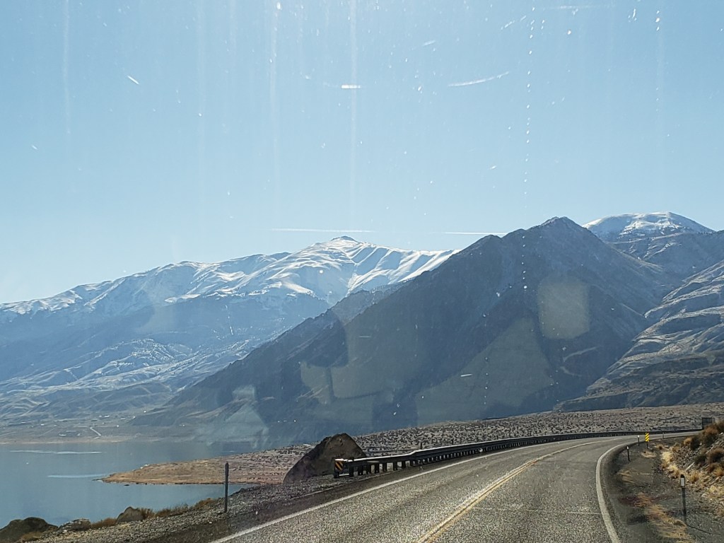
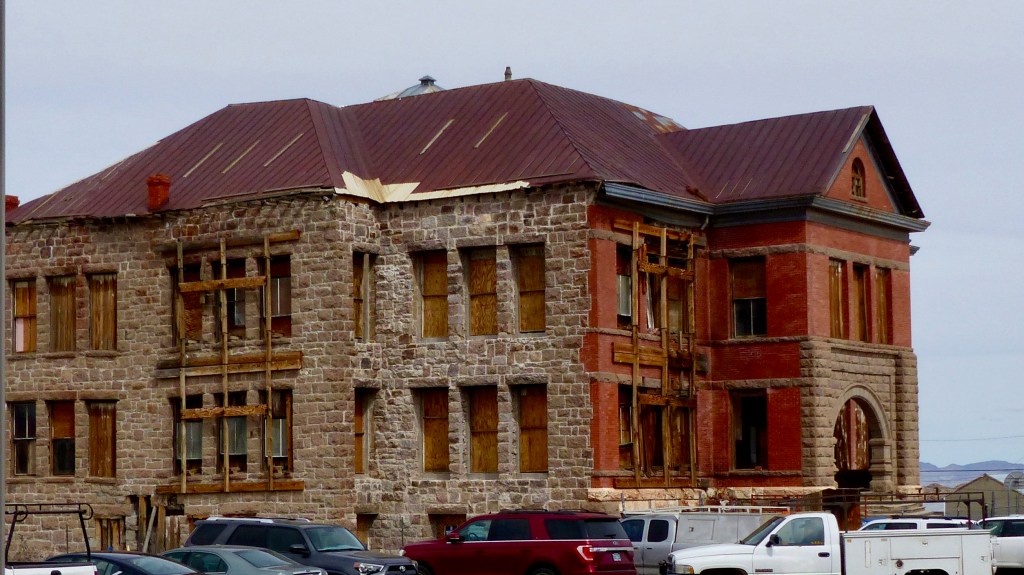
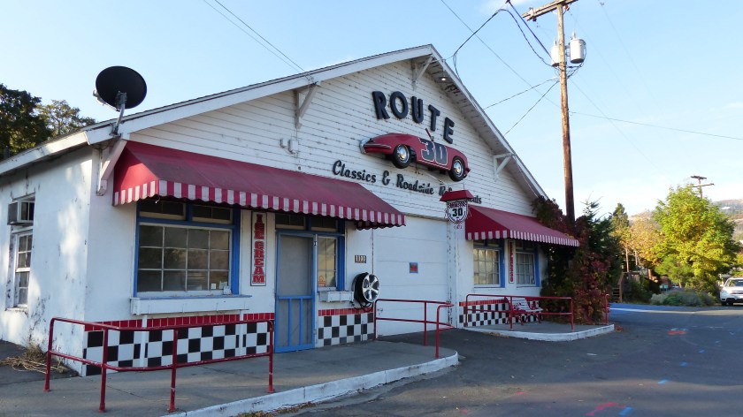
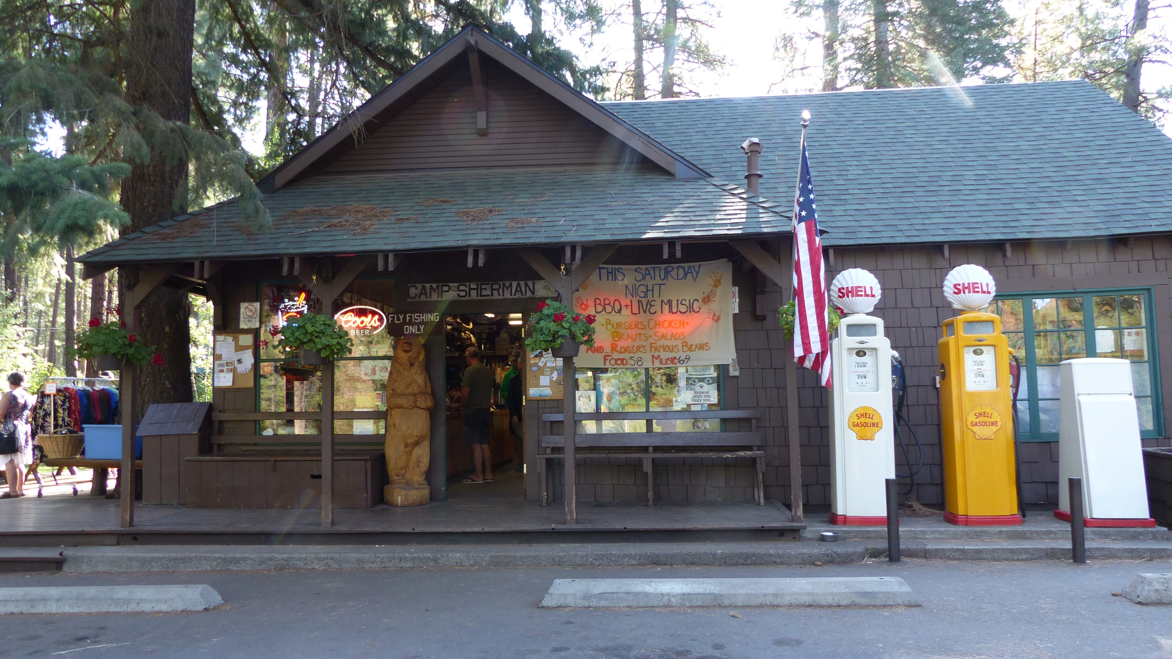
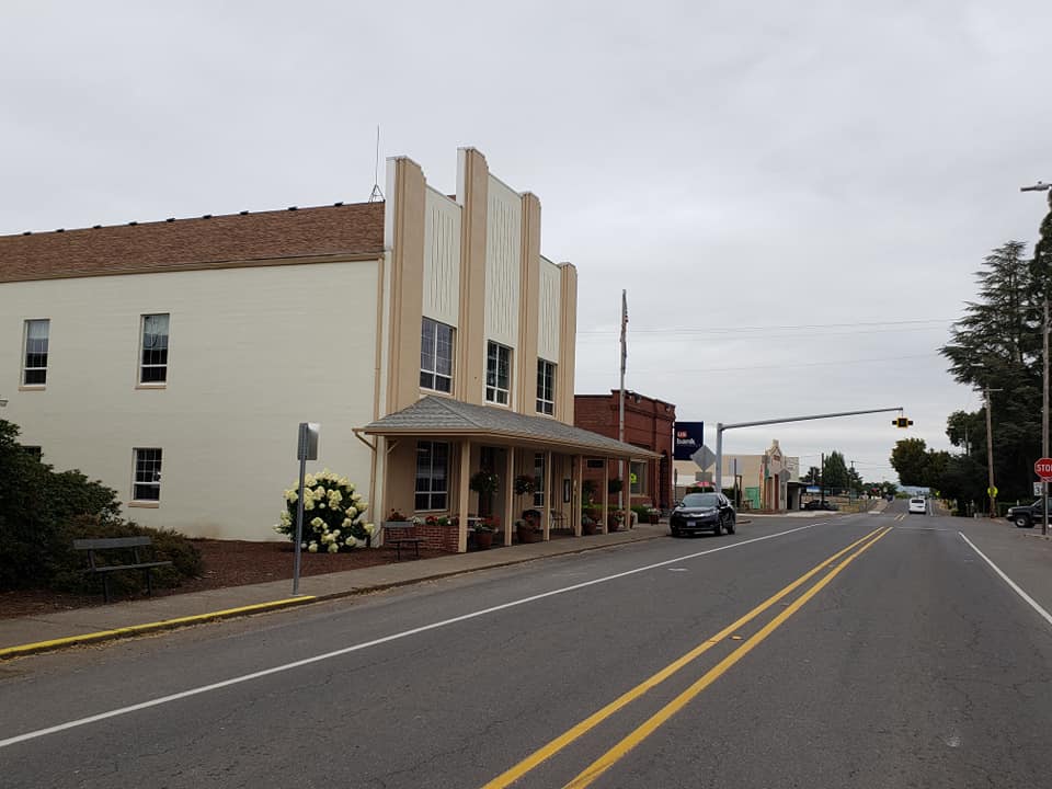
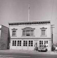
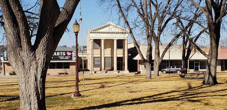
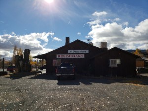
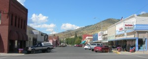
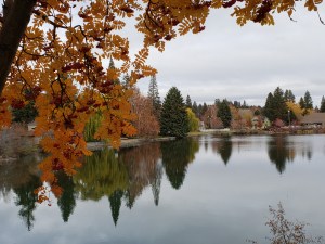
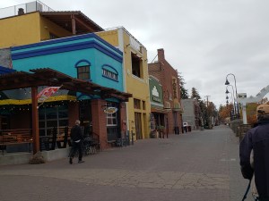
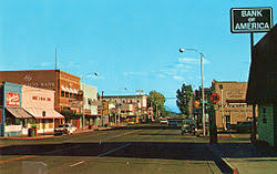
 Downtown Alturas, CA

Our halfway point comes at the city of Alturas, CA (2800 souls). This place is the seat of Modoc County. We stop at their nice community park and walk the dogs. Sully’s RV Park is within sight. We decide to grab some coffee and walk a couple of blocks to an old section of downtown that just happens to have a Starbucks coffee shop. We decide to push on to the little burg of Likely.

Likely (63 souls). Doesn’t sound like much and isn’t today. BUT in yesteryear it had quite a history. Likely now occupies the sight of a Pitt River Indian Village. The town was known as South Fork but renamed under the insistence of the US Post Office that if South Fork wanted a post office it had to have a one word name. So the locals took a vote and named the place Likely. One of the last American Indian Wars was fought a short distance away. In the past the flourishing Likely Peat Moss Company was the major player in town besides ranching. It operated until 1987 when the peat moss supply was depleted. Peat moss was shipped via truck and train via Likely’s own train depot. Like the peat moss company, the railroad is no longer a part of Likely.

Today tourism and ranching are the main economic drivers. The locals have a long running joke that the gross national product of this part of Modoc County is your choice of: rocks, junipers, or sagebrush. A couple of miles off of the main drag is the Likely Place Golf and RV Resort. We drive a 2 lane country road lined with barbed wire fences and lots of beef cattle.

Likely Place Golf and RV Resort

The plan- spending the night there but the gate is closed. What the? Closed for the season? Oh No! So either we double back to Sully’s RV Park or continue on. There’s gotta be an RV Park between Likely and Susanville right off of US 395. Well guess what folks, there ain’t! So we push the additional 85 miles with a nasty cross wind blowing. Not having a decent shoulder on the road makes it even more difficult as the wind keeps pushing us towards the abyss. The road takes us through high valleys, then down the shoulder of deep canyons strewn with volcanic rock outcroppings. We eventually wind our way down to the flats near Honey Lake and mosey over to the Susanville RV Park. We traveled 330 miles today. Ahh, we only overshot our halfway midpoint stop by 125 miles!

We look forward to a quiet and restful stay and it is. Well, almost. I’ll explain. The RV park has a dog walk which is adjacent to a residential area. What separates the two is a ditch and very high grass, like four to five foot high grass. I’m walking our 80 pound lab when this doe mule deer saunters out of the grass and scares the living bejesus out of her and startles me. She turns and stares at us from 100 feet away. We stare back for a moment then turn towards the RV. Out of the grass right in front of us bounds a three prong buck! We must have disturbed them while they relaxed in the grass.

Bright and early Halloween morning we pull up stakes and head the 85 or so miles home. This leg of the trip was uneventful. As we approached Reno the downtown casinos come into view. It’s quite a sight after driving through all those small towns.

Downtown Reno

All you RV’ers know that once home the work just begins. The house is clean and in good shape. Our house sitters always leave the place spic and span. But we do have to unload the rig, clean the rig, dump the tanks, top off the fuel tank, then take it to the storage yard. That’s about a day and a half to two days worth of work. Next, retrieve 2.5 months worth of mail that has accumulated and sort through it all. Three shopping bags full of junk mail are deposited in the recycle bin. Outside most of our shrubs need pruning as well as the roses. Trees have been shedding their leaves in preparation for winter. We rake up our tree’s leaves as well as leaves that have been blown onto our property from elsewhere. The place looks pretty good now.

In conclusion, Jil and I had another great trip. We saw new things, enjoyed visiting with family and friends and working with old friends. The new to us RV is comfortable to live in for extended periods of time. Compared to our old set up, truck pulling 5th wheel, the truck/5th wheel combination was easier to drive in the wind, but our Class A motorhome diesel pusher is a little more convenient during actual travel as everything you need- food, the throne, etc. are right in your coach. One doesn’t have to pull over and stop to gain access to them although that’s what we do most of the time for safety reasons.

And this coach is a lot tighter and easier to heat and cool than our 5th wheel with no drafts that I have detected. Fuel mileage is not quite as good as the truck’s mileage but it is what I expected. A plus is the coach has a 100 gallon tank which allows us to easily travel 600 miles without running the fuel down to an uncomfortable level. The take away is that it is a 100 gallon fuel tank. You don’t have to fill it very often- but when you do……… Just hope when traveling in Kali-fornia’s high priced fuel market that your rig doesn’t get too thirsty. A take away common to both set ups is finding fueling station that can accommodate the very tall and very long. That can be tricky. 

The good thing about delaying a travel blog post is that I can give you a sneak preview of things to come. We have volunteered once again and will be working with the Samaritan’s Purse organization at the Camp Fire that destroyed  the entire town of Paradise CA. We’ll be helping folks who have lost their homes and their cherished belongings in that disastrous fire. From there we’ll be heading south until late winter/early spring (See photos below for a reason to head South).

Until we meet again, Via Con Dios my friends………..

Mr. Doyle is a snow magnet!

Third snowfall of the season


What to Do, What to Do?


Sunday October 28, 2018

Bonneville Fish Hatchery to Bend, OR

Just a note to my readers: The observant reader of this post says “what the heck, that date can’t be right! Well, It is, sorta. That’s the date I started writing this post. Today’s Date is November 25, 2018. We have since arrived at our home, done a lot of work around the house in preparation for winter and the coming Christmas Holiday Season. Yes, time got away from me as three other holidays have past: Halloween, Veterans Day and Thanksgiving. I have one more post to publish, that of the last leg of our trip home. Be patient…………

map bfh- bend

Should I have said “Where to Go?…… Normally we try to vary our routes. Well we kind of snookered ourselves this time. The best routes towards home involved travel on Interstate 5 passing through the Oregon’s Willamette Valley or US Highway 97 traversing Oregon’s high desert county east of the Cascades. We’ve already traveled Oregon’s Interstate 5 corridor in the beginning of this trip. We also visited Bend’s high desert area on our way to Idaho. The weather has turned more like the Fall we know here in the Pacific Northwest, that being wet. So what to do?

We flipped a coin, heads I-5 and tails US97. It’s heads. We disregard the coin flip and head towards the dryer high desert area of Bend, one of our favorite stops in the State of Oregon. After picking up and packing up on Friday we stop at Jim and Connie’s RV to say goodby. It’s been another good time volunteering with these good friends.

Traveling Oregon Highway 35 on the Shoulder of Mt. Hood

The route to Bend has us we travel east on I-84 to Hood River, south on Oregon 35 which takes us through the Fruit Loop of Hood River and onto the east and south flank of the mighty Mt. Hood. As we climb in elevation the forest gets more dense and so does the low cloud cover- yikes! Although a little foggy in places its not too bad. Everything is soaking wet from the overnight rains which continues into this morning. After about an hour we turn south onto US 26 and head towards Warm Springs. There are no towns between the Hood River Valley and Warm Springs.

Approaching Warm Springs, OR

Warm Springs Reservation (2400 souls) is governed by a confederation of Paiute, Wasco and Warm Springs tribes. Here is a little history for ya- https://warmsprings-nsn.gov/history/. The region is very dry compared to the Columbia Gorge. However, the Deschutes River runs right through town. Tourism is important so being good tourists we stop at the casino. No, not to gamble but to let the dogs stretch.

          Ka-Nee-Ta Resort


Tribal Member Rides To Resort

Near Warm Springs we pass the turnoff to Ka-Nee-Ta Resort. I later learn that the resort closed before our arrival. Apparently the resort had been losing money for some time. That has to be a sad occurrence for this small Native American community.

We park as far away in the most distant parking area, right on the edge of the pavement. Dogs leashed, they are the first out but refuse to move as soon as paws hit dirt. They look up at us with that “what the heck did you just do to us” look. We look at the ground and they are standing in the sticker patch from hell! We move them out as best as we can, then provide some sticker removal for their paws. Poor mutzos! We spend quite a bit of time picking stickers from 8 paws. We walk around the perimeter of the parking lot looking for sticker-less ground with no success so I move the rig to a safer boarding area. Everyone jumps aboard and off we go.

Highway 26 follows the Dechutes River Canyon for several miles, then climbs up it’s shoulder to the high desert plain. The tail end of the cold front is kicking up quite a bit of wind. The rig gets a little squirrely when it’s hit by big gusts, but remains manageable. A little farther south is the city of Madras (6000 souls), the seat of Jefferson County.

Crooked River Gorge- 400′ deep!

We join US 97 here and continue south towards Redmond (30,000 souls). About 8 miles north of town we stop at the Peter Skene Ogden State Park to view the vertical walls of the Crooked River Gorge. Redmond has grown so much the last decade that Highway 97 no longer follows the most traditional route through most town, Main Street, but skirts downtown entirely.

Another 20 miles south on US97 and we pull into the Crown Villa RV Resort for the second time in three months. Every time we’ve stayed at Crown Villa the place was packed with higher end Class A motorhomes and nice 5th wheel or travel trailers. This trip around Class A’s are in the minority and the place is packed with less expensive travel trailers and a smattering of 5th wheels. The clientele has also changed- a lot more working age folks, some with families and not so many retirees. In fact it looks like a bunch of folks who found work in Bend have brought their home on wheels and their families from who knows where to work here. That’s a good thing!

   Scenes From Drake Park

The weather improved, the sun came out for a while, so we saddle up and head to downtown Bend and the Drake Park area. Downtown Bend is turn of last century two story predominantly brick buildings. It’s a thriving little downtown.

        Downtown Bend Area

Adjacent to it is Drake Park, a large manicured grass park that lies along the Deschutes River. Walking through the park we are delighted to find numerous youngsters and their parents playing in the deep leaf litter. The Deschutes River is dammed just down river, we cross the small lake to the residential side of the river.

Beautiful Home, Garden Art, Halloween Decor

The homes that lie along the river are just incredible. Those fortunate enough have their manicured back yards end right on the lake. We walk through this great neighborhood, across the vehicle bridge, around through a portion of downtown and back to the car. This is one of our favorite activities here in Bend.

We hadn’t been up on the Cascade Lakes Highway for a while so let’s go! We head up towards Mt. Bachelor with the intent of driving the highway past some very beautiful lakes such as the one below.

Instead we get up to the Mt. Bachelor Village and are greeted by rain turning that is quickly turning to snow. Alrighty then, maybe next time!

MThought For The Day – Mr. Rogers did not adequately prepare me for the people in my neighborhood.

Our Job is Done Here, Where to Next?

Saturday, October 27, 2018

Location: Bonneville Fish Hatchery

P1070025
Fall Color at Tanner Creek

We completed our last week here at the Bonneville Fish Hatchery in a flurry of activity. Fall is definitely showing its presence as all the deciduous trees and the conifers for that matter, have decided its time to drop their leaves. First were the small leaves of the honey locusts which, by the way, are difficult to round up with leaf blowers.

43753395_10217168590707666_4568057414217105408_n-1
More Fall Color

If they are dry all one does is blow them up into the air where whatever puff of wind catches them, scattering them right back where they originated. After blowing them for an inordinate amount of time, trying to tame their uncooperative way, one finally just blows them into small piles and picks them up with a rake.

Other trees are dropping their leaves as well. Oaks drop their big leaves and making a big mess. The conifers drop their dead leaves all of the time but especially when the wind blows. It seems like no more dead leaves can fall from them until they do- with a vengeance. So a lot of time is spent during the fall blowing and raking leaves, which seems to be never ending………. sigh…. at least the honey locusts a now bare……..

The areas that look like someone has actually look great the longest are the walking paths at Herman’s House, the upper and lower trout pond areas, and the small sturgeon pond. Those areas are all cleared of leaves and other debris using just the back pack blowers. Other larger paths and street require the edges be blown with the backpack blowers then the bulk is suctioned up using the trailer mounted vacuum. They also look good after being cleaned. Due to their size they collect a lot more leaves and don’t look as good for as long.

20181025_085839

The Gang Ready To Spawn

20181025_134622

Male Coho

The coho salmon are ripe for spawning so thats what happened Thursday. The Oregon Fish and Wildlife biologists attended taking tissue samples of multiple fish which slows the operation down. Jil estimated that 700 female coho were spawned. Not nearly as many males are required as their milt is shared with the eggs of many females. All of the fertilized eggs were destined for Oxbow Hatchery which we understand will share a portion of their bounty with Eagle Creek.


Jil Assisting in the Spawning Room

One of the side benefits of volunteering here at the Bonneville Fish Hatchery is volunteering (or being volunteered) to help in the Egg Hatch House. That’s where the salmon eggs are raised and monitored until they hatch. When they are large enough they are placed in an outdoor rearing pond. Eventually they will be released into Tanner Creek in order to continue their journey to the Pacific Ocean. To ensure the majority of the eggs remain healthy they are constantly monitored. Dead and “twin” eggs are removed to keep those hundreds of thousand eggs that remain healthy.  Jil (and Connie on occasion) man their tweezers and pick out imperfect eggs for at least six hours a session. The hatch house is cold, the water is cold, the floor is cold. By the time Jil completes her task she is cold, her feet hurt and is generally miserable. That’s the life of a volunteer here at the hatchery!

Unknown

The hatchery is a very popular field trip destination for school kids. Three buses full of grade schoolers arrive at the same time. I watch as the kids go yelling and screaming, playing tag, etc. The adults, at least two, maybe 3 per 10 kids don’t keep close tabs on the kids. Not a gripe per se, but I do remember going of field trips with a class of 30 and only our teacher to keep us kids on the straight and narrow. Anyhow, they all sit down at benches in the picnic area to consume their lunches. Normally we have a big dumpster adjacent to the picnic area but not today. The kids trash will up being stuffed into a trash can across the way- but the can isn’t large enough to contain all of their trash. God knows where the rest of it will be deposited.  So I put Jim and Connie’s clever plan into action. I approach each of the six benches loaded with kids scarfing down their lunches, introduce myself as a volunteer host, hand a large trash bag to the adults in charge of that particular bench asking that they please collect all the trash and place it into this bag and please leave the bag at the table, as I will collect the bags after they finish their lunch. Yes! This will work as well as Jim and Connie’s clever plan has ever worked!

08sa2604_bl_2

When I return expecting to collect the six bags stuffed with trash I see only two……. where in the heck are the other four? Did the elders put the bags in their bus? Oh come on now! So I put on my sleuth hat to find the other four. Not in that trash can…… Oh wait, how about this one? Nope. Not in Mitchell Creek either. The last trash can I check- bulls eye and exactly what I was trying to prevent. Geez, how in the heck did they stuff all of that trash into that can? They must have taken turns doing a tap dance on top of those bags to compact them enough to fit. It nearly takes a pry bar to pop them out. So now I know why kids can’t seem to follow instructions- neither can their teachers.

The above activities describe our last day on duty at the hatchery. As afternoon turns to evening the rain comes right on schedule. I had planned on picking up and storing the sewer hose and water hose but Jil was still using the clothes washer. Okay, I’ll do that in the morning…….


The Dalles, Like Dals, Not Dallis!

Wednesday, October 24, 2018

map to the Dalles

Our time at the hatchery is soon coming to an end. One place we haven’t explored very much is The Dalles (13,000 souls).

dalles-trip-1
The Dalles- Mt. Hood in the Background

This place is of historical significance as it was the location where pioneer emigrants had to build rafts and travel by river in order to continue their journey to the Willamette Valley. Later another choice was offered as a fella by the name of Barlow built a toll road around the south side of Mt. Hood. That meant a choice of rafting the treacherous Columbia River Rapids or paying to continue on dry land. A Pioneer Discovery Center is located just outside of town that tells the story of the pioneers and those who followed.

P1070004
Mosier Totem

Our route to The Dalles took us through the burg of Mosier, then up and over the bluffs that overlook the Columbia Gorge via old Highway 30.

We are glad we chose this 20 or so mile route as the scenery was spectacular. We passed several wineries and farms that are built in the rolling highlands, then stop at the Rowena Crest Overlook.

Views From Rowena Crest Overlook

From the overlook one can see the twisty highway making its way down the bluffs towards the interstate as well as an overview of the Gorge itself. The only downside was there was a heavy haze in the air that smelled like smoke.

P1070012
Old St. Peters Catholic Church

The one place we wanted to visit in The Dalles is the old catholic church. The old church’s steeple stands 176′ high and was considered a navigational landmark by ships captains. However, the original St. Peter’s Church was deemed too small by its congregation, a new church was built and the old church was to be demolished. A handful of town folks caught wind of the church’s impending doom and raised enough money to buy the old gal. So that’s what they did. A preservation society was formed in 1971 which has been dutifully maintaining the church ever since.

Although the church needs a little t.l.c. she is really in pretty good shape. A docent, a non-catholic, told us all about this beautiful lady as well as the trials and tribulations of those who care for her. We are very glad we chose to visit this church.

On another note we were fortunate to visit with some dear friends, meeting them in Troutdale for lunch. As luck would have it Tim and Renee had spent the summer in their newly purchased home in Custer, S.D. and were traveling right by the hatchery on their way to SoCal. A day or two out Tim suffered a detached retina so they hightailed it to the highly recommended Casey Eye Institute in Portland to get Tim’s eye patched up. We met them about a week after the operation and he seems to be doing OK with some vision already restored. As with all old pals who haven’t seen each other for too long a time the conversation started where it left off.  It was sure great visiting with them once again and we are looking forward to our next meet. Via con Dios, our friends.

A Merganser and an American Dipper at Work in Tanner Creek

Meanwhile, back at the hatchery:

Today we were refreshing the fish icons stenciled on the asphalt walks. Following the fish takes one to the more interesting parts of the hatchery, mainly Herman the Sturgeon, the upper and lower trout ponds and the visitors center. Jil and I sweep off the old, worn stenciled fish, place the big fish stencil over the old and line it up as good as we can. Then out comes the special line spray paint and viola!, we have a freshly painted fish on the asphalt.

So as to warn folks that they shouldn’t walk on the freshly painted fish we put out small traffic cones adjacent to them. Ya, you guessed it, not more than a minute after the paint and cone goes down, in my presence, two 8-10 year old kids walk right through the fresh paint, nearly tripping over the traffic cone in the process. Too late to stop the kids I was able to reroute Dad. Fifteen minutes later the same two kids and Dad come out of the gift shop and all three of them walk past the cone and trample another freshly painted fish! The sad thing is that not one of them had an electronic device in hand to distract them….. They were just blissfully unaware of their surroundings. Good thing we don’t have any cliffs at the hatchery……..

Thought For The Day is again – Common sense is not a gift, it’s a punishment. Because if you have it you have to deal with all the people who don’t.

Road Trip(s)!

Thursday, October 18, 2018

map to troutdale

So you were thinking that volunteering at the Bonneville Fish hatchery is all work and no play, eh? Not so! We’ve taken several day trips and lucky you, this is the post where I’ll catch you up on the majority of them.

We’ve gone on a few reconnaissance missions in the last week or two. We went back to Trout Lake on a relatively clear day with the desire to see Mt. Adams. No, we didn’t travel any gravel roads this time, we took a more direct route. That recon mission was successful as the big volcanic peak was out in plain view.

P1060977
12,281 Foot Mt. Adams

P1060978
Another View of Mt. Adams

We also took a 90 mile trip in hopes of catching Mt. St. Helens with her pants, er, clouds down. It’s a beautiful drive through the northwest forest, the road initially following the Wind River valley out of Carson, WA.

Unknown

We stopped at the closed for the season (October 1) Paradise Creek Campground operated by the U.S. National Forest Service to stretch our legs and let the mutzos sniff. While it offered no amenities other than vault toilets and a fresh water spigot each site was paved, many large enough for a motorhome and toad or a 5th wheel and tow vehicle. And talk about beautiful- tall old growth cedars, fir, alder and maple make this shady campground drop dead gorgeous.

map to northwoods

We turn left on Curly Creek Road, leaving the Wind River Canyon. Curly Creek road is another good road, a windy mountain road but it’s in good condition. When we arrived at the Mount St. Helens overlook there she was in all her glory.

P1060984
View of Mt. St. Helens Looking Northwest from Curly Creek Road Overlook

P1060986

The weather was almost perfect the exception being some haze. This is our second trip to this viewing area and we’ve been lucky to see the mountain both times. We spend some time drinking in the view before continuing on.

Curly Creek Road tees into NF90 and brings one to make a decision. Turn right and drive into what I perceive as oblivion, not knowing where the heck it goes……. or turn left and head downhill to the establishment of Northwoods. Northwoods consists of a convenience store and a bunch of cabins know as Swift Forest Camp, most lining the beautiful Swift Reservoir.

We stop at the Eagle Cliff Store and purchase a bite to eat. The proprietor states that today is perfect for viewing from the Mt. St. Helens and Spirit Lake overlook from Windy Ridge. Jil and I make a joint command decision- we don’t feel the urge to travel an additional 94 miles round trip up and back on a windy national forest road so we pass. While here we walk the mutzos through the Eagle Cliff campground. Boy, do they love all the smells the forest has to offer!

The lure of the Swift River beckons. We ford the river (just kidding), drive past the ranger station and drive through the cabins toward the Swift Reservoir. Swift Forest Camp is a PacifiCorp campground. It is located on the same spur road that leads to a picnic area and boat launch. This campground was also closed for the season except for a few sites located outside the closed gates. Boy, the second drop dead gorgeous campground that we’ve seen today!

Our fun meter is pegged out so off towards the barn we go. Over mountain, down the valley and through the gorge, over the bridge and into the hatchery we go- just in time to walk the dogs- again!

map to multnomah

On another Columbia Gorge-ous day we chose to go to historic downtown Troutdale (15,000 souls) and have lunch at the General Store. The hot dogs are delicious! Troutdale serves as the western gateway to the Historic Columbia River Highway (completed in 1929), the Columbia River Gorge, and the Mount Hood Scenic Highway. The Columbia and Sandy Rivers are nearby. It would certainly be a shame if one was in the area and didn’t visit Troutdale. More of a shame is not to take the time to drive the Old Historic Columbia River Highway.

Vista House at Crown Point

That’s Vista House……. Way Over There!

The Historic Columbia River Highway was completed around 1929. The west end does not follow the river bottom very closely but it does traverse cliffs and forest glens while passing several beautiful waterfalls. One can’t be in a hurry on this road as it is very narrow (built during the Model T era) with more twists and turns than a woven rope. Vista House on Crown Point was built to take advantage of the beautiful panorama of the Columbia Gorge that this overlook 730′ above the Columbia River offers.

We’ve been itching to visit the ever popular Multnomah Falls. Every time we go by the huge parking lot is full- signs flash “Parking Lot Full”. Hey, this isn’t during the prime summer months for gosh sakes, this is FALL! We took a chance arriving at the falls parking lot before 9 a.m. and found it not full for a change.

Walking towards the falls we notice quite a few hombres dislodging tree logs and rocks from up high on a steep slope. Their work was necessitated by the Eagle Creek Fire- the fire has killed a lot of trees and loosened the soil that used to retain those boulders. P1060960
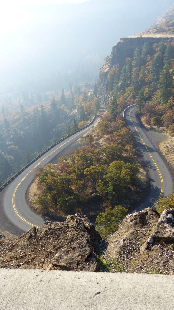
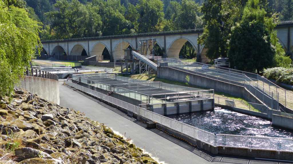
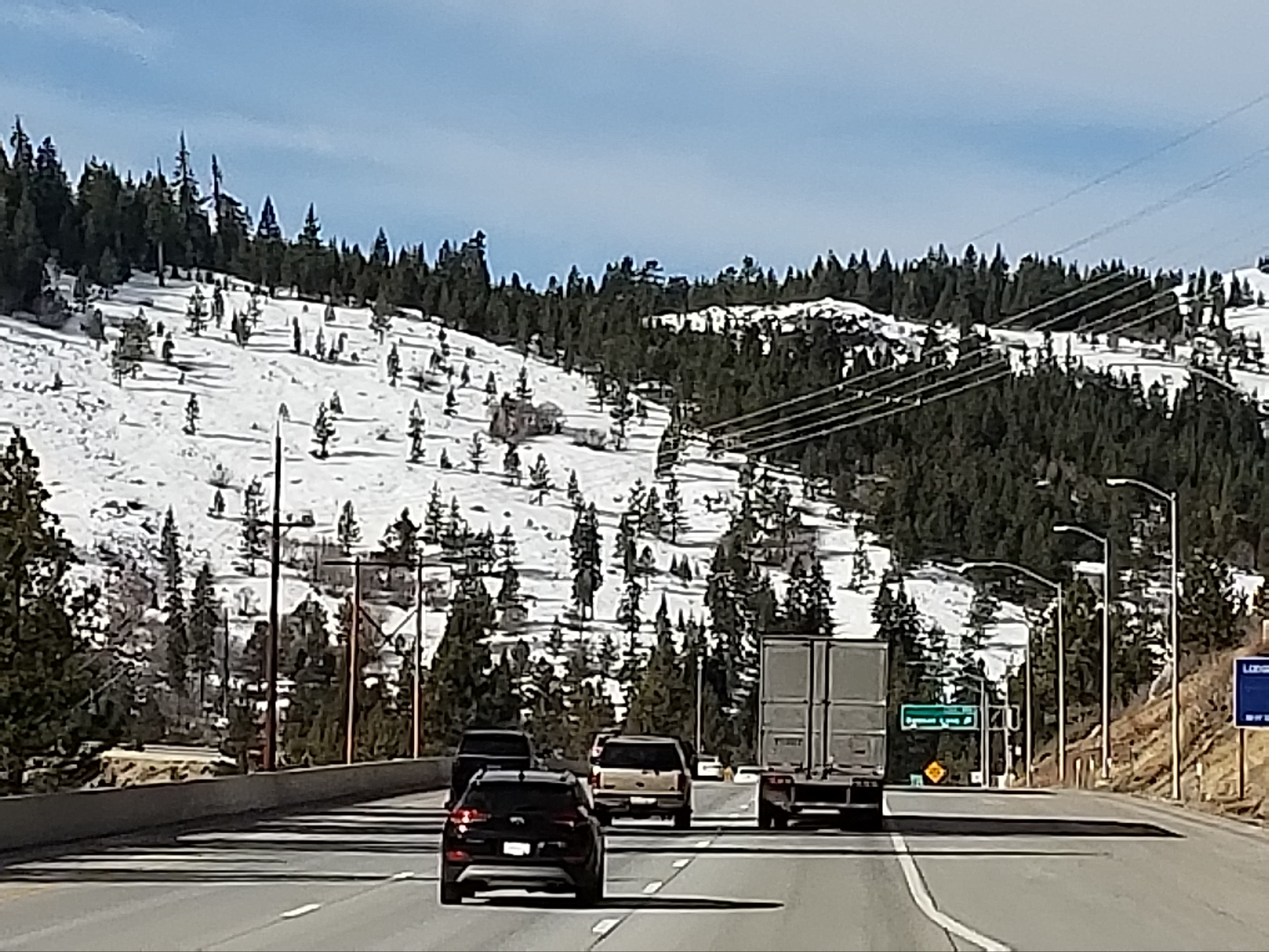
big So the workmen are using safety gear for themselves and lowering logs and boulders to a place where they can safely drop them down to this closed section of the old highway. From there the debris is removed for disposal at a remote site. A several mile section of the old highway will remain closed until the time all the hazardous timber and boulders are removed.

Multnomah Falls is one of the most spectacular falls that we have ever visited. The fall drops twice for a total of some 620′. The lodge and footpaths is listed on the National Register of Historic Places. One can enjoy a great lunch at the lodge, then hike up to the top of the falls if one desires. This fella doesn’t desire, but Jil and I and the mutzos have walked up the trail to that bridge.

P1060964

Jil and Doyle Enjoy Multnomah Falls

So that’s the extent of our day trips up to this point in time. More adventures to come……

Showers, Hatchery Happenin’s and More Info on the 2017 Eagle Creek Fire

BONNEVILLE FISH HATCHERY: WEEK SIX

MONDAY, OCTOBER 15, 2018

P1060976
Sunrise- Host Site #2

The Columbia Gorge definition of rain showers is somewhat akin to my definition of a cloudburst, a deluge if you will. Last Saturday’s morning starts with a steady rain. As the sun comes up rain ends leaving mostly cloudy skies. We are on duty so we spend quite a bit of time doing our morning chores and interacting with visitors. Around 1330 hours we decide to take to mutzos for a walk- just a few big raindrops falling at the time. We get halfway to the garage when the heavens open up with a very intense “shower”. It rained so hard that by the time we scurried the 600 feet back to our RV the roads had puddled and we as well as the dogs were soaked. We tried to open the door to the RV so Jil could go in and grab a couple of towels but the dogs had other ideas. The wedged themselves into the crack of the door and wouldn’t be left outside, even under the awning. So we all piled in soaking wet where the dogs were toweled off and we changed our soaking wet clothes. Some shower!

salmon eggs
Fertilized Chinook Eggs

Salmon that had been sorted out as spawners have been inspected. The females that have ripe eggs have been spawned, the ones that aren’t ripe have been returned to the spawning ponds. Those eggs gathered from the spawners go into a bucket containing water that reminds me of a large popcorn bucket one would buy at a movie theater. Milt from a male is added and presto! The red eggs turn pink, indicating that they have been fertilized. And fertilization is just that fast- instantaneous! A liquid anitmicrobial is added to the bucket to protect the fertilized eggs. The fertilized eggs are transported from the spawning room to the largest building on hatchery grounds, the Egg House.

42503892_10216915263654648_5978101821808312320_n
Rearing Ponds in Foreground, Egg Incubation Room in Background

The eggs are placed in shallow baskets that have a constant flow of water running through them. The eggs are constantly monitored both by machine and by humans to determine their viability. If an egg dies it is removed. Eventually the eggs hatch, the young fish are fed and supported until they are large enough to go outside into the rearing ponds.

racewaysCreston
Fish Guys Working a Rearing Pond Full of Salmon Fingerlings

And there predators await them, mostly birds like the great blue heron, lesser herons, egrets, gulls and occasionally mammals like otters looking for a free dinner. The predators are thwarted by smart Fish Guys who have placed netting over the ponds. An estimated 1.8 million eggs have been harvested to date.

I believe I mentioned that our friends and fellow hosts here at the hatchery were present during the big Eagle Creek wildfire. Here is a link to their blog: https://jimconnietravel.wordpress.com/2017/10/01/fire-fire-and-more-fire/

Here’s a Youtube link to a helicopter flyover of the Eagle Creek Fire dated September 23, 2017- the day I-84 was opened in both directions, two weeks after the fire started……..:

Even though all four of us hosts have worked either in the public sector or worked directly with the public through private enterprise we are still amazed by the lack of common sense by some folks. Case in point- two bus loads of people with learning disabilities pull into the parking lot and unload. The folks on board are having a great time touring the hatchery. Many carry water bottles which the thirsty folks have consumed. Jil spots several of them refilling their water bottles in the Jumping Salmon Fountain located in front of the gift shop. Now this fountain has seen thousands of dirty fingers and a bunch wild critters make contact since we cleaned it last month and God knows what is growing in that clean looking but nasty bacterial soup. Jil stops those unsuspecting folks from filling and probably drinking that unclean liquid and dumps their bottles in the trash. Where are their guardians? Who is getting paid for looking out for those folks, anyway? Raise your hand if you are absent!

Thought For The Day – Common sense is not a gift, it’s a punishment. Because if you have it you have to deal with all the people who don’t.

Where the Heck is Goose Lake?

Week 5: Saturday, October 6, 2018

42537003_10216915264734675_8266205958959529984_n
Great Blue Heron Imitating Salmon Weather Vane

We worked a lot last week, OK? Jim and Connie were busy with personal business part of the week, the weather was pretty good and visitors just kept acomin’. More visitors were drawn in because the gift shop was having their annual weekend sale. More visitors equals more work maintaining the joint, capiche? Not a record setting sales weekend for the gift shop but a strong one.

BFH P. Creek, Trout Lake

As busy as the hatchery was Jil and I snuck away for an adventure. Jil wanted to go to Trout Lake, Washington because the views of Mt. Adams are supposed to be spectacular from that location. I wanted to go to Panther Falls as I hadn’t seen them the first time we went there as I had an achilles tendon that was bothersome. So what do we do? Take a big loop route, first to Panther Falls, then on to Trout Lake in the hopes of a clear view of Mt. Adams.

I planned our route via Google Maps and the whole loop is only 54 miles- piece of cake! So off we go across the Bridge of the Gods for the umpteenth time and drive through Carson WA. We continue on the Wind River Highway then turn onto Panther Creek Road.

42803622_10216962720081029_1681596455069941760_n
Beautiful Fall Colors in Jurassic Park- See the T-Rex Hiding Behind The Tree?

The creek road gives one the feeling that they are on a Jurassic Park jungle ride as the growth of trees and understory plants is amazingly thick. On almost expects to run into a T Rex or maybe a deer even. The road is just wide enough for vehicles to pass one another. Emphasis is on caution as the dense vegetation limits visibility on the curvy road. There is no part of this road that I’d drive faster than 30 miles an hour, with most of it in the 20- 30 mile per hour range.

Sign to Falls Hard to Find, Others are Easy and Very Explicit

As impressive as Panther Falls is the signage is not. The best way to find the falls is to first find a large dirt parking area. Search for a nondescript wooden sign announcing the falls nailed on a tree on the opposite side of the road. Someone has also painted “Panther Falls” with a directional arrow on the road’s pavement but that’s not visible from a vehicle in motion.

P1060956
Panther Falls Trail

The very narrow and steep trail down to the falls requires one’s full attention as to avoid the many root and rock tripping hazards. Once down one finds an observation platform in which to view the impressive 100′ falls- and they are really beautiful.

P1060947
Panther Falls

o
Perspective of the Fall’s Height

P1060952
Panther Creek Just Above the Falls

Off we go up the road where it tees into a gravel forestry road. We leave Jurassic Park and a in a more open forest strewn with volcanic rock outcroppings. We take that road a distance of over 10 miles traveling at no more than 30 miles an hour. The little oncoming traffic there is throws up a lot of dust. Our next stop is Goose Lake, a natural lake that lies in a bowl formed by volcanic activity. The water level in the lake appears to be low. Well, it is the end of the dry season, ya know.

42611641_10216962605198157_4977485479629815808_n-1

42831069_10216962603718120_2910720360364113920_n

Goose Lake

More dusty bouncy gravely road takes us to a spur road. A sign announces that the Natural Bridges are this way. We drive to the parking area expecting to find an informational sign which would tell us how long a hike we’d have to the bridges but no such luck. Not knowing how far the caves are from the parking lot we pass. The next spur road with signage is to the Guler Ice Caves. Not knowing how far we’d have to travel and or hike to the caves we again pass.

P1060957
Trout Lake General Store

P1060958
We Appreciate The Levity!

Eventually we find pavement and continue on the Trout Lake. We looked all over the place and never did see a stinkin’ lake! What’s with the name? Anyhow, Trout Lake (560 souls) isn’t much of a town. We stop at the general store and buy some lunch munchies as we didn’t find a restaurant. Highway 141 parallels the White Salmon River through a lovely farm dotted valley which eventually narrows as it reaches the Columbia Gorge. We head home paralleling the Columbia River, cross it via the Bridge of the Gods and head the four miles west to our home away from home. We throughly enjoyed this outing even though it seemed much longer than what I had calculated as 54 miles round trip. A double check on Google Maps proved me right- 94 miles if its a foot………

BFH- Week 4- Another Long Post!

Saturday, September 29, 2018

I couldn’t figure out why my posts have been so long but I finally had an epiphany. Rather than writing and posting several blogs a week I’ve decided to write only one. And that is why my blabber fingers have been writing such long posts. Duh!

P1060898

The Fall Salmon Run has been very light. Mature fish return to the hatchery anywhere from three to five years from release. Immature salmon known as jacks have returned to the hatchery in almost unprecedented numbers. They are basically yearlings about the size of a trout, that have no business coming home now as they can’t reproduce. The Fish Guys think that early release of fingerlings that was necessitated by the big Eagle Creek Fire may be the cause. Nonetheless, the mature fish are being spawned. The jacks become food for Herman and company.

Preparing to Feed Herman the Sturgeon and Friends- and Herman knows it!

The jacks are laid out on the floor in the walk-in freezer room, and we bag them after they are frozen. We completely filled up one 4’x4’x 3′ tote with 25 bags or approximately 500 jacks just from one harvest! That could be a year’s supply of food for Herman- and there will no doubt be more. To feed Herman the Sturgeon and others in Herman’s pond as well as the sturgeon in the other sturgeon pond the frozen jacks must be prepared. First, a frozen bag of jacks are taken from the walk-in freezer room over to the band saw. Yes, a wood, in this case fish, cutting band saw. The saw is used to cut the jacks into smaller pieces that the smaller fish can handle. Eight to 10 fish are left whole and placed into a bucket. The pieces of fish are evenly divided into two buckets. Now those frozen fish must be thawed in order to be edible and are left overnight at room temperature to thaw. The next day the whole frozen fish have thawed to the point of being slimy and the chunks have turned into a sort of primordial soup. Yum! The whole fish are fed first so that the big fish will eat those and not the smaller pieces meant for the smaller fish, then the chunks/primordial soup is served after about an hour’s wait. One can imagine that serving breakfast to the fishies can get quite messy!

So today we have a predicted rain day. We’ll use today as an example of what’s normal for a rainy day prediction here at the hatchery. Weather guessers say rain for two hours in the morning- prediction= percentage 40% chance. Rain to slacken to occasional showers by afternoon- prediction= 40% chance. Well folks, it rained almost all morning with few breaks. It rained almost all afternoon with just a few more breaks than in the morning. No sun breaks…….. nope, nada, keiner. The rain slackened just enough to let the dogs out to do their then start up once again. Mostly not a hard rain but one that gets everything wet.

Occasionally Mom Nature likes to lull one to sleep with the soft pitter patter of falling rain on the roof. Then the pitter patter stops. Let’s take the dogs out before it starts to rain again. Mom Nature somehow senses our intent and waits until we exit the coach and have walked about a hundred yards. Then BUSSHHH, she dumps a huge bucket of water directly on our unsuspecting bodies- a deluge! How the heck does she know? I did see a pretty sunset way off in the distance about the time the heavens opened. We get the soaking wet mutzos inside and towel them off. Nothing like the smell of wet doggies!

42202083_10216880970797348_6228407735520591872_n

We were in need of a nice day trip. We decided to cross the Bridge of the Gods and head west on Highway 14 towards Camas, WA. We drive by the Bonneville Dam and stop at the day use area provided by the Corps of Engineers. On the premises is the sight of the now defunct Fort Cascades. A series of three forts were built to protect the Cascade Rapids portages. The fort was constructed in 1855 to protect the portage around the final section of the Cascades Rapids. It burned in 1856, was rebuilt and abandoned in 1861. In 1894 the small community site that was built around the fort as well as the fort site were obliterated by the largest flood of the Columbia River in recorded history.

Unknown


Views From North Bonneville, Washington

Continuing on we made a stop at the city of North Bonneville. This place was originally located in the area flooded behind the Bonneville Dam. The town was relocated below the dam and rebuilt by the Army Corps of Engineers. Nearly 600 people live in this master planned community. Homes are built on large lots which are situated around parks and common grounds. It’s a quite lovely place to live. The downside is there is really no downtown shopping area. It does have a civic center complete with social hall, city hall and a post office.

Highway 14 west of North Bonneville takes one through some very thickly forested county, so thick one can’t see the forest for the trees- so to speak. The road winds over hill and dale eventually leveling out on a flood plain. At the west end of that plain, up against a hill is the City of Camas.

Mill workers still without contract    [JUMP]

One could drive right past this town and only see the giant Georgia Pacific paper plant and never notice the quaint, picturesque and historic downtown of Camas (19,300 souls). Camas lies smack dab in between the adjoining cities of Washougal (pop. 15,000) and Vancouver (174,000 souls). Ironically, the city of Vancouver is considered a “suburb of Portland, OR” by Wikipedia. even though a state boundary line and the mighty Columbia River separate the two.

There’s a Bunch of Nuts in Camas!

The historic Old Town Camas is a walkers delight. Not too big, not too small- just right. There’s lots of eye candy i.e. beautiful old style street lamps adorned with flowering plants, and interesting store fronts.

There are lots of signs which are apparently posted by concerned citizens out on the sidewalks with messages that I do not understand with an equal amount that I do.

Since no bridge exists over the Columbia at Camas we continue into Vancouver. An informational sign indicates that its a 30 minute drive to Portland even though it should take 10. Traffic is bumper to bumper for about two miles when we come to the source of the logjam- a minor accident, the vehicles are not blocking the roadway and an officer is on scene taking a report. Once past we accelerate at warp speed, turn onto the southbound I-205 and again onto the eastbound I-84. Our goal is to exit at Troutdale and hit the outlet mall. We buy shoes at a shoe store and some goodies from the Hanes store.

We decide to follow the old Historic Columbia Gorge Highway. It parallels the Sandy River for a ways then heads up to Corbett. We like driving this portion of the highway as it passes through rolling farmland before diving down into the Gorge. Much of the historic highway is closed as the Eagle Fire of 2017 created rock fall and falling tree hazards that haven’t been cleared yet. We head down off of the mesa and into the Gorge and then eastbound on I-84 once again.

We are back at the hatchery safe and sound in our home away from home. More to come……